Ortelius, AbrahamBiblio.com
213 résultats
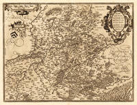
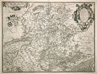
159816639Antwerpen 1598. Other. In excellent condition. 370 by 485mm 14 by 19 inches. Original antique copper engraving published 1598 in a French text edition of the " Theatrum Orbis Terrarum. Uncolored copy in a strong impression. This is a map of Hannonia the Hainaut province of Belgium. Printed in the 1602 Spanish edition of Ortelius's "Theatrum Orbis Terrarum". Includes the cities of Charleroi Ath Tournay Valenciennes Maubeuge and its capital Mons. Rivers and forests have been included with towns churches and cathedrals. The title is engraved in a decorative cartouche decorated with two classicised heads. Ortelius was born on 14 April 1527 in the city of Antwerp which was then in the Habsburg Netherlands modern-day Belgium. The Orthellius family were originally from Augsburg a Free imperial city of the Holy Roman Empire. In 1535 the family had fallen under suspicion of Protestantism. Following the death of Ortelius's father his uncle Jacobus van Meteren returned from religious exile in England to take care of Ortelius. Abraham remained close to his cousin Emanuel van Meteren who would later moved to London. In 1575 he was appointed geographer to the king of Spain Philip II on the recommendation of Arias Montanus who vouched for his orthodoxy. He travelled extensively in Europe and is specifically known to have traveled throughout the Seventeen Provinces; in southern western northern and eastern Germany e.g. 1560 15751576; France 15591560; England and Ireland 1576; and Italy 1578 and perhaps twice or thrice between 1550 and 1558. Beginning as a map-engraver in 1547 he entered the Antwerp Guild of Saint Luke as an illuminator of maps. He supplemented his income trading in books prints and maps and his journeys included yearly visits to the Frankfurt book and print fair where he met Gerardus Mercator in 1554. In 1560 however when travelling with Mercator to Trier Lorraine and Poitiers he seems to have been attracted largely by Mercator's influence towards the career of a scientific geographer. Wikipedia Broe. 71. State 1/2. unknown
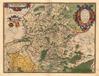
159820683Antwerpen: Christopher Platin 1598. Other. In excellent condition. 370 by 485mm 14 by 19 inches. Original copper engraving published 1598 in a French text edition of the " Theatrum Orbis Terrarum. Uncolored copy in a strong impression. The map is ornated a title cartouche in the upper right corner and a cartouche with a mileage scale as well coats of arms in the upper left side. Ortelius was born on 14 April 1527 in the city of Antwerp which was then in the Habsburg Netherlands modern-day Belgium. The Orthellius family were originally from Augsburg a Free imperial city of the Holy Roman Empire. In 1535 the family had fallen under suspicion of Protestantism. Following the death of Ortelius's father his uncle Jacobus van Meteren returned from religious exile in England to take care of Ortelius. Abraham remained close to his cousin Emanuel van Meteren who would later moved to London. In 1575 he was appointed geographer to the king of Spain Philip II on the recommendation of Arias Montanus who vouched for his orthodoxy. He travelled extensively in Europe and is specifically known to have traveled throughout the Seventeen Provinces; in southern western northern and eastern Germany e.g. 1560 15751576; France 15591560; England and Ireland 1576; and Italy 1578 and perhaps twice or thrice between 1550 and 1558. Beginning as a map-engraver in 1547 he entered the Antwerp Guild of Saint Luke as an illuminator of maps. He supplemented his income trading in books prints and maps and his journeys included yearly visits to the Frankfurt book and print fair where he met Gerardus Mercator in 1554. In 1560 however when travelling with Mercator to Trier Lorraine and Poitiers he seems to have been attracted largely by Mercator's influence towards the career of a scientific geographer. Wikipedia Christopher Platin unknown
158812475Antwerpen 1588. Other. In excellent condition. 370 by 485mm 14 by 19 inches. Original copper engraving published 1588 in the first Spanish text edition of the " Theatrum Orbis Terrarum. Handcolored in outline and wash when published. The map is ornated a title cartouche in the upper right corner and a cartouche with a milage scale as well coats of arms in the upper left side. Ortelius was born on 14 April 1527 in the city of Antwerp which was then in the Habsburg Netherlands modern-day Belgium. The Orthellius family were originally from Augsburg a Free imperial city of the Holy Roman Empire. In 1535 the family had fallen under suspicion of Protestantism. Following the death of Ortelius's father his uncle Jacobus van Meteren returned from religious exile in England to take care of Ortelius. Abraham remained close to his cousin Emanuel van Meteren who would later moved to London. In 1575 he was appointed geographer to the king of Spain Philip II on the recommendation of Arias Montanus who vouched for his orthodoxy. He travelled extensively in Europe and is specifically known to have traveled throughout the Seventeen Provinces; in southern western northern and eastern Germany e.g. 1560 15751576; France 15591560; England and Ireland 1576; and Italy 1578 and perhaps twice or thrice between 1550 and 1558. Beginning as a map-engraver in 1547 he entered the Antwerp Guild of Saint Luke as an illuminator of maps. He supplemented his income trading in books prints and maps and his journeys included yearly visits to the Frankfurt book and print fair where he met Gerardus Mercator in 1554. In 1560 however when travelling with Mercator to Trier Lorraine and Poitiers he seems to have been attracted largely by Mercator's influence towards the career of a scientific geographer. Wikipedia Koe. Ort 23 / #36 111. Broe. 71. State 1/2. unknown
157952409Antwerp. 1579. Based on the 1548 map by Jacques & Jean Surhonio which for security reasons was never published. Only in 1579 when Antwerp was independent for a short time did Ortelius publish it van den Broecke 70. Strapwork cartouche coats of arms two scales. Published in the wonderful Theatrum Orbis Terrarum. Copper engraving. Good condition. Some wear to lower centrefold. Narrow margins a little darkened Original colour. Size: 49 x 37 cm. Van den Broecke 70 unknown
157252379Antwerp. c.1572. Ortelius published this map in his now famous atlas The Theatrum Orbis Terrarum basing it on the earlier 1548 map by Jacques and Jean Surhon according to the reference book of van der Broecke there were only one hundred copies of this map printed. Strapwork cartouche coats of armstwo scales beadwork border. This is a highly decorative inexpensive sixteenth century map. Copper engraving. Fine condition good margins. Original colour. Size: 50 x 38 cm. van den Broecke 69 unknown
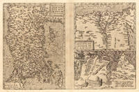
1584686Antwerp: Abraham Ortelius 1584. 19 1/4 x 12 3/4 inches. Very good condition. This is a 4 centuries old map of the Asia Minor area. This is the western most limits of Asia. It is present-day Turkey.with Istanbul Constantinople resting to the left of the map. The map has the east at the top. The second map is Egypt with the nile at center and the delta prominently shown. The remaining map is of Carthage or present day Tunis. Abraham Ortelius unknown
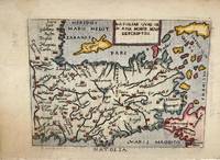
1598M11299Italy c.1598. Very Good. Notes: Miniature map of Turkey oriented with north at the bottom. The Islands of Cyprus Crete and Rhodes are depicted. Italian text on verso.<br>Pietro Marchetti published a pirated pocket version of the Ortelius 'Theatrum Orbis Terrarum'. Size : 75x104 mm 2.95x4.09 Inches Coloring: Hand Colored Category: Maps Asia Near East Turkey; unknown
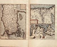
157223534Antwerp: Platin 1572/73. Other. In excellent condition. 321 by 492mm 12 by 19 inches. Original copper engraving uncolored as published 1572/73 in a German text edition of the " Theatrum Orbis Terrarum. The map shows three maps on one double page each of them with a title cartouche. Asia Minor is shown with the east to the north oriented with Cyprus in the eastern Mediterranean. The other small map of Egypt is showing mainly the Nile delta with the neighboring area. The third map shows the surroundings of Tunis Carthago. Villages and towns are shown as miniature views. Moreover the maps are ornated with ships. Abraham Ortelius received the cartographic sources for those maps by Gastaldi and Forlani 1564 for Egypt by Forlani 1566 and Carthago after an Italian one sheet source dated 1535 Broe. 174. Ortelius was born on 14 April 1527 in the city of Antwerp which was then in the Habsburg Netherlands modern-day Belgium. The Orthellius family were originally from Augsburg a Free imperial city of the Holy Roman Empire. In 1535 the family had fallen under suspicion of Protestantism. Following the death of Ortelius's father his uncle Jacobus van Meteren returned from religious exile in England to take care of Ortelius. Abraham remained close to his cousin Emanuel van Meteren who would later moved to London. In 1575 he was appointed geographer to the king of Spain Philip II on the recommendation of Arias Montanus who vouched for his orthodoxy. He travelled extensively in Europe and is specifically known to have traveled throughout the Seventeen Provinces; in southern western northern and eastern Germany e.g. 1560 15751576; France 15591560; England and Ireland 1576; and Italy 1578 and perhaps twice or thrice between 1550 and 1558. Beginning as a map-engraver in 1547 he entered the Antwerp Guild of Saint Luke as an illuminator of maps. He supplemented his income trading in books prints and maps and his journeys included yearly visits to the Frankfurt book and print fair where he met Gerardus Mercator in 1554. In 1560 however when travelling with Mercator to Trier Lorraine and Poitiers he seems to have been attracted largely by Mercator's influence towards the career of a scientific geographer. Wikipedia Broe. 174. Platin unknown
15958572Antwerp Plantin-Moretus 1595. Copper engraving 32 x 49 cms three maps on one sheet: Anatolia or modern Turkey Egypt Tunis and ancient Carthage; modern hand colour conjugate wormhole at centrefold Latin text on verso. An engraved historical note on the map of Carthage indicates that nearby Tunis which is the focus of the map was captured for Christendom by the Holy Roman Emperor and King of Spain Charles V in 1535. A version of the truth perhaps as Charles reinstated the deposed Hafsid Sultan but a Spanish governor resided at Goletta for a generation. The map was first published in 1570 just after the city had fallen into Ottoman hands and although it was briefly recaptured Tunis had been Ottoman for 20 years by the time our example of the map was published. Van den Broecke 174.2 Map unknown
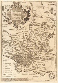
159233601Antwerpen 1592-1612. In ausgezeichnetem Zustand. Oben außerhalb des Kartenbildes ein Wasserrand. 36.2 x 25 cm 14.25 x 975 inches. Hand-Colored Original Copperplate Engraving by Abraham Ortelius depicting Monasteriensis et Osnaburgensis Episcopatus Descriptio. Auctotre Godefrido Mascop Embricense. Published Antwerpen 1592. Sheet: 36.2 x 25 cm 14.25 x 975 inches. A fine and original hand-colored example of Ortelius's celebrated cartographic work documenting this region of Germany with the precision and decorative artistry characteristic of the 15900s. Abraham Ortelius 1527-1598 was a Flemish cartographer and geographer from Antwerp widely regarded as the creator of the first modern atlas. His landmark publication Theatrum Orbis Terrarum 1570 set the standard for atlas-making for the next century presenting uniform copper-engraved maps with scholarly commentary. By Ortelius's death the Theatrum had appeared in 25 editions in seven languages. In 1575 King Philip II of Spain appointed him Royal Geographer. His maps engraved with extraordinary precision are among the most sought-after in antique cartography held in collections including the Plantin-Moretus Museum in Antwerp the Library of Congress and the British Library.This original copperplate engraving with original hand coloring depicts the region of Monasteriensis et Osnaburgensis Episcopatus Descriptio. Auctotre Godefrido Mascop Embricense published in Antwerpen 1592-1612. The map features a decorative Baroque cartouche containing the title inscription. A distance scale is incorporated within the cartouche or alongside it. The map records the political and geographic boundaries of the region as understood in 1592-1612 offering a fascinating window into the history of German territorial organization. Sheet measures 36.2 x 25 cm 14.25 x 975 inches. In good condition overall with minor signs of age appropriate for a 16th-century engraving. Ready to frame. Broe. 100b unknown
1579029357Antwerp: Christopher Plantin 1579. Soft cover. Bom / Good / Bon. 344x514 mm. 1 fólio. Retirado de "Theatrum Orbis terrarum". Adaptação do mapa de Fernando Ãlvares Secco. No verso possui texto em Latim intitulado "Portugalia Regnum" e a indicação da paginação: Fólio 16. De acordo com Van den Broecke - "Ortelius Atlas Maps an illustred guide" este exemplar é da tiragem Plantiniana de 1579 250 exemplares pois a última linha do texto: ad Chinam & Lequios per omnes prouincias maritimas insulasq.adiacentesextenditur e o primeiro R do segundo tÃtulo alinha à esquerda do primeiro R do primeiro tÃtulo. Abraham Ortelius nasceu em Antuérpia após a conclusão dos estudos em grego latim e matemática estableceu-se com as suas irmãs como coloristas de mapas dedicando-se mais tarde ao comércio de livros e moedas antigas. A publicação do seu "Theatrum Orbis Terrarum" editado em Antuérpia em 1570 vai transformá-lo num dos mais importantes cartografos do Séc. XVI. Pela primeira vez uma obra reúne todos os elementos caracterÃsticos de um atlas é também o primeiro a ser composto por mapas bi-fólio de tamanho uniforme. A maior parte dos mapas foram gravados por Frans Hogenberg e inicialmente impressos por Aegidius Coppenium Diesth; a partir de 1579 passaram a ser impressos nas oficinas de Christophe Plantin. Ortelius no "Catalogus auctorum tabularum geographicarum" indica expressamente a autoria deste mapa como sendo de Fernando Ãlvares Seco. A gravura é inspirada quer na edição princeps quer na de Gerard de Jode do ano de 1565 nomeadamente a Cartela com a dedicatória feita por Aquiles Estaço a Guido Sforza. <br/> <br/> Christopher Plantin paperback
1587Map906Antwerp: Abraham Ortelius 1587. French Edition . Hardback. Vg. Early map of SWITZERLAND. No 62 and FRENCH TEXT TO VERSO. 38x 51 cms 15.5 x 20 inches. Lower blank margin cropped but leaving margin below the plate mark. HAND-COLOURED Finely hand coloured in wash and outline. Decorated with a title cartouche. Scarce item. PLEASE EMAIL FOR PHOTOS. <br/> <br/> Abraham Ortelius hardcover
15846753Antwerp: Ortelius 1584. Map on thick paper measuring 8.75 x 7 in 22.25 x 17.75 cm in the image. Taken from the Theatrum orbis terrarum of Ortelius. One of the earliest maps of the kingdom of Huasteca or Guasteca present-day Tamaulipas originally printed on a single sheet with two other maps of Florida and Peru but here presented by itself alone. This is hand-colored with titles in Latin and ornate title cartouche. Very good. <br/><br/> Ortelius unknown books
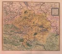
15923013<p>Paper size: 426 x 534 mm. Image size: 367 x 432 mm. 16th century map in original hand-coloring. Hinged to green card stock. Depicts lakes rivers heights forests and towns/cities. Ortelius 94. Van den Broecke 2nd ed. p. 303. ; 426 x 534 mm; All shipments through USPS insured Priority Mail.</p> Abraham Ortelius
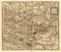
159827386Antwerpen: Moretus 1598. Other. On the sheet are two brown spots visible else in very good condition. 368 by 430mm 14 by 17 inches. Hand-Colored Original Copperplate Engraving by Abraham Ortelius depicting Mansfeldiae Comitatus Descriptio auctore Tilemanno Stella. Sig. Published Antwerpen Moretus 1598. Sheet: 368 by 430mm 14 by 17 inches. A fine and original hand-colored example of Ortelius's celebrated cartographic work documenting this region of Germany with the precision and decorative artistry characteristic of the 15900s. Abraham Ortelius 1527-1598 was a Flemish cartographer and geographer from Antwerp widely regarded as the creator of the first modern atlas. His landmark publication Theatrum Orbis Terrarum 1570 set the standard for atlas-making for the next century presenting uniform copper-engraved maps with scholarly commentary. By Ortelius's death the Theatrum had appeared in 25 editions in seven languages. In 1575 King Philip II of Spain appointed him Royal Geographer. His maps engraved with extraordinary precision are among the most sought-after in antique cartography held in collections including the Plantin-Moretus Museum in Antwerp the Library of Congress and the British Library.This original copperplate engraving with original hand coloring depicts the region of Mansfeldiae Comitatus Descriptio auctore Tilemanno Stella. Sig. published in Antwerpen Moretus 1598. The map features a decorative Baroque cartouche containing the title inscription. A distance scale is incorporated within the cartouche or alongside it. The map records the political and geographic boundaries of the region as understood in 1598 offering a fascinating window into the history of German territorial organization. Sheet measures 368 by 430mm 14 by 17 inches. In good condition overall with minor signs of age appropriate for a 16th-century engraving. Ready to frame. Broe. 94 Koeman 32 Moretus unknown
15903400<p>Very Good. c1590. 16th century map with original hand-colored outlines of Luxembourg. Decorative cartouche. Some foxing most apparent to margins. Latin text to verso with colored historiated initial. Otherwise a handsome copy. Please see image. Plate size approximately 19 1/2 x 14 1/2 in. Overall size approx. 21 1/2 x 17 1/2 in 550 x 445 mm.; 1 pages; All shipments through USPS insured Priority Mail. .</p>
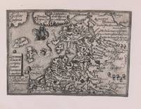
1579M8772Antwerp c. 1579. Margins are trimmed closely and laid on 19th century paper. Otherwise very good. . Notes: Map of Baltic region and Poland from the late 16th century with decorative border with sea monsters and tall ships. Size : 80x107 mm 3.15x4.21 Inches Coloring: Black & White Category: Maps Europe Estonia Latvia; Maps Europe Poland Lithuania; unknown
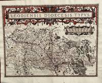
1584675Antwerp: Abraham Ortelius 1584. 19 1/2 x 14 2/4 inches. Very good condition. Ortelius was mentored by Mercator. The friendship yielded a mapmaking enterprise of great success. This map of the diocese of Liege. The main cartouche spreads across and covers the entire 2 pages. There is a secondary mileage cartouche scale. There is a major river through Liege. The Meuse runs thrash the map with primal impact showing the riverine regime as important to a large area. There is a multitude of small towns colored red. This is a very good copy with color not applied at publication. Ortelius oriented the west at the top of the map. Abraham Ortelius unknown
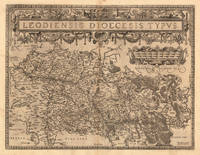
159813893Antwerp 1598. Other. In excellent condition. 380 by 497mm 15 by 19 inches. Original antique copper engraving published 1598 in a French text edition of the " Theatrum Orbis Terrarum. Uncolored copy in a strong impression. The map is ornated a large title cartouche and below a decorative milage scale. This antique map shows Luttich in Belgium. The map is equipped with many small place names rivers woods etc. Ortelius was born on 14 April 1527 in the city of Antwerp which was then in the Habsburg Netherlands modern-day Belgium. The Orthellius family were originally from Augsburg a Free imperial city of the Holy Roman Empire. In 1535 the family had fallen under suspicion of Protestantism. Following the death of Ortelius's father his uncle Jacobus van Meteren returned from religious exile in England to take care of Ortelius. Abraham remained close to his cousin Emanuel van Meteren who would later moved to London. In 1575 he was appointed geographer to the king of Spain Philip II on the recommendation of Arias Montanus who vouched for his orthodoxy. He travelled extensively in Europe and is specifically known to have traveled throughout the Seventeen Provinces; in southern western northern and eastern Germany e.g. 1560 15751576; France 15591560; England and Ireland 1576; and Italy 1578 and perhaps twice or thrice between 1550 and 1558. Beginning as a map-engraver in 1547 he entered the Antwerp Guild of Saint Luke as an illuminator of maps. He supplemented his income trading in books prints and maps and his journeys included yearly visits to the Frankfurt book and print fair where he met Gerardus Mercator in 1554. In 1560 however when travelling with Mercator to Trier Lorraine and Poitiers he seems to have been attracted largely by Mercator's influence towards the career of a scientific geographer. Wikipedia Broe. 64. State 1/3. unknown
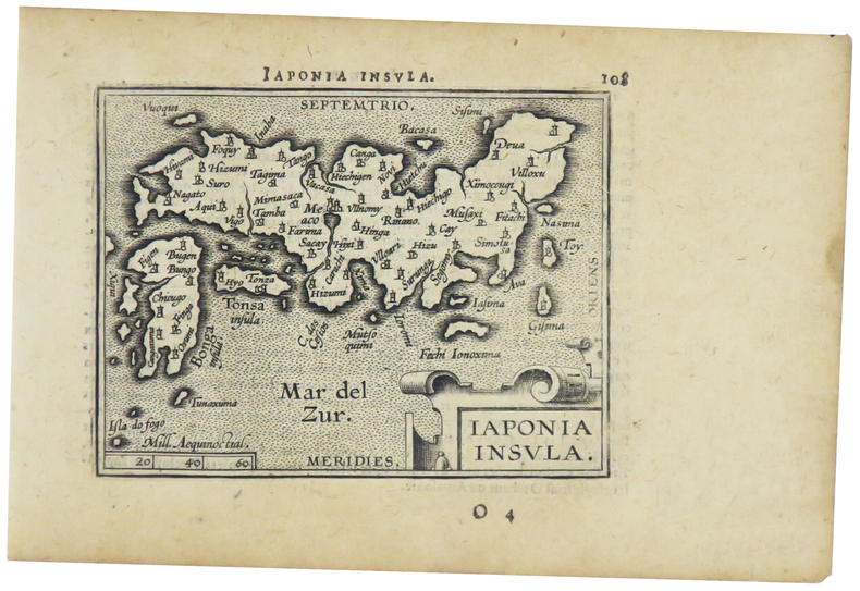
1598LBW-1424[Anvers, 1598]. 82 x 102 mm.
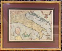
1573311532Antwerp: Ortelius Abraham 1573. framed. Map. Color engraving. Image measures 14 3/8" x 19.75". In gilt frame with empire French matting 23 x 28 1/2 inches.<br/> <br/> Gorgeous 16th century map of Italy. Elevations are beautifully colored and major towns are noted in red. Part of the Balkans Corsica and northern Sardinia are included along with part of Switzerland. Monaco is noted to the West. It was Ortelius's first map of Italy with a depiction of Neptune embracing and kissing a Neirid merwoman. A Sphinx perches atop the distance scale cartouche. Seven ships complete the composition. Some foxing and toning but otherwise a beautiful example of this uncommon edition. <br> <br> Abraham Ortelius 1527--1598 started his career as a Flemish map colorist eventually becoming a publisher cartographer and geographer. He widely regarded as one of the important and influential cartographers in history. He is known for his "Theatrum Orbis Terrarum" which was the first modern atlas. Van den Broecke 118.<br/> <br/> Ortelius, Abraham unknown
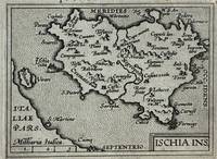
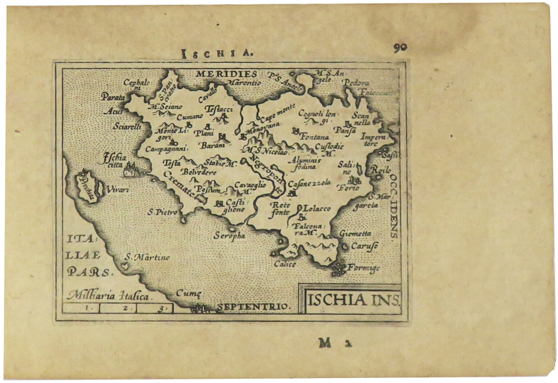
1595223506Antwerp: Philippe Galle 1595. unbound. very good. Miniature map. Uncolored engraving. Image measures 3 1/8" x 4.25".<br/><br/> Great miniature map of Ischia off the coast of Naples detailing the volcanic landscape. From the 1595 pocket edition of Ortelius' "Theatrum Orbis Terrarum" or "Epitome" with text by Pieter Heyns. With Latin text on verso. Small tear and chip to upper right light staining to lower margin.<br/><br/> Philippe Galle unknown books
1595327493Antwerp: Philippe Galle 1595. unbound. Miniature map. Uncolored engraving. Image measures 3 1/8" x 4.25".<br/> <br/> Miniature map of Ischia off the coast of Naples detailing the volcanic landscape. From the 1595 pocket edition of Ortelius' "Theatrum Orbis Terrarum" or "Epitome" with text by Pieter Heyns. With Latin text on verso. Small repair to upper margin.<br> <br> Abraham Ortelius 1527--1598 a Flemish cartographer and geographer is widely regarded as one of the important and influential cartographers in history. He is known for his "Theatrum Orbis Terrarum" which was the first modern atlas.<br/> <br/> Philippe Galle unknown
1598LBW-1405[Anvers, 1598]. 82 x 106 mm.
1584299318Antwerp: Abraham Ortelius 1584. unbound. Map. Engraving. Image measures 14" x 18 3/4". Light staining and toning on right margin but otherwise is good condition.<br/><br/> A representation of some islands in the Mediterranean Sea. Abraham Ortelius 1527-1598 a Flemish cartographer and geographer is widely regarded as one of the important and influential cartographers in history. He is known for his "Theatrum Orbis Terrarum" which was the first modern atlas. Van den Broecke #141<br/><br/> Abraham Ortelius unknown books