Gottfried, Johann LudwigLivre Rare Book
39 458 résultats
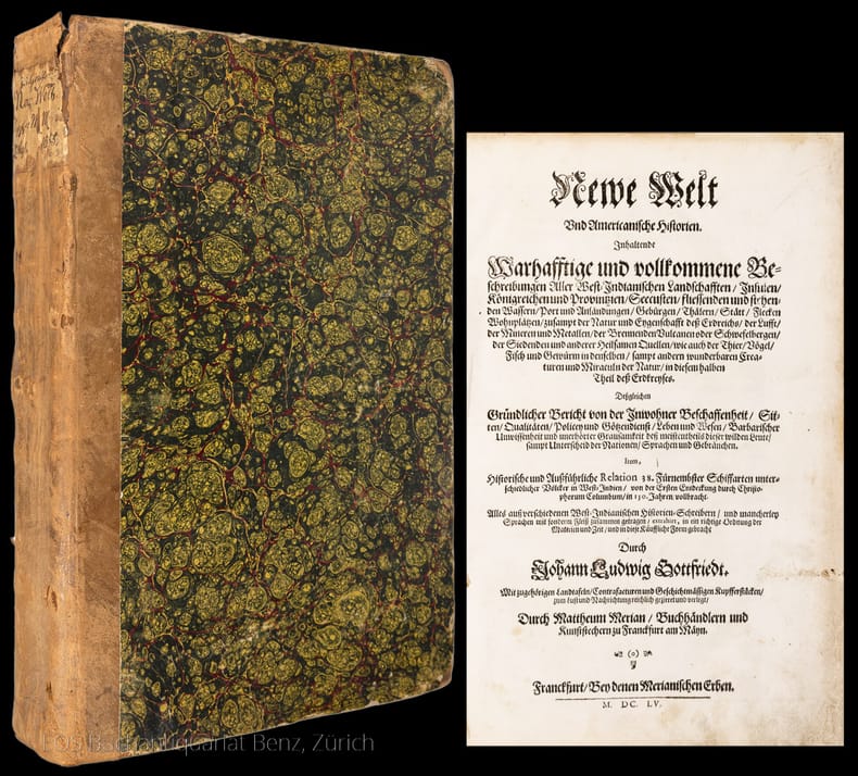
16557501CBFranckfurt, Merianschen Erben, 1655. 2°. (3) Bl., 661, (2) S. Mit gestochenem Titel, 5 doppelblattgrossen Kupferkarten (davon 3 gef.), 2 doppelblattgrossen Kupfertafeln und 174 Textkupfern (davon 5 Karten). Späterer Halblederband mit handschriftlicher Rückenbeschriftung.
8vo. 148 pp. (collates: [1]2 2-194 = 74 ff.). With western round-head letterpress music notation, a decorated rule on the title-page and each page in a frame of rules. Set in Thai type with incidental roman and the place of publication in a decorative textura. This copy with the letterpress presentation slip on blue paper tipped in (from McFarland and his wife), for people who contributed to the project. Contemporary half tanned sheepskin, sewn on 3 recessed cords, gold dotted fillets on spine, bubble-grain grey-brown cloth sides, probably bound for presentation. Very rare first edition (first issue) of McFarland's Thai (Siamese) hymnal, one of the first books printed by the mission press at Phetchaburi (Petchabury) in Thailand, with the 86 hymns selected by donors who contributed at least five dollars for the production of the hymnal. Each hymn appears on a single double-page spread (with the music at the head of the left page) except the last, whose text continues on nine additional pages. The texts of the hymns themselves appear only in Thai, but the title, introductory note and hymn titles also appear in English and each hymn gives the name of the person or organisation that selected it in English only. Some of the donors who selected the hymns lived in Thailand (both Europeans and natives) but most lived in the United States. Each hymn also indicates the metre, either with abbreviations for the common, long, short, hallelujah or particular metre, or with an indication of the number of syllables per line. The music was apparently set and electrotyped by J.M. Armstrong in Philadelphia and the electrotype blocks shipped to Phetchaburi for printing, for the Newberry Library copy of the second issue has a manuscript note "Music typography by J.M. Armstrong, Philadelphia, Pa." (Armstrong advertised his services for music typesetting and electrotyping at the 1876 Centennial Exhibition). - The first European book printed in Thai type is said to be Jean Baptiste Pallegoix's 1854 Thai dictionary (with Latin, French and English translations) by the Imprimerie Impériale in Paris, but missionaries printed Thai books in Asia decades earlier. The Missionary George H. Hough set up a printing office in Yangon (Rangoon), Burma, where he had Thai type made and used it in 1819. His materials were taken to the mission press in Calcutta soon after. Claudius Henry Thomsen of the London Missionary Society brought a printing press to Singapore in 1822 and operated it with another missionary, Samuel Milton, who brought a fount of Thai type from the Calcutta mission, along with a set of matrices to cast more. Thomsen sold the press and materials to the American Board of Commissioners for Foreign Missions (ABCFM) in 1834 and John Taylor Jones printed Thai for them there in 1835. The ABCFM missionary Dan Bradley took one press and the Thai type to Bankok in July 1835 and produced Thailand's first printing with Thai type in 1836, and Jones moved there to take charge of the press. The Thai King Mongkut (Rama IV)'s interest in printing features in the musical "The King and I", based on Anna Leonowens's 1870 memoires. In 1861 Samuel McFarland, Daniel McGilvary and their wives set up the first Thai mission outside Bankok at Phetchaburi, where McFarland printed the present hymnal in 1876 (he is said to have printed a dictionary in 1866). A second edition appeared in 1885 and the fifth and last in 1920. - We have located five other copies of the 1876 edition. The four recorded in WorldCat have 181 pages, but the Pittsburg Theological Seminary has a second copy that has 148 pages, like the present copy. The preliminary note explicitly says the hymnal includes 86 hymns and they are all present, and there is no evidence that any leaves ever followed page 148, so the additional leaves sometimes included were probably added after copies had been distributed to donors. They probably add further hymns or possibly some other supplementary text. The presentation slip for the donors notes that the hymnal is already being used by the missionaries' congregations, so the present copy probably shows the book as the Thai people first saw it. Cf. KVK & WorldCat (4 copies of the 2nd issue); not in Cordier, Indosinica; for the history of the presses: eresources.nlb.gov.sg/infopedia/articles/SIP_1074_2008-12-20.html; J.F. Coakley, "Printing offices of the American Board of Commissioners for Foreign Missions ...", in: Harvard Library Bulletin IX (1998), pp. 5-34, at pp. 26-27.
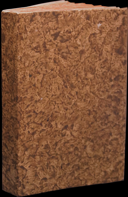
LCS-17598Précieux volume d’une insigne rareté dont la bibliographie de Chadenat consacrée aux voyages anciens (7210 livres décrits) ignore l’existence. Roma, Bartolomeo Zannetti, 1615. In-8 de 263 pp. Cartonnage brun marbré ancien, tranches marbrées. 155 x 103 mm.
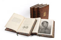
17854401834Paris: Hôtel de Thou 1785. Fine. Five quarto volumes including the final atlas volume containing a total of 88 engraved maps and plates; uniform full calf armorial bindings of the period. <p><p>A superb set of the desirable first French edition of the official account of Cook's third voyage in outstanding contemporary French bindings bearing the arms of the Ruolz Montchal family and the motto "Toujours pret". A smaller edition in octavo was published at the same time but this larger and handsome version is or course greatly preferred. It is illustrated in the manner of the English publication and has a version of the famous "Death of Cook" plate based on the original drawing by John Webber not all copies of the French quarto edition include this plate. Furthermore the fourth and final volume of the text is complete with all seven appendices including the folding vocabulary table.</p> <p>The full story of Cook's great third voyage and his eventual murder while revisiting the Hawaiian Islands that he had discovered earlier during the voyage was almost as eagerly awaited by the European as by the English public: the approximately forty ediitns that appeared befpre 1800 included vesion sin Fench Dutch Geman ruswsian Swedish and Italiqan. This French version is th emost handsome of all the 4editiins ager the English official account.</p> <p>Bligh Burney Colnett Vancouver and Riou - all later to command important voyages of their own - were all members of the expedition which set out to return Omai to Tahiti and to search for a northwest passage. They called at Kerguelen Island Tasmania the Cook Tonga and Society Islands turned north and discovered Christmas Island and the Hawaiian Islands and went on to chart the northwest coast of America from Northern California to 70o 44' where they were stopped by pack ice. On their retrn to Hawaii Cook was killed.</p> <p>The official artist on the voyage was John Webber and his romantic views of the islands of the Pacific published here remain the most evocative portrayals of the islands - helping to create the notion of an island paradise that so affected the public eagerly reading the voyages of discovery being published in the eighteenth century.</p> <p>The Ruolz-Montchal family derived from the Ardèche. but moved in the 18th century to the Lyon area where they held the property of Le Chatelard in Francheville until the early 20th century. Their most famous member was Henri-Catherine-Camille de Ruolz-Montchal 1808-1887 the French industrial chemist composer and comte a friend of both Balzac and Alexandre Dumas.</p> </p> . Provenance: Ruolz Montchal family large gilt coat-of arms on all covers. Hôtel de Thou unknown
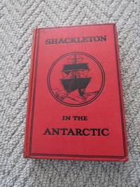
1911400<p>William Heinemann London 1911. Early Edition. Hardcover Original Cloth. Very Good Condition/No Dust Jacket. Signed by Author. 1911 One Volume Edition abridged edition of "The Heart of the Antarctic" 1st edition thus: SIGNED by Ernest Shackleton x 255 pages illustrated b/w photos map diagrams. Original covers no dust jacket. Signed "To Miss A.F. Silborn With the author's Compliments E H Shackleton on front end paper in ink. Shelf wear contents clean. Initially published as a Juvenille younger readers edition it was considerd by the publisher "a great success". Rosove A305. Originally published in two volumes in 1909 this 1911 issue presents the expedition narrative in a more accessible single-volume format retaining the core account of one of the great heroic-age polar ventures. A nice copy of a edition being signed by Ernest Shackleton adds considerably to the rarity and the value. Quantity Available: 1. Shipped Weight: Under 1 kilogram. Category: Arctic & Antarctic; Exploration. Signed by Author. Pictures of this item not already displayed here available upon request. Inventory No: 400. .</p> William Heinemann, hardcover
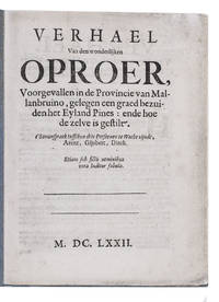
1672ICFELAQ59QY4Holland 1672. Later blue/grey paper wrappers. 4to. With 2 thin rules on the title-page. Set in roman types with incidental italic. First and only edition of a 1672 political pamphlet in the form of a spin-off from Henry Neville's very popular 1668 story of a voyage to the imaginary utopian/dystopian Isle of Pines. The present story is written as a conversation between three militia men on watch discussing the turbulent politics of 1672. One tells of his fictitious voyage and several years residence on a fictitious utopian island called Mallanbruino in the South Pacific. He says it is one degree south of the Isle of Pines. On Mallanbruino the industrious people were oppressed by an emperor but rose up and defeated him with help from a prince who also replaced the evil regents. They note the remarkable similarities to events in the Dutch Republic. The island then set up a new and fairer democratic representative political system bringing peace and happiness to the island. The three men conclude that the Dutch Republic should introduce such a system.Some spots and a small restoration to the extremities of the title-page otherwise in good condition. A fascinating but little-known pamphlet building political propaganda around a story related to the popular imaginary voyage to the Isle of Pines.l Knuttel 10600; M. Reinders Printed pandemonium pp. 195-199; STCN 863300111; not in Gove Imaginary voyages; Van Doorninck Vermomde en naamlooze schrijvers; Ford Isle of Pines 1668 1920; Scheckter Isle of Pines 1668 2011. unknown
169731846Utrecht Chez Guillaume Broedelet, Marchand Libraire 1697
166860608Frankfurt: Wilhelm Serlin, 1668. 12mo (140 x 85 mm). In contemporary full calf with four raised bands and gilt lettering and ornamentation to spine. Small paper label pasted on to top of spine indicating the inventory number in a estate library. A few worm holes to boards. Closely trimmed, a few leaves with slight loss of text to upper margin. Leaf pp. 389/390 with repair in margin, with loss of text, otherwise a nice copy. (20), 31, (3), 430, (14)" (12), 514 pp. + frontispiece and 45 plates (as called for by Sabin).
London, Richard Bentley, 1836. 8vo. In one later full green cloth binding with black leather title-label with gilt lettering to spine. Stamps to front end-papers and small stamp to title-page, otherwise a fine copy. XV, (1), 312, (1) " viii, 321, (1)pp.+ 4 plates [2 frontispieces, a map and a plate depicting two ""Arctomys Okanaganii""]. Without half-title in vol. I (not called for in vol. II).
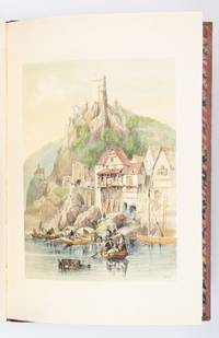
1838ST19413London: Hodgson & Clark 1838. FIRST EDITION. 560 x 380 mm. 22 x 15". 1 p.l. lithograph dedication and table of contents 1 leaf ads. <br/> Apparently unrestored publisher's red quarter morocco over pink watered silk boards flat spine gilt titling on front cover and spine marbled endpapers. WITH 30 VERY FINE SCENIC COLOR LITHOGRAPHS lithograph title and 29 views on 25 plates by T. S. Boys W. Gauci A. Picken and L. Haghe all with original thick tissue guards. Abbey Travel 32; Hardie "English Coloured Books" p. 247. ◆Covers a little soiled and with minor evidence of insect activity corners rather bumped but the original binding without major problems and still surprisingly solid for such a large picture book. Faint stains to free endpapers a few additional trivial defects but VERY FINE INTERNALLY THE PLATES ESPECIALLY CLEAN AND FRESH WITH CONSISTENTLY BRIGHT COLORING.<br/> <br/> Composed of idyllic renderings of views along the great Belgian and German rivers noted in the title the picturesque illustrations in this book are the work of Clarkson Frederick Stanfield 1793-1867 a self-taught artist and close friend of Charles Dickens who began his career as a scenic painter for dramatic productions. In addition to the dramatic landscapes castles and ruins depicted here the artist also paints a picture of daily life in the region by illustrating in great detail the activities of peasants laborers and other common folk who lived and worked in the area. Indeed the stories suggested by the characters' interactions--for example a group of women taking a break from their labors to gossip two lovers stealing a quiet moment on a hillside a solitary old woman selling her meager supply of fresh vegetables on the road--are as enchanting as the landscapes themselves. The theatrical qualities of these plates are perhaps no surprise given the artist's background in stagecraft. Stanfield worked his way up from volunteering for amateur theater productions to a paid position at Drury Lane in London's fashionable Covent Garden district. During his 12-year tenure with that theater as DNB tells us "he achieved a legendary reputation as a creator of romantic landscape scenery. . . . Stanfield's work especially 'taught pit and gallery to admire landscape art and the boxes to become connoisseurs' according to his friend W. M. Thackeray." Even after Stanfield left Drury Lane to focus on his paintings and published works the artist continued to paint scenery for Dickens and even supplied illustrations for some of his works of fiction including the "Christmas Books." DNB notes that upon Stanfield's death Dickens wrote "a moving editorial tribute . . . which described him as 'the soul of frankness generosity and simplicity. The most genial the most affectionate . . . and the most lovable of men.'" Intact copies of the present work are quite scarce in the marketplace. Hodgson & Clark unknown
Folio (31 x 26 x 10 cm). 1211, (1) pp. With chromolithographed title-page and frontispiece portrait of George V (photogravure), numerous photographic reproductions in the text. Publisher's gold-blocked leather, gilt edges. Encyclopedic work on China, Hong Kong, Indochina, Malaya and the Dutch East Indies, giving a comprehensive view of the state of these countries in the early 20th century. Extensively illustrated, including numerous reproductions of photographs. A separate publication by the company that published the Globe Encyclopedia. - Portrait slightly foxed, spine discoloured, otherwise in very good condition. OCLC 14962837.
4to. Engraved title page, 24 engraved plates by Helman, with accompanying engraved text. Contemporary French mottled calf gilt. First edition. Comprises engravings illustrating the life of Confucius, from a set of drawings sent from China to Paris by Jean-Joseph-Pierre Amiot (1718-93), Minister of Beijing, and kept in the Cabinet du Roi. The accompanying text is an abridged version of the philosopher's life. - Provenance: Thomas Philip Earl de Grey, Wrest Park (armorial bookplate); latterly in the library of Jean R. Perrette (his bookplate). - Pale dampstain in lower margin. Cohen/De Ricci 479.
(4), 92, (10), 52, 14, (10) SS. Mit gest. Titel und zus. 164 (statt 166) Ansichten und Karten auf 119 (statt 120) Kupfertafeln (eine faksimiliert). Pergamentband der Zeit mit verblasstem hs. Rückentitel bzw. neuerer Lederband mit altem Rückenschildchen (Anhänge). Folio (ca. 220 x 320 mm). Praktisch vollständiges Exemplar der zweiten Ausgabe von Merians Österreich-Topographie, erstmals mit den beiden Anhängen: die am häufigsten gedruckte von allen topographischen Unternehmungen Merians. Neben mindestens sieben verschiedenen Ausgaben (laut Wüthrich) existiert noch eine ganze Reihe an Varianten, deren Unterschiede aber im Allgemeinen unbedeutend sind. Bei vorliegendem Exemplar wurden das Hauptwerk und die beiden Anhänge getrennt und jeweils separat gebunden. Der Hauptteil insgesamt neu aufgebunden, einige der doppelblattgroßen Tafeln und Landkarten fachmännisch restauriert, Schließbänder und Vorsätze erneuert. Die Tafel von Großpertholz und Reichenau am Freiwald im ersten Anhang auf altem Papier faksimiliert. Die Tafeln durchwegs sauber und klar, beide Teile kaum gebräunt oder fleckig. Die mehrfach gefaltete Tafel von Eisenerz ist hier nicht zusammengesetzt und liegt in zwei doppelblattgroßen Blättern vor. Nebehay/Wagner 407, 2.
4to. (8), 208 pp. With engraved frontispiece and 5 etched folding plates. Contemporary gold-brocade decorated paper wrappers. Only edition. - A detailed travelogue of the Austrian soldier Matthias Puel, who joined the papal fleet in 1660 and participated in several naval expeditions against Ottoman corsairs in the Mediterranean. He describes his experiences as a soldier and traveller, starting with a description of his native Steyr in Upper Austria and his journey to Vienna. He discusses the cities, landmarks and fortresses he visited during his travels, as well as the fierce battles with the Ottomans and the terrible conditions aboard the galleys (cf. ADB XXVI, 692). The plates show fine and uncommon views of Steyr, Vienna, Rome, Naples, and Mt. Vesuvius erupting. "Dedicated to Maximilian Luckhner, the mayor of Steyr [...] Chapters 3-8 treat Hungary, giving a detailed account of Raab, Komorn, Neuhäusel, Tyrnau, and Pressburg" (cf. Apponyi). - Lightly browned; title-page duststained in the margin. Frontispiece trimmed rather closely with minimal loss to image. Wrappers worn; lower corner of front wrapper torn away, rebacked and retouched by a later owner. From the library of the Viennese collector Werner Habel (1939-2015) with his handwritten and stamped ownership, dated 1976, to inside of upper cover. Rare. VD 17, 23:243619V. Apponyi II, 948. Graesse V, 504.
Royal folio (78 x 54 cm). Lithogr. title, table of contents, and 60 engraved maps in border colour. Contemporary half calf over marbled boards with giltstamped spine. Rare atlas, with maps dated between 1822 and 1829, mostly drawn by C. F. Weiland (though some - Galicia, Tyrol, Hungary - are designed and engraved by F. W. Streit). Includes two hemisphere maps of the world and 39 maps of Europe, 6 of Asia (with the Arabian Peninsula shown in the general map and the Arabian Gulf in the map of Iran and Afghanistan), 7 of Africa, 5 of America, and 1 of Australia. - The "Landes-Industrie-Comptoir", founded by F. J. Bertuch in 1791 and in 1804 founder of the subsidiary "Geographisches Institut", had in 1797 first issued A. C. Gaspari's slightly misleadingly named, large-format "Allgemeiner Hand-Atlas der ganzen Erde" ("General hand atlas of the entire earth"), whose 60 maps had been produced by the efforts of no fewer than 11 cartographers (including Streit and Adolf Stieler). Gaspari's atlas was the first to offer continuous improvements in successive editions, which soon led to a standardization of the maps. Until the 1840s most of the work was done by Weiland. Under frequently revised titles the atlas saw no fewer than 49 editions until 1880. - Slightly wrinkled and stained (mainly in the margins); some edge tears to title page and table of contents (some repaired). Binding rubbed and bumped at extremeties. Espenhorst p. 24. Cf. Le Gear 6107 (1848 ed.). Al-Qasimi (2nd ed.) p. 281 (Weiland's 1839 map of Arabia).
Paris, Durand, 1756. 4to. 2 contemp. full mottled calf. Spines with raised bands. Richly gilt compartments. Titlelabels with gilt lettering. Gilt line-borders on covers and on edges of boards. Very light wear along edges. Stamp on title-page. (2),XIV,463,4" " (2),513,81),(2-errata) and 7 folded engraved maps. Having the additional leaves 437-450 marked with an asterix. A few faint scattered brownspots. Wide-margined and clean. On good paper.
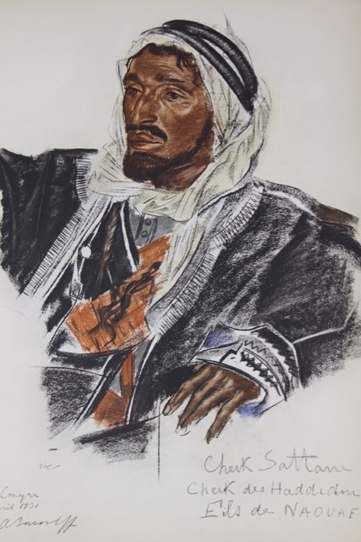
1934131905Paris, Jules Meynial, sous la direction de Lucien Vogel 1934 In-folio 38 x 27, 8 cm, un volume de texte orné de dessins de l’artiste relié à la japonaise & 50 compositions en couleurs hors-texte, sous portefeuille original cartonné à rabats avec premier plat imprimé, lacets. Portefeuille bruni, décharge des lacets du volume de texte sur le premier plat du cahier de la première planche. Deux ff. repliés déliés planches 19 & 32, la seconde avec de légères brunissures. Exemplaire de Lucien Vogel N250 avec le texte sur papier Madagascar-Lafuma et les planches sur papier vélin pur chiffon-Lafuma. Ouvrant la Route de la Soie à l'automobile, la 3e mission de Georges-Marie Haardt et Louis Audouin-Dubreuil également connue sous le nom de 'Mission Centre-Asie' ou plus communément de 'Croisière Jaune', parcourut, entre le 4 avril 1931 et le 12 février 1932, 13 000 km de Beyrouth à Pékin en passant par le Turkestan, le Xinjiang et le désert de Gobi puis au retour par Hanoï, Saïgon, Bangkok, Calcutta, Delhi, Quetta, Ispahan, Bagdad et Damas. Nouvel exploit du groupe Citroën et de la France, l'expédition contribuera également à faire éclater le talent de son peintre officiel Alexandre Iacovleff à travers ses portraits, dessins et peintures d'une grande beauté.
1838021038London: T. McLean D.& P. Colnaghi and John F. Lewis 1838. 1838. Book. Illus. by John F. Lewis. Near Fine. Hardcover. First Edition. Folio approx. 55 x 36.5cm. Complete with all Lithographic plates as called for; tinted frontispiece tinted title-vignette further 27 tinted views on 25 leaves all by Lewis after Coke Smyth. A very clean bright copy. Finely bound in modern brown morocco to style with gilt lettering to the spine and gilt bands to the top and bottom of the spine. Contents clean and tight new light brown endpapers in keeping with the new binding two blank leaves to the front and rear all pages have been professionally cleaned and restored by a paper conservator minimal and unobtrusive water staining remains to some pages and plates mostly confined to the margins and blank areas most plates unaffected new archival paper guards to all plates no inscriptions. A fine complete copy beautifully rebound. References -. Abbey Travel II 394; Atabey 722; Blackmer 1015; Contominas 413; RIBA 1886. T. McLean, D.& P. Colnaghi and John F. Lewis [1838]. Hardcover
18214388John Murray London 1821. First Edition. Hardcover rebound in cloth. Very Good Condition/No Dust Jacket. 1st Edition SIGNED by the Author Parry and also the Purser of The Helca: Full Title - Journal of a Second Voyage for the Discovery of a North-West Passage from the Atlantic to the Pacific Performed in the Years 1821-22-23 in His Majesty's Ships Fury and Hecla under the Orders of Captain William Edward Parry R. N. F. R. S. and Commander of the Expedition. Rebound marbled page edges xxx 571 pages eratta 4 fold-out charts and 4 numbered fold-out panoramas "Appearances of Lands" bound at rear 31 plates inc. frontis 5 of which are maps. Following this volume the 1821 North Georgia Gazette and Winter Chronicle is bound in. SIGNED by the Author to W H Hooper Purser on the Hecla "Wm H Hooper Esq with the Author's Kind Regards on the title page. This book was later gifted and signed by W H Hooper on the fly leaf "J.P. Welsford Esq with the affectionate Regards of Wm H Hooper" also The North Georgia Gazette and Winter Chronicle is also signed on the title page "S L Hodges - from her friend W H Hooper Purser of the Hecla in - Expedition - now of the -1821" Unfortunately the pages of the gazette have been cut down to fit with the volume and as such part of this signature and inscription is missing. Charts and panoramas poorly folded in the past some foxing age toning wrinkling of pages as to be expected. "Through the long arctic winter Parry did everything possible to keep his crew occupied. There was constant activity plays were acted at the 'Royal Arctic Theatre' and Sabine edited a periodical journal The North Georgia Gazette and Winter Chronicle" . This periodical was afterwards published by John Murray and is bound in with this journal. ON THE FIRST VOYAGE Parry was given command of the Hecla and Griper for his first expedition of 1819. Parry sailed up Baffin Bay and through Lancaster Sound and Barrow Strait to the south side of Melville Island encountering much less heavy ice than anticipated. The expedition over-wintered at Winter Harbour on the south side of Melville Island. Freeze-up delayed Parry until August of 1820 but he was still able to continue west to Dundas Peninsula and south to Banks Island before turning to head home to England. Parry's voyage was to be recognized as one of the most important in the history of Arctic exploration. He proved that Lancaster Sound opened a passage to the west he charted a vast area of the unknown Arctic and proved that it was possible to spend the winter north of the Arctic Circle without being in grave danger. He was also the first to reach 110 degrees west longitude which earned him and his crew a cash reward of £5000. AB 13145. The Journal based on Parry's reports appeared in 1821 after the rights had been bought by the publisher John Murray for the stunning amount of a 1000 guineas. In the same year this second corrected edition was published followed by German Dutch and French translations. ON THE SECOND VOYAGE " Sent by the Admiralty to search for a passage along the west coast of Foxe Basin Parry sailed north of Southampton Island instead of south the route preferred by previous navigators and thus became the first to sail through Frozen Strait and confirmed Middleton's discovery of Repulse Bay. In late Aug. having found no passage through Repulse Bay he explored the coast northward sailing as far as Ross Bay. In Feb. 1822 Eskimos visited the ships' winter quarters on Winter Island and spent much of the winter in the expedition's company enabling Parry and his men to make detailed observations on their customs and language. After leaving their winter quarters they explored farther north equiped with Eskimo maps ESKIMAUX CHART No 1 No 2 & No 3 facing p. 197 198 and 252 and found the entrance to Fury and Hecla Strait. Ice prevented their passing through it but overland journeys confirmed that it led westward to a sea. Parry returned to winter quarters and attempted to sail through Fury and Hecla Strait the following summer. Unsuccessful in this attempt and fearing scurvy he then returned home. Sabin 58864. This is the first UK edition. Quantity Available: 1. Shipped Weight: Under 5 kilogram. Category: Arctic & Antarctic; Exploration. Pictures of this item not already displayed here available upon request. Inventory No: 4388. . This book is extra heavy and may involve extra shipping charges to some countries. John Murray hardcover
18866348127 vol. in-8 cartonnage pleine percaline vert, nom de la "Fondation Thiers" au dos en queue, Ministère de l'Instruction Publique et des Beaux-Arts, Comité des Travaux historiques et scientifiques, Ernest Leroux éditeur, puis Imprimerie Nationale, Année 1886, 382 pp. et 11 planches hors texte (dont cartes ethnographiques en couleurs de la Tunisie), parfois dépliantes ; 1887, 350 pp. et 11 planches hors texte, parfois dépliantes (dont nombreuses illustrant les "Principes de la Fortification antique depuis les temps préhistoriques jusqu'au Croisades", par le Lieutenant-Colonel G. de La Noë) ; 1888, 448 pp. 9 planches hors texte, parfois dépliantes (dont Oppidum du Mont-Beuvray par Bulliot, Densité de la Population dans le SE de la France, en couleurs, par Victor Turquan, Péninsule Malaise en couleurs, etc.) ; 1889, 334 pp. et 9 planches hors texte, souvent dépliantes (dont Embouchure la Loire, Saint-Nazaire, Kairouan, Fortifications romaines, etc...) ; 1890, 487 pp. et 6 planches hors texte, parfois dépliantes (dont Carte de l'Ile Formose au XVIIIe siècle, Carte de la Province de Touraine en 1766 par Chauvigné, Carte en couleurs du Tonkin, avec "Pays Montagneux inexploré occupé par les Pirates", "Carte du Pays des Mans-Tiens" par le Lieutenant Massy, Itinéraire de Catat et Maistre à Madagascar, etc...) ; 1891, 526 pp. et 12 planches hors texte, parfois dépliantes (dont "Le Darvaz et le Karatéguine", Carte des connaissances géographiques des Portugais en Indonésie vers 1519, Carte en couleurs du Véron (Touraine) avant 1789 par Chauvigné, Cartes anthropologiques en couleurs de la Khoumirie, etc...) ; 1892, 441 pp. et 7 planches hors texte, parfois dépliantes (dont Carte du Territoire de Hami, Extraite du K'in-ting Sin-Kiang tche-lio (Livre III), Carte de la Région du Thé d'après les itinéraires de la Mission Pavie, etc...) ; 1893, 449 pp. et 14 planches hors texte, parfois dépliantes (dont Nho-Quanphanphudo Région de Hoa-Lu dressée par G. Dumoutier, etc.) ; 1894, 464 pp. et 6 planches hors texte, parfois dépliantes (dont Detailed hydrographic and topographic Chart of the Itasca State Park by Browser, Itinéraires en Mongolie orientale par Bretschneider, Carte de la Brenne avant 1789 par Chauvigné, Copie d'une carte manuscrite de la Guiane dresée par les Jésuites en 1741 communiquée par M. Buache en 1787, Esquisse inédite de la Guyane par M. Buache, etc.) ; 1895, 499 pp. et 12 planches hors texte, parfois dépliantes (dont Itinéraire de Fes à Oudjda suive an 1891 par H. de La Martinière, Carte chinoise du Si-Yu ou Asie Centrale pour accompagner le Mémoire intitulé Récit officiel de la Conquête du Turkestan par les Chinois 1758-1760, Carte de Pho-Hien, Plan de la Forêt d'Arties au XVe siècle, etc...) ; 1896, 415 pp. et 25 planches hors texte, parfois dépliantes (dont fac-similé complet d'un Portulan annamite du XVe siècle par G. Dumoutier, en 24 cartes) ; 1897, 519-11 pp. et 8 planches hors texte, parfois dépliantes (dont Ile de Cayenne et ses environs d'après Bellin, Mappemonde Syriaque, Somal Harrar et Pays Gallas par Alfred Bardey, Carte du Territoire russe administré par la Chine, Itinéraire dans le Quang-Binh au Nord de Dong-Hoï, etc....) ; 1898, 420 pp. et 6 planches hors texte, parfois dépliantes (dont Carcasses flottantes de 1866 à 1893, Itinéraire dans le Quang-Binh au Nord de Dong-Hoï, Itinéraire dans le Quang-Tri, etc...) ; 1899, 505 pp. et 1 grande carte dépliante (El-Yemen et Partie de l'Hadramaut Arabie Méridionale dressés par Alfred Bardey...) ; 1900, 369 pp. et 2 planches dépliantes ; 1901, 423 pp. et planches dans le texte ; 1902, 423 pp. et planches dans le texte ; 1903, 539 pp. et 5 planches hors texte, dont une dépliante ; 1904, 491 pp. et 5 planches hors texte dont une dépliante ; 1905, 496 pp. et 6 planches hors texte, parfois dépliantes ou doubles (dont Schéma des Principales Migrations au Congo Français, etc...) ; 1906, 432 pp. et 3 planches hors texte (dont Distribution géographique des Races sur la Côte occidentale d'Afrique, de la Gambie à la Mellacorée) ; 1907, 497 pp. avec 1 planche dans le texte et 4 planches hors texte, parfois dépliantes ; 1908, 452 pp. avec 3 cartes sur une planche dépliante ; 1909, 420 pp. et 23 planches hors texte (dont reproduction d'un "Atlas inconnu de la dernière expédition de Drake, vues prises de son bord) ; 1910, 446 pp. et 3 planches hors texte ; 1911, 462 pp. avec 6 planches hors texte (dont mappemonde de Ripoll) ; 1912, 520 pp. avec 4 et 22 planches hors texte
4to. (8), 136 p. Contemporary limp vellum. First edition; reprinted in 1704. "Pacifico spent many years studying the topography of Greece in the wake of the Venetian successes against the Turks from 1684 to 1688. His book of 1686, ['Descrittione delle Provincie che formano la Penisola della Morea'], was followed by 'Notizia del Ducato del Atene' (1687) after the Venetian conquest of the city in that year, any by 'Historiografia dell' Isola e Città di Scio' (1694). His undated work on Evvoia, 'Descrizzione del Regno e Isola di Negroponte', was published at Treviso, and he is also credited with the authorship of 'Esatta Notitia del Peloponneso', published by Albrizzi in 1687" (Blackmer). - The Morean War (also known as the Sixth Ottoman-Venetian War), fought between 1684 and 1699, was part of the wider conflict known as the "Great Turkish War", between the Republic of Venice and the Ottoman Empire. The major campaign was the Venetian conquest of the Peloponnese peninsula. On the Venetian side, the war was fought to avenge the loss of Crete in 1669, while the Ottomans were entangled in their northern frontier against the Habsburgs and were unable to concentrate their forces against the Republic. The Morean War remains the only Ottoman-Venetian conflict from which Venice emerged victorious. Venice's expansionist revival would be short-lived however, as their gains were reversed by the Ottomans in 1715. - Evenly browned throughout due to paper; insignificant waterstain near end. A good copy. Weber II, 754. ICCU LIAE\015519. Cf. Blackmer 1233 (2nd ed. only).
- Chez H. Agasse, Paris 1799 - 1807, in-8 (12,5x21cm) ; Pet. in-folio , 7 volumes reliés. - Edition originale et seule édition, très rare complète. Les 2 premiers tomes à la date de 1799, les tomes 3 et 4 à celle de 1802, et les tomes 5 et 6 à la date de 1807. 8 années furent nécessaires à achever l'édition. Cette édition est parue également au format in-4. Edition originale de cet atlas contenant 50 planches et parue en trois livraisons. Première livraison : Empire Othoman, 17 planches. Seconde livraison : l'Egypte et la Perse, planches 18 à 33. Troisième livraison : Voyage en Perse, planches 34 à 50. On notera une carte générale de la Grèce, du Bosphore et de la Thrace, de la Troade, de l'Hellespont, de la Basse Egypte, de la Syrie, de l'Asie mineure... Planches de botanique, costumes, faune... Reliures en demi basane noisette légèrement plus tardive, vers 1815. Dos lisses ornés de 3 fleurons et de 7 séries de filets. Papier sur les plats rose. Les dos des tomes 2, 3, 4 éclaircis. Epidermures le long du mors supérieur du tome 2 et 6. Frottements sur les plats. Bon exemplaire, d'une bonne fraîcheur. Atlas : Reliure moderne en demi basane noisette. Adroit pastiche calqué sur la reliure des 6 volumes et utilisant le même type de fers et filets, et le même type de papier d'époque sur les plats. Trace de mouillure sur 3 planches (36 à 39) en partie basse. Rousseurs pâles éparses. Pliure au coin haut de plusieurs feuillets. Bel exemplaire. C'est en 1792 que fut confié une mission de voyage à Olivier, naturaliste et entomologiste, destinée à recueillir des renseignements et à établir des possibilités commerciales. Il fut accompagné par un autre naturaliste, Bruguière. La narration fait effectivement la part belle à l'économie et au commerce, d'une manière très scrupuleuse. Dans la préface, l'auteur prévient de l'entreprise sérieuse de son ouvrage, nullement destinée aux descriptions pittoresques ou romanesques, mais aux descriptions géographiques exactes et minutieuses, géologiques. Il réside 6 mois à Constantinople, attendant les fonds nécessaires à son voyage, puis visite les îles grecques durant un an, enfin il débarque à Alexandrie le 3 décembre 1794 et passe 6 mois dans le pays jusqu'à ce qu'il soit rappelé à Constantinople. Il se dirige alors vers la Perse et débarque à Beyrouth en octobre 1795. Il visite Sidon et Tyr, puis vont à Bagdad, lui et son collègue, où ils séjournent un mois. Leurs talents de médecin leur permirent de voyager sans encombre. Ils quittent Bagdad le 17 mai 1796 et prennent la grande route royale vers l'Asie centrale, passent par Hamadan, Ecbatane, et vont jusqu'à Téhéran dont le nouveau Shah vient de faire sa nouvelle capitale et qui ne compte que 15000 habitants. Après plusieurs mois d'attente, ils joignent une caravane qui va suivre l'Euphrate, puis 22 jours de marche leur seront nécessaire pour regagner Constantinople le 18 octobre 1797, où ils tentent de rassembler leur collection botanique et zoologique qui entrera au Museum d'histoire naturelle. Dans toutes les contrées qu'il traverse et où il réside, Olivier ne se contente pas de la monographie attendue de géographie physique, humaine et économique, il nous livre de longs chapitres sur l'histoire politique, et n'oublie jamais d'herboriser quand il le peut. [ENGLISH DESCRIPTION ON DEMAND]
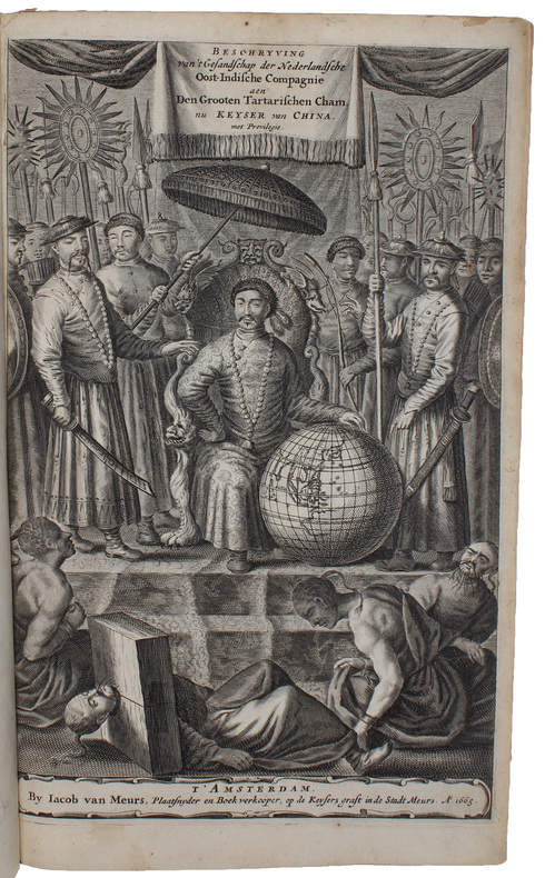
166550802Amsterdam, Jacob van Meurs, 1665. Folio. Contemp. full mottled calf. Richly gilt spine. 6 raised bands. Gilt lineborders on covers. Cracking to leather on hinges, externally repaired with thin leather-strips. Corners reinforced. Engraved title-page and printed (in red/black). (10),208,258,(10) pp., Engraved portrait, large folded engraved map, 2 engraved plates with coat of arms, 34 double-page engraved views, 110 large engraved textillustrations. A faint dampstain to upper margin of the last few leaves. The 2 plates with coat of arms a bit frayed in right margins and a faint dampstain in upper margin. A bit of browning to the first 5 leaves. otherwise internally clean.
177353601Paris, Imprimerie Royale, 1773. 4to. 2 nice contemp. full mottled calf. 5 raised bands. Richly gilt spines, tome-and titlelabels with gilt lettering. Neat repairs to top of spines. Stamps on title-pages. Corners a bit bumped. (4),LXXIX,803"(4),622 pp., 5 folded engraved maps, 1 engraved plate and 5 folded tables. Light browning to a few quires. Lower right corners on the last 3 leaves in volume 1 with a mild foxing.
Amsterdam, Jacob van Meurs, 1665. Folio. Contemp. full mottled calf. Richly gilt spine. 6 raised bands. Gilt lineborders on covers. Cracking to leather on hinges, externally repaired with thin leather-strips. Corners reinforced. Engraved title-page and printed (in red/black). (10),208,258,(10) pp., Engraved portrait, large folded engraved map, 2 engraved plates with coat of arms, 34 double-page engraved views, 110 large engraved textillustrations. A faint dampstain to upper margin of the last few leaves. The 2 plates with coat of arms a bit frayed in right margins and a faint dampstain in upper margin. A bit of browning to the first 5 leaves. otherwise internally clean.