39 462 résultats
4to. (4), 38 pp. With 1 engraved folding map of the Indian Ocean. Contemporary marbled wrappers. Rare first edition of this important work that revolutionized navigation in the Indian Ocean. It proposes a new route from the Île de France (now Mauritius) to the Coromandel coast in India. This more direct route shortened the crossing by 800 leagues and greatly facilitated access to the French possessions on the Indian coast, including the city of Pondicherry. In addition, since the trade routes to China stopped on the eastern coast of India, this new, faster route also shortened the journey to the Far East. Because of the need for quick access to the riches of India and China at that time, Grenier's work on the currents of the Indian Ocean was of great importance for the development of French trade. The engraved map displays the currents in the Indian Ocean to be taken into account by any sailor navigating these waters. - Wrappers somewhat waterstained, interior with occasional faint waterstaining near margins. Untrimmed copy. The first edition not seen at auction since 1987. Cordier 2101. Sabin 28763. Brunet II, 1734. Polak 4097. OCLC 166096625.
Large folio (400 x 570 mm). Double-page-sized lithogr. title page, double-page-sized lithogr. dedication to Ludwig Wilhelm August, Grand Duke of Baden, 2 pp. of preface, 44 double-page-sized letterpress tables with a total of 26 lithogr. maps, all in contemporary hand colour (1 plate with an appendix in oblong 8vo), 4 pp. of contents. Contemporary half cloth with original printed wrappers over boards and green cloth spine. First German large folio edition of the historical atlas that became famous under the author's pseudonym "Le Sage" (first published in London in 1801). Count de Las Cases accompanied Napoleon to Saint Helena as his inofficial secretary. Among the maps are a map of the world in two hemispheres, Europe, America, Africa, Asia with Arabia ("excellent horses, home of the camel, of coffee and aloe"; "Mekka - birthplace of Muhammad; site of the famous Kaaba"; "Nejd - large, fertile, populous province"; in the south: "boundless sand desert with occasional oases; Niebuhr is the geographer of this country which Strabo, Ptolemy and - in the Middle Ages - Abulfeda have described"), as well as of the Ottoman Empire and Greece with the European portion of Turkey. The preface is dated May 1829, the plates are mostly dated between 1825 and 1831, with two new maps of Switzerland, dated 1838, at the end. - Extremities of binding rubbed and bumped, interior shows some occasional brownstaining, mainly confined to margins, otherwise a very clean, well-preserved copy. Phillips 3550 (1831 ed. with only 24 maps).
LCS-16141Édition originale de ce précieux vocabulaire de la langue Moxa parlée par la tribu indienne des Moxos en Bolivie, « le seul ouvrage publié sur cette langue ». (Leclerc). Séduisant exemplaire conservé dans sa reliure en vélin souple de l’époque à recouvrement. [Lima], Joseph de Contreras, 1701.Petit in-8 de (8) ff., 664 pp., 204 pp. mal chiffrées 202, (1) f. Cahier 121-128 relié à l’envers, pte. portion blanche du titre découpée en marge sans atteinte au texte. Relié en plein vélin souple de l’époque à recouvrement, restes de lanières, dos lisse portant le titre manuscrit à l’encre. Reliure de l’époque. 146 x 97 mm.
LCS-12618Rare édition originale de cette relation importante pour la connaissance de la Cochinchine rédigée par le missionnaire Metelle Saccano. Paris, Sébastien et Gabriel Cramoisy, 1653.In-12 de (1) f. de titre, (5) ff. pour l’épître et la table, 139 pp., (1) p. Relié en plein veau granité de l’époque, dos à nerfs orné de fleurons dorés, coupes décorées, tranches rouges. Reliure de l’époque. 154 x 99 mm.
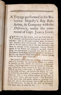
17835001095Hartford Connecticut: Nathaniel Patten 1783. Small octavo lacking the map as do virtually all known copies top four lines of title-page in well prepared facsimile; as always a little browned throughout but generally in rather better condition than most copies; in the original dark calf binding. <p><p>Highly important personal account of Cook's third voyage: the first American account of Cook's third voyage and thus the very earliest American account of the discovery of the Hawaiian Islands later to become the fiftieth state of America. This rare and significant book is notoriously hard to find in good shape. </p> <p>Ledyard one of several Americans on the voyage and the only one to publish an account of the expedition sailed as a corporal of marines. It is now generally acknowledged that he got hold of a copy of Rickman's narrative which he used to help him compile this account after his return to America. He himself describes the sealing of all diaries drawings memorandums and charts of all officers and crew aboard ship at Canton. However the narrative contains considerable information not available elsewhere including the first published description of the Russian presence on Unalaska the first permanent Russian settlement in northwest America only Ledyard Samwell and Edgar visited the settlement. The chart supposed to have been issued with the book which seems to have been an almost direct copy of the Rickman map is missing in almost every copy known and in view of the erratic nature of American eighteenth-century publishing it is nowadays accepted that it was not generally issued.</p> <p>Ledyard's description of his stay at Hawaii his expedition inland and the death of Cook occupies sixty-four pages of the text. The account of New Zealand and Australia is short but includes his observation that 'the island of New-Holland for its boundaries are now ascertained is by much the largest known and most eligably sic situated on the map of nature. even the Empress of Russia might be gratified with such a portion'.</p> </p> . Nathaniel Patten unknown
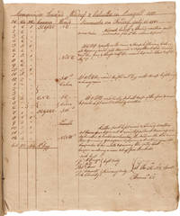
1796WRCAM54712Mostly at sea from New York with stops in Calcutta Saint Helena Ascension Island and Cornwall England 1796. 246pp. Square folio. Original crude burlap covers stab-sewn with thick string. A bit toned and foxed occasional ink or tobacco burns. Very good. A remarkable artifact of early American naval commerce containing the sailing directions and shipboard activities of the "Ship Washington of Philadelphia" which sailed from New York to Calcutta rounding the southern tip of Africa and visiting Saint Helena and Ascension Island before crashing on the rocks at Cornwall England on the way to Hamburg Germany. The log contains a navigational ledger with locations headings wind and weather remarks along with occasional sick lists names of men "unfit for duty" those put on light duty temperatures and other information. The remarks are quite detailed and specific regarding shipboard work and activity. <br> <br> The captain of this final voyage of the ship WASHINGTON was Samuel Hubbart but the identity of the sailor who kept this log is unknown. The ship departed New York on July 4 1795 and reached Calcutta on August 31. Without the need for recording navigational data while in port the log's author switches from the ledger-style format and writes longer more-detailed daily entries describing the crew's activities. The crewmen mentioned include pilots boatswains carpenters coopers caulkers sailmakers and others. Most of the entries pertain to the maintenance of the ship while anchored in the bay. Numerous mentions are made of crew on board fixing various equipment including types and amounts of supplies. A few entries note the employment of Indian "Cooleys" on board the ship making various repairs. An interesting incident of September 17 bears relating: <br> <br> "Hearing a noise upon the main Deck Mr. Naylor went to see what was the matter - upon engaging found Abraham Moor had struck Thomas Williams the Cook as Moor said for wanting to trouble a girl which Moor had on board - Mr. Naylor told him he should not ill use that man for he had every reason to believe it to be false what he alledged against the Cook. Moor said he did not come here to be jawd by a black Man.S." <br> <br> After swearing he would "never go home" on the WASHINGTON Moor literally jumped ship just after this confrontation and hid on another ship before being found and brought back to the WASHINGTON "in irons." <br> <br> In early November a few entries mention the ship receiving a supply of sugar taking on "Three Burr Load of Sugar" on November 7 and two more "Burr Load" two days later. Subsequent entries detail the loading of several "Burr Load of Bales" and "one hundred bags of ginger." <br> <br> Over the course of the ship's time at Calcutta the author mentions encounters with at least four other American ships: the GANGES the HAMILTON the MAJOR PINKNEY of Charleston and the "American Ship Camilla of New York arriv'd here from London." <br> <br> By early February the WASHINGTON left Calcutta for the voyage to Hamburg spelled variously here as "Hamborough" and "Hamburgh" though the ship would never make it to Germany. On March 15 and again on April 6 the recordist notes an inventory of the ship's water supply. By March 23 the ship reaches a point "prependicular on Cape Lagulas Bank" the southernmost point of Africa. About a week later the punishment of a drunken sailor is reported: <br> <br> "Joseph Gonrabbysp who has for some time past been addicted to Drunkeness and no person on board having given him any liquor he was discovered this morning to have taken from the Ships stores about half a Gallon of rum and from his being frequently very drunk there is no doubt of his having been Guilty of the same offence before for which Capt. Hubbart is necessitated to order his Boatswain to flog him. Accordingly mustered all hands aft and give him one and a half dozen lashes." <br> <br> On April 16 the WASHINGTON arrived at the remote island of Saint Helena in the South Atlantic Ocean sending "the Boat on shore with an Officer to the Governor for permission to Anchor." Here the WASHINGTON restocked supplies including water potatoes & other vegetables rice and bread before embarking for Ascension Island which they reached on April 25. The author remarks on the "number of remarkable rocks like pyramids" and "a low point of black Rocks with a fine white sandy beach back of it" witnessed at Ascension Island. The WASHINGTON spent one night at Ascension where a group of men went ashore in order to "spend the Night in Catching Turtle in the different Bays." The crewmen caught twelve turtles and brought them aboard ship before continuing their journey. <br> <br> While heading north to Europe the WASHINGTON was boarded on May 17 by the "Quebec British Frigate Cap J Cook in Company with the Carnatic 74 Rear Admr Powel with a convoy of 21 sail of Transports & Gun boats with 10000 Troops on board bound for Martinico Martinique." On June 7 they again encounter another ship "a Spaniard from some port in South America bound for Cadiz out 3 months & 10 days - we cannot understand rightly what port she was from." <br> <br> Then on June 18 disaster struck the WASHINGTON as it ran aground at the Lizard Rocks off Cornwall England. The log book records the ship's demise: <br> <br> "The weather still very thick and hazy. At 9PM hearing the Surf break on shore took in all the studding sails Braced the Yards sharp and hauled to the Southward finding ourselves in amongst the Rocks off the Lizard have all aback and endeavored to get her out from among them but the Flood tide making very strong drove the Ship so hard upon the Rocks that with every endeavour we found it impracticable to get her off she having settled on them & the strength of the tide Thumping her very hard upon the Rocks sounded the Pump and found she made water very fast. Fired several Guns as a signal of Distress which brought several boats off from the Shore to our assistance." <br> <br> For the next couple of weeks the crew of the WASHINGTON participated in "discharging the cargo" from the ship so that it is not "plundered by the natives" sending everything to Falmouth "where the Goods are deposited under the protection of a Custom house Yaught." The log book mentions one crewman of the WASHINGTON "threatening revenge on Captain Hubbart." Another crewman is put "under a Guard of Soldiers" after selling off some of the muslin stored in the bales rescued from the wreck. Here the ship's log ends along with the career of the Ship WASHINGTON. <br> <br> A unique record of the last voyage of an early American trading vessel with insight into late 18th-century navigational methods and the commercial interests of Federal-era America. unknown books
4to [33 x 26 cm]; xliv, 458 pp, complete with 5 folding maps including large folding map frontis hand colored in outline, 4 folding engraved plates, errata page. original marbled boards with later leather spine, gilt spine title lettering and decorations in blind, a few margins with light foxing, a fine uncut copy with wide margins, copy of Simon McGillivary Junior with his signature dated 1822 on title page. A pi The epic journey by Hearne, who was the first European to reach the Arctic Ocean, at the mouth of the Coppermine River, by land and discovered the Great Slave Lake and the Mackenzie River system. Hearne was employed by the Hudson's Bay Company in Canada for twelve years. He recorded in detail the lives of the Indians and the natural history of the regions seen on his three trips. The book's publication, three years after Hearne's death, was due to the famous French explorer La Perouse, who found Hearne's manuscript when he captured Fort Albany, Hudson's Bay, and stipulated, as a condition of surrender, that the manuscript be published. Sabin 31181: 'The author will be remembered as the first white man that ever gazed on the dreary expanse of the Arctic of Frozen Ocean from the northern shores of the Continent of America. . . a beautiful volume'. Streeter sale 3652: 'This day-to-day record of three trips northwest by land from Hudson Bay was printed from Hearne's manuscript three years after his death'. 'A painfully honest chronicle of his epic journey. . . a classic in the literature of northern discovery' [Newman, Empire of the North]. TPL 445. Cox II, p. 171. Hill 141. Lande 1220. Simon McGillivray (1783?-1840) entered the London firm of McGillivray, Fraser and Co. in 1805, and in 1813 became a partner in the Montreal-based McTavish, McGillivray and Co. He played a leading role in the merger of the Hudson's Bay and The North West companies in 1821 [McCord Museum]. A fine copy of a cornerstone of Arctic exploration with excellent provenance.
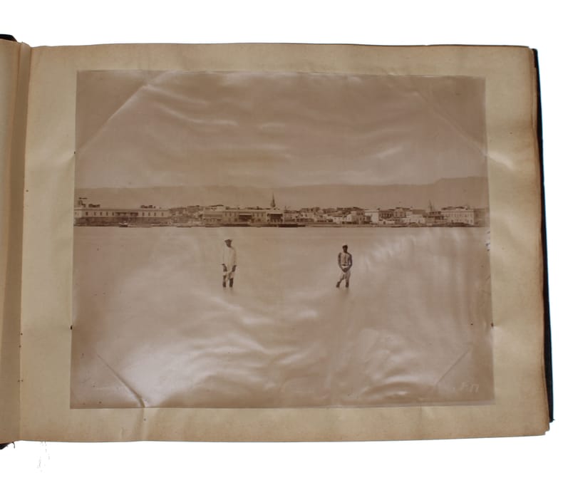
188060316Egypt, ca. 1870ies. Folio-oblong (365 x 280 mm). 146 albumen prints mounted verso and recto on 73 ff. Bound in contemporary half cloth. With traces of paper-label to inner margin of front board. Label of the stationery shop ""Maison Martinet, Albert Hautecoeur, bd des Capucines, 12, Paris"" pasted on to upper outer corner of pasted down front end-paper. Paper creased and some leaves symetrically perforated, not affecting photos. Two photos with tears and a few photos partly detached from paper. Some photos are slightly discoloured and toned but are in general in good condition.
Egypt, ca. 1870ies. Folio-oblong (365 x 280 mm). 146 albumen prints mounted verso and recto on 73 ff. Bound in contemporary half cloth. With traces of paper-label to inner margin of front board. Label of the stationery shop ""Maison Martinet, Albert Hautecoeur, bd des Capucines, 12, Paris"" pasted on to upper outer corner of pasted down front end-paper. Paper creased and some leaves symetrically perforated, not affecting photos. Two photos with tears and a few photos partly detached from paper. Some photos are slightly discoloured and toned but are in general in good condition.
181912884Boston: Sylvester T. Goss. Good with no dust jacket. 1819. First Edition; First Printing. Hardcover. The only xlib mark is an embossed stamp on the title page. The covers three-quarter leather are worn at the edges with both covers only heald on by a couple of the binding strings. The title page is torn horizontally with no loss of paper. Stains on the rear endpaper with staining at the top of the last few pages. The balance of the contents are very good with moderate foxing browning & wear. What can I say it is an old book which has been read. With all that if you are looking for it you know how scarce it is. ; Ex-Library; 12mo 7" - 7½" tall; 240 pages . Sylvester T. Goss hardcover
8vo. 204 pp. With 2 lithographed maps, a lithographed folding plate, 6 wood engraved plates, and 5 wood engravings in text. Contemporary half, tanned sheepskin, marbled edges. First edition, in the original French, of a work on the Second Opium War during the years 1856-60. The author, Armand Lucy, came to China in 1860, probably at the age of 23, as the interpreter to the French general Charles Cousin-Montauban (1796-1878). As an eyewitness, Lucy writes lively about the campaign in letters to his father, who published the letters he received in 1861. The book covers almost a year, starting in Ceylon in April 1860. Lucy gives a detailed account of several battles, with information about the strategies and the casualties. It also includes an account of the looting of the Summer Palace and of the Battle of Palikao, when the English and French took over Beijing, which played an important part in eventually defeating the Qing Empire. The text is illustrated with wood engraved views of Beijing. - Rare. Some foxing throughout the book. Binding slightly rubbed along the extremities. Overal a good copy. Cordier (Sinica) 2494f.
LCS-6946Très intéressante réunion de deux textes de la plus grande rareté relatant les récentes découvertes de deux iles, par les Français et les Espagnols. Lisbonne, s.d. [vers 1752]. -[Suivi de]: II/ Noticia Certa do Descobrimento de huma Nova Terra, modernamente apparecida, e descoberta por huma nao Hespanhola… Lisbonne, Domingos Rodrigues, 1757. 2 ouvrages en 1 volume petit in-4 de: I/ 8-8 pp., gravure d’un bateau avec une île dans le lointain répétée sur les 2 titres; II/ 8 pp. Petite déchirure au f. de titre du 2e ouvrage sans atteinte au texte, papier bruni. Conservé broché.
LCS-13350Récit des missions en Chine par un jésuite français alors que la France est profondément déchirée entre catholiques et protestants. Édition originale conservée dans son vélin de l'époque. Rome, 1650.In-4 de (I) f. bl, 8 ff. préliminaires, une carte dépliante, 326 pp., (I) f. de corrections avec restauration de papier en marge latérale sans atteinte au texte. Vélin ivoire souple. Reliure de l'époque. 222 x 153 mm.
34 pp., accordion-bound, containing a double-page map of the world and 182 hand-coloured images of flags. Text in Japanese. Speckled stiff paper boards with original title label. Arranged by continent, the naval flags here depicted represent mostly European countries, though the Americas, Russia, Australia, Tunis, and Morocco are also present. Probably published soon after Commodore Perry's expedition enforced the opening of Japan to the West in 1854. Rare: a single copy located in libraries worldwide (Tokyo Imperial Palace; shelfmark 274,662). - Title label rubbed, some worming throughout.
8vo. 31, (1) pp. With frontispiece and 4 plates with wood engravings, of which one signed [Ebenezer] "Landells", as well as 8 text illustrations. Thread-stitched in original pale orange wrappers with decorative title printing in red and green. Printed for the proprietors of the junk and sold only on board. Exhibition catalogue for the Chinese trade junk "Keying", at anchor for visitors against admission in the London Docklands in 1848. Personalised copy of the Swedish visitor Carl Peter Freidenfeldt, with autograph of and stamped by the Mandarin on board, He Sing. - The "Keying", an impressive 3-masted 800-ton sailing ship, was the first Chinese vessel ever to sail from Hong Kong to New York and further to London. The junk had been purchased in 1846 in secrecy by unknown British businessmen in Hong Kong, defying a Chinese law prohibiting the sale of Chinese ships to foreigners. Loaded with artefacts and oddities of Chinese culture and sailing with a mixed crew of Chinese and British sailors under the command of Captain Charles Alfred Kellett, the "Keying" reached New York in July 1847 and fast became an attraction serving as a kind of floating ethnographic museum. - In late March 1848, the "Keying" arrived in London to great fanfare, anchoring in the London Docklands, at Blackwall. Several different medals were struck to commemorate its appearance, including one that had a bust of Mandarin Hesing. The ship was visited by Queen Victoria, whose right to be the first European woman to visit it was reserved, as well as by the Duke of Wellington and Charles Dickens. It has been suggested that the Chinese Emperor was aware of the project from the start and was secretly kept informed about it, and that the mandarin served as an informer to report back in detail. Visitors were "received by a Mandarin of Rank and a Chinese Artist of Celebrity" (promotional text on rear cover). - Apart from the description of the ship as a whole, the cook-house and the decks, the present catalogue also contains an annotated and partly illustrated list of Chinese objects (musical instruments, weapons, tableware etc.) exhibited in different parts of the ship. - The wood-engraved plates are captioned "The Keying", "Portrait of Hesing", "Stern of the Keying", "After Deck", and "Saloon". - Ink ownership of "C[arl] P[eter] Freidenfelt, London den 15 Aug. 1848", at the upper edge of front cover. Front flyleaf (recto of 1st plate) with two red ink stamps depicting Chinese characters, one of them being the seal of Prince Hui Rui. Above and below the signature "Hesing" and the word "Keying" in Latin and Chinese letters written in bold ink; at top and bottom of the page a tiny ink comment in Swedish by Freidenfelt: "Anm: Nedanstående är måladt med pensel af den Chinesiske mandarinen Hesing ombord på den Chinesiska Junken den 15 Aug. 1848 på Londons redd. Då jag besökte Mandarinen, fann jag honom läsande Nya Test. på Chinesiska. Han sade på engelska 'a very good book; makes good for the heart.' (Note: The following is painted with a brush by the Chinese mandarin Hesing aboard the Chinese Junk on Aug. 15th 1848 at London's docks. When I visited the Mandarin, I found him reading New Testament in Chinese. He said in English 'a very good book; makes good for the heart'". - An 8 mm tear to rear cover professionally repaired. Wrappers slightly worn with some minor stains, otherwise a well preserved copy.
A total of 25 topographic maps, colour-printed, ca. 57 x 59.5 cm - 58 x 66.5 cm. Constant ratio linear horizontal scale. In Russian (Cyrillic). The Soviet Union's 1:1,000,000 General Staff map quadrangles showing China: from the Russian series of maps produced during the Cold War, based on high-quality satellite imagery, but usually also ground reconnaissance. While there are a few lacunae mostly concerning central China, the South ranging from Myanmar to Fuzhou and parts of the East Coast including Nantong and Beijing are well covered. Assembled continuously, the quadrangles would form an enormous map spanning more than 5 x 6.5 metres!. - Products of a massive, clandestine cartographic project begun under Stalin and ultimately encompassing the entire globe, the Soviet General Staff maps are today noted for their extreme precision. Indeed, even in post-Soviet times they provide the most reliable mapping for many remoter parts of the world: "Soviet-era military maps were so good that when the United States first invaded Afghanistan in late 2001, American pilots relied on old Russian maps of Afghanistan. For almost a month after the United States began a bombing campaign to help oust the Taliban government, American pilots were guided by Russian maps dating back to the Soviet occupation of Afghanistan in the 1980s" (Davies/Kent, p. xi). - Although the details of the cartographic programme evolved over the decades, its overall system and plan remained remarkably constant. "The basic quadrangle is the 1:1,000,000 sheet spanning 4° latitude by 6° longitude. The quadrangles are identified by lettered bands north from the equator and by numbered zones east from longitude 180° [...] Each 1:1,000,000 sheet is subdivided into four 1:500,000 sheets (from northwest to southeast), labeled [by] the first four letters of the Russian alphabet" (ibid., p. 19-21). "Printing such large-format plans in so many colors with near-perfect print registration itself testifies to the skill of the printers in the military map printing factories across the former Soviet Union. The quality of printing reflects the level of training and the reliability of humidity-control equipment and the electricity supply at the time" (ibid., p. 6f.). Although the details of the cartographic programme evolved over the decades, its overall system and plan remained remarkably constant. "The basic quadrangle is the 1:1,000,000 sheet spanning 4° latitude by 6° longitude. The quadrangles are identified by lettered bands north from the equator and by numbered zones east from longitude 180° [...] Each 1:1,000,000 sheet is subdivided into four 1:500,000 sheets (from northwest to southeast), labeled [by] the first four letters of the Russian alphabet" (ibid., p. 19-21). "Printing such large-format plans in so many colors with near-perfect print registration itself testifies to the skill of the printers in the military map printing factories across the former Soviet Union. The quality of printing reflects the level of training and the reliability of humidity-control equipment and the electricity supply at the time" (ibid., p. 6f.). - Although the general terrain evaluation maps and operational maps produced at the smaller scales of 1:1,000,000 and 1:500,000 were not separately marked as classified (larger-scale maps were often specifically labelled "Secret" or "For Offical Use"), all General Staff maps de facto constituted closely guarded military material, none of which became available in the West before the end of the Cold War in the early 1990s. - Light traces of folds and occasional wrinkles, but altogether in excellent condition. Cf. J. Davies / A. J. Kent, The Red Atlas (Chicago/London, 2017).
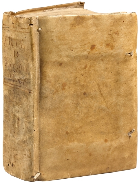
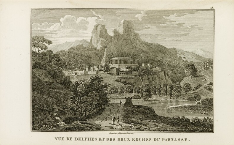
YTB-338 volumes petit in-12 plus 1 volume in-4. Plein maroquin bleu à long grain, filet doré et roulette à froid autour des plats, armoiries dorées frappées au centre, dos à nerfs ornés, coupes décorées, roulette intérieure, tranches dorées. Reliure en maroquin armorié de l’époque signé de Simier. 135 x 83 mm ; 213 x 137 mm. EDITION RARE ORNEE POUR LE TEXTE D’UN PORTAIT ET 28 PLANCHES ET POUR L’ATLAS D’UN TITRE GRAVE ET 35 PLANCHES, DONT 2 DEPLIANTES. Un voyage historique imaginaire, véritable somme des connaissances du XVIIIe siècle sur la Grèce antique et qui contribua à en développer le goût en France et en Europe. PRECIEUX VOLUMES RELIES A L’EPOQUE EN MAROQUIN BLEU AUX ARMES DE LA Duchesse de Berry. Marie-Caroline-Ferdinande-Louise de Bourbon-Sicile, fille de Ferdinand 1er roi des Deux Siciles, et de Marie-Clémentine, archiduchesse d'Autriche, née à Naples le 5 novembre 1798, épousa le 17 juin 1816, Charles-Ferdinand d'Artois, duc de Berry, second fils du futur Charles X, qui fut assassiné le 13 février 1820. La duchesse de Berry, veuve à 22 ans, se consacra à l'éducation de ses deux enfants, Louise-Marie-Thérèse d'Artois et Henri-Charles-Ferdinand-Marie-Dieudonné, duc de Bordeaux, né posthume ; très courageuse, elle essaya en 1832 de fomenter en Vendée un soulèvement légitimiste qui échoua ; trahie le 7 novembre de la même année par le juif converti Deutz, elle fut enfermée dans la citadelle de Blaye où elle mit au monde une fille qu'elle avait eue du comte Hector Lucchesi-Palli, qu'elle avait épousé secrètement en 1831 ; remise en liberté en juin 1833, elle fut tenue à l'écart par la famille royale et se vit enlever la direction de l'éducation de son fils. Elle vécut à Venise et mourut le 17 avril 1870 au château de Brunnsee en Styrie. Cette princesse, aux goûts artistiques très développés, avait constitué dans son château de Rosny, près Mantes, une luxueuse bibliothèque remarquable tant par le choix des éditions et la richesse des reliures que par l'importance des manuscrits qu'elle renfermait.
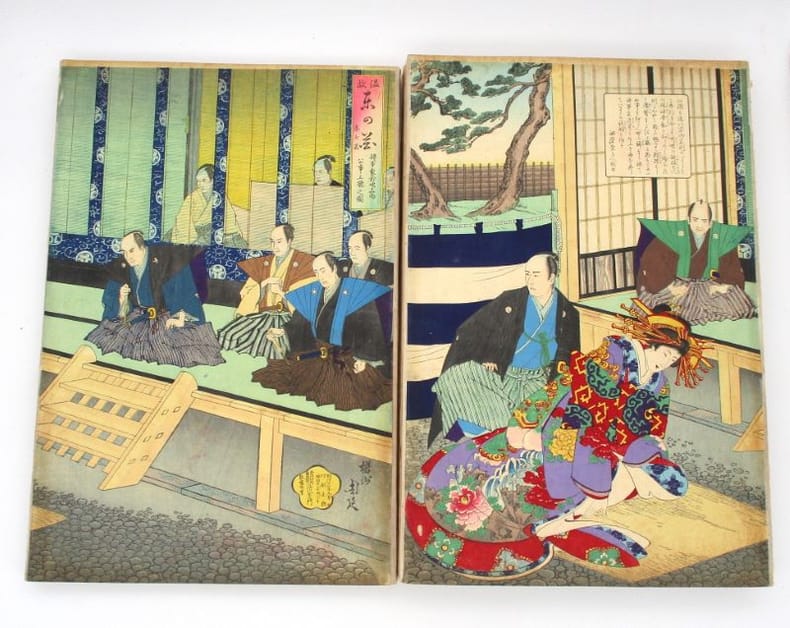
19282Tokyo, [entre 1879-1896]. In-folio, [45] ff., leporello/orihon (terme japonais), cartonnage de toile écrue, étiquette de papier calligraphié à la main (petits frottements, quelques rares manques).
14780Paris, chez Jacques Langlois et Emmanuel Langlois, 1654. 5 parties en 1 volume in-4, (18)-481-(11) pp. et 3 cartes. plein veau granité , dos à nerfs orné, pièce de titre ébène (mors habilement restaurés, ainsi que la page de titre).
16557501CBFranckfurt, Merianschen Erben, 1655. 2°. (3) Bl., 661, (2) S. Mit gestochenem Titel, 5 doppelblattgrosse Kupferkarten (davon 3 gef.), 2 doppelblattgrosse Kupfertafeln und 174 Textkupfer (davon 5 Karten). Späterer Halblederband mit handschriftlicher Rückenbeschriftung. + Wichtig: Für unsere Kunden in der EU erfolgt der Versand alle 14 Tage verzollt ab Deutschland / Postbank-Konto in Deutschland vorhanden +, 7501CB|7501CB_2 [2 Warenabbildungen]
LCS-11568Édition originale de la plus grande rareté de cette relation de la mission établie par les jésuites aux Indes orientales au milieu du XVIIe siècle. Paris, Jean Henault, 1659. In-8 de (1) f.bl., (4) ff., 238 pp., (1) f., (1) f.bl. Relié en plein vélin souple de l’époque, titre manuscrit en tête du dos lisse, cote de bibliothèque en queue. Reliure de l’époque. 161 x 103 mm.
192, (18) SS. Mit gest., ill. Titel und 37 gest., mehrf. gefalt. Ansichten, Karten und Plänen. Etwas späterer Lederband mit reicher Rücken- und Deckenvergoldung. Folio (212:324 mm). Hervorragend erhaltenes und außergewöhnlich breitrandiges Exemplar der zweiten Ausgabe. "Die 1. und 2. Ausgabe sind qualitativ sehr gut: weißes Papier, guter Druck und ausgezeichnete Kupferstiche" (Nebehay/W.). Die Tafeln vollständig mit dem im Tafelverzeichnis nicht angegebenen, häufig fehlenden Plan von Trachenberg und der vierblattgroßen Ansicht von Prag. Aus der Bibliothek des John Thynne, letzter Baron Carteret of Hawnes (1772-1849), mit dessen Exlibris und etwas späterem Sammlerstempel (Monogramm HK) am fliegenden Vorsatz. Der schöne Einband mit minimalen Restaurierungsspuren an den Kapitalen, innen völlig fleckenfrei und auf besserem Papier. VD 17, 23:301612X. Wüthrich IV, 51. Nebehay/W. 405. Schuchhard 14 A.
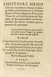
LCS-7618Édition originale «très rare et très recherchée» de cet abrégé des voyages entrepris jusqu’alors par les Gaulois en Asie et en Terre Sainte. Paris, 1552. Paris, Sebastian Nivelle, 1552. Petit in-16 de 55 ff. Sans l’Apologie de la Gaule prévue pour faire suite à ce texte. Relié en plein maroquin prune janséniste, dos à nerfs avec le titre doré, double filet doré sur les coupes, roulette dorée intérieure, tranches dorées. Reliure signée Chambolle-Duru. 112 x 78 mm.
180960270Paris, Dentu, 1809. 8vo & Folio. Four text-volumes and one atlas-volume. Text-volumes uniformly bound (by Harry Larsen) uncut with contemporary blue blank wrappers in recent half calf with gilt lettering to spines. A stamp to title-page in all volumes. With repaired worm-tracts throughout, primarily affecting margins, but with occassional loss of text, otherwise internally clean. LX, 389 (4), 562 + three folding tables (4), 479" (4), 380 pp.Atlas-volume in contemporary half calf with gilt lettering to spine. Worm-tract to inner margin and light margin brownpostting. 25 numbered plates: An engraved portrait of the author, 5 detailed folded maps, 7 plates depicting animals, 8 city plans and views, including a double page plan and view of Buenos Aires, and four bird plates. A complete set.
Paris, Dentu, 1809. 8vo & Folio. Four text-volumes and one atlas-volume. Text-volumes uniformly bound (by Harry Larsen) uncut with contemporary blue blank wrappers in recent half calf with gilt lettering to spines. A stamp to title-page in all volumes. With repaired worm-tracts throughout, primarily affecting margins, but with occassional loss of text, otherwise internally clean. LX, 389 (4), 562 + three folding tables (4), 479 " (4), 380 pp.Atlas-volume in contemporary half calf with gilt lettering to spine. Worm-tract to inner margin and light margin brownpostting. 25 numbered plates: An engraved portrait of the author, 5 detailed folded maps, 7 plates depicting animals, 8 city plans and views, including a double page plan and view of Buenos Aires, and four bird plates. A complete set.