39 458 résultats
Paris, Imprimerie Royale, 1773. 4to. 2 nice contemp. full mottled calf. 5 raised bands. Richly gilt spines, tome-and titlelabels with gilt lettering. Neat repairs to top of spines. Stamps on title-pages. Corners a bit bumped. (4),LXXIX,803 "(4),622 pp., 5 folded engraved maps, 1 engraved plate and 5 folded tables. Light browning to a few quires. Lower right corners on the last 3 leaves in volume 1 with a mild foxing.
178350619Stockholm, Anders J. Nordström, 1783. 8vo. Contemp. hcalf. Raised bands, gilt spine, titlelabel with gilt lettering. A very small nick to foot of spine. XV,766 pp., 9 folded engraved plates, 1 large folded engraved map. A fine clean copy.
Stockholm, Anders J. Nordström, 1783. 8vo. Contemp. hcalf. Raised bands, gilt spine, titlelabel with gilt lettering. A very small nick to foot of spine. XV,766 pp., 9 folded engraved plates, 1 large folded engraved map. A fine clean copy.
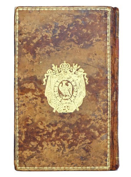
1383Paris : Maradan, an X (1802). L'EXEMPLAIRE DE L'EMPEREUR ET DE L'IMPÉRATRICE AU CHÂTEAU DE MALMAISON
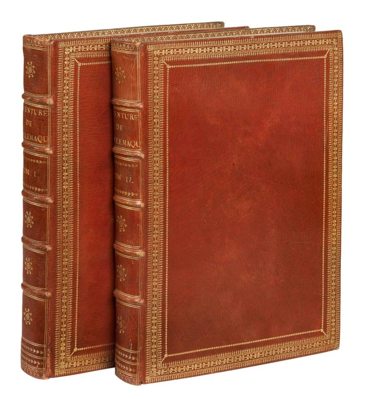
17958032Paris, Antoine-Augustin Renouard, 1795. 2 volumes in-4 (293 x 212 mm), de 2 ff. n. ch., 366 pp. ; 4 ff. n. ch., 348 pp. Maroquin rouge, jeu de roulettes dorées encadrant les plats, dos à nerfs orné, roulette sur les coupes et les chasses, tranches dorées, la tomaison de la reliure a été inversée et rectifiée postérieurement (reliure de l'époque).
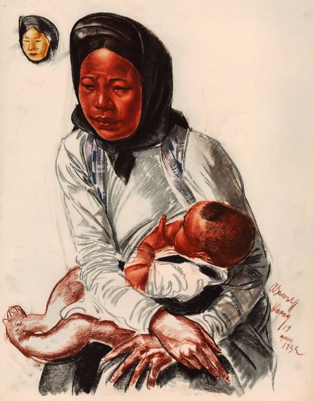
193314334VOGEL MEYNIAL 1933 1 Croquis de route et notes de voyage. Paris, Vogel - Meynial, s.d. (1934), in-folio sous chemise à rabats.
LCS-11086Édition originale de cette remarquable relation par La Condamine de la première descente scientifique de l’Amazone. L’un des quelques exemplaires imprimés sur grand papier. S.l., 1746. In-8 de : I/ (2) ff., xvi pp., 216 pp., 1 carte dépl. ; II / (1) f., 108 pp., (2) ff., 1 pl. dépl. Relié en veau fauve marbré, dos à nerfs orné de fleurons dorés, pièce de titre en maroquin rouge, tranches mouchetées. Coins frottés, petit manque aux coiffes. Reliure de l’époque. 198 x 125 mm.
First edition, 4to (280 x 210 mm), [6], xl, 252, cxlivpp., with errata slip, folding engraved chart frontispiece (lightly offset onto title), 2 folding engraved maps, 29 aquatint plates of which 15 are hand-coloured (some folding), 3 large folding engraved meteorological registers, with an appendix of scientific observations and reports, some offsetting, cont. half calf, marbled boards, five raised bands, five compartments with triple gilt filet borders, the sixth with leather label lettered in gilt, marbled edges, a very handsome copy. "A famous, even notorious, voyage, led by Captain John Ross. As his lieutenants, Ross had aboard William Parry, James Clark Ross, and Edward Sabine, all of future fame as explorers. Ross attempted to proceed westward through Lancaster Sound, but being deceived, presumably by a mirage, he described the passage as barred by a range of mountains, which he named the Croker Mountains, despite the disbelief of his colleagues. On returning to England in November, the report was, at first, accepted as conclusive, and Ross was promoted to post rank in December, 1818. In the following year he published this volume. A controversy soon arose which called Ross's courage into question and opened a life-long quarrel between him and Sir John Barrow, Secretary of the Admiralty".?Hill. Provenance: Armorial bookplate of Colonel Ernest William Greg (1862?1934) to front paste-down. Abbey Travel, 634; Hill, 1488; Lande, 1425.
168160953Genff, Widerhold, 1681. Folio (340 x 210 mm). Recently bound in a magnificent pastiche-binding of brown half calf with gilt red leather title-label to elaborately gilt spine. Vellum corners. Title-page with stains. A few marginal repairs, not affecting text. (8), 82 pp.
Amsterdam, Jacob van Meurs, 1665. Folio (308 x 194 mm). In contemporary full vellum. A few dots and marks to extremities. Small stamp and previous owner’s name to title-page. Occassional underlignings throughout. A few plates with professional marginal repairs. An overall nice copy. (10), 208, 258, (10) pp., + Engraved portrait, large folded engraved map, 2 engraved plates with coat of arms, 34 double-page engraved views and 110 large engraved text-illustrations.
.....Compiled from Papers and other Materials of the Right Honourable George Lord Anson, and Published under his Direction, by Richard Walter, M.A. Chaplain of His Majesty's Ship the Centurion. SUBSCRIBERS COPY OWNED BY SUBSCRIBER LISTED IN BOOK AND WITH ADDITIONAL MANUSCRIPT LEAF SIGNED BY ANSON. First Edition. Quarto, measuring approximately 260mm x 210mm. 34, 420 pages, with 42 engraved folding plates and maps. Bound in a contemporary full calf binding. Bound without the directions to binder leaf, otherwise a stunning and very clean copy of this book. WITH THE SIGNATURE OF HENRY PENNYMAN ON THE TOP OF THE TITLE PAGE WHO IS LISTED IN THE LIST OF SUBCRIBERS AND THE BOOKPLATE OF JAMES PENNYMAN. IN ADDITION THERE IS A MANUSCRIPT LEAF - A RECEIPT FOR LOAN IN SALT - SIGNED IN THE ORIGINAL BY ANSON IN MAY 1752. This is the official account of Anson's voyage. England, at war with Spain in 1739, equipped eight ships under the command of George Anson to harass the Spaniards on the western coast of South America, for the purpose of cutting off Spanish supplies of wealth from the Pacific area. The Spanish fleet sent out to oppose the British ran into storms; provisions ran out and many ships were wrecked. Anson continued taking prizes during 1741-42, off the Pacific coast, and in June, 1743, captured the Manila galleon containing a vast treasure in Gold and Silver. Cox I, p. 49. Hill 1817. National Maritime Museum I, 109. Sabin 1625. Manuscript
- Chez Théodore Le Gras, à Paris 1728, in-12 (9,5x17cm), (2 p.) xvij (7 p.) 346 pp. et (2 p.) ij ; 376 pp. et (2 p.) ij ; 387 pp. et (6 p.) 392 pp. et (6 p.) 404 pp., 5 volumes reliés. - Nouvelle Relation de l'Afrique occidentale Chez Théodore Le Gras, à Paris 1728, 12° (9,5x17cm), (2 p.) xvij (7 p.) 346 pp.; (2 p.) ij 376 pp.; (2 p.) ij 387 pp.; (6 p.) 392 pp.; (6 p.) 404 pp., 5 volumes bound. First edition of this famous description of West Africa. 78 full-page engraved plates: - volume 1: 5 maps, 2 plates and 1 folding plan - volume 2: 6 maps, 17 plates and 4 folding plans - volume 3: 2 maps and 13 plates - volume 4: 5 maps, 8 plates and 3 folding plans - volume 5: 3 maps and 9 plates Contemporary beige calf, spine elaborately gilt, XIXth century red leather title and volume pieces, boards decorated in blind, marbled endpapers, all red edges. Joints and spine-ends very skillfully restored. An old strip of white paper hiding the name of a former owner on each volume. Based on the memoirs of André Brue (director of the Senegal Royal Company), this study contains interesting details on commercial companies in Mauritania, Senegal, Guinea, Gambia and Sierra Leone, customs of the inhabitants, religious beliefs, natural history, etc. Many passages concern the slave trade. "Jean-Baptiste Labat, more commonly known as Father Labat (Paris, France, 1663 - Paris, France, 1738), was a Dominican missionary, botanist, explorer, ethnographer, military man, landowner, engineer and writer. A staunch defender of slavery, he played an important role in the sugar cane industry in the French West Indies. He is known for developing a type of brandy to cure fever, which after some improvements became rum." (Museum of Art and History, Le Havre) [FRENCH VERSION FOLLOWS] Edition originale de cette célèbre description de l'Afrique de l'ouest, illustrée de 78 planches hors texte gravées et réparties comme suit : - tome 1 : 5 cartes, 2 planches et 1 plan dépliant - tome 2 : 6 cartes, 17 planches et 4 plans dépliants - tome 3 : 2 cartes et 13 planches - tome 4 : 5 cartes, 8 planches et 3 plans dépliants - tome 5 : 3 cartes et 9 planches Reliures de l'époque en plein veau blond, dos à cinq nerfs richement ornés, pièces de titre et de tomaisons de cuir rouges refaites au XIXème siècle, filets à froid en encadrement des plats, roulettes dorées sur les coupes et les coiffes, gardes et contreplats de papier à la cuve, toutes tranches rouges. Mors et coiffes très habilement restaurés. Un bande ancienne de papier blanc masque le nom d'un ancien possesseur sur chacun des volumes. L'ouvrage, constitué d'après les mémoires d'André Brue (directeur de la Compagnie royale du Sénégal), contient des détails intéressants sur les compagnies commerciales en Mauritanie, au Sénégal, en Guinée, en Gambie et au Sierra Leone, des considérations sur les moeurs des habitants, sur les croyances religieuses, sur l'histoire naturelle, etc. De nombreux passages concernent la traite des Noirs. "Jean-Baptiste Labat, appelé plus communément Père Labat (Paris, France, 1663 - Paris, France, 1738), était un missionnaire dominicain, botaniste, explorateur, ethnographe, militaire, propriétaire terrien, ingénieur et écrivain. Fervent défenseur de l'esclavage, il joue un rôle important dans l'industrie de la canne sucre dans les Antilles françaises. On lui attribue l'élaboration d'une eau de vie pour soigner la fièvre, qui après quelques améliorations est devenue le rhum." (Musée d'Art et d'Histoire du Havre)
- Ex typographia Francisco Martinez, Matriti (Madrid) 1629, petit in-folio (20x29,5cm), (6) 751pp. (100), relié. - SOLÓRZANO PEREIRA Juan de De iusta indiarum occidentalium inquisitione, acquisitione & retentione Ex typographia Francisco Martinez, Matriti (Madrid) 1629, small in-folio (20 x 29,5 cm), (6) 751 pp. (100), contemporary vellum First edition, very rare. A very attractive frontispiece-title by Roberto Cordier showing an altar with allegories of Faith and Religion, the king of Spain with one foot on an Globe supported by Neptune. A second volume was published in 1639 on the government of the West Indies. Contemporary speckled limp vellum. Jansenist spine. Red morocco title-piece. Spine faded with black spots. Small lacks to head and foot of joints. Trace of a yellow dampstain to right-hand corner of last twenty leaves. Letter to Phillip IV of Spain and introductory portions lacking, a total of 11 leaves. In 1618, Juan de Solórzano Pereira wrote the king a petition to make him part of a book project on the West Indies. King Philip IV was seduced by the general idea of legally asserting once and for all the legitimacy of the Spanish possessions in America and financed the first book on justice, but not the second on the forms of government, which appeared in 1639. The author had been a judge in Lima since 1609 by Royal appointment. The Viceroy of Peru appointed him Governor of Huancavelica, a mining outpost of key economic importance to Spain, an office he was to fill during his eighteen years in Peru, as well as Procurator to the Supreme Council of the Indies (Real y supremo consejo de Indias). Pereira developed an extensive and detailed knowledge of Spanish jurisprudence in the West Indies, studied numerous documents, and ended up with a significant wealth of knowledge, especially on the ancient customs of the indigenous peoples. The first part of the book is dedicated to studying the laws that allowed the attachment of the American possessions to the crown of Castille. Here, the focus is the definitive legitimation of the Spanish possessions in America. The author then looks at the question of the Church and its relations with the Spanish crown, as well as laws on government in general, the administration of justice, and finally the laws regulating relations with the indigenous peoples and territories. The importance of Pereira's work is to be found in his relentless effort to find the history and origin of each law. 1680 saw the publication of the famous collection of the laws of the Indies, (the Recopilacion de las leyes des las Indias), but this could not replace the excellent work of Pereira, who spent a long time studying the oldest laws as well as those of the Indies. In fact, all the ancient laws, and their indigenous origins, disappeared from the collection of the laws of the Indies, and Pereira's work would remain key for the history of the West Indies and Spanish Americas. [FRENCH VERSION FOLLOWS] Édition originale, très rare. Un très beau titre-frontispice de Roberto Cordier figurant un autel avec les allégories de la Foi et de la Religion, le roi d'Espagne un pied sur la Terre, elle-même dans un bras de Neptune. Un second volume sera publié en 1639 sur les gouvernements des Indes occidentales. Reliure de l'époque en plein vélin souple moucheté d'époque. Dos lisse janséniste. Pièce de titre en maroquin rouge. Dos assombri avec taches noires. Petits manques aux mors en queue et en tête. Une trace de mouillure jaune au coin droit des vingt derniers feuillets. Absence de l'épître à Philippe IV d'Espagne et des pièces liminaires formant onze feuillets. En 1618, Juan de Solórzano Pereira écrit au roi une pétition pour lui faire part d'un projet de livre sur les Indes occidentales. Le roi Philippe IV est séduit par l'idée générale d'asseoir définitivement par le droit la légitimité des possessions espagnoles en Amérique et financera le premier livre sur la justice mais non le second sur les formes de gou
Stockholm, Wankijfs Änkia, 1702. 4to. Bound in a fine recent full red morocco with raised bands and compartments with gilt with floral stamps. Gilt lineborder to boards (A.M. Ræder). Title-page printed in red/black. Woodcut vignette to title-page and on errata-leaf. (16), 191, (1 = errata) pp. 4 maps (2 engraved and 2 in full-page woodcut - the maps (Delaware River) and Nova Sveciae in FACSIMILE), 2 engraved plates (Niagara Falls a. Indians). The engraved frontispiece missing (supplied in facsimile from the reprint of the book). The 2 last leaves repaired in inner margins (no loss of text). The first four leaves re-enforced at inner hinge and loosening from block. Some scattered brownspots and marginal browning.
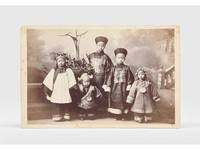
1885179195New York: G. W. Pach & Brothers c.1885. A landmark moment in the history of teaching Chinese A rare photograph of the first instructor of Chinese at Harvard a well-known example of travel against the west-to-east grain. Ko brought with him from China the books that would form the basis of the Harvard-Yenching library. We can trace only a handful of these cabinet cards in commerce. In the late 1870s Harvard decided to offer Chinese classes to prepare undergraduates for lucrative but demanding careers in the Chinese customs service. After the university raised $8750 to finance a lectureship Harvard graduates in China including Edward Drew and H. B. Morse searched for a suitable candidate settling on Drew's former Chinese tutor from Ningbo. Ko 1838-1882 also romanized as Ge Kunhua arrived at Harvard in September 1879 taking as his first student George Lane Pope Professor of Latin in return for Lane teaching him English. "The few remaining photographs of Ko reveal a dignified middle-aged man in the long high-necked heavy garments of a scholar-official of the Qing dynasty" Harvard Magazine. Ko remained in Cambridge until his sudden death from pneumonia in 1882 following which Harvard paid for his family's return to China. His appointment was far ahead of its time: the university did not restore Chinese to the curriculum for another four decades. Ko was accompanied to the US by his six children five of whom are shown in the second cabinet card although only the names of the sons Ge Zhong and Ge Shu are known. Drew helped pay for the pair's education following their father's death. The Pach brothers established their first studio in New York in the 1860s. Between 1877 and 1890 they traded from 841 Broadway. Both cabinet cards give this main address and the Pach satellite locations including Cambridge and New Haven. In 1895 a fire destroyed the firm's entire stock of negatives. 2 albumen prints c.150 x 100 mm and inverse on card mounts 163 x 106 mm verso with yellow surface-paper printed with Pach mark. Light foxing to images image of children slightly faded: very good. "Ko K'un-hua: Brief life of Harvard's first Chinese instructor: 1838-1882" Harvard Magazine 2008; Ye Tian "From Greek/Latin to Chinese" in Deborah L. Morowski & Lynn M. Burlbaw eds Reflections on People Policy and Practices in Curriculum History 2024. unknown
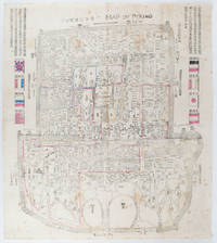
1900169765Circa1900. Large illustrated map of Beijing showing the city in the period following the invasion of the military forces of the Eight National Alliance old folds scale not given. Some scattered light foxing particularly at edges short closed tear at fold lower edge neat non acidic tape repair short section upper edge wear along folds and a couple of small unobtrusive holes with minor image loss. Blocks of text in traditional Chinese right and left upper sections stating each nation's occupied zone Japanese text title accompanies the English title along the upper section of the map. 63.7 x 56.9cm. Very good overall. A rare and significant large Japanese woodblock map of Peking Beijing issued just after the suppression of the Boxer Rebellion. Centred on the Forbidden City the map depicts Peking following the multinational suppression of the Boxer Rebellion or Yihetuan Movement of 1900. The map was issued to illustrate the areas of occupation associated with each of the powers in the Eight Nation Alliance. <br> <br>The map gives measurements of the city walls detailed names of streets and buildings and the boundaries of the inner and outer city including the forbidden city are shown with demarcation lines in pink yellow and blue. The hand coloured eight national flags of the occupation powers are featured at the right and left. <br> <br>This map is essentially a later edition of 京城内外首善全圖 a map of Beijing issued by the Qing for administrative purposes in the mid-19th century. The Japanese seized the wood blocks during the suppression of the Rebellion and subsequently pulled new impressions overprinting them additional details including flags and demarcations of areas of the city held by members of the Alliance. Versions are known in French German Japanese and as with the present example English. An attractive map of great historical interest. . unknown
170561337Amsterdam, Honore, 1705 (+) Amsterdam, Boeteman, 1704. 8vo. In contemporary full calf with four raised bands and richly gilt spine. Tear to upper part of spine. Bookblock bended but still firmly attached to the binding. Title-page and frontispiece (of 'Voyages Du Baron Lahontan') with tears and chipped in margin, partly detached. With a few occassional brownspots and tears in plates.(18), 376, (2), 5-336, (2) pp. + 26 plates (including the frontispiece)" (16), 222 pp. + 2 maps and 4 double-page engraved plates. (collation corresponds to Sabin 38641 & 38634).
In-12, [34]-604-[32]p. Réédition parue du vivant de l'auteur de cette précieuse relation, dont l'édition fut partagée entre les libraires Pierre Van der Aa de Leyde, et Adrian Braakman d'Amsterdam. La première édition de cette relation fut publiée sous le titre de Description de la Louisiane, à Paris, chez la veuve Huré, en 1683 et rééditée sous des titres différents, avec quelques amplifications. Pour la rédaction de son ouvrage, le père Hennepin mit à contribution les récits de Cavelier de La Salle et ceux des pères Zenobre Membré et Christian Le Clercq. C'est dans cet ouvrage que l'on trouve imprimé pour la première fois le nom de Louisiane. Belle illustration gravée en taille-douce, comprenant un frontispice, 2 grandes cartes dépliantes et 6 planches montrant les chutes du Niagara, la construction du Griffon, navire de La Salle, et autres faits marquants. Né à Roye vers 1640, le père Hennepin, entré jeune dans l'ordre des Recollets, s'embarqua pour le Canada en 1676. A l'été 1679, il accompagna Cavelier de La Salle dans l'exploration des grands lacs. En février 1680, il fut chargé par ce dernier de reconnaitre l'embouchure de l'Illinois et remonter le Missisipi ; à hauteur de la rivière Wisconsin, il fut enlevé par des Sioux. Après deux mois de captivité, il fut, ainsi que ses deux compagnons, délivré par Daniel Greysolon du Lhut. Par la suite, le père Hennepin regagna l'Europe. Le Voyage ou Relation exacte de l'origine, mÏurs, coétumes, religion, guerres & voyages des caraibes, sauvages des isles Antilles de l'Amérique, de La Borde, porte un titre particulier, daté aussi de 1704. Papier légèrement roussi, néanmoins très bon exemplaire de cet ouvrage des plus rares.
Woodcut ovoid roundel (60 x 75 mm), contemporarily trimmed to just outside neatline and contemporarily mounted to a larger sheet of paper (in excellent condition). One of the earliest printed views of what is today Beijing: an unrecorded bird's eye prospect over 'Cambalu', or Khanbaliq (on the site of modern Beijing), the capital of China during the Yuan Dynasty (1271-1368). The Yuan Dynasty was founded by the legendary Mongol warrior Kublai Khan, who after conquering China proclaimed his new capital at Khanbaliq, although the city would not be completed until 1293. During the succeeding Ming Dynasty (1368-1644), Khanbaliq was transformed into what is known as Beijing. Interestingly, as seen in the view, the walled rectangular form of the old city of Beijing is already evident in the design of Khanbaliq. Marco Polo visited Khanbaliq, but his description of its location was vague. For over two centuries thereafter Europeans were confused as to not only the location of "Cambaluc", but they even sometimes confused its identify with "Cathay" (China), thinking that it was the name for the entire country. This confusion was cleared up by the Jesuit Matteo Ricci during his first visit to Beijing in 1598, when he definitively identified Khanbaliq as the precursor to the modern Chinese capital. The present work is one of a series of 26 woodcut roundels of views and maps that were found together as collection. Charming, mysterious and apparently unique, in the absence of any accompanying documentation we are left to make educated guesses about their genesis. By all appearances they seem to be late 16th or early 17th century Flemish or Dutch woodcuts, probably proofs for vignettes to adorn the sides of an unrealized copper-engraved wall map (or maps). Indeed, this period saw the beginnings of the "carte à figures" wall maps that became all the rage during the 17th century, and which occupied an iconic place in the art world of the Low Countries. In the fluid and fast-paced environment of the large European print shops, it was common for artists to experiment with designs for copperplate maps by making woodcut proofs, as carving into wood was much quicker and cheaper. Only if the design was accepted for publication was it engraved into copper (an expensive and demanding process). The views within the roundels were generally predicated on the most authoritative recent sources. Many of the views are based on those published within the first four volumes of Braun & Hogenberg's "Civitates Orbis Terrarum" (6 vols., 1572-1618), the first great "town book", featuring bird's eye views of cities in Europe, Asia, Africa and America. Inspired by Ortelius's ground-breaking world atlas "Theatrum Orbis Terraum" (1570), which featured all of the world's known regions in detail, this monumental endeavour featured 546 views and maps of cities. The views from the "Civitates" are imbued with profound historical importance as, in many cases, they are the first accurate and detailed views of many great cities and towns, and were the most popular and influential images of these urban centres available to Europeans during the late 16th and much of the 17th centuries. Other fantastic sources include Jan van Linschoten's "Itinerario" (Amsterdam, 1596), one of the most consequential books ever written, responsible for breaking the Portuguese monopoly on European trade in South and East Asia. Likewise, other views were borrowed from important and pioneering 16th century prints and manuscripts. The unknown maker of the set of roundels to which the present view belongs likely intended for them to serve as proofs for the vignettes adorning the sides of an intended "carte à figures" wall map (or more likely maps). The creation of such woodcut proofs was commonplace, although very few examples survive to this day, as most were destroyed once their incidental use had transpired. In any event, these woodcut roundels are a fascinating insight into the operations of a large cartographic workshop in the late 16th century.
LCS-4074Jolie édition du “routier le plus célèbre du XVIIe siècle” (A. Charon). Exemplaire très pur conservé dans son vélin souple de l’époque. Le Havre, 1731. Au Havre de Grace, chez la veuve de Guillaume Gruchet, 1731. In-4 de (4) ff., 413 pp., bifeuillet signé “Entre C D” ajouté entre les cahiers C et D, 23 pp., nombreuses figures et cartes gravées dans le texte. Rousseurs, pages de garde couvertes d’annotations manuscrites. Relié en vélin souple de l’époque, dos lisse avec le titre calligraphié, quelques taches. Reliure de l’époque. 178 x 140 mm.
179955330Chez H. Agasse | Paris 1799 - 1807 | 12.50 x 21 cm | 7 volumes reliés
8vo. (2), II, (1), (1 blank), 130 pp. With numerous Chinese characters in text and 3 wood engraved illustrations in text. Contemporary blind- and gold-blocked cloth. First separately published edition of a work on Chinese travellers from the 13th century by the Baltic physician and sinologist Emil Bretschneider (1833-1901). The book opens with a preface and an introduction, followed by four chapters, each devoted to a different Chinese traveller or voyage to the west. Bretschneider starts each chapter with a brief introduction, followed by a translation of Chinese sources including many Chinese characters, mostly for Chinese names, cities, rivers, mountains, etc. The first chapter deals with the travels of the Taoist monk Qiu Chuji (1148-1227), who travelled to Persia and India in the years 1221-1224 to meet the Mongol Khan. The second chapter narrates the journey of a Mongol embassy, dispatched in 1259 to west Asia, and chapter three is an "account of Western countries", written by an envoy of the Chinese Jin dynasty around 1220. He describes the customs and culture of the "Mohameddans" he meets in the west, probably describing the city Herat in Afghanistan. The fourth and last chapter describes partly the travels of the Khitan statesman Yelü Chucai, who served Genghis Khan, to present-day Tajikistan and Uzbekistan. The book closes with some corrections and an appendix. Bretschneider mentions in his preface that the text was first published in the Chinese recorder and missionary journal. Bretschneider worked at Beijing from 1866 tot 1883 as doctor to the Russian Legation. "His writings both on botany and geography are extremely valuable" (Couling), most of them dealing with China. - Presentation copy, with a note by the author to "V. Gauvain" in ink on first flyleaf. Title-page with some faint damp stains, otherwise in very good condition. Cordier (Sinica) 2667. Couling 64.
folio [46 x 31 cm]; 12 hand colored lithographed plates as issued by E. Prugue from the original paintings of A.A. BonnaffÚ. original blind-stamped cloth portfolio, gilt title lettering on cover, light staining on front cover but heavier on rear cover, a few light foxing spots but most in the tissue guards, very good impressions of plates. A picture of this book is available up Hilier and Hilier 101. Palau 32375. The plates are of people in Lima in period costume, activities, the titles being El Cholo Coste±o, La Chola Quesera, El Heladero, La Chola Frutera, El Biscochero, La Chola Rabona, La Tapada (de noche), El Indio de la Sierra, La Tapada, La Chola de la Sierra, La Tapada (Saya y manto), La Tapada (Saya y Manto). This copy has 6 additional duplicate plates from another copy (two with margins chipped, lightly foxed). The book was not issued with a title page or text.
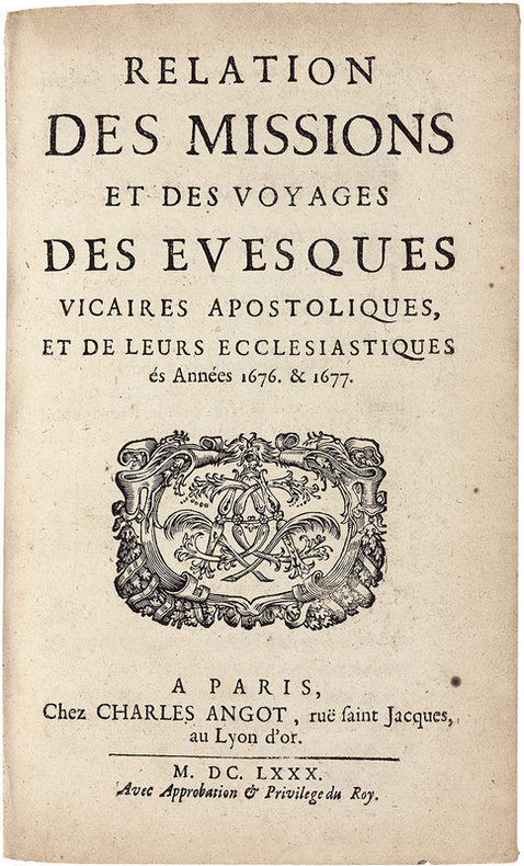
LCS-18085Précieuse édition originale de ce récit des « missions de la Cochinchine, du Tonkin, Siam et Cambodge. Très rare » (Chadenat, II, 4391). Paris, Charles Angot, 1680. In-8 de (8) ff., 242 pp., (1) f. de privilège. Plein veau brun granité, dos à nerfs orné, roulette dorée sur les coupes. Reliure de l’époque. 187 x 116 mm.
LCS-15364Précieuse description de l’Afrique de la plus grande rareté. L’exemplaire Phillips. Tournai, Adrien Quinque, 1622. 2 parties en 1 volume petit in-4 de (2) ff., 152 pp., (3) ff., 194 pp., (3) ff. insérés parmi ces 194 pp., (3) ff. Relié en plein vélin de l’époque, dos lisse avec le titre manuscrit. Reliure de l’époque. 200 x 150 mm.