39 462 résultats
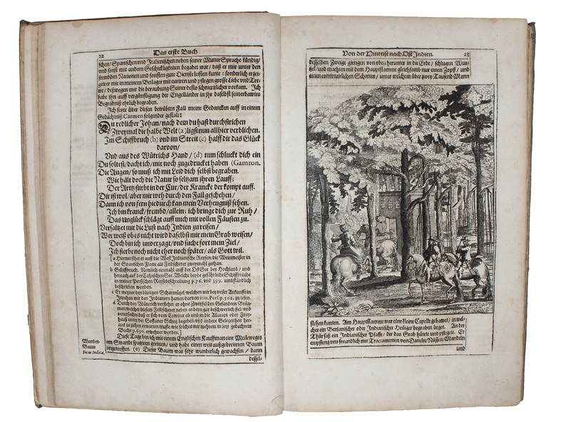
12mo. (20), 455, (1) pp. With separate double-page-sized engraved title and 24 engraved plates (mostly views). - (Bound after) II: Grundmann, Martin. Geist- und Weltliche Geschichtschule, oder ergetzliche nutz- und lehrreiche Geschichte, Beyspiele und Begebnüsse von mancherley wunderbare[n] Verhengnüssen, Gerichten, Wolthaten und Straffen Gottes, als auch seltsamen Zufällen, Eigenschafften und denckwürdigen Tugend- und Lasterthaten der Menschenkinder. Auß bewährten, gelährter Leute Geschicht- Zeit- und Kunstbüchern zusammenbracht. Dresden, Andreas Löffler, 1655. (12), 405, (11) pp. With separate engraved title page and a numismatic plate opposite p. 185. Contemporary vellum. Early, rare German-language gazetteer of the Ottoman Empire, describing many cities and places throughout the Middle East, the Mediterranean and Eastern Europe, including 17th-century accounts of Aden, Mecca and Medina in Arabia. The bird's eye views and plates include Aden, Alexandria, Algiers, and Rhodes; Constantinople; Buda, Pest, Kanizsa, Eger, Esztergom, and Temesvar, as well as Muhammad's grave in Medina. Prefixed to the work is an index of sources from whom this compilation has been drawn (including several Muslim and oriental authors). - Bound first is the first edition of Grundmann's historical manual, with alphabetical articles about the lives or rulers and saints, rare and fantastic plants and beasts, exotic godheads, historical events, commendable traits of character, etc. The fine engraved title includes eight emblematic vignettes. - Old stamps to titles of Grundmann's work; altogether a finely preserved specimen. I: VD 17, 23:315597C. Dünnhaupt 11 (citing only 22 plates). Nebehay/Wagner 1051 (citing only 17 plates). Jöcher II, 704. Will I, 463. Not in Aboussouan, Atabey, Blackmer. - II: VD 17, 39:119939P.
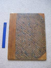
Large 4to (193 × 287 mm). "Komon" patterns for cloth or paper designs. 13 ff. with 159 (but: 156) katazome-dyed paper pattern sheets numbered and captioned by hand. Japanese block stitching in indigo wrappers and ms. cover label. The inside front cover has a ms. note providing the name and address of the seller or manufacturer: "Minato Onochô itchôme - Nanbenya Jûzô". The borders of the specimen sheets are fashioned by re-using an older manuscript. - "Komon" is a Japanese pattern dye style based on especially minutely patterned all-over designs. The intricacy of this style originated in 16th century Japan, when it served to decorate the "kami-shimo", or official Samurai garments, and the clothes of the Shogun's family and of some Daimyos. Occasionally, these would even have privileged ("forbidden") designs (so-called "tomegara") which nobody else could wear. Until well into the 19th century, the production of and trade in such "komon" patterns was subject to a special monitoring system. Since the end of the 18th century the patterns were increasingly used by the urban population. Due to the extreme costliness of their manufacture, such garments were worn mainly on semi-official occasions, especially for private ceremonies and celebrations. The patterns, distinguished by their superior delicacy and minute detail, are produced with the help of wax paste and paper stencils ("kata-gami-zome" or "katazome"; cf. Klein-Bednay, Japanische Musterbücher des 18. und 19. Jhs., in: Von Morris bis Memphis, p. 359). - Compared with five similar pattern books in the Metropolitan Museum of Art, dated "ca. 1680" and "ca. 1700", the present specimen shows a wider range of basic colours, while some designs are slightly less intricate. In all other respects, however - such as the arrangement of the pages, the materials use, the size and the scope - show evident parallels, while the 19th century katazome pattern books or other 19th century textile design collections differ markedly. - Binding rubbed; lower wrapper and 3 leaves show slight worming near the gutter. Cf. Metropolitan Museum of Art - Digital Collections, Identifier nos. 23.88.5 through 23.88.8 and 23.88.10.
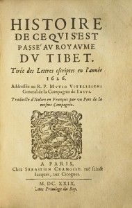
LCS-16911Édition originale de la plus insigne rareté concernant les missions en Chine en 1624 et au Tibet en 1626. Roma, Francesco Corbelletti, 1628.In-8 de 130 pp. Qq. rousseurs, reliure du siècle dernier en plein vélin ivoire, tranches rouges. 148 x 96 mm.
Oblong folio (420 x 312 mm). Contemporary half leather album of 56 large format photographs, ca. 27 x 20 cm. A photograph album containing views of Burma, including images of the staff and works of the Burmah Oil Company, the majority uncaptioned, though several are captioned in the negative and a couple are identified by hand. The Burmah Oil Company was formed in Scotland in 1886 and by the early 20th century owned the largest oil fields in the British Empire, producing 90% of Burma's oil output. - The first eight images show group portraits of staff, the following 48 are topographical or portrait photographs, including views of oil fields, Rangoon, the countryside, an oil blaze and elephants at work. - Album slightly worn; 5 additional large format and 2 small photos (group portraits, a brass band, oil fields enveloped in smoke) loosely inserted. Overall in good condition.
8vo. (16), 427, (1) pp. With each page in a frame of thick-thin rules, mitred at the corners, 4 woodcut headpieces (plus 1 repeat) including 1 with the Portuguese coat of arms, 1 woodcut tailpiece, woodcut decorated initials. Contemporary tanned sheepskin, gold-tooled spine with red morocco label, rebacked. Second edition (after the 1718 Macao edition printed entirely from woodblocks) of a journal of the voyage of António de Albuquerque Coelho (ca. 1682-1745) from Goa in India to Macao on the coast of southern China. The journal was written by João Tavares de Velez Guerreiro, a captain in the Portuguese navy serving in India, who accompanied the governor on the voyage as his chief of staff. Coelho had been appointed governor of the city of Macao in 1717, and they arrived there in May 1718. They travelled via Madras, through the Malay peninsula and along the coasts of Indochina and China. Part 1 gives an account of the voyage itself and part 2 an account of their stay in Johor at the southern tip of the Malay peninsula, where they played a role in a Sumatran adventurer's coup d'état. The publisher Jaime (or Jayme) de la Te y Sagau, better known for his musical publications and his own musical compositions, dedicated the book to the Duke of Cadaval, ending the dedication with a sonnet. It mentions the first Duke, Nuno Álvares Pereira de Melo, but he appears to have died in 1725 or 1727, so it may be addressed to the third Duke Jaime (1684-1749). - Printed on thick paper. With a 1732 inscription on the title-page. The first few leaves are slightly tattered at the fore-edge, not approaching the text, and have been professionally restored, and there are some stains on the fore-edge. Boards show a few minor cuts and scrapes, but binding remains in good condition. A valuable eye-witness account of India, Southeast Asia and China in 1718. Howgego A47. Cordier, Sinica 3219. Löwendahl 377. PorBase (4 copies).
LCS-8124Rare réunion de trois lettres jésuites écrites d’Ethiopie, de Chine et du Tibet. Exemplaire d’une grande pureté conservé dans son vélin de l’époque. Paris, Sébastien Cramoisy, 1629.Soit 3 ouvrages reliés en 1 volume in-8 de : I/ (4) ff., 262 pp. mal chiffrées 252, (1) f.bl. ; II/ (2) ff., 102 pp., (1) f.bl. ; III/ (4) ff., 104 pp. Plein vélin souple de l’époque, dos lisse avec le titre manuscrit. Reliure de l’époque. 168 x 108 mm.
8vo. 2 parts in one volume. (28), 175, (1) pp. (12), 128 pp. Second part contains: [Joachim Bouvet], Icon regia monarchæ Sinarum nunc regnantis. Both parts with separate title pages and frontispieces (repeated portrait of the Emperor K'ang-hsi); additional engraved dedicatory frontispiece (royal monogram) at the beginning of the volume. Contemporary full vellum with faded ink title to spine. Second edition of Leibniz's collection of texts relating to the Jesuit mission to China, the recent treaty between China and Russia, and the remarkable flowering of scientific culture at Beijing under the Manchu emperor K'ang-hsi (d. 1721). In his preface, Leibniz writes: "I consider it a singular plan of the fates that human cultivation and refinement should today be concentrated, as it were, in the two extremes of our continent, in Europe and in Tschina (as they call it), which adorns the Orient as Europe does the opposite edge of the earth." Leibniz had become interested in China after a meeting with the Jesuit missionary Claudio Filippo Grimaldi, who had been appointed mathematician to the court of Beijing. Grimaldi and Leibniz corresponded, and a letter from Grimaldi, addressed from Goa, is reproduced in the work. Leibniz also includes an extract in Latin from Ferdinand Verbiest's "Astronomia Europea sub Imperatore Tartaro Sinico Cam Hy". Verbiest had been entirely responsible for the reintroduction of Western astronomy to China. First published in 1697, this second edition has an additional appreciation for the Emperor by the Jesuit Joachim Bouvet appended which is lacking in the Wolfenbüttel and Berlin copies. - Some minor spotting and browning throughout. Leibniz’s name supplied in neat ink manuscript after initials on title; early notations on front free endpaper; an underlining in red ink. The name of the author of the second part is written on the second title in an early hand. Provenance: G. M and J. H. Farrell (bookplate); Sydney Ross (bookplate); latterly in the library of Jean R. Perrette (bookplate). Extremely rare: no copy of the Lyons first edition has appeared on the market, and this second edition only once. VD 17, 39:123687S. BL (German books) L398. Cordier (Sinica) 835, 634. Streit V, 2779. De Backer/Sommervogel II, 56.
Folio (285 x 430 mm). Engraved half-title, (8) pp., letterpress title with engraved vignette, letterpress half-title, engraved dedication, 15, (1), 17-71, (1), 73-129, (1), 142 ff., (8) pp. With 5 double-page engraved maps, 185 half-page engraved views in the text, and 22 plates (full-page, double-page, and folding, and foliated as 1 or 2 leaves), as well as an engraved headpiece and armorial tailpiece. - (Bound with): L'érection de toutes les terres, seigneuries, & familles titrées du Brabant. Ibid., 1699. (8), 108 pp. With engraved vignette on title page, double-page map of Brabant (same as in first work), engraved dedication, and 7 engraved views in the text. Contemporary full vellum with remains of ties. Fourth, expanded edition of this monumental suite of views showing the chateaux, abbeys, and cities of the Belgian province of Brabant, all finely engraved by G. Bouttats, H. Cause, J. Harrewijn, J. Meyssens, L. Vorsterman, R. Whitehand, and others, after F. Bauduin, W. Hollar, J. van Croes and J. van Werden. Includes a general map of Brabant (from Janssonius/Waesbergen) and four detail maps of the various parts (Louvain, Bruxelles, Antwerp, and Bois-le-Duc). Descriptive text in Latin, French, and Dutch. Among the large-scale plates are a plan of Antwerp and a view of the cathedral, St. Michael's Monastery, Eelwijt Castle, etc. Includes, as common, the author's separately published "Érection du Brabant", extracts from the letters patent granting the establishment of the various nobles' seigneuries. - Some slight waterstaining and brownstaining to margins. Dedication and map of the Louvain area loose with some edge flaws; large tears to the folding views of the Groenendael Priory and of Tongerlo Abbey. Binding rubbed and stained. Most views clean and crisp, in good, well-defined impressions. In all a good copy of this much-sought collection of views. Brunet III, 1002. Bibl. Belgica III, 852/854 (L 108).
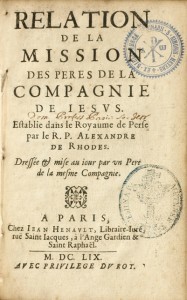
LCS-13109Édition originale de la plus grande rareté de cette relation de la mission entreprise en Perse par le Père Alexandre de Rhodes. Paris, Jean Henault, 1659.In-8 de (1) f.bl., (6) ff., 115 pp., (1) p., (1) f.bl. Relié en plein vélin souple de l’époque, dos lisse avec le titre manuscrit en tête. Reliure de l’époque. 162 x 116 mm.
8vo. (12), 267, (3) pp. With engr. portrait. Modern half vellum, using an older Hebrew manuscript. First edition. - J. A. Schall (1591-1666), missionary and astronomer at the Imperial court at Beijing, was one of the principal Jesuit missionaries in China. He reformed the Chinese calendar and redesigned the Imperial observatory. The present work is his report of his 44-year activity in Asia, also a first-rate source for the history of the 17th-century Jesuit mission in the East. It was edited by J. Foresi after his death. - Old ownerships deleted from title page; some browning and occasional brownstaining. Streit V, 2323. Cordier 821. Lust 845. De Backer/Sommervogel VII, 707, 29, & III, 877, 3 (Foresi).
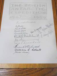
19094440<p>Heinemann London 1909. First Edition. Single Sheet. Very Good Condition/No Dust Jacket. Signed by persons connected with book. In 1909 The Heart of The Antarctic was produced as a Deluxe Special Vellum Binding Issue and limited to 300 copies. The edition contained 2 sheets of signatures 1 from the British participants 14 men of the shore party and 1 from the Australian participants of the shore party 2 men. The sheets would have been signed prior to binding with some spares in case of accidents. This is one of the spares a single unbound sheet of signatures of the British participants of the shore party there is a crease where the sheet has been folded at some time. The signatures are all original. The signatures are of Shackleton Priestley Wild Joyce Day Marston Murray Brocklehurst Adams MacKay ArmytageMarshall Mackintosh & Roberts. The watermarks on the unbound sheet are similar to those found in the bound copy of The Antarctic Book. The watermark on the page of signatures shows part of SCRIVIA FINE and shield with a capital letter T. A rare opportunity to purchase a unique piece on Antarctic history from the Heroic Era Quantity Available: 1. Shipped Weight: Under 1 kilogram. Category: Arctic & Antarctic; Exploration. Signed by persons connected with book. Pictures of this item not already displayed here available upon request. Inventory No: 4440. .</p> Heinemann
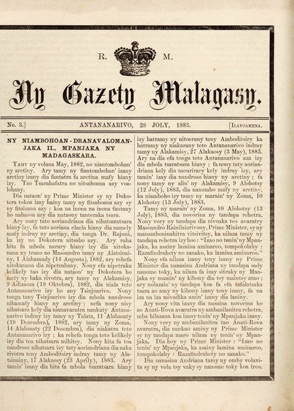
821Antananarivo : Presin' ny Mpanjaka ny Madagaskara (Imprimerie royale), 1883-96. UN DOCUMENT IMPORTANT POUR LES ÉTUDES MALGACHES, TÉMOIN D'UNE PÉRIODE CHARNIÈRE DE L'HISTOIRE DU PAYS
LCS-17482Édition la plus estimée, en grande partie originale, de la description de la Perse de Chardin. Ravissant exemplaire en veau écaille de l'époque aux dos ornés de la toile d'araignée dorée. Paris, Denys Horthemels, 1723 (tome 1), Amsterdam, Jean-Louis de Lorme, 1711 (les 9 autres tomes).10 tomes reliés en 11 volumes in-12 de :I/ (15) ff. avec le privilège, 254 pp., 1 portrait de l’auteur, 1 carte dépliante, 1 planche hors texte ;II/ 334 pp., 9 planches dépliantes;III/ 285 pp., 7 pl. dépl.;IV/ 280 pp., 6 pl. dépl.;V/ 312 pp., 4 pl. dépl. et 6 tableaux dépliants ;VI/ 328 pp., 5 pl. dépl.;VII/ 448 pp. ;VIII/ 255 pp., 16 pl. dépl.;IX/ (Volume de texte) 308 pp. / (Volume de planches) 29 pl. dépl. ;X/ 220 pp., (41) ff. de table.Seul le 1er volume est daté de 1723, les autres sont à la date de 1711. Très légère mouillure en tête du vol. 2, légère mouillure en marge int. du tome 3. Plein veau fauve écaille, triple filet doré autour des plats, dos à nerfs ornés de fleurons dorés à la toile d’araignée, pièces de titre et de tomaison de maroquin rouge et citron, filet doré sur les coupes, roulette intérieure dorée, tranches rouges. Reliure de l’époque.161 x 93 mm.
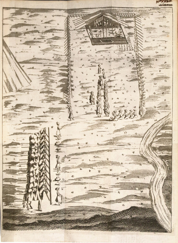
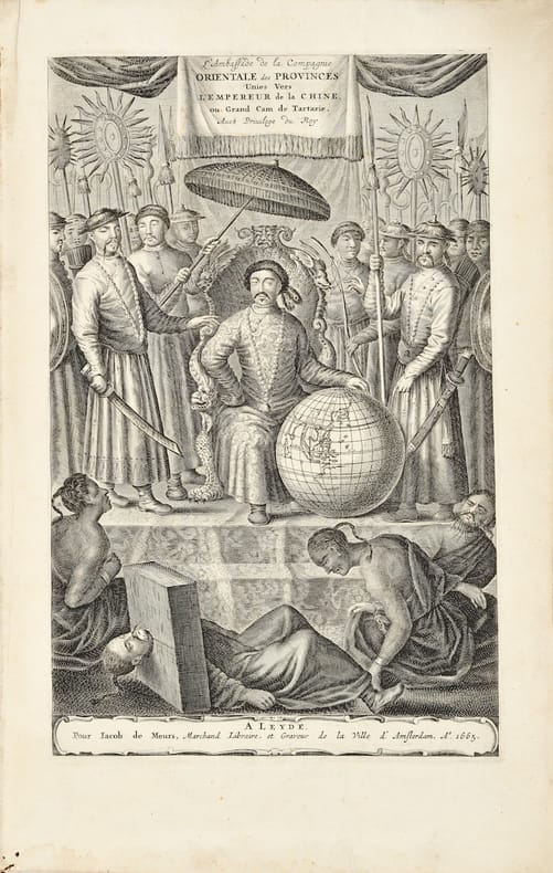
166510567Leyde, Jacob de Meurs, 1665 In-folio (353 x 226 mm), frontispice, titre, portrait, 6 ff. n. ch., 294 pp. mal ch. 290, 1 f. ch., 134 pp., 1 f. ch. Veau marron moucheté, filet doré encadrant les plats, dos à nerfs avec filets et fer floral dorés en caisson, titre doré, coiffes et coins restaurés anciennement, quelques frottements, infimes travaux de vers marginaux aux premiers feuillets (reliure hollandaise du temps).
386Paris ; Rouen : s. n. : Mégard, vers 1859 ; 1859. UNE IMPORTANTE ET RARISSIME PLAQUE À DORER DU MAÎTRE GRAVEUR AUGUSTE SOUZE
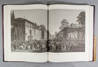
CJW1322Bern: Ertug & Kocabiyuk 2002. No. 46 OF 50 SPECIALLY BOUND COPIES of a total edition of 350. 670 x 508 mm. 26 3/8 x 20". 3 p.l. 10 pp. 63 leaves. <br/> Publisher's scarlet morocco by Buchbinderei Burkhardt AG covers with gilt-rolled border cornerpieces tooled in gilt upper cover with gilt calligraphic Arabic centerpiece lower cover with gilt central heraldic device marbled endleaves all edges gilt. With a portrait frontispiece of Emperor Selim III 48 DOUBLE-PAGE PLATES AND THREE DOUBLE-PAGE MAPS. ◆A virtually as-new copy.<br/> <br/> This is one of the deluxe copies of a modern facsimile of Melling's massive and magnificently illustrated work devoted to 18th century Constantinople a book that provided the earliest interior views and plans of the harems and palaces of Sultan Selim III when it was published in 1819. The illustrations remain the best and certainly most attractive record we have of the city during this era in its history. Our edition was produced from a copy of the elephant folio first printing in the collection of the facsimile's publisher Ahmet Ertug with images faithfully reproduced in their original mammoth size 650 x 970 mm. After his arrival in Constantinople in 1795 architect and painter Antoine Ignace Melling 1763-1831 was appointed imperial architect by Selim III. In the course of his duties he designed and landscaped a seaside palace for Selim's sister Princess Hatice and produced these striking panoramic views of the city and its environs. After completing the palace and a number of other building projects for Selim he returned to Paris and in 1804 issued a prospectus for this work. He established an engraving studio in 1809 to reproduce these drawings and began publishing the completed prints as a series of fascicles that were sent to subscribers. The last one appeared in 1819. The outstanding success of an exhibition of the paintings on which the "Voyage Pittoresque" was based earned Melling the rank of painter to the Empress Josephine. When "Voyage Pittoresque" was originally published booksellers in England sold copies for £84 a huge sum for a book at the time. The original edition in pleasing condition now fetches between $75000 and $100000. Our handsomely bound actual size facsimile offers an attractively priced alternative. Ertug & Kocabiyuk unknown
165854431Schleswig, Johan Holwein, 1658. Folio. Contemp. full vellum. Covers and spine fully intact but with some spots. and light wear along edges. It seems to be bound for a person with the initials W L E M (in gold letters on top of frontcover) and the year, 1658 (also in gold letters at bottom of frontcover). Engraved frontispiece (by G. Rothgiesser) and engraved portrait (Mandelslo). (32),248,(36) pp., 21 large textengravings by Rothgiesser and 1 double-page engraved map (ca 29 x 34 cm.) ""Delineatio Indiæ Orientalis"". Frontispiece a bit frayed in margins, no loss. Printed title-page a bit frayed at bottom, no loss. Last leaf with errata on verso frayed in margins, no loss of letters. Occassionally some browning to some quires in the first part.
London, John Churchill, 1855. 8vo. In publisher's original full embossed cloth with gilt lettering to spine. Spine faded and top of spine chipped. Extremities slightly rubbed. Gilt stamp to front board and stamp to upper part of pasted down front end-paper. Small mark to p. 172, otherwise internally fine and clean. xxxviii, 3-224pp. + 2 charts (""Dr. Kings Conjectual chart 1848"" + ""The Admiralty Chart 1848"") and 3 plates (one of them in text).
Schleswig, Johan Holwein, 1658. Folio. Contemp. full vellum. Covers and spine fully intact but with some spots. and light wear along edges. It seems to be bound for a person with the initials W L E M (in gold letters on top of frontcover) and the year, 1658 (also in gold letters at bottom of frontcover). Engraved frontispiece (by G. Rothgiesser) and engraved portrait (Mandelslo). (32),248,(36) pp., 21 large textengravings by Rothgiesser and 1 double-page engraved map (ca 29 x 34 cm.) ""Delineatio Indiæ Orientalis"". Frontispiece a bit frayed in margins, no loss. Printed title-page a bit frayed at bottom, no loss. Last leaf with errata on verso frayed in margins, no loss of letters. Occassionally some browning to some quires in the first part.
Paris, Plassin, 1798. 8vo. and folio (44 x 30) cm. Textvolumes bound in 4 contemporary half calf. Gilt spines with gilt lettering. Tome-label on volume one eroded. Stamp on title-pages. (4),LXVIII,368 (4),414 316,(120 = Tables) "(4),328 pp. A few scattered brownspots. Atlasvolume bound in matching hcalf. Spine gilt and rubbed. Lower compartment of spine with wear and tear. Engraved portrai of Pérouse as frontispiece. Engraved pictorial titlepage with cupids and naviogational instruments (dessinée par Moreau le Jeune) and 69 engraved maps, plans and plates of which 32 are large folded engraved maps. Mild foxing to some parts of some maps, occasionally mild dampstains to some plates, marginal browning and some spotting. One map with a repair to folding.
18261980<p>John Murray London 1826. First Edition. Marbled boards Quarter bound leather. Very Good Condition/No Dust Jacket. Signed by Author. 1st Edition Association Copy SIGNED BY AUTHOR: WINTER SKETCHES IN LAPLAND Or Illustrations of a journey from Alten on the shores of the Polar Sea in 69 degrees 55 minutes North Lat. through Norwegian Russian and Swedish Lapland to Tornea at the extremity of the Gulf of Bothnia. Intended to exhibit a complete view of the mode of travelling with Rein Deer the most striking incidents that occurred during the journey and the general character of the winter scenery of Lapland. 2nd Title page in French. "With Capt Brookes comps" written is his own hand on title page and a SIGNED letter from Arthur de Capell Brooke to Barry tipped onto verso of front cover. Bookplate of Arthur Hugh Smith Barry Marbury Hall tipped onto verso front cover. A set of 24 tinted lithographs believed to be printed on China paper. The sketches are by Brooke drawn on stone by Harding but the figures and animals are by Dighton. "This work was published in two editions 1826 and 1827 by J. Murray and J. Rodwell respectively. The plates came in three different fashions. Black and white tinted and hand colored." Beautiful images of the winter and its people in the far north. Elephant Folio Half leather binding on marbled boards foxing on some pages paper residues stuck to marbled end papers but overall a in very good condition considering the book is nearly 200 years old. Rare. TRAVELS THROUGH SWEDEN NORWAY AND FINMARK TO THE NORTH CAPE IN THE SUMMER OF 1820. London: Rodwell and Martin1823. 1st Edition: xvi 435 pages illustrated 22 plates of which 2 in colour a lemming and a red coral and a b/w map of Stockholm. In addition 11 vignettes paper tipped-in in the text. Boards detached but text block still solid pencil annotations in margins Ex NSL Library Library bookplate on verso front board library binding and covers in poor condition. Discrete NSL library stamps on plates pages age toned some foxing odd stain but overall very clean condition. Sir Arthur de Capell Brooke 2nd Baronet born in Northamptonshire 22 June 1791 to 6 December 1858 was a British baronet and travel writer Fellow of the Royal Society 1823 and co-establisher of the Raleigh Club 1827. A classic travel narrative illustrated with beautiful lithographic plates depicting winter scenes and the general life in the north including how to travel with reindeers. The author is immersed in the mythology of the polar winter and its inhabitants humans as well as animals. The plates captures the feel of the landscape and its people in a quite facinating way. PLEASE NOTE: Very heavy book which will incur extra postage and insurance. Please contact us for a quote. Sir Arthur de Capell Brooke 2nd Baronet born in Northamptonshire 22 June 1791 – 6 December 1858 was a British baronet and travel writer Fellow of the Royal Society 1823 and co-establisher of the Raleigh Club 1827. Arthur Hugh Smith Barry was the first Baron Barrymore. PLEASE NOTE: This book will incur extra postage and insurance charges. Please contact us for a quote. Size: Large Folio bigger than A3. Quantity Available: 1. Shipped Weight: Under 5 kilogram. Category: Arctic & Antarctic; 19th century; Exploration. Signed by Author. Pictures of this item not already displayed here available upon request. Inventory No: 1980. . This book is extra heavy and may involve extra shipping charges to some countries.</p> John Murray hardcover
Large oblong folio (600 x 485 mm). IX leaves of text, 29 maps (4 multicoloured overview maps and 25 grey provincial maps, overprinted and with captions in red), 14 ff. of index of places (Pinyin typescript). Original printed grey waxed paper wrappers with cloth-reinforced spine edges, screw-bound. Rare CIA-produced atlas of the People's Republic a decade after the "loss of China", at the onset of the country's "Great Leap Forward". It was designed to provide U.S. analysts with "fuller information on Communist adminstrative units" and to aid their interpretation of data emanating from the PRC, of "its statistical reporting, and the complexity of the administrative structure". The names of counties, districts, and municipalities are listed in the margin of each provincial map in Chinese and English. As the editors write in their introduction, the "catastrophic overhaul now in progress requires that the atlas be provisional in content and economical in format". Curiously, the 25 provincial maps are larger-scale reproductions from a 1956 Communist Chinese school atlas, the pocket-size "Chung-kuo fen-sheng ti-t’u" ("Provincial Atlas of a China"), with additional Agency annotations, while the "maps give place names, hsien (county) seats, and some hydrography and roads. The accompanying marginal lists [...] are based on the '1957 Handbook of Administrative Subdivisions of the PRC' (Chung-hua jenmin kung-ho-kuo hsing-cheng ch’ü-hua chien-ts’e) which lists and indexes all administrative units at the hsien level and above as of 1 January 1957." - Maps, captions, and index are carefully coordinated by the editors, including tables of comparative keys to the Wade-Giles, Yale, and the then-new Pinyin romanization system as well as of the standard abbreviations of Chinese characters. A prefixed letter-sized typescript advises readers that the atlas is not intended foremost to convey topographical information, but rather "to aid research workers faced with problems of interpreting current information on Communist China in the light of its complex administrational structure", and requests recipients who find it "does not serve their needs" to return it ("because of the expense involved in the production of the atlas and the limited size of the edition") to the CIA's Record Center at the old CIA Headquarters in the E Street complex of Washington, DC. - A very light waterstain to the upper edge throughout; insignificant wrinkling, more pronounced in upper cover, which also shows light scuff marks and tiny loss to the lower right corner. A fine survival documenting the fraught U.S.-Chinese relations of another age. Phillips/Le Gear VI, 9622. OCLC 1709509.
Small folio (31.5 x 24.5 cm). 12 pp. Contemporary, vellum-backed, stiff marbled wrappers. Rare second edition, second state, of a journal of a voyage from Sumatra to Bengal, kept by Captain Robert Taylor on the ship Ceres, followed by additional comments from "a manuscript, which may be depended upon". Locations sighted include: Hog Island, the Cocos islands, Aceh, the Straits of Malacca, Barren Island and the Andaman Islands. - The journal was published by the eccentric Scottish geographer Alexander Dalrymple (1737-1808), Captain Cook's leading rival. As hydrographer for the East India Company, Dalrymple would publish an annual series of memoirs and detailed ships' logs that he obtained in that function. He would compare historical sources gathered from extensive archival research with newly obtained data straight from the ships and his own careful observations. With these publications Dalrymple became the originator of official British hydrography and as such they give a unique impression of the (development of the) scientific background that laid behind the trade of the British Empire in the East. - The journal was first published in 1782 together with A brief statement of the prevailing winds from monsieur Après De Mannevillette. - A very good copy. A. S. Cook, Alexander Dalrymple (1737-1808), (PhD diss., 1992), A120. ESTC T75520 (6 copies). For Dalrymple: A.S. Cook, "Dalrymple, Alexander (1737-1808)", in: ODNB online (2008); Howgego, to 1800, D4.
8vo. (4), II, IV, (1), V, 154, VI, (1) pp. (including small errata leaf). With two plans of troop formation mounted in the text, including one folding. The title-page is set within a decorative frame and part of the appendix is set in Arabic script. Modern half brown calf, with gold lettering o Very first edition, printed in Lahore in the Punjab region in 1858, of a controversial account by "a Punjab employé". This employee was Frederick Henry Cooper (1827-69), a British civil servant working with the British East India Company in the Punjab region. A very early publication on the Indian Mutiny of 1857, the present work was possibly published before, or in any case simultaneously with, the London edition of the same year. Both the Lahore and London editions are dedicated to Sir Henry Montgomery Lawrence, a British military officer, surveyor, administrator and statesman in British India, who died during the Revolt of 1857. Only the Lahore edition was, according to the title-page, published "for the benefit of the 'Lawrence Asylum'", a military-style boarding school envisaged by Sir Henry Lawrence in the Indian subcontinent highlands for the sons and daughters of British soldiers. - The Revolt (also known as the Indian Rebellion, Sepoy Mutiny, or First War of Independence) was a major uprising in India against the rule of the British East India Company. The conflict took place from May 1857 until November 1858, during which time the British brutally inflicted on the Sepoys and local Indian civilians losses of more than 800,000 people. This eventually resulted in a British victory, the end of the East India Company's rule in India, and the transfer of rule to the British Crown. - A notorious participant in the Revolt, Cooper - together with James Neill, John Nicholson and William Hodson - was responsible for the killing of some 500 Sepoys and civilians. The present work was controversial even at the time of its publication, as it includes an entirely unapologetic and almost gleeful account of Cooper's ruthless actions. Regardless of the controversy surrounding Cooper and his work and its condemnation by an MP in the House of Commons in 1859, Cooper was appointed CB by Queen Victoria in the 1860 Birthday Honours while serving in the Bengal Civil Service. Taylor places the work in context: "Cooper was Deputy Commissioner of the Punjab, based at Amritsar and, although a civilian, was responsible for the 'extermination' of the disarmed 26th BNI at Ujnalla, in particularly inhumane and unpleasant circumstances, for which he was praised and supported by his superiors but roundly condemned by many in the House of Commons when news reached London. He wrote this book to vindicate his conduct which he considered ‘prompt, spirited, and thorough’". - The title-page is signed by the author "Fred Cooper C.B.". The margins contain pencil and ink annotations, most of which give translations of terms and occasional comments on the text itself, by someone who served with the 61st Brigade and has initialled some of his notes "K.C.". Corners of the boards very slightly scuffed; outer margin of pp. 25-28 cut slightly short without affecting the text; some occasional very slight spotting. Otherwise in very good condition. Ladendorf 244. Taylor, Companion to the Indian Mutiny of 1857 (OUP, 1996), 170.
Folio (325 x 530 mm). With 31 double-page engraved maps, including one world map, partly in original hand colour, and 36 engraved city views. 18th century half calf over marbled boards. A collection of maps from the famous Danckerts atlas, created around 1685 and compiled in this version in the late 18th century. The volume contains 28 maps by the Dutch engraver and publisher Justus Danckerts (1635-1701), including a world map showing the Eastern and Western hemispheres, maps of Europe, Asia, Africa and America, as well as maps of Spain, France, Italy, Great Britain, Germany, the Netherlands, Belgium, Bohemia, Hungary, the Balkan Peninsula, Greece, and Poland. The views show various cities in Hungary and Greece, also including Constantinople. There are three maps not originating from Danckerts: a postal map of Germany published in Augsburg by Matthias Seutter; another showing the Holy Land, by Guillaume Sanson; and the third showing the Habsburg empire in 1781, which suggests the terminus post quem for the compilation of this volume. - Lacks a title-page. With 19th century bookplate of a member of the Lasser von Zollheim family, probably Johann Baptist (1822-89), librarian and later the abbot of the Benedictine abbey of Lambach in Upper Austria. A handwritten table of contents on the reverse of the first map; each map numbered by hand. On the back of the maps of France and Poland is a list of field marshals who served under Napoleon. Handwritten bibliographical notes to flyleaf. - Binding rubbed, spine-ends bumped. Paper variously brownstained and fingerstained. A few remarginings with slight loss of text. From the library of the Viennese collector Werner Habel with his signed and stamped ownership, dated 1978, to pastedown. Tibbetts 141. Tooley I, 331. Cf. Philipps 540-541 (1703?), 3470 (1710). Cf. Tooley IV, 104 (Sanson, not mentioning this map), 150 (Seutter, not mentioning this map). Not in Al Ankary, Al-Qasimi, or Couto.