HARNIER Wilhelm vonLivre Rare Book
39 462 résultats
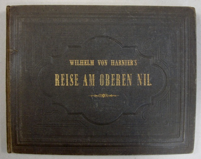
18667682Extrêmement rare ouvrage d'exploration au Nil. L'ouvrage comporte 27 planches lithographiées en couleurs, 1 carte sur double page, et un titre également lithographié. Bel exemplaire, dans sa reliure d'origine. 7 copies recenssées au World Cat. Petites salissures au plat inférieur de la reliure; Faibles rousseurs en marges des estampes. Pleine toile noire d'éditeur; titre doré en long au dos et sur le plat supérieur. Étiquette d'un libraire de St Petersburg. Bon Darmstadt & Leipzig Eduar Zernin 1866 1 volume oblong 25,5 x 33 cm.
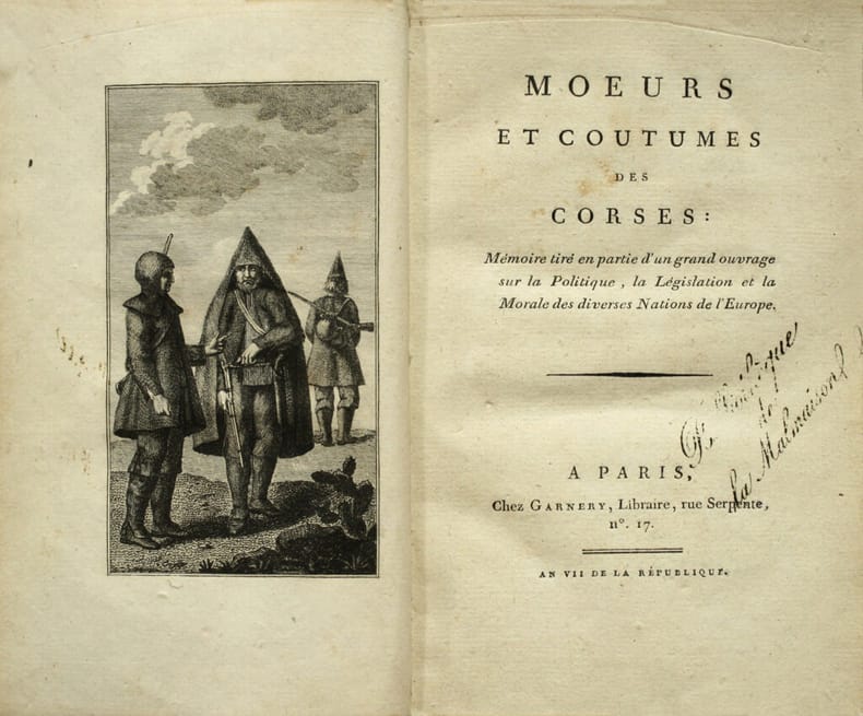
LCS-17457Edition originale de cet intéressant traité sur les Corses en France. Paris, Garnery, An VII (1798-99). Grand in-8 de (4) ff., 1 frontispice, 112 pp. Relié en pleine basane fauve, roulette dorée encadrant les plats, dos lisse orné de fleurons dorés, chiffre P B frappé or en pied du dos, pièce de titre en maroquin rouge, roulette dorée sur les coupes, tranches dorées sur marbrures. Dos légèrement frotté. Reliure de l’époque. 198 x 122 mm.
Oblong folio (440 x 292 mm). Contemporary cloth album of 535 photographs. Various sizes, ranging from 5 x 5 to 13 x 22 cm. A vast trove of photographs showing China throughout the 1920s and 1930s to the early 1940s, mostly captioned. Includes views of Beijing, the Summer Palace, canal, gardens, moat, Imperial Ancestral Temple, Pei Hai from the West, T'Ang Shan & Hei-Lung T'An (1922), Shih-Ching-Shan, Dagoba, Iron Cow, Goddess Kwan-Yin, Beijing 1940 P'ai Lou, Wang-Fu-Chin Ta Chieh, the funerals of Feng-Kuo-Chang and of Prince Pu Lun, Pei-Hai in winter, General Chang-Tso-Lin retreating from Beijing and Chian-Kai-Shek's troops entering in 1928, Shansi troops entering Beijing, celebrations of the Nanjing government taking over Beijing, skating on Pei Hai, aeroplanes, the Yellow Temple in Beijing, scenes at the Liu-Li-Ch'Ang Fair at New Year 1941, masked dancers at the Devil's Dance, Lama Temple, Chinese Games Beijing, the Princess Tomb near Beijing, Coal Hill, Beijing Club and Skating Rink, Europeans in Beijing 1937-40, Beijing Golf Club, Pa-Pao-Shan Course (1939), skating on the Pei-Hai, the West and North Gate, the Great Wall, house at 32 Ta Juan Fu Hut'Ung (1921), the British Embassy at Beijing, the Pagoda at Pa-Li-Chuang, Nian-Niagn-Miao Temple, Lung-Men-Ssu, Chien T'ai Ssu, Miao-Feng-Shan (1922), Pei-Hai and Dragon Screen, the Western Hills on the way to Miao-Feng-Shan (1932), the Citroen Haardt Trans-Asiatic Expedition, the Seann Expedition to Jehol ("up Nankou Pass by six wheeler 1930"), the bridge at Mi-Yun-Hsien, the Chin-Shih-Ling Pass, Ku-Pei-K'ou, the Potola Jehol, palace grounds, General T'Ang-Yu-Lin Governor of Jehol Province, officers of Jehol Army 1930, "to Shih-Chia-Chuang by Road with Major Lovat-Fraser 1929", Nank'ou Pass and Great Wall (October 1919), Ming Tombs, P'ai Lou, temples and fortress at Shih-Ching-Shan, Shan-Hai-Kuan views on the Shih-Ho, Grotto temple, Europeans and landscape at Shan-Hai-Kuan, ruins of Yen-Ming-Yuen, Beijing, destroyed by Anglo-French troops in 1860, the River Temple, "to Chai-T'ang with A. O. Buckingham 1919", Yung-T'ing Ho, Fo-Tzu-Ling, Pei-T'ai Ho (1938), the River Temple at Shan-Hai-Kuan, the Tower and Ocean Palace at Beijing, camels bringing coal to Beijing, etc. Also includes 7 loose photos of Ming tombs and 9 of ornate antique Chinese furniture, along with 24 photographs of the Phillippines and 16 of Japan. Finely preserved.
Large 4to (214 x 257 mm). Album of 18 original watercolours, all pasted to tabs. Later straight-grained red morocco with prettily gilt spine and spine and upper cover labels. Fine suite of eighteen watercolours from Grasset's "Costumes de Différents Pays" series, showing the costumes of Asian, European, African, and American peoples, captioned as follows: - 1. Écossaise près d'un rocher des Druides. - 2. Irlandais sur la chaussée des géants. - 3. Mineur Norvégien. - 4. Danois, chevalier de Dannebrog. - 5. Soldat dela côte de Malabar. - 6. Grand chancelier de Siam. - 7. Batelier Cochinchinois. - 8. Mandarin Tunquinois. - 9. Thibetaine consultans le grand Lama sur le sort de son enfant. - 10. Prêtre Birman. - 11. Musicien Japonais. - 12. Seigneur Japonais. - 13. Dame Japonaise. - 14. Famille Japonaise en Deuil. - 15. Seigneur Abissin. - 16. Dame de Juida [Whydah, Benin]. - 17. Favori du roi de Juida. - 18. Nobles Péruviennes, moderne et ancienne. - Well-preserved throughout in a modern binding bound to style, using an earlier cover label. Cf. Colas I, 1289-1291.
2 panoramas, each composed of four consecutive albumen prints. 1100 x 210 mm. Two of the earliest panoramic views of Xiamen, formerly romanized as Amoy. Xiamen Island was considered to possess one of the world's great natural harbors in Yundang Bay, and its served as China's main port for exporting tea. It was one of five Chinese Treaty ports agreed on by the Treaty of Nanjing in 1842. Under Deng Xiaoping Xiamen became one of the original four special economic zones opened to foreign investment and trade in the early 1980s. - Slightly foxed and browned. Rare.
Engraved map, fine original hand-colour, edged with blue silk, housed in original marbled paper chemise and slipcase, with red morocco label, lettered in gilt. 1470 x 1290 mm. The most accurate map of Asia published at the beginning of the 19th century. It shows significant advancement compared with other maps of the period, incorporating the work of surveyors like James Rennell, to whom the map was dedicated. Rennell was surveyor-general of the East India Company's dominions in Bengal, and the information published in his "Bengal Atlas" in 1779 appears here. Arrowsmith also included remarkable topographical detail such as mountain ranges in regions as remote as Tibet. Remarkably the region on the shore of the Arabian Gulf is already labelled as "Bani Yas" territory. Arrowsmith has marked the track of Lapérouse's voyage in the Indian Ocean and Far East. - Aaron Arrowsmith (1750-1823) was the finest cartographer of his generation. Although he received little formal education, it is believed that he was provided with some mathematical instruction by William Emerson, an author of several books on the application of mathematics to the area of cartography. Around 1770, Arrowsmith moved to London to seek employment. It is believed that he worked for William Faden before joining John Cary Sr. in the early 1780s. There he provided the measurements for John Cary's early publication detailing the roads from London to Falmouth, his first signed work. Arrowsmith set up on his own in 1790 and over the next thirty years produced some of the most beautiful and elegant maps of the era. - In perfect condition. Not in Al Ankary or Al-Qasimi. Cf. Sweet 238 (1811 edition only).
Folio (250 x 359 mm). 2 vols. Together 382 (instead of 384) coloured lithographed plates, some heightened with egg-white. The majority mounted on thick paper with the blind stamp of Eckert & Weiß. Captioned in German. Contemporary half calf with giltstamped spine and spine-title. Marbled endpapers. Luxury edition of the famous military costume series. A nearly complete run of the German and Austrian uniforms from the monumental artistic collection showing the armies of Europe. Vividly and brightly coloured, the splendid plates display costumes as well as characteristic scenes of army life, frequently featuring idyllic scenery or battle scenes in the background. The present volumes include uniforms from Austria, Prussia, Bavaria, Saxony, Hesse, Mecklenburg-Schwerin, Braunschweig, Nassau, Hamburg, Frankfurt, Baden and other states. - The work was originally published in 48 issues comprising 8 plates each, resulting in a total of 384 plates. During the long period of publication, several plates were revised and adapted; many were published in different versions, and more than 425 known plates in total. - Calf somewhat rubbed, occasional light browning. Plates are crisp and clean. Additional title-page of the "Sämmtliche Truppen" series supplied in photocopy in volume I. Contemporary ownership on the title-page overpasted. A good copy of the sumptuous special edition of this magnificent work. Colas 935. Hiler 261. Lipperheide 2120 and Qc 26. For the edition and number of plates cf. Georg Ortenburg in his preface to vol. I. of the Harenberg facsimile edition, Bibliophile Taschenbücher 235, Dortmund 1981, p. 10.
Folio (208 x 280 mm). (16), 100 pp. Title printed in red and black. With woodcut title vignette and full-page woodcut of the author at the end of the preliminaries. Contemporary mottled calf ruled in blind, spine tooled in gilt, red morocco spine label titled in gilt. The second edition of Galvão's history of exploration and voyages, issued after the virtually unobtainable first edition of 1563. According to Sabin, this second edition "is also rare, the greater portion having been destroyed by an earthquake", specifically the catastrophic Lisbon Earthquake of 1755 (Sabin). Galvão's text was translated in 1601 by Hakluyt, who even at such an early date complained about the rarity of the first edition, and who was forced to rely on a copy sent from Lisbon. Currently, only three copies of the first edition are known in libraries, and none outside of North America. - Born in 1503, Galvão was sent to India in 1527. Having distinguished himself there, he was appointed governor of the Moluccas. He maintained a keen interest in military and religious affairs throughout his career, and spent the latter part of his life assembling accounts of the voyages that comprise this collection. He provides a relatively succinct chronological list of ancient and modern discoveries to the year 1550, including those by Columbus, Cabral, Cortés, and Pizarro. As a result, he is considered by some to have invented a new field of European literature: "The author has been styled 'the founder of historical geography.' The book gives a good summary of the geographical explorations of the Portuguese and other important voyagers, including the English" (Hill). - Though an early hand has attempted to cross it out, the inscription "Ex libris Antónii Lomellino d. Vasconcellos" appears on the title-page along with the handwritten date 1745, and "Lomellino" appears again on the final leaf of text. This is the ownership mark of António Lomellino de Vasconcellos, an 18th century bibliophile who collected particularly books of Portuguese origin. Lightly worn, with a few light crayon marks to the margins of some pages. An uncommon and well-preserved edition of this seminal work. Sabin 26468. Borba de Moraes 289. Bosch 180. Rodrigues 1059. Palau 182.290. Leclerc 225. Innocencio I, 147, 720. Hill 670. Bibliotheca Americana 642. European Americana 731/89. OCLC 83247823.
Small folio (224 x 284 mm). 2 vols. (12), 376 pp. (8), 283, (1) pp. With 2 engraved title pages, 25 engraved plates (mostly after Radl), and 1 folding population table. Without the folding map of Frankfurt. Contemporary red morocco, richly gilt to spine and covers with gilt spine label; leading edges gilt, gilt inner dentelle around silk endpapers; all edges gilt. First edition of this historical and topographical description of Frankfurt and numerous towns in the Anterior Taunus aera. A unique luxury copy on wove paper, very wide-margined and in a magnificent contemporary morocco binding. The flyleaf of the first volume bears an autograph inscription by the famous Frankfurt bookseller Hermann Joseph Baer (1811-81) to the Frankfurt-born educator Carl Bernhard Greiss in Wiesbaden (1809-73): "Seinem Freunde Dr. C. B. Greiss / Frankfurt a. M., den 13. März 1864 / Hermann Joseph Baer". - Bindings slightly rubbed; insignificant bumping to lower spine-ends. Some foxing to interior, with some waterstaining to the first leaves of the second volume, otherwise a very appealingly preserved luxury copy of the finest collection of views of Frankfurt published in its time. Brunet III, 669 (VI, 26661). Kayser I, 78.
LCS-13642Édition originale de la plus grande rareté de cette relation connue à quelques exemplaires seulement, contenant le récit de la malheureuse expédition de Royville au «Cap de Nord en Amérique française» réalisée en 1652, avec pour objectif de «porter la connoissance de nôstre Dieu parmy les peuples sauvages & infidels», et les coloniser. L’exemplaire du Comte de Toulouse et du roi Louis Philippe. Paris, Antoine de Sommaville, 1654.In-8 de (8) pp., 200, et 2 planches gravées à pleine page. 2 ff. intervertis sans manque, sans la carte qui manque presque toujours. Maroquin bordeaux, encadrement à la Du Seuil avec fleurons à l’oiseau aux angles, dos orné de fleurons de même, coupes décorées, dentelle intérieure, tranches dorées. (Lortic). 159 x 100 mm.
Drawn in watercolour and pen on laid paper, mounted on contemporary linen (310 x 475 mm). (Bound in): Fellowes, Robert ("Philalethes"). The history of Ceylon, from the earliest period to the Year MDCCCXV; with characteristic details of the religion, laws, & manners of the people and a collection of their moral maxims & ancient proverbs ... To which is subjoined Robert Knox's historical relation of the island, with an account of his captivity during a period of near twenty years ... (With): Knox, Robert. An historical relation of the Island of Ceylon in the East Indies: together with an account of the detaining in captivity the author, and divers other Englishmen now living there; and of the author's miraculous escape. London, Joseph Mawman, 1817. 4to. 2 parts in one. XXII, 341; (1), VIII, 383 pp. With a folding engraved map of Sri Lanka by J. Smith, dated 1816, mounted on contemporary linen, an engraved portrait of Knox by Smith, dated 1816, and 15 engraved plates. Contemporary half calf with gold-tooled spine, marbled edges, marbled endpapers. Manuscript map of the middle third of the island of Ceylon (now Sri Lanka), made before any detailed map of this area had been published. Bound in a book containing the first edition of Fellowes's history of Sri Lanka, published together with a then-current edition of Robert Knox's own account of his stay in Sri Lanka (first edition 1681). - The manuscript map provides great detail for inland Sri Lanka, ranging from Puttalam (upper left) to Kalutara (lower left) and from Batticaloa (upper right) to Kataragama (lower right). This area spans several provinces, including the ancient Kingom of Kandy, showing many roads, towns and villages in great detail, especially around the city of Kandy. The various provinces are distinguished by colour. The map is contemporary with the book, made on English paper watermarked "G L Paine 1813", indicating George Leeds Paine of Kent (cf. Shorter 1971, p. 198). The map thus dates between 1813 and 1817, the period leading up to the last armed conflict between the British colonial government and the Kingdom of Kandy, which resulted in the final defeat of Kandy and the British seizing control of the entire island. - The first part of the book has several manuscript annotations in the same hand as the manuscript map, primarily concerning the bureaucracy and administration of the Kingdom of Kandy. Several corrections are written in the margins of chapter LVI (Offices, Casts and Miscellaneous Particulars), and the list of Singhalese sovereigns on the last page of the first work is expanded in manuscript up to the year 1815, ending with: "The English government established 2 March 1815 - Esto perpetua (may it always be so)". There is no owner's inscription, but the person who drew the map and added the annotations was evidently an Englishman with special interest in Kandy, and the notes, the paper and the circumstances suggest a British officer with a knowledge of the Singhalese language and cartography stationed in Kandy at the time of its capture. - In 1821 John Davy published his new map of Sri Lanka, which for the first time showed especially fine detail in the area around Kandy. No earlier map provided detailed information on the topography of the interior of Sri Lanka, as only the coastal areas were well documented. The present manuscript map is therefore a very early - or maybe even the first - attempt to record the topography of the interior. It was a forerunner to Davy's map and might have provided Davy with information, lending it great importance for the history of Sri Lankan cartography. - Several manuscript corrections in ink in the margins of the first work and several faded annotations in pencil in the margins of the second work. Folding engraved map foxed and first title-page slightly foxed. Spine repaired. The manuscript map has a tear at the foot of the fold, otherwise in good condition. For the manuscript map cf. Ian J. Barrow, Surveying and Mapping in Colonial Sri Lanka: 1800-1900. - For Knox: Cox I, 276f. Henze III, 46f.
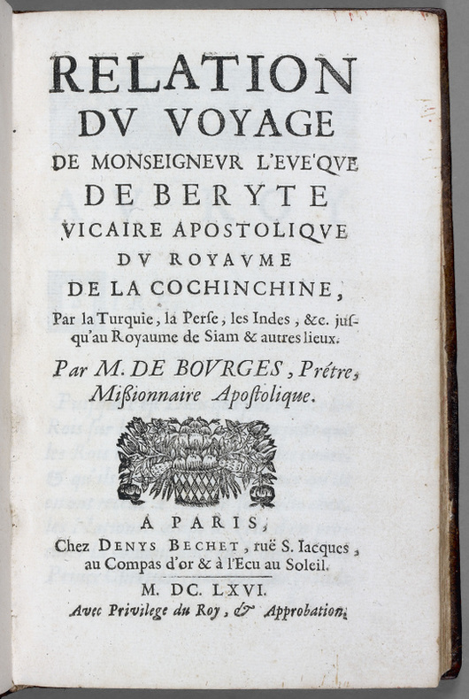
LCS-1031A Paris, chez Denys Bechet, 1666.In-8 de (1) f.bl., (6) ff., 1 carte dépliante, 245 pp., (3) pp., (1) f.bl. Relié en plein veau brun granité de l’époque, dos à nerfs orné, coupes décorées, tranches mouchetées. Reliure de l’époque. 179 x 113 mm.
1773BA0-570London, printed for Stanfield Parkinson, 1773. Lederband der Zeit, 4?, xxiii, 212 Seiten, 1 Blatt Errata, 27 Kupfertafeln inkl. Frontispiz und einer Landkarte, komplett, Einband altersgem?? berieben, Au?engelenke teils etwas m?rbe, dennoch gutes Exemplar, Mit dem Ex Libris des Henry Carew Glanville (1830-1900) Priester in Sheviock, (Cornwall ) // Leather binding of the time, 4?, xxiii, 212 pages, 1 leaf errata, 27 copper plates, incl. frontispiece and one map , complete, binding rubbed due to age, outer joints partly a little friable, nevertheless a good copy, with the bookplate of Henry Carew Glanville (1830-1900) Reverend in Sheviock, (Cornwall )
Oversized hardcover presented with map in its original paper wallet. Boards are fully bound in dark green cloth by Kelly and Walsh, with lettering to front only. Second edition, 284pp. Former copy of Evelyn Gedge, with her bookplates to front pastdown, to reverse side of map and to map envelope. Boards are shelfworn with rubbing to edges and corners, spine is sunned, speckled and lightly chipped at ends. Endpapers and pastedowns are tanned at edges and there are a few small tears to paper in the gutter of front pastedown. Very faint foxing to a few internal pages, otherwise the contents are clean and unmarked throughout and the illustrations are bright and clear, binding is sound. Watermark to map envelope and small tear to opening. Map is unnumbered and is in excellent condition. More photos available upon request. AD Used
171260524Hamburg,von Wiering, 1712. 8vo. In contemporary full calf with four raised bands. Embossed ornamentation to spine. Lower part of back hindge and back board with worm hole. Last three works with small wormtract to lower part of leaves (not affecting Lawson's work, other wise a good copy. [Lawson:] (14), 365, (3) pp. + frontispiece and 1 folded map" (4), 239, (5) (2), 94" (2), 134 pp.
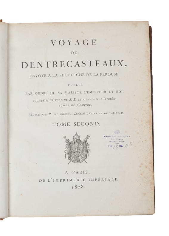
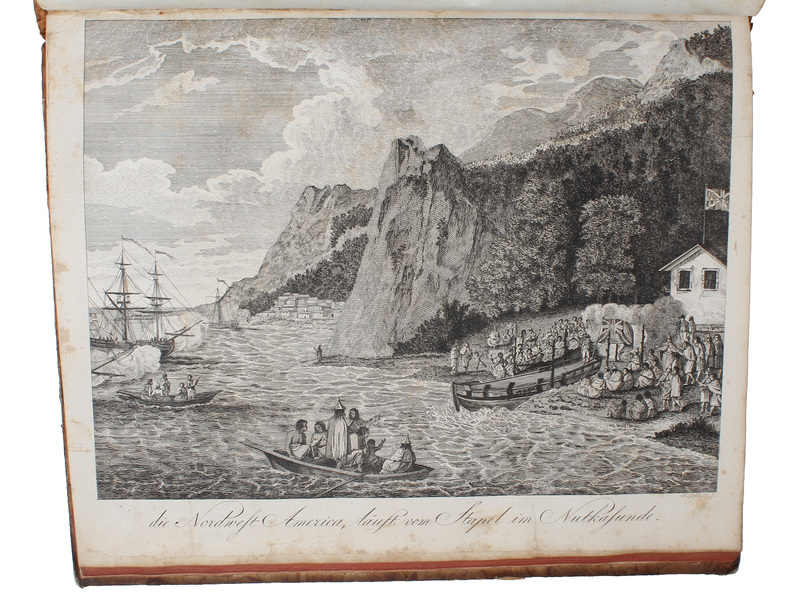
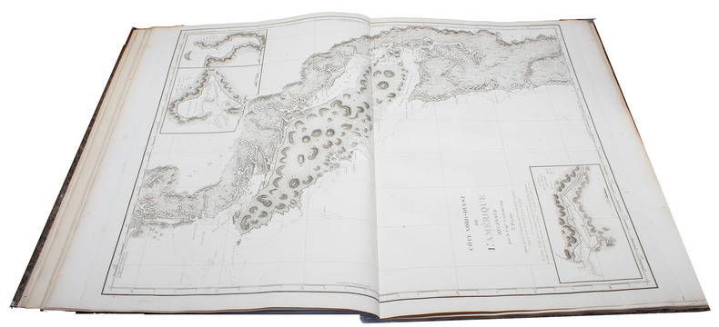
180754627Paris, 1807 (atlas) - 1808 (text). 2 large 4to + 1 folio. All three volumes bound in contemporary half calf with gilding to spines - text volumes uniform. TEXT: Volume 1 with a split front hinge, but block still tight. A patch of paper missing from back board. Both volumes with some edge wear and bumped corners. Old paper labels to inside of front boards, and a stamp to half-titles and title-pages. A bit of brownspotting, but mostly marginal. Overall, most text-leaves are clean and bright. The plates in vol. 1 have some, mostly marginal, brownspotting. Both volumes with wide margins. Some of the text is printed on blue-ish paper. (4), LVI, 704 pp. & 32 folded engraved plates + (4), VIII, 691 pp. & 1 folded plate. Many tables with astronomical observations. In all 33 folded plates. ATLAS: Wear to extremities and bumped corners. Inner front hinge re-enforced. Top right blank corner of title-page repaired, far from affecting text. A stamp to title-page. A bit of brownspotting, mostly marginal. The last ab. 10 maps with a damp stain in the middle. The reast are very nice and bright. 4 (title-page + contents-leaf) pp. & 39 maps and charts, 29 of which are double-page. Fully complete with all 33 folded plates in the text-volumes and all 39 maps and charts in the atlas-volume. A contemporary handwritten note to the title-page of the atlas stating that THE COPY WAS GIVEN TO ADMIRAL VAN DOCKUM AT THE ORDER OF NAPOLEON I. (""à Mr. le Conte-Admiral Joost Van Dockum,/ par ordre de Sm l'Empereur Napoléon 1e."")
Paris, 1807 (atlas) - 1808 (text). 2 large 4to + 1 folio. All three volumes bound in contemporary half calf with gilding to spines - text volumes uniform. TEXT: Volume 1 with a split front hinge, but block still tight. A patch of paper missing from back board. Both volumes with some edge wear and bumped corners. Old paper labels to inside of front boards, and a stamp to half-titles and title-pages. A bit of brownspotting, but mostly marginal. Overall, most text-leaves are clean and bright. The plates in vol. 1 have some, mostly marginal, brownspotting. Both volumes with wide margins. Some of the text is printed on blue-ish paper. (4), LVI, 704 pp. & 32 folded engraved plates + (4), VIII, 691 pp. & 1 folded plate. Many tables with astronomical observations. In all 33 folded plates. ATLAS: Wear to extremities and bumped corners. Inner front hinge re-enforced. Top right blank corner of title-page repaired, far from affecting text. A stamp to title-page. A bit of brownspotting, mostly marginal. The last ab. 10 maps with a damp stain in the middle. The reast are very nice and bright. 4 (title-page + contents-leaf) pp. & 39 maps and charts, 29 of which are double-page. Fully complete with all 33 folded plates in the text-volumes and all 39 maps and charts in the atlas-volume. A contemporary handwritten note to the title-page of the atlas stating that THE COPY WAS GIVEN TO ADMIRAL VAN DOCKUM AT THE ORDER OF NAPOLEON I. (""à Mr. le Conte-Admiral Joost Van Dockum,/ par ordre de Sm l'Empereur Napoléon 1e."")
179154571Berlin, Vossischen Buchhandlung, 1791. 4to. Bound in 3 uniform contemp. hcalf. Riased bands, gilt spines. Tome-and titlelabels on spine with gilt lettering. Very light wear to spine ends. Slightly rubbed. Small stamps on foot of title-pages. Corners lightly bumped. X,130,302(8),XXII,(2),314,(2)XVIII,74,380 pp. 4 large folded engraved maps and 27 engraved plates (some folding). Maps with closed tear at inner foldings. Scattered brownspots, mainly marginal. Occassionally some offsetting from plates. A few plates with light foxing and some with brownspots. In general fine, printed on good paper.
174653621Paris, Chez Didot, 1746-61 (Vols. 1-16) a. Amsterdam, Arkstée et Merkus, 1761 (Vol. 17) a. Paris, Rozet, 1768 (Vol. 18) a. Paris, Panckoucke, 1770 (Vol. 19). 4to. Bound in 19 uniform contemp. hcalf. Richly gilt spines. Titlelabels with gilt lettering. Spines a bit rubbed with light wear to the gilding. All spine-ends neathly repaired with matching leather. Stamps on half-titles. Engraved portrait of Prevost as frontispiece to volume 1. (The portrait with faint brownspots). In all more than 10.000 pp. and with 561 maps, plans and plates, of these ca. 250 engraved maps, many large and folding. A few plates inserted in a wrong volume, but all plates seems to be present in accordence with the listings of the plates. One leaf torn in volume 18, but all text preserved. Very few scattered brownspots. A few quires in one volume with light browning. No repairs to maps. All volumes printed on good paper. A clean and attractive set. The last volume (XX) was issued much later (1789) and is not present here.
180053590Paris, L'Imprimerie de la République, AN VIII (1800). 4to. a. Imperial folio. Bound in 4 uniform contemp. blue hcloth with marbled boards. Gilt lettering on spines. Minimal wear to extremities. Atlas with small repairs to spine-ends. (2,= htitle),XII,491(6, incl. htitle),516"(6, incl. htitle),562 pp. and 7 + 6 + 5 engraved plates (incl. 1 map), all with tissue-guards. Atlas volume (66 x 47 cm.): 4 pp. (incl. htitle) and 10 double-page folded maps and 6 engraved plates (landfalls - profiles). A fine clean copy, wide-margined. 1 leaf a bit brownspotted, 2 leaves a bit frayed in right margin, 2 leaves slightly brownspotted, 2 leaves with loss of a bit of lower corner. Atlas clean and fine, some minor marginal brownspots.
Berlin, Vossischen Buchhandlung, 1791. 4to. Bound in 3 uniform contemp. hcalf. Riased bands, gilt spines. Tome-and titlelabels on spine with gilt lettering. Very light wear to spine ends. Slightly rubbed. Small stamps on foot of title-pages. Corners lightly bumped. X,130,302 (8),XXII,(2),314,(2) XVIII,74,380 pp. 4 large folded engraved maps and 27 engraved plates (some folding). Maps with closed tear at inner foldings. Scattered brownspots, mainly marginal. Occassionally some offsetting from plates. A few plates with light foxing and some with brownspots. In general fine, printed on good paper.
Paris, Chez Didot, 1746-61 (Vols. 1-16) a. Amsterdam, Arkstée et Merkus, 1761 (Vol. 17) a. Paris, Rozet, 1768 (Vol. 18) a. Paris, Panckoucke, 1770 (Vol. 19). 4to. Bound in 19 uniform contemp. hcalf. Richly gilt spines. Titlelabels with gilt lettering. Spines a bit rubbed with light wear to the gilding. All spine-ends neathly repaired with matching leather. Stamps on half-titles. Engraved portrait of Prevost as frontispiece to volume 1. (The portrait with faint brownspots). In all more than 10.000 pp. and with 561 maps, plans and plates, of these ca. 250 engraved maps, many large and folding. A few plates inserted in a wrong volume, but all plates seems to be present in accordence with the listings of the plates. One leaf torn in volume 18, but all text preserved. Very few scattered brownspots. A few quires in one volume with light browning. No repairs to maps. All volumes printed on good paper. A clean and attractive set. The last volume (XX) was issued much later (1789) and is not present here.
Paris, L'Imprimerie de la République, AN VIII (1800). 4to. a. Imperial folio. Bound in 4 uniform contemp. blue hcloth with marbled boards. Gilt lettering on spines. Minimal wear to extremities. Atlas with small repairs to spine-ends. (2,= htitle),XII,491 (6, incl. htitle),516 "(6, incl. htitle),562 pp. and 7 + 6 + 5 engraved plates (incl. 1 map), all with tissue-guards. Atlas volume (66 x 47 cm.): 4 pp. (incl. htitle) and 10 double-page folded maps and 6 engraved plates (landfalls - profiles). A fine clean copy, wide-margined. 1 leaf a bit brownspotted, 2 leaves a bit frayed in right margin, 2 leaves slightly brownspotted, 2 leaves with loss of a bit of lower corner. Atlas clean and fine, some minor marginal brownspots.
189889785Ernest Leroux Augustin Challamel | Paris 1898-1919 | 22.3 x 28.5 cm pour les 10 volumes de texte & 22,8 x 33,3 cm pour l'atlas | 11 volumes de texte reliés + 1 atlas relié + 1 carte dans une chemise-étui
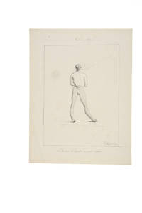
18194504053Guam 1819. In fine original condition. Original ink drawing 310 x 245 mm. fully signed and dated framed. <p><p>Jacques Arago artist on board Freycinet's Uranie during the French circumnavigation of 1817-20 drew this intimate portrait of Brother Ciriaco the curé in Agana the capital of Guam during the visit there of the Uranie expedition between March and June 1819. This is a charming and unusual portrait of a figure who likely expected to be taken more seriously: the cleric is shown in his "at home" attire his petit negligé smoking. His relaxed stance dressed in a vest and daringly striped leggings is further enriched by the addition of the most delicate slippers. </p> <p>Arago 1790-1855 was not only the most accomplished of the artists who made the voyage aboard the Uranie but was one of the most intriguing of the early travellers. The wonders of the long expedition stayed with him for the rest of his life and he continued writing and drawing about the Pacific right up until he lost his sight. In 1822 he published his own well-regarded account of the voyage Promenade Autour du Monde which was published in an English version in 1823. Over the ensuing decades he wrote more differing versions of this interesting account. </p> <p>The Freycinet expedition stayed for a long time in Agana where they were well received by the Spanish Governor Don Jose Medinilla. Agana modern Hagåtña is the capital of Guam and thus the westernmost state or territorial city of the United States despite its modern population numbering only about a thousand.</p> <p>As several of the Uranie crew had recently died from dysentery Louis de Freycinet took this opportunity to rest his men for several months. Here in the Marianas the Spanish missionaries were both powerful and respected and the sailors were required to attend holy week services. Arago was particularly known for his lively and arresting images of the people he encountered with a distinct preference for the unusual or the grotesque. Whether the priest knew that Arago was drawing him at this intimate moment is not known but it seems more likely that Arago captured this image surreptitiously and certainly the satirical tone of the caption - with its reference to the curé and his informal attire - suggests that this delightful vision of the priest off his guard was not meant to be shared. </p> <p>Although unpublished though fully signed and dated the drawing remained in the archives of Louis de Freycinet and his descendants which perhaps indicates that it was at least considered for publication in the massive official account of the voyage.</p> <p>---</p> <p>Arago's textual description</p> <p>In his own books Arago writes at some length various versions and editions including Voyage autour du Monde Paris 1840 vol. II pp. 141-5 and more briefly in his English version Narrative of a Voyage Round the World in the Uranie. commanded by Captain Freycinet. London 1823 pp. 248-50 about the primitive state of religion in the Marianas and the notably pragmatic approach to questions of morality in Agana. He singles out the curé Brother Ciriaco:</p> <p>"Nowhere perhaps is there so much and so little religion as at Guam. The women bestow their favours for a rosary. The men do not blush to offer you a sister or some other of their relations and will immediately after prostrate themselves at the foot of the altar. In the churches the two sexes are separate; and if you see few girls without a veil you also see few men gaze at them. In church the people behave like Christians; in the city and in the country like savages.</p> <p>"Here as in Spain the husbands are very jealous of their wives; lovers of their mistresses: but these excepted you may pay your court if you please to their sisters and friends; what is it to them What is not appropriated to themselves is no concern of theirs: and you will find men shameless enough to offer you as soon as you enter their houses one of their relations for fear you should cast an eye on their wives. At the same time you may be assured that if you please the wife you will not long sigh in vain.</p> <p>"We should be astonished at the prodigious number of processions and religious ceremonies with which the people are amused at Guam if we were not aware that the zeal of devotees and even the carelessness of the indifferent are beneficial to the church and particularly to the priest who takes advantage of every thing. Collections are made at the houses; requisitions are ordered; and there are few of the inhabitants who can escape that sort of tax. Such as have no money of which there is very little in the settlement provide fruit vegetables and meat to fill the stores of the priest who probably distributes a considerable portion among the poor. . . But I saw no poor at Guam!</p> <p>"I imagined the processions would cease when Lent was over and that the people would have a few days respite. By no means: they went on more sedulously than ever: and all things considered these poor people to whom the church prescribes rest or prohibits labour half the week are not so much to blame for devoting three-fourths of their lives to idleness. Is it not even from excess of zeal that the land is so neglected I cannot tell but I fear I was too severe in my first conjectures. Let me be more circumspect in future.</p> <p>.</p> <p>"It is truly painful to see a people who might so easily be guided aright given-up to the darkness in which they are enveloped and even in the present day adopting with blind confidence the absurd narratives of pretended daily miracles with which they are amused every hour of the day. Our learned Abbé de Quelen whose paternal cares are not confined to the instruction of the crew with whom he has made so long a voyage has had many conversations with the priest of Agagna; and he is convinced that the poor man can scarcely instruct his flock in the simplest lessons of the catechism as he is himself ignorant of the fundamental principles of our religion. As to Latin which he told us he had studied from his earliest infancy under the ablest professors at Manilla our chaplain who speaks it with the greatest fluency could scarcely make him understand a few words by turning and varying his phrases: and for my own part I am convinced that as long as such pastors as friar Ciriaco are sent to the Marianne islands religion will be little honoured there and the morals of the people will not be in the slightest degree improved".</p> </p> . Provenance: Until the 1960s in Freycinet family ownership subsequently in a private collection. unknown