[TAIWAN PROVINCE MAP].Biblio.com
4 023 résultats
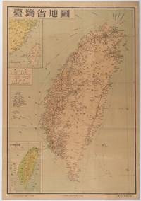
1954215869地圖出版社. Reprint. 1954. Colour folding map of Taiwan showing all major cities towns and villages railways highways roads rivers and sea routes. Topographical inset map at lower left Taiwan Straits with mainland coast inset map at top left. Each map has its own scale. Text in traditional Chinese characters. Washi repairs along some folds on reverse pin marks at corners evenly browned and a little faded. A nice map of Taiwan in fair condition. 77 x 53.8cm. . 地圖出版社. unknown
1837009856London: J. Snow 1837. xx 590pp; colour frontispiece; engraved folding map; title page vignette; 25 bw text ills & portraits. Contemporary 1/2 calf with marbled boards title in gilt to spine; 5 raised bands. Prev owners name on blank preliminary page; slight foxing to frontis and title page map spotted no tears 4 small ticks check marks OK and 3 numbers all in ink on list of illustrations. Rev. John Williams 1796-1839 was the ablest missionary to the Polynesian people and his book was the most printed and widely read of all the contemporary accounts. He was killed by islanders in the New Hebrides in November 1839. The colour frontis features a tattooed native of Raratonga. This is an important early account of London Missionary Society activity in the pPacific and scarce complete with frontis and map especially in this condition. First Edition Second Thousand. Marbled Boards Leather. Fine. Illus. by Baxter G. engravings. 8vo. J. Snow Hardcover
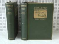
1898006814London: Methuen & Co Ltd 1898. 2 VOLS well illus large 8vo two folding maps pp xx 1278 top edge gilt fore-edge un-trimmed scattered foxing green decorated cloth gilt very slightly worn slight tears to both spine heads. Sven Anders Hedin 1865 - 1952 was a Swedish geographer topographer explorer photographer and travel writer as well as an illustrator of his own works. During four expeditions to Central Asia he discovered the Transhimalaya once named the Hedin Range in his honor and the sources of the Brahmaputra Indus and Sutlej Rivers Lake Lop Nur and the remains of cities grave sites and the Great Wall of China in the deserts of the Tarim Basin. Between 1893 and 1897 Hedin investigated the Pamir Mountains travelling through the Tarim Basin in Xinjiang region across the Taklamakan Desert Lake Kara-Koshun and Lake Bosten proceeding to study northern Tibet. He covered 26000 kilometres 16000 mi on this journey and mapped 10498 kilometres 6523 mi of them on 552 sheets. Approximately 3600 kilometres 2200 miles led through previously uncharted areas. He started out on this expedition on October 16 1893 from Stockholm travelling via Saint Petersburg and Tashkent to the Pamir Mountains. Several attempts to climb the 7546 metres 24757 ft high Muztagata called the Father of the Glaciers in the Pamir Mountains were unsuccessful. He remained in Kashgar until April 1895 and then left on April 10 with three local escorts from the village of Merket in order to cross the Taklamakan Desert via Tusluk to the Khotan River. Since their water supply was insufficient seven camels died of thirst as did two of his escorts according to Sven Hedins dramatized and probably unhistoric account. Bruno Baumann traveled on this route in April 2000 with a camel caravan and ascertained that at least one of the escorts who according to Hedin had died of thirst had survived and that it is impossible for a camel caravan traveling in springtime on this route to carry enough drinking water for both camels and travelers. According to other sources Hedin had neglected to completely fill the drinking water containers for his caravan at the beginning of the expedition and set out for the desert with only half as much water as could actually be carried. When he noticed the mistake it was too late to return. Obsessed by his urge to carry out his research Hedin deserted the caravan and proceeded alone on horseback with his servant. When that escort also collapsed from thirst Hedin left him behind as well but managed to reach a water source at the last desperate moment. He did however return to his servant with water and rescued him. Nevertheless his ruthless behavior earned him massive criticism. In January 1896 after a stopover in Kashgar Hedin visited the 1500 year old abandoned cities of Dandan Oilik and Kara Dung which are located northeast of Khotan in the Taklamakan desert. Beginning of March he discovered Lake Bosten one of the largest inland waters of central Asia. He reported that this lake is supplied by a single mighty feeder stream the Kaidu River. He mapped Lake Kara-Koshun and returned on May 27 to Khotan. On June 29 he started out from there with his caravan across northern Tibet and China to Beijing where he arrived on March 2 1897. He returned to Stockholm via Mongolia and Russia. First English edition. Cloth. Good. Methuen & Co Ltd Hardcover
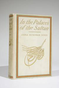
1903573New York: Dodd Mead and Company 1903. First edition. Full cloth. Small quarto. xiv 492 pages. Near fine. Bound in ivory cloth over boards with upper board and spine in orange green and gilt. Top edge of textblock gilt. Some minor edge rubs and faint soil to binding. Black and white photographs. Observations and impressions by an American woman who was with Ambassador Horace Porter's party on a diplomatic visit to Turkey. Dodd stayed at the Sultan's Yildiz Palace at Constantinople. Illustrated with many photographs. Dodd, Mead and Company unknown
18391189Philadelphia: Carey & Hart 1839. First edition. Original cloth over boards. Duodecimos. 242 and 228 pages. Very good in original bindings of pebbled green cloth over boards with paper spine labels. Shallow chipping at heads of spines minor wear and toning to spine labels faint spotting to cloth. Hinges sound interiors mildly age toned. Overall a very attractive set. Frederick Marryat was a British naval officer and pioneering nautical fiction writer. He traveled to America in 1836-1837 and this is the first American edition of his account of that visit. It is an interesting outside view but his criticisms of American culture and society led some to publicly burn his book and effigy. <br /> <br /> Ref. SABIN 44696; HOWES M300; MCKINSTRY P248. Carey & Hart unknown
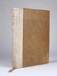
19281333London: The Argonaut Press 1928. Limited edition of 975 copies this copy not numbered. Hardcover. Quarto. cvi 182 pages. Bound in tan cloth over boards with vellum spine integral ribbon bookmark. Ralegh's coat of arms stamped in gilt on upper board spine titled in gilt. Some spotting at lower fore corners of both boards and at bottom of lower board near spine. Old dampstain at bottom inner corners of rear endpapers. Later owner bookplate on front pastedown below Strachey's. Hinges sound. Very good overall. Frontispiece portrait 2 folding maps. A superb edition of Sir Walter Ralegh's Guiana expedition in search of the golden city of El Dorado. Appendices A and B contain Spanish official dispatches that had not seen the light of day for 300 years and which make it possible to compare Ralegh's own account of the 1595 expedition with the narratives of contemporary Spaniards actually on the ground. <br /> <br /> This copy previously owned by Lytton Strachey noted literary critic and founding member of the Bloomsbury Group with his bookplate on front pastedown. The Argonaut Press hardcover
18411950London: John Van Voorst 1841. First Edition . Cloth. Vg/No Jacket. 8vo. Volume II Only. ix 391 pgs. Colour lithograph frontis & 10 b/w illustrs. Original green blindstamped cloth with gilt titles along the spine. Cloth split at the top of the spine and the outer cloth joints are starting to separate. Gently bumped corners and edgewear along the bottom. No names marks or bookplates in text. Other photos available. Inquiries welcome. <br/> <br/> John Van Voorst hardcover
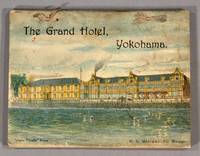
1911851901911. TRAVEL - YOKOHAMA. AMENOMORI N. THE GRAND HOTEL LIMITED. H. E. MANWARING MANAGER. GUIDE BOOK FOR YOKOHAMA AND VICINITY. Yokohama: "Japan Gazette" Press 1911. A small pocket-size guide 14 x 10.5 cm in color illustrated paper wrappers that show the Grand Hotel on the front and a view of Fuji on the back side-sewn with ribbon ties. 46518 text pp. 81 adv. pp. folding map. Following the first section a description of the hotel and the surrounding area which also includes lists of holidays postage money weights and measures etc. there is a section of Anglo-Japanese conversation for tourists. The advertising section is comprised of a wide variety of merchants products and services pearls jewels and curios silks and embroideries photography studios fine hotels pharmacies cars for hire ship and rail lines etc. The small fold-out plan 12.5 x 20 cm of Yokohama City at the end is in fine condition. Negligible edgewear to wrappers and the first few text leaves have one slightly dog-eared corner otherwise it is quite fresh and in very good condition overall. unknown
2002141006008Veszprém 2002. Hardcover. Fine. excellent condition Veszprém hardcover
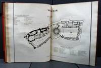
1813e0791London: Edmund Lloyd. G : in Good condition without dust jacket. Rubbed extremities. Some marking to covers. Lower front hinge weakening. Corners worn. Front inner hinge cracked. Foxed prelims. Sporadic foxing to plates sometimes impinging with some offsetting. Light staining at corner of some plates. 1813. First Edition. Red half-leather cover. 340mm x 270mm 13" x 11". 359pp. Heavy item - shipping supplement may apply for overseas. . Edmund Lloyd hardcover
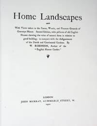
1920wrb08London: John Murray. VG : in very good condition without dust jacket. 1920. Second Edition. Green/gilt hardback cloth cover. 340mm x 270mm 13" x 11". xii 97pp plates. 44 b/w plates. Second Edition with Pictures of Old English Houses Showing the Value of Natural Form in Relation to Good Building: to Compare the Disfigurement of Dutch and Continental Gardens. Heavy book - extra shipping needed for overseas. . John Murray hardcover
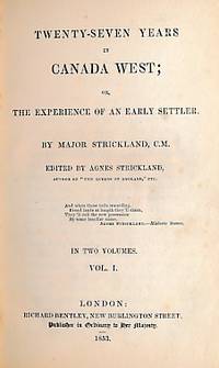
1853e8629London: Richard Bentley. G : in Good condition with embossed stamp on upper board and gilt dentelles. Cover rubbed and scuffed. Prize label on paste-down. Contents G. 1853. First Edition. Brown hardback leather cover. 200mm x 120mm 8" x 5". xix 344pp; viii 344pp. Binding by Jarrold & Sons. . Richard Bentley hardcover
12940London: Sampson Low Marston Searle & Rivington Limited 1889. First edition. Hardcover. Near Fine. Octavo olive green cloth pp. xi 270. Includes chapters on Monte-Casino; Bergamo; Carmagnola 1390-1432; Bulgaria; Buenos Aires; Corfu; Constantinople; "Botzen to Landro via Cadore"; Tunis; and with material on the music of Hungarian Gipsies and Wagner. Welbore St Clair Baddeley was a world traveler writer and amateur archaeologist. This copy bears the author's signed presentation inscription to " W.J. Linton / from an old friend- / St. Clair Baddeley. / Nov.12 91.". Linton was an important engraver a political radical and author. Light foxing to endpapers and page edges small rubs and only minor blemishes to the attractive publisher's binding. <br/> <br/> London: Sampson Low, Marston, Searle, & Rivington Limited, 1889. First edition. hardcover
1978AN-21New York: Garland Publishing 1978. Comprehensive scholarly reference text contains a combination of historical narrative and extensive bibliography which facilitates access to both citations and the literature itself compiled between 1965 and 1977. Includes detailed sections on explorers and ethnographers; expeditions and pioneers; chronologists and prehistorians; archaeologists and anthropologists; current trends and problems; information sources; etc. 279 pgs. Half-title page has a minor slight crease along vertical edge. Minimal shelfwear. First Edition. Hard Cover. Very Good. 8vo - over 7¾" - 9¾" tall. Garland Publishing Hardcover
1985007683London: Thames and Hudson distributor the British School of Archaeology at Athens 1985. Very informative book on the excavation of a sanctuary 1360-1100BC at Phylakopi on the Aegean island of Melos. 513 pages in bright clean condition just a little light marking to top outer edges of pages not inside with 70 pages of photographs giving over 250 individual photographs of the artifacts and the sites many B/w illustrations all present as listed including fold out plans and tables in the book and two in a pocket on the inside rear board plus very informative detailed text. Dustwrapper is a little faded on edges and spinelittle wear to corners of wrapper and inside flaps a little tanned not price clipped. HEAVY BOOK 1.8Kg with packing EXTRA POSTAGE REQUIRED FOR OVERSEAS. a nice example of this book SEE IMAGES. DETAILED IMAGES AVAILABLE ON REQUEST. First Edition First Printing. Boards. Very Good/Good Plus. 10 x 7 ½ Inches. Hardcover. Thames and Hudson [distributor] the British School of Archaeology at Athens Hardcover
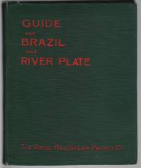
190414710London: Royal Mail Steam Packet Company 1904. Hardcover. Very good. Square 16mo 112 pp plus 13 blank pages at the back for memoranda and log; many photographic illustrations including 2 folding panoramas a folding color map and a table of distances. Early owner's inscription on the front free endpaper; short tear to the fold of one parorama; all else very good or better in original green cloth. The "South American Route" begins in Spain and Portugal proceeding to Madeira Teneriffe St. Vincent Fernando de Noronha Pernambuco Bahia Rio Santos Sao Paolo Monte Video Buenos Ayres etc. Descriptive information history commerce landscape tourist excursions etc is provided on each locale. There is also a list at the end of more than 50 books on South America recommended for the education of travelers including works of history and geography fiction travel narratives dictionaries emigrant's guides and statistics on commerce and natural resources. An uncommon guidebook; 7 copies located in OCLC. Royal Mail Steam Packet Company hardcover
2018008787London England: STANLEY/BARKER 2018. 1st Edition 1st Printing. Hardcover. Near Fine/No Jacket. 4to - over 9¾ - 12" tall. Anderson Christopher. First edition first printing. This is not a limited edition copy of which 30 were issued; this is the trade edition. Type by The Entente London. Cover by Eike Koenig Berlin. Printed by SYL Barcelona. Edition of 1000 casebound copies. 12 x 10 inches. With silk-screened paper-wrapped cover and with a "smudged" effect gold on black front and back but that effect is deliberate and in fact the boards are immensely clean. Unbumped spine head and tail and fairly sharp corners. Text block firmly bound in. With more than 100 unnumbered pages on coated stock. One page introductory essay one page credits; else no text. Featuring full-page full-color photo portraits. Exceptionally clean interior. No dust jacket as issued. A Near Fine copy. 2 lbs. 3 oz. Danziger Gallery in NYC had an exhibition of the photographs featured in this book September 13 to October 20 2018. Christopher Anderson's photographs portray a contemporary China in the midst of perpetual reinvention. The images are tightly cropped and extremely close up bringing the viewer to an intimate distance where all context is removed except for the ambient artificial light that illuminates the faces giving only the sensual information of the physical form allowing the viewer the indiscreet pleasure of staring at another human face and wondering who the individual might be or what they might be thinking about at the moment of the photograph. A somewhat vapid statement by the photographer is as follows: "I have seen the future and it is now and it is China. There is no need for the past. It can be erased. A new happiness is being constructed an approximation of joy better than the real thing." Christopher Anderson is a member of Magnum Photos. He first gained recognition in 1999 when his poignant images of the rescue of Haitian refugees taken onboard a sinking wooden boat named the "Believe in God" won him the Robert Capa Gold Medal. <br/> <br/> STANLEY/BARKER hardcover
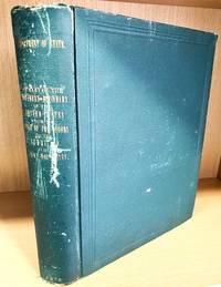
1878010577Washington DC: Government Printing Office 1878. 1st Edition . Hardcover. Very Good. Heavy 4to. A heavy quarto volume over 3.5 kg packaged weight 624 pgs. 7 folding maps at the end. 2 folding maps in text. 15 colour lithograph plates with tissue guards 5 full page diagrams. Clean text; no names or marks no bookplates not ex-library. Binding tight and secure. Typical scuffed green cloth with corners worn through to the boards photo and heavier scars along the spine. Otherwise an excellent example that will require additional shipping charges to all destinations. Inquiries welcome. <br/> <br/> Government Printing Office hardcover
18383977Philadelphia PA: Carey Lea and Blanchard 1838. First UK edition. Hardcover. Good/Good. 8vos 7.5"x5". 252pp. 248pp. Brown cloth-covered boards spine labels deteriorating. Spine slants sunfaded spines soft endcaps rubbed corners light edgewear. Boards spotty small dent to lower cover of vol.1. Bookplates to front pdeps. Tears at hinge to ffep of vol.2 lower hinge starting. Heavily foxed. Scarce. Carey, Lea, and Blanchard hardcover
1980001936New York: G. P. Putnam's Sons 1980. 663 pages clean and tight black cloth with silver ltrs on spine top edges are spotted from shelf dust. DJ is navy pictorial with white ltrs and has numerous nicks/tears/creases/and rubbings on edges. Rare book that tells the full story of Scott's failure and Amundesen's triumph. First American Edition. Hard Cover. G/G. G. P. Putnam's Sons Hardcover
174217649Chez Charles-Nicolas Poirion. Good. 1742. Nouvelle Edition. Hardcover. Bound in brown calf with five bands and lightly faded gilt decoration & lettering. Marbled endpapers. Internal hinges intact. Text is tight bright & intact. Volume #1 has a fold-out 12 1/2" x 9 1/2" color map of Paris 2 fold-out map/plans 5 fold-outs of monuments/buildings & 2 single page engravings. xxiv 631pp 1 errata . Volume #2 has has 3 single page engravings/ plans 3 fold-out plans/maps & 11 fold-outs of monuments/buildings. 2 645pp 1errata . Both front covers & vol-1 rear cover cracked with covers firmly attached. Spine ends rubbed with some loss & bottom corners rubbed. 2 fold-outs have minor tape repair & 2 have small tear at site of attachment. France; 16mo 6" - 7" tall; 1276 pages . Chez Charles-Nicolas Poirion hardcover
1749860361749. TRAVEL HISTOIRE GENERALE DES VOYAGES OU NOUVEAU COLLECTION DE TOUTES LES RELATIONS DE VOYAGES PAR MER ET PAR TERRE . TOME SECOND. Paris: Didot 1749. 450 5 folding maps. 12mo. mottled calf gilt spine raised bands. Spine chipped spine label slightly chipped joints cracked leather cracked. Marbled edges and endpapers small chip to front flyleaf small printed bookplate to front pastedown. A few maps with small closed tears but else in very good condition. Title page continued: "Qui ont ete publiees jusqua present dans les differentes Langues de toutes les Nations connues: contenant ce qu'il y a de plus remarquable de plus utile et de mieux avere' dans le pays ou les voyageurs ont penetre': avec les moeurs des habitans la religion les usages arts sciences commerce manufactures &c. pour former une systeme complet d'histoire & de geographie moderne qui represente l'etat actuel de toutes les nations; enrichi de cartes geographiques et de figures." Depuis le commencement du XV Siecle Premier Partie: Voayages au Sud-Est et aux Indes Orientales. As is. unknown
1753003525London: Printed and sold by Luke Hinde 1753. Hardcover. Very Good. vii 1 194 6 p.; 20 cm. Signatures: A-N8 8vo. Contemporary full calf with blind-ruled border on both boards. Old calf spine repair. Remains of old library label on front fixed endpaper scraped through the endpaper. A Serious Call in Christian Love to all People to turn to the Spirit of Christ has special dated title page but continous pagination. Printer's advertisements on 6 pages following text. Pencil inscription at foot of p. 133: "David Reece Esq. & A. Williams deep in love." First edition. Benjamin Holme 1683-1749 was a Quaker who travelled extensively in the ministry. Various writings related to his visits to Friends in England Wales Scotland Ireland Holland the West Indies and the American colonies were brought together and published in this volume soon after his death. Much scarcer than the scarce 1754 printing. In Very Good Condition: leather is rubbed at head of spine front joint and corners; lacking both free endpapers; foxing and browning throughout; otherwise clean and tight. Printed and sold by Luke Hinde hardcover
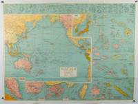
1945180206Sydney.: H.E.C. Robinson. Circa1945. Full colour inset maps principal cities and towns marked shipping routes international boundaries and railways. 99 x 73cm. Some small insect damage has been repaired on the verso visible on map as a few small lighter areas in the western Pacific. Pinpoint holes at folds paper repair along cover but a very good clean copy. From the Sydney publisher H.E.C. Robinson the firm founded in 1895 by Herbert Robinson 1857-1933 a founder of the Royal Geographical Society of Australasia. <br> <br>Although the map is undated North and South Korea are shown as divided which occurred in late 1945 and Manchuria is marked as still under Soviet occupation which only lasted until 1946 at which point it was handed over to Communist China. <br> <br>As well as what now would be considered Southeast Asia the main map shows the eastern half of India Tibet and parts of Mongolia the USSR and East Asia. Inset maps include: Caroline Islands Marshall Islands Federation of Malaya Singapore Hong Kong Taiwan Japan Hawaiian Islands Philippine Islands Midway Gaum and Wake Islands Fiji Islands Eastern & Western Samoa Santa Cruz and Solomon Islands New Caledonia Rabaul Tahiti Lord Howe etc. . H.E.C. Robinson. unknown
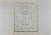
1749136794Paris. circa1749. Black and white engraved plan map of Peking on laid paper folded designed by the prominent French cartographer Jacques-Nicolas Bellin. This map is No. 18 Vol. 5 from the impressive 15-volume "Histoire Generale des Voyages" compiled by French novelist Antoine François Prévost. This city map shows two areas of walled cities: Ville Tartare Imperial city and the Forbidden City and Ville Chinoise ethnic Han residential area. <br> <br>Notes A and B represents buildings within the Forbidden City. A: Lieu de Plaisance ou l'on voit une Montagne faite a la main B: Grandes Cours du Palais de l'Empereur. Two missionary buildings French and Portuguese as well as the Tower of Mathematics illustrated within Ville Tartare. Two temples illustrated side by side near the south gate of the Ville Chinoise. <br> <br>Overall in good condition very light browning on edges and darker toning along the borders of the map. Text in French. Map measures 21 x 16.4cm. . unknown