Schoeller, MaxAntiquariat.de

30 490 résultats
1901172982-1Berlin, Reimer 1901-04. 4°. VIII, 262 S., 2 Bll., 28 S., 2 B ll.; 2 Bll., 330, 4 Bll., 34 S., 1 Bl. Mit 4 Titelbildern, 150 Tafeln (davon 103 ethnographische, 30 ethnologische und 17 Gehörntafeln) und 16 farbige Faltkarten. Orig.-Velourbände mit Goldschnitt.
174310890Jean Neaulme La Haye 1743 1 vol. 2 tomes en un vol. in 4 de 1 f.n.ch. (page de titre) XLIV 414 pp. et IV 192 pp. 172 pp., pleine basane brune de l'époque, dos lisse orné, pièce de titre en maroquin, dentelle intérieure dorée, tranches marbrées (restaurations soignées aux coiffes et coins).
1844219156Alberto Hauser Paris 1844. Softcover Großformat Einzelkartons mit rückseitiger Kurzbeschriftung. Keine beschreibenden Texte. Zustand: Exemplar einer Privatbibliothek mit Kennungen. Rücken Ecken Kanten gut. Alberto Hauser, Paris, paperback
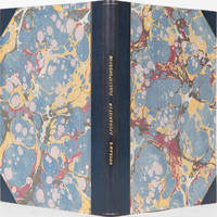
18423983London: JC Bridgewater 1842. First Edition. Soft cover. VG. with the undermentioned persons connected with the late operations in Afghanistan from the commencement of the revolt in November 1842 to the final evacuation of that country by the British troops in October 1842. Correspondence men such as R. Shakespeare Major Rawlinson Capt. Durand J. Willoughbu Capt. Lawrence. 105 pages in 3 sections. Lengthy correspondence about the British involvement in Afghanistan. Original plain wrappers housed in a half leather folding clamshell box. Marbled boards. Gilt title: Outram's Afghanistan correspondence. JC Bridgewater unknown
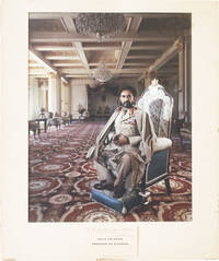
47326N.d. ca 1970s. Original large-format color print in presentation mat with title card affixed to mat below image. View size 49cm x 38cm ca 19" x 15"; overall dimensions 60cm x 51cm. Title card inscribed in black ink: "For Bob MacNeal a fellow photographer with best wishes / Arnold Newman" undated. Mat lightly soiled with a few small chips and abrasions to extremities; image clean and unfaded Near Fine. ca<br/><br/>NOTE: the mat appears permanently fixed to the photograph as presented by the photographer; we have not attempted to examine the print outside the mat. Impressive large-format portrait by Newman here inscribed to one "Bob MacNeal" identified as a "fellow photographer" though we can find no photographers of the period who used this spelling. Possibly a misspelling of Bob MacNeil still active the prominent Canadian fashion photographer; possibly a misspelling of Bob McNeill d.2007 the prominent African-American documentary photographer; or possibly the correct spelling of an acquaintance of no notable prominence at all. Undated but ca. early 1970s a superlative image of the Ethiopian Emperor boldly inscribed and signed by Newman below image. unknown books
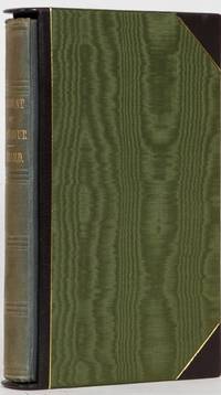
18411247London: James Madden & Co 1841. First. Hardcover. VG-Nr Fine. 308 pp appendices large folding map in front pocket. The author one of three brothers traveled through an area of British controlled Central Asia that lay east of Simla. One of the earliest works on high altitude travel although they never made it through to Tibet. It includes information on history geography tribes languages etc. A truly beautiful copy - original blindstamped cloth showing almost no wear. Text uncut. Someone opened the book to sign their name and never opened the book again. One minute spot on outer rear hinge where cloth is thin. Housed in an opened ended silk slipcase with leather corners and edges gilt ruled. James Madden & Co hardcover
186189748E. Donnaud | Paris 1861-1863 | 17.5 x 26 cm | 6 volumes reliés
185753130ABGotha, Justus Perthes, 1857-1858. 8° (22x14), XLII,638; XII,762; XI,612; XII,688; XII,804 S., mit 153 Textholzschnitten, 60 farblith Tafeln, 16 gefaltete Karten, [so komplett], einheitl grüne Oln mit DeckelblindPräg, goldRTitel, [3 Warenabbildungen] (1. Aufl.) Ecken teils etwas bestossen, Namensstempel auf Vorsatz/Titel, wenige Seiten schwach stockfleckig, ein paar Seiten unaufgeschnitten; Band 1 hintRückenfalz alt mit grünem Band verstärkt, vordFalz leicht geöffnet, BAND 2: hintFalz offen (Rücken fest), vordFa
169711811697 Amsterdam [Amstelaedami], Jean Wolters [Joannem Wolters], 1697. 24 x 18 cm (R), in-4, 1 f. bl. - titre frontispice entièrement gravé - 11 ff. n. ch. (dont titre, dédicace, adresse au lecteur, epistolae, table et privilège) - 565 pp. - 31 ff. n. ch. d'index - 2 ff. bl. - 2 planches, 3 tableaux et 41 (sur 43) cartes gravées hors texte, dont 40 sont dépliantes ou à double page, reliure hollandaise de l'époque en plein vélin doré, plats estampés à froid de motifs des Pays Bas espagnols dans un double encadrement de filets avec fleurons d'angle, dos estampé de filets et fleurons, titre manuscrit à l'époque, traces de lacets. (sig. *3, **4, ***4, A-Z4, Aa-Zz4, Aaa-Zzz4, Aaaa-Kkkk4)
17271098-19A la Haye, Johnson & J. van Duren 1727. Vol. 1 (of 2) apart. gr.-4°. 8 ll., 472, 23 pp. with 1 frontispiece, 31 planches hors-texte dont 6 dépliantes et 10 à double-page. - Mit Frontisp. (v. B. Picart), 29 tlw. gefalt. Kupfertaf. (dav. 16 doppelbl.-gr.) und 2 doppelbl.-gr. gefalt. Karten. Ldr. d. Zt. Mit Rückengoldpräg. Kap. u. Kanten berieb. EA. [5 Warenabbildungen]
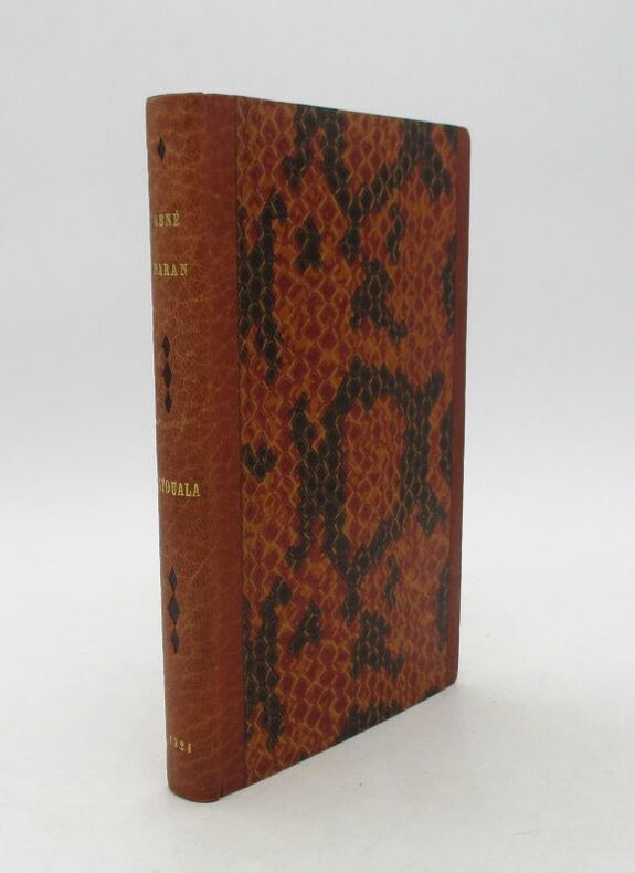
20599Paris, Albin Michel, 1921. In-8, 189 pp., demi-maroquin à bandes havane de Devauchelle, plats de papier imitant une peau de reptile, dos long mosaïqué de petits losanges bruns, tête dorée (1 décharge à la couverture).
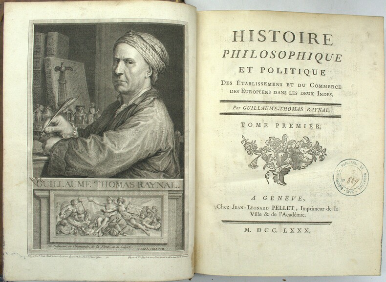
1780PHO-1926Genève, Pellet, 1780, 5 volumes in-4, 4 de texte et un atlas in-4, Texte ; portrait, XVI, 741 pp., 1 pl.; front., (2 ff.), VIII, 485 pp.; front., XV, 629 pp.; front., (2 ff.), VIII, 770 pp., (1 f.), Atlas ; 2f., 28pp. ; illustré complet des 50 cartes (chiffrées 1-49 et 17 bis) ; quelques cartes mal chiffrées et 23 tableaux de statistiques in fine, la plupart dépliants. Rousseurs éparses, feuillets légèrement brunis par places. Tampons humides "Bibliothèque populaire de Bordeaux". Reliure Texte ; Basane fauve marbrée de l'époque, dos à nerfs ornés, triple filet doré encadrant les plats, Atlas ; veau brun marbré de l'époque, dos à nerfs orné, fleurons tulipes entre caissons, tranches marbrées, filet à froid encadrant les plats, double filet doré sur coupes 2 coiffes arasées, une arrachée, petits chocs à 2 autres, frottements et épidermures, coins très émoussés, mors fendillés aux entrées, coins émoussés, tranches marbrées (atlas).
2002104326BBKöln, Taschen, (2002). Folio (50,5 x 35 cm.). 564 S. mit zahlr. Farbtafeln. Original-Kaliko-Einband in Original-Kaliko-Buchkassette.
196527180London: Heinemann Educational Books. Near Fine in Very Good dust jacket. 1965. First Edition. Hardcover. Foreword by Ahmed Ben Bella - President of Algeria introduction by Oliver Tambo. Edited by Ruth First. With black/white photographic illustrations unclipped dustjacket that has small piece missing from top of spine see images overall a very good copy of this first edition. ; 210 x 140mm; 189 pages . Heinemann Educational Books hardcover
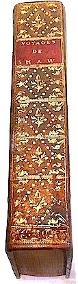
folio [34.5 x 23 cm]; [viii], xv, [i], 442, [ii], 60, [viii] pp, 34 copper engraved plates, plans & maps (including 10 fldg maps, plates), leaf of engraved music, half-title & div half-titles, title in red & black, engraved head & tail pieces, text illus. contemporary full calf, gilt title lettering on red leather spine label, joints cracked but firm, old wear to edges, bookplate of William Robertson, Advocate (relative of Scottish historian of same name, lightly foxed on 2 leaves, interior is crisp, fine. Cox i, p377. Pritzel 8649. Gay 391. Nissen. 3839 Casey Wood p566. Blackmer Sale 307: "His work is valuable for its accurate descriptions of antiquities, geography & natural history he observed". Gibbon praised him and 'his scrupulous fidelity was vindicated by James Bruce and by later African explorers. . . a noble example of typography' (D.N.B., vol 17, p 1384). Lowndes 2372: 'These Travels have been universally esteemed, not only for their accuracy and fidelity, but on account of the illustrations they contain of natural history, of the classic authors, and especially of the Scriptures.' A handsomely printed work, the best description of North Africa of the period. The author visited Egypt, Sinai, Palestine, Cyprus and most of North Africa, and provides much material on Tunis and Algeria. A section on Lebanon is included in the description of the Levant. More than 640 species of plants are described. There is also a list of the rarer plants of Barbary, Egypt and Arabia. The plates include natural history, botany, animals, antiquities. His geological views were enlightened for his time, while his conjectures on the subject of the pyramids have been fully confirmed by later investigators. There is a section on plants, birds, animals, etc, he collected. This is regarded as the best edition which includes the supplement published 6 years later and which contains his folding plate Lithostrotum Preaenestinum which is found in some historical reference works. Another folding plate in the supplement includes 6 images including 5 maps.
1811179813-1Berlin, C. Salfeld 1811-12. X, 10 [= 7-10], 685; 6, 661 S. Mit 1 gest. Frontispiz, 9 (3 gef.) Kupfern u. 1 mehrf. gef. Karte. Halblederband der Zeit mit Rückenschild u. Rückenvergoldung.
1764241716Berlin 1764. Softcover Pergament Zustand: keine Beschädigungen das Blatt 323 hat eine Fehlstelle Eintragungen im Vorsatz in Tinte und Kugelschreiber Innen keine Eintragungen. Rücken Ecken Kanten altersentsprechend aber in Ordnung. Ohne Flecken leicht gewelltes Papier. Berlin, paperback
In-8 gr. (mm 270x210), 2 volumi, p. pelle coeva con cornici dorate e a secco ai piatti, dorso a cordoni (in pelle moderna) con decoraz. e titolo oro, pp. XVIII,(2),458; XVII,(3),373. L’opera è molto ben illustrata f.t. da incisioni in rame, i.e.: 1 ritratto dell’A. in ovale, inciso da T. Dickinson su disegno di H. Edridge - 2 tavole di carattere botanico (Rhamnus Lotus - Shea, or the butter tree (karite’) - 3 di vedute (Ali’s tent at the Camp of Benowm - Kamalia - A bridge over the Ba-fing or Black River) - 1 tav. di musica notata (Song from Mr. Park’s Travels) e 4 grandi mappe, più volte ripieg., con i confini colorati a mano (The route of Mr. Mungo Park - Map of North Africa - Chart of variations - Map to illustrate the last mission into Africa). - Il volume 1° (in una nuova edizione pubblicata nel 1816) contiene la relazione dei “travels in 1795, 1796 and 1797. With an Appendix, containing geographical illustrations of Africa, by Major Rennell”. - Il volume 2° ("The Journal of a mission.."), in seconda edizione (la prima uscì separatamente nel mese di Marzo 1815), contiene “other documents, official and private, relating to the same mission. To which is prefixed an account of the life of Mr. Park”. Cfr. Gay,2788: “L’édition de 1816 et celle de 1817, renferment le journal qui s’est publié séparément sous le titre "The journal of a mission..", London, 1815. La relation de Mungo Park a été traduite dans presque toutes les langues européennes” - Brunet,IV, p. 375 - Printing and the Mind of Man,253. “L’esploratore scozzese Mungo Park (1771-1805) intraprese per conto della Società africana di Londra un viaggio di esplorazione nel bacino del Niger (1795), penetrando dalla Gambia nel Bondu e nella valle del Senegal e seguendo quindi il corso del Niger fino a Segu, nel Bambara. Il resoconto del viaggio ("Travels in the interior of Africa", 1799) lo rese popolare in Inghilterra. Ripartito alcuni anni dopo dalla Gambia (1805), Park raggiunse di nuovo il corso del Niger proponendosi di seguirlo fino alla foce, ma, mentre cercava con un battello di superare le rapide di Bussa, veniva attaccato e ucciso dagli indigeni insieme a tutti i suoi campagni. L’ardimento con cui penetrò in regioni difficili e ostili e il valore delle relazioni scritte fin poco prima della morte, fanno di lui uno dei maggiori esploratori moderni dell’Africa”. Così Diz. Treccani,IX, p. 61. Esemplare ben conservato.
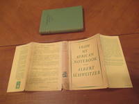
1951051287London Uk: George Allen & Unwin 1951. 1st Edition 2nd Printing. Hardcover. Near Fine/Very Good. Map Photographs. 132 Pp. Catalog At End. Green Cloth Lettered In Brown. Second Printing Stated 1951. Signed By Albert Schweitzer On The Half Title Page Obtained In Person On A Trip To Lambarene By The Previous Owner. Near Fine Slight Browning To Upper And Lower Edges Five Words Faintly Underlined. Dust Jacket Priced 8S 6D Light Usage Slight Browning To Spine A Few Short Tears And Minute Losses At Edges. <br/> <br/> George Allen & Unwin hardcover
185753454ABGotha, Justus Perthes, 1857-1858. Mit Textillustrationen, 60 farblithographierten Tafeln, 1 Plan und 16 teils gefalteten Karten. Grüne Originalleinenbände mit Deckelblindprägung und goldgeprägtem Rückentitel. 5 Bände. [6 Warenabbildungen]
La carta del continente nero di Ortelius rappresenta una delle pietre miliari nella cartografia dell’Africa, diventando subito molto popolare e rimanendo carta di riferimento anche per il secolo successivo. Cartograficamente è una copia della carta di Giacomo Gastaldi del 1564, e segue la tolemaica visione del coso del fiume Nilo. Il bellissimo cartiglio al centro mostra elementi egizi, mentre una grande battaglia navale e due mostri marini decorano questa importante mappa, tratta dall’edizione tedesca del Theatrum Orbis Terrarum. Carta tratta dal Theatrum Orbis Terrarum e che è considerato il primo vero “atlante” moderno. L’opera fu pubblicata in 7 lingue e 36 edizioni, per il quale – nel 1570 - Ortelius ottenne il privilegio, ovvero una sorta di diritto d'autore che impediva ad altri cartografi di pubblicare i propri lavori. Il Theatrum rappresentava il lavoro più avanzato del lavoro della descrizione cartografica. L’Ortelius vi raccolse il sapere geografico e cartografico del suo tempo, proponendo in 147 spettacolari tavole incise l’immagine più fedele del mondo allora conosciuto e, in alcune straordinarie “carte storiche”, regioni e itinerari tratti dalla letteratura, dalla mitologia, dalla tradizione. Ortelius fu anche il primo a citare le fonti, menzionando i nomi dei cartografi nel “catalogus auctorum”. Dal 1598 al 1612 le edizioni postume del Theatrum furono realizzate dal suo collaboratore Johannes Baptiste Vrients. Incisione in rame, eccellente coloritura coeva, in ottimo stato di conservazione. This beautiful map is one of the cornerstone maps of Africa. Geographically, it is a close copy of Gastaldi’s map of 1564 and follows the Ptolemaic view of the Nile. Ortelius' map was modern in appearance, compared to Munster and others, and remained the standard map of Africa well into the 17th century. The map contains a superb vignette of a naval battle on bottom right, and various sea monsters. The cartouche bears Egyptian decorations. From a German edition of Theatrum Orbis Terrarum. Map taken from the Theatrum Orbis Terrarum, which is considered the first true modern "Atlas". The work was published in 7 languages and 36 editions, for which - in 1570 - Ortelius obtained the privilege, a kind of copyright that prevented other cartographers from publishing his works. The Theatrum represented the most advanced work of cartographic description. Ortelius collected in it the geographical and cartographic knowledge of his time, proposing in 147 spectacular engraved plates the most faithful image of the world then known and, in some extraordinary "historical maps", regions and routes taken from literature, mythology, tradition. Ortelius was also the first to cite sources, mentioning the names of cartographers in the "catalogus auctorum". From 1598 to 1612 the posthumous editions of the Theatrum were made by his collaborator Johannes Baptiste Vrients. Copper engraving, contemporary coloring, in good condition. M. Van den Broecke "Ortelius Atlas Maps" (2011), n. 8; O. I. Norwich, "Norwich's Maps of Africa", map 10; R. L. Betz "The Mapping of Africa…" (2007), map 12.
Rocca S. Casciano, Cappelli Editore, 1937, in-folio (cm. 42 x 34), legatura in tutta tela, dorso metallico con cerniere in rame, che compone, con l'ascia in acciaio satinato bianco applicata al piatto anteriore, un fascio littorio. pp. 570 completamente illustrate prevalentemente da fotografie. Disegni di Gigi (Luigi Del Giudice) . Edizione numerata e limitatissima; il ns. esemplare è il n. 710. Qualche macchia alla copertina e qualche normale fioritura diffusa dovuta al tipo di carta, ma buona copia.
XXVIII (Vorwort, Inhalt, Subskribenten), 372, XCII S. (Appendix), 1 Bl. Mit gest. Portr., 3 (2 mehrf. gefalt.) gest. Karten, 5 (2 gefalt.) Kupfertafeln u. 2 Bl. gest. Noten. 4°, HLederband des 19. Jahrhunderts mit goldgepr. RTitel und RFileten, Schnitt marmoriert. Lowndes VII, 1775. DNB XV, 218f. - Privatdruck für den Autor, sehr selten. Mungo Park ist neben James Bruce der bedeutendste englische Afrikaforscher. Auf dieser Reise erforschte er den Lauf des Niger, er setzte sie 1805 fort und drang bis über Timbuktu hinaus vor. - Durchgeh. gebräunt, tls. wasserrandig u. stockfl. Tit. mit unterl. Eckabriss. Die 2 mehrf. gefalt. Karten mit unterl. Falzeinrissen (Karte v. Nordafrika mit rep. Randausrissen). Die S. 367-372 u. I-XIX (Appendix) mit unterl. Randläs. (ohne Textverlust). 1 Bl. "Postscript" u. 2 Bl. Musiknoten am Ende eingebunden. - The indicated shipping costs refer to books weighing up to one kilogram. - Bücher, die schwerer als ein Kilogramm oder größer als 35 x 25 cm sind, werden als Paket verschickt und kosten innerhalb Deutschlands bis zu zwei Kilogramm 6 Euro, darüber hinaus 7 Euro Porto. -
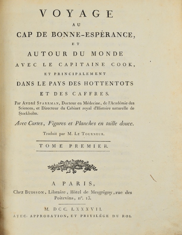
178742702Paris, Buisson, 1787. 2 tomes en 1 vol. in-4 de (4)-XXI-(3)-478 pp. et (4)-462 pp., cartonnage papier crème, pièces de titre vertes (relié vers 1830).
1793255654Johann Jacob Gebauer Halle 1793. Hardcover Pappe 1793 1796. Geschichte des Reichs Rügen des pommerischen Reiches des Herzogthums Pommern a.d. Weichsel der Sorben des Reichs Böhmen. Geschichte d. böhmischen Reichs unter der Obermacht der Hussiten vom Jahre 1527 bis 1620. Geschichte des Reichs von der Schlacht am weissen Berge an bis auf jetzige Zeit. Zustand: keine Beschädigungen keine Eintragungen. Rücken Ecken Kanten berieben am Rücken mit Fehlstellen. Die Bücher halten gut zusammen die Bindung ist unbeeinträchtigt Innen ohne Flecken. Johann Jacob Gebauer, Halle, hardcover