Gebhardi, Ludewig Albrecht:Biblio.com
Livre Rare Book
De l'Afrique.
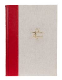
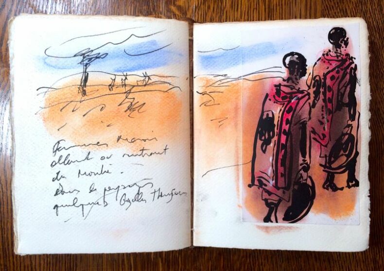
9431 Carnet broché avec une couverture en cuir souple. 22 x 16 cm, n.p. S.l.n.d. Edition originale.
Librairie L'Abac · La Hulpe, Belgique1 750,00 €
30 547 résultats
1793255654Johann Jacob Gebauer Halle 1793. Hardcover Pappe 1793 1796. Geschichte des Reichs Rügen des pommerischen Reiches des Herzogthums Pommern a.d. Weichsel der Sorben des Reichs Böhmen. Geschichte d. böhmischen Reichs unter der Obermacht der Hussiten vom Jahre 1527 bis 1620. Geschichte des Reichs von der Schlacht am weissen Berge an bis auf jetzige Zeit. Zustand: keine Beschädigungen keine Eintragungen. Rücken Ecken Kanten berieben am Rücken mit Fehlstellen. Die Bücher halten gut zusammen die Bindung ist unbeeinträchtigt Innen ohne Flecken. Johann Jacob Gebauer, Halle, hardcover
9431 Carnet broché avec une couverture en cuir souple. 22 x 16 cm, n.p. S.l.n.d. Edition originale.
9431 Carnet broché avec une couverture en cuir souple. 22 x 16 cm, n.p. S.l.n.d. Edition originale.
- Madame Huzard, Paris 1835, 31x43cm, relié. - First edition and the first printing of the plates. Plate volume only. Bradel binding of marbled paper boards by T. Boichot, preserved covers repaired and laid down. This copy retains its 18 plates mounted on guards, but lacks the title page, showing details of the work undertaken to remove the western obelisk at Luxor, as well as various sites and costumes in Egypt linked to the places visited by the expedition. Tiny wormtracks occasionally affecting some engravings, dampstain to upper margin, traces of sewing to inner margin. Very rare. [FRENCH VERSION FOLLOWS] Edition originale et premier tirage des planches. Volume de planches seul. Reliure à la bradel en plein cartonnage recouvert de papier marbré, couverture restaurée et doublée conservée, reliure signée de T. Boichot. Exemplaire bien complet de ses 18 planches montées sur onglets, mais sans la page de titre, reproduisant les détails des travaux exécutés pour l'enlèvement de l'obélisque occidental de Luxor, et divers sites et costumes d'Egypte se rattachant aux lieux habités par l'expédition. Minuscules galeries de vers affectant parfois certaines gravures, une mouillure en marge supérieure, traces de couture en marge intérieure. Très rare.
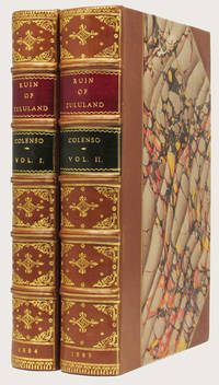
188432731London: William Ridgway 1884-1885. 2 volumes plus Prospectus First Edition Illustrated with original photographs at the front of each volume. 8vo Very handsomely bound in fine three quarter polished calf over marbled paper covered boards the spines with raised bands double gilt ruled the compartments with elaborately gilt decorations within panels featuring corner and central tooling contrasting red and green morocco lettering pieces gilt. xx 380; xvii 513; 4 pp. A fine copy the handsome bindings in excellent and very pleasing condition the text-blocks clean and well preserved hinges tight and strong. An excellent set of this rare work. RARE FIRST EDITION. An important and rare work in which the author covers the War and subsequent events including Cetshwayo 's visit to England and his return to a broken Zululand. Colenso was a great admirer of Cetshwayo.<br> Mendelssohn's South African Bibliography Vol.1 page 356 – 357: states that the Zulu war may be divided into three periods the first of which is that treated of in " The History of the Zulu War" while this work covers the second and third periods. The author argues that " had the restoration of Cetywayo been carried out in the kind and honest spirit in which it was conceived long ere this the misery of Zululand would have been over." It is alleged that a certain portion of the inhabitants of Natal assisted by the Government officials had provoked the constant succession of wars and disputes between the British the Boers and the natives. Sir Bartle Frere Mr. Shepstone and others are accused of having worked up an agitation which transformed a peaceful situation with the Zulus into a position which ostensibly demanded an army of defence as an urgent necessity ; and this latter being at last conceded by the home Government no time was lost in changing the attitude of defence into one of offence which resulted in " one of the most needless and disastrous campaigns which ever disgraced our arms."<br> In the second volume there is an interesting account of the visit of Cetywayo to England and of his interviews with members of the Royal family and Lord Kimberley. The King spoke earnestly to the Colonial Minister on the subject of John Dunn's treachery and ingratitude and asked that he should not be allowed to settle in the country ; he however agreed to the terms set forth under which he was allowed to return to his kingdom. The work gives a clear account of the unhappy state of Zululand after the King's return until his death " again a prisoner " under the protection of the British Resident. The author like her father and sister was a strong champion of Cetywayo and was greatly grieved and indignant at the intrigues which are stated to have led to the ruin and death of the Zulu king who she asserts " stands out amidst all the chaos of South African blunders and wrongdoings . as grand a figure as any in modern history. His faith in our England wrought his downfall and his death. William Ridgway hardcover
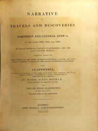
182623980London: John Murray 1826. First edition 4to 2 volumes in 1; pp. x 2 xi-xlviii i.e. lxviii 335 1; 4 269 1; 38 engraved plates and maps 1 folding and backed with linen 1 hand-colored 6 wood-engraved vignettes in the text; half brown morocco over marbled cloth rebacked old gilt-decorated spine neatly laid down; very good sound copy. Denham 1786-1828 made extensive and important explorations in Africa. When he accompanied Bornuese troops in an expedition against the Fellatah they were put to utter rout and only Denham escaped with his life "after encountering dangers and deprivations his narrative of which reads like a frenzied dream.The work which went through several editions has numerous illustrations from sketches by the author together with an Appendix of Natural History and other notes" DNB. He was later appointed lieutenant-governor of the colony of Sierra Leone where he died of the African fever. Ibrahim-Hilmy p. 172. <br/><br/> John Murray hardcover books
182623980London: John Murray 1826. First edition 4to 2 volumes in 1; pp. x 2 xi-xlviii i.e. lxviii 335 1; 4 269 1; 38 engraved plates and maps 1 folding and backed with linen 1 hand-colored 6 wood-engraved vignettes in the text; half brown morocco over marbled cloth rebacked old gilt-decorated spine neatly laid down; very good sound copy. Denham 1786-1828 made extensive and important explorations in Africa. When he accompanied Bornuese troops in an expedition against the Fellatah they were put to utter rout and only Denham escaped with his life "after encountering dangers and deprivations his narrative of which reads like a frenzied dream.The work which went through several editions has numerous illustrations from sketches by the author together with an Appendix of Natural History and other notes" DNB. He was later appointed lieutenant-governor of the colony of Sierra Leone where he died of the African fever. Ibrahim-Hilmy p. 172. John Murray unknown
Due volumi di cm. 28x22; pp. XVI, (2), 427; (4), 372, (2). 9 carte geografiche ripiegate fuori testo e 8 tavole in acquatinta a colori. Elegante e solida legatura coeva in piena pelle, dorso a 5 nervetti con titoli e ricchi fregi in oro, piatti inquadrati entro cornicetta dorata, tagli marmorizzati, risguardi in carta marmorizzata. Piccolo foro di tarlo passante per tutto il volume al margine inferiore bianco del primo volume molto lontano dal testo e dalle illustrazioni. Qualche brunitura dovuta alle carte geografiche presente in tutti gli esemplari. Seconda e migliore edizione 389
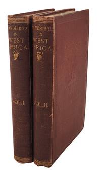
186324075London: Tinsley Brothers 1863. Hardcover. Very good. Two volumes in the rarest binding state without Burton’s name or FRGS on the spines but with a “second edition†slug on the title pages. This state was apparently unknown to Penzer and was probably the result of an attempt to boost sales by the publisher as the text is unchanged. Plate of Julu house is the frontispiece to Volume I and the map now detached and laid in is in Volume II. Both volumes lightly bumped/rubbed but clean and sound. Small bookplate of F.H. Spencer on each front pastedown along with a small bookseller stamp and evidence of a few markings removed. Much to his dismay Burton’s first consular posting landed him on a small desolate island off the coast of West Africa. He took every opportunity to leave the place exploring various parts of the mainland and making observations on cultural and traditions health and sanitary conditions and slavery among other things. The account of his journeys into Sierra Leone and Nigeria to investigate stories of gold and gold mining is credited with drawing public attention to mining prospects in the region. Penzer 71-72; Casada 70. Tinsley Brothers hardcover
186313920London: Tinsley Brothers 1863. Hardcover. Very good. Two volumes in the rarest binding state without Burton's name or FRGS on the spines but with a "second edition" slug on the title pages. This state was apparently unknown to Penzer and was probably the result of an attempt to boost sales by the publisher as the text is unchanged. Plate of Julu house is the frontispiece to Volume I and the map now detached and laid in is in Volume II. . Both volumes lightly bumped/rubbed but clean and sound. Small bookplate of F.H. Spencer on each front pastedown. Much to his dismay Burton's first consular posting landed him on a small desolate island off the coast of West Africa. He took every opportunity to leave the place exploring various parts of the mainland and making observations on cultural and traditions health and sanitary conditions and slavery among other things. The account of his journeys into Sierra Leone and Nigeria to investigate stories of gold and gold mining is credited with drawing public attention to mining prospects in the region. Penzer 71-72; Casada 70. Tinsley Brothers hardcover books
18303981London: Printed for the Oriental Translation Committee 1830. First Edition. Half Lthr Over Marbled Boards. Very Good. or autobiographical memoirs of the Moghul Emperor Timur written in the Jagtay Turky language turned into Persian by Abu Talbib Hussyny and translated into English by Major Charles Stewart. 153 pp 2 appendices map frontis. Large format. Autobiography of one of the great emperors of Central Asia who conquered many other armies and formed a great kingdom. Some foxing on map frontis otherwise internally near fine. Bound in plain green book cloth with gilt stamped title. Printed for the Oriental Translation Committee unknown
4to [29.5 x 23 cm]; xxxi, [v], xxvi, 230 pp, 6 engraved maps and engraved folding map as called for. original boards with modern gilt ruled calf spine, antique style, with raised bands, gilt title lettering on red morocco letterpiece, old light stain in upper corner of some leaves, very minor foxing, attractive wide-margin copy, near fine. A picture of t Cox I, 392: 'The official situation which the author held gave him opportunities of gaining much valuable information, the accuracy of which may be depended on (Lowndes)'. Kainbacher I, 157. Engelmann I, 176. Work 8. With very detailed and well-drawn plates, including images of the king marching at the head of armed women, human and other victims devoted fro sacrifice, prisoners of war, etc. Thee author was governor at Cape Coast castle.
8vo [21.5 x 13 cm]; 5 volumes, xii, 395; [ii], 403, [i, plate list, errata]; li, 288; iv, 383; iv, 488 pp, 34 copper engraved plates including folding, frontis & the plate of the Hottentot woman which was suppressed from most copies, without the map. contemporary full tree calf, gilt borders on covers, gilt decorated spines, gilt lettering on black leather labels, some joints cracked but firm, internally a few light stains but mainly free of foxing, lightly chipped spine end, very good set, clean. A p Mendelssohn, I, 889, 890: 'His description is unique for this period, as little information respecting these regions had been published up to this date'. This a complete set of the author's first journey in Southern Africa, together with his second journey in three additional volumes, describing his travels to Algoa Bay and the district then known as Bruyntes Hoogte via Mossel Bay, through the Camdeboo country and crossing the Gamka, Buffalo, and Touws Rivers. The second expedition was to Namaqualand, Damaraland, Bechcuanaland and the Kalahari Desert. It provides an interesting and early narrative of South Africa at a time when it was little known. This is the best edition with all the plates including of giraffes, which were little known then, the local people, and several views including a view of the Cape and the town from a ship, a folding view of an encampment. Wood 433, 434. His many references to birds and animals became useful primary sources for many later works by other authors. A classic work on African travel.
Incisione in rame (cm 52.5x61.8) con magnifica colorazione di mano coeva. Splendida mappa dell'intero continente africano, incluso il Madagascar, titolo entro cartouche al margine inferiore sinistro è decorato con figure di indigeni, leoni ed elefanti. Ottimo esemplare, freschissimo, di questa carta disegnata originariamente da Justus Danckerts e poi ripresa da De Wit per il suo atlante. . .
Xilografia, mm 252x340 (foglio mm 310x380), dipinta a mano. Tratta dalla rara edizione italiana della Geographia Universalis, edita nel 1558<BR>Secondo stato della prima mappa dell'intero continente africano e un vero e proprio capolavoro della cartografia rinascimentale. Qualche brunitura e lieve traccia di sporco marginale, professionale restauro alla piegatura centrale in basso.<BR>Questa importantissima carta rappresenta la prima mappa ragionevolmente ottenibile che raffigura l'intero continente africano, una fantastica sinergia visiva di immaginazione arcaica ed esplorazione recente. La forma complessiva del continente è abbastanza ben definita, essendo stata ampiamente esplorata dai portoghesi fin dai tempi del principe Enrico il Navigatore, a metà del XV secolo, come evidenziato dalla comparsa di una caravella nella parte inferiore della mappa. I vari regni africani sono indicati dai simboli pittorici della corona e dello scettro. Secondo la tradizione tolemaica, il Nilo ha la sua sorgente in una serie di laghi che si trovano ai piedi delle misteriose Montagne della Luna. La terra intorno al Capo di Buona Speranza, in Sudafrica, è abbellita dall'apparizione di un elefante, mentre i pappagalli esotici occupano gli alberi in Angola. La cosa più divertente è che vicino alla costa dell'Africa orientale, il "Monoculi", o uomo con un occhio solo immaginato dagli scrittori classici, siede in attesa di un ipotetico visitatore europeo. <BR>Münster fu un brillante polimatico e uno dei più importanti intellettuali dell'epoca rinascimentale. Formatosi a Tubinga, i suoi quaderni universitari sopravvissuti, il Kollegienbuch, rivelano una mente dalla curiosità insaziabile, soprattutto per quanto riguarda la cosmografia. In seguito Münster divenne professore di ebraico a Heidelberg e poi, dal 1529, all'Università di Basilea. Negli anni Trenta del Quattrocento si dedicò alla traduzione della Geografia di Tolomeo, aggiungendo nuovo materiale relativo alle nuove terre scoperte in Africa, nelle Americhe e in Asia. Il risultato fu la pubblicazione della sua apprezzata Geographia Universalis, stampata per la prima volta nel 1540. Fu anche un innovatore per quanto riguarda il design e l'impaginazione delle mappe, e fu uno dei primi a creare uno spazio sui suoi blocchi di legno per l'inserimento dei nomi dei luoghi in caratteri metallici. <BR>Norwich, Maps of Africa, 2; Tooley, The Printed Maps of the Whole of the Continent of Africa, Part 1 (1500-1600), 6.<BR><BR>
180415505London: T.Cadell and W. Davies 1804. First Edition. Hardcover. Very good. Quarto. pp. ix 3 632 with 8 plates including frontispiece five of which are hand-colored. Recent full calf with new endpapers original red spine label preserved three armorial ink stamps on the top edge of the text block. Tissue repair to first page of table of contents ocasional foxing and minor soiling in the margins; overall quite clean and sound. "Barrow accompanied Lord Macartney's mission to the court of China in 1792 as his private secretary and the present account.is one of the best illustrated English travels on China. The eight plates are from drawings by William Alexander who also accompanied the embassy and later published his own work. The strict exclusion of Europeans by the Chinese emperors had left China very much terra incognita to the western world well into the nineteenth century. Barrow was an excellent observer and the text contains a number of descriptions and illustrations of Chinese artifacts and novelties. Among these are a plate depicting musical instruments extensive renditions of Chinese melodies in western western notation and a long description with illustration of an abacus" Hill 62. Historian Michael Adas notes that Barrow "interspersed descriptions of his travels and personal experiences with lengthy discussions of varying aspects of Chinese culture.His judgments on the quality of Chinese life and material culture tended to be favorable at the beginning of his residence in China but grew more and more disparaging as time passed." Unlike Jesuit writers who praised the sophistication of Chinese science and culture Barrow argued that a once-great civilization had been on the decline since the fifteenth century providing "an implicit contrast between static past-minded backward China and the continually improving foreward-looking industrializing states of Europe Adas Machines as the Measure of Man pp 179-180. Cox I:346; Cordier 2388. T.Cadell and W. Davies hardcover books
180415505London: T.Cadell and W. Davies 1804. First Edition. Hardcover. Very good. Quarto. pp. ix 3 632 with 8 plates including frontispiece five of which are hand-colored. Recent full calf with new endpapers original red spine label preserved three armorial ink stamps on the top edge of the text block. Tissue repair to first page of table of contents ocasional foxing and minor soiling in the margins; overall quite clean and sound. "Barrow accompanied Lord Macartney's mission to the court of China in 1792 as his private secretary and the present account.is one of the best illustrated English travels on China. The eight plates are from drawings by William Alexander who also accompanied the embassy and later published his own work. The strict exclusion of Europeans by the Chinese emperors had left China very much terra incognita to the western world well into the nineteenth century. Barrow was an excellent observer and the text contains a number of descriptions and illustrations of Chinese artifacts and novelties. Among these are a plate depicting musical instruments extensive renditions of Chinese melodies in western western notation and a long description with illustration of an abacus" Hill 62. Historian Michael Adas notes that Barrow "interspersed descriptions of his travels and personal experiences with lengthy discussions of varying aspects of Chinese culture.His judgments on the quality of Chinese life and material culture tended to be favorable at the beginning of his residence in China but grew more and more disparaging as time passed." Unlike Jesuit writers who praised the sophistication of Chinese science and culture Barrow argued that a once-great civilization had been on the decline since the fifteenth century providing "an implicit contrast between static past-minded backward China and the continually improving foreward-looking industrializing states of Europe Adas Machines as the Measure of Man pp 179-180. Cox I:346; Cordier 2388. T.Cadell and W. Davies hardcover
3259Mazoe Rhodesia: Frank Read Press 1982. First Limited to 250 Copies. Half Leather. Near Fine. 218 pp. Elephant folio. A completely handmade book. Copy #9 of only 250. All presubscribed prior to publication. Following the enthusiastic reception and mountains of compliments garnered by the first tribute to Caldwell Frank Read Press did a second book this on the artist's work in general. There are fabulous illustrations of African game his watercolors are world renowned references notes information on his studio a bibliography of notes and references and a zoologist's appraisal of Caldwell's work. There are 44 full page colored plates of Caldwell's work each with a matching page of text. The quality of workmanship and materials has rarely been matched in bookmaking. Clearly this was a long labor of love for the Reeds and they made sure it would be a book that will long be remembered. Another fitting tribute to Caldwell's work. This copy has obviously neither been read nor changed hands often because it is in near fine condition in original red cloth over linin. Substantial additional postage. Frank Read Press unknown
1878247639R. Deputazione biblioteca Vallicelliana Roma 1878. Hardcover mit Leinenrücken und -ecken 1878-1943. Vol 1 2 3 4 5 6 7 8 9 10 11 12 13 14 15 16 17 18 19 20 21 22 23 24 25 26 27 28 29 30 31 32 33 34 35 36 37 38 39 40 41 42 43 44 46 47 48 49 50 51 52 53-55 56-58I della Nuova Serie 59 60 61 62 63 65 66. Indice dei Voll. 1-40 1877-1917 41-50 1918-1927. Zustand: keine Beschädigungen keine Eintragungen Rücken Ecken Kanten gut. R. Deputazione, biblioteca Vallicelliana, Roma, hardcover
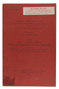
1940ABC_46347London: Meteorological Office Air Ministry 1940. Original publisher's printed red wrappers. 8vo. With map frontispiece and several illustrations and tables in the text. First edition of a rare climatological study originating from a series of meteorological handbooks of the Indian Ocean issued by the British government between 1940 and 1944. The three-volume series comprising a total of 12 parts was prepared by the Meteorologial Office Air Ministry in cooperation with the Naval Meteorological Branch Admiralty London; it was reprinted for the U.S. Navy as late as 1980. The ESSA Technical Memorandum of 1969 mentions another reprint in 1945.The present volume is the last of nine parts of volume II covering the climate of the East African coast from the equator to Cape Delgado discussing tropical cyclones and depressions winds visibility clouds rain and hail temperature humidity and other meteorological events. The frontispiece shows a map of the relevant area; additional diagrams illustrate surface winds and higher winds as well as the amount of clouds and rainfall. The tables show the general climate in Mombasa Tanga Zanzibar Dar es Salaam Kilwa and Lindi as well as the monthly frequency of wind direction and force at sea and in the upper air and the visibility at coastal stations.Library shelfmark in pencil as well as a mounted blank loaning sheet to final blank page. 7 combinations of letters and digits in black felt pen to lower cover. Traces of a shelfmark label and a cancelled inscription to front cover. Not a single copy in auction records.l U.S. Department of Commerce ESSA Technical Memorandum EDSTM10 A Note on Climatology of Thailand and Southeast Asia 164 19; WorldCat 1181290135. Meteorological Office, Air Ministry, unknown
18072101-21Lpz., Göschen 1807. gr.-8°. VIII, 176 S. Mit 26 (v. 27) Kupfertaf. (davon 1 doppelblattgr. u. 17 farb.) v. J. J. Wagner. Mod.- HLdr.-Bd. m Rückengoldpräg. Tit., 1 Textbl. u. Taf. vers. gestemp., 8 Taf. im Innensteg u. a. d. unt. Ecke wasserrandig ohne Bildbeeinträchtigung. Taf 6 (Paradeplatz im Fort St. George) fehlt. EA. [4 Warenabbildungen]
1950LBW-8621Rabat, Éditions Africaines Perceval, [1950]. Lithographie en couleurs de 635 x 985 mm ; encadrée sous verre.
179053129ABParis, Hotel de Thou, 1790-1792. Ca. 25,5 x 19,5 cm. Mit 80 Kupferstichen und 8 mehrfach gefalteten Karten. Ledereinbände der Zeit. 6 Bände. [4 Warenabbildungen]
Veduta obliqua della presa della città turca di Bona (oggi Annaba), con il vescovado di Sant'Agostino, per ordine di Ferdinando I de' Medici, da parte dei Cavalieri di Santo Stefano e delle forze toscane nella più grande operazione anfibia intrapresa dall'Ordine di Santo Stefano nel 1607. Orientato con sud-ovest in alto (punti cardinali). La flotta toscana, il cui scopo principale era quello di ingaggiare la navigazione ottomana e i pirati berberi, era comandata da Jacopo Inghirami (luglio 1565-3 gennaio 1624) ammiraglio del Granducato di Toscana e marchese di Montevitozzo. Questa stampa è citata da Carchio (2012) in un elenco cantagalliano in cui dice che questa veduta, che celebra la vittoria delle truppe toscane sui turchi, precede la decorazione della Sala di Bona di Palazzo Pitti a Firenze, con lo stesso soggetto di Bernardino Pocetti (1548-1612). Il titolo appare in alto al centro, in un cartiglio, decorato con attrezzature militari, sormontato dallo stemma dei Medici con la croce dell'Ordine di Santo Stefano; sotto il titolo c'è un altro stemma in forma di scudo diviso in quattro quarti vuoti da una croce i cui bracci sono quattro lune crescenti (le armi dei papi Pio II e III). Acquaforte, 1607, firmata in lastra in basso a destra Remigius Canta Gallina fecit. 1·6·0·7. Magnifica prova, ricca di toni, impressa su carta vergata coeva, con sottili margini, tracce di pieghe di carta visibili al verso, per il resto in ottimo stato di conservazione. Remigio Cantagallina, era acquafortista e disegnatore e lavorò con Giulio Parigi, Paul Bril influenzò le sue primissime opere, ma il suo modo di creare la prospettiva attraverso l’intensificazione delle ombre deriva da Antonio Tempesta. Cantagallina fu uno dei primi artisti ad abbandonare la visione tardo Manieristica della natura come fantastica e spaventosa per sostituirla con un genuino interesse verso temi quotidiani. Foglio d’occasione, ovvero realizzato per documentare l’avvenimento. Rarissimo. Bibliografia M. Carchio, Vasari vedutista: Cantagallina e gli Argonauti nel mare Arno, Firenze, 2012, p. 69; M. Gemignani, ‘La conquista di Bona’, Società di Storia Militare 2, 1994, pp. 375-7; J. B. Hattendorf and R. W. Unger, War at sea in the Middle Ages and the Renaissance, Woodbridge, 2003, p. 182; M. McDonald, The Print Collection of Cassiano dal Pozzo. Part II, Architecture, Topography and Military Maps, 3 vols, London 2019, cat. no. 2814. A medium - high oblique view of the taking of the Turkish-held town of Bona, with the Bishopric of Sant’Agostino, by order of Ferdinando I de’ Medici, Grand Duke of Tuscany (30 July 1549-17 February 1609) by the Knights of St Stephen and Tuscan forces in the greatest amphibious operation undertaken by the Order of St Stephen in 1607. Oriented with south-west to top (cardinal points). The Tuscan fleet, whose main purpose was to engage with Ottoman shipping and Berber pirates, was commanded by Jacopo Inghirami (July 1565-3 January 1624) Admiral of the Grand Duchy of Tuscany and marquis of Montevitozzo. This print is mentioned by Carchio (2012) in a chonological list of Cantagallina’s work in which she says that this view, which celebrates the victory of the Tuscan troups over the Turks, preceded the decoration of the Sala di Bona di Palazzo Pitti, Florence, with the same subject by Bernardino Pocetti (1548-1612). The title appears in the top centre, in a cartouche, decorated with military equipment, surmounted by the Medici coat of arms with the cross of the Order of St Stephen; below the title is another coat of arms in the form of a shield divided into four empty quarters by a cross the arms of which are four crescent moons (the arms of Popes Pius II and III). Etching, 1607, signed in plate at lower right Remigius Canta Gallina fecit. 1-6-0-7. Magnificent proof, rich in tone, printed on contemporary laid paper, with thin margins, traces of paper creases visible on the verso, otherwise in excellent condition. Remigio Cantagallina, was etcher and draftsman and worked with Giulio Parigi, Paul Bril influenced his very first works, but his way of creating perspective through the intensification of shadows comes from Antonio Tempesta. Cantagallina was one of the first artists to abandon the late Mannerist view of nature as fantastic and frightening and replace it with a genuine interest in everyday themes. Broadsheet, that is made to document the siege. Very rare. Bibliografia M. Carchio, Vasari vedutista: Cantagallina e gli Argonauti nel mare Arno, Firenze, 2012, p. 69; M. Gemignani, ‘La conquista di Bona’, Società di Storia Militare 2, 1994, pp. 375-7; J. B. Hattendorf and R. W. Unger, War at sea in the Middle Ages and the Renaissance, Woodbridge, 2003, p. 182; M. McDonald, The Print Collection of Cassiano dal Pozzo. Part II, Architecture, Topography and Military Maps, 3 vols, London 2019, cat. no. 2814.
Incisione in rame su doppio foglio (mm 436x549) con bellissima colorazione coeva, verso velato da finissimo foglio di carta Giappone. Bella e rara carta nautica, tratta dal celebre atlante di De Witt ''Orbis Maritimus ofte Zee Atlas", della costa atlantica meridionale dell'Africa. Nel cartiglio titolo in latino e olandese: a sinistra un gruppo di europei che conducono negoziati commerciali. Al centro, tre leoni, un leopardo e un serpente dividono il cartiglio. Sulla destra due nativi. In basso a destra della carta nautica sono rappresentati Nettuno e una figura femminile, trainati su un carro da tre cavalli. La costa presenta molte insenature e l'isola di S. Elena Nuova è un po' più a sud del solito. "Frederick de Wit deve essere considerato uno dei più importanti editori di mappe della seconda metà del XVII secolo. La maggior parte delle sue mappe sono di ottima qualità, sono caratterizzate da un'incisione chiara e bella, dall'attualità e ricchezza dell'immagine cartografica nonché dall'equilibrio delle decorazioni cartografiche". (Lexikon der Kartographie II, p. 899), Koeman M. Wit 1, 27. Koeman, Atlantes Neerlandici, IV, pp.191 e 518-519. Shirley 444. Putnam, Early sea charts, 75.. .