Bernatzik, Hugo AdolfAntiquariat.de

30 547 résultats
192913053Wien, Seidel, 1929. 139 Seiten, Tafelteil. 4°. Original Leinwand (leicht fleckig und etwas bestoßen).
193394197ABWien, Seidel & Sohn 1933. 25 x 32,5 cm. 2 Bl. Text, 152 Tafeln mit 400 (halb- oder ganzseit.) Abbildungen, OLwd. mit goldgepr. Deckel- u. Rückentitel (Oberkante u. Rücken verblasst, leicht fleckig). Innen tadellos erhalten. Selten. EA. OLwd. mit goldgepr. Deckel- u. Rückentitel (Oberkante u. Rücken verblasst, leicht fleckig). Innen tadellos erhalten. Selten. EA.
17513036FBGöttingen, Vandenhoek Verlag, 1751. 8°. 19 x 12,5 cm. [16] Blatt, 428, [10] Seiten. Lederband der Zeit mit reicher Rückenvergoldung, goldgeprägtem Titel auf rotem Lederrückenschild und rotem Sprengschnitt. [6 Warenabbildungen] (= Sammlung neuer und merkwürdiger Reisen zu Wasser und zu Lande, 3).
Querformat. (ca. 13,1 x 18 cm). 5 Photographien. Original-Photographien, mit weissem Bildrand, Rückseiten mit Beschriftung (Bleistift) und zweimal mit Namensstempel. Photopapier minimal wellig, vereinzelt leicht verblasst, insgesamt gut erhalten. Altersentsprechend guter Zustand. Die Photographien aus dem Besitz des deutschen Geographen, Forschungsreisenden und Kolonialpolitikers Georg Hartmann liegen in einem größeren Format und auf festem Photopapier vor. Die historischen Aufnahmen zeigen Ansichten aus dem Nordwesten Namibias (damals: Deutsch-Südwestafrika), wo Hartmann in den Jahren zwischen 1893 und 1908 eingesetzt war. Er war dort unter anderem für die 'South West Africa Company' tätig, mit dem Ziel verschiedene Gebiete dieser deutschen Kolonie wirtschaftlich zu erschließen. Die Photographien sind wie folgt auf den Rückseiten beschriftet (mit Bleistift): Wasserstelle Gamgamas (Uniab) / Teilwasserfall Kunene. östl. Swartboydrift / Ugabtal mit ... / Am Hochgebirge des Kaokoveld. Wasserstelle Gans / Kontakt: Granit-Schiefer bei Geioms (südl. Kaokoveld). Zwei der Photographien enthalten auf der Rückseite einen Stempel von Hartmann: Dr. Georg Hartmann / Frankfurt (Oder) / Fürstenwalder Straße 46. Diese wurden scheinbar zu späterem Zeitpunkt aufgebracht, denn erst in der NS-Zeit verlegte der einstige Forschungsreisende seinen Wohnsitz dorthin. Möglicherweise hat er zu dieser Zeit (im Alter) sein Archiv geordnet, wobei der Großteil seiner Afrika-Sammlung später offenbar dem Kriegsverlauf zum Opfer fiel. Die historischen Aufnahmen stammen also noch aus der Zeit des deutschen Kolonialismus, vermutlich wurden sie sogar schon vor 1908 gemacht. Alle fünf Aufnahmen gehören definitiv zusammen, die Handschrift (mit Bleistift) ist identisch. Seltene historische Photographien aus der deutschen Kolonialgeschichte im späteren Namibia!
1851R3811-00Lpz.,Hartleben 1851. 5 Tle. in 1 Bd. kl.8°. Zus. 691 S. Hln. d.Zt., etw. berieben, Rücken geschossen, einige Bl. mit schwachem Wasserrand, vereinzelt min. stockfl., gutes Expl.. - (Historisch-romantische Gemälde und Reisebilder 25.-29.Bd.)
(ca. 8,3 x 13,6 cm). 6 Photographien. Original-Photographien ohne Bildrand, die Rückseiten sämtlich mit Beschriftung und Datierung. Photographien gut erhalten, teils ganz leicht verblasst. Altersentsprechend guter Zustand. Die Photographien tragen rückseitig eine handschriftliche Beschriftung in deutscher Sprache. Dieser zufolge wurden sie im Zeitraum Juli 1913 bis Februar 1914 aufgenommen. Eine Aufnahme enthält den blauen Stempel der 'Gesellschaft Süd-Kamerun'. Alle Aufnahmen haben das selbe Format und fotografische Bildqualität, zudem sind sie sämtlich in derselben Handschrift beschriftet, datiert und identisch signiert. Die 'Gesellschaft Süd-Kamerun' besaß bis zum Ersten Weltkrieg große Plantagegebiete in Ikassa, Südkamerun. Ein konkreter Ort läßt sich den Beschriftungen nicht entnehmen, doch mit hoher Wahrscheinlichkeit handelt es sich um Gebiete in Südkamerun und auch um jenes Gebiet um Ikassa. Eine der Beschriftungen verweist beispielsweise auf den Fluß Boumba im Südosten. Die Aufnahmen tragen folgende konkrete Beschriftung, wobei sich nicht alle Worte und Ziffernfolgen vollständig entziffern lassen: Raplia Sumpf [...] Juli 1913, Koch (mit Stempel) / Buschposten 11 I. Pr. St. 6 (von Prinz) Febr. 1914, Koch / Pr. St. XIV um BöK (...) Sept. 1913, Koch / Bumba bei Pr. St. XV (Koch) Aug. 1913, Koch / Zentralfarm o. P. St. VI Juli 1913, Koch / [....] Febr. 1914, Koch. Die historischen Aufnahmen stammen aus der deutschen Kolonialzeit selbst, erst mit Kriegsverlauf ab August 1914 wurden die Gebiete enteignet und anderen Kolonialmächten übergeben. Die sehr interessanten Ansichten zeigen einerseits männliche Europäer in Plantagengebieten und an reizvollen Orten wie am Flußufer des "Bumba". Andererseits sind auch Afrikaner (männlich und weiblich) in größerer Zahl auf den Plantagengebieten zu sehen. Interessant ist auch der "Buschposten" (siehe Beschriftungen) auf einer der Aufnahmen. Historische Bilder mit konkreten Bezügen zur Kolonial- und Wirtschaftsgeschichte im heutigen Kamerun!
1815169974Wien, Bauer, 1815. M. 1 gef. gest. Kte. u. 18 gef. Kpfr.-Taf. XI, 352 S.; 2 Bl., 448; 560 S. Ppbde. d. Zt. m. Rsch. Einbde. bestoßen u. beschabt. Kl. Exlibris a. Innendeckel. Teils (stellenw. auch stärker) gebräunt bzw. braunfl. Bd. 3 Einbd. m. Nässeschaden u. im Text m. Nässepur (gegen Ende stärker, auch m. kl. Textverl.). (Magazin von merkwürd. neuen Reisebeschreibungen 23-25).
193226117Berlin, Privatddruck, 1932. Folio (36 x 31 cm). 32 jew. auf lose Kartontaf. unter Seidenschutzblatt montierte photograph. Abb. zusammen mit Textheft (8 Bl. auf unbeschnittenem Bütten in OUmschlag) in OHlwd.-Mappe mit mont. Deckelbild.
186347236ABGotha, Perthes 1863. 4°. XIV, 50 S., 1 Bl., 164 S. Halbleder der Zeit mit Rückentitel. Etwas berieben. Der Text im Rand teils angestaubt,etwas gebräunt oder etwas stockfleckig. Die letzten Textblätter mit geringf. Wassserrand im Fußschnitt. Schwacher 'Kellergeruch'. Die letzte Karte im unbedruckten Rand gebräunt. 1
18999743ABPrag, Mercy, 1899. 45,5 : 34 cm. VII, 122 páginas con 32 láminas, 1 mapa de doble página litografiado en color y 1 grabado en madera en el texto. Media tela editorial ilustrado en color, estuche original.
18741321689Leipzig, Brockhaus, 1874. 14, 599, (3) S., 76 (st. 77) Holzschnitte im Text u. a. Tafeln, 1 Farbtaf. u. 12, 561 S., 47 Holzschnitte im Text u. a. Tafeln, 1 zweifarbige Karte (Reiseroute). Ldrbd d. Zeit u. Lwd. Einbde. beschabt u. etwas fleckig, Sign. a. Fuß, St. a. Tit. Bd 1: Kopf m. Einriß, Innengelenke eingerissen, durchgehend nässerandig; 1 Taf. u. 1 Falt-Karte fehlen; Bd 2: anfangs schwach nässerandig, durchgeh. etwas braunfl. Letztes Bl. u. Karte m. Knickspur.
19,5 x 13 cm. Band 1: XII, 291 Seiten, 2 Faltkarten. - Band 2: VIII, 250 Seiten, 2 Faltkarten. - Band 3: VIII, 234 Seiten, 4 Faltkarten und 1 Falt-Tabelle. Halbleinenband der Zeit (Band I) und Halblederbände (Bände II und III). *1. Das Kamerun-Gebirge. - 2. Das Flußgebiet von Kamerun, seine Bewohner und seine Hinterländer. Leben und Sitten der Eingeborenen, Natur, Klima und kulturelle Bedeutung des Landes, dessen Handel und die deutschen Faktoreien auf Grund eigener Anschauung und Studien geschildert. - 3. Teil: Das südliche Kamerun-Gebiet, die spanischen Besitzungen, das französische Kolonialreich und der Congo. (= Die Deutschen Besitzungen an der westafricanischen Küste, Band III). - Der zweite Teil von 3 je in sich abgeschlossenen Folgen von Forschungsreisen in die Kolonie Kamerun. Der vorliegende Band behandelt das Flußgebiet von Kamerun. Die große Faltkarte zeigt das Flußgebiet nach eigenen Aufnahmen von Zölner. - Tadelloses Exemplar der Originalausgabe, hübsch gebunden. Bücher de
EXE-104Bruxelles, chez Dujardin, 1789. Petit in-8° veau, dos à nerfs (reliure de l'époque).
7379aafLondon, Sampson Low, Marston, Searle and Rivington, 1890, in-4°, 529 p. with 165 woodcut ill. & maps / 472 p. with 170 woodcut ill. & maps, 1 map with some repairs and 1 loose, orig. publisher’s illustrated red cloth. Spines sunned, else a fine set.
- EDIZIONE ORIGINALE, COLORITURA COEVA -Importante e decorativa mappa tratta dal "Nuovo Atlante Geografico Universale delineato sulle ultime osservazioni", edito a Roma dal 1792 fino al 1801, opera che la Calcografia Camerale commissionò al Cassini al fine di sostituire l’ormai obsoleto "Mercurio Geografico".Giovanni Maria Cassini, Chierico Regolare Somasco fu geografo e cartografo, ma anche intagliatore di architetture e prospettive - uno dei migliori discepoli di Giovanni Battista Piranesi - Cassini fu uno degli ultimi sferografi italiani del Settecento ed i suoi globi ebbero una notevole diffusione, come pure questo "Nuovo Atlante Geografico".Incisione in rame, coloritura coeva dei contorni, leggere bruniture, per il resto in ottimo stato di conservazione.L'Atlante del Cassini fu ristampato dalla Calcografia Camerale nel primo quarto del XIX secolo, prima del 1839. Solo gli esemplari di prima edizione come questo sono stampati su carta vergata coeva e sono colorati a mano in epoca. Le tirature del XIX secolo sono già su carta meccanica, priva di vergelle, e generalmente in bianco e nero. - FIRST EDITION, CONTEMPORARY OUTLINE COLOUR -The Italian painter and engraver, Giovanni Maria Cassini, produced this splendid map of as part of his epic three-volume atlas. Published in: Nuovo atlante geografico universale delineato sulle ultime osservazioni. Roma, Calcografia camerale, 1792-1801.Cassini was geographer and cartographer but he was also good at engraving architectural items and perspectives – he was one of the best disciples Giovanni Battista Piranesi had. Moreover, Cassini was one of the last artists to engrave spheres in the XVIII century and his globes were quite famous and widespread, and realized the most important Italian Atlas of the XVIII century; his maps always bear a cartouche, extremely rich in colours and details. Copperplate with fine original hand colour, some foxing, otherwise in very good condition.The Cassini's Atlas was reprinted by the Calcografia Camerale in the first quarter of XIXth century (before 1839). Only the first edition of the atlas is printed on contemporary laid paper, while the late issue are on XIXth century paper and often without colour.
FIRST EDITION (so stated) of this outstanding photobook devoted to Soweto (not to be confused with other, far more common, books about Soweto with photographs by Magubane). 192 pp. This copy belonged to civil rights hero Jack Greenberg, and has a SIGNED PRESENTATION INCRIPTION from Magubane (dated June 13, 1979) to Greenberg's son. Folio. Publisher's cloth and dustjacket. Tiny traces of wear to extremities of dj, else FINE AND BRIGHT.
29739-zc2o.J. 350 Seiten und 1 Blatt Register. Leinwand der Zeit mit Rückentitel (etwas berieben und bestoßen, sonst sehr gutes und sauberes Exemplar). 4° (28 x 22,5 cm). [2 Warenabbildungen] fest gebunden
Lars JonssonNot in perfect condition. unknown
18093221809 Paris, P. Mongie l'aîné, 1809. 2 tomes, 20,5 x 13 cm (R), in-8, [4] + XVI + 390 pp. & [4] + 407 pp., demi-basane brune de l'époque, plats de papier marbré, dos lisse fleuronné doré, pièces de titre et de tomaison.
8vo., First Edition, with portrait frontispiece, 10 plates on 7 and 2 full-page maps in the text; handsomely bound in full dark green crushed morocco, sides with gilt frame border, back with raised bands, second and fourth compartments lettered and ruled in gilt, all other compartments tooled in gilt, gilt top, hand-made endpapers, ribbon marker, front panel and backstrip of dustwrapper mounted on new and separate leaves at front, custom-made slip-case, a most attractive copy ideal as a gift or for presentation. With striking dustwrapper portrait by C.H. Birtwhistle. The first dedicated biography, it was a huge success and has been many times reprinted and reissued. Enser, p. 374.
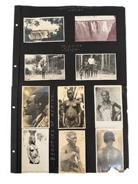
1920234321920. Indigenous peoples of Africa photo archive circa 1920s-1930s recording Shilluk Sudanese Congolese Nile and Victoria Falls subjects within the colonial-era climate of expeditionary travel and anthropology. The captions identify locations and peoples across a wide geographic range including "Shilluks of the Nile Sudan Africa" "Pygmies Congo" "Natives White Nile" and "Victoria Falls Africa." Such material was produced during a period when European and American travelers researchers missionaries and press photographers circulated native African culture for audiences shaped by imperial geography ethnographic classification and popular fascination with the African continent.<br /> <br /> Photo archive of 19 silver gelatin photographs each 3.25" x 5.25" Africa circa 1920s-1930s. Subjects include Shilluk men posed with bead necklaces arm ornaments headbands and draped cloth; Sudanese girls seated outdoors; men gathered beside dugout canoes on the Nile; a riverside settlement captioned "On the Banks of the Nile"; and a line of men identified as "Stork Men." The Congo section includes a group gathered in a forest clearing and a Western man standing beside Congolese natives under the caption "Pygmies Congo." Additional portraits emphasize hair styling scarification beadwork body ornament and dress including captions reading "Fancy Hair Styles Africa" "Beauties of Africa" "Native of Nile" and "Sudanese White Nile." Victoria Falls appears in two views placing human subjects within a broader travel record of African geography and spectacle. Captions on many of the margins<br /> <br /> By the early twentieth century much of Africa had been divided among European colonial powers following the 1884-1885 Berlin Conference which formalized imperial claims across the continent without African participation. The archive records how African people and places were subjects of anthropological research and interest to Westerners. The captions preserve period terminology named regions and the collecting habits of a Western observer moving across Sudan Congo the Nile and Victoria Falls. The presence of the Western man posed with Congolese subjects is especially important marking the encounter as more than scenic tourism and aligning the group with field travel research missionary contact or journalistic documentation. Mounted on black album leaves with handwritten captions; some prints show fading edge wear and light surface abrasion and the mounts show chipping and losses at corners. Overall in very good condition. Portraits emphasizing scarification ornament hairstyles and bodily presentation were often produced within a colonial framework that treated African communities as subjects of scientific racial or geographic classification. At the same time these scenes now preserve important visual records of cultural practices regional identity and daily life during a period of rapid political and social transformation under colonial rule. unknown
190431111Portland OR: J.K. Gill Co. 1904. First edition . Pictorial paper covers. Very good plus. The farm irrigation fishing ranch range orchard hop yard and timber resources are dealt with in detail. Supplies practical answers to questions usually asked by those interested in migrating to Oregon. 191 pages. Smith: Pacific Northwest Americana 7215. Spine paper and edgewear to fragile front paper cover professionally repaired. A very good plus copy. <br/> <br/> J.K. Gill Co. unknown
1813115London: Richard Phillips 1813. First. Plain Linin Over Paper Boards. VG. to the Cape of Good hope Isles of Bourbon France and Seychelles to Madras and the Isles of Java St Paul and Amsterdam. 112 pp. Folding map frontis. Bookplate of Percival Bishop. Plain binding deserves to be replaced as this is a rather scarce work and internally the condition warrants upgrading. Richard Phillips unknown
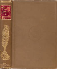
18912097NY: The Century Co 1891. First. Hardcover. VG. Notes of a journey through China Mongolia and Tibet. 398 pp profuse ill. The results of a long journey through several thousand miles of the imperfectly known parts of the Chinese empire. VG. Internally actually near fine. And Covers nice in original blindstamped tan cloth. Gilt stanped part of spine also nice with only minor wear at spine tips. But the contrasting colored gilt stamped leather label shos wear and there is rubbing to the label as well. The Century Co hardcover
186712039New York: D. Van Nostrand 1867. First edition . Hardcover. Very Good. A compilation of revised articles originally written for the New York Times. Howes S315. Graff 3736. See Wagner-Camp 422b for Seymour's 1865 report on the U.P. segment just west of Omaha. Engraved frontispiece of Seymour with tissue guard. Bound in original light brown cloth with lettering on cover and spine in gilt. Slight wear to lower edges and corners. One tiny damp spot and slight soiling to small portion of front cover. Hinges sound and pages fine. A very good copy. <br/> <br/> D. Van Nostrand hardcover