30 547 résultats
1890013624New York: Charles Scribner's Sons 1890 First American Edition. 8vo. In 3 volumes complete. With 2 steel engravings and over 150 illustrations and maps. Two large and one folding map have been professionally strengthen at their folds so that they are complete usable as these maps are often not. A separate map volume was created matching the two original volumes to hold them. The two original volumes are newly hinged and restored by a fine bookbinder. Volume I has a steel engraving of Stanley protective tissue 547 pp. Volume II has a second engraved portrait of Stanley protective tissue 540 pp. Stamp of previous owner to title pp. and verso of free front endpapers. Very good. Charles Scribner's Sons hardcover
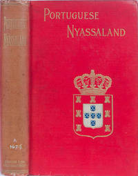
1899159London: Sampson Low 1899. First. Orig. Gilt Cloth. VG. Discovery population rsources and present administration of the territory of the Nyassa Company. with a review of the Portuguese Rule on the East Coast of Africa. 295 pp. ill. Very large pull out folding map in original rear pocket. Unobtrusive Wendell Harris private library stamp on bottom title page. Very small white spine numbers. Sampson Low unknown
Wear to extremities. Front hinge started with ffep slightly loose. Archival tape repair to fold-out front map. Binding loose in spots; The story of the Portugese expeditions through central Africa, translated and annotated by Sir Richard Burton; 8vo 8" - 9" tall; 271 pages
- Imprimerie Impériale, Paris 1809-1829, 71x54cm, une feuille. - Original, unshaved, full-page etching from the "Imperial edition" of the Description de l'Égypte, or 'Recueil des observations et recherches faites en Égypte pendant l'expédition française, publié par les ordres de Sa Majesté l'Empereur Napoléon le Grand [A Collection of the observations and research carried out in Egypt during the French expedition, published on the orders of his Majesty the Emperor Napoleon the Great]'. Produced between February 1802 and 1830 on the orders of Naopleon Bonaparte and published between 1809 and 1828, 1,000 copies were printed and distributed to institutions, on vergé paper with an 'Égypte ancienne et moderne' watermark, visible when held up to the light. Light marginal spotting not touching image, otherwise in very fresh, fine condition. An engraving from the Description de l'Egypte, one of the masterpieces of French printing and the birth of a new field: Egyptology. A gigantic survey of Egypt at the time of Bonaparte's conquests in 1798 and 1799, the work is divided into 13 volumes of engravings making up 892 plates, of which 72 colored, as well as presenting the splendors of the Egypt of the Pharaohs in 9 volumes. The other volumes discuss natural history and present a fascinating portrait of Coptic and Islamic Egypt as it was seen by Bonaparte's Eastern Armies. The 'Egyptian campaign', militarily a disaster, demonstrates, through the engravings of the Description d'Egypte, the scientific success it nonetheless became thanks to the 167 expert members of the Commission of the Sciences and Arts of the Institut d'Egypte [Egyptian Institute] who followed Napoleon's army. The Institut gathered together in Egypt the mathematician Monge, the chemist Berthollet, the naturalist Geoffroy Saint-Hilaire as well as numerous artists, engineers, architects and doctors. They were tasked with re-discovering modern and ancient Egypt and displaying its natural treasures as well as the know-how of its inhabitants. This edition, the so-called "Imperial" edition of the plates for the Description de l'Egypte was printed in four large formats, two of which were specially created for it and christened "Moyen-Egypte" and "Grand-Egypte". A special press was built to print it, the process extending over 20 years, from 1809 to 1829. The "Imperial" edition proved so popular that a second edition, this time in black and white and without the "Egypte ancienne et moderne" watermark - known as the "Royal Edition" - was published during the Restoration by the printing house of C.-L.-F. Panckoucke (Paris). The engravings of the Description d'Egypte owe a great deal to Baron Dominique-Vivant Denon, illustrator, diplomat, collector and later Director of the Musée Napoléon (the Louvre). His exploration of the South of Egypt gave Bonaparte the idea of sending the experts of the Institut there, thus creating a faithful and complete portrait of the area. This was the research gathered together from 1802 in the mammoth Description de L'Egypte. Denon embarked on this story of archeological exploration at the age of 51, reaching first Alexandria and then Cairo before exploring Upper Egypt. Along with the members of the Institut d'Egypte, the Natural History Museum's painter H.J. Redouté (brother of Pierre-Joseph Redouté, author of Roses), the mineralogist Dolomiue, and the draughtsman Joly, Denon then explored the Nile Delta and Lower Egypt. When, however, he joined the 21st Light Infantry Regiment as it marched across Upper Egypt in pursuit of the retreating Mameluks in November 1798, he found himself the only civilian. In the very midst of the battle itself, he reeled off sketches of the works of art that peppered his path right up to the threshold of the Sudan. He said that he had crossed "a country that is, apart from its name, entirely unknown to Europeans, and therefore everything was worth describing" (Voyages dans la Basse et la Haute Egypte pendant le
Tomi I – II (opera completa). Tomo I: Furne et. C.e Édieturs, 1859. In 4to, pp. XI, 550 + 1 (Table des Chapitres), incisioni su acciaio in b/n f. t. protette da velina, leg. orig. in t. percallina marrone con titoli e fregi oro al dorso, tagli oro. Staccato il piatto anteriore, segni marginali ma marcati di umido al contropiatto, foxing e fioriture più diffuse alle prime pagine e comunque presenti, seppur in maniera marginale, in tutto il volume, un progressivo alone di umido al margine inferiore interessa le pagine e quindi talora anche le tavole, staccata una tavola dai margini non belli. Nell'insieme esemplare con difetti ma completo delle tavole, in cui tutte risultano discrete seppur interessate da marginali fioriture, tipiche in questi volumi con questo tipo di carta. Volume II: Furne et. C.e Édieturs, 1843. In 4to, pp. 584 (con la Table des Chapitres, Table Analytique e Table des Planches), incisioni su acciaio in b/n f. t. protette da velina + alcune carte ripiegate, leg. orig. con piatti in cartonato, dorso in pelle con fregi e titoli oro, punte, contropiatti e fogli di guardia rivestiti in carta marmorizzata. Le carte risultano in parte interessate da ingiallimento, peraltro, normali foxing e fioriture alle pagine, tipiche in questi volumi con questo tipo di carta, ma nell'insieme trattasi di solido e buon esemplare, in cui anche tutte le tavole risultano buone. L'opera tratta di viaggi e scoperte dei più famosi navigatori, descrive approfonditamente razze, società, usi, costumi e tradizioni dei popoli, flora, fauna, bellezze e particolarità naturali dei luoghi. Nel primo volume: Brasile, Capo di Buona Speranza, Madagascar, India, Filippine, Cina, Giappone Isole Hawaii. Nel secondo volume: le isole di oceania, Africa, America, Europa. I due volumi, peggiore il primo, migliore il secondo, appartengono a edizioni diverse ma completano l'opera.
- Imprimerie Impériale, Paris 1809-1829, 71x54cm, une feuille. - Original, unshaved, full-page etching from the "Imperial edition" of the Description de l'Égypte, or 'Recueil des observations et recherches faites en Égypte pendant l'expédition française, publié par les ordres de Sa Majesté l'Empereur Napoléon le Grand [A Collection of the observations and research carried out in Egypt during the French expedition, published on the orders of his Majesty the Emperor Napoleon the Great]'. Produced between February 1802 and 1830 on the orders of Naopleon Bonaparte and published between 1809 and 1828, 1,000 copies were printed and distributed to institutions, on vergé paper with an 'Égypte ancienne et moderne' watermark, visible when held up to the light. Light marginal spotting not touching image, otherwise in very fresh, fine condition. An engraving from the Description de l'Egypte, one of the masterpieces of French printing and the birth of a new field: Egyptology. A gigantic survey of Egypt at the time of Bonaparte's conquests in 1798 and 1799, the work is divided into 13 volumes of engravings making up 892 plates, of which 72 colored, as well as presenting the splendors of the Egypt of the Pharaohs in 9 volumes. The other volumes discuss natural history and present a fascinating portrait of Coptic and Islamic Egypt as it was seen by Bonaparte's Eastern Armies. The 'Egyptian campaign', militarily a disaster, demonstrates, through the engravings of the Description d'Egypte, the scientific success it nonetheless became thanks to the 167 expert members of the Commission of the Sciences and Arts of the Institut d'Egypte [Egyptian Institute] who followed Napoleon's army. The Institut gathered together in Egypt the mathematician Monge, the chemist Berthollet, the naturalist Geoffroy Saint-Hilaire as well as numerous artists, engineers, architects and doctors. They were tasked with re-discovering modern and ancient Egypt and displaying its natural treasures as well as the know-how of its inhabitants. This edition, the so-called "Imperial" edition of the plates for the Description de l'Egypte was printed in four large formats, two of which were specially created for it and christened "Moyen-Egypte" and "Grand-Egypte". A special press was built to print it, the process extending over 20 years, from 1809 to 1829. The "Imperial" edition proved so popular that a second edition, this time in black and white and without the "Egypte ancienne et moderne" watermark - known as the "Royal Edition" - was published during the Restoration by the printing house of C.-L.-F. Panckoucke (Paris). The engravings of the Description d'Egypte owe a great deal to Baron Dominique-Vivant Denon, illustrator, diplomat, collector and later Director of the Musée Napoléon (the Louvre). His exploration of the South of Egypt gave Bonaparte the idea of sending the experts of the Institut there, thus creating a faithful and complete portrait of the area. This was the research gathered together from 1802 in the mammoth Description de L'Egypte. Denon embarked on this story of archeological exploration at the age of 51, reaching first Alexandria and then Cairo before exploring Upper Egypt. Along with the members of the Institut d'Egypte, the Natural History Museum's painter H.J. Redouté (brother of Pierre-Joseph Redouté, author of Roses), the mineralogist Dolomiue, and the draughtsman Joly, Denon then explored the Nile Delta and Lower Egypt. When, however, he joined the 21st Light Infantry Regiment as it marched across Upper Egypt in pursuit of the retreating Mameluks in November 1798, he found himself the only civilian. In the very midst of the battle itself, he reeled off sketches of the works of art that peppered his path right up to the threshold of the Sudan. He said that he had crossed "a country that is, apart from its name, entirely unknown to Europeans, and therefore everything was worth describing" (Voyages dans la Basse et la Haute Egypte pendant le
- Imprimerie Impériale, Paris 1809-1829, 53,5x71cm, une feuille. - Original, unshaved, full-page etching from the "Imperial edition" of the Description de l'Égypte, or 'Recueil des observations et recherches faites en Égypte pendant l'expédition française, publié par les ordres de Sa Majesté l'Empereur Napoléon le Grand [A Collection of the observations and research carried out in Egypt during the French expedition, published on the orders of his Majesty the Emperor Napoleon the Great]'. Produced between February 1802 and 1830 on the orders of Naopleon Bonaparte and published between 1809 and 1828, 1,000 copies were printed and distributed to institutions, on vergé paper with an 'Égypte ancienne et moderne' watermark, visible when held up to the light. Light marginal spotting not touching image, otherwise in very fresh, fine condition. An engraving from the Description de l'Egypte, one of the masterpieces of French printing and the birth of a new field: Egyptology. A gigantic survey of Egypt at the time of Bonaparte's conquests in 1798 and 1799, the work is divided into 13 volumes of engravings making up 892 plates, of which 72 colored, as well as presenting the splendors of the Egypt of the Pharaohs in 9 volumes. The other volumes discuss natural history and present a fascinating portrait of Coptic and Islamic Egypt as it was seen by Bonaparte's Eastern Armies. The 'Egyptian campaign', militarily a disaster, demonstrates, through the engravings of the Description d'Egypte, the scientific success it nonetheless became thanks to the 167 expert members of the Commission of the Sciences and Arts of the Institut d'Egypte [Egyptian Institute] who followed Napoleon's army. The Institut gathered together in Egypt the mathematician Monge, the chemist Berthollet, the naturalist Geoffroy Saint-Hilaire as well as numerous artists, engineers, architects and doctors. They were tasked with re-discovering modern and ancient Egypt and displaying its natural treasures as well as the know-how of its inhabitants. This edition, the so-called "Imperial" edition of the plates for the Description de l'Egypte was printed in four large formats, two of which were specially created for it and christened "Moyen-Egypte" and "Grand-Egypte". A special press was built to print it, the process extending over 20 years, from 1809 to 1829. The "Imperial" edition proved so popular that a second edition, this time in black and white and without the "Egypte ancienne et moderne" watermark - known as the "Royal Edition" - was published during the Restoration by the printing house of C.-L.-F. Panckoucke (Paris). The engravings of the Description d'Egypte owe a great deal to Baron Dominique-Vivant Denon, illustrator, diplomat, collector and later Director of the Musée Napoléon (the Louvre). His exploration of the South of Egypt gave Bonaparte the idea of sending the experts of the Institut there, thus creating a faithful and complete portrait of the area. This was the research gathered together from 1802 in the mammoth Description de L'Egypte. Denon embarked on this story of archeological exploration at the age of 51, reaching first Alexandria and then Cairo before exploring Upper Egypt. Along with the members of the Institut d'Egypte, the Natural History Museum's painter H.J. Redouté (brother of Pierre-Joseph Redouté, author of Roses), the mineralogist Dolomiue, and the draughtsman Joly, Denon then explored the Nile Delta and Lower Egypt. When, however, he joined the 21st Light Infantry Regiment as it marched across Upper Egypt in pursuit of the retreating Mameluks in November 1798, he found himself the only civilian. In the very midst of the battle itself, he reeled off sketches of the works of art that peppered his path right up to the threshold of the Sudan. He said that he had crossed "a country that is, apart from its name, entirely unknown to Europeans, and therefore everything was worth describing" (Voyages dans la Basse et la Haute Egypte pendant
- Imprimerie Impériale, Paris 1809-1829, 71x54cm, une feuille. - Original, unshaved, full-page etching from the "Imperial edition" of the Description de l'Égypte, or 'Recueil des observations et recherches faites en Égypte pendant l'expédition française, publié par les ordres de Sa Majesté l'Empereur Napoléon le Grand [A Collection of the observations and research carried out in Egypt during the French expedition, published on the orders of his Majesty the Emperor Napoleon the Great]'. Produced between February 1802 and 1830 on the orders of Naopleon Bonaparte and published between 1809 and 1828, 1,000 copies were printed and distributed to institutions, on vergé paper with an 'Égypte ancienne et moderne' watermark, visible when held up to the light. Light marginal spotting not touching image, otherwise in very fresh, fine condition. An engraving from the Description de l'Egypte, one of the masterpieces of French printing and the birth of a new field: Egyptology. A gigantic survey of Egypt at the time of Bonaparte's conquests in 1798 and 1799, the work is divided into 13 volumes of engravings making up 892 plates, of which 72 colored, as well as presenting the splendors of the Egypt of the Pharaohs in 9 volumes. The other volumes discuss natural history and present a fascinating portrait of Coptic and Islamic Egypt as it was seen by Bonaparte's Eastern Armies. The 'Egyptian campaign', militarily a disaster, demonstrates, through the engravings of the Description d'Egypte, the scientific success it nonetheless became thanks to the 167 expert members of the Commission of the Sciences and Arts of the Institut d'Egypte [Egyptian Institute] who followed Napoleon's army. The Institut gathered together in Egypt the mathematician Monge, the chemist Berthollet, the naturalist Geoffroy Saint-Hilaire as well as numerous artists, engineers, architects and doctors. They were tasked with re-discovering modern and ancient Egypt and displaying its natural treasures as well as the know-how of its inhabitants. This edition, the so-called "Imperial" edition of the plates for the Description de l'Egypte was printed in four large formats, two of which were specially created for it and christened "Moyen-Egypte" and "Grand-Egypte". A special press was built to print it, the process extending over 20 years, from 1809 to 1829. The "Imperial" edition proved so popular that a second edition, this time in black and white and without the "Egypte ancienne et moderne" watermark - known as the "Royal Edition" - was published during the Restoration by the printing house of C.-L.-F. Panckoucke (Paris). The engravings of the Description d'Egypte owe a great deal to Baron Dominique-Vivant Denon, illustrator, diplomat, collector and later Director of the Musée Napoléon (the Louvre). His exploration of the South of Egypt gave Bonaparte the idea of sending the experts of the Institut there, thus creating a faithful and complete portrait of the area. This was the research gathered together from 1802 in the mammoth Description de L'Egypte. Denon embarked on this story of archeological exploration at the age of 51, reaching first Alexandria and then Cairo before exploring Upper Egypt. Along with the members of the Institut d'Egypte, the Natural History Museum's painter H.J. Redouté (brother of Pierre-Joseph Redouté, author of Roses), the mineralogist Dolomiue, and the draughtsman Joly, Denon then explored the Nile Delta and Lower Egypt. When, however, he joined the 21st Light Infantry Regiment as it marched across Upper Egypt in pursuit of the retreating Mameluks in November 1798, he found himself the only civilian. In the very midst of the battle itself, he reeled off sketches of the works of art that peppered his path right up to the threshold of the Sudan. He said that he had crossed "a country that is, apart from its name, entirely unknown to Europeans, and therefore everything was worth describing" (Voyages dans la Basse et la Haute Egypte pendant le
- Imprimerie Impériale, Paris 1809-1829, 53,5x71cm, une feuille. - Original, unshaved, full-page etching from the "Imperial edition" of the Description de l'Égypte, or 'Recueil des observations et recherches faites en Égypte pendant l'expédition française, publié par les ordres de Sa Majesté l'Empereur Napoléon le Grand [A Collection of the observations and research carried out in Egypt during the French expedition, published on the orders of his Majesty the Emperor Napoleon the Great]'. Produced between February 1802 and 1830 on the orders of Naopleon Bonaparte and published between 1809 and 1828, 1,000 copies were printed and distributed to institutions, on vergé paper with an 'Égypte ancienne et moderne' watermark, visible when held up to the light. Light marginal spotting not touching image, otherwise in very fresh, fine condition. An engraving from the Description de l'Egypte, one of the masterpieces of French printing and the birth of a new field: Egyptology. A gigantic survey of Egypt at the time of Bonaparte's conquests in 1798 and 1799, the work is divided into 13 volumes of engravings making up 892 plates, of which 72 colored, as well as presenting the splendors of the Egypt of the Pharaohs in 9 volumes. The other volumes discuss natural history and present a fascinating portrait of Coptic and Islamic Egypt as it was seen by Bonaparte's Eastern Armies. The 'Egyptian campaign', militarily a disaster, demonstrates, through the engravings of the Description d'Egypte, the scientific success it nonetheless became thanks to the 167 expert members of the Commission of the Sciences and Arts of the Institut d'Egypte [Egyptian Institute] who followed Napoleon's army. The Institut gathered together in Egypt the mathematician Monge, the chemist Berthollet, the naturalist Geoffroy Saint-Hilaire as well as numerous artists, engineers, architects and doctors. They were tasked with re-discovering modern and ancient Egypt and displaying its natural treasures as well as the know-how of its inhabitants. This edition, the so-called "Imperial" edition of the plates for the Description de l'Egypte was printed in four large formats, two of which were specially created for it and christened "Moyen-Egypte" and "Grand-Egypte". A special press was built to print it, the process extending over 20 years, from 1809 to 1829. The "Imperial" edition proved so popular that a second edition, this time in black and white and without the "Egypte ancienne et moderne" watermark - known as the "Royal Edition" - was published during the Restoration by the printing house of C.-L.-F. Panckoucke (Paris). The engravings of the Description d'Egypte owe a great deal to Baron Dominique-Vivant Denon, illustrator, diplomat, collector and later Director of the Musée Napoléon (the Louvre). His exploration of the South of Egypt gave Bonaparte the idea of sending the experts of the Institut there, thus creating a faithful and complete portrait of the area. This was the research gathered together from 1802 in the mammoth Description de L'Egypte. Denon embarked on this story of archeological exploration at the age of 51, reaching first Alexandria and then Cairo before exploring Upper Egypt. Along with the members of the Institut d'Egypte, the Natural History Museum's painter H.J. Redouté (brother of Pierre-Joseph Redouté, author of Roses), the mineralogist Dolomiue, and the draughtsman Joly, Denon then explored the Nile Delta and Lower Egypt. When, however, he joined the 21st Light Infantry Regiment as it marched across Upper Egypt in pursuit of the retreating Mameluks in November 1798, he found himself the only civilian. In the very midst of the battle itself, he reeled off sketches of the works of art that peppered his path right up to the threshold of the Sudan. He said that he had crossed "a country that is, apart from its name, entirely unknown to Europeans, and therefore everything was worth describing" (Voyages dans la Basse et la Haute Egypte pendant
1896STLD0107Edinburgh u. London, William Blackwood and Sons 1896. Gr.-8°. XVI, 576 S. Mit Porträt-Front, 15 ganzseit. Abb. auf Taf., 24 Textillustrationen und einer gef., farb. Karte. OLeinenbd. m. braungedr. Deckelbild, schwarzgepr. Deckel- u. goldgepr. Rü.titel. Bindung geringf. gelockert, Einbd. u. Schnitt angestaubt, Ecken bestoßen, Unterkanten berieben, tls. stockfleckig u. eselsohrig, hint. Vorsatz m. Signaturen v. alter Hd. EA. "One of the classics of African sport, this book describes the author's hunting experiences in Portuguese East Africa and the eastern Transvaal. He relates hunting in the rugged Kloof country after bushbuck, kudu, and leopard. In the Khalamba foothills, he bagged buffalo .. He also hunted sable, giraffe, and wildebeest. Two long chapters on lion hunting are also featured. Complementing the text are excellent illustrations by Charles Whymper" (Czech, African, S. 89).
- J. Pougeois, Paris 1868, 15,5x24cm, relié. - Edition originale. Reliure en plein chagrin aubergine, dos à quatre fins nerfs sertis de filets dorés orné de triples caissons dorés agrémentés de motifs typographiques dorés, un petit manque en tête de la coiffe supérieure, encadrement d'un filet dorés sur les plats ornementés d'arabesques romantiques estampées à froid, gardes et contreplats de papier à la cuve, tranches dorées, liserés dorés en tête et en pieds des coupes, élégante reliure romantique de l'époque. Etiquette de distribution de prix encollée sur un contreplat, rousseurs éparses affectant principalement les feuillets en tête. Exemplaire complet de sa carte dépliante in-fine. [ENGLISH DESCRIPTION ON DEMAND]
1880221045Selbstverlag Druck der A. Kolb`schen Buchdruckerei Dillingen 1880. Softcover Zustand: mit Kennungen einer Privatbibliothek. Rücken Ecken Kanten bestoßen. Der Einband ist brüchig hat Rissstellen an den Kanten kleine Fehlstellen. Die Anfangs- und Endseiten sind gelbfleckig. Die Fadenheftung ist nicht mehr gut. Selbstverlag, Druck der A. Kolb`schen Buchdruckerei, Dillingen, paperback
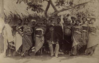
74962c.1880. . Albumen print. Good tonal range and in good condition.<br /> <br /> [c.1880]. unknown
38860LONDON JOHN BUSH 1870. FIRST EDITION. SMALL QUARTO FINELY BOUND IN HALF LEATHER. T.E.G. WITH A MAP AND 40 FULL PLATES BY LEAR AND MANY VIGNETTES. SOME FOXING TO THE PRELIMS AND PAGE EDGES OTHERWISE CLEAN. A HANDSOME COPY OF A SCARCE WORK. LONDON, JOHN BUSH, 1870 hardcover
29255LONDON T. BECKET 1768. FIRST EDITION QUARTO ORIGINAL FULL LEATHER RAISED BANDS GILT. THE FRONT BOARD IS SCARRED TO THE BOTTOM CORNER OTHERWISE VERY GOOD. VERY CLEAN TIGHT BINDING. 382 PAGES PLUS TWO PAGE CATALOGUE. THE AUTHOR WAS A MINISTER ON THE ISLE OF SKYE. LONDON, T. BECKET, 1768 hardcover
folio [38.5 x 29 cm]; xxii, 202 pp, double page photogravure frontis, 113 fine photogravure plates, folding panorama of elephants charging in rear pocket, colored map, title in red & black, index. orig dark blue cloth with gilt title lettering on front cover & spine, t. e. g., spine lightly faded but lettering clear, light stain on corner of cover, rear corner bit bumped, bookplate of Frances Myers and signature on endpaper, a near fine clean copy. A very large work, printed on heavy paper, with superb photos of African animals, especially elephants, rhinoceros, hippopotamus, buffalo, giraffes. The preface is by Sir Sydney F. Harmer. The author, describes his travels to British East Africa, Kenya, and his photographic experiences. He provides a chapter and some plates on the equipment he used. The appendices are on elephants, mammoths.
1887198062Berlin, 1879-1887. M. mehr. Ktn. u. Taf. Bd. 1 u. 2 in 1 Hlwdbd. d. Zt. Einbd. berieben, fleckig u. leicht bestoßen. Rücken m. Fehlst. Papierbed. sind Bd. 1, H. 2-5, u. Bd. 2, H. 2, stärker gebräunt. Einzelne S. lose u. randrissig. Tit. zu Bd. 1 papierbed. bröselig u. lose. 3 Karten gelöst. Bd. 2 H. 1 u. 2 durchgeh. m. Knicken. Vors., Tit. u. Karten m. St. Rest in OBr. Umschl. angeschmutzt, teils wasserrandig, fleckig, m. Randläsuren u. kl. Fehlst. Teilw. unaufgeschn. Bd. 5 H. 2 teils knittrig u. es fehlen Ktn. u. Taf.
168487325Frakfurt/Leipzig: Joachim Bilden 1684. Gebundn. Joachim Bilden unknown
189790461Hachette | Paris 1897 | 19 x 28.2 cm | Reliure de l'éditeur
Carta nautica pubblicata nel'atlante "Nouvel Atlas de Marine. Composé d’une Carte Generale, et de XII Cartes Particulieres, qui Representent Le Globe Terrestre…" di Isaac Brouckner (Bruckner) che rappresenta il primo atlante nautico prussiano, edito per la prima volta nel 1749.La carta generale e le 12 particolari dell'atlante, tutte in proiezione mercatoriana, delineate dal Brouckner, furono incise su rame da Nicolaus Frdr. Sauerbrey, attivo a Berlino. L'atlante è preceduto da un testo con la spiegazione per l'uso delle carte fornita in 4 lingue: tedesco, inglese, francese e olandese.Il progetto dell'atlante nautico fu concepito dall'Accademia delle Scienze di Berlino, e infatti l'opera reca la dedica alll'allora direttore Samuel Count von Schmettau.Per la realizzazione delle carte, Brouckner si servì delle più recenti fonti disponibili presso l'Accademia berlinese, con il risultato di un'opera assolutamente accurata e aggiornata.Si ha notizia di un'edizione olandese dell'atlante, pubblicata 10 anni dopo la prima, nel 1759. Mentre il testo introduttivo reca la data aggiornata al 1759, le carte recano invece la data 1749, come nella prima edizione.Questa carta dell'Africa meridionale costituisce la tavola 9 dell'opera.Incisione su rame, aggiunto l'angolo inferiore destro, in ottimo stato di conservazione. Map published in" Nouvel Atlas de Marine. Composé d’une Carte Generale, et de XII Cartes Particulieres, qui Representent Le Globe Terrestre…" by Isaac Brouckner (Bruckner), the first Prussian Maritime Atlas, published first time in 1749. Drawn up by order of the Academy of Sciences in Berlin and dedicated to its director, Samuel Count von Schmettau . 1 world map & 12 charts – all in Mercator projection – engraved by Nicolaus Frdr. Sauerbrey (map engraver and engraver of arms in Berlin, d. about 1771), with explanation & exercise for the use of the charts in all four languages : German , English , French, and Dutch.For the preparation of the atlas Brouckner could fall back upon all recent sources available at the Berlin Academy of Sciences and used these indeed – so Phillips – to the greatest benefit of the atlas:“ … prepared … by order of field-marshall count Samuel von Schmettau, who did so much in Prussia to raise the level of the scientific undertakings, not only theoretical but practical, of the Berlin Royal academy of sciences during the eighteenth century. In order that this atlas might be as complete as possible, Count von Schmettau placed at Brouckner’s disposal all the sheets and memoirs that were available, which were dealt with in a masterly way by the geographer, with the result that a most creditable marine atlas for the time was prepared, which certainly deserves to be designated as the first Prussian marine atlas . ”“A little-known Dutch edition of Isaac Brouckner’s Nouvel atlas de marine, first published in 1749, Berlin, was also added by purchase” (Imago Mundi IX [1952], 116) – , its charts still carry, irrespective of the typographical Dutch text dated 1759, the unchanged year 1749 of present first edition.This Africa's map is the plate 9 of the atlas.Copper engraving, added the lower right corner, otherwise in perfect condition. Tooley 83; Shirley BL, M.BROU-1a
18012924-00Bln. u. Hamburg 1801. Tit., 432 (4) S. Mit 1 Kupfertaf., 1 Plan u. 1 gefalt. Kupferkarte. Pbd. d. Zt. m. goldgeprägt. Rückensch. Kanten schwach berieb. - (Bibliothek der neuesten und interessantesten Reisebeschreibungen, VI) [4 Warenabbildungen]
1792100309ABParis, Plassan, 1792. Tafelband. 26 x 20,5 cm. Mit gestoch. Titelvign. u. zahlr. Abb. auf 80 (von 88) doppelblattgr., teils mehrfach gefalt. Kupfertafeln (davon 4 mehrf. gefalt. Kupferkarten). 2 Bll. Marmor. Halblederbd. der Zeit m. goldgeprägt. Rt. - Es fehlen die Tafeln Nr. 53 bis 58, Nr. 75 u. Nr. 88. - 1 Karte m. kl. hinterlegtem Einriss, Karten u. 2 Tafeln m. leichtem Feuchtigkeitsrand, sonst gutes Ex.
187747246ABLeipzig, Brockhaus 1877. 2 Bände. Gr.-8°. XVI, 325, (1); XVI, 324 S. Original-Leinwand. Etwas berieben, Gelenke geringf. angeplatzt (teils geklebt). Geringf. gelockert. Namensstempel am Vorsatz. Teils stockfleckig, teils gebräunt.
190713284Paris Augustin Challamel 1907 GRAND In-8 Fort XV+776 pp, (.) Mission Chari-Lac Tchad, 1902-1904, récit du voyage de la mission ; appendice par MM. Pellegrin, Germain, Courtet, Petit, Bouvier, Lesnes, du Buysson, Surcouf. Envoi de l'auteur, frontispice couleurs, nombreuse illustrations en noir in-texte, cartes et plans dépliants, et VII planches in-fine. Plats muets, dos orné de quadruples filets dorés, reliure et cachets de la Société de géographie commerciale. Dos passé, épidermures sur coiffes et mors, quelques restes d'étiquette de papier en tête.