VAN KEULEN Johannes (1654 - 1715)MareMagnum

34 274 résultats
Acquaforte e bulino, 520x600 mm, firmata in lastra nel cartiglio: ‘t Amsterdam By Iohannes van Keulen Boeck Zeekartverkooper en Graad-boog. Maker By de Nieuwen Brugh inde Gekroonde Lootsman Met Privilegie Voor 15 Jaaren.Magnifica prova, con meravigliosa coloritura coeva, in eccellente stato di conservazione.Carta tratta da: De Nieuwe Groote Lichtende Zee-Fakel, ‘t Derde Deel. Verhoonde de Kunsten van Granaden, Catalonien, Provence, Italien, Dalmatien, Grieken, Thracien, Natolien, Syrien, Egyptne, en de geheele Noordkust van Barbaryen, met alle haer onderhoo rende en tussschen leggende Eylanden. (…) Door Claas Jansz. Vooght, Geometra Leermeester der Wis-konst. Die geen voor de sijnen en kent, als die by Johannes van Keulen gedrukt zijn. t’ Amsterdam, Gedruckt voor Johannes van Keulen, Boeck en Zee-Kaert-verkoper, aen de Nieuw-brugh, in de gekroonde Lootsman. 169. Met Privilegie voor 15 Jaren.Nuova carta del Mediterraneo di Johannes I Van Keulen che compare per la prima volta nell’edizione olandese del De Nieuwe Groote Lichtende Zee-Fakel. Si tratta di una delle otto nuove carte aggiunte alle originali 17 della prima edizione del 1682. Koeman sostiene che, sebbene il frontespizio della raccolta riporti la data - incompleta – 169[.], le carte aggiunte siano state realizzate dopo il 1704, come dimostrerebbe la scena di una battaglia navale riportata sopra una delle tavole nautiche. Inoltre, a tutte le carte nautiche viene aggiunta la scala metrica in miglia italiane, già presente nella versione italiana dello Zee-Fakel, pubblicata nel 1705 con il titolo di Nuova, E Grande Illuminante Face del Mare (cfr. Koeman, AN, IV, p. 346, Keu 108).Bibliografia: C. Koeman, Atlantes Neerlandici: Bibliography of Terrestrial, Maritime and Celestial Atlases and Pilot Books Published in the Netherlands up to 1880 Vol. IV, Amsterdam 1970, pp. 338-347, Keu 88 A (2) 180; cfr. R. Shirley, Maps in the Atlases of the British Library, Londra, 2004, pp. 1200-1213; cfr. D. de Vries, G. Schilder, W. Morzer Bruyns, P. van Iterson, I. Jacobs, The Van Keulen Cartography Amsterdam 1680-1885, Alphen aan den Rijn, 2005. Etching and engraving, 520x600 mm, signed in the cartouche: ‘t Amsterdam By Iohannes van Keulen Boeck Zeekartverkooper en Graad-boog. Maker By de Nieuwen Brugh inde Gekroonde Lootsman Met Privilegie Voor 15 Jaaren.Magnificent proof, with wonderful original coloring, in excellent condition.From: De Nieuwe Groote Lichtende Zee-Fakel, ‘t Derde Deel. Verhoonde de Kunsten van Granaden, Catalonien, Provence, Italien, Dalmatien, Grieken, Thracien, Natolien, Syrien, Egyptne, en de geheele Noordkust van Barbaryen, met alle haer onderhoo rende en tussschen leggende Eylanden. (…) Door Claas Jansz. Vooght, Geometra Leermeester der Wis-konst. Die geen voor de sijnen en kent, als die by Johannes van Keulen gedrukt zijn. t’ Amsterdam, Gedruckt voor Johannes van Keulen, Boeck en Zee-Kaert-verkoper, aen de Nieuw-brugh, in de gekroonde Lootsman. 169. Met Privilegie voor 15 Jaren.New Mediterranean map by Johannes I Van Keulen that appears for the first time in the Dutch edition of De Nieuwe Groote Lichtende Zee-Fakel. This is one of the eight new charts added to the original 17 of the first edition of 1682. Koeman claims that, although the title page of the collection bears the - incomplete - date [169], the added charts were made after 1704, as would be shown the scene of a naval battle reported above one of the nautical charts. Furthermore, the metric scale in Italian miles is added to all nautical charts, already present in the Italian version of the Zee-Fakel, published in 1705 with the title of Nuova, E Grande Illuminante Face del Mare (see Koeman, AN, IV, p 346, Keu 108).Bibliografia: C. Koeman, Atlantes Neerlandici: Bibliography of Terrestrial, Maritime and Celestial Atlases and Pilot Books Published in the Netherlands up to 1880 Vol. IV, Amsterdam 1970, pp. 338-347, Keu 88 A (2) 180; cfr. R. Shirley, Maps in the Atlases of the British Library, Londra, 2004, pp. 1200-1213; cfr. D. de Vries, G. Schilder, W. Morzer Bruyns, P. van Iterson, I. Jacobs, The Van Keulen Cartography Amsterdam 1680-1885, Alphen aan den Rijn, 2005. S. Bifolco, "Mare Nostrum, Cartografia nautica a stampa del Mar Mediterraneo" (2020), p. 167, tav. 73.
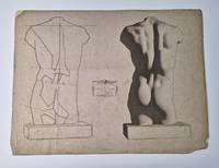
155470Paris Goupil & Cie Editeurs no date 1868 This course taught Vincent van Gogh how to draw human figures. Loose-leaf plates on grey paper with the original white/grey paper backing. Dimensions: 44 x 59 cm. All plates are numbered. The following plates from the first series Première partie are on offer here: 1 2 5 7 9-12 15-17 19-22 24-26 28-29 32 36 40 42 46 49 52-53 56. Details: All plates have a small printed colophon in a frame with the general title the part number and title the plate number and the publishers name. In fine print at the bottom of the sheets the name of the printer Lemercier in Paris is mentioned on most plates. 27 plates also have a small blind stamp of the firm Goupil in the lower margin. See for this stamp the French database 'marquesdecollections' stamp no. L.1090. Condition: Mosts lithos are in rather good condition. The plates have evidently been used a few have tiny pinholes. Some of them have been folded showing creases. Most of the plates are frayed and worn at the edges with a few small tears and dog-ears. Several plates are foxed or spotted. Four plates are in lesser condition: plate 2 has large folds the lower corners are damaged and there is foxing; plate 26 has two long creases and a large tear; plate 36 has a crease a damaged corner and a tear of six cm.; plate 56 is almost torn through the middle. NOTE: The beautiful plates of the famous Drawing Course Cours de dessin by Bargue and Gérome were made for beginning students of drawing schools and art academies to copy. In this way they could become familiar with the principles of contour light and shade and at the same time develop an appreciation for 'good taste' by looking at examples of great art. The drawings of the first part of the course were made after plaster casts of famous classical and renaissance statues. The series starts with simple forms of isolated body-parts and then offers images of gradually increasing complexity. To help the student to manage the essential forms of a head or torso many plates are divided into two parts. A schematic outline with straight lines and angles stands beside the finished drawing. § The plates of the drawing course are now hard to find. Of the original publication of 197 loose-leaf lithography plates divided into three parts there are only a few complete sets known. Our collection is a part of the first volume: 'Modèles d'après la bosse' Models after casts which consisted of 70 plates. It was published in 1868. The second series completed in 1870 was: 'Modèles d'après les Maîtres de toutes les époques et de toutes les écoles' Models after masters of all periods and all schools. The third series completed in 1873 was: 'Exercices au fusain pour préparer à l'étude de l'académie d'après nature' Charcoal exercises in preparation for drawing the academic nude. The first two sections were meant for schools for design and decorative arts. The third section with live models was used only in art academies. There were no instructions published with the plates that was left to the teachers in the schools. It was common practice in the schools to start with copying prints and drawing from plaster casts of classical statues. As a second stage students copied old masters. In the art academies they then went on to live models. This training was part of the tradition of 19th century neoclassicsm. The imitation of nature was the only goal for artists. Objects and human bodies should be drawn and painted meticulously. Works of art were both realistic and idealistic following the concept of 'good taste'. In France this resulted in smooth and finished works influenced by the standards of the French 'Académie des Beaux-Arts'. This so-called 'Academic Art' came under criticism at the end of the 19th century when the concept of art changed radically. The Drawing Course is the last great document of the 19th century tradition of art education. It was widely used in France and England. § Vincent van Gogh writes about it in his letters he has worked through the whole course at least once. Van Gogh worked very hard on this course because he hoped to gain some income with the sale of his drawings. In a sketchbook owned by the Van Gogh Museum in Amsterdam there are several pencil drawings made after Bargue's plates. Nowadays the didactic and artistic quality of the course is greatly admired by both amateur and professional artists. § The firm Goupil & Cie was an important publisher of original prints and art reproductions in Paris. They hired skilled engravers and lithographers and used the latest techniques. The firm also developed into a renowned art dealer. The 'Cours de dessin' sold very well for Goupil and loose plates were still sold until the firm was dissolved around 1920. Charles Bargue 1826-1883 was a French draughtsman lithographer and painter who has left a small number of paintings. Jean-Léon Gérome 1824-1904 was a French painter and sculptor an esteemed representative of academic art. The main source for information on the course is: G.M. Ackerman. Charles Bargue with the collaboration of Jean-Léon Gérôme Drawing Course. Paris ACR 2017 first edition 2003. A copy of this book is added. unknown
177876402Chez Samuel Fauche | à Neuchâtel 1778 | 19 x 25 cm | 2 volumes reliés
1st edition. Period boards with original multichrome illustrated wrappers bound in. Oblong 4to, 15 pages. All pages illustrated with large modernist illustrations by Ryback 24 x 32 cm. In Yiddish. Title translates as, Birds. Illustrations in color appear on the front and back covers. Large illustrations in blacm and white appear within the book. A Fair-good condition copu, with Cover almost completely detached and several detached leaves. Tears to borders of all of the leaves. Fragile paper sold for over $2600 at auction in 2014. See: Futur Antérieur, L'Avant-Garde etle Livre Yiddish (1914-1939) (Skira, Paris, 2009. No. 152). A Limited reprint of the book was issued in 1983. Issachar Ber Ryback (1897-1935 ) was a Jewish-Ukrainian-French painter [who] attended the art school in Kiev until 1916. He joined a progressive group of painters and was influenced by advocates of a modern Jewish literature such as David Bergelson and David Hofstein. The painters Alexander Bogomazov and Alexandra Exter were in Kiev at the time, and they taught him in 1913. In 1916 El Lissitzky and Ryback were given the task to make Jewish art memorials of schtetls [sic] from Ukraine and Belarus. When he participated in an exhibition of Jewish paintings and sculptures in Moscow the spring 1917, his works were especially recommended.During the October Revolution in 1917, he took part in multiple activities to redefine avantgarde Yiddish culture, e.g., he was a member of Kultur Lige in Kiev. Later he went to Moscow. After his father was killed by Petliura's soldiers in the pogroms in Ukraine, he fled in April 1921 to Kaunas and in October 1921 he obtained a visa for Germany. He was in Berlin until 1924.He was a member of the Novembergruppe and exhibited his Cubist pictures at both the Berliner Secession and the Juryfreien Kunstausstellung .At the time the Jewish education organization World ORT was situated in Berlin and he made the design for its logo.In 1924 he tried to work in the Soviet Union by decorating scenes at Yiddish theaters.In 1926 he emigrated to Paris and did not return to Russia.In 1928 he had a solo exhibition in the Galerie aux Quatre Chemins and in 1929 in the "Galerie LArt Contemporain. His style of painting had turned to the Expressionistic coloring of the School of Paris in the interwar period. Further exhibitions followed at galleries in The Hague, Rotterdam, Brussels and Antwerp. In 1935 he traveled to the opening of his exhibition in Cambridge. He did not live to see the retrospective exhibition in Paris organised by Georges Wildenstein.Rybak was a contemporary of Jewish-Russian artists Natan Issajewitsch Altman, Boris Aronson and Marc Chagall, who transmitted the Jewish tradition in modern art (Wikipedia). SUBJECT(S): Yiddish poetry. Children's literature, Poe´sie yiddish. Litte´rature de jeunesse. OCLC: 19306454. OCLC.OCLC lists 3 copies (Yale, Princeton, HUC), plus YIVO and Harvard list a 1930 edition (OCLC: 970831653), which we presume to be the same book, for a total of 5 copies worldwide. Rounded outer corners, childs notes on later blank endpapers, which are damaged, and some light crayoning to several of the illustrations. Fragile paper, with chip to outer edge, a few leaves detaching, no text or illustration affected. A copy in worse condition sold for over $2600 at auction in 2014. An emblematic rare Ryback childrens book (YID-36-15)
Rare First Edition Christopher Columbus' America Codice Diplomatico Colombo-Americano 1823 SPOTORNO, Giovanni Battista Codice diplomatico colombo-americano ossia raccolta di documenti originali e inediti, spettanti a Cristoforo Colombo alla scoperta ed la Governo dell’America. Pubblicato per ordine degl’Ill.mi Decurioni della Città di Genova. [Colombus-America Diplomatic Codex: Collection of Original Unpublished Documents Relating to Christopher Columbus, the Discovery of America, and the Government. Published by order of the Decurions of the City of Genova.] THE RARE FIRST EDITION IN ORIGINAL WRAPPERS Ponthenier, Genova, 1823. Rare First Edition. 4to. lxxx, 348 pages, engraved frontispiece, 4 lithograph plates. Text is in both Italian and Spanish. Publisher's original illustrated blue wrappers, uncut pages. Volume measures 28 x 21.5 x 3 cm. Very minor foxing, spine ends chipped, otherwise in very good, original condition, internally bright. An exceedingly scarce and important work. "Cartas, previleg's, çedulas y otras escrituras de Don Christoval Colon Almirante Major del mar oceano visorey y governador de las islas y tierra firme." [Letters, charters, certificates and other writings of Christopher Columbus, Admiral of the Ocean Sea, Viceroy and Governor of the Islands and the Mainland.] A monumental work recording previously unpublished details of the great navigator's voyages of exploration and discovery, in the form of critical communication and official documents which ultimately led to the colonization of America. "This most important and valuable collection was edited by Prof. Spotorno, and consists of an historical memoir of Columbus, by the editor, followed by the letters, notes, privileges, and other writings of the great navigator, comprising every authentic document, with portrait, facsimile, autographs, etc." Sabin 14644.
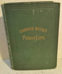
1874056852<p>New York: P. J. Kenedy. Good. 1874. 1st Edition. Hardcover. Hardcover no jacket this scarce vintage treasure is inscribed dated and signed by the author it is inscribed to "John Rafferty in the compliments of." Northern Hotel New York March 24/74." The green cloth is worn through to the boards at the corner-tips and at the spine-ends which have shallow loss the spine is a sightly darker shade than the covers the gilt titles remain bright and the binding is tight internally there is a small brown blemish on the frontis page not affecting the frontis and in the margin of the title page the original tissue-guard is present the contents are clean and there are two pages of ads after the text the second ad is for The Northern Hotel in New York the author 1831-1915 a fiery Irish nationalist was a founder of The Fermians also known as the Irish Republican Brotherhood he endured harsh conditions during his imprisonment for treason this book describes his experiences he was released from prison and was exiled to the USA where he leased The Northern Hotel in Manhattan for a time he was feared as a terrorist in England and was loved as a freedom fighter by the Irish people Quote: "Rossa was not the greatest man of the Fenian generation but he was its most typical man"; 446 pages; Signed by Author .</p> P. J. Kenedy hardcover
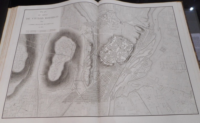
225749Paris, Firmin-Didot, 1836-1837 4 forts vol. in-8 et atlas in-folio, demi-chagrin vert, dos à nerfs orné (texte) et demi-veau havane à coins, dos lisse (atlas) (reliure de l'époque). Rousseurs. Carte générale de l'atlas restauré dans une marge. Dos passé et petit manque à la coiffe supérieure pour l'atlas.
1787PHO-2345Paris, Hôtel de Thou 1787-1788. 2 vol in 4°, tome 1, frontispice gravé par Boily d'après Cochin, 65 p, 77 cartes, tome 2, 112 p, tables, 63 cartes, toutes montées sur onglets, relié cartonnage d’attente époque, manque aux dos, dos cassé (T2), quelques cartes brunies, rares piqures. Complet avec dans le premier tome, les cartes de géographie ancienne, celles relative à l’Europe ainsi que les hémisphères traditionnels et obliques, dans ce second tome de l’Atlas, on trouve les parties du Monde hors de l’Europe et la carte des environs de Paris (n°121), pas de cartes 111 et 116 mais deux cartes 117 et une 102 bis.
In folio (mm. 465x320), bella legatura in mz. pelle coeva a grandi ang. con fregi dorati, dorso a cordoni con decorazioni e titolo oro, pp. 76,(28), magnificamente illustrato fuori testo da: 1 tavola con 10 piccoli ritratti in medaglione, 1 mappa “exhibiting the retreat of the French Army from Moscow to Paris”, 1 tavola con facsimili, tutte inc. in rame e 19 splendide acquetinte colorate a mano (di cui 4 a doppia pagina) che raffigurano per lo più vedute di: “Mosca (2) / Danzica / Berlino / Francoforte / Dresda / Amburgo / L’Aja / Lipsia (4) / l’Isola d’Elba, ritratto di Napoleone, Porto Ferrajo / Amsterdam / Rosiere / Smolensko / Hanau / Paris / Ceremony of Te Deum by the Allied Armies on the Square of Louis XV, at Paris, the 10th April 1814”, tutte ampiamente descritte. Sempre dello stesso A., è unita la seguente opera: - "The Campaign of Waterloo", illustrated with engravings of “Les quatre bras. La belle alliance. Hougoumont. La Haye Sainte”, and other principal scenes of action. Including a correct military plan, together with a Grand View of the Battle on a large scale. To which is prefixed a history of the campaign, compiled from official documents and other authentic sources. London, 1816, di pp. (2),34,10 (“Biographical notices of the sovereigns, warriors and statesmen who have eminently signalised themselves in the campaigns of Moscow, Leipsic, France and Waterloo”), arricchita da: una bella veduta dell’Isola di S. Elena, inc. su legno nel t., 2 tavole con numerosi picc. ritratti in medaglione “of the British and their allied - The royal family of France, The family of Buonaparte, French generals, statesmen, etc.; 1 piano della battaglia, inc. in rame f.t. e 4 splendide acquetinte colorate a mano (di cui 1 a doppia pagina): “View from Mont St. Jean of the Battle of Waterloo.. the Evening of the 18th June 1815”. Entrambe le opere sono in "prima edizione". Cfr. Benezit,II, p. 701: “Robert Bowyer (1758-1834), britannique. Acquarelliste, miniaturiste. Il fut très apprécié à la cour de George III et exposa à la Royal Academy, entre 1782 et 1828 et à la Free Society en 1828” - Tooley “English Books with coloured plates..”, nn. 97 e 98. Testo con qualche lieve uniforme ingiallitura; una tav. con piccolo alone al margine super., altrimenti bell’esemplare ben conservato.
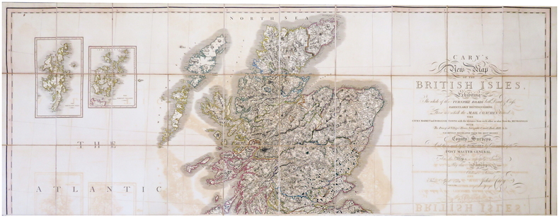
1819LBW-6802London, John Cary, 1819-1833. En trois feuilles coupées en 30 sections chacune, montées sur toile et pliées, pouvant être jointes pour former une carte de 1,91 x 1,71 m ; plats au dos de percaline prune, protégeant les feuilles une fois repliées, avec vignettes portant les titres de North, Center et South ; sous étui de percaline prune avec vignette de titre sur le premier plat.
Carta tratta da: Atlas ou Recueil de cartes geographiques Dressées Sur les Nouvelles Observations de Mrs de l’Academie Royale des Sciences Par N. de Fer, Geographe de sa Majesté Catolique et de Monseigneur le Dauphin. A Paris, chez l’Auteur dans l’Isle du Palais sur le Quay de l’Orloge a la Sphere Royale. Avec privilege du Roy 1709.Acquaforte, dimensioni 360x755 mm. Titolo nel cartiglio in basso a destra; imprint editoriale nel cartiglio in alto a sinistra, che contiene anche la scala metrica: A Paris, Chez l’Auteur dans l’Isle du Palais sur le Quay de l’Orloge à a la Spere Royale. Avec Privilege du Roy. 1709. In basso a destra, la firma dell’incisore Johannes van Loon. Carta nautica del Mediterraneo pubblicata nell’Atlas ou Recueil de cartes geographiques di Nicolas de Fer, dedicata a Luigi di Francia le “Grand Dauphine”, erede al trono di Luigi XIV. Bell'esemplare in coloritura antica.Bibliografia: Mare Nostrum, a historic voyage across the Mediterranean Sea, Lussemburgo, 2003, p. 40; M. Pastoureau, Les Atlas Francais XVIe-XVIIe siècles, Parigi, 1984, pp. 167-223, FER II A (77). Etching, with fine old colour, very good condition.Map taken from: Atlas ou Recueil de cartes geographiques Dressées Sur les Nouvelles Observations de Mrs de l’Academie Royale des Sciences Par N. de Fer, Geographe de sa Majesté Catolique et de Monseigneur le Dauphin. A Paris, chez l’Auteur dans l’Isle du Palais sur le Quay de l’Orloge a la Sphere Royale. Avec privilege du Roy 1709.Title in the cartouche below right; imprint editorial in the cartouche at the top left, which also contains the metric scale: A Paris, Chez l'Auteur dans l'Isle du Palais sur le Quay de l'Orloge à a la Spere Royale. Avec Privilege du Roy. 1709. At the bottom right, the signature of the engraver Johannes van Loon.Chart of the Mediterranean published in the "Atlas ou Recueil de cartes geographiques" of Nicolas de Fer, dedicated to Louis of France the "Grand Dauphine", heir to the throne of Louis XIV.Bibliografia: Mare Nostrum, a historic voyage across the Mediterranean Sea, Lussemburgo, 2003, p. 40; M. Pastoureau, Les Atlas Francais XVIe-XVIIe siècles, Parigi, 1984, pp. 167-223, FER II A (77). S. Bifolco, "Mare Nostrum, Cartografia nautica a stampa del Mar Mediterraneo" (2020), pp. 256-257, tav. 119.
Acquaforte e bulino, mm 440x540, firmata in lastra nel cartiglio in alto a sinistra.Bellissimo esemplare di questo raro portolano del Mediterraneo, in magnifica coloritura coeva.Opera tratta da: De Zee-Atlas Ofte Water-Waereld, Vertoonende all de Zee-kusten Van het bekende Deel des Aerd-Bodems, Met een generale beschryvinge van dien. Seer dienstigh voor alle Schippers en Stuurlieden; mitsgaders Koop-lieden om op ‘t Kantoor gebruykt te werden. Nieuwelijks aldus uytgegeven. t’ Amsterdam, By Hendrick Doncker, Boekveerkooper, en Graat-boog-maker, in dee Nieuwe-brug-steeg, in ‘t Stuur-mans Gereetschap. Anno. 1660.Prima versione della carta del Mediterraneo inserita nell’atlante nautico di Hendrick Doncker (circa 1625 - 1699), lo Zee-Atlas of Water-Waerelt (1659), il più aggiornato tra gli atlanti nautici del secolo d’oro della cartografia olandese. Tra il 1659 e il 1669, Doncker aumentò progressivamente il numero di carte; prima da 19 a 30 e quindi a 50. Questa versione della carta del Mediterraneo è presente nelle successive ristampe del 1661, 62, 63 e 64 (cfr. Koeman, IV, pp. 159-160, Don 3-7) per essere sostituita nel 1665 da una carta in due fogli di atlante - non sovrapponibili - una con la rappresentazione della parte occidentale e una di quella orientale del Mar Mediterraneo.Bibliografia: C. Koeman, Atlantes Neerlandici: Bibliography of Terrestrial, Maritime and Celestial Atlases and Pilot Books Published in the Netherlands up to 1880 Vol. IV, Amsterdam 1970, pp. 152-189, Don 2 (8); National Maritime Museum, Catalogue of the Library - Vol. Three, Atlas & Cartography, Londra, 1971, p. 75, n. 84 (14); cfr. R. Shirley, Maps in the Atlases of the British Library, Londra, 2004, pp. 1161-1163. Etching and engraving, 440x540 mm, signed on plate in the cartouche at the top left.Beautiful example of this rare Mediterranean nautical chart, in magnificent original colouring.These is the first version of the Mediterranean map inserted in the nautical atlas by Hendrick Doncker (circa 1625 - 1699), the Zee-Atlas of Water-Waerelt (1659), the most up-to-date among the nautical atlases of the golden century of Dutch cartography. Between 1659 and 1669 Doncker progressively increased the number of charts; first from 19 to 30 and then to 50. This version of the Mediterranean map is present in the slater reprints of 1661, 62, 63 and 64 (see Koeman, IV, pp. 159-160, Don 3-7) to be replaced in 1665 from a map in two sheets of atlas - not joinable - one with the representation of the western part and the second one for the eastern part of the Mediterranean Sea.From: De Zee-Atlas Ofte Water-Waereld, Vertoonende all de Zee-kusten Van het bekende Deel des Aerd-Bodems, Met een generale beschryvinge van dien. Seer dienstigh voor alle Schippers en Stuurlieden; mitsgaders Koop-lieden om op ‘t Kantoor gebruykt te werden. Nieuwelijks aldus uytgegeven. t’ Amsterdam, By Hendrick Doncker, Boekveerkooper, en Graat-boog-maker, in dee Nieuwe-brug-steeg, in ‘t Stuur-mans Gereetschap. Anno. 1660.Bibliografia: C. Koeman, Atlantes Neerlandici: Bibliography of Terrestrial, Maritime and Celestial Atlases and Pilot Books Published in the Netherlands up to 1880 Vol. IV, Amsterdam 1970, pp. 152-189, Don 2 (8); National Maritime Museum, Catalogue of the Library - Vol. Three, Atlas & Cartography, Londra, 1971, p. 75, n. 84 (14); cfr. R. Shirley, Maps in the Atlases of the British Library, Londra, 2004, pp. 1161-1163. S. Bifolco, "Mare Nostrum, Cartografia nautica a stampa del Mar Mediterraneo" (2020), pp. 106-107, tav. 39.
1st Edition. Original paper wrappers bound into period cloth, 4to, 6-16 pages per issue. In Yiddish. Includes some cartoons and other illustrations, including one we noticed by William Gropper. Der Yunion Arbayter (The Union Worker) lasted 2 volumes, running weekly until 1927. The first volume, complete, is here. A.L.G.V.Y / I.L.G.V.Y. stands for the Yiddish name for the heavily Yiddish speaking International Ladies Garment Workers Union; this newspaper was published by an Anarchist section within the union. Yiddish-speaking Jewish anarchists were one of the pillars of the U.S. anarchist movement before World War II. This largely immigrant radical milieu was centered in New York City and opposed capitalism, the state, and organized religion. Yiddish-speaking anarchists built militant unions, anarchist newspapers, and other organizations to further their cause. Many famous anarchists were linked to this movement, including Johann Most, Emma Goldman, Alexander Berkman, and Rudolf Rocker. Yiddish-speaking anarchists played a pivotal role in unions like the International Ladies Garment Workers Union (ILGWU), while the Yiddish anarchist newspaper the Fraye Arbeter Shtime (The Free Voice of Labor) was the largest and longest-lasting U.S. anarchist publication and formed a significant part of the Yiddish cultural landscape. In the 1930s a second generation of bilingual Jewish anarchists emerged, including Sam and Esther Dolgoff, and Audrey Goodfriend, whose influence is still felt in todays anarchist movement.Despite the importance of Yiddish anarchism to the histories of both the U.S. Left and the Jewish community, it has been largely forgotten and written out of historical scholarship (YIVO). Cited in Paul Avrichs Anarchist Portraits (Princeton, 1988) pp 192 & 196. Listed in John Pattens Yiddish Anarchist Bibliography - Periodicals (https://www.katesharpleylibrary.net/w9gk09). SUBJECT(S): Jewish anarchists. OCLC 10218086. OCLC lists 3 holdings worldwide LOC, YIVO, NYU), with NYU holding only this one volume and the Union List of Serials suggesting that the run may have "Ceased with Sept. 26, 1927 issue?" Rear hinge starting. Three issues printed on lower quality paper have darkened, but without any edgewear or breakage. The other 49 issues, printed on quality paper and well protected, remain bright white. All issues clear and very well preserved. Very Good Condition. An outstanding complete volume of a very rare and important Yiddish Anarchist periodical. (YID-42-20)
[4]-46 pp. "The governments of England, Russia, and France thought through the publication of the exchange of diplomatic writings of the days before the beginning of [WWI], they could furnish a proof in the eyes of their own peoples and of the entire civilized world that the blame for the most gigantic shedding of blood which the world has ever experienced falls only upon 'war-lusting Germany,' and that they for their part did all in their power to avoid the catastrophe. England has published a 'Blue Book,' Russia an 'Orange Book,' and France a 'Yellow Book.'" - p.5. "Dr. Karl Helfferich, German Secretary of the Treasury, reviews the 'White,' 'Yellow,' and 'Orange' papers, and reaches a different conclusion from that of James M. Beck [author of the 1914 book 'The Evidence in the Case'], holding the Allies responsible for [WWI]". - front cover. "A translation from the semi-official Nord-deutsche Allgemeine Zeitung of Jan. 26 [1914] of an exhaustive comparative study of the diplomatic documents published by the various warring countries concerning the origin of the world war." - p. [3]. "Dr. Helfferich's brilliant analysis of the world situation was published first by George Stilke, Berlin, under the title of 'The Genesis of the Great War.' It appeared in the N.Y. Times under the title under which it is here reprinted." - p. [2]. George Sylvester Viereck's The Fatherland Corporation also published a WWI-era periodical called The Fatherland which endorsed "Fair Play for Germany and Austria-Hungary". Grey card covers fragile with chips from front and back tips. Cover fold mostly open. Contents printed upon glossy stock which is clean, unmarked and gently toned. A worthy copy of this important WWI document. Book
186144586S.l.n.d., , (1861 circa). In-4 broché de (56) ff. sous chemise et étui cartonnés, pièce de titre de maroquin vert (reliure moderne).
LBW00284St. Gallen J.B. Isenring circa 1840 400 x 490 mm.
236770Paris, Charpentier, 1836 4 vol. in-8, maroquin prune à grain long, dos lisse orné en long, large bande de filets dorés en encaddrement sur les plats, fleurons en écoinçon, fer doré dans les angles, monogramme P. F. de P. au centre des plats, tranches dorée, roulette intérieure, gardes de moire blanche à décor floral (Simier r. du Roi).
177444335A Rome, et se trouve à Paris, chez Le Jay, 1774. 2 vol. in 12 de (8)-CVIII-324 pp. ; (4)-603 pp. (chiffré 601), (7) pp. (catalogue), veau marbré glacé, dos lisse orné, pièce de titre en maroquin rouge et de tomaison en maroquin vert, tranches marbrées (reliure de l'époque).
156620279Lyon, A. Gryphius, 1566. 3 Teile in einem Band. Prächtiger Kupfertitel (von alter Hand aufgezogen), III - X, 1 n.n. Bll., 995 S., 17 n.n. Bll (Index und Errata), 1 Blatt mit großer Druckermarke. Zahlreiche figürliche Holzschnitt-Initialen, einige größere in Metallschnitt. Ein großes Wappen in Holzschnitt. Fol., Lederband des 18. Jahrhunderts über 5 Bünden mit reicher Rückenvergoldung und goldgeprägtem Rückenschildchen. Berieben, Deckel etw. wurmstichig, Hinterdeckel etwas stärker.
"Everyone who is concerned with international finance listens when Schacht speaks. His new plan, designed to restore Europe's economic well-being, is an ingenious, essentially uncomplicated idea which has already affected official plans for dealing with Europe's [post WWII] exchange problems. For the rest of his life Dr. Schacht will remain a controversial figure on account of the political role he played in Germany from 1930 onwards; but as a financial and banking expert - as friend and collaborator of Montague Norman, and many other experts in this field - he has had hardly an equal in our time." - dust jacket. 125, [1] pp. First English printing of the 1949 German first edition. Original light yellow cloth lettered in red is very well preserved. Binding tight. Former library copy but with only two markings: a stamp inside the front board and a stamp upon the copyright page. Modest lean to spine. Average wear to dust jacket which is now preserved in archival-grade Brodart. A quality copy of this daring proposal. Peterson p.367 Book
Nieuwe Paskaart van‘t Tweede Gedeelte der Middelandsche-Zee Tusschen ‘t I. Malta en Alexandretta = The New Sea Map of the Seconde Partie of the Midland-Sea (...) = Nouvelle Carte Marine pour la Deuxiesme Partie de la Mer-Mediterranee (...) = Nuova Carta Maritima la Seconda Parte del Mar-Mediteraneo (...).Acquaforte e bulino, finemente colorata in epoca, in ottimo stato di conservazione. Il titolo della parte orientale, nel grande cartiglio in alto a destra è riportato in 4 lingue ma non in spagnolo. In basso al centro si legge: t’ Amsterdam by Ioannes van Keulen Boek-Zeeekard Verkooper en Graad boog maker aande Oost Zyde van de Nieuwe brug inde Gekroonde Lootsman Opgestelt door G: v: Keulen. met Privilegie.Rappresentazione nautica del Mediterraneo orientale; in basso a destra, troviamo il particolare della costa libica: Barbaria van I. Zerby tot Tripoli. La carta appartiene al terzo volume dello Zee-Fakkel, del quale è una delle tavole aggiunte nel 1709 da Gerard van Keulen. Firmata da Johannes Van Keulen (1654- 1715), la carta è completata e stampata dal figlio Gerard (1678 - 1726), il cui nome è riportato in entrambi i cartigli. Sebbene, secondo Koeman, la carta sarebbe stampata solo nel 1734 (cfr. AN, IV, p. 341, Keu 95 e V, p. 203), Irene Jacobs conferma che la carta appartiene all’aggiornamento dello Zee-Fakkel del 1709 (cfr. Charts in Zee-Fakkel and Zee-Atlas, p. 204). Il primo atlante Van Keulen nel quale abbiamo riscontrato la presenza della carta è il terzo volume dello Zee-Fakkel, edizione francese del 1723: Le Nouveau & Grand Illuminant Flambeau de la Mer (…) par Nicolas Jansz Vooght, & Gerard van Keulen, Geomêtre, & Maistre en Mathematiques. Imprime a Amsterdam: par Jean Van Ceulen, Marchand Libraire de Cartes Marines. A° 1723. Conservato alla Biblioteca Nacional di Madrid, il volume è citato ma non descritto da Koeman (cfr. AN, IV, p. 345, Keu 103 D). Le raccoltenautiche di Johannes van Keulen non erano composte da carte progettate intenzionalmente per questo tipo di opere: una quarantina di carte furono pubblicate per la prima volta nel 1680, ma il numero delle tavole aumentò sin da subito; nel 1683 - quando furono pubblicate le parti I, II, III, e IV - il numero aumentò a 116 mappe. L’atlante più voluminoso, apparso nel 1695, comprende 160 mappe di Johannes van Keulen. Più tardi, verso il 1709, Gerard van Keulen aumentò il numero di lastre a 185: quellepiù obsolete furono sostituite da altre; alle tavole venne assegnata una nuova numerazione. La tradizione libraria prevedeva che un atlante nautico dovesse iniziare con una mappa del mondo; Van Keulen, non essendo in possesso di una lastra di rame con raffigurazione del planisfero, ricorreva alle tavole di Johannes de Ram, Claesz Visscher o altri intagliatori. Gerard van Keulen, che successe al padre nel 1704, intraprese una nuova attività nel settore cartografico; ampliò l’atlante nautico con diverse sue carte e lo pubblicò nella forma definitiva, in cinque parti analogamente allo Zee-Fakkel, rinumerando le lastre.Bibliografia: C. Koeman, Atlantes Neerlandici: Bibliography of Terrestrial, Maritime and Celestial Atlases and Pilot Books Published in the Netherlands up to 1880 Vol. IV, Amsterdam 1970, p. 341, Keu 95 (3, 4) 204, 205, pp. 384-385, nn. 204, 205; cfr. R. Shirley, Maps in the Atlases of the British Library, Londra, 2004, pp. 1200-1213; I. Jacobs, Charts in Zee-Fakkel and Zee-Atlas, in “The Van Keulen Cartography”,Amsterdam 1680-1885, Leida, 2005, p. 204, nn. 202-203. Nieuwe Paskaart van ‘t Tweede Gedeelte der Middelandsche-Zee Tusschen ‘t I. Malta en Alexandretta = The New Sea Map of the Seconde Partie of the Midland-Sea (...) = Nouvelle Carte Marine pour la Deuxiesme Partie de la Mer-Mediterranee (...) = Nuova Carta Maritima la Seconda Parte del Mar-Mediteraneo (...).Etching and engraving, of the eastern part of the map, with fine original outline colour.Nautical representation of the Eastern Mediterranean Sea; in the lcartouche at the top right, is shown in 4 languages but not in Spanish. At the bottom center reads: t 'Amsterdam by Ioannes van Keulen Boek-Zeeekard Verkooper en Graad boog maker aande Oost Zyde van de Nieuwe brug inde Gekroonde Lootsman Opgestelt door G: v: Keulen. met Privileges.The first atlas Van Keulen in which we found the presence of paper is the third volume of the Zee-Fakkel, French edition of 1723: Le Nouveau & Grand Illuminant Flambeau de la Mer (...) par Nicolas Jansz Vooght, & Gerard van Keulen, Geomêtre , & Maistre en Mathematiques. Imprint in Amsterdam: par Jean Van Ceulen, Marchand Libraire de Cartes Marines. A ° 1723. Preserved at the Biblioteca Nacional in Madrid, the volume is quoted but not described by Koeman (see AN, IV, p. 345, Keu 103 D). Johannes van Keulen's nautical collections were published for the first time in 1680, but the number of plates increased immediately; in 1683 - when parts I, II, III, and IV were published - the number increased to 116 maps. The most massive atlas, which appeared in 1695, includes 160 maps by Johannes van Keulen. Later, around 1709, Gerard van Keulen increased the number of plates to 185: the most obsolete ones were replaced by others; the tables were given a new numbering. The book tradition foresaw that a nautical atlas should start with a map of the world; Van Keulen, not being in possession of a copper plate depicting the planisphere, resorted to the plates of Johannes de Ram, Claesz Visscher or other carvers. Gerard van Keulen, who succeeded his father in 1704, undertook a new activity in the cartographic sector; he expanded the nautical atlas with several of his maps and published it in its final form, in five parts similarly to the Zee-Fakkel, renumbering the plates. S. Bifolco, "Mare Nostrum, Cartografia nautica a stampa del Mar Mediterraneo" (2020), pp. 170-171, tav. 75.
Rarissima carta geografica raffigurante l’Europa, l’Africa e le coste orientali del Nord America. Esemplare nel terzo stato finale, con il cartiglio in basso a sinistra vuoto e le linee di rotta cancellate. Il primo stato della lastra presenta il cartiglio vuoto. L’opera è firmata nel secondo stato da Orazio Bertelli, in qualità di incisore della lastra, mentre la dedica a Francesco Scaridino include la data e la firma dell’autore ed editore Domenico Zenoi. Questo terzo stato presenta di nuovo il cartiglio bianco. La mappa, rarissima, può essere occasionalmente inclusa nelle raccolte di piccolo formato edita da Bertelli e Camocio.Meurer descrive solo due stati dell’opera, ignorando questa ulteriore ultima variante.Orazio Bertelli (attivo a Venezia nella seconda metà del sec. XVI)Orazio Bertelli, probabilmente fratello di Luca, lavorò a Venezia e, secondo Le Blanc, anche a Roma come editore calcografico e forse anche incisore. Nel 1582 stampò a Venezia opere di Agostino Carracci, Paolo Veronese e di altri autori. Molte delle incisioni attribuitegli probabilmente furono da lui solo pubblicate.Domenico Zenoi (attivo a Venezia nella seconda metà del sec. XVI)Detto anche Domenego Veneziano, fu attivo a Venezia come incisore. Nel 1567 chiese al Senato veneto il privilegio collettivo per stampare opere di soggetto religioso, ritratti e alcune mappe. Zenoi incise inoltre stampe di soggetto mitologico e storico. La sua produzione cartografica va all’incirca dal 1559 al 1574, e le sue carte sono firmate generalmente Dominicus Zenoi Venetus excidebat, più raramente Dom.co Zenoi cum privilegio e Domeneco Venetiano. Zenoi incide carte di Gastaldi e di Sofiano e lavora per Donato e Ferrando Bertelli e per Camocio. Incise anche alcune carte inserite nel Civitatum aliquot insignorum et locorum magis monitorum exacta delineation cum additione aliquot Insularum principalium edito da Ferrando Bertelli nel 1568, e da Donato Bertelli nel 1574, e alcune delle Isole famose,porti, fortezze, e terre marittime sottoposte alla Ser.ma Sig.ria di Venetia, ad altri Principi Christiani, et al Sig.or Turco, novamente poste in luce, in Venezia del Camocio del 1571. Nel 1568, fu multato di 10 ducati dalla magistratura degli Esecutori contro la Bestemmia per alcuni sonetti osceni illustrati da immagini, di cui alcune copie furono trovate in vendita presso la bottega di Camocio, multato a sua volta, ma di soli 5 ducati.Bell’esemplare con piccoli margini, perfetto stato di conservazione. Rare map showing Europe, Africa and the eastern coast of North America. Exemple in the third, final, state, with the cartouche in the lower left empty and the wind lines deleted.The first state of the plate has the empty cartouche The work is signed in the second state by Orazio Bertelli, as an engraver of the plate, and the dedication to Francesco Scaridino includes the date and signature of the author and publisher Domenico Zenoi. This was the third presents again the cartouche white.The map, rare, can occasionally be included in the collections of small format published by Bertelli and Camocio.Meurer describes only two states of the work, ignoring further this latest variant. Gallo (1950): p. 97, n. 2; Van der Heijden (1992): n. 22a; Meurer, The Strabo Illustratus Atlas, p. 183, 168; Almagià, Monumenta Cartographica Vaticana II, p.116-117, nota 9; Tavernari (2014): n. 3.
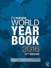
2016Adhya-9781857438192T&F/ROUTLEDGE 2016. Paperback. New. T&F/ROUTLEDGE paperback
2016Adhya-9781857438192T&F/ROUTLEDGE 2016. Paperback. New. T&F/ROUTLEDGE paperback
1820BB0781London: John Murray Albermarle-Street 1820. First Edition. Paper-covered Boards. First Edition with the rare 4-page publisher's catalog dated April 1820 of this classic of economic theory. 8vo: vi601 1pp. "London: Printed by C. Roworth Bell-yard Temple-bar." on colophon and title-page verso as called for. Uncut in the original publisher's drab blue paper-covered boards largely unopened with brown paper spine and remnants of original printed label. Internally fresh and bright with only occasionally spotting original spine largely perished but restored sensitively by an expert conservationist the boards somewhat stained and bumped but thoroughly original hinges reinforced. Small owner's book label probably contemporary partly effaced reading T Cobb. Clamshell case with leather spine label gilt. An unsophisticated copy of a truly scarce in publisher's binding important and desirable book a cornerstone of economic thought and a major influence on other scientific endeavors including the principles of evolution developed by Charles Darwin and Alfred Russell Wallace. Goldsmiths'-Kress 22767. Kress C577. Lowndes 1459. The title of Malthus's final major work is "something of a misnomer as the book was conceived as a series of tracts rather than a comprehensive and systematic treatise. . . . The Principles had only a limited impact at the time and was severely criticized by J. R. McCulloch and David Ricardo; the latter prepared extensive critical notes. But more recently it has received greater recognition largely as a result of the comments by John Maynard Keynes in the 1930s. Keynes argued that Malthus's theory of effective demand provided a scientific explanation of unemployment and that the hundred-year domination of Ricardo over Malthus had been a disaster for the progress of economics. Keynes believed that if economics had followed Malthus instead of being constrained by Ricardo in an artificial groove the world would be a much wiser and richer place." ODNB N. B. With few exceptions always identified we only stock books in exceptional condition carefully preserved in archival removable mylar sleeves. All orders are packaged with care and posted promptly. Satisfaction guaranteed. Fine Editions Ltd is a member of the Independent Online Booksellers Association and we subscribe to its codes of ethics. John Murray, Albermarle-Street unknown