34 270 résultats
Lot of 6 issues of Germany's first published aviation magazine, Der Flieger, published by the founder Kurt Tucholsky during the Great War, these issues featuring flying aces such as the Red Baron Manfred von Richthofen and leading tactical pioneer of aerial formations Oswald Boelcke, and notable events taking place in the air and on the frontlines of the Great War. Octavo. Illustrated field newspapers, issues number 19, 22, 23, 34 from 1917, issue number 29 dated May 1918, and issue number 1 dated October 1918 Text is in German. Magazines vary slightly in size, the smallest measuring approximately 26 x 35 cm and the largest measuring approximately 27 x 38 cm. Some chips and small tear at extremities, otherwise in very good condition, nicely preserved. Der Flieger was published by Kurt Tucholsky (1890-1935), who became one of the most important journalists of the Weimar Republic. Der Flieger was a field newspaper, now remembered as the oldest German aviation monthly periodical. From 1915 to 1917 Tucholsky served in the artillery flying school East I in Alt-Autz. From 26 November 1916 to November 1918 he published the field newspaper Der Flieger. Tucholsky was one of the most important journalists of the Weimar Republic Early issues of Der Flieger are exceedingly scarce. The present lot features Richthofen's 75th victory described by one of the very first men with whom Richthofen shared the details only two hours after the bold action, not long before he lost his own life in combat, an account of how in 1916 Oswald Boelcke earned the award "Pour le Mérite" along with Max Immelmann, an aviator's aerial view of Verdun shortly after the great battle of 1917, and more. Richthofen's 75th victory, a most notable attack which earned him a prestigious chivalry award, is recounted by one of the very first men who heard the details firsthand from the gallant aviator himself - only a couple of hours after the incident. Flying Ace Manfred von Richthofen, the famed Red Baron, is featured in the issue of 12 May 2018 with an article titled "Wie Richthofen seinen 75. abschoß [How Richthofen Shot Down his 75th." Richthofen had died in air combat only six weeks earlier on 21 April 1918, being the highest-scoring ace of the war, eventually being credited with 80 official victories. The account is written by a Lieutenant Lampel, who had only just met the famous ace for the first time on 2 April 1918. Only a couple of hours earlier Richthofen had claimed his 75th victory, by taking the lives of 19-year-old Second Lieutenant E.D. Jones and Second Lieutenant R.F. Newton. Flying ace Oswald Boelcke is featured with a portrait sketch on the front of the October 1918 issue, which is followed by an article describing the event that earned him the prestigious award "Pour le Mérite" being the second Great War aviator to receive the honor, immediately after and on the same day as Max Immelmann. Published for German aviators and frontline fighters alike, the issues center on matters timely and relevant to those who were directly involved in the monarch's scheme for economic and political domination of central Europe and the creation of a German colonial empire.
"For Improvements in Fire-Arms" [England], 25 July 1872. Manuscript Victorian patent document on vellum, folded and docketed, a rare and excellent example of a patent of invention for a guns, granted to William Edward Blake of New York City. Large printed document completed in manuscript and measuring approximately 76 x 51 cm, with original blue paper revenue stamp for five pounds, and a double-sided yellow wax seal measuring 16 cm in diameter. Small perforation at fold, age-toning to verso, otherwise in very good and original condition, a lovely and bright document, as issued, with a scarce large Victorian wax seal in its original round tin case. A round black tin container houses the massive double-sided yellow wax seal, diameter 16 cm (6.25 inches), attached to the document by original red plaited cords, one side being the Great Seal of the Realm, the other being Queen Victoria seated on a fully caparisoned royal horse. Diminutive fissures to sides of seal, otherwise in very good original condition, with vivid and crisp wax impression. The Commissioners of Patents' Journal, September 1872 issue, records this patent, no. 2224, being granted provisional protection for six months, as also stated in the document itself. Rare official patent document for an invention for "improvements in fire-arms" valid for fourteen years and issued to William Edward Blake, an inventor from New York City. Patent number 2224 was valid in the United Kingdom of Great Britain and Ireland, the Channel Islands, and Isle of Wight, with the condition that the specified stamp duty payments were remitted at the times specified, one hundred pounds being payable in the seventh year after the initial patent issue date, for example. Excerpt from the patent: "... Whereas William Edward Blake of the City of New York, United States of America, hath by his petition humbly represented to Us that he is in possession of an Invention for Improvements in Firearms, which the inventor believes will be of great public utility, that he is the first and true inventor thereof... that the same is not in use by any other..." End Excerpt In the following year, 1873 William Edward Blake would receive at least one patent from the United States Patent Office, "for improvements to gun-stocks and spades, patent number 135,624." Blake described this dual-purposed instrument to be especially useful to American soldiers, in particular the Corps of Royal Sappers, Miners, and Engineers, by reducing the weight and number of tools carried over long distances. In essence he devised a two-in-one gun and spade by affixing a small shovel to the gun-stock which served dually as the shoulder rest when firing. It is conceivable that the present patent, valid in the United Kingdom, was for the same apparatus. Little is revealed about Mr. Blake in the present document, apart from his American citizenship and skill in manufacturing firearms for improved efficiency. Further research, however, may find the inventor to be a relation or even a partner of other Blake family gun makers. For example, John Henry Blake, was the manufacturer of a bolt action 7-shot revolving magazine sporting rifle, which was similar to a military type tested by an Ordnance Board of Governor's Island, New York, in July 1891. Blake, P. & E. W. of New Haven, Connecticut, manufactured Model 1821 muskets; the two partners are believed to have been the nephews of Eli Whitney Sr., and also to have been the trustees of the Whitney Armory from 1823 until Eli Whitney Jr. came of age in 1842. And earlier, the firm French, Blake and Kinsley, musket makers, secured a contract for 4,000 stand of arms on 20 October 1808, having delivered at least 2,175 units by 7 October 1812. The Great Seal of the Realm or Great Seal of the United Kingdom (prior to the Treaty of Union the Great Seal of England, then until the Union of 1801 the Great Seal of Great Britain) is a seal that is used to symbolize the Sovereign's approval of important state documents. Sealing wax is melted in a metal mould or matrix and impressed into a wax figure that is attached by cord or ribbon to documents that the monarch wishes to make official. Queen Victoria had to select four different Great Seal designs during the sixty-three years of her reign. England's patent law began to be criticized in the 1850s, for obstructing research and benefiting the few at the expense of public good. According to historian Adrian Johns, the campaign "remains to this day the strongest ever undertaken against intellectual property", coming close to abolishing patents altogether. Despite much public debate, the system wasn't abolished, though it was reformed with the Patent Law Amendment Act of 1852. This simplified the procedure for obtaining patents, reduced fees and created one office for the entire United Kingdom, instead of different systems for England and Wales and Scotland. Around the same time, however, an anti-patent movement began to take shape, and would continue until the early 1870s, spirred by inventors, entrepreneurs, and radical laissez-faire economists. Prominent activists included Isambard Kingdom Brunel, William Robert Grove, William Armstrong and Robert A. MacFie. A new sequence for numbering patents also began in October 1852. Patents applied for between October and December 1852 were numbered from 1-1211. For each subsequent year patents were numbered in annual sequences beginning with the number 1. This system was in place until 1915. Manuscript
Rare Arnoux Hippolyte albumen photographs of Port Said taken circa 1869, contemporary to the opening of the Suez Canal, and still on their original uncut albumen leaf. Together with a rare albumen carte-de-visite portrait photograph of Ferdinand de Lesseps taken in the acclaimed studio of Charles Reutlinger in Paris in 1863. The Port Said CDV size albumen photographs feature embedded manuscript captions in French, and measure approximately 9 x 5 cm, remaining together on the single uncut albumen leaf measuring 20 x 7 cm. The complete carte-de-visite of Ferdinand de Lesseps, having one round-trimmed corner, the photographer's two studio addresses and the coat of arms of the Kingdom of Great Britain printed to verso, measures approximately 6 x 10, and the mounted portrait photograph measures approximately 5,5 x 9. De Lesseps' biography annotated in manuscript in pencil to verso. Minor creasing to some corners of leaf, slight age-toning to De Lesseps photograph, otherwise the lot is in Very Good Condition. Uncut CDV Photographs are exceedingly scarce; early photographs of Port Said are also rare, making this a most uncommon and valuable addition to any photography collection. The uncut albumen leaf of 10 photographs is the work of acclaimed French photographer Hippolyte Arnoux who is best remembered for his superior photographic documentation of the construction of the Suez Canal from start to completion. This lot of photographs is especially reminiscent to the artist as he earned his fame with his important and stellar photography of the construction of the canal. Being in the form of an uncut leaf, as such preserved in its most original status, makes it an invaluable and remarkably scarce primary source artefact. The highlight of one of the photographs, which aids to date the images, is captioned "Fare de Port Saïd" and shows the iconic lighthouse designed by François Coignet. The city being only modestly developed at the time, two nostalgic photographs serve to memorialize the early days of what would become a global center; these are captioned "Port et Ville de Port Saïd" and "Entree du Canal a Port Saïd". At the dawn of a new era, we notice the large sailing vessels which would soon be replaced by steam powered steel cruisers. One of the photographs, captioned "Quay Mehemet Ali a Ismailia" shows the grand villa where de Lesseps was based, his residence and office at Ismailia. A close-up view of the aforementioned guard shelters and reception dock on the shore of the Suez Canal is seen in a photograph of one of De Lessep's first passenger steamers utilized on the canal. The vessel is approaching the residence of the viceroy and at least three individuals in a canoe are preparing to disembark. The photograph of Ferdinand de Lesseps was taken circa 1863 by Charles [Carl] Reutlinger (1816-1888) whose photography studio in Paris quickly rose to prominence, becoming the most notable studio of its day, and famous for its portraits of politicians, visiting dignitaries, royalty, actors, artists, musicians, composers, opera singers, ballet dancers, philosophers, members of clergy (Catholic, Jewish and Protestant), essentially all manner of notables of the period.
Rudolf Diesel's retained copy of his own signed manuscript letter to Samuel Breslauer, concerning the installation of a gas engine. Text is in German. 4to. Two single leafs, 2 pages of text on onion skin paper measuring approximately 30 x 24 cm. Minor age-toning, otherwise in very good condition. In this correspondence, Diesel describes alterations being made to the design of his first prototype, making comments on the compressor, transmission, and the lighting system (ignition), among other things. The second prototype, described here, would be built by October the same year. The specific plan for this engine model is noted in the upper margin: Plan F.B.930. Rudolf Christian Karl Diesel (1858-1913), needing no introduction, was a German inventor and mechanical engineer who is world-famous for having invented the Diesel engine. At the time of this letter, Diesel was diligently working on altering and perfecting his 1893 engine design. This design would later be known as the diesel engine. The first prototype Motor 150/400, had been completed 12 July 1893. Initial tests proved it to be a successful concept. By October 1895, after the first prototype had been converted into the second prototype Motor 220/400. After testing, and always seeking to improve, again it was decided that a completely new engine had to be designed from scratch. On 20 February 1896, Krupp, Maschinenfabrik Augsburg, and Diesel, decided to start the development of the new engine. The new engine was supposed to be a 250 mm bore engine with a 400 mm stroke. On 5 March 1896, Diesel filed a patent application for supercharging; on 26 March, it was decided to build the new engine with a supercharger. In order to improve the efficiency of the development process, a new design bureau was built directly into Diesel's Augsburg testing laboratory. Several young engineers worked there, including Imanuel Lauster. On 30 April 1896, after Lauster had completed the drawings, the workshop at Augsburg began making parts for the engine. The first successful Diesel engine Motor 250/400, designed by Rudolf Diesel, was officially tested in 1897 by German industrial engineer Moritz Schröter. Schröter concluded, "we are beholding a quite marketable machine that has been thoroughly designed with great attention to every single detail." At this time, several firms bought licences for building legal copies of the Motor 250/400. It is now on display at the German Technical Museum in Munich. The recipient of the correspondent is Samuel Breslauer (1870-1942), a lawyer, journalist and editor, who rose to be head of the Politics department for the Berlin newspaper "Berliner Lokal Anzeiger", a daily newspaper with one of the highest national circulations of its time. Breslauer is remembered as one of the numerous Jews who were captured and deported camp during the holocaust. Surely his public role would have made him an immediate target by the German extremist leader. In August 1942, Breslauer and his wife Bertha were taken to the Theresienstadt concentration camp where they both died, she within four days.
Manuscript diary with several drawings, kept by an Englishman who travelled with his family to Germany, Belgium, Switzerland from 29 May 1867 - 15 June 1867, then to France from 1 June 1873 - 12 December 1874, relocating them for these 15 months to Normandy. Contains approximately 36 drawings, one which is a double-leaf scene pasted within, and a few botanical specimens mounted within. Accompanied by a travel itinerary with colour map detailing part of the first journey to the continent in 1867. 8vo. 2, 136, 156 pages. Brown leather boards, tooled front and back. Volume measures approximately 10 x 15 x 2 cm. Map/itinerary leaf measures 18 x 12,5 cm. Wear to boards especially at spine, front hinge delicate, otherwise in very good condition, an interesting Victorian diary. The writer is John Davis Britton, born on 28 December 1832 as revealed within the diary when he celebrates his 41st birthday at home in Vire. He is travelling with his wife Kitty, and children, at least five of whom are named - Lizzie, Aline, Ethel, Diddy, Dick. The delightful two-week travel to the continent features accounts of Lucerne at the dawn of tourism before most of today's historic hotels were even built, and highly favourable descriptions of Freiburg im Breisgau which has nothing short of enamoured the visitors. Manuscript
Mm 200x270 Opera completa nei suoi 4 volumi pubblicati tra il 1845 ed il 1850. Legatura in mezza pelle marrone con titolo e fregi in oro al dorso che è interessato da leggere abrasioni ai margini, piatti marmorizzati. Vol. I°, 1845, di 654 pp. con 24 tavole a colori non comprese nel testo. Vol II°, 1847, di 582 pp. con 16 tavole a colori non comprese nel testo. Vol. III°, 1849, di 552 pp. con 15 tavole a colori non comprese nel testo. Vol. IV°, 1850, di 608 pp. con 20 tavole a colori non comprese nel testo, ( la prima in apertura, che riguarda Talleyrand, ha un minuscolo foro ed è interessata da gore causate,crediamo, dallo stesso stampatore). In questo ultimo volume sono aggiunti rispetto alla edizione francese ed alla prima in lingua italiana (1833) il "Testamento di Napoleone", le "Massime di Napoleone relativamente alla Guerra", le "Massime estratte dalle Memorie del celebre Generale italiano Montecuccoli", le "Lettere di Napoleone a Giuseppina, durante la prima Campagna d'Italia, il Consolato e l'Impero; e lettere di Giuseppina a Napoleone ed a sua Figlia", lo "Assassinio del Maresciallo Brune", la "Dell'Evasione di Napoleone dall'Isola d'Elba", i "Pensieri di Napoleone dulla Divinità". Sporadiche e tenui fioriture riguardano le prime ed ultime carte dei quattro tomi, peraltro tutta l'opera è assai fresca ed in ottime condizioni complessive. Tutte le 75 incisioni in rame con la loro coloritura coeva, che illustrano le battaglie e i loro protagonisti, sono presenti. Text in Italian. "Weighing over 2 Kg. international orders may need extra shipping". Spedizione in 24 ore dalla conferma dell'ordine.
50315aafTiguri (Zürich), typs Heideggeri, 1751, in-8vo, 7 Bl. + 241 S. (S. 213 bis 230: Jacobi Le Long, ... de scriptoribus historiae naturalis Galliae; S. 231 bis 241: Index authorum), teils etwas gebräunt, späterer Ganzlederband auf Bünden im Stil der Zeit, vergold. Titel a.d. Rücken, marmorierter Schnitt. Schönes Exemplar.
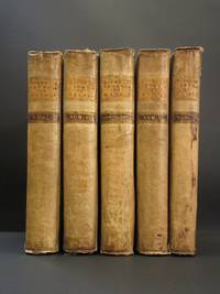
17531196A011Haya Haia/Geneva Palmyra: A Spese Di Errigo-Alberto Gosse E Comp / All' Insegna Della Verita 1753-1755. Hardback. Printed pages: 4to xxxii 524 viii 573 viii 564 xii 560 xii 303 1 blank 84 46 index. Very Good Minus. 8 x 10 inches 20 x 25.5 cm. Complete four volume set plus uniformly bound first edition of the posthumous works volume. Contemporary vellum bindings with some splits to edges staining to spine of volume V. Musty smell some light foxing. Stain to upper corner of early leaves in volume III. Portrait frontis and one further plate in volume I. Italian language. An early printing of Giannone's landmark history of the Kingdom of Naples. A scarce complete set. Overall condition is Very Good Minus. Please Note: This is a very heavy item and international postage will be more than the standard rate - a postage supplement will be requested after the order has been placed. Please contact us for an accurate postage cost for your location. Size: 8 x 10 inches 20 x 25.5 cm. A Spese Di Errigo-Alberto Gosse E Comp / All' Insegna Della Verita hardcover
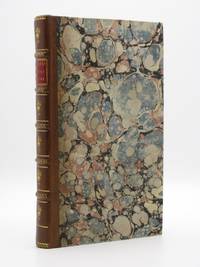
17921206T039London: J. Debrett 1792. 1st Edition . Hardback. Printed pages: 8vo. xxiv 336 22. Very Good. 5.25 x 8.75 inches 13.5 x 22 cm. First English language edition. Translated with considerable additions from the third Russian edition Obozrenie Rossiiskoi Imperii 1790. Recent half calf leather binding with marbled boards. Spine with five raised bands red morocco title label gilt ornament to each compartment. Good solid binding a little light foxing text is otherwise very clean throughout. Complete with the fold-out map and large fold-out plate of arms and uniforms of the different governments of the Russian Empire both with old paper repairs to reverse. Errata to final page. Lacking the half-title. One of the first geographical descriptions of Russia. Includes modern day Estonia and Latvia as the Riga Governorate. ESTC: T188833 & T203474. Overall condition is Very Good. Size: 5.25 x 8.75 inches 13.5 x 22 cm. J. Debrett hardcover
2019__0367175207Routledge 2019. Hardcover. New. 51 edition. 1292 pages. 10.75x8.25x2.50 inches. Routledge hardcover
2018__1857439422Routledge 2018. Hardcover. New. 48 new edition. 1590 pages. 11.25x8.50x2.75 inches. Routledge hardcover
2019__0367175347Routledge 2019. Hardcover. New. 22 edition. 889 pages. 11.75x8.50x2.25 inches. Routledge hardcover
2018__1857439457Routledge 2018. Hardcover. New. 21 new edition. 926 pages. 11.00x8.50x2.25 inches. Routledge hardcover
2019__0367174863Routledge 2019. Hardcover. New. 22 edition. 649 pages. 11.50x8.75x1.75 inches. Routledge hardcover
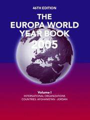
2005__1857433068Europa Pubns 2005. Hardcover. New. 46 edition. 4450 pages. 13.25x10.75x6.50 inches. Europa Pubns hardcover
2015__185743790XRoutledge 2015. Hardcover. New. 47 revised edition. 1392 pages. 11.22x8.74x2.40 inches. Routledge hardcover
2022__1032274301Routledge 2022. Hardcover. New. 31 edition. 664 pages. 11.00x8.50x1.50 inches. Routledge hardcover
Rara carta del Mediterraneo stampata a Londra da John Bowles e dedicata al re George II.Ristampa della lastra che William Berry dedica a re James II, databile al 1685 circa.La famiglia dei Bowles è una delle più importanti tipografie londinesi del XVIII secolo. L’azienda fu fondata da Thomas Bowles I (m. 1720). Il fulcro della sua attività era la vendita di stampe e la pubblicazione di libri nella stamperia che si trovava in una strada trafficata nel cuore della città di Londra, vicino alla Cattedrale di St. Paul. Stampavano con indirizzo St. Paul’s Church Yard. Fu seguito negli affari dai suoi due figli, John (1701 - 1779) e Thomas II (1688 - 1767), il quale, dopo aver preso in mano l’attività nel 1714 circa, divenne uno dei più importanti editori di stampe a Londra. Thomas II fu anche partner di numerosi progetti di atlanti, quali il Britannia Depicta (1720) di Emmanuel Bowen, il New Description of England and Wales (1724), il The World Described (1726) e il The Great English Atlas (1750) di Herman Moll. Grazie alla collaborazione con suo fratello, pubblica un numero di interessanti mappe sciolte, che descrivono importanti eventi del periodo: mappe del teatro di guerra, piani di assedio e piani di battaglia. John Bowles era un prolifico editore di materiale originale che descrivesse in dettaglio le ultime scoperte nel Canada artico, gli assedi spagnoli di Gibilterra, gli ultimi sviluppi urbanistici della città di Londra, e così via. Intorno al 1753 collaborò con suo figlio Carington (1724 - 1793) e insieme lavorarono per dieci anni come John Bowles & Son. Nel 1762 Thomas II si ritirò in favore di suo figlio Thomas III, il quale morì improvvisamente, nello stesso anno; Carington lasciò la collaborazione con suo padre per subentrare allo zio Thomas II e in seguito mantennero attività separate. Carington Bowles era un tipografo che pubblicò diverse mappe; dapprima con indirizzo S.t Pauls Church Yard, poi con Post-Chaise Companion (dopo il 1780). Particolarmente note sono le sue mappe caricaturali - dai disegni di Robert Dighton - su Inghilterra e Galles, Scozia e Irlanda rappresentate come figure umane. Gli successe suo figlio, Henry Carington Bowles (1763 - 1852), che in società con Samuel Carver, continuò nell’attività familiare. Acquaforte, stampata su due fogli, finemente colorata a mano, in ottimo stato di conservazione. A very rare map of the Mediterranean Sea, published by John Bowles in London. Printed with the original plate by William Berry, with the dedication to King James II (circa 1685).Etching, printed form two plates, with contemporary colouring, very good condition.The family business was established by Thomas Bowles (I) (d. 1720). The core of his business, and that of his successors, was print-selling and publishing, with a sideline in maps that might be of interest to visitors to his shop, found at the Corner of ‘Paul’s Alley’, next door to the Chapter-House in St. Paul’s Church Yard, a bustling thoroughfare in the heart of the City of London, by St. Paul's Cathedral.He was followed into business by his two sons, Thomas (II) and John; the business was transferred to Thomas (II) in about 1714, with the agreement that he would pay a total of £1,000 to John when he came of age, so he could set up his own business. Thomas (II) (1688-1767) went on to become a leading, and highly successful, London printseller and publisher. As a retailer, he also catered to map buyers; he published what might be termed “good shop stock”: separately published plans of London and environs, including an early pocket plan of the city, maps of England and Wales, Scotland, the British Isles, the world and so on. He was also a partner in a number of atlas projects, notably Owen and Bowen’s road-book, the ‘Britannia Depicta’, (1720), Moll’s ‘New Description of England and Wales’ (1724), ‘The World Described’ (1726 onward) and the ‘Large English Atlas’ in the 1750s.Then, often working in conjunction with his brother, he published numbers of interesting broadsheet maps depicting important events of the period, such as theatre of war maps, siege-plans and battle-plans that would interest and inform his customers, to supplement the brief accounts in the news-sheets of the day, which were mostly unillustrated. Much of Bowles’ broadsheet output is rare today.His brother John Bowles (1701-1779), in map terms at least, is the more interesting of the brothers; without the benefit of an existing stock to exploit, he had to rely on producing new and interesting maps for his clients. He is generally to be found as a co-partner with his brother on atlas projects, and they sometimes shared other publications. They were also avid buyers of existing plates, which could be put back into service, but John was a prolific publisher of original material, sold separately over his shop counter, whether detailing the latest discoveries in Arctic Canada, Spanish sieges of Gibraltar, maps of London with the latest developments, or wall maps of the world, Americas, and so on.In about 1753, he was joined in partnership with his son Carington, and they worked together for about ten years as John Bowles & Son; by 1762, Thomas (II) had retired in favour of his son Thomas (III), but in that year Thomas (III) died suddenly. His father was compelled to return to trade, but with no intention of remaining; a deal was struck, and Carington left the partnership with his father to take over from Thomas (II) and thereafter they maintained separate businesses. The break does not seem to have been entirely a happy one; they continued to co-operate on existing stock, but generated little new together; when John died in 1779, the business went to Robert Wilkinson, who continued it on into the eighteenth century, content to reuse the existing plate stock with little interest in improving it.
Acquaforte, dimensioni 525x775 mm. Imprint editoriale in lastra, nel cartiglio con il titolo: A Paris chez Basset Rue S.t Jacques au coin de celle des Mathurins, à l’Image S.te Genevieve. Il tient Magasin de toue sortes de Papiers en Rouleaux.Raro portolano dell'Europa e Mediterraneo, in ottimo stato di conservazione.Carta nautica dell’Europa realizzata aggiornando la matrice della carta pubblicata da Alexis-Hubert Jaillot nel 1699 circa. Scompaiono tutti gli elementi decorativi, compreso il grande cartiglio barocco in alto a destra, sostituito da un semplice riquadro. Abraso anche il cartiglio che conteneva le scale grafiche, che rimangono nell’angolo superiore sinistro. La carta è completamente emendata, con nuovi toponimi scritti con lettering differente; piccole correzioni anche di carattere geografico nelle linee di costa e nel corso di alcuni fiumi.Louis Denis (1725-1794) è stato un incisore, cartografo e geografo francese. È noto soprattutto per aver pubblicato Le Conducteur français, una guida per le strade del regno di Francia. Sappiamo molto poco della sua vita; sembra che la sua occupazione originaria fosse quella di incisore. Nel 1760, unì le forze con l’ingegnere-geografo ed editore Louis-Charles Desnos per modificare ed aggiornare le mappe esistenti. Louis Denis aveva la qualifica di “géographe des enfants de France”; diede una solida cultura geografica al duca di Berry, futuro Luigi XVI. La sua opera più importante è stata Le Conducteur français, contenant les routes desservies par les nouvelles diligences, messageries & autres voitures publiques; avec un détail historique & topographique des endroits où elles passent, même de ceux qu'on peut apercevoir [sic]; des notes curieuses sur les chaînes des montagnes qu'on rencontre, etc. :si tratta di itinerari di viaggio per ciascuna delle strade principali del regno, accompagnati da mappe di alta precisione e qualità che lo rendono uno degli antenati delle guide di viaggio moderne. Iniziata nel 1776, l’opera non fu mai completata; vennero pubblicati solo 52 itinerari di viaggio. Ogni opuscolo ottenne l’approvazione di Didier Robert de Vaugondy (1723-1786) che dal 1773 era censore reale per la geografia, la navigazione e i viaggi. Louis Denis fu anche autore di numerose planimetrie di Parigi, stampate tra il 1758 e il 1781.Andrè Basset “il giovane” fu editore, scrittore e commerciante di stampe. Fratello del libraio ed editore di stampe Antoine Basset “il vecchio”. Le prime notizie su di lui lo danno attivo nel febbraio 1749. Nell’aprile del 1779, fu accusato di aver contraffatto la suite di “Modes et costumes français” pubblicata da Esnault e Rapilly. Nella sua abitazione furono raccolte e confiscate 262 incisioni, che vennero poi distrutte l’11 di dicembre. Aveva un negozio in Rue St. Jacques, la strada di Parigi degli incisori e tipografi, e stampava con la marca tipografica con “l’Image S.te Genevieve”. Deceduto nel giugno 1787, viene spesso confuso con suo figlio e successore Paul-André Basset. Etching, signed after the title: A Paris chez Basset Rue S.t Jacques au coin de celle des Mathurins, à l’Image S.te Genevieve. Il tient Magasin de toue sortes de Papiers en Rouleaux.Rare pilot of Europe and the Mediterranean, in excellent condition.This chart of Europe was made updating the plate published by Alexis-Hubert Jaillot in about 1699. All the decorative elements disappear, including the large Baroque cartouche at the top right, replaced by a simple "box". The cartouche containing the graphic scales, which remain in the upper left corner, is also erased. The chart is completely amended, with new toponyms written in different lettering; small corrections also of geographic character in the lines of coast and in the course of some rivers.Louis Denis (1725-1794) was a French engraver, cartographer and geographer. He is best known for having published Le Conducteur français, a guide on the streets of the kingdom of France. We know very little about his life; it seems that his original occupation was that of an engraver. In 1760, he joined forces with engineer-geographer and publisher Louis-Charles Desnos to modify and update existing maps. Louis Denis had the title of "géographe des enfants de France"; gave the Duke of Berry, future Louis XVI, a solid geographical culture. His most important work was Le Conducteur français, contained in the routes desservies par les nouvelles diligences, messageries & autres voitures publiques; avec un détail historique & topographique des endroits où elles passent, même de ceux qu'on peut apercevoir [sic]; des notes curieuses sur les chaînes des montagnes qu'on rencontre, etc. : these are travel itineraries for each of the main streets of the kingdom, accompanied by maps of high precision and quality that make it one of the ancestors of modern travel guides. Begun in 1776, the work was never completed; only 52 travel itineraries were published. Each booklet obtained the approval of Didier Robert de Vaugondy (1723-1786) who from 1773 was royal censor for geography, navigation and travel. Louis Denis was also the author of numerous plans in Paris, printed between 1758 and 1781.Andrè Basset "the young" was a publisher, writer and print dealer. Brothers of the bookseller and print publisher Antoine Basset "the old". He had a shop on Rue St. Jacques, the Parisian street of engravers and printers, and he printed with the typographical mark with "Image S.te Genevieve". Died in June 1787, he is often confused with his son and successor Paul-André Basset. S. Bifolco, "Mare Nostrum, Cartografia nautica a stampa del Mar Mediterraneo" (2020), p. 283, tav. 133.
Carta tolemaica dell'antica regione della Sarmazia corrispondente all'attuale territorio di Ucraina e Russia. Nel 1522 Fries produsse un’edizione della Geographia di Tolomeo, basata sulla versione di Strasburgo del 1513 di Martin Waldseemuller. Le carte furono rielaborate e ridotte nel formato, apportando lievi modifiche. Successivamente ristampata nel 1525, sempre a strasburgo, e nel 1535 a Lione e 1541 a Vienne, con modifiche nei titoli e nelle scritte al verso. Esemplare tratto dall’edizione del 1525, del "Claudii Ptolemaei Alexandrini Geographicae Enarrationis".Xilografia, finemente colorata a mano, in ottimo stato di conservazione. Ptolemaic map of the ancient Sarmatia region corresponding to the current territory of Ukraine and Russia.From 1525 Laurent Fries edition of Waldseemuller's Atlas, one of the most sought after of all editions of Ptolemy.Woodcut, finely colored by hand, in excellent condition.
18054967A Clermont, de lImprimerie de Landriot, An XIII (1805). 1805 1 vol. fort in-8° (215 x 144 mm.) de : [4] ff. (Faux-titre, Titre, Dédicace); IX (Avertissement); [1] p.b., 459 pp.; [3] pp. (Errata, Remarques sur les planches); 2 tableaux dépliants reliés in-fine. (ex-dono de l'auteur à Mme Jourdes sur le faux-titre: «Lauteur fait hommage de cet ouvrage à Madame Jourdes»). (Exemplaire non rogné. Petites taches et rousseurs marginales, trace de mouillure dans la partie supérieure des premiers ff.). Cartonnage bleu éditeur.
Delineata sulla scia della più grande veduta di Jeremias Wolff, l’opera offre quaranta riferimenti topografici. Il Leopold, era un modesto incisore ed editore di Augsburg; la sua serie di vedute di città, da cui questa incisione è tratta, venne pubblicata con pochissima tiratura, rendendo quindi le opere particolarmente rare. Incisione in rame, in ottimo stato di conservazione. Leopold was a modest engraver and publisher in Augsburg; the series of city views, from which this one is taken, has been published in a very limited circulation, which means these works are very rare. A finely-engraved view of pre-fire London seen from the south side of the Thames with fashionably dressed figures promenading in the foreground. With descriptions below in both German and Latin separated by the coat of arms of London. Joseph Friedrich Leopold (1668-1726) was an engraver in Augsburg, taking over the publishing firm of J.U. Kraus in 1719. His son, Johann Christian Leopold (1699 - 1755), succeeded him. Copperplate, in excellent condition.
Rarissima veduta prospettica della città di Reims, circa 1630, firmata in basso a sinistra E. Moreau fe & excudit. Acquaforte e bulino, impressa su carta vergata coeva, con margini, in ottimo stato id conservazione. Edmé Moreau era un incisore francese, nato nel febbraio 1596 a Châlons-en-Champagne e morto nel novembre 1648 a Reims.Nipote di Claude Chastillon, esercitò il suo mestiere a Reims dal 1617 fino alla sua morte, ma fu più attivo dal 1620 al 1648. Avrebbe anche lavorato a Parigi intorno al 1601. Le sue opere più importanti e migliori furono eseguite per la città di Reims, dove abitò in rue Saint-Étienne, poi lavorò con François Bernard al Griffon d'Or, Nicolas Hécart alla Bible d'Or e collaborò con l'incisore Nicolas Son. Durante la Prima Guerra Mondiale i suoi disegni e le matrici, che costituivano l'importante calcografia della città, furono danneggiate dall'incendio del 1917; poi restaurate e ricostituite dall'artista locale Abel Jamas. Le sue opere sono numerose; il suo bulino si distingueva per finezza e leggerezza. All'epoca l’arte dell'incisione era lontana dalla perfezione, ma Moreau sembra un precursore della grande scuola francese. Eseguì le sue opere più importanti e migliori per la città di Reims, tra cui tre piante prospettiche. La prima, derivante da un disegno dello zio Claude Chastillon, è datata 1622 ed è dedicata ai cittadini di Reims. Questa terza prospettiva, in ordine cronologico sebbene priva di data, è relativa a qualche anno dopo. Aggiunse una cornice di vignette – in un panneggio decorato con frange - che rappresentano le facciate degli edifici più prestigiosi della città, tra cui la cattedrale, il municipio, la tomba di Saint Remi, il portale di Saint-Nicaise, il battesimo di Clovis e le armi della città con il motto: "Dieu en soit garde". Questo tipo di veduta – sulla base delle mappe dei grandi editori olandesi Blaeu e Visscher -era divenuto molto di moda all’epoca. Opera di grande rarità. Bibliografia V Meyer, GBA 125 (1995), pp. 277-302 Very rare perspective view of the city of Reims, circa 1630, signed lower left E. Moreau fe & excudit. Etching and engraving, printed on contemporary laid paper, with margins, in excellent condition. Edmé Moreau was a French engraver, born in February 1596 in Châlons-en-Champagne and died in November 1648 in Reims. A nephew of Claude Chastillon, he practiced his craft in Reims from 1617 until his death, but was most active from 1620 to 1648. He would also have worked in Paris around 1601. His most important and best works were executed for the city of Reims, where he lived in the rue Saint-Étienne, then he worked with François Bernard at the Griffon d'Or, Nicolas Hécart at the Bible d'Or and collaborated with the engraver Nicolas Son. During World War I, his drawings and matrices, which constituted the city's important chalcography, were damaged by fire in 1917; then restored and reconstituted by local artist Abel Jamas. His works are numerous; his burin was distinguished by finesse and lightness. At the time, the art of engraving was far from perfect, but Moreau seems a precursor of the great French school. He executed his most important and best works for the city of Reims, including three perspective plans. The first, derived from a drawing by his uncle Claude Chastillon, is dated 1622 and is dedicated to the citizens of Reims. This third perspective, in chronological order although undated, relates to a few years later. He added a frame of vignettes - in a drapery decorated with bangs - representing the facades of the most prestigious buildings of the city, including the cathedral, the town hall, the tomb of Saint Remi, the portal of Saint-Nicaise, the baptism of Clovis and the arms of the city with the motto: "Dieu en soit garde". This type of view - based on the maps of the great Dutch publishers Blaeu and Visscher - had become very fashionable at the time. Work of great rarity. Bibliografia V Meyer, GBA 125 (1995), pp. 277-302
Basata sull'opera di Jacob van Deventer del 1550, la carta mostra l’Olanda in maniera molto dettagliata, comprese le piccolo cittadine, le città fortificate, fiumi, laghi (molti dei quali sono stati bonificati nel corso del diciassettesimo secolo e sono quindi scomparsi). In alto a sinistra è inciso uno stemma araldico, un’elaborata rosa dei venti si trova invece al centro in alto. Mappa altamente decorativa delle province olandesi di Friesland, Groningen e Drente e della provincia tedesca di Friesland. Edizione con testo latino. Carta tratta dal Theatrum Orbis Terrarum e che è considerato il primo vero “atlante” moderno. L’opera fu pubblicata in 7 lingue e 36 edizioni, per il quale – nel 1570 - Ortelius ottenne il privilegio, ovvero una sorta di diritto d'autore che impediva ad altri cartografi di pubblicare i propri lavori. Il Theatrum rappresentava il lavoro più avanzato del lavoro della descrizione cartografica. L’Ortelius vi raccolse il sapere geografico e cartografico del suo tempo, proponendo in 147 spettacolari tavole incise l’immagine più fedele del mondo allora conosciuto e, in alcune straordinarie “carte storiche”, regioni e itinerari tratti dalla letteratura, dalla mitologia, dalla tradizione. Ortelius fu anche il primo a citare le fonti, menzionando i nomi dei cartografi nel “catalogus auctorum”. Dal 1598 al 1612 le edizioni postume del Theatrum furono realizzate dal suo collaboratore Johannes Baptiste Vrients. Incisione in rame, eccellente coloritura coeva, in ottimo stato di conservazione. Bibliografia Van den Broecke, Ortelius Atlas maps, 79. Based on the map by Jacob van Deventer (1550). It shows Holland in great detail, including small towns, walled cities, rivers and lakes (many of which were reclaimed in the 17th century, and no longer exist). A coat of arms is in the upper left corner of the map image, an intricate compass rose is in the upper middle area, while in the ocean there are many sailing ships and smaller fishing boats. A very decorative map of the Dutch provinces of Friesland, Groningen and Drente and of the German Province of Friesland. Latin text edition. Map taken from the Theatrum Orbis Terrarum, which is considered the first true modern "Atlas". The work was published in 7 languages and 36 editions, for which - in 1570 - Ortelius obtained the privilege, a kind of copyright that prevented other cartographers from publishing his works. The Theatrum represented the most advanced work of cartographic description. Ortelius collected in it the geographical and cartographic knowledge of his time, proposing in 147 spectacular engraved plates the most faithful image of the world then known and, in some extraordinary "historical maps", regions and routes taken from literature, mythology, tradition. Ortelius was also the first to cite sources, mentioning the names of cartographers in the "catalogus auctorum". From 1598 to 1612 the posthumous editions of the Theatrum were made by his collaborator Johannes Baptiste Vrients. Copper engraving, contemporary coloring, in good condition. Bibliografia Van den Broecke, Ortelius Atlas maps, 79. M. Van den Broecke "Ortelius Atlas Maps" (2011), n. 79.
1832STLN0001Frankfurt, Verlagsmagazin für Literatur und Kunst 1832-34. Gr.-8°. Zus. ca. 2000 S. mit 304 Ansichten in Kupfer- u. Stahlstich auf Tafeln. Grüne Leinenbände der Zeit mit Titel u. feinen Zierleisten in Goldpräg. auf Rü. sowie umseit., rotem Sprengschnitt. Einbände stellenweise berieben u. mit Lichtspuren, Schnitt gebräunt, im Text sauber, aber tlw. gebräunt u. stockfl., die Tafeln sehr frisch. Goedeke XI, 260, 21,9; Kosch V, 674f.; Nebehay-Wagner 725, 8-19 (vgl. zu den enth. Wien-Ansichten). Fünf Sammelbände des reich illustrierten Ansichtenwerkes, das zwischen 1832 und 1840 als Fortsetzungswerk in insgesamt 13 Bänden mit 732 Stichen erschienen ist (Europa: 11 Bände = 104 Hefte; Asien: 2 Bände = 24 Hefte). Verfasser ist der deutsche Schriftsteller und Abenteurer Johann Konrad Friederich (1789-1858). Er trat 1805 in den französischen Militärdienst ein und führte ein abenteuerliches Soldatenleben in Italien und Spanien. F. war beteiligt an der Verhaftung Papst Pius VII. (1809) und überbrachte die Meldung Napoleon nach Schönbrunn. 1819 nahm er Abschied vom Militärdienst und betätigte sich als Schauspieler, Schriftsteller und auch Komponist. - Unsere Sammlung enthält: Bd.I (in 3 Abt.): Italien (Rom / Ober-Italien / Unter-Italien) mit zus. 127 Ansichten; Paris mit 29 Ans. (aus Bd. II: Frankreich); London mit 45 Ans. (aus Bd. III: Großbritannien); Wien mit 12 Ans. (aus Bd.IV: Süddeutschland); Berlin mit 16 Ans. (aus Bd.V: Norddeutschland); Konstantinopel mit 12 Ans. (aus Bd. VI: Türkei); topographisch-historischer Überblick der Schweiz m. 16 Ans. (aus Bd. VI: Schweiz); Brüssel mit 12 Ans. (aus Bd. VIII: Belgien); Athen mit 12 Ans. (aus Bd. IX: Griechenland); Lissabon mit 10 Ans. (aus Bd. X: Portugal und Spanien); Babylonien und Assyrien sowie Syrien mit 12 Ans. (aus Bd.I der II.Hauptabt. Asien). Die reizenden, fein ausgeführten Graphiken meist ohne Stecherangabe zeigen Kunst- und Baudenkmäler sowie Gesamt- und Teilansichten zahlreicher Städte. Teilweise unter Beibindung der Nebentitel. Text- und Tafelteil unvollständig (umfassende Kollation auf Anfrage). - Unterliegt der Differenzbesteuerung.