34 270 résultats
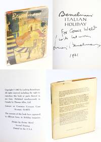
1961564j1805Boston: Houghton Mifflin Company. Very Good in Fair dust jacket. 1961. Second Printing. Hardcover. Signed and inscribed by Ludwig Bemelmans upon half-title page. "In this book you will get a new insight into many of the lovely places of Italy - Venice Rome the Italian Riviera Naples Capri and Ischia. But more important you will meet people the old prince in the Borghese Gardens of Rome the sunny girl who did the chores in Bemelmans' rented villa in Capri and the professor in exile in Ischia the wonderful island that for so long has languished in the shadow of glittering Capri. Bemelmans makes Italy itself more real perhaps than any book on Italy has ever done before." - dust jacket. ix 1 102 p. In addition to the endpapers and frontispiece there are 30 black illustrations by the author. Aside from a drop of liquid visible on pages 98-102 very clean tight and unmarked with light wear. Heavy wear to dust jacket now in glossy new archival-grade protection. A quality signed example by this beloved author and illustrator. Pomerance A22. ; Illustrations; 4to; Signed by Author . Houghton Mifflin Company hardcover
1955442j1514Chicago: The University of Chicago Press. Fair with no dust jacket. 1955. First Edition. Hardcover. "A Jewish journalist recounts his impressions of ten Germans whom he came to know while masquerading as a gentile in a German village immediately following World War II. Concludes that these 'typical' Germans thought of themselves as good and decent people even though they had cooperated with the Nazi regime and felt they had done nothing wrong." - Paul Madden on page 415 of 'Adolf Hitler and the Nazi Epoch'. "The ten former Nazis were each of them a most marvelous mixture of good and bad impulses their lives a marvelous mixture of good and bad acts. I liked them. I couldn't help it. Again and again as I sat or walked with one or another of my ten friends I was overcome by the same sensation that had got in the way of my newspaper reporting in Chicago years before. I liked Al Capone. I liked the way he treated his mother. He treated her better than I treated mine." - pages viii-ix. xii 346 p. Former library copy with relatively few associated markings. Somewhat above-average wear to original black cloth lettered in orange upon backstrip. Binding sound. No dust jacket. Laska 282 Snyder 406; 8vo . The University of Chicago Press hardcover
1822W1311London: R. Ackermann 1822. Complete in 4 volumes with 72 of 72 hand-colored stipple engravings. Abbey Travel 6; Tooley Color Plates 515; Catalogue Russica S1294. Full brown leather. The books are clean and tight. All volumes have been professionally rebacked retaining the original spines. Some relatively minor edgewear; pages and plates are clean and bright. The engraved bookplate of Pearl Haggins designed by Spenceley is affixed to the front pastedown endpaper in each volume. First Edition. Hardcover. Collectible-Very Good. 24mo - over 5" - 5¾" tall. Book. R. Ackermann Hardcover
2021x-036769879XRoutledge 2021. Hardcover. New. 30 new edition. 654 pages. 11.50x8.75x1.50 inches. Routledge hardcover
2014x-1857436997Routledge 2014. Hardcover. New. 14 edition. 750 pages. 11.00x8.25x2.00 inches. Routledge hardcover
1857436660New. Brand new and still unused unknown
Carta nautica della parte occidentale del Mediterraneo, che comprende la penisola. Opera tratta da: Nieuwe Groote Zee-Spiegel, Inhoudende het Straets-Boeck Ofte de Vertooninge en de Beschrijvinge Der Middelantsche Zee, In verscheyde Zee-Karten en Opdoeningen van Landen, etc. Gesneden gedruckt en uytgegeven t’ Amsterdam. By Pieter Goos, op ‘t Water, in de Vergulde Zee-Spiegel, by de Nieuwe-brugh. Anno 1662.L’attività editoriale di Pieter Goos (1616 - 1675) si sviluppa dopo aver acquistato le lastre di rame delle carte nautiche che Anthonie Jacobsz Lootsman fa incidere per il suo De Lichtende Columne ofte Zeespiegel. Goos ristampa ed aggiorna l’atlante del Lootsman, pubblicando sue edizioni di questo lavoro in varie lingue, e aggiungendo nuove mappe. Il suo motto editoriale era “Op ‘t Water, in de vergulde Zeespiegel” (sull’acqua, nello specchio dorato del mare). Con l’indirizzo “Op ‘t Water” Goos stampa la sua prima versione del Lichtende Columne ofte Zee-Spiegel nel 1650; opera che aggiorna con un numero sempre crescente di carte nautiche. Nel 1662 viene alla luce la terza parte dello Zee-Spiegel, il cosiddetto Straets-Boek del Mediterrano, una raccolta di 25 tavole nautiche stampata con testo in olandese. L’atlante nautico del Mediterraneo di Goos ispirò il capitano genovese Francesco Maria Levanto, che nel 1664 tradusse il testo e fece incidere le 25 tavole nautiche per la Prima Parte dello Specchio del Mare, stampato a Genova da Gerolamo Marino e Benedetto Celle. La raccolta di Goos fu poi tradotta per i mercati inglese e francese, pubblicati entrambi nel 1669: il Lighting Colom Of the Midland-Sea e la Troisieme Partie Du Grand et Noveau Miroir ou Flambeau de la Mer. Incisione in rame, coloritura coeva dei contorni, lievi abrasioni e ossidazioni, per il resto in ottimo stato di conservazione.Bibliografia: C. Koeman, Atlantes Neerlandici: Bibliography of Terrestrial, Maritime and Celestial Atlases and Pilot Books Published in the Netherlands up to 1880 Vol. IV, Amsterdam 1970, pp. 192-217, Goos 44 A (1, 2); National Maritime Museum, Catalogue of the Library - Vol. Three, Atlas & Cartography, Londra, 1971, p. 83, n. 92 (nn. 18-19); cfr. R. Shirley, Maps in the Atlases of the British Library, Londra, 2004, pp. 1172-1175. Sea chart of the western part of the Mediterranean Sea, including the peninsula. Pieter was the son of Abraham Goos, cartographer and engraver; he enlarged his father’s business and became one of the most famous engraver of sea charts in Amsterdam of the XVII century. From: Nieuwe Groote Zee-Spiegel, Inhoudende het Straets-Boeck Ofte de Vertooninge en de Beschrijvinge Der Middelantsche Zee, In verscheyde Zee-Karten en Opdoeningen van Landen, etc. Gesneden gedruckt en uytgegeven t’ Amsterdam. By Pieter Goos, op ‘t Water, in de Vergulde Zee-Spiegel, by de Nieuwe-brugh. Anno 1662.Like Colom, Doncker and Jacobsz, he published a sea atlas, the Zee-Spiegel, deriving his work from the plates he was given by Jacobsz. The atlas has been then reissued in different editions and languages, and it was very famous among its contemporaries. Apart from publishing his Zee-Spiegel in the classical part I and II (Europe and Atlantic Coasts) and III (Mediterranean), he started a new tradition, publishing also parts IV and V, depicting routes for West Indies and West Africa. Copperplate, contemporary colour on the outlines, small abrasions, in general in good condition.Bibliografia: C. Koeman, Atlantes Neerlandici: Bibliography of Terrestrial, Maritime and Celestial Atlases and Pilot Books Published in the Netherlands up to 1880 Vol. IV, Amsterdam 1970, pp. 192-217, Goos 44 A (1, 2); National Maritime Museum, Catalogue of the Library - Vol. Three, Atlas & Cartography, Londra, 1971, p. 83, n. 92 (nn. 18-19); cfr. R. Shirley, Maps in the Atlases of the British Library, Londra, 2004, pp. 1172-1175. S. Bifolco, "Mare Nostrum, Cartografia nautica a stampa del Mar Mediterraneo" (2020), pp. 124-125, tav. 48.
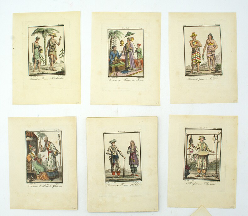
1806PHO-1894Paris, Madame veuve Hocquart, 1806, in-8, sous étui, 123 planches (160) en couleurs, gravées par Lachaussée Jeune, de costumes d'Europe (50 sur 80), d'Asie (34 sur 36), d'Afrique (18) et d'Amérique (21 sur 22), accompagnées de 5 cartes en couleurs (Amérique septentrionale, Amérique méridionale, Afrique, Asie, Europe, toutes datées de 1806, sur 6), manque les 4 frontispices, tache sur une planche sinon aucun défaut.
1717STLD0185Rom, alla spese di Michel' Angelo, e Pier Vincenzo Rossi Librari in Banchi, all' Insegna della Salamandra 1717. 8°. Gest. Titel, Titel, 4 Bll., 614 S., 7 Bll. Mit 25 (statt 24 angegebenen) gef. Kupferstich-Plänen. Pergamentband der Zt. auf 5 Bünden m. Rü.beschriftung v. alter Hd. Einbd. etw. angeschmutzt u. an den Kanten bestoßen, Läsur am unt. Kapital, Vorsätze gebräunt, Titel m. kl. Monogrammstempel, im Text vereinz. braunfleckig aber sauber. ADB 32, S. 397. Neue Ausgabe des erstmals 1600 in Antwerpen in lateinischer Sprache erschienenen Werkes des Antwerpener Ratsherrn und gelehrten Reiseschriftstellers Franz Schott (1549-1622). Schott verwertete darin das Werk des Philologen Stephan Pighius 'Hercules Prodicius', Karten seines, ihm nahe stehenden Landsmannes Ortelius, Werke unterschiedlicher Schriftsteller und außerdem persönliche Mitteilungen seines Bruders Andreas S., der als Jesuit längere Zeit in Italien verweilt hatte. "So ist ein Gemisch von Geschichte, Geographie, Topographie, Dichtung und Wegweiser entstanden, in welchem die Rücksicht auf die Stimmen des Alterthums und auf die kirchlichen Zustände, Gebäude u. s. w. sich weit vordrängt .. " (ADB). - Mit reizenden Stadtplänen aus der Vogelperspektive von Venedig, Bologna, Ferrara, Rom, Ancona, Genua etc. u. einer Gesamtkarte von Italien.
1881000878Paris: Imprimerie Nationale 1881. Hardcover. Very Good. 4to 9 x 11 xciv 854 pages. Ancien eleve de l'Ecole des chartes le historien Arthur-Andre-Gabriel Michel de Boislisle 1835-1908 entra au ministere des Finances et y devint sous-chef des archives. Membre du Comite des travaux historiques membre et secretaire de la Societe des antiquaires il fut elu membre libre de l'Academie des inscriptions et belles-lettres en 1884. Sous les auspices du ministere des Finances et d'apres les documents des Archives nationales Arthur de Boislisle publia la Correspondance des controleurs generaux des finances avec les intendants des provinces 1874-1883 et pour la Collection des documents inedits de l'Histoire de France Les memoires des intendants sur l'etat des generalites 1881. Arthur de Boislisle a egalement laisse une histoire de la Chambre des comptes de Paris 1873 ainsi qu'une monumentale edition des Memoires de Saint-Simon 1879-1908. Rebound in green buckram paper label. Interior spotless. Imprimerie Nationale hardcover
1857437020New. Brand new and still unused unknown
2016__1857438108Routledge 2016. Hardcover. New. 80 revised edition. 2488 pages. 11.75x9.25x5.00 inches. Routledge hardcover
165118077Moguntiae : impensis J. G. Schönwetter 1651 Petit in-4 17x21 cm., plein vélin époque à recouvrement, 6- 778- 104 pp. Titre gravé délié lion belge et carte des Pays-Bas, 26 portrait hors-texte & 30 planches repliées hors-texte. Mouillures en continue en pied, brunisseurs éparses, parfoit soutenues.
2013__1857436970Routledge 2013. Hardcover. New. 60 edition. 1417 pages. 11.00x8.25x1.75 inches. Routledge hardcover
123126o.J. * Lose in Leinenflügelmappe der Zeit (42 x 64 cm; etwas angeschmutzt und stockfleckig, Bindebänder defekt) mit großer eingelassener Ansicht des Ätna auf Sizilien in Original-Temperamalerei (Farbabsplitterungen), monogrammiert und datiert: (18)84. [5 Warenabbildungen]
242530S.l., n.d. (1802-1805) 52 x 33 cm., cadre en pichepin, sous verre (cadre du XIXe siècle).
88087Genève, Jullien, 1908-1919 8 vol. in-12, env. 300 pp. par vol., plusieurs planches (dont des portraits), demi-chagrin brun, dos à nerfs, dos et couv. conservés (rel. moderne). Dos un peu passés mais bon exemplaire.
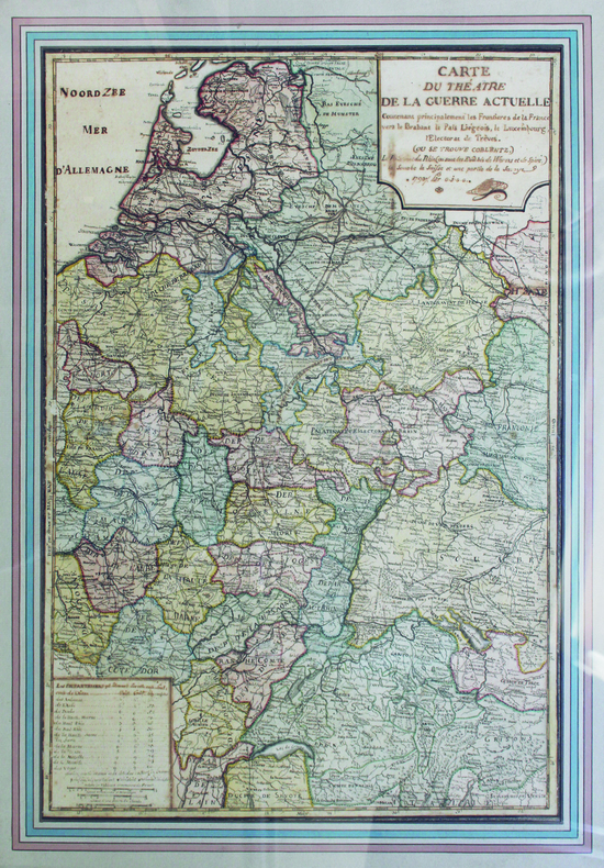
1793LBW-65751793. 65 x 46 cm ; encadrement de bois doré moderne.
2366641790 in-8, veau fauve, dos lisse orné, tranches rouges (reliure de l'époque).
180859861H. Nicolle Lenormant | Paris 1808 | 12 x 20.50 cm | 6 volumes reliés dont un atlas
Grande carta geografica dell’Europa, inc. in rame e a colori. E’ composta di 4 fogli, montati su tela, ciascuno di cm. 64,5 x 73,7, suddivisi in 15 riquadri: vi figurano anche un ritratto del dedicatario, Sir Joseph Banks (President of the Royal Society), e una bellissima veduta che inquadra il titolo. Cfr. Tooley’s Dictionary of Mapmakers, p. 24: “Aaron Arrowsmith (1750-1833), English cartographer, engraver and publisher. Hydrographer to his Majesty. Established in London ca. 1770 and in 1790 set up his own establishment. In all he issued 200 maps, mostly large scale, and was easily the foremost cartographer of his time”. Con aloni alla tela di due fogli, altrimenti ben conservata e contenuta in astuccio.
238791Paris, Nancy, Berger-Levrault, 1902-1907 5 vol. in-8, 41 planches (la plupart dépliantes) de cartes, plans, croquis, vues ou panoramas, très nombreux tableaux (le plus souvent dépliants), demi-percaline lie de vin à coins (reliure de l'époque).
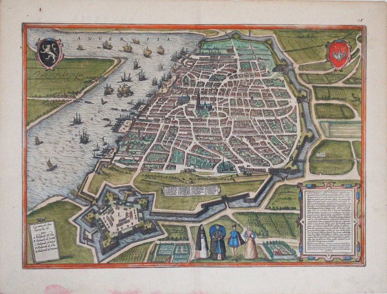
1572LBW-3249[Cologne, 1572]. 338 x 479 mm.
16830Paris, éditions Verve, 1955. In-folio, 114 pl., cartonnage éditeur illustré par Joan Miró (frottements des coiffes du cartonnage).
177717837Weidmann, Leipzig 1777. XVI, 432 S. mit 7 gefalt. Karten u. Plänen. Halbleder der Zeit mit Rückenschild. Etwas beschabt u. bestoßen. Rücken mit mehreren kleinen Wurmspuren, im Falz teils etwas beschädigt. Kapitale mit kleinen Fehlstellen. Buchblock teils etwas fleckig, Plan von Athen etwas ungenau gefaltet, im Ganzen innen aber schön und sauber erhalten.