DELAFOSSE (Jean-Baptiste).Livre Rare Book

34 272 résultats
1780LBW-5245Paris, Mondhare, 1780. 514 x 626 mm.
Litografia tinta acquarellata a mano, circa 1840/50, firmata in basso a destra. Magnifica prova, impressa su carta coeva, con margini, minime ossidazioni agli estremi del margine bianco, per il resto in ottimo stato di conservazione. Isidore Laurent Deroy, è un acquarellista, pittore e litografo francese. Fu allievo dell'architetto Félix e del pittore Cassas. Autore di un notevole corpus di lavoro, particolarmente incentrato sulle vedute di città, tradotte poi in litografia tinta, ideali quindi per essere colorate. Le opere appartengono alla serie denominata Ports de Mer d’Europe, realizzata in collaborazione tra il Deroy e André Chapuy. Le vedute venivano pubblicate dall’editore Turgis sia a Parigi che a New York. Bellissimo esemplare. Tinted lithograph with watercolor, about 1840/50, signed at the bottom right. Magnificent proof, printed on contemporary paper, with margins, minimum oxidation at the ends of the white margin, otherwise in excellent condition. Isidore Laurent Deroy, is a watercolor painter and lithographer French. He was a pupil of the painter and architect Félix Cassas; author of a remarkable body of work, particularly focusing on the views of the city, then translated into color lithograph, making them ideal for coloring. The works belong to the series called Ports de Mer d'Europe, created in collaboration between Deroy and André Chapuy. The views were published by the publisher Turgis both in Paris and in New York. Beautiful example.
184326Paris, Imprimerie Nationale, Juillet 1790 in-8, 152 p., sous ficelle.
Rara incisione che raffigura l'attacco di Barcellona del 1714, nell'ambito della Guerra di Successione Spagnola (1701 - 1714). L'incisione appartiene a una suite dedicata all'avvenimento, tutte incise da Martin Engelbrecht da disegni di Jacques Rigaud (1681?-1754). Didascalia storica bilingue, francese/tedesco. Acquaforte e bulino, ottimo stato di conservazione. One of the engravings by Martin Englebrecht after Rigaud; view of besieging troops outside walled city. Title and text printed below in French and German. Etching and engraving, in very good condition.
1795LBW-5421London, William Faden, 1795. En 20 sections montées sur toile et pliées, formant un plan de 468 x 915 mm.
Grande ed interessante carta del Mediterraneo pubblicata da William Faden nel "General Atlas".Si tratta di un insieme di due mappe: il foglio occidentale comprende il territorio del Portogallo, della Spagna, Italia, Maghreb e parti della Francia e dei Balcani; sono incluse le isole spagnole di Minorca, Maiorca e Ibiza insieme a Corsica, Sardegna Malta e Sicilia. Il foglio orientale comprende la parte orientale che si estende dalla Croazia ad est fino all’Iran e dalla Crimea a sud fino al delta del Nilo in Egitto; sono comprese le isole di Creta, Cipro e il Mar Nero. La Grecia e la Turchia moderne compaiono nella loro interezza (compresa l’area precedentemente nota come Kurdistan), nonché Georgia, Armenia, Giordania, Israele, Palestina, Iran, Iraq, Siria, Ucraina e Balcani. Codificata per colore in base al territorio politico, l’opera raffigurata la penisola italiana divisa in vari stati e ducati.Acquaforte, su carta vergata coeva, finemente colorata a mano in epoca, in perfetto stato di conservazione. A large map of the Mediterranean Sea by Faden's General Atlas.This is an appealing 1785 map of the Mediterranean region issued by William Faden. A set of two maps, the western sheet covers from Portugal, Spain, Italy, the Maghreb or the Barbary Coast of Africa and includes parts of France and the Balkans. The Spanish Islands of Minorca, Majorca and Ibiza are included, along with Corsica, Sardinia, Malta and Sicily. The eastern sheet extends from Croatia east as far as Iran and from Crimea south to Egypt’s Nile Delta, including the islands of Crete or Candia and Cyprus and the Black Sea. Covers the modern day Greece and Turkey in their entirety (including the area formerly known as Kurdistan), as well as Georgia, Armenia, Jordan, Israel, Palestine, Iran, Iraq, Syria, Ukraine and the Balkan nations. Color coded according to political territory, the map notes several important towns, rivers, cities, lakes, islands and mountains along with other topographic features. Depicts the Italian peninsula divided up in to various states and duchies. Jerusalem, Baghdad (Bagdad), Constantinople (the capital of the Roman Empire) and other important cities.When this map was drawn this region was dominated by the waning Ottoman hegemony. The Ottomans would nevertheless continue to exert a powerful influence on this region until the early 19th century. The Barbary Coast was a hotbed of piracy – much like the Somali Coast today. The Barbary Pirates would attack trading ships passing through narrow Gibraltar straits and western Mediterranean. Ships would be destroyed or appropriated, cargo seized and the crew and passengers enslaved. By the early 19th century, piracy in this region had become so intense that the United States launched its first major naval offensive against Tripoli. The resultant 1805 Battle of Derne later inspired a portion of the lyrics of the Mariners’ Hymn ‘To the shored of Tripoli’.This map was printed and issued by William Faden in his 1811 edition of the General Atlas. Phillips (atlases) 6010, 6013, 6047.
183085353ABTorino, Alessandro Fontana, 1830-1833. 8°. Mit 231 num. Tafeln auf 234 Bl. (meist koloriert und teils gefaltet) und 2 gefalt. Tabellen. Halblederbände mit roten Rückenschildern und wenig Rückenvergoldung. Europa. 10 vol. in 13 vol. Terza editione.
242915Paris, Magimel, an IX - 1800 2 parties en un fort vol. in-4, [4] ff. n. ch., XXXII pp., 103 pp. (avec interversion typographique des f. 59-60 et du f. 61-62), 502 pp., avec 6 grands tableaux dépliants hors texte, une carte, broché sous couverture d'attente de papier bleuté, non coupé. Dos un peu défraîchi, petit travail de ver en marge intérieur n'altérant pas la lecture, carte détachée.
208874Paris, Baudouin, 1828 4 vol. in-8, 1 tabl. dépliant, 8 fac-similés, 6 cartes dépliantes, demi-basane blonde, dos lisses ornés de motifs dorés, tranches marbrées (reliure de l'époque). Dos passés et frottés, début de fente aux mors du tome 1. Rousseurs.
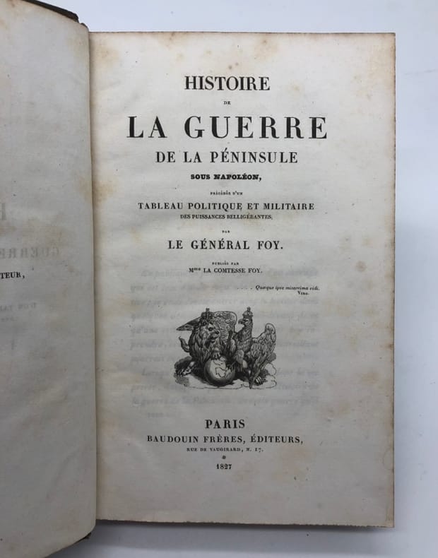
222677Paris, Baudouin, 1827 4 vol. in-8 et un atlas gr. in-8, 1 tabl. dépl., 8 fac-similés, atlas de 6 cartes ou plans, 1 portrait, demi-veau prune, dos lisse orné, tranches mouchetées (rel. de l'époque). Qqs rousseurs. Qqs épid sur les contreplats. Mouillures prononcées à l'atlas.
215715Nancy, Paris, Berger-Levrault, 1914-1932 3 vol. grand in-8, LXI-487 pp., VIII-358 pp. et VII-288 pp., 6 planches (dont 4 portraits), croquis in-t., 7 tableaux, 9 croquis et 2 cartes dépliants, demi-chagrin mandarine, dos lisse, filets à froid, couv. cons. (Montécot). Dos un peu passé. Bon exemplaire.
1806PHO-1913Paris, Madame veuve Hocquart, 1806, petit In-4, basane havane, dos lisse orné de compartiments finement dorés avec pièces de titre, plats ornés d'une frise dorée formant encadrements, dentelle intérieure dorée, tranches dorées. Ex-libris G. Cottereau (Coins frottés, coiffe supérieure abimée, frottements, quelques légères rousseurs.
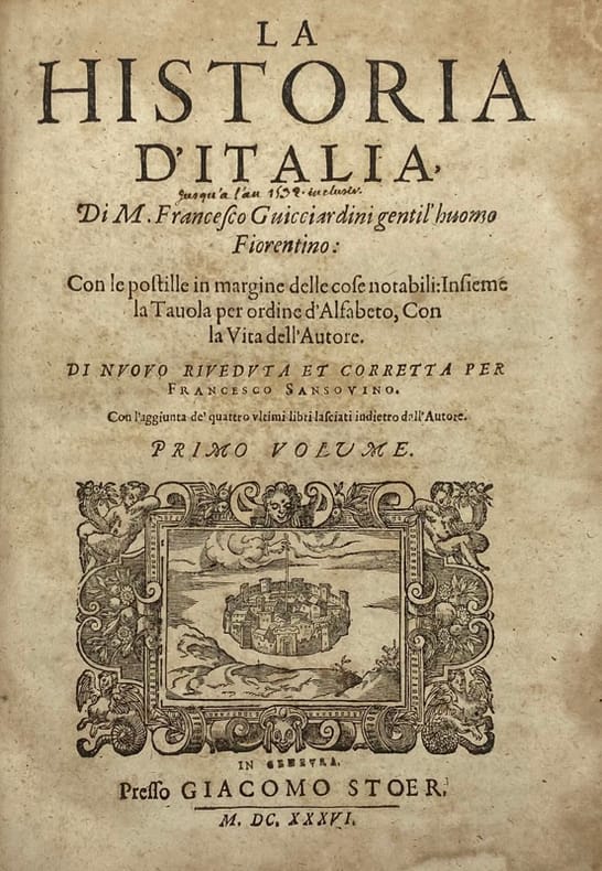
202297Genève, Jacob Stoer, 1636 2 tomes en un fort vol. in-4, [16] ff. n. ch. (titre, dédicaces, vie de Guichardin, table), 604 pp., [10] ff. n. ch. de table, [554] pp. mal chiffrées 558 (il y a saut de chiffrage de 176 à 181), veau fauve marbré, dos à nerfs cloisonné et fleuronné, pièce de titre, encadrement de double filet à froid sur les plats, tranches rouges (rel. du XVIIIe s.). Mors abîmés, coiffes rognées, des pages roussies parfois fortement.
210033Paris, H. Fournier, 1836 2 vol. in-8, XVI-440 pp. et 449 pp., avec un portrait-frontispice lithographié d'après un dessin de l'auteur, demi-veau gris, dos à nerfs orné de filets dorés (reliure de l'époque). Qqs rousseurs. Ex-libris Bibliothèque de Mr Laplagne Barris. Bon exemplaire.
Carta del Mediterraneo stampata a Parigi da Alexis Hubert Jaillot.Questo abile uomo d’affari nacque verso il 1632 ad Avignon-lès-Saint-Claude. Dall’infanzia Jaillot aveva mostrato un buon talento per l’arte e il disegno e da suo fratello Pierre-Simón aveva imparato la scultura. Durante il conflitto franco-spagnolo la loro città natale fu devastata, e così i due fratelli si trasferirono a Parigi nel 1657. Lì acquisirono presto una certa reputazione e il titolo di “Sculpteur du Roy”. Nel 1665, Jaillot si sposò con Jeanne Berey, figlia di Nicolas I Berey. La fortuna di Jaillot fu di entrare nel mercato cartografico in un momento particolarmente favorevole. All’inizio del 1668, sotto Luigi XIV, per la Francia iniziò un periodo particolarmente fecondo, come conseguenza della costante espansione territoriale c’era una grande richiesta di mappe che rappresentassero le conquiste francesi e le nuove frontiere. In seguito, Jaillot si associò con i figli di Nicolas Sanson, e fu in grado di commercializzare nuove carte con il prestigioso nome Sanson. Il suo atlante del 1681, l’Atlas Nouveau, divenne un tale successo commerciale che fu copiato illegalmente da altri editori. Jaillot non può essere annoverato tra i cartografi dell’epoca come i Sanson e Duval, fu però un abile incisore che seppe intelligentemente sfruttare le risorse che aveva ereditato, facendone opere mirabili. La sua fama crebbe al punto che il 20 luglio 1686 fu nominato “Géographe du Roy” e gli fu assegnata una cospicua pensione annuale; il titolo gli consentì di difendersi dai numerosi contraffattori. Una delle sue opere più belle fu Le Neptune François, o Atlas Nouveau des Cartes Marine. Dall’inizio del diciottesimo secolo la sua produzione di carte diminuì: erano richieste mappe sempre più aggiornate che non era in grado di offrire. D’altronde, i concorrenti più giovani erano geografi del calibro di Guillaume Delisle. Jaillot (m. 1712) cedette, quindi, l’azienda a suo figlio Bernard Jean-Hyacinthe.Incisione in rame coloritura coeva dei contorni, lievissime tracce di colla nelle pieghe centrali, per il resto in otitmo stato di conservazione. Map of the Mediterranean sea printed in Paris by Alexis Hubert Jaillot.Copperplate, with outline original colouring, good condition.Alexis Hubert Jaillot born around 1632 in Avignon-lès-Saint-Claude. Since childhood Jaillot had shown a good talent for art and drawing and had learned sculpture from his brother Pierre-Simón. During the Franco-Spanish conflict their hometown was devastated, and so the two brothers moved to Paris in 1657. There they soon acquired a certain reputation and the title of "Sculpteur du Roy". In 1665, Jaillot married with Jeanne Berey, daughter of Nicolas I Berey. Jaillot's fortune was to enter the cartographic market at a particularly favorable time. At the beginning of 1668, under Louis XIV, a particularly fruitful period began for France, as a consequence of the constant territorial expansion there was a great demand for maps that represented French conquests and new frontiers.Later, Jaillot joined forces with the sons of Nicolas Sanson, and was able to market new maps with the prestigious Sanson name. His Atlas of 1681, the "Atlas Nouveau", became such a commercial success that it was illegally copied by other publishers. Jaillot cannot be counted among the cartographers of the time such as the Sansons and Duval, but he was a skilled engraver who was able to intelligently exploit the resources he had inherited, making them wonderful works. His fame grew to the point that on 20 July 1686 he was named "Géographe du Roy" and was given a large annual pension; the title allowed him to defend himself against numerous counterfeiters.
143299Paris, Ancelin et Pochard, 1821 in-8, VIII-XVI-464 pp., 9 cartes dépl. montées sur onglets, veau acajou, dos lisse orné, dentelle d'encadrement sur les plats (rel. de l'époque).
18378065Paris, chez Anselin, 1837. In-8 de VII-(1)-286 pp., demi-basane bleue, dos lisse orné (reliure de l'époque).
1816LBW0008dParis, C. Wassermann, 1816. 2 volumes in-8 de (2) ff., VI, II, 376 pp. - (2) ff., 415 pp. ; demi-basane brune, dos lisses ornés, pièces de titre de veau orange, tranches rouges (reliure de l'époque).
180397Paris, Chassériau et Hécart, 1819-1821 5 vol. in-8, 2 cartes dépl., veau fauve, dos lisse recouvert de basane verte et orné, tranches marbrées (rel. de l'époque). Ex-libris Michel Marie de Pomereu. Bon exemplaire.
Decorativa carta geografica delle Isole Britanniche, riferita al tempo degli antichi Romani.La carta, per la prima volta pubblicata da Ortelius nel suo Parergon del 1595, è basta su informazioni geografiche fornite dalla carta murale delle Isole Britanniche di Mercator (1564) e sugli aggiornamenti forniti da Saxton (1579). Le notizie storiche sono invece derivanti dalle fonti classiche quali Plinio, Tacito, Appiano e Strabone. Tratta dal Parergon, il primo atlante storico mai pubblicato. Fu inizialmente concepito da Ortelius come appendice del suo Theatrum Orbis Terrarum ma visto il notevole successo di queste carte storiche divenne in seguito un lavoro indipendente e rimase la fonte principale di tutti i lavori simili per tutto il XVII secolo. Come sottolinea Koeman “il Parergon deve essere considerato come lavoro personale di Ortelius. Per quest'opera, infatti, diversamente dal Theatrum, non copiò le mappe di altri cartografi, ma ne disegnò lui stesso di nuove ed originali…prese luoghi, regioni e territori delle civiltà classiche illustrandone e spiegandone la storia, una materia molto vicina al suo cuore. Le mappe e le lastre del Parergon devono essere valutate come le più importanti incisioni che rappresentano il diffuso interesse per la geografia classica nel XVI secolo”. Il Theatrum Orbis Terrarum e che è considerato il primo vero “atlante” moderno. L’opera fu pubblicata in 7 lingue e 36 edizioni, per il quale – nel 1570 - Ortelius ottenne il privilegio, ovvero una sorta di diritto d'autore che impediva ad altri cartografi di pubblicare i propri lavori. Il Theatrum rappresentava il lavoro più avanzato del lavoro della descrizione cartografica. L’Ortelius vi raccolse il sapere geografico e cartografico del suo tempo, proponendo in 147 spettacolari tavole incise l’immagine più fedele del mondo allora conosciuto e, in alcune straordinarie “carte storiche”, regioni e itinerari tratti dalla letteratura, dalla mitologia, dalla tradizione. Esemplare tratto dall'edizione latina del 1619. Incisione in rame, finemente colorata a mano, in ottimo stato di conservazione. Decorative and rare map of the British Isles in Roman times. The map was first published in the 1595 edition of Ortelius' atlas. The map was made based upon modern information from Mercator's 1564 map of the British Isles, improved by a new outline from Saxton's 1579 map (Meurer p. 197, Karrow 56/16, p. 387-388)nd ancient knowledge from Diodorus, Siculus, Plinius, Appianus, Tacitus, Cæsar and Strabo. The map is filled with ancient place names, Hadrian's Wall, and Wall of Pius (mislabeled Severi Imp. Murus).Richly embellished with three large strapwork cartouches and several sailing vessels. Map taken from the Parergon, the first historical atlas ever published. It was initially conceived by Ortelius as an appendix to his Theatrum Orbis Terrarum, but given the considerable success of these historical maps it later became an independent work and remained the main source of all similar works throughout the seventeenth century. Koeman wrote: "This atlas of ancient geography must be regarded as a personal work of Ortelius. For this work he did not, as in the Theatrum, copy other people's maps but drew the originals himself... He took many places and regions from the lands of classical civilization to illustrate and clarify their history, a subject very close to his heart... The maps and plates of the Parergon have to be evaluated as the most outstanding engravings depicting the wide-spread interest in classical geography in the 16th century." The Theatrum Orbis Terrarum, which is considered the first true modern "Atlas". The work was published in 7 languages and 36 editions, for which - in 1570 - Ortelius obtained the privilege, a kind of copyright that prevented other cartographers from publishing his works. The Theatrum represented the most advanced work of cartographic description. Ortelius collected in it the geographical and cartographic knowledge of his time, proposing in 147 spectacular engraved plates the most faithful image of the world then known and, in some extraordinary "historical maps", regions and routes taken from literature, mythology, tradition. Latin editon of 1619. Copperplate with fine hand colouring, very good condition. Van den Broecke #192; Shirley, R.W. (BI to 1650) 186, pl.42.
Bella mappa del territorio perugino, pubblicata nel Theatrum Orbis Terrarum di Ortelius. La carta si basa sul lavoro di Ignazio Danti del 1580, incisa da Mario Cartaro (Bifolco-Ronca, tav. 103; Meurer p. 136-137). Il Theatrum Orbis Terrarum è considerato il primo vero “atlante” moderno. L’opera fu pubblicata in 7 lingue e 36 edizioni, per il quale – nel 1570 - Ortelius ottenne il privilegio, ovvero una sorta di diritto d'autore che impediva ad altri cartografi di pubblicare i propri lavori. Il Theatrum rappresentava il lavoro più avanzato del lavoro della descrizione cartografica. L’Ortelius vi raccolse il sapere geografico e cartografico del suo tempo, proponendo in 147 spettacolari tavole incise l’immagine più fedele del mondo allora conosciuto e, in alcune straordinarie “carte storiche”, regioni e itinerari tratti dalla letteratura, dalla mitologia, dalla tradizione. Ortelius fu anche il primo a citare le fonti, menzionando i nomi dei cartografi nel “catalogus auctorum”. Dal 1598 al 1612 le edizioni postume del Theatrum furono realizzate dal suo collaboratore Johannes Baptiste Vrients. Esemplare tratto dall'edizione spagnola. Incisione su rame, magnifica coloritura coeva con ritocchi, in ottimo stato di conservazione. A nice map of Perugia, published in Theatrum Orbis Terrarum by Ortelius. The map is based on Egnatio Danti's 1580 Perugia map, engraved by Mario Cartaro (Bifolco - Ronca, tav. 103; Meurer p. 136-137). Map taken from the Theatrum Orbis Terrarum, which is considered the first true modern "Atlas". The work was published in 7 languages and 36 editions, for which - in 1570 - Ortelius obtained the privilege, a kind of copyright that prevented other cartographers from publishing his works. The Theatrum represented the most advanced work of cartographic description. Ortelius collected in it the geographical and cartographic knowledge of his time, proposing in 147 spectacular engraved plates the most faithful image of the world then known and, in some extraordinary "historical maps", regions and routes taken from literature, mythology, tradition. Ortelius was also the first to cite sources, mentioning the names of cartographers in the "catalogus auctorum". From 1598 to 1612 the posthumous editions of the Theatrum were made by his collaborator Johannes Baptiste Vrients. Copper engraving, with later hand colour, good condition. Spanish text on the verso.
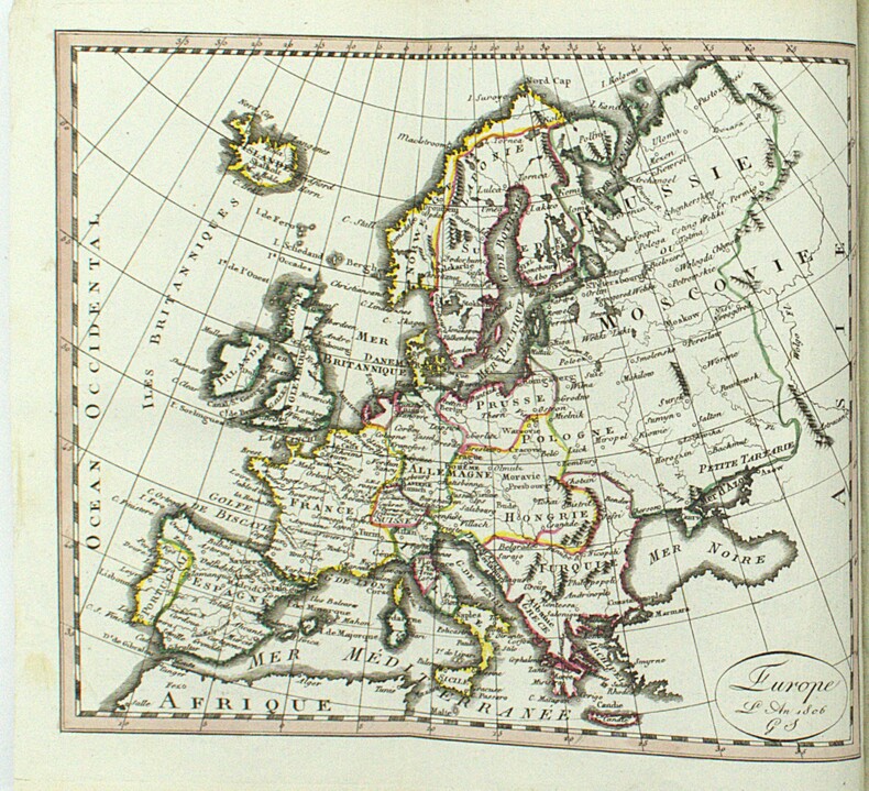
Carta del territorio europeo nella qual sono indicate tutte le vittorie del popolo francese sotto la guida di Napoleone Bonaparte. Nell'angolo in basso a sinistra sono proposte le piante planimetriche delle capitali conquistate: Milano, Monaco di Baviera, Roma, Il Cairo, Saragozza, St. Jean D'Acre, Malta, Danzica, Napoli, Vienna, Berlino, Praga, Lisbona, Madrid, Mosca e Torino. In basso al centro si notano numerose scale che testimoniano il vasto pubblico al quale era indirizzata quest'opera. Carta intelata.
182024917Paris Chez Aimé André 1820 1 , in-4 demi-percaline havane Paris, Chez Aimé André, 1820, in-4, 24-294 pages-1 feuille non chiffrée, demi-percaline havane, pièce de titre en maroquin rouge.
1698LBW-6637Venise, 1698. 49 x 73,5 cm, sur une feuille de 51 x 75 cm.
LBW02e4fRome circa 1780 380 x 593 mm.