34 272 résultats
Folio (34 x 25 cm). 204 pp. text + 105 tinted lithograph vues after Rothmuller on together 71 plates (complete). Nice contemporary half leather binding, gilt spine. *Reiber 2248. Slg. Baumgartner 742. Thieme-B. XXIX, 94. - With vues of Alspach, Egisheim, Ensisheim, Gebweiler, Colmar (8, one double page), Pfaffenheim, Schauenberg, Schwendi, Sigolsheim, Sulzbach, Turckheim etc. - On the first pages partly somewhat browned, but in all a good copy. Bücher fr
Rara mappa che illustra il Teatro della guerra russo-turca (1768-1774).La mappa si focalizza sui territori situati sulle coste settentrionali e occidentali del Mar d’Azov e del Mar Nero e della Crimea, ovvero Bulgaria, Romania, Moldavia, Ucraina (allora parte della Polonia) e Russia, che si estendono fino ad Astracan e al Mar Caspio.La mappa è tratta da carte manoscritte realizzate a partire dall'ultima guerra russo-turca che si è svolta tra il 1735 e il 1739. In alto a destra si trova il resoconto dettagliato della guerra precedente, con l’indicazione delle date importanti, delle battaglie e di altri fattori che hanno portato all’attuale situazione politica descritta dalla mappa. La carta illustra le nuove città e i forti costruiti dai russi, lungo il Dnieper e il Don, e nelle città di Orel e Samara.Acquaforte con coloritura coeva dei contorni, più volte ripiegata, in buono stato di conservazione. Fine example of this rare map illustrating the Theater of Russo-Turkish War (1768-1774).The map emphasizes the territories located on the north and west coasts of the Sea of Azov and the Black Sea and Crimea, namely Bulgaria, Romania, Moldova, Ukraine (then part of Poland) and Russia, extending to Astracan and the Caspian Sea.The map is drawn from handwritten maps drawn up since the last Russian-Turkish war which took place between 1735 and 1739, most notably New Servia, territory bordering the new Russian-Turkish border in Ukraine, which was won by the Russians during this war. At the top right is detailed accounting of the prior war, setting for the important dates, battles and other factors leading to the current map.The map illustrates the new cities and forts built by the Russians, along the Dnieper and the Don, and in the cities of Orel and Samara. Copperplate with original outline colour, usual folds, good condition.
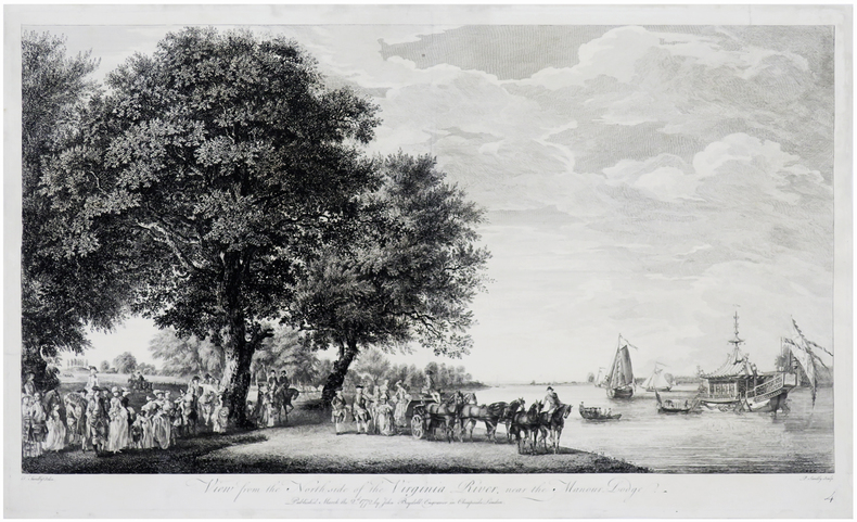
LBW-6246London, John Boydell, March the 2.d 1772. 335 x 563 mm.
170214782Naples, , 1702. In-12 de 368-(14) pp., tables, 1 portrait gravé, 1 titre-frontispice et 33 planches gravées, veau brun granité, dos lisse orné, pièce de titre en maroquin rouge, tranches rouges (reliure de l'époque).
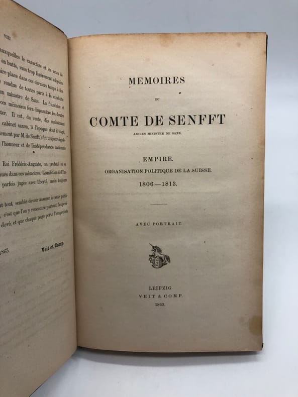
221564Leipzig, Veit & Comp., 1863 grand in-8, VIII-[2]-249 pp., portrait en frontispice, demi-basane verte, dos à nerfs orné (reliure de l'époque). Mors et coiffes un peu usés.
242169Leipzig, Veit & Comp., 1863 grand in-8, VIII-[2]-249 pp., portrait en frontispice, percaline verte, filets à froid (reliure de l'époque).
153919Paris, Treuttel et Würtz, 1826 16 vol. in-8, demi-veau cerise, dos lisse orné, tranches marbrées (rel. de l'époque). Ex-libris de la Bibliothèque du château de Loupy. Bel exemplaire.
1815128895J. C. Sepp & Fils, Amsterdam - G. Dufour, Paris, 1815. XXXVIII, 618 S. ; 22 x 14 cm ; Halbleder.
Rara carta del Mediterraneo in due fogli di Gerard Valck, stampata ad Amsterdam alla fine del XVII secolo.Relativa al periodo antecedente al sodalizio con il cognato Peter Schenk.Bella coloritura coeva, in ottimo stato di conservazione. Copperplate with fine original colour, very good condition.Rare two sheet map of the Mediterranean, published by Gerard Valk circa 1700.The map extends from the Straits of Gibraltar to Cypress and Haifa. Includes an allegorical title cartouche.
226384Amsterdam, Steenhouwer & Uytwerf, 1719 3 vol. in-12, XX pp., un f. n. ch., 564 pp. ; [4] ff. n. ch., 398 pp. (interversion des ff. 389-90, 391-92, 393-94 et 395-96) ; [3] ff. n. ch., 328 pp. (pp. 273-276 reliées par erreur après la page 280), avec 4 cartes dépliantes hors texte (toutes dans le premier volume), veau havane granité, dos à nerfs cloisonnés et fleuronnés, tranches mouchetées (reliure de l'époque). Petits manques aux coiffes.
RARITA’ CARTOGRAFICA Sconosciuta piccola carta geografica con imprint di Pietro Zancon e data 1794, appartenente a un non documentato atlante in miniatura dal titolo “Atlante tascabile per le dame”, suddiviso in tre tomi, stampati “IN VENETIA Presso G. Zatta”, senza data ma circa 1795. Si tratta di carte da visita – con un apposito spazio bianco dove apporre il proprio nome – dove compare l’imprint o di Pietro Zancon (accompagnato dalla data 1794) o di Giacomo Zatta (con data 1794 o 1795), che, come si legge sul frontespizio, risulta l’editore dell’opera. Possiamo ipotizzare che la serie, iniziata da Zancon fu poi terminata dallo Zatta. Sulla carta dell’Italia – presumibilmente la prima tavola dell’opera – compare stampato il nome di Chiara Minelli Rota, nobildonna veneziana che sposò Antonio Rota nel 1794; tutte le restanti 65 carte recano lo spazio bianco privo di nome. In precedenza, le carte erano note solo attraverso una serie, priva di imprint editoriale, venduta 21 anni fa (1999) dall’Antiquariaat Haas di Bedburg Hau; parlando con Stephan Haas, la serie, priva di titolo e dati editoriali si componeva di 70 mappe. Le carte furono vendute separatamente sotto il nome di G. Bonatti, firma dell’incisore che si trova nella carta della Francia. In seguito, le tavole furono attribuite a Pietro Zaricen da Geoffrey King (cfr. Miniature Antique Maps, p. 181). Il nome dello Zaricen viene dedotto dalla carta della contea del Roussillon, che reca l’iscrizione “Venezia 1794 App.o P. Zancon”, letto erroneamente come Zaricen. Lajos Szantai include la carta dell’Ungheria nella sua cartobibliografia, traducendo il nome dell’autore in Zancen (cfr. Atlas Hungaricus 1528-1850). Sempre King, che non menziona nessuna carta firmata da Zatta, sostiene che “About the turn of the century a signed card of the first edition, with a map of the province of Roussillon in the south of France, was seen at an Ephemera Society Fair in London”. Questo esemplare sembrerebbe oggi quello conservato alla Yale University Library [1978 351], che lo descrive composto da 70 carte geografiche. Non sappiamo se sia il numero totale delle mappe, e l’assenza di un indice o dell’elenco non consente di stabilire l’esatto numero delle carte che lo compongono. http://hdl.handle.net/10079/bibid/3611852Confrontando le carte erroneamente attribuite allo Zaricen ci si accorge che la lastra è abrasa in corrispondenza della firma di Zancon o Zatta. Molto scarse sono le notizie sulle carte che possiamo ora definire “ex Zaricen”. Jason Hubbard nella sua bibliografia recente sulle carte del Giappone raffigura la carta priva dell’imprint “App.o G. Zatta” attribuendola - sulla base delle informazioni bibliografiche finora note – a Giuseppe Bonatti e Pietro Zaricen: “This is one of the 70-odd geographical cards, printed on one side only, acquired by the Haas brothers in 1999. The cards cover countries around the world and include detailed map of Italian provinces. The card with the map of France carries the inscription: G. Bonatti fece; and it is presumed that Bonatti engraved all of them although this is questioned by King” (cfr. J. Hubbard, Japoniae Insulae, n. 124). Il nostro esemplare della carta della Francia, che reca l’imprint “Venezia 1794, App.o P. Zancon” reca in basso a destra la firma di Bonatti sopra menzionata. Dunque, l’unica differenza tra questa serie di sconosciute carte sembra essere la presenza degli imprint editoriali di Zancon e Zatta, accompagnati dalla data 1794 o 1795. Giuseppe Bonatti è menzionato da V. Valerio nella qualità di incisore cresciuto alla scuola Remondini di Bassano, autore di alcune carte per l’atlante di Pazzini Carli (Siena, 1788-1800) e per l’Atlante Geografico di Carlo Antonio Barbiellini (Milano, 1807). Dal 1809 in poi lavorò come incisore per il Deposito della Guerra di Milano (cfr. V. Valerio, Cartografi Veneti, p. 153). Pietro Zancon era, assieme ... A GREAT RARITY Unknown small map with imprint by Pietro Zancon and date 1794, belonging to an undocumented miniature atlas entitled “Atlante tascabile per le dame” (Pocket Atlas for ladies), divided into three volumes, printed "IN VENETIA Presso G. Zatta", undated but about 1795. A rare set of visiting cards published in Italy features pretty little maps of all parts of the world - with a special white space where to put your name - where the imprint appears or of Pietro Zancon (accompanied by the date 1794) or Giacomo Zatta (with the date 1794 or 1795), who, as can be read on the title page, is the publisher of the whole Atlas. We can speculate that the series, started by Zancon was later terminated by Zatta. On the map of Italy is printed - presumably the first map of the work - the name of Chiara Minelli Rota, Venetian noblewoman who married Antonio Rota in 1794; all remaining 65 maps bear the blank space without names. Previously, the maps were known only through a series, without editorial imprint, sold 21 years ago (1999) by the Antiquariaat Haas of Bedburg Hau; speaking with Stephan Haas, the series, without title and printing details, consisted of 70 maps. The maps were sold separately under the name of G. Bonatti, the engraver's signature found on the map of France. Later, the plates were attributed to Pietro Zaricen by Geoffrey King (see Miniature Antique Maps, p. 181). The name of Zaricen is derived from the Roussillon county map, which bears the inscription "Venice 1794 App.o P. Zancon", incorrectly read as Zaricen. Lajos Szantai includes the map of Hungary in his cartobibliography, translating the author's name into Zancen (see Atlas Hungaricus 1528-1850). Always King, who does not mention any map signed by Zatta, said: "About the turn of the century a signed card of the first edition, with a map of the province of Roussillon in the south of France, was seen at an Ephemera Society Fair in London ". This copy would seem to be the one preserved in the Yale University Library [call number 1978 351], which describes it as being composed of 70 maps. We do not know if it is the total number of maps, and the absence of an index or list does not allow to establish the exact number of maps. http://hdl.handle.net/10079/bibid/3611852 Comparing the maps erroneously attributed to Zaricen one realizes that the plate is erased in correspondence with the signature of Zancon or Zatta. There are very little information on the maps, that we can now define as "ex Zaricen". Jason Hubbard in his recent bibliography on the maps of Japan depicts the map without the imprint "App.o G. Zatta" attributing it - on the basis of the bibliographic information so far known - to Giuseppe Bonatti and Pietro Zaricen: “This is one of the 70-odd geographical cards, printed on one side only, acquired by the Haas brothers in 1999. The cards cover countries around the world and include detailed map of Italian provinces. The card with the map of France carries the inscription: G. Bonatti fece; and it is presumed that Bonatti engraved all of them although this is questioned by King” (cf. J. Hubbard, Japoniae Insulae, n. 124). Our copy of the map of France, which bears the imprint "Venice 1794, App.o P. Zancon", also shows the signature of Bonatti mentioned at the bottom right. Therefore, the only difference between this series of unknown maps seems to be the presence of the addresses of Zancon and Zatta, accompanied by the date 1794 or 1795. Giuseppe Bonatti is mentioned by V. Valerio as an engraver raised at the Remondini school in Bassano, author of some maps for the atlas of Pazzini Carli (Siena, 1788-1800) and for the geographical atlas of Carlo Antonio Barbiellini (Milan, 1807). From 1809 onwards he worked as an engraver for the Milan Deposito della Guerra (see V. Valerio, Cartografi Veneti, p. 153). Pietro Zancon was, together with the most famous brother Gaetano, a native engraver of Bassano del Grappa, who grew up at the Remondini prin...
16451196A012Geneva Ginevra / Geneve / Genf: Giacomo Stoer Jacques Stoer 1645. 3rd Edition . Hardback. Printed pages: 4to 32 604 20 558 i.e. 554 2 blank 102. Very Good. 6.5 x 9.25 inches 16.5 x 23.5 cm. Third and final Stoer printing published in Geneva in 1645 preceded by the 1621 and 1636 editions. The Stoer printings include several passages in books 3 4 and 5 that were omitted from previous editions. Also included with this edition is Leoni's 'Considerationi sopra l'Historia d'Italia' originally published in Venice in 1583 and in a revised edition in 1600. Contemporary full vellum covers browned slight wear to ends of spine wear and bumping to corners of boards. Spine has five raised bands and inked title. Good solid binding a little light foxing to text otherwise clean throughout. Early owner's inscription to front free endpaper: 'Rawlinson Roma'. Pagination in part II omits pages 177-180 as expected. Italian language. A landmark work covering the period 1490 to 1534 although the first edition wasn't published until 1561 more than twenty years after Guicciardini's death. A nice solid example of this sought after early edition. Brunet Vol. II p1803. Overall condition is Very Good. Size: 6.5 x 9.25 inches 16.5 x 23.5 cm. Giacomo Stoer (Jacques Stoer) hardcover
92 pages. Lovely A.J. Casson painting of a bustling winter street on front cover Features: Great vintage photo ad for the New International "Special Delivery" Truck; Cream of Wheat ad claims it keeps pupils more alert; When Men Kill for Whisky - Millionaire Carling Breweries Executive Sam Low of Walkerville, Ontario was kidnapped by Gangsters for a $35k ransom - great photo-illustrated article about rum-running between Windsor, Ontario and Detroit; Brummagen Love, by Thelma Rudge; What I Learned from Europe, by Ontario Premier G. Howard Ferguson; Ottawa-Vancouver in 32 Hours - The Stirring Story of Canada's First Transcontinental Air Mail Flight - with photos; The Mystery of Number Nine, by Leslie McFarlane - Part 1; Louis Letourneau, Leo Dandurand and Joe Cattarinich - a colorful description of the adventures and achievements of The Three Musketeers of Modern Sport; Canada's Pictorial War Records - Adequate Housing Required, by W.W. Murray; Lights in the Windows, by Lillian Beynon Thomas; Full-colour colour reproduction of painting "Canada's Answer" by Norman Wilkinson, R.I.; The Work Cure - Vetcraft has brought health, happiness and economic being to hundreds of veterans; By Especial Corespondent, by Geoffrey Hewelcke; The Devil Guards His Own, by Victor Lauriston; Amazing photo of Malahat Drive on Vancouver Island - not much more than a couple of ruts through the forest; Nice ad for the De Soto Six, by Chrysler; "New York Now Huge Negro City - Black Invasion of Harlem"; Art Deco-style ad for the New Frigidaire refrigerator; Science Teaching Weather Control - Man has made enormous progress in combat with nature; Fantastic colour full-page ad for Packard cars; Great colour full-page ad for Wahl-Eversharp Pens, Pencils, Desk Sets; Wonderful full-page ad for Erector Set toys; Color ad for Chipso Laundry Soap; *Magnificent* Colour Centerfold ad for Parker Duofold Pens, Pencils and Duettes; Great full-page colour ad for Westclox Clocks; Ad for Mueller Faucets of Sarnia, Ontario; "Let the Laundry Do It" - a two-colour ad encouraging readers to let laundries clean their clothes; Nice Hupmobile Ad for their Century Six and Eight; Colour photo ad for Kodak cameras; Lovely colour full-page ad for Moirs Chocolates; Article about collector Walter McRaye; Buses Hurt British Railways - with photo of their first auto Pullman which allows passengers to sleep on the bus; The Road to Perth - short history article by Donald McNicol; Ad for the T-N Toilet which promises to 'banish embarrassment' because it is quiet; Colour ad for Swift's Premium Hams and Bacon; Two-Colour full-page Christmas-themed ad for Eveready flashlights and batteries; Home-Made Christmas Gifts; Short write-up and photo of Elizabeth Styring Nutt; Rug Magic, by Mary Agnes Pease; Stewart Warner radio ad; Business Article - "Adventuring in Speculation is Highly Specialized Business"; Colour ad fo Sun-Maid Puffed seeded Muscat Raisins inside back cover. Average wear to textblock. Crossword completed on page 83 otherwise unmarked. Chips and openings along cover fold. Covers loose as one but present. Back cover in rough shape. Particularly wonderful content to go with the excellent front cover artwork. Book
5738398-nnew. unknown
2020__9004416617Martinus Nijhoff 2020. Hardcover. New. bilingual edition. 677 pages. French language. 10.00x7.00x2.50 inches. Martinus Nijhoff hardcover
2013x-1857436857Routledge 2013. Hardcover. New. 10 edition. 763 pages. 11.00x8.50x2.00 inches. Routledge hardcover
2011x-1857436156Routledge 2011. Hardcover. New. 8th edition. 750 pages. 11.14x8.43x1.93 inches. Routledge hardcover
23852664-nnew. unknown
DADAX1857437438Routledge 2015-06-15. 79. hardcover. New. 9.00x5.00x11.50. Buy with confidence. Excellent Customer Service & Return policy. Routledge hardcover
19137764ALeipzig, Baedeker, 1913. Kl. 8°. XXII, 134 Seiten. Mit 5 Karten, 11 Plänen und 4 Grundrissen. OLeinenband mit Deckel- u. Rückenvergoldung. 2. Auflage.
186082Genf, Briquet et fils, (ca. 1860). Kl. Quer 8°, 11 farb. Lithos. (davon 2 Panoramen) v. Lemercier u. Cuvillier, Illustrierter goldgeprägter Original-Halbleinen. Fast NEUWERTIG!
2007x-185743434XEuropa Pubns 2007. Hardcover. New. 10 edition. 604 pages. 11.25x8.75x1.75 inches. Europa Pubns hardcover
2012__9004242899Martinus Nijhoff 2012. Hardcover. New. bilingual edition. French language. 9.50x6.75x2.50 inches. Martinus Nijhoff hardcover
2010x-1857435567Routledge 2010. Hardcover. New. 19 edition. 569 pages. 11.00x8.50x1.50 inches. Routledge hardcover
8vo [20.5 x 13.5 cm]; 2 volumes, xvi, 366; [ii], 306 pp, illustrations are woodcuts by Richard T. Austin, index. later cloth backed marbled boards, gilt spine title lettering on spine, few discrete and light library stamps, a very good+ set, sound and clean. A picture of this book is available upon request by email. Cox i, 188: "An important and interesting work on Lapland and parts of Norway and Sweden. This famous botanist was himself the instigator of a large number of scientific voyages." Catalogue of the Works of Linnaeus in British Museum (1933) #188. Soulsby 192. Hulth 160. Junk p. 59: 'wichtung und selten'. Sansbergs Bokhandel, catalogue 12, p. 117: "Linnaeus started his work of investigation during his early manhood with his journeys to the Swedish provinces, where he noted the natural resources of the country-side. In the summer of 1741 he visited Oland and Gotland, in 1746 Vastergotland and Bohuslan and Skane in 1749. His accounts of these trips are his most often read works. They are of great topographical interest and abound in his observations of nature, animal and plant life as well as in ethnographical and economical matters. His geological remarks are of particular interest. The style is Linnaeus's usual: short, direct and to the point, often shot through with humour and touched with a lyrical love for nature." Smith bought Linnaeus's manuscripts and brought them back to England. The first Swedish edition was not until 1888.