1 282 résultats
184 pages. Black and white diagrams and photographic plates. Map endpapers. Gilt lettering upon red cloth. Authors kept a log while trekking the wilds of Alaska to study the forests and forest diseases of the state. They experienced "a big country of mountains, timber, game, salmon rivers, and glaciers, The pleasure derived from this simple account was so great that we decided to allow others to share it with us. It is our wish that you may tramp, eat, and camp with our party each day." - Preface. No dust jacket, apparently as issued. Unmarked with average wear. Binding intact. A sound copy. TOURVILLE 432. Book
18947777AG. P. Putnams Sons 1894. HB NODJ ISSUED 1894 1st edition with dates matching on title & copyright page NF-/VG AS-ISNODJ 12 mo Green & Grey embossed decorated Cloth with some rub & scuff to Cover primarily spine area & Back Cover X-LIBRARY with some unobstrusive Marks Labels numbers ETC O/W nice Condition & tight light Fox few small light stains cover 201 pages. First Edition. Hard Cover. G. P. Putnams Sons hardcover
514 pages. Archival black and white illustrations. An exciting look back at the early days of Alaska. The thirty chapters include such topics as Vigilante Days of '98 at Dyea and Skagway, Dawson and the Klondike Mines, American Occupancy of the Yukon Basin, Rafting Down the Kantishna River, Animla Migration from Asia to Alaska, The Judge Tried by a Miner's Meeting, and many more. Author served as U.S. District Judge in Alaska 1900-1908, Alaska Congressman for 14 years, and as Editor for seven volumes of "Alaska Law Reports". Prior owner names atop front free endpaper and title page. Above-average wear and soiling to blue boards. Few coffee drops to fore-edge. Contents in quality condition. Endpapers yellowed but contents remain bright. Binding intact. Worthy working copy. Book
Features: Sandy Shumway - Miniaturist of the Month; English History in Miniature; America's First Ladies (1886-1900); Cinema Palaces; Judy Beals' - artisan update; Joan and Bill Helton - a happy harmony of talents; Portraiture in Miniature - Pauline Chamness and Dorothy Hoskins interpret the Alaskan frontier with their work; Len and Kathy Schiada - Capturing the design of the Victorian era; Marilyn Taylor's Crafty Concoctions; DIY - A Country Christmas; Joann's Nook for Santa; Mary's Menus - Holiday Favorites; Begin your tinsmithing technique in miniature with this kitchen scoop; Growing Landscapes - a flexible foundation landscaping design for your miniature yard; and more. Clean and unmarked with moderate wear. A quality copy. Magazine
1972001462Field Museum of Natural History, Chicago 1972. 1. Print Broschur Sehr gut
2000mon0000002277Univ of Washington Pr 2000T. paperback. Very Good. 0.2500 in x 11.2500 in x 8.7500 in. 1st edition. Paperback. General wear but clean and solid. Ships from a smoke-free home. Hand-wrapped and packaged in cardboard. Univ of Washington Pr paperback
0931163188.Gpaperback. Good. Access codes and supplements are not guaranteed with used items. May be an ex-library book. paperback
192 pages. A very informative vintage driving travel guide to the entire province of British Columbia and parts beyond, complete with black and white photos and dozens of sensational ads for tourist-related service businesses. Unmarked with average wear. Binding sound. Take a wonderful step back in time! Book
0882402048New. paperback. New. Satisfaction Guaranteed or your money back. paperback
Large quarto in a black DJ (red spine) ; ix, 118 p : ill (some color) ; 29 cm Lighthouses -- Alaska -- History -- Coastal -- Photography
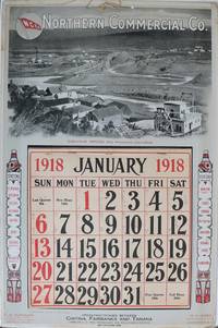
1918137331San Francisco: International Printing Co. 1918. Undetermined. very good. Colour calendar on heavy cardstock. 21" X 14". Occasional very light chipping and to edges. Corners bumped with some creasing. A few other light creases to edges. Full calendar pad Jan - Dec present with penciled notation in most days. Original string hanger present. Colours bright and unfaded. This poster is in very good condition. A scarce advertising calendar for the Northern Commercial Company N.C.Co. a retail company which maintained rural village stores across Alaska and in the Yukon. N.C.Co also operated steamships through Alaskan trade routes. The image on the poster features mining at Iditarod Alaska. Two totem poles on either side of the calendar pad list several stations of the N.C.Co. including Fairbanks Dawson Yukon Territory Bettles Iditarod and many others. The verso of the calendar is a full-page map of Alaska showing sea routes and locations of N.C.Co posts. A later incarnation of the business still maintains 30 stores across rural Alaska. See two other examples in this catalogue. 1918 International Printing Co. unknown
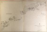
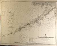
56420London: British Admiralty 1903 1929. . An engraved chart on heavy stock uncolored sheet size 40 x 27.5 inches. Published 23rd April 1903; New Edition 1st March 1929. Clean and attractive original vertical fold some small additions in red pen. In lower right: "Engraved 1903" and "Zc 1929". Chart number is 3336. Small typed label on verso giving chart & folio info. Published under the Superintendence of Rear Admiral Sir W.J.L. Wharton. A detailed chart of the Fox Islands Group in the Eastern Aleutians. <br/><br/> London: British Admiralty, 1903 (1929). unknown
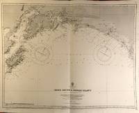
56423London: British Admiralty 1890 1925. . An engraved chart on heavy stock uncolored sheet size 34 x 27 inches. Published 9th July 1890; Large Corrections Jan. 1908; Small corrections printed to 1925 and mss. to 1929. Clean and attractive original vertical fold some additions in red pen. In lower right: "Engraved by Davies & Company". Chart number is 1499. Small typed label on verso giving chart & folio info. Published under the Superintendence of Captain W.J.L. Wharton. The south coast of Alaska centered on Prince William Sound. First published 1890 this is a printing of 1925. <br/><br/> London: British Admiralty, 1890 (1925). unknown
56422London: British Admiralty 1890 1924. . An engraved chart on heavy stock uncolored sheet size 34 x 27 inches. Published 9th July 1890; New Edition 19th Jan. 1917. Small corrections printed to 1924 and mss. to 1929. Clean and attractive original vertical fold some additions in red pen. In lower right: "Engraved by Davies & Company". Chart number is 1500. Small typed label on verso giving chart & folio info. Published under the Superintendence of Captain W.J.L. Wharton. A detailed chart of the Aleutian Islands chain from Alaska to Seguam Island. Several engraved vignettes of shorelines at the bottom. Originally published 1890 this is a 1924 printing. <br/><br/> London: British Admiralty, 1890 (1924). unknown
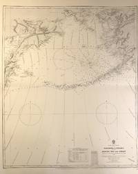
56408London: British Admiralty 1884 1928. . An engraved chart on medium stock uncolored sheet size 27 x 34 inches. Published 28th Oct. 1884; New Edition 15th Jan. 1923. Large Corrections 14th Sept. 1928. Original horizontal fold a clean and attractive copy some small additions in red pen. In lower right: "Engraved by Davies & Company". Chart number is 2460. Small typed label on verso giving chart & folio info. Published under the Superintendence of Captain W.J.L. Wharton. Good details of the Aleutian Islands and Bering Sea Eastern Siberia and the Bering Strait at the top. <br/><br/> London: British Admiralty, 1884 (1928). unknown
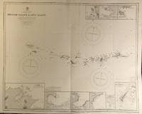
56421London: British Admiralty 1890 1928. . An engraved chart on heavy stock uncolored sheet size 34 x 27 inches. Published 9th July 1890; New Edition 28th Sept. 1928. Clean and attractive original vertical fold. In lower right: "Engraved 1890" and "Zc 1928". Chart number is 1501. Small typed label on verso giving chart & folio info. Published under the Superintendence of Captain W.J.L. Wharton. A detailed chart of the Aleutian islands including the Near Islands Rat Islands and Andreanof Islands groups. Included are nine small inset maps of harbours and anchorages on the various islands: Bay of Islands Korovin Bay Nazan Bay Bay of Waterfalls Suchikof Bay McDonald Bay Constantine Hr. Kiska Hr. and Chichagof Hr. Included in this chart are Attu Island and Kiska Island which were occupied by the Japanese during WW II. Two inset maps provide details of these islands: Chichagof Harbour on Attu Island and Kiska Harbour on Kiska Island. <br/><br/> London: British Admiralty, 1890 (1928). unknown
Light wear to cover. Inscribed by author on title page. 11 3/4"w x 8 3/4"h. Approx. 32 pages. Color illustrations by Shannon Cartwritght.
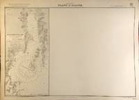
56394London: British Admiralty 1907 1930. . An engraved chart on heavy stock uncolored sheet size 27.5 x 20 inches. Published 22nd April 1907; Small corrections printed to 1930. Unfolded a nice clean copy some small marks in red pen. In lower right: "Engraved 1907" and "Zc 1930". Chart number is 3655. Small typed label on verso giving chart & folio info. Published under the Superintendence of Rear Admiral A. Mostyn Field. Much of this chart is blank; the left edge prints a map of Resurrection Bay showing Seward and the U.S. Naval Reservation. <br/><br/> London: British Admiralty, 1907 (1930). unknown
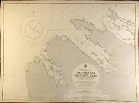
56398London: British Admiralty 1900 1929. . An engraved chart on heavy stock uncolored sheet size 27.5 x 20 inches. Published 13th July 1900; New Edition - Large Corrections 15th November 1929. Clean and attractive never folded. In lower right: "Engraved 1900" and "Zc 1929". Chart number is 3132. Small typed label on verso giving chart & folio info. Published under the Superintendence of Rear Admiral Sir W.J.L. Wharton. Saginaw Bay has recently 2019 been renamed to Skanax Bay following a petition from Tlingit tribal leaders complaining of its association with the 1869 Kake War during which a U.S. warship The Saginaw destroyed three Tlingit communities. <br/><br/> London: British Admiralty, 1900 (1929). unknown
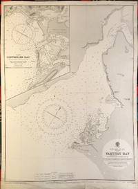
56391London: British Admiralty 1902 1922. . An engraved chart on heavy stock uncolored sheet size 20 x 27.5 inches. Published 13th Dec. 1902; New Edition 8th Jan. 1915. Small corrections printed to 1922 and mss. to 1929. Unfolded. Some wear and a short tears to lower margin basically clean and very good some revisions and additions in red pen. In lower right: "Engraved by Davies & Company". Chart number is 3313. Small typed label on verso giving chart & folio info. Published under the Superintendence of Rear Admiral Sir W.J.L. Wharton. Inset map of Controller Bay. Yakutat Bay has had various names; James Cook called it "Bering Bay" as indicated on this chart. Jean-François de La Pérouse who visited it in 1786 named it "Baie de Monti" for one of his officers; also in 1786 Captain Nathaniel Portlock named it "Admiralty Bay". The Spanish referred to it as "Almirantazgo" and it was also called "Port Mulgrave" when Alessandro Malaspina and José de Bustamante y Guerra sailed into the bay on their Malaspina Expedition 1789-94. <br/><br/> London: British Admiralty, 1902 (1922). unknown
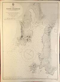
56390London: British Admiralty 1907 1930. . An engraved chart on heavy stock uncolored sheet size 20 x 27.5 inches. Published 5th March 1907; New Edition 14th Feb. 1930. Clean and attractive never folded. In lower right: "Engraved 1907" and "Zc1930". Chart number is 3633. Small typed label on verso giving chart & folio info. Published under the Superintendence of Rear Admiral A. Mostyn Field. <br/><br/> London: British Admiralty, 1907 (1930). unknown
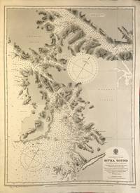
56389London: British Admiralty 1895 1925. An engraved chart on heavy stock uncolored sheet size 20 x 27.5 inches. Published 26th Aug. 1895; Large corrections to Nov. 1900; Small corrections printed to 1925 and mss. to 1930. Clean and attractive never folded some small additions in red pen. In lower right: "Engraved by Edwd. Weller". Chart number is 2337. Small typed label on verso giving chart & folio info. Published under the Superintendence of Rear Admiral W.J.L. Wharton. Sitka Sound was named Ensenada de Susto by Juan de la Bodega on 15 August 1775. It was later named Norfolk Sound by James Cook. In 1801 Fleurieu published a map naming it Baie Tchinkîtâné in an attempt to use Tlingit toponyms. <br/><br/> London: British Admiralty, 1895 (1925). unknown
56397London: British Admiralty 1895 1925. . An engraved chart on heavy stock uncolored sheet size 20 x 27.5 inches. Published 30th Sept. 1895; Large Corrections Jan. 1898; Small corrections printed to 1925 and mss. to 1927. Some dust soiling at lower edge in general a nice clean copy a few additions in red pen. In lower right: "Engraved by Edwd. Waller". Chart number is 2348. Small typed label on verso giving chart & folio info. Published under the Superintendence of Rear Admiral W.J.L. Wharton. A detailed chart of the islands and coastal area around Sitka; the Sitka town plan indicates the Wireless Telephone Stn. Astronomical Stn. Indian Village and Mission. <br/><br/> London: British Admiralty, 1895 (1925). unknown
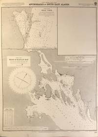
56402London: British Admiralty 1898 1925. An engraved chart on heavy stock uncolored sheet size 20 x 27.5 inches. Published 2nd Aug. 1898; New Edition Nov. 1921; Small corrections printed to 1925 and mss. to 1926. Clean and attractive never folded short tears to margin at lower right some small additions in red pen. In lower right: "Engraved by Davies & Company". Chart number is 837. Small typed label on verso giving chart & folio info. Published under the Superintendence of Rear Admiral Sir W.J.L. Wharton. Two maps: Seal Cove Gravina Island and Head of Kasaan Bay at Prince of Wales Island. <br/><br/> London: British Admiralty, 1898 (1925). unknown
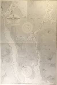
56415London: British Admiralty 1899 1930. . An engraved chart on heavy stock uncolored sheet size 27.5 x 40 inches. Published 20th Feb. 1899; New Edition 17th Jan. 1930. Original horizontal fold a clean and attractive copy some small additions in red pen. In lower right: "Engraved 1899" and "Zc 1930". Chart number is 3022. Small typed label on verso giving chart & folio info. Published under the Superintendence of Rear Admiral Sir W.J.L. Wharton. Divided vertically into two charts this extends from Frederick Sound to Sumner Strait showing the Lindenberg Peninsula Mitkof Island Woewodski Island. Previously known as Wrangell Strait this channel is 22 miles long. <br/><br/> London: British Admiralty, 1899 (1930). unknown