[FRED HARVEY - SANTA FE RAILWAY]Biblio.com

10 875 résultats
190951186N.P.: W.J. Black 1909. 1909. First edition. 8" x 5" in color pictorial wrappers. 23pp. illustrated from photographs and drawings. The El Tovar Hotel also known simply as El Tovar is a former Harvey House hotel situated directly on the south rim of the Grand Canyon in Arizona United States. The hotel was designed by Charles Whittlesey Chief Architect for the Atchison Topeka and Santa Fe Railway and was opened in 1905 as one of a chain of hotels and restaurants owned and operated by the Fred Harvey Company in conjunction with the Santa Fe railway whose Grand Canyon Depot was 330 feet away. It is at the northern terminus of the Grand Canyon Railway which was formerly a branch of the Santa Fe. The hotel is one of only a handful of Harvey House facilities that are still in operation and is an early example of the style that would evolve into National Park Service Rustic architecture. The booklet provides detailed information about and attractive views of the El Tovar Hotel including both exterior and interior attractions as well as information on things to do in the area. Rubbing and scraping to wrappers along with light wear to the extremities. W.J. Black, 1909. unknown
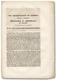
3730953<p>Np likely Massachusetts: np 1848. Large single sheet folded down to form 8pages; untrimmed as issued. One fold line expertly strengthened with tissue.</p> <p>Rare. Free Soil Party campaigning for Benjamin Franklin Newhall abolitionist politician self-made businessman stationmaster on the Underground Rail Road UGGR who helped formerly-enslaved African American fugitives seeking their freedom by moving onward from stations in Boston. Siebert </p> <p>Newhall was an unsuccessful Free Soil candidate for Massachusetts’s 2nd congressional district in the United States House of Representatives. This tract promoted Newhall and the Party’s “uncompromising hostility to the usurpation of Slaveholders—the Slave power—the power exercised by 30000 men owners of the 3000000 of Slaves.†p1</p> <p>OCLC AAS Peabody NYPL Duke.</p> unknown
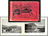
190716960London: W. Mate & Sons 1907. Very Good/No Dust Jacket As Issued. <br /> <br /> Printed paper boards with decorations and titles. designed to captivate and enthrall! oblong. 9 by 6 inches. The bindings are tight and square. Text clean light even toning. Moderate shelf handling wear. The folded map has toned with a closed tear. The text is flawlessly clean with a delicate even toning. Corners rubbed. The magic of the Lake District is displayed with 48 historical and professional black and white full-page photographs each a visual masterpiece. Several additional pages feature two photos on each page creating a feast for the eyes. To enhance your journey accompanying text eloquently describes the locales captured in these attractive images.<br /> <br /> Approximately 30 pages of historical advertising portrays life in Edwardian England. Bursting with life these advertisements offer a splendid array of lodging refreshment and services. Most of them occupy full-page layouts accompanied by enchanting photographs that transport you to a world of the past. W. Mate & Sons unknown
2015LFA-126746465Un ouvrage de 240 pages, format 165 x 215 mm, illustré, broché couverture couleurs rempliée, publié en 2015, Editions Géo, bon état
2004LFA017d92004 : une revue de 174 pages, format 215 x 270 mm, illustrée, brochée couverture couleurs, bon état
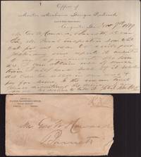
188936180Augusta: Georgia Railroad 1889. Paper. Good. Paper with printed letterhead at top and illustrated envelope. Paper is approx. 8" x 5". Folded. Contents written on one side and pertain to inspection of "white oak." Signed at the bottom by the Railroad Mater Mechanic manager John Cook. <br /> <br /> Letter comes with a printed illustrated envelope from the Georgia Railroad. The back side of the envelope is an illustration of the 1888 "Augusta National Exposition." Edge wear to the envelope. Envelope in fair condition. Georgia Railroad unknown
190330359Chicago: Poole Brothers 1903. Second Edition. Wraps. Very good. Wraps. 7.5" x 5". 32 pages. Illustrated with photographs plan of the Prison grounds and map of the railroad route in back. Gray illustrated covers with title on front. Poole Brothers unknown
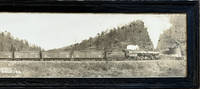
191863179Bethlehem PA & New York NY: Lehigh Valley Railroad ca. 1918. Large oblong double atlas panoramic silver gelatin photograph sized 47 x 8.5 in. caption at lower fore-edge w/in the negative preserved in the original quarter-sawn oak black stained original glass VG image with excellent contrast. This original panoramic photograph approaching a water tank hauling 75 cars of grain for the War effort during World War I captures the efforts of delivering harvested and processed grain from farmers through grain elevators and later delivery to markets for processing and sale. Although originally founded in 1846 to haul anthracite coal from the coal fields of Pennsylvania the Lehigh Valley RR became an essential freight and passenger line through New York in the early 20th-Century and were well known for their significant network of grain elevators and transport logistics. The Class R-1 Steam Locomotives from Baldwin were numbered originally from 4000-4075 many of which were used by Lehigh Valley RR for slow heavy freight haulage. Lehigh Valley Railroad, unknown
192460276Chicago IL: W.J. Black Passenger Traffic Manager Atchison Topeka and Santa Fe Railway Co. April 1924. 4to. measuring 4 x 9 in. folds out to 4to. measuring 8 x 9 in. printed in orange & black with 54 2 double-columns i.e. 28 pp. numerous photo illustrations large centerfold map of Grand Canyon in orange & black 2nd map at rear in orange & black. Self-printed illustrated softcovers cover art photo of Grand Canyon photos of local Native Americans in area on back minor shelfwear rubbing still VG copy. First edition thus of this nicely illustrated tourism brochure extolling the benefits costs and wonders of seeing the Grand Canyon. The photos and text detail stays at the El Tovar Hotel travel to the Grand Canyon and Tusayan Forest by automobile views by automobile along the Lincoln Point and the Palisades with Painted Desert View and even an image of the first plane to land in the Grand Canyon in August 1922. Worldcat locates 2 copies Northern AZ U U of MI. W.J. Black, Passenger Traffic Manager, Atchison, Topeka and Santa Fe Railway Co., paperback
1908138240High Bluff Manitoba: Edwin C. Blair c1908. Undetermined. very good. 24pp. Oblong quarto. Black cloth photo album rubbed with some loss of cloth on front board. Spine reinforced with additional patterned cloth. 24 albumen photographs loosely inserted between 12 double-mounted leaves. 10 photos are signed "Blair" a few with additional titling in pen to photo. 23 photos with a stamp on verso: "Real photographs of real life in Canada by Edwin C. Blair High Bluff Manitoba; 1 photo stamped "Photo by E.C. Blair. Two photos are dated 1908. Photos measure approximately 6.75" X 5". very good A fantastic collection of photographs documenting the construction of the Grand Trunk Railway in Alberta. Includes a variety of subjects such as horse-drawn lumber operations steam-powered construction equipment hard rock excavation construction of the Battle River and Clover Bar bridges steam locomotives and camp life. 1908 Edwin C. Blair unknown
1901137938Montreal: Grand Trunk Railway System 1901. Undetermined. near fine. 1st Edition. 16pp. Tall octavo. Original folding brochure with printed and embossed wrappers. Staple bound. Measures 8.5" X 8.25" unfolded. Light rubbing to spine. With map of Pam-American grounds in Buffalo and colour folding map printed on recto and verso of Georgian Bay Muskoka Lakes and Kwartha Lakes of Ontario. Map measures 16" X 15.75". near fine A scarce piece of Ontario Grand Trunk Railway and Pan-American Exposition ephemera in an excellent state of preservation. Illustrated throughout with photographs of Ontario and the adjacent areas of Buffalo New York with text on activities in the area. The Pan-American Exposition was a World's Fair in Buffalo NY in 1901. 1901 Grand Trunk Railway System unknown
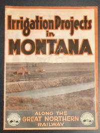
8917St. Paul MN: Great Northern Railroad n.d. First edition. Illustrated wrappers stapled. Near Fine. 4to. Pp. 20. Illustrated throughout with superb black and white photos of agrarian scenes along the route. Maps to verso of front cover and rear cover. Color illustrated wraps lettered in black and orange; scuffs and slight loss on front cover. Circa 1922. Stamp of E.C. Leedy / General Agricultural Development Agent / Great Northern Railway / St. Paul Minn to foot of select pages. Scarce. OCLC locates holdings in only six libraries. Great Northern Railroad unknown
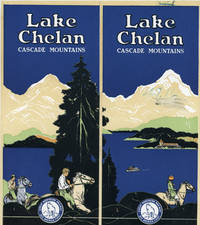
191546858N.P.: Privately printed n.d. ca. 1915. ca. 1915. WASHINGTON. First edition. 9 1/8" x 32" sheet folded to 16 panels each measuring 9 1/8" x 4." 2 bright colorful cover panels. Maps. Illustrations. Lake Chelan is on the east side of the Cascade Mountains in the north central part of the state of Washington. The Great Northern Railway promoted the region as "A Wonder 'Stop-off Place' for Tourists Bound to or from the Pacific Northwest." It is described as "A stupendous and splendid fjord that from the west highlands of that Great River of the West the Columbia outstretches for more than a half-hundred miles through and to the very heart of the Cascade Mountains of Washington - a fjord that is the most remarkable lake-in the-mountains in all America – and "roundabout the head of this lake about Stehekin and the Hotel Field a wonder region of the Cascades that abounds in delightful mountaineering 'short jaunts' both be 17 saddle horse and 'over trails afoot' . such is Lake Chelan and its country." The brochure goes on in great detail about the various lodging opportunities trails and camping trips train and boat service and physical description of the region. It is illustrated from photographs offering photos of scenery Hotel Field individuals riding horses cruising along Chelan's shores etc. Two maps include a two-panel colored map titled "Lake Chelan and the Lake Chelan Country / Cascade Mountains / Washington." It shows roads trails and the auto-stage road from the Great North Railway to the Lakeside Chelan Station. The other map is a one-panel system map. This map has the code 1-mcmxv which is the source for the date attribution. This is one of the scarcer and most graphically interesting promotional brochures of the region from this early time period. An attempt to erase a number from one of the color panels along with a green scratch-through of a number at top edge of same panel along with light soiling and light wear to edges and folds. Very good. Privately printed, n.d. [ca. 1915]. unknown
195262951Wenatchee WA: World Publishing Co. 1952. 4to. 9.5 x 12.5 in. 64 pp. printed in double columns. With text illustrations decorations photo illustrations. Gray textured softcovers illustrated w/ locomotive front cover brown borders yapp fore-edges minor soiling slight scuffing edgewear still VG copy inscribed by author to Robert Burks. First edition inscribed of this often printed and popular work detailing the many “Rails Across the Cascades†columns by Anderson from The Wenatchee Daily World about the Great Northern Railroad relating that “trains once climbed over the Cascades via ‘switchback’ . . ; 101 persons died in the 1910 snowslide tragedy of Wellington at the west portal of the old Cascade tunnel. . . Lake Chelan area was surveyed by the Northern Pacific for a cross-Cascade route in 1870. . . “ First editions are quite scarce. Worldcat locates 8 copies. World Publishing Co., paperback
1841105399Paris, Librairie de Charles Gosselin 1841 In-12 18 x 11 cm. Reliure demi-chagrin havane, dos à nerfs, 558 pp., table des matières, 1 carte de France repliée in fine. Reliure légèrement frottée, intérieur en bon état.
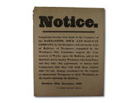
1833002876Durham: J.H. Veitch 1833. Single sided printed broadside approximately 220mm x 275mm. Browned slightly creased with small amount of loss to top left hand corner otherwise quite clean. Notice from the Committee of the Hartlepool Dock and Railway Company asking contractors upon the Railway and Docks not to employ workers who have dogs and warning the contractors that they will be held responsible for any damage occasioned by the "wanton or unnecessary Trespasses of their Workmen on the Lands adjoining the Railway". Printed by J.ohn H.ardinge Veitch see Hunt 'The Book Trade in Northumberland and Durham to 1860' page 91 and Wallis' 'Supplement' page 46. Not in COPAC. First Edition. Unbound. Good. 4to. Broadside. J.H. Veitch Paperback
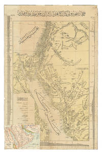
1904ABC_47091Constantinople: Matba a-i Bahriye 1904. Colour-lithographed map 76.5 x 49.5 cm trimmed to neat line. A rare separately issued official railway map with the entire text in Ottoman Turkish depicting the route of the Hejaz Railway. Following a route proposed by the eminent Turkish engineer Mukhtar Bey and surveyed by the cavalry officers Umar Zaki and Hasan Mu'ayyin the epic project funded by subscriptions from the global Islamic faithful completed a rail link from Damascus to Medina by 1908. The present map shows the intended continuation to Mecca never completed. Although it went no further south than Medina the railway nevertheless briefly allowed many thousands of pilgrims to make the Hajj in relative comfort bringing them to Medina and within about 300 km of Mecca. It shows the northern half of the Red Sea the Sinai peninsula the southeast corner of the Mediterranean Sea and what were to become Palestine most of Jordan and parts of Lebanon and Syria.A contemporary Ottoman colour-lithographed map of the Arabian Peninsula has been pasted over the lower left corner below the key like an inset map hiding only a tiny bit of the main maps topographic image. Old folds and creases some small tears repaired tiny chips to neat line some light stains. Some remnants of tape and old private collector's stamps on the back. Still in good condition. Matba a-i Bahriye, unknown
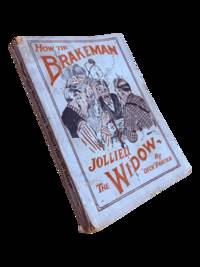
19189630Chicago: Porter & Regan 1918. First edition. 18x13.5cm 128pp. Illustrations. Perfect bound in illustrated wrappers with edge wear soiling and a few chips. Page block toned. A very good copy. <br /> <br /> Apparently the third and final book in the Brakeman series of humorous stories by a former hobo-turned member of the Brotherhood of Railroad Trainmen and Brotherhood of Railroad Brakemen. OCLC cites a single holding for the second book in the series A thirty-eight-dollar brakeman tied to a tin can at the Huntington but none for this title nor the first 32 Years on the Hurricane Deck of a Freight Train. Porter & Regan unknown
191039114Holyoke: Holyoke Street Railway Co. n.d. ca 1910. 1910. MASSACHUSETTS. First edition. 9" x 6 3/4" in color pictorial wrappers. 24pp. illustrations. 17 full-page tinted views to include Summit House Mt. Tom; View of Mt. Tom from Easthampton Car Leaving Lower Station for Summit; Kenilworth Castle with Mt. Tom in Distance; Mt. Tom Railroad and Summit House; Going Through Rock Cut; Upper Station; Southerly View From Mt. Tom; Rustic Arch at Mountain Park etc. followed by text which offers information about Mt. Tom the Summit House the street-cars of Holyoke the views from Mt. Tom etc. Most photographs include people. Over-sized wrappers lightly worn at corners. Very good. A very attractive booklet. Holyoke Street Railway Co., n.d. [ca 1910]. unknown
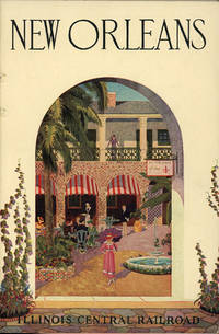
192951612N.P.: Rand McNally & Co. 1929. 1929. 9" x 6" in pictorials wrappers. 32pp. Printed in green ink and with decorative border surround text and pictures. Illustrations. Maps. Detailed description of New Orleans to include the French Quarter Canal Street Bourbon Street churches monuments parks the Garden Distrct Mardi Gras New Orlenas being the gateway to the Panama Canal etc. One-page map of New Orleans and vicinity and 1-page system map of the Illinois Central. Light soiling to wrappers and with light wear to the extremities. Very good. Rand McNally & Co., 1929. unknown
185754076Chicago: Illinois Central Rail Road Office 1857. 8vo. 80 pp. plus 4 pp. of Illinois Central RR promotional ads printed on lavender-coloured paper promoting passage to St. Louis Kansas Nebraska the Michigan central Railway Line the Niagara Falls suspension bridge and St. Paul Minnesota via steamer and railroad line. With frontisp. maps 1 double-page of Illinois RR lands a bucolic farm scene in Illinois text woodcut engravings tables. Light tan printed & illustrated softcovers cover art of “typical†Illinois farm minor chipping head & foot of spine minor wear & bumping to corners faint soiling ex-library stamp on verso of title still G copy. First edition of this illustrated land promotion for Illinois extolling the advantages for prospective homesteaders and settlers for settling in Illinois rather than further west. The promotional work extolls the quality of the soil the advantages for buying land with direct access to the newly built railroads with pricing information on fuel fencing and other products. Selling the lands granted to them became a preoccupation of railroad companies as they pushed West with mixed strategies. Some the Illinois Central mortgaged to provide capital construction revenues while other lands were sold stipulating that the homesteaders or settlers needed to cultivate and occupy the land before sale in order to delay the amount of taxes owed by the Railroad. There were two different issues of this 1857 land promotion with one printed in Boston and the other scarcer version in Chicago. Ante-Fire Imprints 263; See: John Hall Patrimonialism in America: The Public Domain in the Making of Modernity In: Charrad & Adams Patrimonial Capitalism and Empire 2015 pp. 29-39. Illinois Central Rail Road Office, paperback
185638108New York: John W. Amerman Printer 1856. 1856. 9" x 5-1/2" tan printed wrappers. 64pp. Two black and white frontispiece maps. The first map is 9" x 5-1/2" and is entitled "OUTLINE MAP OF ILLINOIS." The second map covers 2 pages 10-1/2" x 6-3/4" and is entitled "RAILWAY GUIDE TO THE ILLINOIS CENTRAL RAIL ROAD LANDS." Everything you would want to know about settling down in Illinois is in this booklet to include railroad routes value of land for farming value of crops towns and villages. The Company owns valuable tracts of iron and lead ores also coal beds of immense richness. "Illinois Is now in the start of its great advance towards becoming the first producing State in the Union. Having Lake Michigan on one side furnishing a constant outlet for its produce the Mississippi to the west with its tributaries the Illinois and Rock Rivers both navigable streams running far into its interior the Wabash on its eastern borders and Ohio on the south the natural facilities would seem unequaled in the world." Several letters from successful farmers telling of the advantages and prospects of Illinois. Other subjects discussed are the climate soil health coal Illinois Central Railroad Lands the cost of opening a farm the population agriculture statistics of towns et. al. Light wear to the extremities along with chipping to spine lower fore-corner of front wrapper creased wrappers discolored else a good copy. John W. Amerman, Printer, 1856. unknown
185738092Boston: Geo. C. Rand & Avery Printers No. 3 Cornhill 1857. 1857. ILLINOIS. 9" x 5-1/2" pictorial wrapper. 84pp. including wrappers. Two black and white maps. The first map is 9" x 5-1/2" and is entitled "OUTLINE MAP OF ILLINOIS." The second map covers 2 pages 10-1/2" x 6-3/4" and is entitled "RAILWAY GUIDE TO THE ILLINOIS CENTRAL RAIL ROAD LANDS." Everything you would want to know about settling down in Illinois is in this booklet to include railroad routes value of land for farming value of crops towns and villages mechanical labor will continue to be in constant demand. The Company owns valuable tracts of iron and lead ores also coal beds of immense richness. "Illinois Is now in the start of its great advance towards becoming the first producing State in the Union. Having Lake Michigan on one side furnishing a constant outlet for its produce the Mississippi to the west with its tributaries the Illinois and Rock Rivers both navigable streams running far into its interior the Wabash on its eastern borders and Ohio on the south the natural facilities would seem unequaled in the world." Several letters from successful farmers telling of the advantages and prospects of Illinois. Other subjects discussed are the climate soil health coal Illinois Central Railroad Lands the cost of opening a farm the population agriculture statistics of towns et. al. The cove and first 2 pages are detached from spine overall chipping else a booklet full of information. Good copy. Geo. C. Rand & Avery Printers No. 3 Cornhill, 1857. unknown
185638884New York: John W. Amerman Printer 1856. 1856. 9" x 5-1/2" yellow printed wrappers. 64pp. Two black and white frontispiece maps. The first map is 9" x 5-1/2" and is entitled "OUTLINE MAP OF ILLINOIS." The second map covers 2 pages 10-1/2" x 6-3/4" and is entitled "RAILWAY GUIDE TO THE ILLINOIS CENTRAL RAIL ROAD LANDS." Everything you would want to know about settling down in Illinois is in this booklet to include railroad routes value of land for farming value of crops towns and villages. The Company owns valuable tracts of iron and lead ores also coal beds of immense richness. "Illinois Is now in the start of its great advance towards becoming the first producing State in the Union. Having Lake Michigan on one side furnishing a constant outlet for its produce the Mississippi to the west with its tributaries the Illinois and Rock Rivers both navigable streams running far into its interior the Wabash on its eastern borders and Ohio on the south the natural facilities would seem unequaled in the world." Several letters from successful farmers telling of the advantages and prospects of Illinois. Other subjects discussed are the climate soil health coal Illinois Central Railroad Lands the cost of opening a farm the population agriculture statistics of towns et. al. Ex-library copy. Wrappers lightly soiled and with light chipping to edges of front panel and with a 1" chip missing to bottom corner of rear wrapper along with chipping at tops and bottoms of spine. John W. Amerman, Printer, 1856. unknown
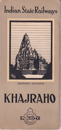
1930221365Indian State Publicity Railways. No date. Ca.1930s. Travel ephemera folding once into black and white pictorial cover 24.5 x 11.5cm sepia and white photographic illustrations brown and white pictorial/pictographic map 12pp. Light wear card covers. Very good copy. Includes tourist map of India with pictographs of tombs and other noteworthy monuments and buildings. . Indian State Publicity Railways. unknown