10 875 résultats
1886LIST112Cincinnati: St. Andrews Bay Railroad and Land Company 1886. Various Formats. Near Fine. An unusual collection of ephemera relating to the early development of the area of the Florida Panhandle east of Pensacola and an interesting ephemeral window into the type of land schemes that led to the population of Florida by northerners. In the late nineteenth century the area of Port Panama City in the Florida Panhandle was largely undeveloped though the town had strategic interest as a supplier of salt for the confederacy. In the 1880s the St. Andrews Bay Railroad and Land and Company was the second of two companies to sell land in the St. Andrews Bay region to unsuspecting northerners only to go bankrupt. The company promised to build a railroad from Alabama down to Southport crossing North Bay and eventually terminating in St. Andrews. Though the railway project was abandoned many people settled in the area as a result of the land sales. The company became known locally as the "Cincinnati Company."<br /> <br /> <br /> Includes: <br /> <br /> Warranty deeds for land sold to Lizzie Kegema Hosley of Somerville MA. 1886-1887.<br /> <br /> Letter from the St. Andrews Bay Railroad & Land Co to L.K. Hosley of Somerville Mass. explaining why the offer of 40 acres for $1 was contingent on her purchasing 299 building lots. On color lithographed letterhead featuring oranges and fishing.<br /> <br /> Notice on taxes to be paid by owners of property at St. Andrews Bay.<br /> <br /> Two envelopes with printed notices "This sealed envelope contains one Free Land Warrant" no contents.<br /> <br /> Envelope addressed to Lizzie Kegema Hosley of Somerville Mass. from the St. Andrews Bay R.R. and Land Co. Northern Office Cincinnati Oh.<br /> <br /> An interesting and early collection of Floridian real estate detritus. Generally well preserved in very good to near fine condition. St. Andrews Bay Railroad and Land Company unknown books
6295Japan: ca. 1898-1912. Copper mining at Ashio in Tochigi Prefecture began about 1600 and production continued until 1973; in the late 19th century it produced 39 percent of Japan's copper output. At the end of that century it was decided to build a railway connecting the mine to major rail lines to facilitate transportation of the outbound copper ore and inbound supplies horses had carried or pulled everything before. The engineering problems were considerable: the line runs along the Watarase River through a deep valley subject to frequent flooding. The railway was finished in 1911-12. The collection contains a series of letters containing reports on design and construction printed documents regarding the stock company formed to finance the building of the railway "Ashio Tetsudo Kabushikigaisha" reports from engineers regarding preparations further reports regarding expected capacity needs for the railroad line six photographs of the construction and a very fine and large 1820 x 760 mm. manuscript diagram on four joined sheets of tissue paper showing the route through the valley and elevations. This large diagram has been heightened in color green blue red and brown. In fine condition. unknown books
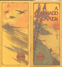
191339797Chicago: The Franklin Company 1913. 1913. COLORADO. 8 3/4" x 4 1/4" color pictorial covers. 23 pages and then 24 pages that are tri-folded and fold out to 8 3/4" x 12" illustrations advertisement map. Discusses the wonders of Colorado to include its climate its sportsmen's activities Colorado Springs Estes Park Manitou Ute Pass Glenwood Springs Pikes Peak Clear Creek Platte Canyon Pueblo etc. 2 pages devoted to advertising the Santa Fe Railroad and including rates. Numerous wonderful black and white photographs of individuals participating in various activities scenery and points of interest railroad scenes etc. Many photographs contain people. The borders around every page in the booklet are illustrated with various individuals involved in various activities. 8 1/4" x 7 1/4" contour map of the Colorado Rockies. Light soiling to wrappers along with tiny closed tear to front panel edge and with light wear to the extremities. Very good. A very interesting and nicely produced brochure. The Franklin Company, 1913. unknown
191434760Chicago: The Franklin Company 1914. 1914. First edition. 8 3/4" x 4 1/4" color pictorial covers. 23 pages and then 24 pages that are tri-folded and fold out to 8 3/4" x 12" illustrations advertisement map. Discusses the wonders of Colorado to include its climate its sportsmen's activities Colorado Springs Estes Park Manitou Ute Pass Glenwood Springs Pikes Peak Clear Creek Platte Canyon Pueblo etc. 2 pages devoted to advertising the Santa Fe Railroad and including rates. Numerous wonderful black and white photographs of individuals participating in various activities scenery and points of interest railroad scenes etc. Many photographs contain people. The borders around every page in the booklet are illustrated with various individuals involved in various activities. 8 1/4" x 7 1/4" contour map of the Colorado Rockies. A very interesting and nicely produced brochure. The Franklin Company, 1914. unknown
0332038920.Ghardcover. Good. Access codes and supplements are not guaranteed with used items. May be an ex-library book. hardcover
0266174612.Ghardcover. Good. Access codes and supplements are not guaranteed with used items. May be an ex-library book. hardcover
1332115241.Gpaperback. Good. Access codes and supplements are not guaranteed with used items. May be an ex-library book. paperback
0260841099.Ghardcover. Good. Access codes and supplements are not guaranteed with used items. May be an ex-library book. hardcover
189430071St. Louis: Woodward & Tiernan 1894. Seventh edition. Paperback. 124pp. Duodecimo 20 cm Peach and black printed wraps. Good. The wraps are foxed and faded. The rear wrap is partially detached. The wraps have perhaps been discreetly glued to the spine. There are numerous losses from the paper of the spine and there are also some small losses from the edges of the wraps. In addition there are several short closed tears in the edges of the wraps. There are several very light moisture stains on the front wrap and there is a thin 1 and 1/4 inch tall light moisture stain on the fore edge of the rear wrap. The edges of the pages at the beginning are chipped and have small light stains in the bottom corners. The pages are browned. Compliments of the Passenger Department Union Pacific The Overland Route. Flake 9078. With a map on the inside of the front wrap. Woodward & Tiernan paperback
1396429735.Ghardcover. Good. Access codes and supplements are not guaranteed with used items. May be an ex-library book. hardcover
1391067282.Gpaperback. Good. Access codes and supplements are not guaranteed with used items. May be an ex-library book. paperback
1396384014.Ghardcover. Good. Access codes and supplements are not guaranteed with used items. May be an ex-library book. hardcover
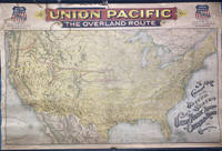
189649745Chicago: Rand McNally & Co. 1896. 1896. RAILROAD MAP. Oblong atlas folio. 37 x 56 in. One large color lithograph map mounted on linen showing the routes of the Union Pacific and subsidiary railroads in red with red yellow & black banner style lettering at upper fore-edge Union Pacific shields with mentions of subsidiary Railways mounted to upper & lower wooden rods as issued some minor lifting & creasing from being rolled over the years minor tide mark at left fore-edge upper fore-edge minor fraying and darkening still nice complete example of this map. First Rand McNally & Co. edition thus of this uncommon First Rand McNally & Co. edition thus of this uncommon Union Pacific Railroad route map intended to be used by travel agents and passenger agents in Union Pacific stations across the West. The map demarcates the Overland Route and connections with the Oregon Short Line RR Co. Oregon RR & Navigation Co. and the Southern Pacific in bold red stretching West from Kansas City Leavenworth St. Joseph Omaha Council Bluffs Sioux City & Fort Worth. A version of this map was initially released in 1892 by Reeves with the Knight Leonard & Co. and a little larger by a couple inches as it included insets for Sandwich Islands and Alaska whereas this version focuses only on the Continental United States. Rand McNally & Co., 1896. unknown
1332402399.Gpaperback. Good. Access codes and supplements are not guaranteed with used items. May be an ex-library book. paperback
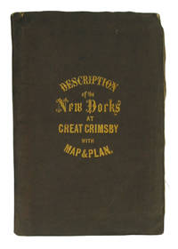
28506Manchester. Bradshaw and Blacklock. 1852. Soft cover. 12mo. 18cm. 24p. 2 tables 3 large folding maps in stiff brown wraps with gilt titles on the upper cover upper hinge starting else fine cgc. Started in April 1849 the New Docks were a major scheme of reclamation and dock construction initiated by the Manchester Sheffield and Lincolnshire Railway later the Great Central. The booklet published early in the year predicted that the completion of the project would be in May 1852. A large detailed plan of the docks and reclamation is included along with two maps one showing connections from Grimsby to the rest of Great Britain the other connections from Grimsby to Europe. Manchester. Bradshaw and Blacklock. [1852] unknown
0265421292.Ghardcover. Good. Access codes and supplements are not guaranteed with used items. May be an ex-library book. hardcover
1333729669.Gpaperback. Good. Access codes and supplements are not guaranteed with used items. May be an ex-library book. paperback
0365866776.Gpaperback. Good. Access codes and supplements are not guaranteed with used items. May be an ex-library book. paperback
0366352008.Ghardcover. Good. Access codes and supplements are not guaranteed with used items. May be an ex-library book. hardcover
B9781019546604Hardback. New. hardcover
0266592163.Ghardcover. Good. Access codes and supplements are not guaranteed with used items. May be an ex-library book. hardcover
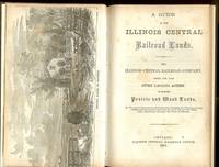
185936215Chicago: Illinois Central Railroad Office 1859. 1859. ILLINOIS RAILROAD. First edition. 9" x 6" original pictorial wrappers 4 60 pp. engraved illustrations two frontis. maps one of Illinois showing the lines and stations of the ICR and the other a system map plus a frontispiece of a Prairie Scene in Illinois. Information is provided on the area and extent classification of soils the composition of the soils water crops stock raising etc. Also information on the Illinois Central Railroad and how and why buy their lands inducements to settle in Illinois statistics of towns on the ICR etc. Light wear to the spine ends interior clean overall a very good copy. Illinois Central Railroad Office, 1859. unknown
1861001302Chicago: Illinois Central Railroad Office 1861. First Edition . Hardcover. Very Good. 8vo - over 7¾" - 9¾" tall. ANDREW John. In modern brown cloth title to spine in gilt. Internally new endpapers has an outline map of Illinois with map of the Rail Road Lines to verso frontis of Prairie scene in Illinois 3 4-60 pp 2 maps from Appletons Railway Guide 1 pl 6 illustrations within text all B&W some light edge browning & spotting bookseller label to epd. Has articles on Inducements to Emigrate Progress of Development Soil and Productions of Illinois etc. An interesting and informative little read. <br/> <br/> Illinois Central Railroad Office hardcover
192846131Chicago: Poole Bros. Inc. 1928. Oblong 16mo. 59 1 pp. Photo illusts. 1 map. Photo-illust. self-printed wrappers slight shelfwear NF copy stapled as issued. First edition thus of this travel brochure detailing the trip by steamship and railroad along the White Pass & Yukon Route from Skagway Alaska to Dawson City on the Yukon River Yukon Territory. Poole Bros., Inc., unknown
0267139578.Ghardcover. Good. Access codes and supplements are not guaranteed with used items. May be an ex-library book. hardcover