4 642 résultats
60409 ½ inches 24 cm. diameter; 21 inches 53 cm. total height. Single pedestal globe with horizon ring armature & meridian all of wood wear and staining on meridian at point where fits into stand some chipping at extremities else fine; globe with vibrant original color and clear sharp patina; some abrasion & losses mostly in lower and upper extremities; overall very good plus condition.<br /><br />An attractive very capably executed table or desk globe in the distinctive style of the Delamarche firm <i>"the most successful French entrepreneurs in maps and globes"</i> Dekker/ van der Krogt. This was an original work by the son Felix who succeeded his father in the management of the firm in 1817. The globe is geographically up-to-date notably in the South Pacific and Alaska with information from then recent Russian voyages such as Krusenstern's. Related to this at the time the globe appeared and reflected on it Europeans were beginning to differentiate between various regions of the Pacific. These were based on a better understanding of cultural and other differences between the peoples of various areas encountered on these recent voyages. For example in 1831 the French explorer Dumont d'Urville proposed the use of the terms "Micronesia" and "Melanesia" for various parts of the Pacific as distinguished from Polynesia. Printed dashed lines on this globe labeled "Division Oceanique" roughly approximate the three eventually accepted divisions of what is referred to as the South Pacific though the regions are not named on the globe. Delamarche also clearly identifies on the globe the more traditional divisions of the Pacific between "Grand Ocean Boreal" "Grand Ocean Equinoxial" and "Grand Ocean Austral."<br /><br />The Delamarche firm was the first to successfully reach a fairly sizable general market of globe buyers. It accomplished this by reducing the cost of constructing globe stands and other parts while maintaining a high level of quality in the maps of their globes which are cleanly and attractively engraved. Traditional brass meridians were replaced by wooden ones and the horizon rings and armatures supporting the rings were greatly simplified and made from either wood or stiff board. Also the firm generally used simpler single-pedestal stands rather than four-legged designs. Yet as this well-preserved example demonstrates Delamarche's design and materials proved to be very durable.<br /><br />Charles-Francois Delamarche 1740-1817 the founder of the family firm was the successor of the great map and globe-making family the Robert De Vaugondys as is cited in the title of this globe. Delamarche in fact seemed to have cornered the globe market in France by also incorporating the stocks of Jean Fortin and Jean Lattre. Delamarche's son Felix took over the firm upon his father's death and managed it until 1848 when Gosselin succeeded him. The firm continued well into the latter 19th century under yet another Delamarche descendent.<br /><br />Dekker/ Van der Krogt <i>Globes from the Western World</i> pp. 63 74; Dekker E. <i>Globes at Greenwich</i> pp. 321-25; Suarez T. <i>Early Mapping of the Pacific</i> p. 25.
60409 ½ inches 24 cm. diameter; 21 inches 53 cm. total height. Single pedestal globe with horizon ring armature & meridian all of wood wear and staining on meridian at point where fits into stand some chipping at extremities else fine; globe with vibrant original color and clear sharp patina; some abrasion & losses mostly in lower and upper extremities; overall very good plus condition.<br /><br />An attractive very capably executed table or desk globe in the distinctive style of the Delamarche firm <i>"the most successful French entrepreneurs in maps and globes"</i> Dekker/ van der Krogt. This was an original work by the son Felix who succeeded his father in the management of the firm in 1817. The globe is geographically up-to-date notably in the South Pacific and Alaska with information from then recent Russian voyages such as Krusenstern's. Related to this at the time the globe appeared and reflected on it Europeans were beginning to differentiate between various regions of the Pacific. These were based on a better understanding of cultural and other differences between the peoples of various areas encountered on these recent voyages. For example in 1831 the French explorer Dumont d'Urville proposed the use of the terms "Micronesia" and "Melanesia" for various parts of the Pacific as distinguished from Polynesia. Printed dashed lines on this globe labeled "Division Oceanique" roughly approximate the three eventually accepted divisions of what is referred to as the South Pacific though the regions are not named on the globe. Delamarche also clearly identifies on the globe the more traditional divisions of the Pacific between "Grand Ocean Boreal" "Grand Ocean Equinoxial" and "Grand Ocean Austral."<br /><br />The Delamarche firm was the first to successfully reach a fairly sizable general market of globe buyers. It accomplished this by reducing the cost of constructing globe stands and other parts while maintaining a high level of quality in the maps of their globes which are cleanly and attractively engraved. Traditional brass meridians were replaced by wooden ones and the horizon rings and armatures supporting the rings were greatly simplified and made from either wood or stiff board. Also the firm generally used simpler single-pedestal stands rather than four-legged designs. Yet as this well-preserved example demonstrates Delamarche's design and materials proved to be very durable.<br /><br />Charles-Francois Delamarche 1740-1817 the founder of the family firm was the successor of the great map and globe-making family the Robert De Vaugondys as is cited in the title of this globe. Delamarche in fact seemed to have cornered the globe market in France by also incorporating the stocks of Jean Fortin and Jean Lattre. Delamarche's son Felix took over the firm upon his father's death and managed it until 1848 when Gosselin succeeded him. The firm continued well into the latter 19th century under yet another Delamarche descendent.<br /><br />Dekker/ Van der Krogt <i>Globes from the Western World</i> pp. 63 74; Dekker E. <i>Globes at Greenwich</i> pp. 321-25; Suarez T. <i>Early Mapping of the Pacific</i> p. 25. books
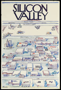
14949California: Pacific Ventures 1984. 912 by 610mm. 36 by 24 inches. Colour printed poster laid down on foamcore. A view of Silicon valley in its early days parodying Saul Steinberg's classic New Yorker cover "View of the World from 9th Avenue". This view shows Silicon Valley and the offices of its important technology companies looming large in the foreground. Among the companies named are Apple Hewlett Packard and Intel. As the view recedes across San Francisco bay there is a humorously foreshortened view of North America with much smaller views of Lake Tahoe Las Vegas New York and Boston with of course MIT. North Carolina and Texas' computer industry centres are competitively nodded at as well with Piedmont NC's Research Triangle and Austin's Silicon Gulch both shown. Further in the distance is the Atlantic Ocean with France and Germany shown as long islands followed by the Pacific Ocean culminating in Japan. "Silicon Valley" is written at the top of the image in the New Yorker's instantly recognisable font. By appropriating Steinberg's image a self-aware joke about New York City's self-centredness Silicon Valley lays claim to its own importance in the world. Funnily enough they weren't entirely wrong as the next few decades of innovation and economic success would prove. The company behind this image Pacific Ventures appears to have been a venture capital firm in the area that was involved in the technology sector. However we have been unable to find any mention of a Pacific Ventures operating at this time in Silicon Valley though there was a explosion of such companies in the area following Apple's 1980 IPO. Nonetheless the statement behind this image would have served a Silicon Valley based investment firm well. Saul Steinberg's "View of the World from 9th Avenue" appeared on the cover of the New Yorker in March 1976. It has since become one of the most popular and recognisable covers in the magazine's history and it spawned countless parodies as every city from Boston to Omaha clamoured to make a version of their own. Steinberg is quoted in a 2001 New York Times article as having said that if he had received the proper royalties " I could have retired on this painting." Pacific Ventures, unknown
Carta apparsa nella sesta parte, "Océanique", dell'Atlas universel de géographie physique, politique, statistique et minéralogique di Vandermaelen. L'atlante fu prodotto in un'unica edizione nel 1827; furono venduti solo 810 esemplari completi. Questa grande opera, che comprende circa 378 mappe uniche e che fu compilata nell'arco di tre anni, fu il primo atlante litografico e il primo a rappresentare il mondo con la stessa proiezione e in una scala uniforme. Philippe Marie Guillaume Vandermaelen è stato un cartografo fiammingo attivo a Bruxelles nella prima parte del XIX secolo. A Vandermaelen si deve uno dei più notevoli sviluppi dell'impresa privata nella cartografia, ovvero il suo straordinario Atlas Universel de Geographie in sei volumi. Vandermaelen, nato a Bruxelles il 23 dicembre 1795, viene considerato come il più grande cartografo belga dopo Mercatore e Ortelius. Figlio di un medico che era diventato un ricco produttore di sapone, muovendosi in un ambiente commerciale e da autodidatta, divenne un commerciante di prodotti chimici e farmaceutici. Fanatico di geografia, la sua carriera subisce una svolta definitiva quando, nel 1825, inizia a pubblicare un rivoluzionario Atlas universel che lo consacra come cartografo. Primo atlante al mondo a rappresentare la Terra su una scala unica ed eccezionalmente grande, l'Atlas universel offriva la rappresentazione più ampia, completa e precisa mai realizzata. I suoi contemporanei lo capirono, come la Chiesa cattolica romana, che era in una fase di espansione. Negli anni Trenta del XIX secolo, Roma sosteneva che questo atlante era assolutamente il miglior atlante disponibile, prezioso strumento della sua politica missionaria nell'Oceano Pacifico e nelle isole meridionali. Bibliografia Marguerite Silvestre, Philippe Vandermaelen, Mercator de la jeune Belgique, 2016. Map appeared in the sixth part, 'Océanique,' of Vandermaelen's Atlas universel de géographie physique, politique, statistique et minéralogique. The atlas was produced in one edition in 1827; only 810 complete sets were sold. This great work, featuring some 378 unique maps and compiled over three years, was the first lithograph atlas, and the first to render the world on the same projection and at a uniform scale. Philippe Marie Guillaume Vandermaelen (December 23, 1795 - May 29, 1869) was a Flemish cartographer active in Brussels during the first part of the 19th century. Vandermaelen is created with "one of the most remarkable developments of private enterprise in cartography," namely his remarkable six volume Atlas Universel de Geographie. No one could have foreseen that Philippe Vandermaelen, born in Brussels on 23 December 1795, would become the greatest Belgian cartographer since Mercator and Ortelius. Son of a doctor who had become a wealthy soap maker, moving in a business environment and self-taught, he became a dealer of chemical and pharmaceutical products. As a geography fanatic, there was a definitive shift in his career when, in 1825, he began to publish a revolutionary Atlas universel which established him as a cartographer. As the first atlas in the world to represent the Earth on a single and exceptionally large scale, the Atlas universel offered the widest, most complete and most precise representation ever achieved. His contemporaries understood this, such as the Roman Catholic Church, which was in a phase of expansion. In the 1830s, Rome claimed that this atlas was “the best atlas available” and was the instrument of its missionary policy in the Pacific Ocean and the southern islands. Litograph, with original outline colour, very good condition. Bibliografia Marguerite Silvestre, Philippe Vandermaelen, Mercator de la jeune Belgique, 2016.
1860WRCAM41089BWashington 1860. Twelve volumes bound in thirteen. Profusely illustrated with maps lithographic plates colored lithographic plates profiles etc. Large thick quarto. Original blindstamped cloth spines gilt. Minor edge wear. Each volume rebacked retaining original backstrip but with new endpapers. All but one volume from the Senate issue Vol. XII Part 1 is the House issue with a Senate backstrip. Lacking the general map of the routes surveyed from Vol. XI. Several maps with holes and separations along fold lines many with large tears including Warren's map of the western United States. Occasional tideline affecting text or an illustration scattered foxing and toning. Overall quite clean internally. Good plus. This large quarto set is the most important and massive compilation of exploration reports and data ever published about the trans-Mississippi West. Under the direction of Secretary of War Jefferson Davis the Pacific Railroad survey in two years increased the contemporary knowledge of the geography topography geology and natural history of the West by a quantum leap. Included herein are the reports of Humphreys Stevens Beckwith Whipple Warren Williamson Lander et al supplemented with reports on scientific observations and numerous significant achievements in cartography including Warren's "Map of the Territory of the United States from the Mississippi to the Pacific Ocean." here present in the eleventh volume which has been hailed as "the best cartographical work on the West up to its time." Howes. The illustrative material engraved and lithographed views specimens of birds fishes and other animals is of the highest quality often in colored state and encompasses thousands of illustrations either in the text or as separate plates. Wheat devotes twenty-four pages of detailed discussion to the maps in this series of reports singling out the Warren map as "among the great maps of the United States that preceded the Civil War." <br> <br> All things considered this edition of the Pacific Railroad Surveys stands as a testament to one of the greatest government sponsored projects in our history and is a foundation work for any collection devoted to Western Americana or cartography. HOWES P3 etc. WHEAT TRANSMISSISSIPPI 822 through 824 843 through 846 852 853 864 through 867 874 875 877 through 882 898 936 23 in all. TWENEY 89 59. WAGNER-CAMP 262 through 267. RITTENHOUSE 442. REESE STAMPED WITH A NATIONAL CHARACTER 75. ZAMORANO SELECT 108. REESE BEST OF THE WEST 138. hardcover books
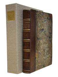
In-4°, due volumi, XIV, 463pp; (2cc), 514pp; prima edizione originale senza le 7 carte pieghevoli della seconda edizione, pubblicata lo stesso anno. Legatura coeva in vitello francese marmorizzato, tagli rossi, con nervi e titolo in oro al dorso. Uno dei rari esemplari comprendenti le 7 carte supplementari nel secondo volume (437*-450*) intitolate Scoperte degli Olandesi nell’Australasia. Si tratta di uno delle più importanti opere consacrate alle prime spedizioni nel Pacifico del Sud. “Il suo studio fa epoca nella conoscenza dell’Oceania(...). De Brosses, raccogliendo tutti i testi conosciuti dai viaggiatori, chiama a raccolta tutti gli studiosi e aiutò a creare un clima favorevole alle esplorazioni scientifiche e alle installazioni coloniali” (O’Reilly 93). Si tratta di una raccolta di narrazioni della maggioranza dei più famosi viaggiatori nei Mari del Sud, cominciando dal secondo viaggio di Vespucci nel 1502 fino ai viaggi di Magellano, Drake, Schouten, Tasman, etc. (Pézennes, France). “Questa è un’opera estremamente importante e completa sui viaggi, e un’opera eccezionale sulla preistoria dell’Australasia (Hill, p.35). Sabin, 8388. In-4°, two volumes, XIV, 463pp; (2cc), 514; first original edition without the 7 folding cards of the second edition, published the same year. Contemporary fine French marbled calf binding, red edges with bands and golden title on the spine. One of the rare copies including the 7 additional leaves in the second volume (437 *-450 *) entitled Discoveries of the Dutch in Australasia. It is one of the most important works devoted to the first expeditions to the South Pacific. "His study made an epoch in the knowledge of Oceania (...). De Brosses, gathering all the texts known by travelers, summons all the scholars and helped to create a climate favourable to scientific explorations and colonial installations "(O'Reilly 93). It is a collection of narratives of the majority of the most famous travelers in the South Seas, starting from the second voyage of Vespucci in 1502 up to the journeys of Magellan, Drake, Schouten, Tasman, etc. (Pézennes, France). "This is an extremely important and complete work on travel, and an exceptional work on the early history of Australasia (Hill, p.35). Sabin, 8388.
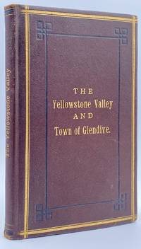
188210945St. Paul MN: The Pioneer Press Co 1882. First Edition First State. 100pp. Octavo 24 cm Presentation binding. Publisher's full grained brown leather with the title gilt stamped on the front board and backstrip. A.E.G. Satin moire endsheets. Near fine. Inscribed on the front free endsheet. 'Mr. Minnie with compliments of the author. Map of the Yellowstone Valley 42 cm x 70 cm and the Plat map of Glendive 40 cm x 56 cm present and both linen backed and in nice condition. Presentation copy. The trade edition of this work was bound in green printed wrappers with 10 pages of advertisements in the front and 3 to 10 pages of advertisements in the rear. Map of transcontinental was attached to the rear free endsheet. Our copy predates the various issues with advertisements and the map attached to the rear free endsheet. Eberstadt and Yale copies and others only list the plat and cattle trails maps. Early Montana promotional item from the Northern Pacific Railroad a year before they opened the Gardiner Gateway at the north end of Yellowstone Park. An important descriptive tract of the new country at the time of its settlement with a fine large map showing the towns and cattle trails. Eberstadt 132: 478. Howes Y8. Rampaging Herd 1535. This is the first time that we've handled or encountered this title. Rare. The Pioneer Press Co unknown
192052937Klamath Falls OR: Colonel Boyd Yaden & Myrtle Madison Yaden Public Works Administration United States Army Corps of Engineers ca. 1920-1960. Eight albums. 1st - Oblong 14 x 9.25 in. 80 pp unpaginated. With 244 photos sized from 1 x 1 in. up to 7 x 10 in. many hand-coloured as well as a few Real Photo Postcards. Limp calf stamped & decorated in colour on front & back covers sewn w/ rawhide tie at gutter margin; 2nd - Oblong 4to. 11.25 x 7.25 in. 100 pp unpaginated. With 249 original photos many w/ annotations some w/ markings within the negative sized 2.75 x 3.5 in. up to 6.75 x 10 in. Limp black simulated leather post-binder sewn at gutter margin w/ black silk braid silver lettering stamped on front cover. 3rd - 4to. 96 pp unpaginated on thick toned paper stock w/ 154 original photos tipped-in taped and mounted with corners into album some with ink annotations below or beside images. Black boards post-binder sewn at gutter margin w/ black silk braid scuffing edgwear some rubbing occasional tears. 4th - Thick folio. 12.25 x 14.25 in. 70 pp unpaginated. on thick toned paper stock. With 104 photos sized from 4 x5 in. up to 8 x 10 in. most 7 x 10 in. nearly all with text in lower fore-edge of negative or printed in blank below image on lower fore-edge all mounted either with tape or glue. Tan padded boards post-binder sewn at gutter margin w/ brown silk braid some scuffing edgewear rubbing. 5th - Thick folio. 154 pp unpaginated. With 239 photographs sized 3.75 x 5.75 up to 8 x 10 in. many of them are 9 x 9 in. most with text in lower fore-edge of negative or printed in blank below lower fore-edge all mounted either with tape or glue. Embossed & decorated padded dark brown boards post-binder nickel-plated screwposts rear hinge repaired in black tape scuffing rubbing. 6th - 4to. 32 pp unpaginated. typed sheets attached to portfolio leaves with 17 original photos mounted 1 large folding colour map 4 pp. TLS signed by Governor Paul Fannin on Arizona State letterhead 2 TLS from Harry Wildnauer Federal Works Agency and Guy Kirksey Air Corps tipped-in. contained with padded leather portfolio gilt decorations silk endpapers minor scuffing. 7th - Oblong 4to. 12 x 7.5 in. 96 pp unpaginated. thick black paper stock. With 228 original photos sized 7 x 11 in. with two 4 pp. programs for Pig’n Whistle Evening Concerts in Seattle WA. Limp embossed Arts & Crafts brown cloth post-binder black silk braid rounded corners front inner hinge starting. 8th - Oblong folio. 13 x 10.5 in. 100 pp unpaginated. on thick black paper stock. With 484 original photographs many with annotations on versos some mounted with glue others with corners some loose a few missing sized from 1 x 2 in. up to 8 x 10 in. Limp textured brown calf post-binder rounded corners sewn at gutter margin with brown silk braid some edgewear rubbing weakening to many leaves at gutter margin an excellent archive filled with bright images strong contrast. This immense photo album archive assembled by Lt. Colonel Boyd Yaden 1906-1980 incorporates eight albums. The first of these albums document his career serving with the Provisional Co. No. 2 1st Battalion 55th Coastal Artillery of the U.S. Army serving the batteries at Fort Kamehameha Fort Kam. The 55th CA was equipped with 155 mm. Grande Puissance Filloux guns typically mounted atop concrete Panama Mounts which enabled the pieces to traverse 360 degrees as well as 75 mm. field pieces. These remarkable images show the artillery gun crews test firing the 155 mm. guns loading shells night firing camp drills inspections athletics expanding the tracks for the 41st Coast Artillery Locomotive at Fort Kamehameha and more. Of special interest are three photos documenting the first Navy Pacific Flight by Commander John Rodgers in the PN-9 Seaplane from San Pablo CA non-stop to Honolulu HI which ran out of gas and landed in the Pacific Ocean. The crew fashioned sails from wing fabric and later leeboards to steer the flying boat and finally came within 15 miles of Kauai where it was discovered by the USS R-4 submarine. The second & third albums chronicle Boyd Yaden’s life with his wife Myrtle Yaden 1901-1988 moving from Klamath Falls OR to Alaskan Resident Engineer and Inspector for the Public Works Administration overseeing the installation of the sewer system in Petersburg Alaska with several photos showing street scenes digging up of streets to lay pipe earthmoving equipment steam shovels and finally the finished streets with bustling economic activity. In addition there are photos of building railroad trestles bridges and logging operations on Wrangell Island Alaska with photos showing the construction logging sites totem poles and then his work as supervising engineer for the Public Works Administration during the Depression building a power plant near Anchorage AK followed by the project of rebuilding the power plant in Seward AK with photos showing the phases of construction. The third album includes photos of the couple on the steamship SS Hazel B No. 2 hunting & fishing in Alaska and the Pacific Northwest the Pioneers Home in Sitka as well as documenting trips to visit relatives in Seattle North Dakota and New York. Two very large photo albums are devoted to Colonel Yaden’s activities as Division Engineer for United States Army Corps of Engineers and later for the Air Transport Command in Alaska and Western Canada. The albums open with an extensive group of photos of Hammer Field near Fresno California now Fresno Yosemite International Airport with images showing the laying of foundations training crash of a B-24 Bomber June 27 1942 the theaters bowling alley Sub Exchange NCO Club tennis courts recreational facilities swimming pool sandstorms and more. In addition Yaden oversaw the mineral and strategic materials facilities in Trona CA with images of the nearby Ruth Mine loading operations onto trucks and railcars. In 1943 Yaden began an engineering and photographic survey of the Western Canadian air bases for the ATC and has included large photos of Calgary Air Base aerial views of Edmonton Air Base and the Edmonton Air Base Edmonton Airport Wing Hangars under construction the Edmonton Satellite Airport aerial views and detailed photos of the Namao Airbase Alberta along with others such as the Grand Prairie Airbase Dawson Creek Fort Neslon Airbase Watson Lake Y.T. Whitehorse Y.T. and the ATC engineering post including the sawmill lumber racks and construction equipment in Canada. The last half of the fifth album is devoted to airfields and airbases in Alaska including the Northway Airfield showing aircraft landing hangars under construction engineering and structural detail photos Tanacross Airport AK Ladd Field and a whole series of large aerial views of the Galena Flood. Yaden also oversaw Airfield site surveys in Port Clarence Nome Point Spencer Imuruk Basin even including a dog sled team and Native American guide in the depths of winter. In addition The final two albums are devoted to the life and activities of Myrtle A. “Madison†Yaden 1901-1988 who taught school in Whitefish Montana then moved to Mullan Idaho the Puget Sound region during the 1920s and later Klamath Falls where she would meet Boyd Yaden. This album includes photos of the gold dredges in Mullan Idaho near Wallace North Dakota Agricultural College band members Montana High School basketball champions football teams hijinks with fellow students and teachers the YWCA Camp on Bainbridge Island treks to Seattle Poulsbo and other areas around the Sound. Boyd Yaden was the nephew of Oregon Pioneer George Nurse who founded Linkville attended the Univ. of Oregon served with the 55th Coast Artillery in Hawaii joined Battery D 249th Coast Artillery of the Oregon National Guard was commissioned a 2nd Lieutenant became a licensed civil engineer in Klamath Falls worked in Alaska Canada California and Oregon where he became an engineering expert on building and working on permafrost in the Arctic and later worked with the Flood Control Agency in Phoenix AZ before returning to Klamath Falls OR as basin engineer. See: Laisa Leao Remembering Hammer Field U.S. Department of Veterans Affairs 2015; William Gaines Coast Artillery Organizational History 1917-1950. Part I Coast Artillery Regiments The Coast Defense Journal Vol. 23 Issue 2 pp. 29-31; Siemon Muller Frozen in Time: Permafrost and Engineering Problems 2008. Colonel Boyd Yaden & Myrtle Madison Yaden, Public Works Administration, United States Army Corps of Engineers, hardcover
186895331868. <p>The Transcontinental Railroad made possible the winning settlement and development of the American West. It led to a revolution in interstate and international trade opening the markets of the west coast and Asia to the east and Europe while bringing products of eastern or European industry to the growing populace west of the Mississippi and beyond. The railroad caused a great production boom and was in a sense America’s first technology corridor. As it encouraged the growth of American trade and business so too did the railroad impact the nation's public discourse and intellectual life by making it possible to come and go across the length of the continent in just over a week. Now for the first time the beauties and riches of the central part of the continent could be accessed any anyone in days. Nothing was the same afterwards. Many people consider the Transcontinental Railroad the greatest technological feat of the 19th century and one of the most consequential major construction projects ever undertaken.</p><p>Before the advent of the Transcontinental Railroad a journey across the continent to the west coast meant months of careful preparation and acquisition of a conveyance and supplies then a dangerous six month trek over rivers deserts and mountains all the way risking the loss of necessities and encounters with blizzards and Indians. Alternatively a traveler could hazard a three to six month sea voyage around ferociously stormy Cape Horn which proved a graveyard to many ships or sail to Central America and cross the Isthmus of Panama through the jungle in part by pack animal and in part by rail which took five or six weeks risking exposure to any number of deadly diseases in the crossing. So it is no surprise that interest in building a railroad uniting the east and west coasts of the continent began soon after the advent of the locomotive.</p><p><strong>Early Trains in the US and the Idea to Build a Train Connecting East and West Coasts</strong></p><p>The first trains began to run in the U.S. in the 1830s along the East Coast and by the 1840s the nation's railway networks extended throughout the East South and Midwest. The annexation of the western territories including California following the Mexican War the almost immediately subsequent discovery of gold in the region in 1848 the resultant Gold Rush starting in 1849 and statehood for California in 1850 brought momentum to the idea of building a railroad across the nation to the Pacific. Meanwhile thousands of immigrants and miners sought their fortune in the West. During the 1850s Congress sponsored numerous survey parties to investigate possible routes for a transcontinental railroad. No particular route emerged as a clear favorite as the project became yet one more point of contention between the North and South before the Civil War with each wanting the railroad to go through their section.</p><p>Theodore Judah was a civil engineer who helped build the first railroad in California and he became obsessed with the idea of a transcontinental railroad running through Nebraska Wyoming Utah Nevada and California. In 1859 he drew up letters of incorporation for the Central Pacific Railroad Company. Judah surveyed the route creating maps that he used to bolster a presentation of the scheme he made to Congress in October 1861. Many Congressmen were leery of beginning such an expensive venture especially with the Civil War underway but President Abraham Lincoln a long-time supporter of railroads saw in the proposal an important additional opportunity: to help knit California and the West to the Union. He agreed with Judah and on July 1 1862 Lincoln signed the Pacific Railway Act authorizing land grants and government support which amounted to $32000 per mile of track laid to two companies the Central Pacific Railroad and the Union Pacific Railroad. The Central would start at California’s eastern rail point in Sacramento cross the Sierras go through Nevada and into northern Utah where it would meet up with the Union Pacific. The Central Pacific Railroad spiked the first rail on October 26 1863 and its construction crews began building the line east from Sacramento.</p><p>At the eastern end of the project Gen. Grenville Dodge and his assistant Peter Dey surveyed the potential route the Union Pacific would take. They recommended a line that would follow Nebraska’s Platt River along the North Fork would then cross the Continental Divide at South Pass in Wyoming and continue along to Green River then head into Utah. President Lincoln favored this route and made the decision that the eastern terminus of the Transcontinental Railroad would be Council Bluffs Iowa across the Missouri River from Omaha Nebraska.</p><p><strong>The Union Pacific</strong></p><p>Thomas Durant a medical doctor turned businessman gained control of the Union Pacific Railroad Company in July 1863. Though Durant took the office of vice president he was the actual leader of the railroad. In 1864 Congress passed the second Pacific Railway Act which doubled the size of the land grants and allowed the railroads to sell their own bonds. The Union Pacific began to lay tracks at Omaha Nebraska in July 1865. But Durant's management of the actual building of the rail line was sub par and lacked both organization and people with sufficient knowledge and skills to accomplish its ambitious task.</p><p>So as 1866 dawned Durant hired Grenville Dodge as chief engineer of the railroad Dodge began advising Durant immediately although he would not leave the service until May and Dodge insisted up front that Jack Casement and his brother be hired to lay the track and actually construct the Union Pacific line. John S. Jack Casement had worked as a railroad contractor on the Ohio Railroad prior to the Civil War. During the war he rose to the rank of General and Brigade commander and was admired for his bravery management skills and railroad experience. Jack and his brother Daniel had formed the firm of J.S. & D.T. Casement; “General Jack†was construction leader while Daniel handled financial matters.</p><p><strong>Jack and Dan Casement Build the Railroad</strong></p><p>The Casements came to an understanding with Durant and they agreed upon a proposal letter dated February 6 1866. That letter provided that the Casement firm would ""lay and fill the track on the Union Pacific Rail Road for seven hundred fifty dollars per mile on the following terms and conditions. The Rail Road Company to furnish motive power cars wood and water and tracks for boarding cars and pay for delays of over three consecutive days caused by want of material motive power or other default or neglect of Company. The track to be laid in a good and workmanlike manner and filled and surfaced with material taken from the side of the road the whole to be subject to the approval and acceptance of the Engineer of the Company in charge of the work and the track to be accepted on the completion of every twenty miles and approximate estimates to be made by the Engineer in charge and paid monthly. We will lay the track as fast as required not to exceed one mile per day and will at the option of the Company on ten days notice reduce our gang to a force sufficient to lay one half mile per day. We will furnish engineer men and all other help for the trains used in distribution of material and take the materials for track at any point on the Rail Road within one hundred feet of the track and we will furnish oil waste etc for trains in our employ. All trains used in construction or for any purpose by us are to be run subject to the regulations & schedule time of the Company & under the general control of the Superintendent of the Company. We will make no extra charge in cutting and filling in leveling ties unless it exceeds six inches. No extra charge for putting in frogs and switches for all necessary sidings. And we will place the labor of all our men at the disposal of the Company whenever the delays exceed three days and charge for their time as per our payroll. We will commence as soon as the Company requires & will lay track during the whole of the present season and longer if the Company requires.†This proposal was signed “J.S. & D.T. Casement.†Durant responded to the Casements two days later on February 8 1866. His letter stated: “J.S. & D. T. Casement Painesville Ohio. Gentlemen: Your proposition to the Union Pacific Railroad Company under date of Feb. 6 1866 in relation to track-laying is received and has been considered. The Company decides to regard your proposition and this acceptance as the agreement upon the subject. The Company reserves the right to terminate this arrangement in case you do not perform the agreement on your part. Yours truly Thomas C. Durant V. P.""</p><p>Jack Casement was responsible for all matters relating to building the Union Pacific. He hired the workers many of whom were former military personal gathered the materials and supplies and went into the field. As during the war his post was at the front in the construction camps which he ran like an army at the end of the line where the work was being done or in his car at the tail of the work train. Scrappy and hard-working he oversaw not just the laying but the grading of the track as well. As one of the necessities of his job to get to and from the work sites the Union Pacific presented him with annual passes to use their cars.</p><p><strong>Jack Casement’s engraved Union Pacific pass for 1868</strong> used by him to manage and supervise work on the Transcontinental Railroad signed by Company President John D. Perry. This pass was retained by Casement’s descendants until recently when we obtained it directly from them.</p><p>Under Casement’s leadership the Union Pacific laid 1087 miles of track from Fremont Nebraska west to Utah where the Central Pacific and Union Pacific Railroads met to form the transcontinental railroad. His was a magnificent achievement that compares well with the Central Pacific Railroad which laid 690 miles.</p><p>On April 9 1869 with construction work nearing a conclusion and both the Union Pacific and Central Pacific needing a meeting point Congress established it as Promontory Summit north of the Great Salt Lake in Utah. Less than one month later on the morning of May 10 1869 locomotives from the two railroads met nose-to-nose to signal the joining of the two lines. At 12:57 p.m. local time at a ceremony planned to connect the railroads Leland Stanford Governor of California and president of the Central Pacific and Durant as vice-president of the Union Pacific were to pound in the golden spike with silver hammers. Both men proved unable to hit the spike so Jack Casement stepped up to do the job accompanied by much cheering from the workers surrounding him. Telegraphers announced the completion of the Pacific Railway. Canons boomed in San Francisco and Washington. Bells rang and fire whistles shrieked as people celebrated across the country. The nation was indeed united.</p> unknown
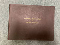
191048451Boston: Tudor Press n. d. ca 1910. 1910. RAILROAD WYOMING COLORADO UTAH. First and only edition. A special deluxe limited edition for presentation this being copy no. 479. Original oblong maroon boards with titles stamped in gilt on the front cover decorated front and rear endpapers n. p. 210 pp. 115 full-page photographs 85 pages of text one in-text map showing the route of the railroad and an elephant folio map coded in color showing the route from Laramie to Coalmont laid-in the front of the volume. The large folding map measures 65.4 x 90 cm 25 3/4" x 35 1/2" with a scale of about 14 miles for 1 inch. This large and handsomely produced volume was likely published for the purpose of luring potential investors into view the Company's operations. Having also the recipient's name in autograph and presented with the compliments of the railroad. This unusual and most remarkable album amounts to what can honestly be described as an extensive visual history of the development of the Laramie Hahns Peak and Pacific Railway System with much material on the region through which it passed including photographs of the people the industries the immense natural resources available to them the construction of dams and canals farming mining ranching lumbering etc. The text and captions emphasize the prospects for further development with much important information both textual and visual on Laramie Steamboat Springs Hayden Vernal Meeker etc. We find no note of this edition nor even the title of this edition in Howes or Graff. The Eberstadts had a so-called trade edition with no mention of the splendid map nor the presentation leaf. Overall an album of immense importance beauty and rarity especially having the large folding map. Minor wear to the corners else a near fine tight copy housed in a cloth slipcase with leather spine label and titles stamped in gilt. Map fine. Tudor Press, n. d. (ca 1910). hardcover
18019122London: Printed for T. Cadell Jun. & W. Davies; Cobbett & Morgan; and W. Creech by R. Noble 1801. First edition. 4to 4 viii 412 2 errata cxxii pp with "General History of the Fur Trade" following the Voyages section and errata leaf. Complete with half title often lacking frontis portrait three large folding engraved maps. Fine 1/2 polished calf tooled in blind and lettered in gilt on spine marbled boards endpapers and page edges. Few stains and foxing to prelims most notably at the inner margin of the frontis and title pages. Otherwise scattered light foxing mainly marginal and more pronounced on the final dozen leaves or so. Maps quite nice with typical offsetting from folds some foxing and toning. A very good copy in attractive binding housed in a custom oatmeal cloth Solander box lined with green felt gilt spine label. <br /> <br /> A cornerstone work on early Pacific Northwest exploration being the first account of crossing the continent from ocean to ocean by a white man some dozen years before Lewis and Clark. This text also represents the first published account of the fur trade which was attributed to Roderick Mackenzie. A nice copy in attractive binding. <br /> <br /> Howes M 133. Sabin 43414. Streeter 3653. <br /> <br /> <br /> . Printed for T. Cadell, Jun. & W. Davies; Cobbett & Morgan; and W. Creech, by R. Noble unknown
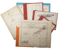
1872WRCAM29311Various places 1872. Twelve cards each 17 x 13 inches a.e.g. with manuscript captions in lower margins. Images are 9 x 6 1/2 inches except the two oval images of San Francisco. Some minor soiling on cards some images slightly faded. Very good. Archivally matted protected with a mylar sheet. An excellent collection of views quite early for Hawaii and New Zealand. The four views of Honolulu include one wide view of the town a view of a side street with a church steeple in the background the Pali mountain pass and the harbor with several large vessels at anchor. In New Zealand the Supreme Court building in Christchurch and the city of Littleton are displayed. The San Francisco images include the Palace Hotel and the famous Cliff House. Of particular interest are the three views of the Central Pacific Railway. The sections of the track include Capestown the Palisade and Summit Station each with fresh evidence of the line's recent completion. Also in the collection is one image of a railroad along the banks of Salt Lake and three wide views of Salt Lake City one with the Mormon tabernacle completed in 1871 prominently featured. An attractive collection of views each quite displayable. unknown books
1798205561798. Very good condition. Scarce copper engraved proof plate for a very early image of Canada's British Columbia coast depicting First Nations people and their village as encountered by Captain George Vancouver. This is a proof for plate IV Volume I of George Vancouver's Voyage 'A Voyage of Discovery to the North Pacific Ocean and Round the World; in which the Coast of North-west America has been Carefully Examined and Accurately Surveyed .'. <br /> <br /> Vancouver's voyage was intended to ensure Britain's hold on territory on the Northwest coast of North America and to search for the Northwest Passage. Vancouver who began his career sailing under Capt. Cook explored the mouth of the Columbia River Vancouver Island and Puget Sound. <br /> <br /> There were no commissioned artists on the voyage; Thomas Heddington 1776-1860 was one of four gifted crewmen who made drawings of the new territory. A midshipman on the ship Chatham Heddington's view shows a tree covered hill with the village at the top with wooden fish drying structures on the slope and with First Nation people in canoe on the water. Bute's Canal is now known as Bute's Inlet about 125 miles from Vancouver on the southwest coast of British Columbia. <br /> <br /> Vancouver describes the scene depicted here: ". fires of the natives had been observed on entering this canal; which I distinguished by the name of 'Bute's Canal'. Here was found an Indian village situated on the face of a steep rock containing about one hundred and fifty of the natives some few of whom had visited our party on their way up the canal and now many came off in the most civil and friendly manner with a plentiful supply of fresh herrings and other fish which they bartered in a fair and honest way for nails". <br /> <br /> The drawings were later revised by William Alexander to illustrate Vancouver's Voyage. The original ink and wash sketch for this proof plate sold in Vancouver in 2012 for $55000 Heffel Fine Art Auction House May 17 2012.<br /> <br /> The proof plate printed on tissue paper laid on to India paper. Image size 13 1/2 x 10 1/2". Full paper size 17 1/4 x 12". Two faint diagonal creases upper left side.<br /> <br /> with the printed edition of the print titled 'Village of the Friendly Indians at the entrance of Bute's Canal'. "W. Alexander del: from a Sketch taken on the Spot by T. Heddington" and "J. Landseer sculp" printed below the image. London published May 1st 1798 by R. Edwards New Bond Street J. Edwards Pall Mall & G. Robinson Paternoster Row. 11 1/2 x 9 1/4". Both images in very good condition. unknown
1720267561720. Folio. 23pp. Modern three-quarter morocco and cloth gilt. Woodcut arms and typographical decoration on title. Small brown stain on titlepage and second leaf. Minor soiling else.<br/> <br/>A detailed extensive proclamation to reinforce the strength and size of the Spanish fleet trading between Spain and South America primarily via Lima in Peru. Also printed in Madrid the same year though this edition is significantly rarer. Rare with no other copies of this edition appearing in auction records and the only copies appearing in OCLC located at the national libraries of Spain Chile and Britain.<br/> <br/>Palau 239622; Medina BHA 2357; LeClerc 466; Sabin 66408. unknown books
1755ABC_474521755. Manuscript of 24 pages 6 printed maps on cardboard. This wonderful logbook details the journey of a French captain from Manila to the Maluku Islands in todays Indonesia. The journey took place during the months of March to May of 1755. The captain of the ship recounted with great detail the events of every day of the journey with detailed daily accounts of the weather winds manoeuvres of the ship its departures anchorages and precise coordinates at every point of the journey. The captain furthermore had a keen eye for the geographical and nautical details along the journey. He recounted the exact locations of for example sandbanks and bays where ships and their crews can take provisions and fresh water. The accounts are detailed and captivating: "After our boats were back on board we set sail . in the afternoon to moor under the old Portuguese fort on the Solor island Indonesia the winds for the tide were fresh at 1:34 a.m. . sand and gravel and then I went back to mooring. The pavilion of the fort . the village is under the said fort at 3 cables from us .". The captain goes on to describe the geographical features of the islands as well as other places en route with great detail. Curiously we find inscriptions in Spanish and the names of one don Phelipe Qui who describes himself as el piloto and one Padre Don Estevan de Melo. The latter might be identical with Don Estevan Roxas y Melo a native of Lima Peru and secretary to the Archbishop of Manila Rodriguez since 1736. Roxas y Melo was part of the 1751 reconstruction of the Cathedral of Manila working under the auspice of the Italian architect Juan de Uguccioni.The logbook comes with six printed maps partly illustrating the journey of the captain pasted on contemporary cardboard. They depict the Bay of Sulavesi with the city of Bantang Pitcairn the coast of New Guinea the coast of Queensland the Santa Cruz Islands in the present-day Solomon Islands and Alejandro Selkirk Island. The plates stem from the French translation of James Hawkesworths An Account of the Voyages Hawkesworth Relation des voyages entrepris par ordre de sa Majesté Britannique actuellement regnante; pour faire des découvertes dans l'hemisphère meridional Paris 1774.Some holes on the first sheet not affecting the text. Small water damage some slighlty affecting the text. Remnants of seals on last page. Otherwise in good condition. unknown
Unread. As new. Number 216 of limited edition of 350 copies. Signed by co-author R.E. Gosnell. "Few publications, if any, of similar size and excellence have been produced in Canada." - From Editor's Foreword. Part I includes 210 pages and eighteen chapters which constitute "a survey of events from the earliest times down to the Union of the Crown Colony of British Columbia with the Dominion of Canada." Part II is "a history, mainly political and economic, of the Province since Confederation up to the present time." Part I is preceded and followed by dozens of tissue-protected black and white portraits of individuals influential in the early history of the province, complete with their brief biographies upon the tissue. Part II comprises eighteen chapters over 226 pages plus 5 pages of addenda followed by dozens of tissue protected portraits of "some of the men conspicuous as present day factors in development." Top edge gilt. Gilt lettering upon backstrip. Marbled endpapers. Exceptionally clean, bright, and unmarked with zero wear. Brown suede exterior appears as fresh as the day it was applied over 100 years ago. This majestic fourteen pound tome measures 13" x 10.5" x 4". A magnificent acquisition for any serious collector of British Columbia history. A better copy will not be found. [Lowther 1607, Hale 2523, Edwards & Lort 3177, Strathern 495] Book
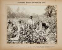
1900373823St. Louis 1900. 34 photographs mounted recto and verso on 17 cards with printed album title on each the images captioned in the negative on linen guards. Oblong small folio 10-1/8x12-1/2 inches. Contemporary half calf and cloth covered boards titled in gilt on the upper cover leather perished contents loose. The images generally dark printings in good condition. Provenance: Battery Park Hotel Asheville NC presentation in gilt on the upper cover from H. C. Townsend Gen'l Pass'r and Ticket Agent St. Louis. 34 photographs mounted recto and verso on 17 cards with printed album title on each the images captioned in the negative on linen guards. Oblong small folio 10-1/8x12-1/2 inches. The images by an unindentifed photographer comprise lovely compositions of buildings and scenes along the route in Missouri Kansas Nebraska and Arkansas. OCLC locates only a single example at University of Texas Austin. unknown
NUMBER ONE OF ONLY TEN SETS OF THIS OUTSTANDING PORTFOLIO OF EXPRESSIONIST ETCHINGS, WITH MANY OF THE ETCHINGS PRINTED ON OLD JAPANESE PAPER. In 1918 German novelist Hans Bethge wrote "Satuila oder vom Zauber der Suedsee" ("Satuila or the Enchantment of the South Sea"), the story of a young woman in Samoa. It is a sensual, escapist tale: the situation in Germany was quite terrible after the defeat in WWI, and there was great demand for escapism. This novel was a hit, and a deluxe edition, with 6 original etchings by German Expressionist artist Georg Alexander Mathey, was published in Berlin in 1921. The etchings are extremely beautiful, perfectly capturing the lush sensuality of the landscape and the unabashed sexuality of the characters (similar to the depictions of Gypsies by Otto Mueller, from about the same time). This edition of the novel was limited to 250 copies. Aside from the book edition, 10 sets of the etchings were printed, with large margins. In these 10 sets, each of the etchings is signed and numbered by the artist. I OFFER ONE OF THESE 10 SETS: SET NUMBER 1, with each of the etchings numbered 1/10 and signed in pencil by the artist. FOUR OF THE SIX ETCHINGS IN THIS SET ARE PRINTED ON OLD JAPANESE PAPER, AND ARE PERHAPS UNIQUE AS SUCH. Additionally, there is a signed working proof of an early version of one of the etchings, also printed on old Japanese paper. This proof is probably unique, as the etching was never published. The set is as it was issued. Each etching (sheet size 8 1/2 x 7 inches--22 x 18 cm) is individually matted, and the original parchment-backed cloth portfolio case (16 1/2 x 13 inches--42 x 33 cm). There is a little light wear to the portfolio, but the etchings are fine and bright. An important and extremely rare item (and perhaps the only German Expressionist depictions of the South Pacific!)
4to [29 x 24.5 cm]; [ii], xxiii, [i, errata], 388, 13, [i, directions] pp, engraved frontis portrait, plus 32 engraved plates, maps and charts including 20 folding. orig full tree calf, rebacked with orig gilt decorated spine, gilt title lettering on orig red spine leather label, wear at corners & spine ends, armorial bookplate of Robert Austen, marbled endpapers, interior clean, crisp & fine with only slight foxing. Taylor 401. Cox i, 301. Hill p. 108: 'Forrest sailed from Balembangan, in the 'Tartar', a native prahu of about ten tons burden, with two English officers and eighteen Malays, towards the Moluccas. He pushed further east than any of his company predecessors, eventually reaching Geelvink Bay in New Guinea. The voyage was one of examination and enquiry . . . the tact with which he conducted his intercourse with the natives, and the amount of work done in a small boat, deservedly won him credit as a navigator'. They explored the Gilolo Passage between New Guinea and the Moluccas, then sailed to Mindanao, examining the Sulu Archipelago, Mandiolo, Batchian and Waygiou, and reaching the Malay peninsula A vocabulary of the Magindano tongue is added at the end of the book. There is much on the native people, their customs, manners, activities. The book is famous for its fine engraved plates and maps.
188553538Paris: Imprimé pour Isadore Liseux et ses amis 1885. First edition thus. Near fine. First vernacular translation of these suppressed Latin elegies that include the most explicit poetic expressions of homosexual desire of the Italian Renaissance. The HECATELEGIUM was first published in Florence in 1489 by a poet so notorious for his open homosexuality that Machiavelli named him in a 1501 letter as one of those poets who would have been burned at the stake had they not been protected by powerful cardinals "qui nisi haberent refugium in asylum nunc huius nunc illius Cardinalis combusti iam essent". Massimi's fame during his long life was nearly extinguished over the centuries of suppression and silence that followed which saw a heavily bowdlerized edition of the HECATELEGIUM published in Parma in 1691 and this privately printed edition in French and Latin only in 1885 the first uncensored edition since 1523. Though the Latin of this edition is complete certain obscene Latin words are printed in Greek rather than French in the facing translation still deemed too filthy to be read by anyone without a protective classical education. Undertaken by the shadowy publisher Antoine-Isidore Liseux 1835-1894 it was printed in Liseux's elegant typographical style in a "private" edition of 120 copies. Rare and important. 9.75'' x 6.5''. Later three-quarter cherry-red calf over marbled boards signed "Canape Belz" with matching marbled endpapers. Edition of 120 copies this copy no. 80. Text in French and Latin. xvi 354 2 pages. Minor rubbing to extremities. Old shelf label removed from head of spine. Else bright clean and sound. Imprimé pour Isadore Liseux et ses amis unknown
4to [30.5 x 23.5 cm]; xxix, [ii, errata, directions leaf], 360, 47 pp, 22 plates and maps including 6 folding maps and charts, tables, with the half title page (often lacking). contemporary leather backed marbled boards, gilt spine title lettering, joints rubbed, corners worn round, some light staining to about 5 plates at rear, mostly marginal, generally clean and unmarked, very good, a tall copy with wide margins. A picture of Two ships, the King George commanded by Portlock and the Queen Charlotte, commanded by George Dixon, visited the Falkland Islands, made a long stay at Hawaii, then proceeded to survey the American coast, to more accurately map the coast and to establish a British presence in the region's fur trade. National Maritime Museum 140: 'Dixon discovered Queen Charlotte Island, named after his ship'. Buck 35. Sabin 20364. Howes D365. Wickershaam 6574. Lada-Mocarski 43. Hill 352: 'This expedition set out to establish a trade in furs in North America. Dixon visited Hawaii three times in the course of the voyage. . .discovered Queen Charlotte Islands, Port Mulgrave, Norfolk Bay, Dixon Entrance and Archipelago while continuing down the coast and trading with the Indians.. . . Dixon's contribution to the work also includes the valuable maps. The accounts of this expedition relate to the geography, ethnology, and natural history of the American coast from Nootka Sound northward'. The fine plates including many views, birds, portrait, etc. One of the detailed appendices is on the natural history encountered. Dixon had earlier sailed with Cook on the Resolution
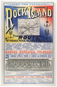
5510Chicago: Cameron Amberg & Co. Printers ca. 1880. Illustrated chromolithographic broadside with map 21.25†x 13.125†plus margins inset map measuring 4.5†x 5.875†illus. measuring 3.25†x 12.5â€. CONDITION: Very good margin chipped at upper right corner a few minor stains. <p>A rare and striking broadside issued by the Chicago Rock Island & Pacific Railway advertising the Rock Island through-express route and promoting the railroad’s numerous destinations connections and amenities.</p> <p>Featuring the eye-catching mix of typefaces and colors that characterized railroad advertising in this era this attractive broadside promotes the numerous midwestern stops and destinations accessible via the Chicago Rock Island & Pacific R’y. At this time two through-express trains for Kansas and Nebraska ran daily in connection with the Atchison Topeka & Santa Fe and Union Pacific railroads. As noted here meals were served in palace dining cars for seventy-five cents each and 150 pounds of baggage were allowed on each full ticket and seventy-five pounds on each half ticket free. The line’s various destinations included Iowa City Council Bluffs Denver Salt Lake City and San Francisco as well as “all points in Kansas Nebraska Colorado Arizona New Mexico Utah Montana and California.â€</p> <p>Showing the Rock Island R.R. in bold the inset map spans from Chicago and Lake Michigan in the east to Omaha and Council Bluffs in the west and reaches from St. Paul in the north to St. Louis and Kansas City in the south—with Lake Michigan lying in the upper-right corner. One axis of the line extends from Milwaukee and Racine Wisconsin to Leavenworth Kansas and another stretches from Chicago to Omaha. Various spurs connect to both.</p> <p>The lower section of the broadside features a marvelously detailed illustration of the interior of a palace dining car showing numerous fashionably dressed passengers seated and dining among African American waiters who are shown in the small kitchen and serving food. In the far-right end of the train men are depicted in drawing rooms—reading newspapers and smoking—and various railway operators and ticket-men appear at the ends of the car. Also included is a table of connections with various railroads that could be made in “Union depots.†Through-tickets via this route could be found on sale at all coupon offices in the U.S. and Canada. Those seeking additional information folders maps and times-tables are encouraged to contact any of the ten agents and managers of the Rock Island R.R. listed at the bottom who were based in New York Toronto Philadelphia Chicago etc.</p> <p>Established in 1847 as the Rock Island & LaSalle R.R. the company was reincorporated in 1851 as the Chicago & Rock Island R.R. Co.—its rails during this period reaching to Morris Illinois and later Ottawa. After acquiring the Mississippi & Missouri R.R. in 1866 the company was renamed Chicago Rock Island & Pacific R.R. Co. Expanding between 1873 and 1882 the company built more branch lines that reached into Iowa as well as Kansas City. In 1880 the firm was reorganized under the name Chicago Rock Island and Pacific R’y Co. and by 1883 extended nearly to the southern boundary of Kansas. After Congress granted passage across Indian Territory in 1887 the Rock Island R.R. began developing through Texas to Galveston as well as New Mexico Territory. During the 1920s the railroad enjoyed considerable success. In 1926 the company began constructing a freight line between Amarillo Texas and Liberal Kansas which was finished in 1929 and served to make accessible a country of rich grain. While the railroad industry continued fairly steadily through 1930 between 1931 and 1935 the Depression took a toll on the Rock Island R.R. and went into decline. The company ceased operation in 1980.</p> <p>OCLC records just one copy held at Yale.</p> <p>REFERENCES: “Chicago Rock Island and Pacific Railway Records†at Kansas Historical Society online.</p> Chicago: Cameron, Amberg & Co., Printers, [ca. 1880] unknown
18871408San Francisco 1887. About very good. 668pp. including numerous in-text or full page illustrations and eight photolithographed plates plus large folding map. Folio. Original pictorial wrappers. Wraps with some soiling wear at edges; front wrap with a few signs of biopredation; two small chips to rear wrapper; spine perishing at extremities. Minor worming at upper corner of a few interior leaves. Light tanning. A rare and extravagant promotional for the Pacific Cable Railway Company which manufactured installed and operated the famous streetcar system of San Francisco and in several other American cities. The present work also serves as a declaration of patent with a list of patents and patent holders at the rear and the text comprises a detailed technical description of the wire cable system with many illustrations of its mechanisms and operation as well as general accounts of the systems running in San Francisco Los Angeles Chicago and Kansas City. In addition to the technical diagrams are several attractive line illustrations and eight photolithographed plates reproduced by artotype of the cable cars of San Francisco in action all by Britton & Rey. The folding map at the rear provides a detailed delineation of the lines running across the city. Very scarce OCLC locates only five copies.<br /><br />Cowan II p.512. books
Raro secondo stato della carta, proveniente dal quinto volume dell’opera Raccolta di tutti i viaggi fatti intorno al mondo da diverse nazioni dell’Europa di Jean Pierre Berenger edito nel 1794-96 illustrato con carte dell’editore veneziano Zatta. Rispetto alla medesima carta inserita in “Atlante novissimo”, cambiano il titolo e la data. Bel cartiglio figurato.Buono stato di conservazione con pieghe editoriali e traccia di restauri agli angoli delle medesime.La carta viene per la prima volta pubblicata in Atlante Novissimo dello Zatta, edito tra il 1779 ed il 1785. Atlante fra i più belli e completi mai pubblicati in Italia nel XVIII secolo, l'opera più famosa dello Zatta. L’Atlante Novissimo, come si specifica anche nel titolo, è “accresciuto sulle osservazioni scoperte fatte dai più celebri e più recenti geografi”. Tra le novità più significative vi è la comparsa delle nuove isole scoperte nell'Oceano Pacifico da James Cook e la prima carta italiana della Nuova Zelanda. Le illustrazioni furono ideate e disegnate dai suoi collaboratori Giovanni Marco Pitteri, Anton Friedrich Busching, Pietro Antonio Novelli ed incise da Giuliano Zuliani. Il primo tomo dell’atlante è introdotto da un breve saggio di geografia generale dove l’autore definisce in modo sintetico e preciso gli elementi che compongono i reticoli eclittico ed equatoriale usati nelle tavole. Interessante la sezione dove si sofferma a descrivere il fenomeno della precessione degli equinozi e quello della variazione ciclica dell'obliquità dell'eclittica. Acquaforte, stampata su carta vergata coeva, coloritura coeva dei contorni, in buone condizioni. - THE VERY RARE SECOND EDITION OF 1794 - Taken from 'Raccolta di tutti i viaggi fatti intorno al mondo da diverse nazioni dell’Europa' by Jean Pierre Berenger. The date is changed into 1794Antonio Zatta's map of New Zealand is not only one of the first to show the results of Cook's voyages, but is also one of the most attractive of the islands. Considerable coastal detail, with reference to the Endeavour's path, and a little and surmised internal detail. The map delineates two islands, tentatively identifying the Southern Island separate. The map shows Cook's tracks around the island, along with the astronomical observations. Nice topographical detail is shown, along with a blend of native and European place names on the islands. The map includes several annotations. The decorative cartouche, in full original colour, shows a native village scene. New Zealand, though discovered by Tasman in 1642, received no further European exploration until the first Pacific voyage of James Cook. Cook sailed the coast of New Zealand for 6 months, proving that it was not part of the Great Southern Continent, as many had believed. Cook visited New Zealand several times, with Zatta's map drawn from information provided in the latest of his voyages.
19048792San Francisco: Whitaker & Ray Company 1904. First Edition. Hardcover. Good. Whitaker & Ray Company San Francisco 1904. First Edition. Covers reinforced at the outer edges and spine with white tape. First free end-paper missing. Front hinge separated from the text. Moderate foxing to a few pages most pages clean and bright. -- A Juvenile book of jingles characteristic of the west. Contains jingles on such subjects as the Chinaman Cliff House Golden Gate Park etc. Beautifully illustrated by 19 full page seven color litho-prints. -- One edition published in 1904 in English and held by 2 libraries worldwide. Size: Quarto. 39 pages not numbered. -- Condition:. Whitaker & Ray Company hardcover