6 261 résultats
56-0257San Francisco Calif.: Southern Pacific Company 1946. Map. Blueline print 36" x 67." From Fruitvale to Hayward with Melrose Mulford Stonehurst Russell City. Includes proposed Highway Route 69 shaded. With Key to Industries approx. 40 listed. Includes Scale 1" = 1000'. San Francisco, Calif.: Southern Pacific Company, 1946. unknown
Anchorages in the Galapagos Islands.In the left part of the chart insert of Wreck Bay and approaches From a British survey in 1849 with additions and corrections. In the middle of the chart insert of Iguana Cove From a British survey in 1836, Webb Cove From a British survey in 1886, James Bay From a British survey in 1836, Sulivan Bay From a British survey in 1836, Terrapin Road From a British survey in 1836, Freshwater Bay From a British survey in 1836, Conway Bay From a British survey in 1846, Wreck Bay to Stephens Bay From Italian surveys in 1882 and 1885. In the right part of the chart insert of Tagus Cove From a British survey in 1835, Gardner Bay From a British survey in 1835, Post Office Bay From British surveys in 1836 and 1846, Sappho Cove From a British survey in 1883, Black Beach Anchorage From a French survey in 1887. Washington D.C., published July, 1899, at the Hydrographic Office, under the authority of the Secretary of the Navy. Small corrections: Printed: Oct. 1926. Folded editorially. Autore: Admiralty Charts. Luogo: Galapagos Islands - Pacific Ocean. Anno: '900. Tecnica: incisione. Dimensioni: 639x1105 mm
Wonderful vintage brochure in brown decorated card covers. Measures 23 cm x 10.5 cm when closed. Opens to reveal six large double-side leaves, each measuring 30.5 cm x 23 cm when folded-out. Includes twenty-three black and white reproductions of photos plus a map, all supported by considerable text. Rates for cottages and tents provided inside back cover. A plaque located near the former site of the inn states it closed in 1928 and burned down in 1936. It was purchased in 1910, a year before this brochure was printed, by Toronto feminist Flora MacDonald Denison who, inspired by the philosophy of Walt Whitman, set out to build a wilderness retreat for the avant-garde. Guests were offered painting lessons, amateur theatre, and poetry readings. Many well-known Canadian artists, including members of the Group of Seven, painted and sketched in this area, drawn by the strking landscape. Moderate wear. Unmarked. Binding intact. A marvelous piece of Canadiana. Book
60 pages. Many reproductions of wonderful archival black and white photos. Features include: The Patrick Family Legend; The First Game; The First Year; The First Stanley Cup; The Second Stanley Cup; The Great Denman Fire; Fred (Cyclone) Taylor; The Life and Times of Coley Hall; The Glorious Smokies; The Brat Called Pistol - Eddie Dorohoy; The Rollicking, Raggedy Vees; The Spirit of the Canucks; The Drillers of Kimberley; The Heart of Fred J. Hume; The Life and Laughs of Babe Pratt; The Palace by the Sea - Pacific Coliseum; The Anatomy of a Franchise; and more. One page CKNW 98 ad highlights play-by-play man Jim Robson. Molson ad features photos of their 1969-70 hockey scholarship winners including: John Cumberbirth, Bob Gaston, Pat Russell, Keith, Nordin, Richard Beauchamp, Daryl Fedorak, Brian Debiasio, Brenk Kaufmann, Robert Little, George Walton and Don Young. One-page pricelist of Canucks merchandise. Printed upon glossy stock. Clean and unmarked with moderate wear. A sound copy of this very informative, nostalgic and uncommon work from the year the Canucks entered the NHL. Book
Una mappa dettagliata centrata sull'Oceania. Basata sui dati della spedizione di Dumont d'Urville.Litografia, in buono stato di conservazione. A detailed map centred on Oceania. From the expedition of Dumont d'Urville.Good and dark impression.
18542457Paris ; Niort, Allouard et Kaeppelin ; Robin, [1854]. In-8 de (6)-368-(2) pp., toile verte, décor à froid sur les plats, tranches dorées (reliure de l'époque).
Features: Are the Hill Lines Preparing to Invade California Territory?; Big Railway Systems of U.S. Cutting Expenses; Prepare for the Panama Canal! (Editorial); Nautical biography of Capt. James S. Gibson (with photo); What Should We Do To Be Prepared For the Opening of the Panama Canal?; Salvage of Steamer Spokane is Praised by Marine Experts - article with photo; Portland to have powerful fireboat; Review of Marine Insurance and Shipping Law; New Collier Neptune Takes on 13,000 tons of coal in One Day - article with photo; Floating Gridiron for Scows designed by George Francis Fay is built by the Drummond Lighterage Co. - feature article with two photos and three diagrams; News of Tacoma; Casualties to Pacific Coast Shipping; Largest scow on the Pacific Coast built by Nelson & Kelez of Seattle - brief article with photo; and more. 44 pages including several pages of nostalgic ads, some illustrated in black and white, featuring local marine and rail interests. Printed upon glossy coated stock. Average wear. Binding intact. Few library markings to front cover. A well-preserved copy of this highly-informative memento of Pacific Northwest transportation over a century ago. 12" x 9". Magazine
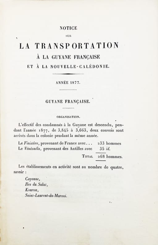
188044732Paris, Imprimerie nationale, 1880. Grand in-8 de 200 pp., 3 grandes cartes dépliantes, percaline beige (Gilg, Dodé).
1884LBW-509Edinburgh, 1884. 571 x 441 mm.
Features: Julius Kruttschnitt of the Harriman Lines Claims Railroads and Labor Friendly; Great Northern Finances for Fiscal Year; Steel Bridge Across Chehalis River at Aberdeen to Open 23 September; Rapid Work on Argo Terminals; Innovation of Ticket Cases - article with photo of modern ticket case; Final Bursting of Controller Bay Bubble (editorial about Alaskan nautical dangers); Business Profile of Kenneth C. Kerr, Industrial Agent of the Alaska Steamship Company (with photo); Improper Packing Causes Great Loss; Record Freight Train runs from Altoona to Enola, PA; Many Abandoned Railways in U.S.; Free Baggage Allowances in Various States and Countries; The World's Wheat Crop; Bernard N. Baker Outlines Plans of Atlantic and Pacific Transportation Co.; General H.M. Chittenden Makes Statement for Seattle Port Commission; What the (New) Port Commission May Do for Seattle; The Proposed West Point Immigration Station - article with map showing location of the proposed station and the proposed West Point Waterway Improvement as planned by Virgil Bogue; Review of Marine Insurance and Shipping Law; Empress of China Crew Exonerated; Decision in Princess May Stranding; Marine Decisions; Diagrams illustrating work to soon begin on Pier 1, owned by the Northern Pacific Railway Company; Casualties to Pacific Coast Shipping; The San Pedro - New C.P.R. Steamer for Trans-Pacific Service - article with illustration; and more. 44 pages including several pages of nostalgic ads, some illustrated in black and white, featuring local marine and rail interests. Printed upon glossy coated stock. Average wear. Binding intact. Few library markings to front cover. A well-preserved copy of this highly-informative memento of Pacific Northwest transportation over a century ago. 12" x 9". Magazine
Bella carta dell'Australia di Benedetto Marzolla, che elenca le sue fonti cartografiche e fornisce informazioni politiche e statistiche sulle aree coperte. La carta è inserita nell’ Atlante geografico. Corredato di notizie relative alla geografia fisica politica, ed in generale alla statistica delle varie regioni del Globo. Compilato ed eseguito in litografia per cura e sotto la direzione di Benedetto Marzolla edito a Napoli nel 1856. Marzolla, autore di importanti atlanti sulle provincie del Regno di Napoli, è anche autore di diverse carte sulle Circoscrizioni Ecclesiastiche nel Regno delle Due Sicilie, pubblicate postume, nello stesso anno della morte (1858) a Napoli nello Stabilimento Geografico diretto da Luigi Manzella. Benedetto Marzolla fu disegnatore topografo e litografo; geografo e cartografo; membro della Commissione di statistica presso il Ministero dell'Interno. Personaggio di grandissimo rilievo nella cartografia napoletana ed italiana del XIX secolo, Marzolla ottenne in vita pubblici riconoscimenti ed attestati per la produzione cartografica di altissima qualità. La sua notorietà si è lentamente dissolta dopo la morte; va tuttavia osservato che solo la mancanza di uno spiccato coinvolgimento politico in senso risorgimentale e di una valenza letteraria nella sua opera non lo hanno reso famoso come i contemporanei Francesco Costantino Marmocchi (1805-1858) e Attilio Zuccagni-Orlandini (1783-1872), con i quali può certamente confrontarsi. I progetti culturali didattici e editoriali di Marzolla furono e rimangono di straordinaria modernità; egli inventò, è il caso di dire, un nuovo modo di intendere e di disegnare la carta geografica, fornendo una visione assolutamente originale della comunicazione dei dati geografici attraverso la combinazione di testo e immagine. Con tale operazione, egli riuscì a fondere in un'unica opera, storia, geografia, economia, statistica e cartografia, raggiungendo un equilibrio grafico di rara efficacia (cfr. V. Valerio, Benedetto Marzolla Brindisino, Geografo e Cartografo dell'800 Europeo, Brindisi 2008). Bell’esemplare con coloritura coeva dei contorni, in ottimo stato di conservazione. Bibliografia V. Valerio, Benedetto Marzolla Brindisino, Geografo e Cartografo dell’800 Europeo (2008). Attractive map of Australia by Benedetto Marzolla, listing his cartographic sources and giving political and statistical information on the areas covered. Map taken from the Atlante geografico. Corredato di notizie relative alla geografia fisica politica, ed in generale alla statistica delle varie regioni del Globo. Compilato ed eseguito in litografia per cura e sotto la direzione di Benedetto Marzolla published in Naples in 1856. Marzolla, author of important atlases on the provinces of the Kingdom of Naples, is also the author of several maps on the Ecclesiastical Circumscriptions in the Kingdom of the Two Sicilies, published posthumously in the same year of his death (1858) in Naples in the Stabilimento Geografico directed by Luigi Manzella. Benedetto Marzolla was draftsman topographer and lithographer, geographer and cartographer. Personality of great importance in the Neapolitan and Italian cartography of the nineteenth century, Marzolla obtained during his life public recognition and certificates for the production of high-quality cartography. His notoriety slowly faded after his death; it should be noted, however, that only the lack of a strong political involvement in the sense of the Risorgimento and of a literary value in his work did not make him as famous as his contemporaries Francesco Costantino Marmocchi (1805-1858) and Attilio Zuccagni-Orlandini (1783-1872), with whom he can certainly compare himself. Marzolla's cultural, didactic and editorial projects were, and remain, extraordinarily modern; he invented a new way of understanding and drawing maps, providing an absolutely original vision of the communication of geographical data through the combination of text and image. With this operation, he was able to merge in a single work, history, geography, economics, statistics and cartography, achieving a graphic balance of rare effectiveness. Benedetto Marzolla is famous for being among the most important cartographers of the XIX century, for being the one to print geographic maps using high quality lithographies.His Atlante Geografico, made of 58 maps, presents finely sketched works. Six maps depict North America, among them famous map of gold diggers in California, deriving from Hippolite Ferry. Extremely relevant are also the maps of Antarctic, South Africa with the plan of Cape Town and those about Australia.Though the maps are dated between 1843 and 1856, this 1858 edition, printed in Naples at the Stabilimento Geografico Strada San Carlo (founded by Marzolla himself), represents the final version of his atlas, the last one before his death. A posthumous edition will be published in 1865.The atlas is pretty rare, is not actually listed in Phillips, British Library e OCLC. Beautiful specimen with contemporary outline coloring, in excellent condition. Bibliografia V. Valerio, Benedetto Marzolla Brindisino, Geografo e Cartografo dell’800 Europeo (2008).
18342587Paris, Imp. de Cosson, 1834. In-8 de VIII-318 pp., demi-veau brun, dos orné à nerfs, pièce de titre en veau noir (reliure de l'époque).
In-4 p., 5 voll., cartonato editoriale figurato a colori, pp. 758; 848; 665; 676; 628; con complessive 1600 tavv. a colori. Uno degli studi più completi ed esaustivi sui molluschi marini indo-pacifici. Complessivamente la fauna filippina conta, ad oggi, 5835 specie identificate e documentate, appartenenti a 297 famiglie diverse. L’opera, così suddivisa: “Gastropoda. Part 1 - Gastropoda. Part 2 - Gastropoda. Part 3 & Bivalvia, Part 1 - Bivalvia. Part 2 / Scaphopoda, Polyplacophora, Cephalopoda & Addenda - New records, completing the volumes I to IV”. Allo stato di nuovo.
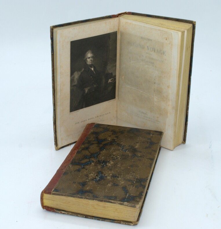
1835PHO-1525Paris, chez Bellizard, Barthés, Dufour et Lowell ,1835, 2 volumes in-8, lxi-1fnch-456pp., 2ffnch-544pp., relié demi basane époque, dos lisse avec auteur et titre, tranches jaunes, petits frottements, coins usés, petites rousseurs carte et portrait.
512 pages. The third of seven reports which cover the survey and demarcation of the international boundary between Alaska and Canada and between the United States and Canada from the Atlantic Ocean to the Pacific Ocean, excepting that part of the boundary through the Great Lakes and the St. Lawrence River, which was surveyed and reported upon by the International Waterways Commission. Compiled in accordance with the provisions of Article III of the treaty between the United States and Great Britain, signed at Washington, April 11, 1908. Printed on high quality coated paper. Includes four colour fold-out maps, all of which are in excellent condition. Dozens of fascinating black and white photographs. Detailed Table of Contents, List of Illustrations, and Indeces. Clean, bright and unmarked. Very light wear. Binding tight. Bright gilt lettering upon green spine. Lettering upon front board significantly faded. Top and bottom corners of the last 60 pages bear minor moisture-induced undulations. Very nice copy. Please note: Sketches of the triangulation and precise traverse were printed under separate cover which is not included. Book
714 pages. Contents include: How Mrs. S.E. Waller's Pictures Have Been Painted; The Money Kings of the New World, by W.T. Stead; Dr. Niels Finsen and his remarkable discovery of healing rays - with wonderful photos; The Making of a Flume - with great photos; The Tame Fish of Logan; The New Khartoum - with many photos; The Floor of the Pacific, by The Hon. W.E. Meehan, Fish Commissioner of the State of Pennsylvania - with photos; The Money Kings of the Modern World II - The Rothschilds, by W.T. Stead - with several photos and illustrations; The Momentous Motor - great vintage technology article with photos; "Skin O' My Tooth" - Edited and Compiled by Baroness Orczy; Bird Babies; Strong Mac; The Making of a Mandolin - with photos; The Money Kings of the Modern World - Part III - Mr. J. P. (Pierpont) Morgan; Municipal Ambulance Work - with fantastic photos of horse-drawn ambulances; Baron Shibusawa of Japan - with great photos; The Game of Sticke - its evolution and progress; The Fiscal Policy of The Empire, by John Holt Schooling; Coalport Porcelain - the story of an ancient and famous industry; The Most Wonderful Map in the World - France, in Jasper, Set with Jems; Hints on Sea-Swimming - Mr. Montagu A. Holbein give advice, and suits the action to the world for photographic illustration; The Nelson Room at Trafalgar House; The Money Kings of the Modern World - Some European Potentates - M. Witte, Baron Hirsch, Alfred Nobel, Alfred Beit, Herr Krupp, M. Jean de Bloch; The Fiscal Policy of the Empire - Part II; A Painter of the Sea-Coast - Mr. Elmer Keene and his Art; Sir James Brooke - Rajah of Sarawak; Pictures in Postage Stamps - using old postage stamps to create art; Capturing A Sperm Whale - with awesome photos; plus many fictional stories. Backstrip all but detached. Front free endpaper and first several pages loose but present. Several other pages loose. Hinges open. Above-average wear. Reading copy only, but remains a very informative and enjoyable reference. Book
1978R100071956Noumea Diffusion. 1978. In-4. Relié toilé. Bon état, Couv. convenable, Dos satisfaisant, Intérieur frais. 466 pages + 506 pages + 501 pages + 521 pages + 549 pages + 451 pages - textes sur deux colonnes - nombreuses illustrations, photos, dessins, cartes en noir et blanc et en couleurs dans et hors texte - rodhoïd conservé - signet conservé - illustration en couleur/noir et blanc contre collée sur le 1er plat de chaque volume.. . . . Classification Dewey : 996-Autres régions du pacifique
Original Australian parliamentary paper, printed on a single folio blue sheet, double sided, measuring approximately 13.5 inches x 8.5 inches (34cm x 22cm). In very good and original condition. This is an original document printed by the government of Victoria, Australia, during the Victorian gold rush, providing rules and regulations respecting the issue of licenses for mining, under the authority of the Local Act, entitled "An Act for the better management of the gold fields of Victoria".
8vo, 50 pages, with map and portrait bound in recent green paper boards. Text in German. This a monthly issue of an obscure and rare Geographical publication issued in Weimar/ Germany in the late 1700's and early 1800's named 'Geographische Ephemeriden.' It contains a large 50 page report about New Georgia which today is part of the Solomon Islands in the South Pacific. In this report the author explores the history, fauna, flora and people of the islands and draws on accounts by John Hunter, Bougainville, Carteret, Labillardiere and others who visited them. The report is accompanied by a portrait of Captain John Hunter as well a fold-out map measuring 250 mm x 190 mm. A very early report and map on the Solomon Islands and very rare.
8vo, 16 pages, contained in a complete 200 page monthly issue of the Geographische phemeriden, attractively bound in brown cloth with marbled boards and gilt spine. Very good condition and very crisp inside. Text in German. This is the 1804 Edition of an obscure and rare Geographical publication issued in Weimar/ Germany in the late 1700's and early 1800's named 'Geographische Ephemeriden.' It contains a portrait of Hernando Maghellan and a 16 page report about the Spanish Voyages to North America. Little was known about these Spanish voyages as the Spanish kept things secret. In 1791, Alessandro Malaspina undertook a search for the Northwest Passage. He surveyed the Alaska coast from Yakutat Bay to Prince William Sound. At Yakutat Bay, the expedition made contact with the Tlingit. The expedition's scientists made a study of the tribe, recording information on social mores, language, economy, warfare methods, and burial practices. During the return to Mexico, Malaspina's expedition spent a month at the Spanish outpost in Nootka Sound on Vancouver Island (see below). The expedition made a study of the Nootka. The two ships then sailed south to Mexico, stopping at the Spanish settlement and mission at Monterey, California on the way. Simultaneously an expedition under Francisco de Eliza, exploring the Strait of Juan de Fuca, discovered an entrance to the Strait of Georgia, which prompted further investigation. In Acapulco, Malaspina took over two schooners, the Sutil and Mexicana, placed them under the command of one of his officers, Dionisio Alcalá Galiano, and had them sail north to explore the Strait of Georgia. Galiano's expedition took place in 1792 at the same time as that of George Vancouver. The two expeditions met in the Strait of Georgia and worked together to map the waters and establish the insularity of Vancouver Island
South Pacific Ocean, 20 May 1873. Manuscript signed letter written by an American merchant, Captain Summers of Honolulu, penned onboard a barque recently purchased by him, as he made his return voyage from Iquique (then part of the Viceroyalty of Peru) to the Sandwich Islands (Hawaii). 8vo. 4 pages. Double leaf letterhead measuring approximately 12,5 x 20 cm, with small embossed image of a colonial building. Mild age-toning and tearing at folds, otherwise in very good condition. In the July 1st 1873 issue of Honolulu's 'The Friend" magazine for mariners, this specific voyage was recorded as follows: "Liberian bark Clara Louise, Master Summers, Sailed from Iquiqui, Peru, May 4th, ... crossed the line... during three days had heavy winds and calms, took the NE trade... with fair weather, arrived on the 17th June." A letter of excellent content concerning one Honolulu ship owner's experience in the sea trade, Captain Summers describes his attempts to obtain cargo at Iquique (now in Chile, then part of Peru), mentioning saltpeter and copper, as well as the high price of fresh water. Finding little success in purchasing goods to resell on the Pacific coast of South America, he makes efforts to earn income by chartering cargo. He rightfully blames the introduction of the steamship for reduced opportunity available to independent merchants such as himself, still using sails to navigate large wooden vessels. Still, he remains optimistic of the opportunity to secure cargo in the Sandwich Islands, possibly owing to his Honolulu connections. Especially damaging to his endeavour and ambition is one unscrupulous character, referred to as 'Old Fearrington', from whom he purchased the barque Clara Louise. Upon trying to sell the vessel itself, in Callao, he found some of the vessel's wood to be rotten. His ship was therefore neither sellable, nor sea-worthy for cross-Atlantic voyages. Perhaps most disappointing, the captain could not afford the risk of transporting sugar, a lucrative and prolific commodity at the time, as the ship's hull could not be trusted with such weight. The recipient of this correspondence is the captain's brother Tom who appears to live in the San Francisco Bay area. The captain ends his letter with a request for his brother to write to San Francisco wholesaler and importer Cross & Co., most likely the captain's client. Excerpts from the letter: "My dear Tom, I have been down this way again and after a passage of 80 days anchored in Iquique itis one of the most desolate holes... not a spear of grass for 60 miles of the town, water 10 cents per gallon... 40 cents for washing a shirt." "... I discharged after 20 days delay what with holidays... I could get no cargo on this boat so I thought it best to try the Sandwich Islands... but 400 miles out of the way." "I might got some sugar if I had not been deceived in this vessel. I have had plenty of chance to sell but old Fearrington had the rotten wood all covered... had to trust his word but he did lie... I have sent him $2200 in gold of of this freight so you see that he has received $6000 from me in 15 months..." "... he deceived me, told me she was sound all through and I had not the money to spare to have her overhauled... if she had been a good sound vessel I could have sold her and made good a profit by it for both of us..." "When I wanted to sell it at Callao they overhalled and found some of her timbers rotten..." "I have not taken any wages since leaving and I think if I can get some more good charters I shall make myself whole and give him back his rotten old ship..." "... getting down to Iquique she commenced leaking... had to keep the pump going all the time... had to get caulked all over and now she is tite... " "I have been told by one of my best friends in Boston that old Fearrington will do me out of the profets & ship yet he has done so with several captains ruined them..." "... I don't know whether I will get any cargo at the Sandwich Islands but I am in hopes..." "... the business in both oceans is very dull the steamers take all the trade. If she was a sound vessel I would go to Japan or China and sell... she will not carry 300 tons with safety..." "I must now close... give my love to Sarah and all of your dear family. Write direct Cross & Co. California Strait S. Fran." "goodby from your affectionate Brother, Wm H Summers." End Excerpts. Further research is warranted to learn more about the Captain, although it appears from historical records that his home was in Honolulu. The present letter suggests that he was a man of integrity, and that he had family in San Francisco. The Annual Report of the Hawaiian Historical Society, Vol 5, mentions a Captain Summers of Honolulu who was involved in hunting seals in 1826 with a brig called Waverley. This may be the same Summers or a relation, possibly his father. A San Francisco Ship Passenger List names William Summers as making a voyage on a British schooner named Koh-i-noor in November 1851 from Lahaina to San Francisco, presumably to visit his brother. The ship had only a scant few passengers, but a substantial cargo of potatoes from Hobart Town, as well as potatoes and oranges from Hawaii. A book titled "History of Bucks County, Pennsylvania," edited by J.H. Battle; published by A. Warner & Co. in 1887, outlines genealogical connections and mentions, "Sir Richard Summers, from whom the Sandwich islands derived the name by which they were first known, as the Summers islands". This reference may lead to the lineage of Captain Summers who wrote the present letter. "The Friend" began as a monthly newspaper for seamen, which included news from both American and English newspapers, and gradually expanded to adding announcements of upcoming events, reprints of sermons, poetry, local news, editorials, ship arrivals and departures and a listing of marriages and deaths. Reverend Samuel Chenery Damon was sent by the American Seamen's Friend Society to be chaplain in Honolulu, where he began to edit and publish the periodical in 1843. Reverend Damon had published between a half million and a million copies of The Friend, most of which he personally distributed, by the time he retired in 1885. Manuscript
8vo [23 x 15.5 cm]; xii, 456 pp, 8 fine lithographed plates, 7 being hand-colored, other tinted, other engraved illustrations from drwgs, the plates drawn by J. Wolf, W. Fitch, George Angas (4 are botanical, others animals, birds). original blind-stamped cloth, gilt spine title lettering, cloth faded and rear internal hinge repaired, old inscription on title margin dated 1861, interior clean and near fine, excellent plates. A picture of this book is available upon request by email. Ripley 26. Ferguson 6929. Wood 231: 'An interesting account of the author's observations on the flora and fauna of Australasia, in which birds figure large, at least half of the 23 chapters containing references to them'. The book contains an extensive chapter on the platypus, which the author here calls a water mole, together with a hand colored plate of same. Fitch, who painted the botanical subjects, was one of the most respected botanical artists of his time. Other subjects are by artists G.F. Angas, Thomas Baines and Joseph Wolf, each a highly respected and important natural history artist. An important contribution including marine biology, ornithology, bird migration, plants including those with agricultural application, botanic garden, medicinal remedies, etc.
8vo [22.5 x 15 cm]; vi, [i, errata sheet inserted loose], 488, 32 [publisher's ads dated January 1853] pp, 7 plates including 4 colored lithographed plates, frontis, other engraved illus, large folding engraved map, tables. later cloth, gilt title lettering on red leather spine label, minor foxing or light stain on few leaves, mostly marginal, short presentation inscription to the Survey of the North Pacific & China Seas, from 'the Observatory', 1853, very good+ copy, sound. Abbey Travel 602. Ferguson 9436. Snow 633. Taylor 80. Hill p. 98. Good descriptions of customs, society, conditions, bit on cannibalism, etc, Savage Island, Manua, Tutuila, Upolu, Samoa, Vavau, Lifuka, Tonga, Fiji, New Hebrides, New Caledonia, Port Jackson, etc.
1911100851Souvenir pamphlet 8vo colored printed pictorial wrappers illustrated 16 pp. Folded and creased down the middle with a little wear at the fold some minor rubbing to wrappers normal aging; otherwise very good. This is a scarce piece of ephemera commemorating the 1911 groundbreaking ceremony by President William H. Taft for the exhibition in the Golden Gate Park. While the purpose of the exhibition was to celebrate the completion of the Panama Canal it seemed to function more as a worlds fair held in San Francisco. It took over three years to construct and the exhibition ran from February through December 1915. There are a number of black and white photographs in the booklet including a double page panoramic view of the city of San Francisco. The activities of the ceremony are recorded in this pamphlet which feature speakers songs marches and what they had for dinner Blair-Murdock Co.,
194064220N.P. Washington D.C.: N.P. Prepared and distributed by Army Orientation Course Special Service Division ca. 1940. One double-atlas folio colour map sized 38 x 41.75 in. colour lithograph on thick paper stock fold creases as issued minor age toning some minor edgewear slight weakening to fold creases at corners still a VG bright copy. First edition thus of this nicely executed map issued possibly printed by the Army Service Forces Orientation map series sometime during the Second Sino-Japanese War and possibly just prior to U.S. entry into World War II indicating much of the Pacific was still dominated by the Japanese Empire - Taiwan with Formosa Seoul Korea still indicated as Keijo Chosen as well as Port Arthur still indicated as Ryojun now Lushun China. The map features latitude and longitude lines but no coordinates with the Northeastern corner depicting the Aleutian Islands of Attu and Agattu Northwestern Corner Nepal & Tibet Southwestern corner ocean and Java & Sumatra while the Southeastern corner caputres the Coral Sea and tip of Australia coloured blue with white and brown. This has some similarities to the “waterproof†maps issued. No legend or printing information supplied. Worldcat locates 1 copy U of MT Mansfield Library also copy located at NIOD Instituut voor Oorlogs- Holocaust- en Genocidestudies Netherlands No. 6101. N.P., Prepared and distributed by Army Orientation Course, Special Service Division?, unknown