2 675 résultats
192363359Victoria B.C.: Archives of British Columbia Printed by William H. Cullin 1923. 8vo. xx 171 1 pp. With portrait numerous plates and two maps. Beige-coloured publisher’s cloth over beveled boards black lettering front cover & spine rough-cut fore-edge textblock as issued minor shelfwear rubbing slightly shaken very faint ex-lib markings on spine dustsoiling still G copy from the libraries of Dr. John C. Brougher 1901-1983 founder of Vancouver Clinic and famed obstetrician & gynecologist believed to have delivered over 10000 children in SW Washington during his years of practice and Clark County Historical Society Collections recently deaccessioned bookplates on front pastedown. First Archives of British Columbia edition drawing from the original journal kept by Archibald Menzies who served as naturalist on the Discovery in Vancouver’s famed voyage around the World from 1790-1794 and this specifically deals with his notes observations and naturalist explorations in the Puget Sound and Vancouver Island in 1792. This journal expands substantially on Prof. Meany’s “Vancouver’s Discovery of Puget Sound†includes specific tables and index of the thousands of specimens collected as well as including the expedition’s frequent encounters with the Northwest Coast Native American Indigenous Peoples. Archives of British Columbia, Printed by William H. Cullin, hardcover
151959504London; New York: Grant Richards Ltd.; Dodd Mead & Co. 1915-1916. Two vols. Tall 8vo. 1st - 304 pp. Photo frontisp. 23 photo plates. Red publisher’s buckram black lettering front cover & spine t.e.g. minor shelfwear minor soot soiling head of spine lower fore-edges w/ d.j. cover art photo & lettering in red printed price label of 12/6 front cover & spine minor soiling spotting to spine chipping & minor tear head of spine upper corner front cover affecting a few letters; 2nd - 327 1 pp. Photo frontisp. 15 photo plates. Dark burgundy publisher’s cloth black lettering front cover & spine w/ illustrated d.j. cover art photo & lettering in red remnants of printed price labels front cover & spine of 12/6 soot soiling to fore-edges darkening & spotting to spine minor chipping head & foot of spine still a VG/VG- set. First British edition of vol. 1 & first American edition of vol. 2 of this uncommon set of travel memoirs through Australia the South Pacific New Zealand and West Africa. He recounts his adventures running away to Sea living in the Bush adventuring with Robert Louis Stevenson both books surviving cannibals tramping through Fiji Samoa Tahiti the Marquesas and the Australian gold fields. The sequel memoir focuses again on adventures with Robert Louis Stevenson songs he composed voyages to Honolulu and the Territory of Hawaii Japan and recounts time with an exceptional Sierra Leone African violinist. Safroni-Middleton 1873-1950 was a British composer violnist harpist writer and astronomer and composed the “Imperial Echoes†theme music which for years was played on the “Radio Newsreel†of the BBC. He would also later pen the science fiction novel “Under Many Names†1937 describing the adventures of his hero traveling through the stars via thought waves to meet an advanced extraterrestrial civilization. Grant Richards, Ltd.; Dodd, Mead & Co., hardcover
189132829St. Louis: Woodward & Tiernan Printing Co. n.d. 1891. 1891. First edition. Third edition. 12mo. Original orange wrappers printed in black ink 82 2 pp. illustrated map. advertising. Issued by the general passenger department of the Missouri Pacific Railway. A general description of the state and its place in history is provided. Plus soil rainfall churches schools higher educational opportunities newspapers population and wealth corn wheat oats stock farming wild flowers orchards and vineyards salt lead and zinc stone brick and lime coal gas hunting and fishing cities irrigation etc. Views are offered of farms and ranches parade grounds city parks etc. of various cities. Herd 1204 says "Issued by the Missouri Pacific Railway Company this book appeared in many editions though all are now rare." Prior to this copy the earliest edition of a similar booklet was a 13th edition and that was 15 years ago. Fine clean copy with a fine folding map. An exceptional copy of a rare item. Woodward & Tiernan Printing Co., n.d. (1891)]. unknown
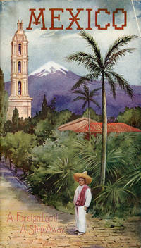
190753081St. Louis: Sam'l F. Myerson Prtg. Co. n.d. ca 1907. ca 1907. 8 3/4" x 5" in colorful pictorial wrappers. 52pp. Map. Black and white illustrations throughout. Information on preparing for a trip to Mexico followed by information and photographs of what might expect to see and experience along the way from St. Louis to Mexico City. Photographs and information on Topo Chico Monterrey Saltillo Cedral Bocas San Luis Potosi Tampico Queretaro Patzcuaro Chapultepec the Viga Canal Mexico City bullfights ancient pyramids etc. A wonderful collection of photographs taken by S.W. Matteson C.W. Archer and C.B. Waite. Fold-out map 14 1/2" x 8 3/4" showing system route from St. Louis to Mexico City inside rear wrapper. Covers and title page lightly soiled. Crease at top corner of front wrapper and with 1/2" closed tear along with scuffing and rubbing to both wrappers and to spine. Very good. A very nicely produced booklet. Sam'l F. Myerson Prtg., Co., n.d. [ca 1907]. unknown
193044298St. Louis: A.D. Bell Passenger Traffic Manager Missouri Pacific Railroad n.d. ca 1930. ca 1930. 8 3/4" x 5" in bright colorful pictorial wrappers showing a market scene on the front wrapper. 50pp. Illustrations. Map. Written with the potential tourist in mind the brochure discusses a trip from St. Louis to Mexico City describing what one will see and experience on the trip. Black and white photographs include Chapultepec Castle scenery caverns various falls Saddle Mountain street scenes monuments important buildings churches locals etc. Fold-out colored system map at end of brochure showing the Missouri Pacific Railway lines and its connections from St. Louis southward thru Texarkana Austin San Antonio and down to Mexico City. Chart showing how to pronounce Spanish and Indian names. Light soiling to wrappers and with minor wear to the extremities. A nicely produced and informative brochure. A.D. Bell, Passenger Traffic Manager, Missouri Pacific Railroad, n.d. [ca 1930]. unknown
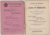
189246034St. Louis: Woodward & Tiernan Print. Co. 1892. Stapled paper wrappers. A good copy wrappers chipped soiled starting to detach seller stamp to front wrapper occasional soiling to contents. Lacking folding map. 64 pp. Illus. with b/w engravings. 12mo. Promotional booklet published by the Missouri Pacific Railway encouraging settlement in Nebraska. Lacks folding map. Woodward & Tiernan Print. Co. unknown
189287869St. Louis MO: Printed by Woodward and Tiernan Printing Co 1892. Second Edition. Staplebound Pamphlet. Good Plus. Stapled pamphlet. 7.5 in. x 5.25 in. pp. 64. Illustrated with in-text drawings and a fold-out map of Nebraska 21 in. x 26 in. Pink cardpaper wraps with black title to front. Light soiling to covers with chips to top/bottom of spine; older tape repairs to length of spine reattaching front cover and to left edge of rear cover. Fragile edges with chips to corners and several short closed tears to cover edges. Clean interior with very good plus map. This brochure was presented "With the Compliments of the General Passenger Department of the Missouri Pacific Railway." The text provides description and chart of information related to population geography geology weather land prices distances horticulture churches and more. Printed by Woodward and Tiernan Printing Co unknown
1970151354N.p.: N.p. 1970. Archive of 32 vintage photographs documenting the October 20 1970 collision of two trains along the Chicago Rock Island and Pacific Railroad line in Raytown Missouri. Also included in the archive is a single broadside reward poster offering $5000 for information pertaining to the accident. <br /> <br /> According to a contemporary newspaper article which appeared in nearby Jackson County's Independence Examiner the accident was believed to have been caused by juvenile vandalism to a nearby track switch. The collision and subsequent derailment resulted in the death of one engineer whose partial body is visible in several photographs. <br /> <br /> The photographs in the archive range from close-up shots of the mangled train cars and tracks to distance views of the surrounding woods. Frequently displayed in the images is a small handwritten police chalkboard noting the date location and case numbers. A vivid and interesting look at investigative photography and railway disasters in the late twentieth century. <br /> <br /> Photographs 10 x 8 inches housed in a manila envelope with the logo of Chicago Rock Island and Pacific Railroad Co. on the top left corner. Reward poster 9 x 12 inches. Poster and photographs Near Fine overall envelope Very Good plus. N.p. unknown
1910300407Los Angeles Pacific Electric Railway ca. 1910. 1910. Folding 4 panel brochure 8 x 16. 7 b/w photographs. Printed in yellow and black. Very good-fine. Includes time tables fair schedules geographical information on Alpine Tavern San Bernardino Mountain Auto Line. No Binding. Very Good/No Jacket. Los Angeles, Pacific Electric Railway [ca. 1910]. unknown
1924300408Los Angeles Pacific Electric Railway ca. 1924. 1924. Folding 12 panel brochure 8 x 16. 14 tinted photographs. Printed in tan orange and black. Very good-fine. Stamp of Peck-Judah Travel Agency on upper cover. Includes time tables points of interest; housing etc. No Binding. Very Good/No Jacket. Los Angeles, Pacific Electric Railway [ca. 1924]. unknown
1931300406Los Angeles Pacific Electric Railway 1931. 1931. Folding 8 panel brochure 8" x 16". 12 sepia illustrations; map. Printed in tan cream and black. Very good-fine. Printed by California Rotogravure Company. Includes time tables points of interest; housing etc. No Binding. Very Good/No Jacket. Los Angeles, Pacific Electric Railway [1931]. unknown
1890300405Pacific Electric Railway 1890. 1890. Photograph depicting 37 passengers at the Echo Mountain Terminal 3500 feet above sea level with printed descriptive information on the verso of mount with pictorial borders. 4 1/2" x 7 3/4" image on stiff 10" x 7" mount. No Binding. Very Good/No Jacket. Pacific Electric Railway [1890]. unknown
1910302511Pacific Electric Railway ca. 1910. 1910. Original photograph depicting 43 passengers men and women dressed in coats and hats at the Echo Mountain Terminal 3200 feet above sea level with printed descriptive information on the mount with pictorial green borders. 4 11/16" x 7 1/2" image on stiff 6 1/16" x 9" pictorial folder. No Binding. Fine. Pacific Electric Railway [ca. 1910]. unknown
198662393Norman OK: Univ. of Oklahoma Press 1986. Tall 8vo. xx 289 3 pp. Title in green & black w/ photo illustrations maps. Green boards white & gilt lettering on spine slight shelfwear rubbing w/ d.j. minor scuffing edgewear minor sunning to spine still NF/VG- copy inscribed by both authors on ffep. First edition stated & inscribed of this invaluable work detailing the 150 Indigenous Peoples tribes belonging to 15 different language groups in the Pacific Northwest from the coast to the Columbia Plateau and Great Basin including Washington Oregon Idaho and Western Montana. Volume 173 in the Civilization of the American Indian Series. Univ. of Oklahoma Press, hardcover
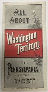
188853587Chicago: Rand McNally & Co. 1888. 1888. 20 3/4" x 13 1/2" sheet folded to 24 panels. Map. One cover panel; one panel showing N.P.R.R. route from Minneapolis to Washington Territory; and 10 panels of information to include information on the area's location and physical features climate agriculture stock raising manufacturing mining public schools cities and towns etc. Opposite 12 panels offer a map of Washington Territory printed in red and black. A rare promotional piece to encourage sales of Northern Pacific Railroad lands in Washington Territory. Light soling a few small splits to creases and with minor wear to the extremities. Very good. Rand, McNally & Co., 1888. unknown
190837940St. Paul: Privately printed n.d. ca. 1908. 1908. MINNESOTA. 8" x 5" in pictorial wrappers. 47 pp. illustrations maps. Overview of the area followed by information on various lake areas serviced by the Northern Pacific main line and branches the Duluth Short Line and the Minnesota & International Railway. Much on Isle Royale. Information on game and fish laws of Minnesota various excursion rates to various summer resorts based on Duluth departures. List of hotels lakes rates kinds of fish etc. Map of the lake region map of the heart of the lake country map of the region showing the Minnesota and International Railway map of the region showing the "Duluth Short Line" and Isle Royale. Illustrations throughout. Staples rusted with center page loose from staples with soiling to wrappers. Exposed to some dampness. Good. Exposed to dampness staples rusted. Good. Privately printed, n.d. [ca. 1908]. unknown
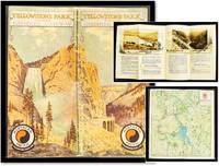
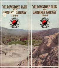
191017034Minneapolis Minn: Northern Pacific Railway; 1910. Stapled wraps. Very Good/No Dust Jacket As Issued. <br /> <br /> Stapled color illustrated wraps; 8.5 by 9 inches 38 pages produced to fold at make a 4.5 inch pamphlet color map of Yellowstone park and a center fold map of the Northern Pacific Railway system and a page of prices and a roster of the railroad executives. A lovely promotional piece of railroad memorabilia with Toned photos on each page bordered with drawings and each section has a decorative title. <br /> <br /> A promotional guide for travelers accessing Yellowstone National Park via the Gardiner Gateway in Montana. This gateway was significant as the original and at that time the only railroad entrance to the park with the Northern Pacific Railway's Gardiner station operating from 1903 to 1954. <br /> <br /> The brochure features 38 pages of toned photographs each bordered with drawings showcasing Yellowstone's natural wonders. It includes a color map of the park and a centerfold map of the Northern Pacific Railway system providing travelers with visual and navigational aids. Additionally the brochure contained a page detailing prices and a roster of the railroad executives offering practical information for prospective visitors. <br /> <br /> The Gardiner Gateway was a pivotal access point to Yellowstone with the Northern Pacific Railway promoting it as the 'original entrance to Yellowstone National Park.' The nearby Roosevelt Arch whose cornerstone was laid by President Theodore Roosevelt in 1903 further emphasized the significance of this entrance. Adapted from online sources Northern Pacific Railway; unknown
188210945St. Paul MN: The Pioneer Press Co 1882. First Edition First State. 100pp. Octavo 24 cm Presentation binding. Publisher's full grained brown leather with the title gilt stamped on the front board and backstrip. A.E.G. Satin moire endsheets. Near fine. Inscribed on the front free endsheet. 'Mr. Minnie with compliments of the author. Map of the Yellowstone Valley 42 cm x 70 cm and the Plat map of Glendive 40 cm x 56 cm present and both linen backed and in nice condition. Presentation copy. The trade edition of this work was bound in green printed wrappers with 10 pages of advertisements in the front and 3 to 10 pages of advertisements in the rear. Map of transcontinental was attached to the rear free endsheet. Our copy predates the various issues with advertisements and the map attached to the rear free endsheet. Eberstadt and Yale copies and others only list the plat and cattle trails maps. Early Montana promotional item from the Northern Pacific Railroad a year before they opened the Gardiner Gateway at the north end of Yellowstone Park. An important descriptive tract of the new country at the time of its settlement with a fine large map showing the towns and cattle trails. Eberstadt 132: 478. Howes Y8. Rampaging Herd 1535. This is the first time that we've handled or encountered this title. Rare. The Pioneer Press Co unknown
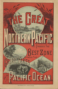
188249882Chicago: Rand McNally & Company 1882. 1882. First edition. 9" x 6" in color pictorial wrappers printed in red blue & black with vignettes of wheat threshing cattle mining and logging on front wrapper. 82pp. plus 2 pp. publisher's ads for Oregon Railway & Navigation Co. Contents. Illustrations. Maps. Uncommon Northern Pacific Railway land promotion detailing the sites and possibilities along the Northern Pacific route at the end of the 19th century. The work details the history of the NPRR divisions branch lines development opportunities for homesteaders and businesses in Western Washington the inner-mountain West Montana Yellowstone National Park the Dakotas Minnesota and specific land grants available from the NPRR in Minnesota and the Dakotas. Large color map attached to inside rear wrapper. Map fine. Light chipping to wrapper edges and with a few small closed tears to wrapper edges along with light soiling and rubbing to spine. Very good. Rand, McNally & Company, 1882. unknown
1871761New York 1871. Good plus. Folding pamphlet 6 x 17 inches. Separated along one fold. A few later pencil annotations. Light wear and tanning. A scarce advertisement for bond investment in the Northern Pacific Railroad issued in 1871 during the first great construction push on the line. Although the company was founded in 1865 ground was only broken on construction in 1870 after considerable backing by Jay Cooke. This pamphlet outlines the plans for the railroad to be built from St. Paul to Portland and Seattle the prospects for passenger and freight business upon completion and the extent of the land grants afforded the railroad by the federal government. The text goes on to describe the financial instruments on offer their advantages over Treasury bonds chiefly a greater yield at 7-8% vs. 5-6% and their security against the commercial and financial assets of the railroad as well as its land grants. With a map of the proposed route on the rearmost panel. A scarce call for investment in the Northern Pacific from its early history. unknown
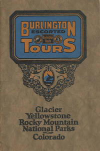
192548702N.P.: Privately printed n.d. ca 1925. ca 1925. 9" x 6" color pictorial wrappers. 47 pages tinted illustrations maps tour plans. Numerous tour itineraries and schedules with numerous beautifully colored photographs of various areas buildings and parks. Tours discussed include Glacier and Yellowstone; Colorado and Yellowstone; Inter-Mountain Route From Colorado to Yellowstone and Glacier; Colorado and Glacier. General information for the tourist including cost of tours discussion of climate apparel booklets of possible interest a list of ticket routing for various tours calendar schedules for various tours etc. Separate map depicting each tour. Very good plus. Privately printed, n.d. [ca 1925]. unknown
191449010N.P.: Privately printed 1914. 1914. 9" x 8" in color pictorial wrappers folded in half to 60 pp. including cover. Double-column text. Illustrations map itinerary. The purpose of this pamphlet is to provide information about the park for the potential tourist as well as offering the advantages of the Northern Pacific Railways as a means of reaching the park. Offers history of the park and information about it to include its climate when to visit park information park transportation fishing hunting hotels and camps excursions through the park etc. Double-page color map at center entitled "Yellowstone National Park Showing Stage Lines" followed by itineraries pricing and schedules for various park tours. Numerous black and white photographs throughout of various points of interest. Cover page is scraped and rubbed as well as rubbing to spine. Very good. Privately printed, 1914. unknown
194158323New York: Reynal & Hitchcock 1941. 8vo. 8 304 pp. Illustrated title page w/ illust. of the soprano aria Caro nome from Verdi’s Rigoletto as well as larger facsimile plate of the sheet music. Tan cloth purple lettering minor shelfwear slightly cocked w/ d.j. Art Deco cover art of looming house & yellow lettering minor chipping head of spine minor creasing & edgewear still a VG/VG copy. First edition of this La Grande Oregon author’s first mystery set against the backdrop of the murder of an imperious coloratura soprano. After being lured out of retirement and joining the Monte Calvo Opera Company based in San Francisco California the opera diva is killed by a knitting needle at Lucifer’s Pride a half-finished castle in the Columbia River Gorge. Meyers who was an avid singer opera aficionado modeled his murdered soprano after the great Luisa Tetrazzini 1871-1940 and the “Lucifer’s Pride†castle built for her as a would-be wedding present on the famed Maryhill Museum dedicated in 1926 by Queen Marie of Romania and opened in 1940. Hubin I p. 570. Reynal & Hitchcock, hardcover
190151889Forest Grove OR & Portland OR: Pacific University; Press of Mann & Abbott 1901. Tall 8vo. 160 pp. Photo illustrations text illustrations illustrated ads. Green cloth illustration of oak tree in black gilt decorative lettering on front cover minor shelfwear rubbing slight bumping to corner still VG copy. First edition of this scarce and early yearbook for the noted Liberal Arts College in Forest Grove founded in 1849 as the Tualatin Academy. Worldcat locates 2 copies. Pacific University; Press of Mann & Abbott, hardcover
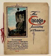
190922859Chicago: Chicago Association of Commerce 1909. First Edition. Quarto; 8pp. Four string-tied and stapled leaves with ten 3 1/2" x 5 1/2" mounted colored illustrations each titled in red along with a map of the route. Near Fine copy in grey cardstock titled and color photograph tipped to front cover. Rare promotional piece; we fine only 1 copy at University of Michigan. This booklet was prepared by the Oregon Railroad & Navigation Company the Oregon Short Line Railroad the Union Pacific Railroad and the Chicago & Northwestern Railway as an itinerary for the approximately 40 Chicago merchants' return trip ". calling your attention to a few of the points of interest in a country of marvellous scenes wonderful accomplishments and a still more wonderful future." Lists 38 members of the Chicago Association of Commerce making the return trip. Uncommon attractive & elaborate promotional piece. Chicago Association of Commerce unknown