2 675 résultats
1889354257San Francisco: H.S. Crocker & Co 1889. 70pp. Original printed wrappers. Spine chipped. Small old stamp on titlepage. Very good. 70pp. Introductory material by Leland Stanford. A positive report on the Central Pacific's dealings with the government. <br/><br/> H.S. Crocker & Co unknown
193846532Chicago: Manz Corporation 1938. 1938. 9 7/8" x 6 3/4" in color pictorial wrappers. 57 pp. index illustrations many in color maps schedules itineraries. Booklet filled with information about pictures of and Itineraries for 12 different tours lasting from 8 - 19 days and costing from $82.07 to $364.26. Most of the tours include Yellowstone National Park and go on to offer extending tours to Salt Lake City The Royal Gorge Colorado Springs Denver Zion Bryce Canyon Grand Canyon Cedar Breaks Estes Park. Offers a 14-day tour to California Old Mexico and Yosemite as well as a 13-day tour that visits the Pacific Northwest Mt. Rainier the Canadian Rockies Banff and Lake Louise. Descriptions of and information about Yellowstone National Park Salt Lake City Zion Bryce & Grand Canyon National Parks. Map of Yellowstone National Park with route of railroad and route of auto trips marked; Map of Southern Utah Parks with bus tour and bus side-trips marked along with a small table of distances; Map showing the routes of all tours of the National Parks. General information offered including information on hotels and lodges in the parks baggage what to wear church services information for the woman who travels alone touts the comfort convenience and pleasure of each and every tour etc. Numerous photographs throughout probably about half of all photographs are in color. Pictures include interior of train Old Faithful the Tetons Tower Canyon various wildlife important buildings Royal Gorge Bear Creek Canyon individuals participating in various activities Horseshoe Park Garden of the Gods Columbia River Lake Louise San Francisco Mariposa Grove Grand Canyon Bryce Canyon etc. Light soiling rubbing to spine and light wear to the extremities. Very good. Manz Corporation, 1938. unknown
193946531Chicago: John C. Pollock Department of Tours 1939. 1939. 9 7/8" x 7" in bright colorful pictorial wrappers depicting a man and woman riding on a train and looking at the beautiful mountain view through a large window. 65 pp. index illustrations many in color maps schedules itineraries. Booklet filled with information about pictures of and Itineraries for 15 different tours lasting from 8 - 20 days and costing from $82.02 to $363.47. Most of the tours include Yellowstone National Park and go on to offer extending tours to Salt Lake City The Royal Gorge Colorado Springs Denver Zion Bryce Canyon Grand Canyon Cedar Breaks Estes Park. Offers a 14-day tour to California Old Mexico and Yosemite and the Golden Gate International Exposition as well as a 13-day tour that visits the Pacific Northwest Mt. Rainier the Canadian Rockies Banff and Lake Louise. Descriptions of and information about Yellowstone National Park Salt Lake City Zion Bryce & Grand Canyon National Parks. Map of Yellowstone National Park with route of railroad and route of auto trips marked; Map of Southern Utah Parks with bus tour and bus side-trips marked along with a small table of distances; Map showing the routes of all tours of the National Parks. General information offered including information on hotels and lodges in the parks baggage what to wear church services information for the woman who travels alone touts the comfort convenience and pleasure of each and every tour etc. Numerous photographs throughout probably about half of all photographs are in color. Pictures include interior of train Old Faithful the Tetons Tower Canyon various wildlife important buildings Royal Gorge Bear Creek Canyon individuals participating in various activities Horseshoe Park Garden of the Gods Columbia River Lake Louise San Francisco Mariposa Grove Grand Canyon Bryce Canyon etc. Light soiling light rubbing to spine and light wear to the extremities as well as creasing to corners. Very good. A nicely produced booklet. John C. Pollock, Department of Tours, 1939. unknown
194046534Chicago: The Regensteiner Corporation 1940. 1940. 9 7/8" x 6 3/4" in color pictorial wrappers. 65 pp. index illustrations many in color maps schedules itineraries. Booklet filled with information about pictures of and Itineraries for 15 different tours. Most of the tours include Yellowstone National Park and go on to offer extending tours to Salt Lake City The Royal Gorge Colorado Springs Denver Zion Bryce Canyon Grand Canyon Cedar Breaks Estes Park. Descriptions of and information about Yellowstone National Park Salt Lake City Zion Bryce & Grand Canyon National Parks. Map of Yellowstone National Park with route of railroad and route of auto trips marked; Map of Southern Utah Parks with bus tour and bus side-trips marked along with a small table of distances; Map showing the routes of all tours of the National Parks. General information offered including information on hotels and lodges in the parks baggage what to wear church services information for the woman who travels alone touts the comfort convenience and pleasure of each and every tour etc. Numerous photographs throughout probably about half of all photographs are in color. Pictures include interior of train Old Faithful the Tetons Tower Canyon various wildlife important buildings Royal Gorge Bear Creek Canyon individuals participating in various activities Horseshoe Park Garden of the Gods Columbia River Lake Louise San Francisco Mariposa Grove Grand Canyon Bryce Canyon etc. Minor rubbing to spine and light wear to the extremities. Very good plus. The Regensteiner Corporation, 1940. unknown
196839971N.P.: Privately printed 1968. 1968. 7 1/2" x 5 1/2" with white front cover and with street scene of San Francisco showing cable car in foreground and the Golden Gate Bridge in the background. Rear cover is blank. Buffet offerings include doughnuts ice cream juices cigars playing cards candy bars various alcoholic beverages etc. Below listing is the announcement that "For your protection: Liquors and cordials are contained in individual original bottles. Employees are instructed to open bottles in your presence. Sale of liquor in individual bottles to carry away is prohibited." Light tanning to edges and with light wear to the extremities. Very good. Privately printed, 1968. unknown
189837912Chicago: Poole Bros. 1898. 1898. COLORADO. 8 1/2" x 6 1/2" in color pictorial wrappers. 44 pp. illustrations. Information on Manitou Colorado Springs Pikes Peak the Manitou and Pike's Peak Railway side trip to the Grand Canon of the Arkansas various parks the Rocky Mountain Limited etc. Double-page drawing of "The Rocky Mountain Limited" above the floor plan of the train above a line map of the route from Chicago to Denver. Numerous illustrations of scenes along the Great Rock Island Route. Wear and rubbing to corners and spine. A nicely produced booklet. Poole Bros., 1898. unknown
18851099Chicago: Geo. F. Cram 1885. Good plus. Large folding pamphlet approximately 20 x 41.5 inches. A few small chips and short closed tears at edges; several short separations and very minor losses along folds. Contemporary agent's ink stamp on cover panel. Tape repair across portion of horizontal fold; one panel with patches of light staining. A scarce colorful promotional for the Rock Island Route as well as its national and international connections with a fascinating stamp of an Australian sales agent. One side of the sheet prints an extensive promotional text and timetables for the various routes and services of the Chicago Rock Island & Pacific Railway. The main side of the sheet prints a map of the United States with state borders shaded in four colors highlighting the principal routes of the Rock Island from Chicago to Minnesota Iowa and Kansas and its connections to points on both the East and West Coasts. An inset map at lower right promotes the Rock Island as part of a transcontinental route between the United Kingdom Ireland and Australia. Most interestingly this copy is stamped on the cover panel with the information of a George. H. Hibbard "Australian Passenger Agent America's Cons'd Trans-continental Railways 6 Bridge Street Sydney N.S.W." Hibbard was evidently the agent in charge of distributing information about the trans-America route in Sydney one of its end points.<br /> <br /> Several issues of this map were published during the 1880s all scarce. We locate copies of the present 1885 issue at Stanford SMU and the Library of Congress. Geo. F. Cram unknown
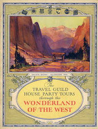
193049325Chicago: The Travel Guild Inc. 1930. 1930. 11" x 8 1/2" in colorful pictorial wrappers. 32 pp. Illustrations. Index. Itineraries. Printed in brown and with photos in sepia. The "House Party" trains are all sleeping car trains that travel through the Pacific Northwest and Canadian Rockies. They carry a recreation car for dancing bridge receptions lectures community singing and other social activities; a lounge car for reading observation; a special baggage car and dining car. The trains offer radios dynamic phonographs baths the latest magazine and a special buffet service. Information about to include what tourists can expect to see and do as well as pictures of several tours . Pacific Northwest and Canadian Rockies Tour; Yellowstone Salt Lake and Colorado Tour; the Great Circle Tour which includes Colorado Indian Detour Grand Canyon California and Canadian Rockies; the Yellowstone Park Tour; etc. Information about a 7-day Yellowstone Park Extension; a 10-day Alaska Extension Tour and a 7-day Indian Detour. Numerous photographs throughout. Light soiling on wrappers and with light wear to the extremities. Very good. A nicely produced booklet. The Travel Guild, Inc., 1930. unknown
200763972Portland OR: Ooligan Press Portland State University & Chinese Consolidated Benevolent Association 2007. 4to. 109 3 pp. Title & text in Chinese & English printed in red & black w/ photo illustrations illustrations throughout. Red publisher’s cloth gilt lettering front cover & spine colour plate mounted front cover w/ open-backed slipcase NF/NF copy from the library of Tom Atiyeh. First edition 1st printing of this excellent work tracing the Chinese diaspora into the Pacific Northwest following the 1849 California Gold Rush seeking riches in Oregon gold mines coastal fisheries working salmon canneries building railroads surviving extreme racism legal discrimination and exploitation. Not to be confused with very common softcover issued under the same title. Ooligan Press, Portland State University & Chinese Consolidated Benevolent Association, paperback
195560170Elma WA: Fulco Publications Press of The Elma Chronicle 1955. 8vo. 8 229 1 pp. Illustrated title photographic illustrations. Red cloth gilt lettering on spine slight shelfwear minor rubbing w/ d.j. cover art logging scene chipping head & foot of spine closed tears at joints old scotch tape repairs to spine & some offset ghosting still a NF/Fair copy inscribed by the author on the ffep. from library of Pete Hurd w/ bookplate on ffep. First edition signed. This scarce Northwest title was written by the former secretary to Washington State Governor Louis F. Hart and founder with Frank Satterlee of the Olympia News in 1924 and finally a consulting criminologist. This work includes the crimes adventures mass murderers and manhunts for John Tornow Billy Gohl Harry Tracy Frank Romandorff Henry Plummer Boone Helm Doc Howard Chris Lowry Peter Miller and many others. Very scarce in original dustjacket. Fulco Publications, Press of The Elma Chronicle, hardcover
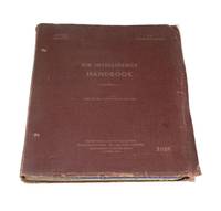
19434384Southwest Pacific: Directorate of Intelligence 1943. Quarto red cloth binder viii approximately 167 pp. odd pagination illustrated with tables and diagrams and a map. Binder cloth worn preliminary leaf shows signs of insect bites on bottom and top left corner otherwise a good copy. Pilot instruction manual belonging to a man named G. Erickson matricule: 413558. 3 additions were made to this manual on February 26th 1945 March 5th 1945 and April 1st 1945 respectively.</p> <p>This manual is divided into seven parts: handling of information enemy aircraft own aircraft shipping interrogation and reporting general and references. Directorate of Intelligence unknown
190261457San Francisco CA: The History Publishing Co. 1902. Thick folio. 11 x 13.5 in. 545 3 31 1 xiii 1 pp. Extra-illustrated title text illustrations plates rubricated initials photogravure plates preserving tissue guards rubricated initials and more throughout. Full calf on beveled boards cover decoration & ornament embossed in blind on front cover gilt lettering stamped on front cover & spine gilt inner dentelles a.e.g. expertly rebacked w/ original spine laid-back down minor repairs to corners endpapers renewed ink markings & annotations on a few pages still a VG- tight and sound copy of this very heavy tome. First edition of this lavish production detailing the founding and growth of Freemasonry Lodges in the Oregon Washington Idaho & Montana Territories and later States including specific biographical details of key personnel. The weighty work opens with a narrative of the origins of Freemasonry the Scottish Rites and the Knights Templar as well as the rise and progress of the Mystic Shrine and Eastern Star. In 1846 7 Freemasons organized and petitioned the nearest lodge in Missouri for a charter granted for the Multnomah Lodge No. 84 in the same year. The first Masonic lodge in Washington was located in Olympia in 1853 while still part of the Oregon Territory. The History Publishing Co., hardcover
1908138240High Bluff Manitoba: Edwin C. Blair c1908. Undetermined. very good. 24pp. Oblong quarto. Black cloth photo album rubbed with some loss of cloth on front board. Spine reinforced with additional patterned cloth. 24 albumen photographs loosely inserted between 12 double-mounted leaves. 10 photos are signed "Blair" a few with additional titling in pen to photo. 23 photos with a stamp on verso: "Real photographs of real life in Canada by Edwin C. Blair High Bluff Manitoba; 1 photo stamped "Photo by E.C. Blair. Two photos are dated 1908. Photos measure approximately 6.75" X 5". very good A fantastic collection of photographs documenting the construction of the Grand Trunk Railway in Alberta. Includes a variety of subjects such as horse-drawn lumber operations steam-powered construction equipment hard rock excavation construction of the Battle River and Clover Bar bridges steam locomotives and camp life. 1908 Edwin C. Blair unknown
197662645Seattle WA: Office of Public Archaeology Institute for Environmental Studies University of Washington 1976. 4to. viii 306 3 pp. With maps photo illustrations text illustrations diagrams plates 1 large folding Kanaka Village stratigraphy map in rear pocket. Stiff colour-illustrated softcovers cover art from plate scrap and rivets Hudson’s Bay Co. minor bumping to couple corners edgewear still a VG bright copy. First edition of this surprisingly uncommon and detailed archaeological study examining the Indigenous Hawaiian’s who worked and lived at the Hudson’s Bay Company Fort Vancouver along the Columbia River when the area was still the Oregon Country controlled by Great Britain. The majority of the Hudson’s Bay Hawaiian employees lied in their own village several hundred feet southeast of the Fort along the Columbia possibly established before 1829 and consisted at their height of at least 122 male Hawaiians. They and their families served as labor force worked the farm and also labored in the Fort itself. Office of Public Archaeology, Institute for Environmental Studies, University of Washington, paperback
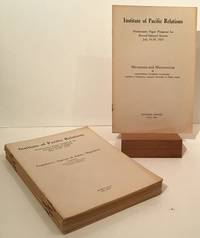
192720483Honolulu: Institute of Pacific Relations 1927. First Edition thus. Octavos; 14 booklets from 6pp to 36pp generally in Very Good to Near Fine condition in staplebound wrappers. The Institute of Pacific Relations IPR was established in 1925 to provide a forum for discussion of problems and relations between nations of the Pacific Rim. Included here are 'Micronesia and Micronesians" by Professor Naomasa Yamasaki; 'Legislative Aspects of Asiatic Migration' prepared by International Labor Office League of Nations; 'The Second Generation Oriental in America' by William C. Smith; 'Facing the Future of the Missionary Movement' by Edward H. Hume M.D.; 'Memorandum on Missions' by Henry T. Hodgkin; 'The Problem of Population and Food Supply in Japan' by Dr. Shiroshi Nasu; 'The Education and the Economic Outlook for the Boys of Hawaii' by Romanzo Adams; 'The Japanese Race from Anthropological Point of View' by Akira Matsumura; 'Concessions and Settlements - and Their Transference to Chinese Rule by Mingchien Joshua Bau; 'Asiatic Immigration in New Zealand: Its History and Legislation.' by Dr. G.H. Scholefield and T.B.H. Hall; 'The Outstanding Cultural Assets of the Chinese People'/The Chinese Point of View of the So-Called Material Civilization of the West' by Sophia Chen Zen; 'The Social Status of the Japanese in Hawaii: Some of the Problems Confronting the Second Generation' by Tasuku Harada; 'The Labor Movement in China' by Ta Chen; and 'Child Workers in China' by Miss L.M. Friedlander. Institute of Pacific Relations unknown
197363592Seattle WA: Executive Committee for Publication of Issei c/o Japanese Community Service Japan Publications Inc. 1973. Thick 8vo. xxviii 1016 pp. With 100’s of photo illustrations text illustrations. Gray publisher’s cloth Japanese lettering embossed in blind on front cover gilt & red lettering on spine w/ original open-backed slipcase NF/NF copy. First edition 1st printing stated in English of this very scarce and extraordinary history of Japanese-American immigration into the Pacific Northwest and American West originally published as Hokubei hyakunenzakura 北米百年桜 1969. This outstanding reference opens with reconstructed maps of the Japanese Districts in Seattle Tacoma Spokane Portland and Vancouver BC followed by extended detailed sections on sailing to the US from Japan secret passages ship-jumping Japanese Exclusion Acts Japanese Women workers for railroads salmon canneries sawmills farming hotels restaurants and more. Of particular interest is the detailed chapter on Japanese-American women falsely recruited and forced into the sex trade in Seattle Portland and other Western cities including the fact that they were even smuggled in through luggage. Executive Committee for Publication of Issei, c/o Japanese Community Service, Japan Publications, Inc., hardcover
191363071Seattle WA: Seattle Union Record 1913. Folio. 9 x 12 in. 132 pp. With photo illustrations text illustrations illustrated ads throughout. Colour-illustrated softcovers cover art of miner holding pick-axe w/ Seattle waterfront in the background in tan & blue Rainier Beer advertisement on back cover minor chipping head & foot of spine dustsoiling & soiling front cover minor bumping to corners still a G copy. First edition of this scarce and important supplement issued in conjunction with the 33rd Annual Convention for the AFL composed of craft unions for cigar makers garment workers carpenters electricians and others. They also served as the umbrella union for the United Mine Workers of America and at the time were supporting the Coal strike in Colorado as well as the Michigan Copper strike organized by the Western Federation of miners. Union locals such as the Brewery Workers Women Waitresses Women Garment Workers the women’s Union Card & Label League and others include sections on their histories labor organizing and philanthropic efforts. Worldcat locates 5 copies NYPL Bancroft Seattle Public U of W U of MI Seattle Union Record, paperback
192751699San Francisco: Southern Pacific Lines Printed by Sunset Press ca. 1927. 4to. 80 pp unpaginated. 74 photo plates. Colour-illustrated softcovers yapp edges wraparound cover art by Maurice Logan 1886-1966 one of the California Society of Six Painters who produced boldly coloured impressionistic paintings and watercolours in constrast to the muted tonalims and landscapes of earlier San Francisco painters such as Keith and Hill. The front cover painting of New Orleans Broulatour Mansion in the French Quarter was commissioned by the Southern Pacific for their 1927 souvenir book travel poster and postcard slight shelfwear very slight creasing slight tidemark upper left corner still a VG bright copy. First edition of this beautiful brochure chronicling the points of interest along the Sunset Route including New Orleans African-Americans picking peppers Houston Waco San Antonio Charles Nackee famous Apache Scout in southern Arizona Yaqui Indian Village orange groves near Los Angeles filming movies in Hollywood and more. Southern Pacific Lines, Printed by Sunset Press, paperback
193863046Portland OR & Kelso WA: Kilham Stationery & Printing Co. Marsh Underwood 1938. 12mo. 62 pp. Photo illustrations throughout. Green publisher’s cloth gilt lettering front cover slight shelfwear very slight rubbing & faint spotting still NF copy. First edition of this self-published memoir detailing this Cowlitz County logger’s beginnings in New England Wisconsin and finally working lumber camps along the Lewis River in Southwest Washington and in Snohomish Washington. He has included a sketch of a Wisconsin logging camp as well as many historic photographs describing logging methods early logging companies in the West and more. Underwood 1876-1939 originally worked as a Vermont logger and by 1910 was a River Driver directing log rafts from Woodland WA down to Portland OR on the Columbia River and later as logging camp superintendent in Snohomish WA. Kilham Stationery & Printing Co., [Marsh Underwood, hardcover
1981197204Los Angeles California n.p. 1981. 1981. Folding 6 panel brochure 8" x 22". 11 tinted color photographs; map by D.W. Pontius; blue background on front panel. Very good. Scarce. Includes advertisements for Mt. Lowe Orange Empire Trolley trip to Redlands Balloon trip Old Mission Trip. No Binding. Very Good. Los Angeles, California [n.p.] 1981. unknown
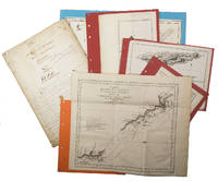
1755ABC_474521755. Manuscript of 24 pages 6 printed maps on cardboard. This wonderful logbook details the journey of a French captain from Manila to the Maluku Islands in todays Indonesia. The journey took place during the months of March to May of 1755. The captain of the ship recounted with great detail the events of every day of the journey with detailed daily accounts of the weather winds manoeuvres of the ship its departures anchorages and precise coordinates at every point of the journey. The captain furthermore had a keen eye for the geographical and nautical details along the journey. He recounted the exact locations of for example sandbanks and bays where ships and their crews can take provisions and fresh water. The accounts are detailed and captivating: "After our boats were back on board we set sail . in the afternoon to moor under the old Portuguese fort on the Solor island Indonesia the winds for the tide were fresh at 1:34 a.m. . sand and gravel and then I went back to mooring. The pavilion of the fort . the village is under the said fort at 3 cables from us .". The captain goes on to describe the geographical features of the islands as well as other places en route with great detail. Curiously we find inscriptions in Spanish and the names of one don Phelipe Qui who describes himself as el piloto and one Padre Don Estevan de Melo. The latter might be identical with Don Estevan Roxas y Melo a native of Lima Peru and secretary to the Archbishop of Manila Rodriguez since 1736. Roxas y Melo was part of the 1751 reconstruction of the Cathedral of Manila working under the auspice of the Italian architect Juan de Uguccioni.The logbook comes with six printed maps partly illustrating the journey of the captain pasted on contemporary cardboard. They depict the Bay of Sulavesi with the city of Bantang Pitcairn the coast of New Guinea the coast of Queensland the Santa Cruz Islands in the present-day Solomon Islands and Alejandro Selkirk Island. The plates stem from the French translation of James Hawkesworths An Account of the Voyages Hawkesworth Relation des voyages entrepris par ordre de sa Majesté Britannique actuellement regnante; pour faire des découvertes dans l'hemisphère meridional Paris 1774.Some holes on the first sheet not affecting the text. Small water damage some slighlty affecting the text. Remnants of seals on last page. Otherwise in good condition. unknown
193160944Syracuse NY: Empire New England Company Inc. 1931. One large 6-panel dissected colour linen-backed map featuring one hemisphere map of Pacific Ocean 34 inches in diameter within larger 40 x 52 in. colour-printed wall map with scale at Equator of 1:23300000 folding down to 19.5 x 17.25 brass grommets mounted for hanging at upper fore-edge minor edgewear rubbing at crease folds minor age toning light fraying to the linen still VG copy. Second printing of this scarce linen-backed dissected wall map reflecting the extent of Imperialist Colonial spheres of influence in the Pacific just 10 years before the outbreak of World War II. These educational maps served as key instructional tools for detailing Japanese British Dutch French Portuguese and U.S. colonies dependencies and mandated territories demarcated here in respective colours spanning from Asia to the Americas and include British holdings in Antarctica. Worldcat locates 1 copy Boston Public. Empire New England Company, Inc., unknown
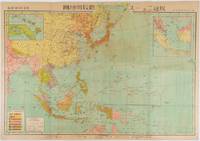
1719219230東京. Tokyo.: 日本放送協会. Nihon Hōsō Shuppan Kyōkai. Showa 17 1942. Colour folding map scale 1: 10000000 54.7cm x 79.5cm chronology of building the Greater East Asia Co-Prosperity Sphere on reverse. Some light browning a little darker at folds and reverse washi repairs to folds on reverse. This colour map of Asia and the Pacific published on 30 January 1942—just one month after Japan's attack on Pearl Harbor—offers a striking glimpse into wartime strategy and propaganda. Remarkably despite being produced at the war's outset it accurately anticipated key battlegrounds that would define the conflict. The main map is supplemented by two inset maps: one in the upper right highlighting Japan the Hawaiian Islands and Honolulu and another in the lower left focusing on Singapore with Darwin marked along the lower edge. <br> <br>The reverse side features a revealing chronological chart titled "Building Great East Asia" documenting Japan's military expansion from the 1931 Manchurian Incident through January 1942 as troops advanced across Southeast Asia. Notably two blank rows were intentionally left at the chart's end anticipating future victories to be recorded as the war progressed—a telling detail that underscores the map's dual role as both strategic document and propaganda tool. An interesting map which combines geographical precision with ideological messaging. . 日本放送協会. [Nihon Hōsō Shuppan Kyōkai]. unknown
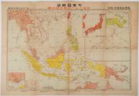
1719176771東京. Tokyo.: 日本放送出版会社. Nihon Hōsō Shuppan Kaisha. Showa 17 1942. Colour folding map scale 1:14500000 55cm x 80cm naval warship photographic illustrations on reverse. The wartime paper is browned and friable but small closed tears along fold lines and edges have been neatly repaired with archival washi on the verso. 79 x 53cm This colour map of Asia and the Pacific was published as a supplement to a magazine Hoso 放送 on January 1942 less than one month after the Pearl Harbor attack by the Japanese Forces. The war had just started but amazingly the map accurately predicted where the fighting would take place throughout the war. An inset map on upper right shows Singapore Borneo Sumatra and Java where battles took place in the area in early 1942. An inset chart on lower left shows various resources and their location including coal tin and iron ore clearly showing that the war was fought over securing resources. On reverse eleven photographic illustrations of war ships from Germany Britain the US and Japan are shown including the Prince of Wales and Enterprise. . 日本放送出版会社. [Nihon Hōsō Shuppan Kaisha]. unknown
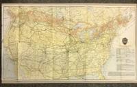
19205872Canadian Pacific Railway 1920. First Thus. Loose Sheet. Very Good-. Poole Brothers. Map measuring 31.75 inches x 17.75 inches printed four-color. Map shows the breadth of lower Canada from just north of Vancouver Island across to Newfoundland as well as all of the United States excluding southernmost Texas and Florida. CPR lines are represented in red ink whereas connecting American railroads are in black. Black stars along the CPR indicate locations of Canadian Pacific Hotels. Two slight chips to left margin and with a couple short closed tears along folds. Please see photo. A handsome map from the tail-end of the golden age of rail travel. Now preserved in a removable clear archival sleeve. Canadian Pacific Railway unknown