Misson MaximilienMareMagnum

50 745 résultats
<p>4 volumi, 16,5 cm, rilegatura in piena pelle, titolo e ricchi fregi in oro ai dorsi, risguardi marmorizzati, tagli colorati. Frontespizi in rosso e nero, una tavola in antiporta al primo volume, 76 tavole incise in rame fuori testo, molte delle quali ripiegate E' ritenuta la guida preferita per Goethe nel suo viaggio in Italia</p>
2 vol. in 16°, antiporta figurata, pp. XVI+678; pp. II+670. Legatura coeva in piena pergamena.Edizione riccamente figurata da xilografie in nero nel testo e da 19 tavole ripiegate f.t. tra cui una pianta della città di Roma. Fresco esemplare. La famosa guida romana si componeva di tre tomi (due relativi alla descrizione della città con vari itinerari e un volume spesso mancante dedicato agli usi e costumi degli antichi romani). I nostro esemplare si compone solo dei primi due tomi. Raro.
1919816St. Louis MO: The Texas Railway Guide Company 1919. Softcover. Good. Published by The Texas Railway Guide Company of St. Louis Missouri the map measures 23" x 23" 570 x 570 mm. Staining and tears along the folds else near very good. Professionally matted and framed. WITH THE RARE BOOKLET: 8vo. 136 pp. Original self-wrappers chipped lower cover chipped with significant loss; textblock browned and brittle but still SUITABLE FOR EXHIBITION AND STUDY. VERY SCARCE AND BEAUTIFULLY FRAMED RAILROAD MAP OF TEXAS AND OKLAHOMA WITH THE RARE BOOKLET WHICH GIVES ROUTES OFFICIAL TIME TABLES AND ADVERTISEMENTS FOR HOTELS MOST OF WHICH HAVE BEEN DESTROYED. This work also includes parts of Oklahoma Colorado New Mexico and Mexico. Delineated are counties major cities and also small cities that at one time held a prominent place along certain railroads but has subsequently been bypassed by highways and have turned into ghost-towns. <br /> <br /> The scale of the map is approximately 10 miles to 1/4 in. The full title of the booklet is: "Texas and Oklahoma railway and hotel official guide: containing the official time tables of all railway lines operating in Texas and Oklahoma also useful and valuable information for the traveling public for shippers and for railway men generally. The Texas Railway Guide Company unknown
Very Good Turkish, Ottoman (1500-1928) Contemporary red cloth. Roy. 8vo. (24 x 16 cm). In Ottoman script (Old Turkish with Arabic letters). [1], 229, [1] p., many b/w and color ills., 30 chromo-lithographed maps. Wear and fading on spine, some ex-library stamps on the colophon and several blank pages, ownership ink inscription and signature on the first page-overall a good copy. First edition of this rare Ottoman atlas for the primary schools in the late Ottoman Empire, including beautiful 30 chromo-lithographed maps of the Ottoman land according to administrative regions (provinces) and richly illustrated with b/w plates of the cities and provinces in the Middle East. Map list: 1. World map 2. Complete Imperial Ottoman 3. Arabian Peninsula 4. Anatolia 5. Asia Minor 6. Marmara and Black Sea 7. Aegean (The Archipelago) 8. Demography of Anatolia and Syria, Libya, etc 9. Administrative map of Anatolia 10. Map of mines of Anatolia 11. Agricultural map of the Imperial Ottoman 12. Arabian Peninsula 13. Map of the Edirne Vilayat [Adrianople Province of the Ottoman Empire] 14. Map of the Bosphorus 15. Map of the Hüdavendigâr Vilayat [Brusa Province] 16. Maps of Izmit and Biga Sanjaks 17. Map of Aydin Vilayat and Mentese Sanjak 18. Map of the Konya Vilayat 19. Maps of the Adana Vilayat and the Mediterranean Sea 20. Maps of the Erzurum and Ankara Vilayats 21. MAps of Kastamonu Vilayat and Bolu Sanjak 22. Map of the Trebizond Vilayat 23. Maps of the Van and Bitlis Vilayats 24. Maps of the Sivas and Harput Vilayats 25. Maps of the Bagdad and Basrah Vilayats 26. Map of the Mosul Vilayat and Day al-Zor Sanjak 27. Map of the Aleppo Vilayat and Urfa Sanjak 28. Map of the Syria and Beirut Vilayats 29. Map of the Arabia 30. Maps of the Yemen vilayat and Asir Sanjak. This atlas was printed four times for the different classes of the early Turkish / Ottoman schools, during World War 1 (two times in 1916) and the National Struggle (two times in 1921). Geylangil was born in Istanbul in 1887 and studied in Aleppo and Baghdad. Geylangil, who also studied economic geography, taught geography at many schools, including Galatasaray High School. Until his death, he wrote 14 books on geography, most of which were geographical atlases. In 1941, he was among the founding members of the Turkish Geographical Society. Özege 23216.; TBTK 11481.; We couldn't find any copy of this edition worldwide.
Very Good Turkish, Ottoman (1500-1928) Original map. Oblong atlas folio. (57 x 77 cm). In Ottoman script. Folded. Stains on the upper side. Slightly chipped margins. Filistin haritasi. Scale: 1/250.000. Erkilet was an officer of the Ottoman Army and the general of the Turkish Army. In fall 1941 he, along with General Ali Fuad Erden, visited the occupied territories in Ukraine (including Crimea) on the invitation of Gerd von Rundstedt. From there he and other Turkish officers flew to Rastenburg to meet Hitler in person. In 1943 he published his essays on that trip under the title "What I Saw on the Eastern Front". Being a staunch Turanist, he was briefly detained for Panturkic activities in 1948 together with some other prominent Turanists.
Very Good Turkish, Ottoman (1500-1928) Original wrappers. Demy 8vo. (21 x 14 cm). In Ottoman script (Old Turkish with Arabic letters). 83 p. Chipped on extremities of pages and cover, minor stains on edges. Otherwise a good copy. First and only edition of this first work in book form on Baku and Azerbaijani oil. After the occupation of the Republic of Azerbaijan by the Red Army, many Azerbaijani intellectuals such as Mehmed Emin Resûlzâde (1884-1955) sought refuge in Turkey, established a publishing house called "Milli Azerbaycan Nesriyâti" [i.e. National Azerbaijan Publication] in 1928, Istanbul, and to make the voice of Azerbaijanis heard in exile to influence world public opinion. This book was published as the 9th publication of this publishing house. It was printed in Orhaniye Printing house in 1928 and was actually composed of the articles written by the author in the "Azeri-Turk" magazine. The first article appeared in the issue dated 15 August 1928, with other articles following it. The book, in which Mehmed Emin Rasülzade also penned a presentation, consists of the chapters: The Role of Oil in the World War, Azerbaijan at the Genoa Conference, Azerbaijan at the Hague Conference, the American Rivalry in Britain, A Common Front against the Bolsheviks, the Pursuits of the Oil Competition. Compiled from Mehdiyev's articles, is not only a propaganda work against the Russian occupation but also the first in-depth work written on Baku and Azerbaijan oil. Many sources in the text are referenced in footnotes. Mehdiyev says that world politics is shaped by the economy and oil is the most important factor in this context. In addition to expressing how important it is for the First World War, he also makes predictions about how oil will shape world politics in the future. According to Mehdiyev, whoever dominates the world's oil reserves will be the strongest state in the world. Based on M. Fanning, Mehdiyev states that Azerbaijani and Baku oil has an estimated 8 million barrels of resource rather than Mexican, American, Turkish, and Iranian oil. Only one paper copy in Bogaziçi University's Library in Turkey according to the OCLC: 82001141.; Özege 1960.
Very Good Turkish, Ottoman (1500-1928) Contemporary (early 19th century) quarter brown cloth with marbled boards, "Yahudi ebrûsu" end-papers. Roy. 8vo. (23 x 16 cm). In Ottoman script (Old Turkish with Arabic letters). 90 p., numbered with Arabic numeric system in pencil, around seven illustrated schemes of magical diagrams. Written on a probably 17th-18th century European paper with "Crescent" watermark, naskh script with "harakât", black and red ink. Early and a rare posthumous manuscript copy of this 18th-century Islamic majmua, containing the treatment methods and drug compositions against physical and spiritual diseases, with material and magical suggestions, copied 32 years after the author's death by a "Hafiz" with an addendum of new drugs and treatments compiled from older annotations of this work. "In the first part of the work on spiritual medicine, verses, prayers, talismans, and magic formulas in the Islamic culture like "wafqs" that are believed to be treated; in the second part, on physical medicine, drug formulas from various material objects for physiological diseases are shown." (Çagrici). Harputî was an 18th-century poet and prose from Harput (Kharberd). In the introduction to the manuscript, he stated that he is not a doctor, but that he writes practices that can heal patients due to his experiences. Despite this, the text was widely used in Ottoman medicine in the 18th and 19th centuries.
2 volumi, 25 cm, pp. (20); 391, (4); (4), 506, (2); diverse incisioni nel testo, 14 tavole all'acquatinta su carta forte protette da velina rappresentanti i monumenti storici di Milano, qualche gora al margine bianco di alcune tavole, 2 grandi tavole più volte ripiegate con la pianta della città e dei dintorni di Milano, una per volume. Esemplare numerato 146 su 1500, firmato dal podestà di Milano Casati. Timbro privato applicato alla carta di dedica. Rilegatura coeva in mezza pelle, titolo in oro al dorso, piatti marmorizzati, esemplare fresco e ottimo. Cfr. Lozzi,I,2650 - Predari,164 - Cat. Hoepli,787 - Schlosser, p. 573 - Villa "Bibl. delle Guide di Milano",221
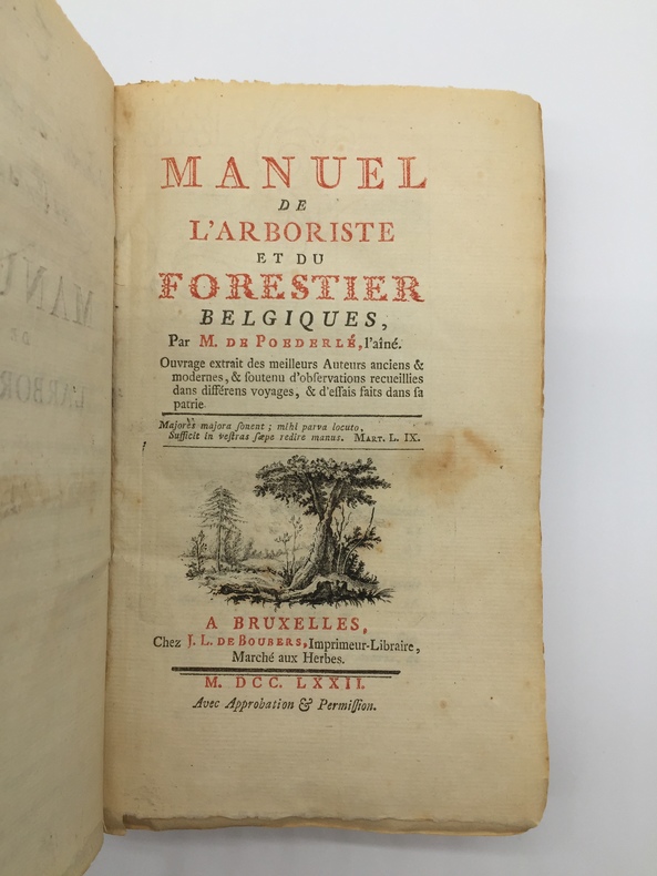
17721840Couverture rigide 1ère Édition J.-L. de Boubers - Emmanuel Flon 1772 Bruxelles 19,5x11,5 cm
1 volume in-4°, pp. (8), 417, (3), legatura in pergamena floscia coeva, titolo manoscritto al dorso, sporadiche fioriture alle carte, ottima copia, molto genuina. I "Synonymia geographica" sono un elenco di concordanze tra nomi geografici antichi e moderni, quest'edizione verrà poi ampliata, come dizionario geografico, col titolo Thesaurus geographicus (1587), vera e propria opera di geografia storica. La prima versione dei Synonimia apparve come indice in alcuni atlanti precedentemente pubblicati contenente circa 2000 voci; in questa prima edizione separata ce ne sono circa 10000. Importante edizione originale. EXPORT LICENCE AVAILABLE
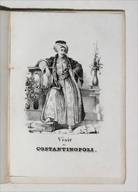
18504999<p>EUROPEAN TRAVEL GUIDE FOR YOUNG READERS</p><p>12mo 240 pp with engraved title page frontispiece and 7 further acqua-forte engraved plates. Bound in original publisher's printed brown wrappers minor damage to spine clean and fresh and excellent and very genuine copy. With stamps likely a bookseller's to head of cover and title page "Rodi-Ferrario". Very good.</p><p>Very rare first and only edition of this travel guide to Europe written as the title suggests for young readers in a pocket 12mo format. The guide moves from tours of Italy and Switzerland all the way to Poland Lithuania and Turkey as well as Great Britain providing 8 engraved plates of national costumes along the way. The charming illustrations depict: a young woman of 'Batz' Bath; a woman of Civita-Vechia Romagna; a citizen of Seville; a young woman of Gaeta Two Sicilies; a boatman from Le Havre a woman of Oberhash Switzerland; the Vizier of Constantinople; and finally a female Athenian. The commentary passes from the historical to contemporary details of travel between major destinations and occasional remarks of art-historical interest. Florence is noted to contain in the same breath the sepulcres of Galileo Aretino Machiavelli and Alfieri the latter having been sculpted by Canova p 72. England Scotland and Ireland are noted very much in passing: although the empire stretches 'to the Ganges' the islands themselves are accorded little interest. The guide does mention "the reknown of the univeristy of Oxford the most learned in England" with no mention however of its more easterly counterpart.</p><p>Unrecorded in OCLC no U.S. copy traced.</p><p> ICCU 1175063<br /><br /></p> Fratelli Reycend paperback
18640008949London: Chapman And Hall 1864. Revised edition. Hardcover. Fine. 8vos 3/4 brown morocco extra-gilt spines marbled boards and edges. Ex libris Cyrus K. Hale. <br/><br/>The title-page states "In Eight Volumes". Some versions of this had nine. Dyce is considered to have been a scrupulous editor: "Its textual criticism is of the highest value and the brief annotations are always useful and to the point. The glossary is full and meets most of the difficulties. A vast number of.Shakespearean students regard it as the most readable and satisfactory of all the editions of the dramatist - DNB." Frontispiece portraits. Jaggard SHAKESPEARE BIBLIOGRAPHY p. 538 . Chapman And Hall hardcover
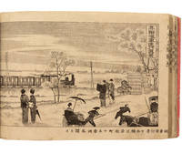
18901650681890. TOKYO GUIDE. Tokyo meisho hitori annai. Illustrated with two double-page woodcut maps and 28 full page woodcut views. Oblong 8vo. bound in publisher's wrappers in a new cloth folding box. Tokyo: Hoeido 1890. A guide to Tokyo at the end of the nineteenth century. Among the scenes which show the growing Western influence on Japanese life are depictions of European style buildings carriages and a steam train. In fine condition. hardcover books
1225O7NM1E7Leather Bound. Good. London: N. Hailes 1818 . Stated second ed.- Scarce London primer in French with instructive plates; cautionary tales with lurid examples of blinded killed or maimed kids who didn't listen to their parents and fell before horses knives guns firing squads or out the window of an attic swing they designed themselves the frontis illustration. Our pics. Conduct of life - 204 pages. Quarter leather gilt and marbled boards. Toning and edgewear. Still well bound. Contemporary signature of Jane G. and bookseller's ticket: Illard Grosvenor Square else unmarked. hardcover
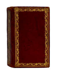
179812270Madrid: Imprenta Real 1798. 108x64mm. 4¼x2½". Madrid Imprenta Real 1798. 2 tomos en un volumen. En 12º 108 x 64mm. 1 mapa de España a doble página coloreado a mano en la época retrato de Carlos III dibujados por Goya y grabado por Carmona portada grabada 216 216 pp. Encuadernación de la época en marroquén rojo ruedas doradas en los planos formando rectángulos lomera decorada con un hierro dorado que se repite cabeza y cortes dorados. Edición original de este apreciado calendario y guÃa de forasteros de Madrid completo del mapa retrato y portada grabada. Es uno de los <em>Kalendarios</em> más apreciados por contener el retrato del rey grabado por Carmona sobre dibujo del maestro Francisco Goya. Ejemplar vestido con una atractiva encuadernación de la época en marroquén rojo. Publicación de periodicidad anual fundada en 1722 por Luis Félix de Miraval y SpÃnola y que hasta 1734 se titula Kalendario particular. A partir de 1725 su impresor será Juan Sanz; después lo serán sus herederos y desde 1730 Antonio Sanz su sobrino que en 1769 cederá los derechos a la Corona española a cambio de una pensión vitalicia. En su portada se expresa que contiene los nacimientos de los reyes reinas los setenta miembros que componen el sacro colegio cardenalicio los prÃncipes de Europa los ministros que componen los tribunales de Su Magestad en sus reinos con indicación de sus residencias particulares en Madrid. En definitiva se trata de una guÃa completÃsima de la Administración del Estado del antiguo régimen con la indicación de sus órganos ejecutivos y consultivos consejos reales juntas instituciones cientÃficas y académicas y demás organismos y entidades que la monarquÃa española fue creando a lo largo del siglo dieciocho entre estas la propia Real Biblioteca Pública antecedentes de la Biblioteca Nacional de España y las reales academias con los nombres de los arzobispos y obispos de España y de las Indias la composición de los tribunales chancillerÃas y audiencias relación de reinos y provincias y partidos con los nombres de sus gobernadores intendentes y corregidores. En la edición de 1767 comienza a incluir grabados como los de Carlos III los PrÃncipes de Asturias o el del Palacio de Aranjuez y después los de Carlos IV y la reina Maria Luisa para en el siglo XIX incluir los de Fernando VII y los de su hija la joven reina Isabel II. Asimismo llegará a estampar una docena de mapas de España y planos de Tomás López y sus hijos. En 1774 saldrá ya de la Imprenta Real de la Gazeta incluirá las relaciones de caballeros de Carlos III de catedráticos de los Estudios Reales de embajadores y cónsules y vicecónsules del Rey en el extranjero la cronologÃa de los reyes de España o el calendario de las principales ferias. Imprenta Real unknown
Francesco Pieraccini, Pisa, 1787. Prima originale edizione. In 8vo, solo il tomo 1 (su tre che compongono l'opera), pp. XL (con l' "Indice de' Titoli di questo Primo Tomo"), 439 (con l' "Ordine Alfabetico de' Professori del Disegno nominati nel primo tomo per Opere da loro fatte") + 2 grandi tavole in fine (rispettivamente di cm 46 x 51 e 31 x 42), ossia la "Pianta della Città di Pisa fatta l'Anno 1787" e la "Veduta dei quattro rinomati Edifizj della Città di Pisa. 1. Duomo 2. San Giovanni 3. Campanile 4. Campo Santo" (disegnata da Alessandro da Morrona e incisa da Ferdinando Fambrini), leg. orig. in piena pelle con titolo oro su tassello rosso, contropiatti e fogli di guardia in carta marmorizz. Si tratta del solo primo volume di questa importante opera ma l'esemplare risulta in elegante legatura, molto ben conservato e soprattutto dotato di queste due eccezionali tavole, entrambe a pieni margini ed ottimamente incise.
In-8°; cc. (16), pp. 613, (2) vignetta incisa su legno al frontespizio, nel testo iscrizione recante il nome di san paolo in greco e in latino, e altro legno raffigurante San Pietro in barca in mandorla. Legatura in piena pergamena con titolo manoscritto al dorso.
carta geografica incisa, divisa in 16 scomparti montati su tela (cm. 96 x 70), la Scala è ad 1/128,000 del Terreno, scale di conversione in Pertiche di Ferrara, Pertiche di Bologna, Piedi agrimensorj di Ravenna, Palmi romani, Metri - la Dedicatoria è incisa su lastra monumentale con stemma cardinalizio della famiglia Arezzo immersa in paesaggio e veduta di Ferrara - minime bruniture
43566Saint Malo, Chez L.H. Hovius,. , 1784 Relie, petit in-4 , Reliure de l'epoque. (relie 19e siecle,) 384pp avec illustrations. Derniere edition, bon etat.
18442178Couverture souple 1ère Édition Carilian-Goeury et V. Dalmont 1844 Paris 23x14 cm
8vo., First Edition, with over 70 plates and 4 folding maps (2 large and coloured); handsomely bound in red full morocco, back with five raised bands ruled in gilt, second and fourth compartments lettered in gilt, all other compartments tooled in gilt with a floral spray, original pictorial wrappers preserved, a most attractive copy ideal as a gift or for presentation. With a contemporary picture postcard and embroidered Christmas card (1945) loosely inserted. One of the best - and scarcest - pre-WWII guides to Hong Kong. Profusely illustrated and with very numerous trade advertisements throughout, it includes detailed coloured maps of Hong Kong Island and the New Territories, and plans of the Central District of Victoria and the Canton-Kowloon railway. A splendid copy of a work rarely found complete. EXTREMELY SCARCE.
2 voll. <br/> STATO: USATO, MOLTO BUONO.<br/> TITOLO: Fonti italiane per la storia della scoperta del Nuovo Mondo Vol.I: carteggi diplomatici ed epistolari. vol.II: narrazioni sincrone, resoconti dei viaggi di Pietro Martire d’Anghiera, di N.Scillacio, di Amerigo Vespucci, di Marino Sanuto e altri dal 1493 al 1550.<br/> AUTORE: Berchet,Guglielmo. (Raccolte da)<br/> EDITORE: Ministero della Pubblica Istruz
1830WOC-1130Contient: 1-ALEXANDRE DE LABORDE: Au Roi et aux Chambres, sur les véritables causes de la Rupture avec Alger et sur l'Expédition qui se prépare. Paris, Chez Truchy, Libraire, 1830. Ornée de 2 plans (Environs d'Alger et Plan d'Alger). VI,111 pages. 1bis:Pièces à l'Appui; LV pages. 2- De la Domination Française en Afrique, et des Principales questions que fait Naitre l'Occupation de ce Pays. Paris,Imp-Lib. De Dondey-Dupré Père et fils, 1832. 154 pages. 3 -J.M.H.B: Itinéraire du Royaume d'Alger, Comprenant: La Description des Villes, Villages, Bourgades, Tribus sujettes et indépendantes, Ruines, Antiquités, Rivières, Ruisseaux, Montagnes, Curiosités naturelles; des détails sur les Moeurs et Superstitions locales, le Climat, le Sol, le Gouvernement, la force militaire, les rapports avec les Chrétiens et les puissances chrétiennes, et un résumé de l'histoire de cette Régence depuis les Romains jusqu'à nos jours. Toulon, L. Laurent, Libraire-éditeur, sur le Port, 1830. 191 pages. 4:Notice sur le Mode de Gouvernement provisoirement établi dans Le Royaume D'Alger. Alger, le 1er janvier 1831. 32pages. 5 - J. ODOLANT-DESNOS: Possibilité de Coloniser ALGER ou Mémoire dans lequel on Démontre les Avantages Industriels que la Colonisation du Territoire d'Alger procurerait aux Cultivateurs et à la France. Paris, Chez G.-A. Dentu, Imprimeur-Libraire, 1831. 50 pages.
In-8, Paris, 1878, Impr. Alcan-Lévy, la société la Publicité. Legatura editoriale in tela viola, dorso con titolo e ornamenti in oro. Titolo e blasone della città di Parigi al piatto anteriore. Rara opera di letteratura effimera, testimonianza dell'importante evento storico e culturale rappresentato dalla terza Esposizione Universale di Parigi. La prima parte è dedicata all'Esposizione, con inserizioni pubblicitarie e due piante a colori piegate fuori testo. Pianta 1: piano generale nel Palais du Champ de Mars e nel Palais du Trogadero, costruito per l'occasione. Pianta 2: dettaglio dei padiglioni nel Palais du Champ de Mars. La seconda parte del volume è dedicata alla città di Parigi con la descrizione pubblicitaria dei teatri piu importanti, con i prezzi dei biglietti. A molti teatri è dedicata una stampa fuori testo che li raffigura. L'opera proseuge con le piantine dei diversi arrondissements e innummerevoli inserzioni, notizie storiche, economiche e culturali. Uno spaccato vivo del tessuto economico e culturale della città di Parigi nel 1878. Condizioni: dorso scolorito, foxy e scolorimento ai piatti. Fragilità della legatura nei primi fascicoli. Imbrunimento della carta. In-8, Paris, 1878, Impr. Alcan-Lévy. Editorial binding in purple canvas, spine with title and gold ornaments. Title and arms of the city of Paris at the front panel. Rare work of ephemeral literature, testimony of the important historical and cultural event represented by the third Universal Exhibition in Paris. The first part is dedicated to the Exhibition, with advertisements and two colored plants folded out of the text. Floor plan 1: general plan in the Palais du Champ de Mars and the Palais du Trogadero, built for the occasion. Plan 2: detail of the pavilions in the Palais du Champ de Mars. The second part of the volume is dedicated to the city of Paris with the advertising description of the most important theaters, with ticket prices. Many theaters have an out-of-text print depicting them. The work continues with the maps of the arrondissements and innumerable advertisements, historical, economic and cultural testimonies. A vivid look at the city of Paris in 1878. Condition: discolored spines, foxy and discoloration of the panels. Fragility of the binding in the first issues. Browning of the paper.
First Edition. xv, [16]-494 pp. 22.5cm x 16cm. Index. Dr. Johnson was a graduate of the Homoeopathic Medical College of Pennsylvania, Member of the American Institute of Homoeopathy, and author of 'Johnson's Therapeutic Key'. Bevelled brown cloth-covered boards decorated in black and gilt. Above-average wear. Front hinge half open. Back hinge open. Binding tender. Child's neat practice writing pencilled on front and back of first blank leaf. A worthy copy of this early comprehensive homoeopathic work. (Hoolihan S-646) Book