50 745 résultats
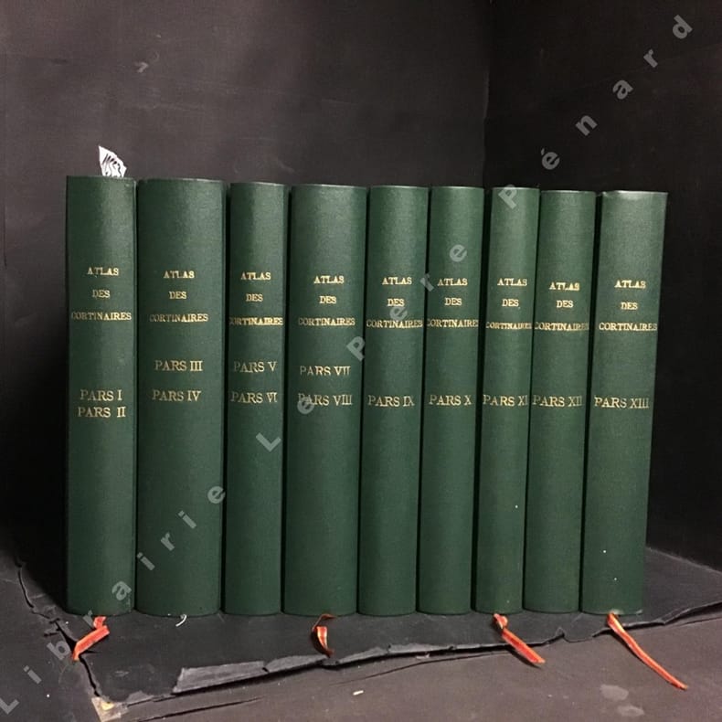
19941255341994 Fédération mycologique Dauphiné-Savoie - 1994 - 16 volumes in-8, reliés, formats carrés, pleine percaline verte, titres et tomaisons sur les dos en doré, toutes tranches mouchetées, signets rouges - Contient 913 planches hors-texte en couleur
Very Good French Original map. Oblong Double Elephant Folio. (96x156 cm). In French. Scale: 1/1.500.000. With explanation of geographical terms in Greek, Turkish, Arabic and Persian; With overview sheet: Aperçu general de la division administrative des provinces asiatiques de l'Empire Ottoman. (Jaar: 2011 - Europeana Collections). French edition of Kiepert's huge map of the Imperial Ottoman territories. "Includes list of geographic terms in eastern languages and notes on administrative divisions. Includes notes on materials the cartographer used to put together the map". (See LC copy). Kiepert, (1818-1899), was born in Berlin. He traveled frequently as a youth with his family and documented his travels by drawing. His family was friends with Leopold von Ranke, who inspired Kiepert's creative endeavors. Kiepert was taught by August Meineke in school. Meineke influenced Kiepert's interest in classical antiquity. He attended Humboldt University of Berlin. He studied history, philology, and geography. He published his first geographical work, with Carl Ritter, in 1840, titled Atlas von Hellas und den hellenischen Kolonien. The atlas focused on ancient Greece. In 1848 his Historisch-geographischer Atlas der alten Welt was published. In 1854, his atlas, Atlas antiquus was released. It was translated into five languages. Neuer Handatlas über alle Teile der Erde was first published in 1855. In 1877 his Lehrbuch der alten Geographie was published, and in 1879 Leitfaden der alten Geographie, which was translated into English (A Manual of Ancient Geography, 1881) and into French. In 1894 he created the first part of a larger atlas of the ancient world titled Formae orbis antiqui. He traveled to Asia Minor four times between 1841 and 1848. He created two maps of the region, including Karte des osmanischen Reiches in Asien, in 1844. Kiepert taught geography at the University of Humboldt-Berlin starting in 1854. He taught at the university until his death. Akyol, article 536.; Dagtekin p. 22 (With detailed bibliography on Kiepert's maps). Rare. Preserved in a frame, will be sent without its frame. A wall map.
Very Good Turkish, Ottoman (1500-1928) An extremely rare litho propaganda map published as an extra supplement to the Tercümân-i Hakîkat [i.e. The Translator of Truth] newspaper just before the proclamation of Republic in Turkey in 1923 by Mustafa Kemal Atatürk (1881-1938), showing the front in West Anatolia during the War of Independence (or National Struggle) between 1919-1922 against Greek forces. The upside of the map between the note as title 'Gift to the readers of 'Tercümân-i Hakîkat', Mustafa Kemal Atatürk's portrait among decorated heroic lithographed drawings. In the lower right corner, can be seen legends of the map, scale, and mapmaker's signature. Tercümân-i Hakîkat was a daily newspaper published in Istanbul between 1878-1921 during the Ottoman Empire. Tercüman-i Hakîkat, the most important newspaper published during the reign of Sultan Abdülhamid II, was founded by novelist Ahmed Midhat Efendi, (1844-1912). In the beginning, most of the articles were written by Ahmed Midhat Efendi. It was an encyclopedic newspaper with the aim of inculcating and educating reading habits among the Turks and it played an important role in the training of many famous Ottoman journalists. Its first issue was published on June 26, 1878. After Ahmed Midhat's death in 1913, the newspaper changed owners, and the last issue was published on February 11, 1921. Ibrahim Alaettin Gövsa, (1889-1949), was an Ottoman / Turkish journalist, educator, and intellectual who supported the War of Independence the most. This propaganda map published in Tercümân-i Hakîkat, during the war in 1920 or 1921, is a propaganda tool that calls on the literate people belonging to a certain class, especially those living in Istanbul, to support the war, and aims to spread the word that Turkey is winning the war. Original lithograph map. 50x35,5 cm. In Ottoman script (Turkish with Arabic letters). Scale: 1: 250.000. Occasionally foxing and slight stains on paper, folded traces. Otherwise a very good copy.
Very Good Turkish, Ottoman (1500-1928) Original wrappers. Large roy. 8vo. (25 x 17 cm). In Ottoman script (Turkish with Arabic letters). [1], 39 p. First and Only Edition of the description of an early pilot guide to the Aegean Archipelago with the Mediterranean shores of Africa, Cyprus et alli, not including Morea (Peloponnese peninsula) which was published separately as 'Tarîfât-i Sevâhil-i Mora' [i.e. Description of the shores of Morea]. Admiral / General Süleyman Faik Pasha, who graduated from the Ottoman Naval Academy, was promoted to captain in 1864 after his travel to the Cape of Good Hope, and with the information, he obtained during this trip, he published and translated three guides, especially on the seas and coasts under Turkish / Ottoman rule. This early and rare book was one of his translations from its original pilot guide in English, printed in the Bahriye Matbaasi [i.e. The Press of the Turkish Naval Forces] located in Kasimpasa district which is a quarter within the Pera area of Constantinople, a low-lying area north of the Golden Horn. is one of the oldest residential areas in Istanbul with a strong naval tradition. The ships of Sultan Mehmed II sailed into the Golden Horn from this quarter. After the fall of Constantinople, Kasimpasa flourished. By the 16th century, it contained the Imperial Arsenal and docks of the Ottoman Navy, home to 120 ships. The Turkish Naval High School was founded in 1773 within a printing house shortly after foundation, to teach geometry and navigation to naval and civilian merchant captains on board a galleon anchored at Kasimpasa. The Turkish Naval Academy was housed in Kasimpasa from 1838 to 1850. Extremely rare. Only one copy in OCLC 1030771711 (Orient-Institut of Istanbul).; Özege 19742. Not in ATYB (Askerî Tarih Yayinlari Bibliyografyasi).
Very Good Turkish, Ottoman (1500-1928) Contemporary handsome quarter leather binding raised four bands and gilt lettering to spine. Roy. 8vo. (24 x 17 cm). In Ottoman script (Old Turkish with Arabic letters. 171, [1] p., 15 folded maps. First and only edition of this early naval guide to the Mediterranean and Aegean Islands and shores prepared by the Ottoman Admiral Süleyman Faik. A comprehensive early printed guide to the Cezâyir-i Bahr-i Sefid [i.e. Ottoman Province of the Archipelago] including the descriptions of all islands in the Archipelago such as Patmos, Peraka, Paros, Delos, Ipsara, Acina, Sekino, Mikonos, Bozcaada (Tenedos), Istanköy (Kos), Imroz, Crete, Anti Paros, Alosis Islands with West and East of the Archipelago, and Edremit Bay, Doris Bay, Rafti Port, Aynaroz Bay; and Anatolian shores such as Izmir (Smyrna), Kusadasi, Gallipoli. This rare book has 15 folded portolan maps of Marmaris Port, Makri Port, Naghos Port, Karaagach (Ptelea, Evros in Greece) Port, Kakuve and Tertumos Ports, portolan of Iskenderun (Alexandrietta), portolan of Lazkiye (Al-Lazkiyya in Syria), portolan of Avret Island and Trablus-Sam, and portolan of Beirut and Sida. Süleyman Faik (1845-1909) was a general, and afterwards an admiral and a Chairman of the Turkish / Ottoman Navy General Staff, divisional. Only six copies in OCLC: 773143926, 67075343.; Özege 16579.; Not in ATYB: Askerî Tarih Yayinlari Bibliyografyasi [= Bibliography of Turkish History of Military Books].
New Persian Original bdg. HC. Folio. (34 x 24 cm). In Persian with abstracts in English. 392 p., color and b/w ills. Tehran became a major city of Iran after 1554 A.D. during the Safavid period when Shah Tahmasb I, son of Shah Ismail, ordered the implementation of two large-scale public works. The first project was the construction of ramparts and moats surrounding the entire city, which defined the city's perimeters and increased its defense. The rampart consisted of 114 towers, representing the 114 chapters within the Holy Quran and enclosed an area of 4.35 km2. The second project was the establishment of the bazaar, the heart of the industrial and commercial activities of the city, surrounded by numerous holy shrines. However, it was 240 years later in the Spring of 1796 A.D. that Tehran became the national capital of Iran, during Agha Mohammad Khan Qajar's reign. 2016 A.D. actually marks the 220th year since Tehran became the political centre of Iran. The first known map of Tehran (page 18), a Russian spy map, dates back to 1826 A.D. The next Russian map of Tehran (page 24) from 1852 A.D. was translated into Persian and presented as a gift to Naser al-Din Shah Qajar (page 29). After the establishment of the military polytechnic school in 1851 A.D. and the arrival of Europe an military instructors, the importance of accurate topographical maps was recognized by the nation's leaders. The Austrian artillery trainer for cannons, August Karl Krziz, coordinated in 1858 A.D. the preparation of the maps of Tehran (page 39) and its surrounding area (page 35). This was the beginning of scientific cartography in Iran. By 1863 A.D., maps of Tehran Province for the purpose of tax collection (page 58) were being produced by engineer Abdul Rasool Khan. Tehran dramatically expanded after a huge flood in 1867 A.D. destroyed a large portion of the Safavid period ramparts and moats, after which Alexander Bohler, a French military instructor, designed a new and enlarged rampart and moat enclosure. Within four years between 1867 A.D. and 1871 A.D., Tehran grew from 4 .35 km2 to 19.75 km2 with these new constructions. By 1891 A.D., a highly detailed and technical map of Tehran (page 64) had been produced by Abdul Ghafar Najmolmoq. During the reigning years of Mozafar al-Din Shah, Mohammad Ali Shah, and Ahmad Shah, maps for Tehran postal services (page 126) and Tehran provincial delineation (page 127) were produced. During these years, the Russian, British and French prepared several geopolitical maps of the region including Tehran. For example, the map on page 323 reproduces a map prepared in 1892 A.D. by the British Survey of India at the scale of 1:506,880. In 1914 A.D., German publisher Wagner & Debes prepared a touristic map of Tehran (page 134). In 1922 A.D. the Ministry of Culture's Investigation Section prepared a map of schools in Tehran (page 138). During the Pahlavi I period (1925~1941 A.D.), modernization of Tehran became a national priority. By 1930 A.D. a map for street enlargement in Tehran (page 158) had been published. In 1932 A.D., the demolition of the Naser al-Din Shah Qajar period ramparts began simultaneous to further expansion of urbanized Tehran. The 1936 A.D. military map of Tehran (page 169) is testimony to the changes in the urban morphology of this period. The creation of a dedicated military cartographic service in 1935 A.D. marked an important milestone in the history of cartography in Iran. The 1937 A.D. urban development plan of Tehran (page 170) clearly shows the new streets, squares and urban development envisioned. The first known aerial photograph of Tehran dating from 1940 A.D. (page 177) displays the realization of this urban development plan. After the invasions by the Russians, British and Americans in 1941 A.D., cartographic activities in Iran suddenly increased. Sergeant Mohammad Reza Ghaffari privately published maps of Tehran [.] The above mentioned maps are a few representative samples of the over 270 maps
182514841Madrid: Imprenta Real 1825. 112x67mm. 4½x2¾". Madrid Imprenta Real 1825. En 12º 112 x 67mm. 192 pp. Portada grabada. -II: 144 pp. Portada grabada. Gran mapa de España plegado grabado por Carmona plano de Madrid y sus cercanÃas por Tomás López. Preciosa encuadernación de época en marroquén rojo estilo imperio atribuida a Suárez. Publicación de periodicidad anual fundada en 1722 por Luis Félix de Miraval y SpÃnola y que hasta 1734 se titula Kalendario particular. A partir de 1725 su impresor será Juan Sanz; después lo serán sus herederos y desde 1730 Antonio Sanz su sobrino que en 1769 cederá los derechos a la Corona española a cambio de una pensión vitalicia. En su portada se expresa que contiene los nacimientos de los reyes reinas los setenta miembros que componen el sacro colegio cardenalicio los prÃncipes de Europa los ministros que componen los tribunales de Su Magestad en sus reinos con indicación de sus residencias particulares en Madrid. En definitiva se trata de una guÃa completÃsima de la Administración del Estado del antiguo régimen con la indicación de sus órganos ejecutivos y consultivos consejos reales juntas instituciones cientÃficas y académicas y demás organismos y entidades que la monarquÃa española fue creando a lo largo del siglo dieciocho entre estas la propia Real Biblioteca Pública antecedentes de la Biblioteca Nacional de España y las reales academias con los nombres de los arzobispos y obispos de España y de las Indias la composición de los tribunales chancillerÃas y audiencias relación de reinos y provincias y partidos con los nombres de sus gobernadores intendentes y corregidores. Comienza con el calendario gregoriano con el santoral de cada dÃa y datos astronómicos y contiene también el jubileo de 40 horas asà como datos estadÃsticos de matrimonios nacimientos y fallecimientos de las parroquias madrileñas y un resumen de los enfermos en sus hospitales. También otra sección sobre los dÃas en que la corte se viste gala o los dÃas en que vienen y parten los correos en la Estafeta General de Castilla en esta corte o la relación de los caballeros del Toisón de Oro. Asimismo incluirá los valores de las monedas españolas y sus valores de cambio con las más importantes de Europa. Desde 1768 le acompañará el Estado militar de España con portada propia con los nombres de los capitanes y tenientes generales del Ejército de Su Magestad mariscales de campo brigadieres y oficiales de Marina etc. En la edición de 1767 comienza a incluir grabados como los de Carlos III los PrÃncipes de Asturias o el del Palacio de Aranjuez y después los de Carlos IV y la reina Maria Luisa para en el siglo XIX incluir los de Fernando VII y los de su hija la joven reina Isabel II. Asimismo llegará a estampar una docena de mapas de España y planos de Tomás López y sus hijos. En 1774 saldrá ya de la Imprenta Real de la Gazeta incluirá las relaciones de caballeros de Carlos III de catedráticos de los Estudios Reales de embajadores y cónsules y vicecónsules del Rey en el extranjero la cronologÃa de los reyes de España o el calendario de las principales ferias. En 1790 ya incluye un Ãndice al final o al comienzo y en el siglo diecinueve las relaciones de la Real Orden de Damas Nobles de las sociedades económicas o del Real Seminario de Nobles. Su volumen irá aumentando a lo largo de los años desde el centenar hasta superar las cuatrocientas páginas. Durante la invasión del ejército napoleónico el kalendario no aparecerá en 1809 ni en 1810 y para 1811 saldrá de la Imprenta de D. Miguel Segovia impresor de la Real Marina desde la Real Isla de León en Cádiz elaborado por dos redactores de los que se encargaban de las principales guÃas de forasteros de litigantes de comercio y hacienda y de guerra y marina de Madrid y se titulará GuÃa patriótica de España. Incluye una introducción narrando las dificultades que se dan para elaborarla y constará de dos partes. En la primera se dará cuenta del gobierno legÃtimo de sus tribunales y estado militar y la segunda de los cuerpos y oficiales de los ejércitos residentes en Cádiz asà como de la relación de diputados de las Cortes acompañada de un artÃculo. Las de 1812 y 1813 se titularán GuÃa polÃtica de las Españas y es también impresa en Cádiz la primera en la oficina de la viuda de Comes y la segunda en la Imprenta Nacional. En este caso es elaborada por un solo redactor e incluye unas efemérides patrióticas de los principales acontecimientos que se han venido producido durante la guerra contra los ejércitos franceses y artÃculos introductorios a la relación del cuerpo legislativo listado de diputados y del tribunal y secretarÃa de Estado de Cortes poder ejecutivo consejo supremo de Regencia Consejo de Estado embajadores y comandantes de los ejércitos. La de 1813 incluirá una addenda titulada Exércitos nacionales. Al regreso de Fernando VII retornará de nuevo a su tÃtulo anterior y a prácticamente a los mismos contenidos que publicaba durante el antiguo régimen hasta que durante el trienio liberal modifica otra vez su cabecera y algunos de sus contenidos al incluir de nuevo la relación de diputados a Cortes y las nuevas instituciones administrativas que el incipiente Estado liberal comienza a crear. En 1821 se titula GuÃa de forasteros en Madrid y en 1822 y 1823 GuÃa polÃtica y militar estampándose en la denominada Imprenta Nacional antes Imprenta Real. Por su parte el Estado militar de España que venÃa publicándose conjuntamente con el kalendario en 1821 1822 y 1823 se titulará Estado de los ejércitos de la monarquÃa española. El calendario para 1825 resulta asimismo interesante porque en las relaciones no aparecerán los "purificados". Esta publicación seguirá editándose hasta 1837 cuando es sustituida por la titulada GuÃa de forasteros en Madrid incluyendo los grabados de la reina gobernadora Maria Cristina y su hija Isabel II y dando cuenta de la nueva organización que el Estado liberal estaba creando en sustitución a la del viejo régimen por lo que el kalendario es una fuente de información básica para el conocimiento tanto de la evolución de la estructura estatal como de quienes eran titulares de sus numerosos órganos e instituciones desde la monarquÃa absolutista e ilustrada del dieciocho hasta las primeras décadas de construcción del Estado liberal con sus dos episodios más influyentes el constituyente de las Cortes de Cádiz y su epÃgono del trienio. Imprenta Real unknown
Nella qual si contiene il sito di essa, l'origine e le Signori delle Città e de' Castelli, co' nomi antichi e moderni, i costumi de popolie le conditioni de paesi. Et in più gli huomini famosi che l'hanno illustrata; i monti, i laghi, i fiumi, le fontane, i bagni, le minere, tutte l'opere maravigliose in lei della natura prodotte. Aggiuntavi la descrittione di tutte l'Isole all'Italia appartenenti, c0' suoi disegni collocati i luoghi loro, con ordine bellissimo. Con le sue tavole copiosissime. Nuovamente ristampata, con forma e diligenza revista e corretta. Due parti in un volume in 8vo, cm. 15x205; "La Descrittione": carte 34 non numerate + 495 (1); "Le Isole": carte 100 + 10 di indice e registro non numerate. Dedica dell’Autore ai sovrani di Francia Enrico II e Caterina de Medici. Doppio frontespizio con marca tipografica incisa, capolettera xilografati. Con 7 tavole ripiegate o a doppia pagina incise fuori testo. Antiche firme sul primo frontespizio e piccoli lavori di tarlo a margine, risanati. Errori di numerazione ma testo collazionato e completo. Legatura coeva in tutta pergamena rigida, titolo dorato su tassello al dorso, piccoli tagli alla pergamena sul dorso. Bell'esemplare. Codice inv.1031250
Vincenzo Batelli e Comp., Firenze 1827. Terza edizione. Sei voll. in 12esimo, pp. XX, 365 (con Indice degli Artisti); 338, XII, III (Indice delle Vedute); 284, III (Indice delle Vedute); 283, III (Indice delle Vedute); 310, III; 298, XI (Avvertimento ai Lettori e Indice delle vedute). A inizio di ciascun volume è presente una incisione (nel primo volume, in antiporta, è il ritratto dell’Abate Francesco Fontani, alla quale segue la “Carta della Toscana”, unica carta contenuta nell’opera a fronte di tutte le altre che sono vedute; nei successivi volumi, sempre a inizio volume, ci sono vedutine di città) + 4 piante rip. in b/n f. t. delle città di Firenze, Pisa, Siena e Livorno + moltissime incisioni in rame all'acquaforte in b/n f. t. all'interno dei sei volumi (si tratta di un'opera munita di un eccezionale apparato iconografico che illustra tutte le città della Toscana e luoghi secondari di essa; la collazione degli esemplari è sempre variabile e porta a un numero di tavole spesso diverso ma che è di circa 220), leg. orig. in mz. pelle marrone con tassello nero, filetti dorati al dorso, piatti in cartone marmorizz. nero / arancio. Opera basilare per la storiografia della Toscana, importante e rara a reperirsi completa dei volumi e delle tavole. Difetti alle legature con usura dei dorsi e delle cuffie (staccato il piatto ant. del primo volume, facilmente restaurabile), lievi aloncini a talune pagine (tracce di muffa alle prime pagine del sesto volume), nell'insieme buoni gli interni con tavole ben impresse e sempre pulite.
18203657Couverture rigide Etablissement lithographique du Comte de Lasteyrie 1820 Paris 29,5x22,5 cm
1941759696New. Brand new and still unused unknown
0785317775New. Brand new and still unused unknown
1450815472New. Brand new and still unused unknown
0147546273New. Brand new and still unused unknown
0147546621New. Brand new and still unused unknown
184734230New York: Published by Phelps Ensign & Thayer 1847. First edition under this title. Large folding map with a border of engraved portraits views and symbols outlined in colored 24 x 21 inches. Some discoloration of map small holes or tears along a few folds else very good. 1 vols. 12mo. Original red straight-grained morocco with steam engine and steam ship "St. Louis" and the title on the covers within an ornamental border in gilt on the upper cover and blind on the lower. Spine lacking with volume separating between text and large folding map at back binding rubbed else a very good copy with the signature of Dr. Pardon Lapham dated 1847 on the endpapers. First edition under this title. Large folding map with a border of engraved portraits views and symbols outlined in colored 24 x 21 inches. Some discoloration of map small holes or tears along a few folds else very good. 1 vols. 12mo. With inset of Florida and New York. Published by Phelps, Ensign & Thayer unknown books
1720D84DQOR1MSG6Amsterdam: Paul de la Feuille 1720. Contemporary gold-tooled mottled calf with a red morocco title label lettered in gold on the spine gold-tooled board edges and red sprinkled edges. 8vo. Ad 1 with 28 engraved illustrations on 24 folding leaves including 20 illustrations of Amsterdam's most famous buildings and 4 leaves showing Dutch and European flags printed on both sides of the paper. Further with a small woodcut vignette on the title page one woodcut decorated initial and one woodcut headpiece. Ad 2 with a woodcut floral vignette on the title page and typographical tables in the text. 2 works in 1 volume. With: 2 Tarif general des Provinces Unies pour les droits d'entrée & de sortie que payent les marchandises tant en ce païs qu'à la Mer Baltique au passage du Sont.Amsterdam Paul de la Feuille 1718. Enlarged third and best edition - the first with running text instead of dialogues - of an interesting description of the city of Amsterdam together with a work containing the tariff rates for import and export of all kinds of goods and merchandise imposed by the Dutch Republic in alphabetical order. Also included are the tariff rates imposed in the Sont entrance of the Baltic sea and the last ordinances on the subject dated 1652 and 1655.The first edition of the Guide was published in Amsterdam by Daniel de la Feuille in 1701 and was mostly bound together with an edition of the Tarif of 1707 a second edition was printed in 1709.The plates show the most important buildings of the city such as the city hall now the Royal Palace of Amsterdam the stock exchange the main churches the 4 city gates the buildings of the Dutch East India Company VOC the Portuguese Synagogue etc.; the plates with the flags are from Fokkens' L'Art de Blason.Some minor dust soiling along the edges of the leaves the folding plates and quire K are slightly browned. Otherwise in very good condition.l Kress library S.2892; Ad 1: Nijhoff & V. Hattum 117; STCN 300355386 3 copies; WorldCat 65353974 838244431 46615043 313124792 46652734 1159002974 122306935 433419188 886395040 17 copies; cf. Cat. Goldsmith I10831 ed. 1772; not in Einaudi; ad 2: STCN 180657542 7 copies. Paul de la Feuille, unknown
1967ABC_46470London: United Kingdom Hydrographic Office 1967. Grey-blue back wrapper; the two quires map and back wrapper held together by two metal staples. Blue cloth with title information in yellow on front cover and spine the supplement loosely inserted at the end of the volume. Large 8vo. The main work with 3 maps including 2 folding and 82 views of coastal profiles on 52 plates. The supplement with 2 folding maps on the two sides of a single folding leaf and 4 views of coastal profiles on 3 pages. With: NAVIGATION - RED SEA - PILOT GUIDE. Supplement No. 7 - 1977 to Red Sea and Gulf of Aden pilot eleventh edition 1967 corrected to 4th March 1977 Whenever reference is made to the pilot this supplement must be consulted.London United Kingdom Hydrographic Office 1977. The essential standard sailing directions for the Red Sea and Gulf of Aden corresponding with zone NP64 on the official Admiralty charts. These nautical works - pilot guides and charts - were published by the United Kingdom Hydrographic Office which provides the necessary hydrographic and marine geospatial data to all kinds of maritime organisations across the world. The publications are not only used by the British Royal Navy but can also be found on board the majority of international merchant ships. The data provided in the pilot guides and other publications are compliant with SOLAS the Safety of Life at Sea treaty guidelines and are updated constantly in weekly "Notices to mariners" and supplements to and new editions of the pilot guides whenever necessary.The present copy is the 11th edition 1967 of the pilot guide with sailing directions and other information on the weather currents radar ranges etc. relating to the Red Sea and Gulf of Aden including the supplement issued in 1977. The first two pages are printed on red-pink paper. Binding slightly rubbed and faded board edges very slightly soiled fore-edge of the supplement slightly frayed. Overall in good condition. United Kingdom Hydrographic Office, hardcover
3 voll. in 8° antico, broch. edit. stampata, due dorsi ab. rifatti, pp VIII, 256: VI, 304; XII, 248 e 22 incisioni in rame di Ranieri Grassi, molte in deliziosa acquatinta. Rarissima ed importante guida. Fossati Bellani II, 3238
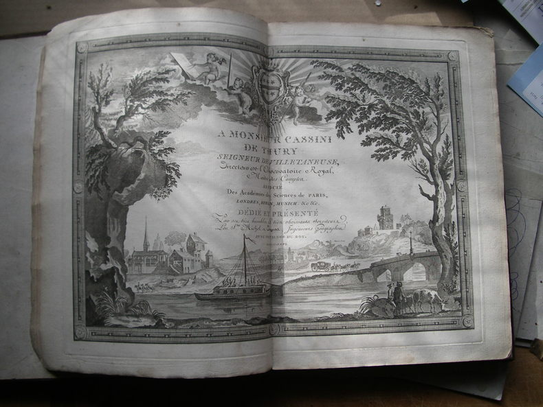
1768130631768 basane mouchetée, dos à n. (mouillure marginale aux 3 premiers ff.). in-4, titre, frontispice, 1 carte, 18 cartes montées sur onglet la plupart dépliantes, 6 et 10 pp. Paris Au globe 1768
19885109432Utrecht: Bohn, Scheltema & Holkema 1976-1988. ca. 7500 pp. Gr.-8° (25 x 17 cm). Orig. blue cloth bindings, gilted title on spine.
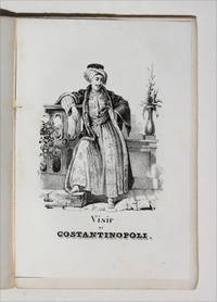
18504999Torino: Fratelli Reycend 1850. Soft cover. Very Good. 12mo - over 6¾ - 7¾" tall. 1 ff 240 pp with engraved title page frontispiece and 7 further acqua-forte engraved plates. Bound in original publisher's printed brown wrappers minor damage to spine clean and fresh and excellent and very genuine copy. With stamps likely a bookseller's to head of cover and title page 'Rodi-Ferrario'. Very rare first and only edition of this travel guide to Europe written as the title suggests for young readers in a pocket 12mo format. The guide moves from tours of Italy and Switzerland all the way to Poland Lithuania and Turkey as well as Great Britain providing 8 engraved plates of national costumes along the way. The charming illustrations depict: a young woman of 'Batz' Bath; a woman of Civita-Vechia Romagna; a citizen of Seville; a young woman of Gaeta Two Sicilies; a boatman from Le Havre a woman of Oberhash Switzerland; the Vizier of Constantinople; and finally a female Athenian. The commentary passes from the historical to contemporary details of travel between major destinations and occasional remarks of art-historical interest. Florence is noted to contain in the same breath the sepulcres of Galileo Aretino Machiavelli and Alfieri the latter having been sculpted by Canova p 72. England Scotland and Ireland are noted very much in passing: although the empire stretches 'to the Ganges' the islands themselves are accorded little interest. The guide does mention "the reknown of the univeristy of Oxford the most learned in England" with no mention however of its more easterly counterpart. ICCU 1175063; unrecorded on OCLC. <br/> <br/> Fratelli Reycend paperback books
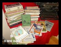
1945303922London; Boy Scouts Association etc. Various dates primarily pre-1950 1945. 1st edition. Hardcover. Some reprints softcovers in the main. Topics covered include Ranger Guiding Camp Fire Singing Drills & Ceremonials Prayers Quiz Books Map-Reading Scout Games patrol Corners & Dens Camp Cookery Sea RangeringHandicrafts Knotting etc. Publishers include Novello Arthur Pearson Brown Glasgow Humphrey Milford etc. Subjects; Scout Association.Scouting Youth activity. Scouts Youth organization members. Boy Scouts - Handbooks manuals etc. - Pictorial works. Pfadfinder. Erziehung. Good to very good copies all in the original often vibrantly colored stiff-card wrappers. Hardcovers with dust-wrappers. London; Boy Scouts Association etc. Various dates (primarily pre-1950) hardcover
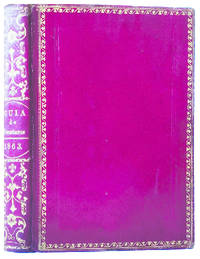
18637174La Habana: Imprenta del Gobierno y CapitanÃa General 1863. First Edition — Primera edición. Hardcover — Tapa dura. 155x107mm. 6x4¼". La Habana Imprenta del Gobierno y CapitanÃa General 1863. En 8º 155 x 107mm. 292 63 32 pp. 6 estados plegados grabados al texto. Encuadernación en tafilete rojo de época hilo y rueda dorada en los planos lomera cuajada de adornos dorados cabeza y cortes también dorados. Edición original de la GuÃa de Forasteros de la Isla de Cuba para el año de 1863 con su Estado Militar y el Apéndice de las alteraciones que han ocurrido durante la formación de la guÃa. Este almanaque comenzó a publicarse en 1791 con el tÃtulo <em>Calendario manual y guÃa de forasteros de la Isla de Cuba</em> denominación con la que permaneció hasta 1814 cuando pasó a denominarse <em>GuÃa de forasteros de la Isla de Cuba y calendario manual</em> 1814-1825 y desde entones con el tÃtulo actual hasta su fin en 1884. Atractivo ejemplar en tafilete rojo de época. Imprenta del Gobierno y Capitanía General hardcover
18436321SLND [France, 1843 [colophon]. 1843 1 vol in-12° (178 x 115 mm) de: 300 pp calligraphiées à l'encre brune, noire, rouge et or dans des encadrements tracés à l'encre bleue, têtes de chapitres ornés de compositions polychromes, 1 blason à l'aquarelle (p.20) et 1 dessin à l'encre représentant un aigle (p. 86). (légéres brunissures aux derniers feuillets). Demi-maroquin rouge à coins à grains longs d'époque, dos lisse orné et titré à l'or "Monumens de Paris", plats recouverts de papier à la colle rouge immitant le maroquin bordé d'un filet doré. (usures et défauts d'usage).