MISSON Maximilien:Livre Rare Book

50 745 résultats
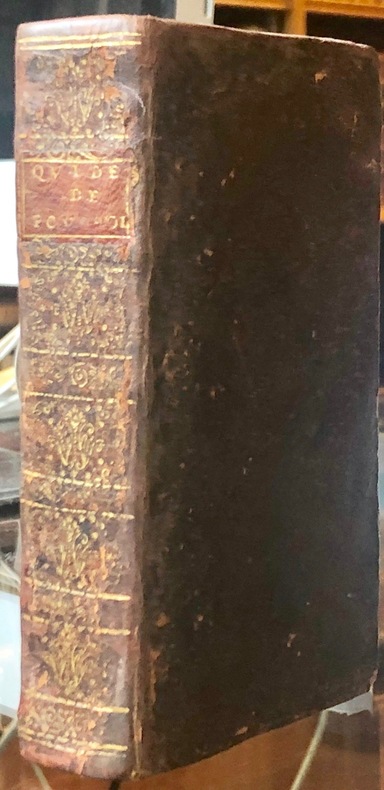
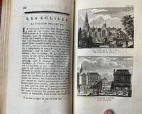
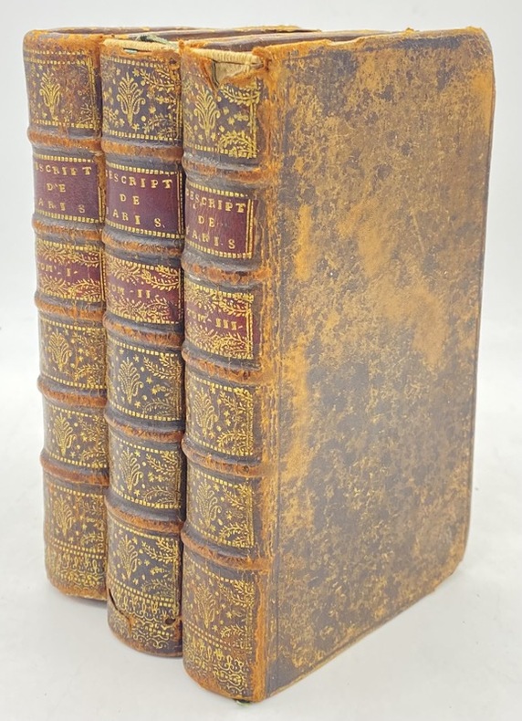
170220405La Haye, Henry van Bulderen, 1702. 3 volumes in-12 de [56]-339-[21]; 356-[24]; 414-[20] pages, plein veau brun, dos à nerfs ornés de filets et fleurons dorés, pièces de titres bordeaux, tranches rouges.
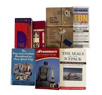
1987209821987. Damron Bob Lindsy Van Gelder Pamela Robin Brandt Hanns Ebensten and others archive of seven travel publications and related materials dating from 1987 to 2003 documents the development of queer travel infrastructure and the circulation of information necessary for LGBTQ individuals to navigate public space safely in the late twentieth century. Produced during and after the AIDS crisis these guides provided listings of bars hotels medical resources and social organizations at a time when visibility and safety varied widely by region. The publications extend a tradition of minority travel guides comparable in function to The Negro Motorist Green Book offering practical tools for identifying supportive environments and avoiding hostile ones. Early editions of the Damron guides compiled through firsthand travel by Bob Damron established a model for cataloging queer friendly spaces across North America and beyond while later publications expanded coverage to Europe and incorporated broader cultural and political resources.<br /> <br /> Archive of seven items comprising five travel guides one fold out map and one volume of travel writing published between 1987 and 2003. Items include:<br /> 1 Damron Bob. Damron Address Book. San Francisco 1987. Approximately 3 x 6 inches. Contains over 6000 listings across the United States Canada and Mexico with extensive coverage of U.S. locations.<br /> 2 Van Gelder Lindsy and Pamela Robin Brandt. Are You Two.Together A Gay and Lesbian Travel Guide to Europe. 1991. Approximately 345 pages. Covers accommodations dining and travel sites across multiple European countries. Signed by both authors.<br /> 3 The Gay and Lesbian Handbook to New York City. 1994. Approximately 277 pages. Includes listings for cultural venues social organizations and medical resources including AIDS related services.<br /> 4 Columbia Fun Maps: Mapping the Gay and Lesbian World. San Francisco 1995. Fold out map with directory of businesses and resources in San Francisco.<br /> 5 Damron Bob. Damron Address Book. 1998. Expanded edition with hundreds of pages of listings across North America the Caribbean and Europe.<br /> 6 Ebensten Hanns. The Seals on the Icepack and More Gay Travel Adventures. 1999. Signed and inscribed. Travel narratives documenting experiences in multiple global locations.<br /> 7 Frommer's Gay and Lesbian Europe. 2003. Comprehensive guide to travel across the United Kingdom and continental Europe.<br /> <br /> These materials document how LGBTQ travelers relied on print networks to construct routes of movement community and safety prior to the widespread availability of digital resources. The guides reveal the geographic distribution of queer spaces the integration of medical and social support listings during the AIDS crisis and the expansion of international travel opportunities in the late twentieth century. Ebensten's travel writing provides a narrative counterpart to directory based guides offering firsthand accounts that complement the logistical frameworks of the other publications. Together the archive provides evidence of how queer communities mapped social belonging across cities and nations contributing to the study of LGBTQ history tourism and spatial politics. Light handling wear across volumes with typical age toning; overall clean and stable. Overall very good condition. unknown
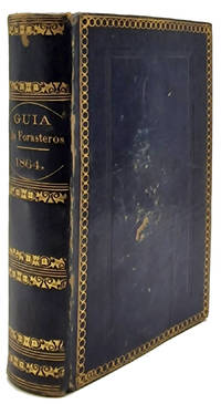
18649843La Habana: Imprenta del Gobierno y CapitanÃa General 1864. Hardcover — Tapa dura. 150x105mm. 6x4¼". La Habana Imprenta del Gobierno y CapitanÃa General 1864. En 8º 150 x 105mm. 346 19 51 pp. 12 pequeños grabaditos con los signos zodiacales. Estado Militar: 53-viii pp. 1 h. 7 estados plegados. Encuadernación en tafilete azul de época hilo dorado en los planos formando un rectángulo lomera con adornos dorados cabeza y corte también dorados. Edición original de la GuÃa de Forasteros de la Isla de Cuba para el año de 1864. Este almanaque comenzó a publicarse en 1791 con el tÃtulo <em>Calendario manual y guÃa de forasteros de la Isla de Cuba</em> denominación con la que permaneció hasta 1814 cuando pasó a denominarse <em>GuÃa de forasteros de la Isla de Cuba y calendario manual</em> 1814-1825 y desde entones con el tÃtulo actual hasta su fin en 1884. Imprenta del Gobierno y Capitanía General hardcover
Munchen, Franz Hanfstaengl, s. d. (ma 1892 o 1894). In 4to grande, antip. con A. e titolo, front. con piccola ill., indice, pp. 6 n.n. (di E. von Wald – Zedtwitz), a seguire 60 ill. lit. in b/n o virate in verde, in marrone o in seppia, di cui molte a p. p., raffig. vedute, scorci di paesaggi e personaggi caratteristici della Capri ottocentesca, leg. in t. tela verde, ill. al piatto con i faraglioni sullo sfondo, Autore e titolo in oro, fogli di guardia in carta decorata, tagli in oro. Celebre figurato ottocentesco dedicato a Capri, con disegni riguardanti la vedutistica e la vita popolare. Christian Wilhelm Allers, noto illustratore e litografo tedesco, autore di piacevoli album litografici dedicati alle mete dei suoi viaggi (Interlaken, Grindelwald, il Wetterhorn, il Lago di Lucerna, Napoli e Capri). Nei suoi volumi, peraltro i più celebri, si rendono efficacemente l’atmosfera dei luoghi e le impressioni che potevano trarne i viaggiatori sul finire del diciannovesimo secolo, quando il viaggio era ancora un’avventura fortemente romantica e individuale: sono ritratte carrozze ferroviarie, piccole stazioni, grandi alberghi, locande, i passatempi dei turisti, i ristoranti e le “tables d’hotels”. Allers era innamorato di Capri e ivi possedeva una elegante villa a Punta Tragara. Impiegava gran parte del suo tempo a passeggiare con ammiratori, amici e signore, lavorando “en plein air” e disegnando ovunque ne avesse voglia o qualora qualcuno glielo chiedesse: lasciava schizzi e bozzetti sulle pareti degli alberghi, sulla pagine del registro viaggiatori, sulle pareti di osterie, caffè e barbieri. Particolarmente bello e ricercato questo volume dedicato a Capri. Esemplare un po' allentato ma in ottimo stato di conservazione.
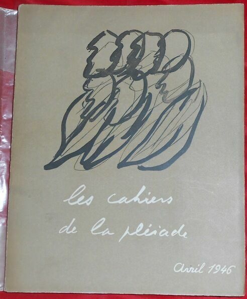
1946138191946. Paris Éditions Gallimard du n°I avril 1946 au n°XIII automne 1951-printemps 1952 ; le n°VI est 1/25 ex. h.c. num. sur vélin pur fil lafuma navarre (n°F) ; le n°III est 1/100 ex. h.c. num. sur vélin pur fil lafuma navarre (n°LVI) 1er papier ; les n°s II IV V VIII et XIII sont des ex. num. sur papier de chataignier (300 ex. 250 pour le n°VIII et 225 pour le n°XIII) - Broché couv. rempliée 18 5 cm x 23 5 cm 216+ 285+ 160+ 179+ 177+ 183+ 198+ 202+ 208+ 188+ 214+ 206+204 (2620) pages - Rédacteur en chef : Jean Paulhan secrétaire : Dominique Aury ; textes et poèmes de Henri Calet Gaston Chaissac V. Larbaud Ch. A. Cingria Boris Vian L.-F. Céline (pré-originale de Casse-Pipe) Malcom de Chazal Roger Caillois Joë Bousquet René Char Francis Ponge Georges Bataille André Breton Maurice Fourré Georges Limbour Henri Michaux Pierre Bettencourt Rolland de Renéville A. Pieyre de Mandiargues Arthur Adamov André Malraux P. Claudel A. Suarès Paul Valéry G. Bernanos Roger Nimier Albert Camus Drieu la Rochelle Jean Paulhan (Guide d'un petit voyage en Suisse) Jean Dubuffet René de Solier Jean Giono etc.; couv. ill. et présentation typographique de Fautrier ; la livraison de l'été-automne 1950 est consacré à Saint-John Perse ; table des matières des 9 premiers numéros dans le n°IX - Les n°s VII VIII X XI XII XIII ne sont pas coupés; bien complet des hors-texte ; les n°s I II et XIII ont le papier jaunissant sinon très bon état
170214782Naples, , 1702. In-12 de 368-(14) pp., tables, 1 portrait gravé, 1 titre-frontispice et 33 planches gravées, veau brun granité, dos lisse orné, pièce de titre en maroquin rouge, tranches rouges (reliure de l'époque).
183843204Paris, Baudry, Aimé André, 1838. 3 vol. in-8 (4)-IV-494 pp., (4)-572 pp., 560 pp., table, 1 carte coloriée, maroquin rouge orné sur les plats d'un somptueux décor doré à la cathédrale, dos lisse orné, dentelle intérieure, tranches dorées, couvertures conservées (reliure de l'époque).
In Oblungo (15,5x12 cm); 26 c. di tav. Legatura coeva conservata editoriale entro cofanetto editoriale con titolo impresso in oro al piatto anteriore della custodia. Alcune pecette di adesivo a consolidare un lato. Opera sconosciuta alle principali bibliografie. Trattasi probabilmente di una versione di prova o di presentazione della rarissima pubblicazione "Wood's illustrated guide to London; containing 26 views of the principal public buildings, &c., beautifully engraved on steel, with descriptions in French and English". In questo esemplare le tavole realizzate in acciaio sono state poi stampate con un particolare procedimento di stampa tanto che le stesse risultano impresse leggermente in rilievo su carta patinata applicata su cartoncinirigidi. Ogni tavola presenta una descrizione dell'illustrazione in francese e inglese. Esemplare completo di tutte e 26 le tavole. L'opera venne realizzata in occasione dell'Esposizione Universale di Londra tenutasi appunto nel 1862. L'opera non venne poi probabilmente mai data alle stampe se non in pochissimi esemplari dimostrativi. Un'altro esemplare conosciuto conservato nella New York Public Library, sipresenta rilegato e con una pagina di titolo seguita dalle ventisei tavole ma con la descrizione delle stesse al recto delle illustrazioni e non poste sotto l'incisione come in questo esemplare, Fra gli edifici delineati: Windsor Castle; The treasury Whitehall; Custom House London; Tower of London; New House of Parliament; Hungerford Suspension Bridge; The Colosseum Regents Park; The Royal Exchange; Greenwich Hospital; Front View of Byckingham Palace Residence of Queen Victoria; Thames Tunnel; St. Pauls Cathedral; Coal Exchange London; Statue of William the 4.that London Bridge; Building for the Great Exhibition 1851; London Bridge from Surry side of River Thames; Bank of England; Duke of Yorks Column Waterloo Place; Westmister Abbey; Nelson Monument Trafalgar Square; New Hall Lincolns Inn; Somerset House; Wellington Statue Hyde Park Corner; Railway Pier Blackwall;Past Office London; British Museum. Le tavole si presentano in buone-ottime condizioni di conservazione. Very rare.
145 pages. Index. Footnotes. Reference list. Supplemental 1984 price guide laid-in. "Contains nearly 450 illustrations covering every type of candlestick brand-name model, plain to fancy blacksmith models, folding and mechanical models. Also included are many wonderful underground photos from the turn of the century showing mine candlesticks in actual use. Includes a discussion of history, collecting pointers, and guides to cleaning and recognition." - from photocopy of publisher's book list laid-in. Wilson's superbly detailed diagrams exquisitely present these artifacts in their original form. Average wear. Binding intact. Unmarked. A sound copy of this magnificent reference. Book
New New English Original bdg. Dust wrapper. 4to. (30 x 21 cm). In Turkish. 15 volumes set: (6620 p.). This is an exhaustive study on the administrative division of vilayets (provinces) and kazas (districts of provinces) of the Turkish Republic. Order in alphabetical. a heavy and oversize full set.
carta incisa su rame in 9 fogli divisi in 8 sezioni ciascuno montati su tela, circa cm. 130 x 177, alcune strade colorate in rosso, con camicia e cofanetto con titoli applicato, abrasioni e piccole rotture al cofanetto
15322Half leather binding 339 34 p. illustrated. Fine copy. Exlibris U. Proost. Lit: Nijhoff/Van Hattum 122. With 28 engravings of city views. De tekst van deze gids is geheel verschillend van de vorige edities. Het boek is geïllustreerd met een uitvouwbare plattegrond en 14 platen waarop 28 gravures met stadsgezichten door D. Veelwaard. B10031. hardcover
In Verona, per Jacopo Vallarsi e per Pierantonio Berno, 1732, voll. 2, in-8, leg. coeva in piena pergamena, pp. XIV, [2], 677, [3], 86, [2] - VII, [1], 541, [15]. Con una tav. incisa in rame f.t. nella prima parte; 28 calcografie legate fuori fascicolazione (compresa la pianta della città) e 16 incisioni in rame n.t. (alcune su disegno di G.B. Tiepolo) nel terzo volume. I due volumi presenti sono in ottime condizioni. Mancano la seconda e la quarta parte. Seconda edizione. Timbretto di biblioteca privata sui front.
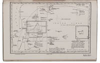
1946L95GI2DERRRALondon: hydrographic department admiralty colophon: printed by Butler & Tanner 1946. 8vo. With two maps to be used as an index 10 plates and a few illustrations in text. Publishers beige cloth. With: Supplement no. 5-1956 relating to the South Indian Ocean pilot sixth edition 1946 corrected to 23 April 1956. London hydrographic department admiralty colophon: printed by Tinlling & Co. Liverpool 1946. 8vo. With a loosely inserted folding plate illustrating the system of buoyage. Publishers wrappers. The standard pilot guide for the South Indian Ocean published by the British admiralty with a foreword by A.G.N. Wyatt rear-admiral and hydrographer of the navy. The first chapter includes general information such as details on the islands' government dependencies flora fauna populations trade products communication services shipping currency weights and measures time health etc. The other chapters give detailed navigational details directions latitudes and longitudes shoals tides winds light beacons anchorage dangers etc. for "Madagascar Iles Comores Ile de la Réunion Mauritius the Seychelles the Chagos Archipelago and other islands lying westward of longitude 80° East".With deaccession stamps. A good copy. hydrographic department, admiralty (colophon: printed by Butler & Tanner), hardcover
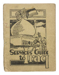
1942ABC_47444Baghdad: PAI force G. H. Q. Welfare Committee 1942. Original publisher's beige printed paper wrappers. 14.5 x 11 cm. With two full-page maps of Iraq and Baghdad on page 24 and 25 and a full-page map of the "Baghdad Amenities area" on the back wrapper. Further with 6 pages of advertisements serving as endleaves. A very rare guide intended for British armed forces stationed in Iraq during the Second World War. It was probably handed to the soldiers soon after arrival. Works like these were often discarded when they were no longer needed. As such there are usually few of them left. This particular military guide is likewise extremely rare. We have only been able to find 3 other copies 2 of which are located at the Imperial War Museum in London.The Services guide to Iraq was probably published by the welfare committee of the British PAI force which is short for "Persia and Iraq Force". The British were stationed here to prevent Nazi Germany from invading the region for oil among other reasons. The guide was meant to teach the soldiers the basics of finding their way in this new country. It explains where to go for sports music religion legal aid education the costs of sending letters home and how to recognize and prevent various tropical diseases. It also aims to instill some cultural awareness in the reader: included is an excerpt of a work about the history of Iraq by Seton Lloyd 1902-1996 archaeologist and then curator at the Baghdad museum.The paper wrappers are torn at the bottom of the spine with some loss of material barely affecting the integrity of the binding a small stain and two small pen marks in red and green on the front wrapper. Somewhat browned throughout. Otherwise in good condition.l Not in WorldCat. PAI force G. H. Q. Welfare Committee, unknown
231411Paris, François Fournier, 1717 3 vol. in-12, [48] pp. (titre, épître, préface, table des matières), 494 pp. ; [32] pp. (titre, table des matières), 526 pp., ; [24] (titre, table des matières), 456 pp.-6 pp ; avec 29 planches repliées dont un plan de Paris, veau brun, dos à nerfs ornés, tranches mouchetées de rouge (reliure de l'époque). Manques à certaines coiffes, travail de ver au dos du tome 2, dos et plats frottés, coins usés. Déchirure restaurée au plan de Paris.
Firenze, Nella Stamperia Imperiale, 1750. In 4to, front. in rosso / nero con incisioni entro tondi raffiguranti l'Imperatore Francesco I dei Pisani cui l'opera è dedicata, pp. (8), 415, con 8 grandi tavole incise in rame in b/n e rip. f. t., testatina iniziale e capolettera figurati, vecchia bross. in carta marmorizzata (al piatto è apposta piccola etichetta della Stamperia e Libreria Giovanni Silvestri, Milano), dorso in tela con titolo ms. su etichetta in carta. Le belle tavole sono incise da Niccolò Mogalli sui disegni di Antonio Zocchi. Il Cocchi, noto come il "filosofo mugellano", seppur nativo di Benevento (1695 - 1758), fu medico all'Isola d'Elba e lettore di anatomia a Firenze. L'opera si divide in sei capitoli e tratta diffusamente della qualità, referenze mediche, situazione geografica e vantaggi climatici dei bagni delle antiche terme pisane (cfr. Moreni, I, 275: "Sarà sempre uno dei più utili libri, che abbiano visto pubblica luce"; Lozzi, II, 3645; Graesse II, 205; Gamba, 2200). Qualche difetto alla prima carta, la "Pianta della Città di Pisa", peraltro tutte risultano fresche e ben impresse, testo stampato su forte carta uso mano a grandi margini, buon esemplare.
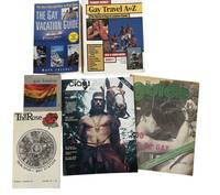
1978211511978. Gay travel guides published between 1978 and 2002 document the development of LGBTQ social spaces and travel networks during the late twentieth century. Printed guides of this kind served as practical tools for gay and lesbian travelers seeking safe environments and community venues in cities and tourist destinations. At a time when many establishments serving LGBTQ patrons were not openly advertised in mainstream publications specialized travel guides compiled addresses telephone numbers and descriptions of bars restaurants hotels gyms clubs and other gathering places. Today these publications provide valuable documentation of LGBTQ cultural geography preserving records of venues and community spaces that often operated informally and have since disappeared.<br /> <br /> Archive contains six travel guides and magazines published between 1978 and 2002 documenting LGBTQ travel destinations and social venues in North America and Europe. The publications include directories of establishments travel advice and descriptions of cities known for active LGBTQ communities. Many listings include addresses telephone numbers and brief descriptions of businesses catering to gay and lesbian travelers.<br /> <br /> 1 Ciao! The World of Gay Travel. New York: QQ Publications 1978. 54 pages. Early international gay travel magazine featuring destinations including Canada Malaysia El Salvador and Morocco with numerous listings for cafes bars restaurants and other venues.<br /> <br /> 2 The Rose. Vol. 1 No. 15. 1980. 43 pages. Travel and lifestyle guide focused on Southern California with listings for gay and gay friendly bars restaurants clubs gyms and entertainment venues.<br /> <br /> 3 The Guide to Gay New England. Boston: The Haymarket 1987. 70 pages. Travel guide covering New England destinations including cities such as Providence and Manchester as well as established resort communities including Provincetown.<br /> <br /> 4 Gay London: A Guide. London: Ellipsis 1999. Guide to LGBTQ nightlife and community spaces in London including bars clubs bookstores and cafes.<br /> <br /> 5 Ferrari Guides: Gay Travel A to Z. Phoenix: Ferrari International Publications 2001. 160 pages. Directory style guide listing United States destinations with entries for bars tour operators bathhouses and related venues.<br /> <br /> 6 Chesnut Mark. The Gay Vacation Guide: The Best Trips and How to Plan Them Revised and Updated. New York: Kensington Books 2002. 212 pages. Travel planning guide featuring information on resorts cruises tours and seasonal destinations popular among LGBTQ travelers.<br /> <br /> Together these publications illustrate the growth of LGBTQ tourism and the increasing visibility of queer social networks during the late twentieth century. Travel directories such as these helped connect travelers with welcoming venues and contributed to the development of identifiable LGBTQ neighborhoods and resort destinations. The guides also preserve historical records of establishments that have since closed making them useful sources for studying the geography of LGBTQ culture and nightlife. Volumes remain clean and well preserved with light handling wear. Very good condition overall and a representative group of late twentieth century LGBTQ travel publications. unknown
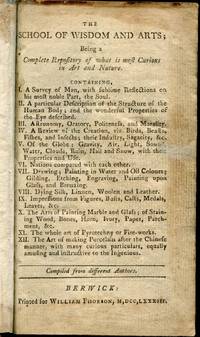
17833220072<b>FIRST BERWICK EDITION.</b> <i>12mo pp. iv 5-339 1 blank viii contents; a little browned in places but generally clean throughout; in recent half sheep over marbled boards spine with red morocco label lettered in gilt.</i><br /><br /><br />Scarce Berwick printing of this appealing lady and gentleman's pocket guide on subjects such as the human body astronomy oratory morality nations animals painting gilding to name but a few. As far as we are aware the work was first published in Gainsborough in 1776.<br /><br />OCLC records three copies in North America at Brown Library of Congress and Winterthur Museum. William Phorson hardcover
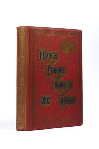
121682London J.P. Segg 1892 . Large 8vo. 20 x 27 cm. viii 372pp 20 double-page coloured maps adverts all pages lavishly decorated with gilt borders some spotting on endpapers inner hinges slightly loose; publisher's pebble-grained cloth over boards gilt decorated and lettered; a very good copy<br /> This attractive hotel guide was published annually by Segg. The first edition was issued in 1871. Tt includes detailed maps hotel directories railway routes steamship routes and london theatre with prices.<br /> London J.P. Segg, 1892 hardcover
Very Good Turkish, Ottoman (1500-1928) Original engraved map on the silk handkerchief made in Yildiz Palace for the 'Iane Sergisi' [i.e. Exhibition of the Social Assistance] in the period of Sultan Abdülhamid II. In its decorative frame. Frame size: 53,5x53,5 cm; map size: 38x38 cm. In Ottoman script. Scale: 1/600.000. Several minimal splits, minor foxing, and slight stains on cloth. Otherwise in good condition. A rare and decorative 1897 silk handkerchief map of the Greco-Turkish War in 1897, which was the only war in which the Ottoman army was victorious during the reign of Abdulhamid 2, is a fine example of Ottoman / Turkish cartographic textiles made in Ottoman court (Yildiz Palace textile workshops). This beautiful map depicts an attractive war scene from the 1313 Greek War on the upper half, and it's engraved a map of Balkan & Greek lands on its lower half. War painting has 'Melona' signature in Ottoman script. The map shows Thessaloniki [i.e. Salonica] Bay on the west; Yanya [i.e. Ioanna] Vilayat on the east; lands of Greece, Galos Bay, Uzi Strait on the south and Dimetoka and Avalonia areas in the Serefiye, Ergiri sanjaks on the north in its period. Written on the map, "Baht-i himâye-yi feyzvâne-i cenâb-i hilâfetpenâhide evlad-i süheda ve mecrûhin-i asakir-i sâhâne", [i.e. It was printed for the "Iane Sergisi" (i.e. The Social Help Exhibition) in the high memory of our soldiers who were martyred and veterans in the Greek War under the patronage of the Sultan.]. The Greco-Turkish War of 1897, also called the Thirty Days' War and known in Greece as the Black '97 (Mauro '97), or the Unfortunate War (Atychis polemos), was a war fought between the Kingdom of Greece and the Ottoman Empire. Its immediate cause was the question over the status of the Ottoman province of Crete, whose Greek majority long-desired union with Greece. Despite the Ottoman victory on the field, an autonomous Cretan State under Ottoman suzerainty was established the following year (as a result of the intervention of the Great Powers after the war), with Prince George of Greece and Denmark as its first High Commissioner. This was the first war effort in which the military and political personnel of Greece were put to test since the Greek War of Independence in 1821. For the Ottoman Empire, this was also the first war effort in which the reorganized military personnel were put to test. The Ottoman army was under the guidance of a German military mission led by Colmar Freiherr von der Goltz, who had reorganized it after the defeat in the Russo-Turkish War (1877-1878). The conflict proved Greece was wholly unprepared for war. Plans, fortifications and weapons were non-existent, the mass of the officer corps was unsuited to its tasks, and training was inadequate. As a result, the numerically superior, better organized, equipped and led Ottoman forces pushed the Greek forces south out of Thessaly. Almost all of the aids made to the families or disabled people of those who were martyred in the 1897 Ottoman-Greek War (such as printing this map) were made within the framework of the donations of "Evlâd-i Süheda and Malûlîn-i Guzât-i Asâkir-i Sahane". People and citizens of all classes and beliefs, including members of the Ottoman court, ministers, bureaucrats, civil servants, merchants and tradesmen, participated in this aid campaign at the end of the 19th, beginning of the 20th century. Not in OCLC.
Imponente Opera in 49 volumi edita a cura dell' istituto della Enciclopedia Italiana fondata da Giovanni Treccani. Questa è l'edizione 1949 che comprende la ristampa integrale fotolitica dei 35 volumi pubblicati tra il 1929 ed il 1936 il volume della prima appendice ed i 2 volumi della II Appendice. Volumi ben conservati, pagine perfette. Nel dettaglio: 35 volumi di enciclopedia, 1 volume Indici, 13 volumi di Appendice così suddivisi: 1 vol App. I, 2 vol. App. II anni 1938-1948, 2 vol. App. III anni 1949-1960, 3 vol. App. IV anni 1961-1978, 5 vol. App. V anni 1979-1992. Numero pagine oltre 1000 USATO
138611aafParis, Bohaire et Dentu, 1840, in-8vo, VIII + 239 p. (+ 1: tables des matières), légères rousseurs au début de l’ouvrage, non rogné, Ex libris Peter E. Obergfell, brochure originale verte imprimée avec titre dans un encadrement typographique, très bon exemplaire.
180x115 mm, pp. (16), 526, (2), 240, 288, 120, rilegatura coeva in piena pergamena morbida, titolo manoscritto al dorso e al taglio superiore. Marca tipografica al frontespizio: Un leone che tiene uno stemma con monogramma del tipografo, in cornice animata. . Le ultime 4 carte sono rinforzate al taglio esterno lontano dal testo mostrano piccoli forellini al margine bianco, per il resto esemplare buono. Unica edizione stampata in Piemonte e seconda edizione del XVII secolo: a differenza delle altre edizioni questa non ha le carte geografiche. Importante e celebre opera di geografia politica, l'autore fu considerato uno dei più grandi economisti dell'epoca, viene anche considerato un precursore degli studi demografici.
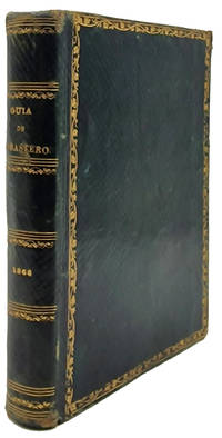
18689845La Habana: Imprenta del Gobierno y CapitanÃa General 1868. Hardcover — Tapa dura. 150x105mm. 6x4¼". La Habana Imprenta del Gobierno y CapitanÃa General 1868. En 8º 150 x 105mm. 320 pp. 12 pequeños grabaditos con los signos zodiacales. Estado Militar: 64 32 4 pp. Encuadernación en piel chagrÃn verde de época greca dorada en los planos formando un rectángulo lomera con adornos dorados cabeza y corte también dorados. Edición original de la GuÃa de Forasteros de la Isla de Cuba para el año de 1868 y Estado Militar para aquel año. Este almanaque comenzó a publicarse en 1791 con el tÃtulo <em>Calendario manual y guÃa de forasteros de la Isla de Cuba</em> denominación con la que permaneció hasta 1814 cuando pasó a denominarse <em>GuÃa de forasteros de la Isla de Cuba y calendario manual</em> 1814-1825 y desde entones con el tÃtulo actual hasta su fin en 1884. Imprenta del Gobierno y Capitanía General hardcover