Botero, GiovanniMareMagnum

50 748 résultats
180x115 mm, pp. (16), 526, (2), 240, 288, 120, rilegatura coeva in piena pergamena morbida, titolo manoscritto al dorso e al taglio superiore. Marca tipografica al frontespizio: Un leone che tiene uno stemma con monogramma del tipografo, in cornice animata. . Le ultime 4 carte sono rinforzate al taglio esterno lontano dal testo mostrano piccoli forellini al margine bianco, per il resto esemplare buono. Unica edizione stampata in Piemonte e seconda edizione del XVII secolo: a differenza delle altre edizioni questa non ha le carte geografiche. Importante e celebre opera di geografia politica, l'autore fu considerato uno dei più grandi economisti dell'epoca, viene anche considerato un precursore degli studi demografici.
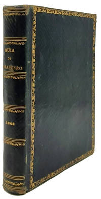
18689845La Habana: Imprenta del Gobierno y CapitanÃa General 1868. Hardcover — Tapa dura. 150x105mm. 6x4¼". La Habana Imprenta del Gobierno y CapitanÃa General 1868. En 8º 150 x 105mm. 320 pp. 12 pequeños grabaditos con los signos zodiacales. Estado Militar: 64 32 4 pp. Encuadernación en piel chagrÃn verde de época greca dorada en los planos formando un rectángulo lomera con adornos dorados cabeza y corte también dorados. Edición original de la GuÃa de Forasteros de la Isla de Cuba para el año de 1868 y Estado Militar para aquel año. Este almanaque comenzó a publicarse en 1791 con el tÃtulo <em>Calendario manual y guÃa de forasteros de la Isla de Cuba</em> denominación con la que permaneció hasta 1814 cuando pasó a denominarse <em>GuÃa de forasteros de la Isla de Cuba y calendario manual</em> 1814-1825 y desde entones con el tÃtulo actual hasta su fin en 1884. Imprenta del Gobierno y Capitanía General hardcover
In 12° (13,7×9 cm); XII, 501, (3 b.) pp. e 17 c. di tav. fuori testo più volte ripiegate compresa tavola con veduta di Venezia posta in antiporta. Legatura coeva in mezza pelle con titolo, numero dei volumi e fregi in oro al dorso su fascette in pelle verde e rossa. Difetto alla cerniera del piatto anteriore con perdita di pelle anche se la legatura risulta solida. Piatti foderati con carta marmorizzata coeva. La prima tavola con la pianta di Venezia presenta un restauro al margine basso e per il resto all’interno in buone-ottime condizioni di conservazione. Tagli spruzzati in rosso. Antico timbretto di provenienza nobiliare al frontespizio, leggerissimo e solo in parte leggibile. Antica firma di appartenenza privata alla prima carta bianca. Al recto del piatto anteriore ex-libris che identifica l’esemplare come appartenuto alla celebre collezione del grande ingegnere aereonautico, imprenditore e pioniere dell’aviazione, Giovanni Battista Caproni che fu anche grande collezionista di libri e che nato ad Arco stabilì la sua residenza ed attività a Vizzola (Varese). L’esemplare qui presentato a differenza degli altri conosciuti è l’unico che presenta 17 tavole fuori testo rispetto alle 15 solitamente presenti facendo di questo esemplare un unico. Rarissima edizione di una delle più celebri guide di Venezia compilate dal celebre stampatore ed editore veneziano Giovanni Battista Albrizzi che diede grande impulso alla qualità dell’editoria veneziana avvalendosi della collaborazione dei migliori disegnatori e incisori del tempo quali il Piazzetta, gli Zanetti, il Pitteri ed il Bartolozzi. Questa nuova edizione del “Forestiero” è illustrata in parte dal celebre incisore veneziano, Antonio Buttafuoco. L’opera descrive un ideale percorso turistico di sei giorni per la Serenissima. Delle ultime 150 pagine, un centinaio, sono dedicate alla descrizione delle isole lagunari. Le ultime 50 contengono invece la descrizione del forma statale della città, le festività, i pubblici divertimenti, la regata, i funerali solenni dei Dogi. Cfr.: G.B. Albrizzi. Cfr.: Melzi G., Anonime e pseudonime e Schulz, J., Albrizzi’s Forestiere illuminato and Teatro delle fabbriche più cospicue and their illustrations, in: Bollettino dei Musei Civici di Venezia, 3 (2008), p. 100-15.
Illustrations de MM. Rouargue Frères. Paris, Belin - Leprieur et Morizot Editeur, s.d. (ma 1865 ca.). In 8vo gr., pp. VIII, 544, con 23 tavv. ill. f. t., dal tratto assai fine, disegnate e incise su acciaio dai fratelli Rouargue e protette da veline, di cui 6 colorate a mano e raffiguranti tipici costumi e mestieri; le restanti sono pittoresche vedute di città, leg. in percallina color vinaccia ai piatti e in marrone chiaro al dorso, titolo e fregi dorati al dorso, contropiatti e fogli di guardia in carta avorio, tagli oro. Questo celebre figurato francese sull’Italia ha rappresentato per lungo tempo l’introduzione più aggiornata a un viaggio nella penisola. Minime tracce alla legatura e un po’ di foxing alle pagine ma buon esemplare.
<p>15 cm, rilegatura coeva in piena pergamena, titolo ben manoscritto al dorso che è diviso da tre nervi,1538 Mense Martio; p. (36) di indice delle antichità memorabili di Roma, p. 257, 1 c.b. Capilettera figurati. Omessa nella numerazione la carta 239-240. Firmetta di possesso al retro del frontespizio. Qualche maccietta alla seconda cop. Bell' esemplare.</p>
In 4° oblungo (cm.37x54), mz. pelle coeva, buon es. corredato da 92 tavv. incise da Laguillermie, Rainaud, Shmith, A. Piat, E. Grezel, splendidamente decorate con disegni relativi all'economia o alle usanze dei dipartimenti o delle colonie, di Raimon-Bonheur e Perrot e le leggende sono registrate da Abel Malo, Ch. Simon e altri. Tutte le mappe hanno incisioni a colori sui percorsi, ferrovie e canali.
2118312 volume in-4° relié demi toile chagrinée bordeaux (reliure uniforme sauf pour un volume). 27 années consécutives de cette revue pionnière dans le développement du Tourisme en France.
1996wc1856Haug Cartonné 1996 Quatre volumes in-4 (19 x 27.5 cm), cartonnés, couvertures illustrées en couleurs, 286 pages (tome 1, édité en 1996), 602pages (tome 2, édité en 1999), 264 pages (tome 3, édité en 1997) et 612 pages (tome 4, édité en 2001), illustrations et photographies en couleurs in et hors-texte ; légères taches d'usage aux plats, étiquettes de prix au 4ème plat des tomes 2 et 3, petites marques au 1er plat du tome 3, bel état. Livraison a domicile (La Poste) ou en Mondial Relay sur simple demande.
Very Good Turkish, Ottoman (1500-1928) Original color map. Folded. Oblong folio. (35 x 52 cm). In Ottoman script. Color lithograph. It shows Sudan and West Africa, Atlas Ocean shores, Sahra Desert, and other parts of Africa. Scale: 1:15.000.000. A very detailed and attractive map. Slightly fading. Otherwise a very good copy. Dated Hegira: 1310 = [Gregorian 1894]. [EARLY OTTOMAN MAP of SUDAN] Sudan. Sâye-i Türkiye Hazret Gazi Sultan Abdülhamid Hân-i Sâni'de Maarif Umûmiye Nezâret-i Celîlesi ruhsatiyle meshur Haset tarafindan Fransa Cemiyet-i Cografya âzâlarindan mütesekkil komisyona mahsûs tanzîm edilmis oldugu son defaki atlasinin tercümesi olarak bu def'a Erkân-i Umûmiyye Dairesi Besinci Fen Subesi'ne me'mûr piyade mirlivâlarindan saâdetlü Ali Seref Pasa ve rifatlubinbasi fütûvvetlü Muhyiddin Efendi maarifetleriyle tertib ettirilmistir. Ali Seref Pasa or Hafix Ali Esref. He was a soldier, who was schooled in Paris as a cartographer around 1862. Already in Paris he published his first atlas with 22 maps, called 'Yeni atlas'. Upon his return to Istanbul he became a chief cartographer at the Maatbaa-i amire Printing Press in Beyazit, which was the successor of the Muteferrika press from 1727. Among others he translated the large Kiepert map of Anatolia to Ottoman. He died in 1907, leaving his large project of a gigantic map of Anatolia in 100 sheets unfinished. Ali's name is often misunderstood or even listed as two different people: Ali Seref Pasa and Hafiz Ali Esref. Until the surname law adopted on June 21, 1934, Turks did not have surnames. They were born with one first name and were until the adulthood described only as sons or daughters of their parent's names. Later they were given titles such as Effendi (Sir), Bey (Chief) or Hanim (Madam) for higher classes, or they were given names according to their work or class. The names were not inherited by children until 1934, when the surname law was enforced. The map maker Ali received names Seref, the honourable, and Pasa, the dignitary. He was also known as Hafiz, the memorizer of Qur'an and Esref, Proud. So Ali Seref Pasa would have a meaning 'Honourable Dignitary Ali, and Hafiz Ali Esref, Memorizer of Qur'an, Proud Ali. Daruttibaa - Matbaa-I Amire Printing Press: The first press in the Muslim world, called Daruttibaa, was founded in Istanbul by Ibrahim Muteferrika in 1727, with a permission of Sultan Ahmeet III. It was located in Muteferrika's house. The first book was published in 1729 and until 1742 sixteen other works followed. After Muteferrika's death, the press was supressed for printing, as printed books were considered dangerous. In 1796 the press was purchased by the government and moved to Uskudar in Istanbul, and in 1831 finally to Beyazit, where it was renamed to Matbaa-i Amire in 1866. The press was closed in 1901 and was reopened in 1908 under the name 'Âmire' In 1927 the name changed to State Printing House. The press still exists and is known for publishing school and educational books. Extremely rare. Not in OCLC.; Not in TBMM Map Collection.
Very Good Turkish, Ottoman (1500-1928) Original lithograph map with brown, white and blue tons. 81x57 cm. In Ottoman script (Old Turkish with Arabic letters). All toponyms are in Ottoman Turkish and Arabic. Scale: 1:500,000. Shows Mediterranean shores on the north, Bahr-i Lût [i.e. the Dead Sea], Aqaba Bay, areas of Arabic tribes in very detail, in addition, special huge lands like 'Al-Hism Land'. Also, it shows holy places, antiquities, fortresses, rivers; and Turkish Sanjaks, Qazas, Nahiyes, Qariyes based on the Ottoman administrative system. Cartographer is not indicated, but, it's composed for military purposes in the last period of the Imperial Ottoman, especially for showing Arabian tribes spreading over vast areas in its period, just before World War 1 (date of the printing of this map), such as 'Houtat Tribe'. A very detailed and attractive map of Palestine and Quds area and their topography. Following the Muslim conquest of Palestine in 636-640, several Muslim ruling dynasties succeeded each other as they wrestled control of Palestine: the Rashiduns; the Umayyads, who built the Dome of the Rock and the al-Aqsa Mosque in Jerusalem; the Abbasids; the semi-independent Tulunids and the Ikhshidids; the Fatimids; and the Seljuks. In 1099, the Crusaders established the Kingdom of Jerusalem in Palestine, which the Ayyubid Sultanate conquered in 1187. The Crusaders failed to retake Palestine despite further attempts. The Egyptian Mamluks took Palestine from the Mongols (who had conquered the Ayyubid Sultanate) in 1260. The Ottomans captured Palestine in 1516 and ruled it until Egypt took it in 1832. Eight years later, the United Kingdom intervened and returned the region to the Ottomans. Considerable demographic changes happened during the 19th century and with the regional migrations of Druze, Circassians, and Bedouin tribes. The emergence of Zionism also brought many Jewish immigrants from Europe and the revival of the Hebrew language. Arabs in Palestine, both Christian and Muslim, settled and Bedouin, were historically split between the Qays and Yaman factions. These divisions had their origins in pre-Islamic tribal feuds between Northern Arabians (Qaysis) and Southern Arabians (Yamanis). The strife between the two tribal confederacies spread throughout the Arab world with their conquests, subsuming even uninvolved families so that the population of Palestine identified with one or the other. Their conflicts continued after the 8th-century Civil war in Palestine until the early 20th century and gave rise to differences in customs, tradition, and dialect which remain to this day. Beit Sahour was first settled in the 14th century by a handful of Christian and Muslim clans (hamula) from Wadi Musa in Jordan, the Christian Jaraisa and the Muslim Shaybat and Jubran, who came to work as shepherds for Bethlehem's Christian landowners, and they were subsequently joined by other Greek Orthodox immigrants from Egypt in the 17th-18th centuries. Due to the legacy of the Ottoman period, the ethnic origins of some rural and urban Palestinians are either Albanian, Circassian, or from other non-Arab populations.
Very Good Turkish, Ottoman (1500-1928) Paperback with original wrappers. Restored wrappers and spine masterfully. Roy. 8vo. (24 x 17 cm). In Ottoman script (Turkish with Arabic letters. 171, [1] p. Maps are missing. First and Only Edition of this early naval guide to the Mediterranean and Aegean Islands and shores prepared by Ottoman Admiral Süleyman Faik. Süleyman Faik, (1845-1909), was a general, after admiral and Chairman of the Turkish / Ottoman Navy General Staff, divisional. A comprehensive early printed guide to the Cezâyir-i Bahr-i Sefid [i.e. Ottoman Province of Archipelago] including the Aegean shores, the Archipelago, the Dardanelles, Rhodes, Cyprus, et alli. Only six copies in OCLC: 773143926, 67075343.; Özege 16579.; Not in ATYB: Askerî Tarih Yayinlari Bibliyografyasi [= Bibliography of Turkish History of Military Books].
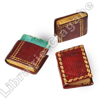
20240Paris, Caillot, rue S. André des Arts, n.57, s.d. (avant 1811, date à laquelle il n’est pas maintenu comme imprimeur) ; minuscule 30 x 20,5 mm, maroquin grenat à grain long, roulette décorative d’encadrement des plats, gros pointillé doré au dos, tranches dorées, étui en forme de livre relié : 36 x 25 mm, maroquin grenat à grain long, dos à faux nerfs et fleurons dorés, double encadrement des plats, pointillé fin et pointillé gras, tranches dorées (reliure de l’époque) ; 80 pp. y compris le titre.
46840Minerva Press.1993.In-4,couv.souple ill.en couleurs.375 p.Nombreuses reproductions en noir.Dédicace de l'Auteur. TBE.En langue anglaise.
12095Paris, Chez le Normant, 1831-1833 ; 5 tomes in-8, demi-veau glacé bronze, dos lisse, faux-nerfs noirs et dorés, fleurons décoratifs, titre et tomaison dorés, tranches mouchetées de rouge (reliure de l'époque) ; (4), IV, 487, (1) pp. ; (4), 307, (1) pp. ; (4), 443, (1) pp. ; (4), 359, (1) pp ; (4), 315, (1) pp.
6 voll. <br/> STATO: USATO, MOLTO BUONO.<br/> TITOLO: Guide pittoresque du voyageur en France, contenant la statistique et la description complèye des 86 Départements, orné de 740 vignettes et portraits gravés sur acier, de 86 cartes de Departements, et d'une grande carte routière dela France; par une societé de gens de lettres, de géographes et d'artistes.<br/> AUTORE: --<br/> EDITORE: Firmin Didot Frère
16°, pp. (2), VIII, 519, (1), cartonato editoriale con silografia del Duomo al piatto, copia fresca e in barbe con nota del proprietario al contropiatto posteriore: "Donatomi il giorno 6 gennaio 1822 da' Fratelli Silvestri". Ecco perché l'esemplare conserva la rara pianta di Milano legata al fondo, anche questa candida e ben conservata, da restaurare i due strappetti alla carta e relative tracce di nastro trasparente.
Sm. 8vo., Tenth Edition, on India Paper, with 38 folding coloured maps, 11 full-page maps and plans (a number coloured), numerous illustrations, plans and tables (several full-page) in the text, and a very large folding coloured map mounted on cloth in pocket at rear, some mild offsetting to blank preliminaries, endpapers very lightly age-soiled; handsomely bound in full crushed red morocco BY HATCHARDS, upper board lettered in gilt, back with five shaped raised bands, second compartment lettered in gilt, all edges gilt, wide gilt doublures elaborately tooled in gilt with a floral border enclosing multiple frames, laid paper endpapers, red, yellow and green silk head- and tail-bands, red buckram pocket, a splendid and ornate copy ideal as a gift or for presentation. THE BINDING IS SIGNED ON FRONT PASTE-DOWN. IT WAS COMMISSIONED BY GUY WESTMACOTT WHOSE NAME IS LETTERED IN GILT ON FRONT BOARD (this could well be Guy Randolph Westmacott of the Grenadier Guards). A SPLENDID AND UNIQUE COPY OF THE ONE OF THE BEST EDITIONS OF THE FINEST TRAVELLER'S GUIDE TO INDIA AND SURROUNDING REGION. VERY SCARCE IN ANY CONDITION.
In-12° (cm. 16,7), legatura successiva in m. pergamena con titolo ms. al dorso; pp. 450 [10] in barbe con 1 tavola in rame ripiegata f.t. (Duomo); lievi fioriture sparse e una piccola gora marginale a pochissime carte. Prima edizione rara della «guida artistica più completa ed importante della seconda metà del Settecento» [Villa 67]. «Nessuno era più appassionato amator delle arti di questo autore» [Cicognara 4236]. Cfr. anche Fossati Bellani 1867; Predari 162. Buon esemplare.
(Napoli- Guide- Fig. ’800) BRUNO F. Saverio. L'Osservatore di Napoli ossia.... De' pubblici stabilimenti, de' monumenti storici ed artistici e delle cose notevoli di Napoli, con una breve descrizione de' suoi contorni, specialmente delle antichità di Pozzuoli, Ercolano, Pompei, Stabia, Pesto, ecc., e la indicazione di tutte le strade della Capitale, e delle notizie che vi agevolano il provvedimento di quanto è necessario al ben vivere. Opera indispensabile al Napolitano e al Forastiero in Napoli. Napoli, Stamperia del Vaglio, 1855. 8°, bella leg. tutta pelle con tit. in oro al d.; pp. (10)-595 con due ritr. (Ferdinando II e Maria Teresa Isabella) e 22 belle tavole di vedute e monumenti , incise f.t. Rarissimo da reperire così completo.
Firenze, Pietro Allegrini alla Croce Rossa, 1786. In 8vo, due parti in unico volume. Parte prima: antip. incisa con due medaglioni, su uno dei quali è il ritratto del dedicatario dell’Opera, Tommaso degli Obizzi, sull’altro un’immaginetta allegorica con motto “Duce Virtute”, delineati dal Piazzesi e incisi dall’Allegrini, front. con stemma dello Stato di Volterra, pp. XV, 214, incluso l’Indice delle Cose Notabili e le Correzioni e Aggiunte. Parte seconda: “Saggio di ricerche sopra lo stato antico e moderno di Volterra. Dalla sua prima origine fino ai nostri tempi per facilitare ai giovani lo studio della storia patria. Opera dell’Abate Anton – Filippo Giachi Rettore del Regio Spedale di detta città. Dedicata al Nobil Uomo il Signor Cavalier Raffaello Guarnacci Patrizio Volterrano e Capitano nella Real Banda Toscana”. Siena, Luigi e Benedetto Bindi, 1796. Front. con piccola incisione, pp. VIII, 219 incluso l’Indice delle Cose Notabili + 3 n. n. con le Correzioni e Aggiunte. Leg. in modesto cartonato marrone con al dorso tassello titolato e datato manoscritto in coeva scrittura nera corsiva. Testo raro, a maggior ragione da trovarsi completo delle due parti, edite l’una a Firenze, l’altra a Siena, a distanza di dieci anni. Manca, come di consueto, l’Appendice alla seconda parte, stampata a Siena nel 1798. Alcune coeve e graficamente precise postille a margine, inchiostro marrone. Esemplare con certe tracce d’uso esterno, visibili nel dorso scollato e nei difetti delle punte, frontespizio con una impressione leggermente più “stanca” rispetto alle pagine di testo e con abrase un paio di letterine, brunitura al taglio superiore delle pagine, all'interno alcuni aloncini e alcune fioriture verso le ultime pagine, nell'insieme ben conservato, fresco e marginoso.
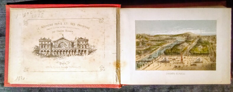
1878WOC-2428Dessiné d'après Nature et Lithographie par Charles Rivière. 23 planches en couleurs repliées en accordéon, dissensions de la gravure (10x6,3cm) avec les marges (13,5x9,5cm) et 1 gravure en noir et blanc de page de titre. Paris, Michel, Éditeur , Passage Choiseul, 78. Sans date (vers 1878) in-12 (15x10,5cm) percaline rouge éditeur, avec le titre en doré un peu passé dans un encadrement.
Foligno: Tomassini, 1828. Due parti in unico volume, ciascuna con proprio frontespizio. 528 pagine a numerazione continua con 8 pagine non numerate all'inizio della prima parte e 6 all'inizio della seconda, un foglio di errata in fine. 23 tavole incise, 5 delle quali piu' volte ripiegate. 22X15cm. Rilegatura coeva in mezza pergamena, con tassello sul dorso, parzialmente staccata e con abrasioni e mancanze. Bruniture e fioriture all'interno. Alcune delle tavole presentano strappi lineari in corrispondenza delle piegature senza pregiudizio per le immagini. Rinforzo cartaceo al margine interno tra le pagine 22-23, 32-33, 46-47 e 512-513. Alcune note a matita. Tra le pagine 348 e 349 e' stato applicato un foglio con dotte note manoscritte di antico lettore. Firma di possesso sul frontespizio. Esemplare completo in ogni sua parte. Celebre guida di Tivoli, senza dubbio la migliore mai pubblicata, ancora oggi fonte insostituibile. L'Autore, in forma epistolare, descrive minuziosamente tutti i monumenti della citta' e dei suoi dintorni senza trascurare cenni sulla storia e sull'economia dei luoghi. Notevole anche l'apparato iconografico dove spiccano la pianta di Tivoli (20x35 cm) e la grande tavola del Pinelli raffigurante la processione della festa dell' Inchinata (23x28 cm). All'esemplare e' allegata una lettera autografa firmata dell'Autore. Opera di notevole rarita'. [M124]
0881764825-11-1-29Random House Value Publishing. Very Good. With dust jacket. It's a well-cared-for item that has seen limited use. The item may show minor signs of wear. All the text is legible with all pages included. It may have slight markings and/or highlighting. Random House Value Publishing unknown
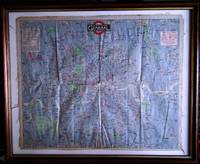
1919816St. Louis MO: The Texas Railway Guide Company 1919. Softcover. Good. Published by The Texas Railway Guide Company of St. Louis Missouri the map measures 23" x 23" 570 x 570 mm. Staining and tears along the folds else near very good. Professionally matted and framed. WITH THE RARE BOOKLET: 8vo. 136 pp. Original self-wrappers chipped lower cover chipped with significant loss; textblock browned and brittle but SUITABLE FOR EXHIBITION AND STUDY. ¶ Very scarce railroad map of Texas which also includes parts of Oklahoma Colorado New Mexico and Mexico. Delineated are counties major cities and also small cities that held a prominent place along certain railroads. The scale of the map is approximately 10 miles to 1/4 in. OUR COPY CONTAINS THE RARE BOOKLET the full title of which is: "Texas and Oklahoma railway and hotel official guide: containing the official time tables of all railway lines operating in Texas and Oklahoma also useful and valuable information for the traveling public for shippers and for railway men generally." This excellent guide is of further interest in the abundance of woodcut illustrations of actual hotels many most of which have been destroyed. The Texas Railway Guide Company unknown books