50 748 résultats
Very Good German Original autograph letters signed, concert programs and one ticket of Bruno Walter and Jose Iturbi in 23 September 1932 by Anita Tiedcke, letters by and to Anita Tiedcke, Muhiddin Erel and Suna and Sevim Erels. Includes 54 concert programs, booklets and leaflets which some of them are handwritten, typewritten and mostly original prints. Some programs contains Anita Tiedcke's violin parts, early ones in Berlin (1930s), and later period ones in Istanbul. Especially typescript Istanbul programs (such as Aysegül Sarica's ones) are extremely rare and very important collection on Turkish history of classical music. One special designed hand written and drawn concert program titled "In Mozart Reich - Weihnachts Konzert gespielt von Nannerl u. Wolfgang Mozart. 24 autograph letters from and to all family members. Letters belong to Anita Tiedcke, are especially important for which include legal correspondences about Anita Tiedcke's conversion to Islam with her musician identity and musical history. Anita Tiedcke changed her name as 'Emine Erel' after conversion to Islam and marriage. Suna and Sevim Erels' letters also talk about music mostly. They are written in German usually, but some of them are in Turkish. Also the collection contains some book lists, catalogues. Anita Tiedcke completed her musical education at the Conservatory of Hamburg with the violonist Erika Besserer. After her marriage to Muhiddin Erel, she continued her musical studies in Istanbul and worked as an instructor at the Municipal Conservatory. In 1945, she was appointed as the mayor of the Istanbul Municipal Symphony Orchestra. The couple had two daughters, Suna and Sevin. Suna Erel was not content with the conservatory, but she also graduated from the Münch Hochschule für Musik Academy. Professor Suna Erel, who worked at Mimar Sinan University for many years, retired 8 years ago. For his achievements, the German government awarded Suna Erel the Beethoven medal. Muhiddin Erel was a Turkish professor and doctor. He was the founder of Ege University Medicine Faculty in 1955. Extremely rare and fine collection.
New Turkish Original bdg. HC. In publisher special box. Atlas folio. In Turkish. 336 p., fully color ills. Tarihte Türkiye haritalari: 2000 yillik harita koleksiyonu. This work begins from the first ages, continues with maps from Islamic geographers, maps with religious motifs, maps from the age of explorations and from the Ottoman Empire, goes until the Arabic letter maps from the early years of the Turkish Republic and ends with the map of Hatay joining the Turkish Republic in 1939. It is an indispensible work that traces the evolution of cartography in these lands. The collection, enriched with maps compiled from the major museums and libraries of England, France, the Netherlands, Russia and the USA, is the largest exhibition of maps of the Turkish lands. THis book is a product of nearly 20 years of work with 265 select maps in large 50 x 70 cm pages. A very heavy volume.
Very Good Turkish In decorative contemporary clothes. Roy. 8vo. (24 x 17 cm). In Turkish. 2 volumes set: (614 p.;1154 p.). Mardin was a Turkish jurist, academician and politician. He was one of the ends of the Ottoman Empire and the firsts of Turkish Republic lawyers. He worked as a lecturer at Istanbul University during his whole life, where he graduated, and became a professor of the Civil Law. He ws born in Shkodra. Scarce. First Edition.
New English Original cloth bdg. In publisher's special box. Elephant folio. (51,5 x 35 cm). In English and Turkish. 336 p. The book features maps in Italian, Greek, Hungarian, Armenian and Swedish. The collection is compiled from major museums and libraries around the World. This is a follow up to Maps of Turkey Through the Ages published in 2018. Presented by Prof. Cemal Sengör and preface by Ilber Ortayli. Contributed by Ilber Ortayli, Dogan Uçar, M. Sinan Genim, Ahmet Isik Dogan, Mehmet Perinçek, Mustafa Kaçar, Dogan Kuban, Cahit Kayra, Murat Önes, Misra Erkaya, Celal Sengör Ingiliz, Fransiz, Alman ve Rus kartograflarin Istanbul için özel olarak hazirladiklari 14.-19. yüzyillara ait haritalarin çogunlukta oldugu atlasta ayrica Italyanca, Yunanca, Macarca, Ermenice ve Isveççe Istanbul'un tarihteki haritalari yer aliyor. Roma ile ayni yillarda yerlesim alani olarak seçilen Istanbul'un antik dönemine iliskin Homerus'un anlatimina göre 17. ve 18.yüzyillarda çizilen haritalarin detaylarinda MÖ 513-480 yillarinda Istanbul ve Çanakkale Bogazlari üzerinde kurulan Darius Hispastes ve Kserkses köprülerinin anlatim ve çizim detaylari ilk kez Tarihte Istanbul Haritalari kitabinda yer aliyor. Dünya kütüphanelerinden derlenen pek çok harita ve belge ilk kez bu kitapta bir araya getirildi. Türkçe ve Ingilizce olarak hazirlanan Tarihte Istanbul Haritalari atlasi, Tarihte Türkiye Haritalari atlasinin devami niteliginde. Boyut Yayin Grubu'nun Koleksiyon Kitaplar serisinde Bülent Özükan'in hazirlayarak yayinladigi Tarihte Istanbul Haritalari kitabi, Osmanli ve Türk cografyasina iliskin büyük boyda yayinlanan (51.5 x 35 cm) kitaplar serisinin altincisini olusturuyor.
Very Good Turkish, Ottoman (1500-1928) Original cromolithograph mounted on cloth. Folded. Some foxing and slimming on creases. Oblong double elephant folio. (97 x 107 cm). In Ottoman script. Shows the Bosphorus, Istanbul city with detailed place names. Black Sea at North, Marmara Sea at South and the Princes' Islands seen at southwest area. Mapmaker not described usual like in Turkish military maps. An extremely rare the Bosphorus map with its unusual size. Not in TBBMM library (The Grand Assembly of Turkish Republic Liibrary). Not in Military Libraries in Turkey.
Very Good Turkish, Ottoman (1500-1928) Original color map. Folded. Oblong atlas folio. (50 x 60 cm). In Ottoman script. Shows Rhodes and Tilos Islands. Scale: 1/200.000. Hegira: 1332 = Gregorian: 1916. Not description on map-maker. This is one of the series of the Bonn projection maps which are the first map series in modern techniques in Turkey and the Ottoman Empire. This is one of the series of the Bonn projection maps which are the first map series in modern techniques in Turkey and the Ottoman Empire. In order to produce these maps covering Turkish territory, Reconnaissance Branch was incorporated into The Mapping Commission. The maps were produced in the datum based on the latitude and longitude of Ayasofya Mosque in an equal area Bonn Projection. The field works for the 123 sheets covering the country were conducted by 76 staff. The production was completed in 18 years starting from east-west. Fieldworks continued without stopping except in the years 1914 and 1920. This map series called also reconnaissance maps contributed a lot to producing 1:25.000 scale maps. A very detailed and attractive map of Rhodes Island showing its harbors and Ottoman place names.
Very Good German Original color lithograph maps in 7 special cloth cases. Cases large 8vo., only seventh one is smaller which is covered by European marbling. Bookseller and bibliothek stamps on some maps, plans and sketches; and cases interior. A fine map collection. Contents: V.1: Includes 1 map, 2 plans and 5 skecthes, 1 uebersichtskarte. Uebersichtskarte für die Geschichte des Iten und IIten schlesisschen Krieges von 1740-1745. Kriege Friedrichs des Grossen. 1/740000. 73x81 cm.; Plan zur Erstürmung von Glogam am 9 Marz 1741 (Entworfen nach alten Planen). 1/6250 / 1/100000. 48x52 cm; Plan der Schlach bei Mollwitz am 10 April 1741. 1/25000. 43x59 cm.; (Skizze) Stellung der preussischen und oesterreichischen Truppenam, 3 Januar 1741. 1/740000. 30x30 cm.; Skizze zum Scharmützel bei Ellguth und zum Gefecht bei Ottomachall am 9. Januar 1741. 1/67500. 34x26 cm.; Skizze zu den Winterquartieren des preussen mit Stellung der Truppen am 20 Februar 1741. 1/740000. 46x52 cm.; Skizze zum Ueberfall bei Baumgarten am 27 Feb. 1741. 1/50000. 29x34 cm.; Marsch der oesterreichischen Armee unter F. M. Neipperg und der preussischen Truppen unter dem Könige von der Schlacht bei Mollwitz. 1/1480000. 36x42 cm.; [.] Standorte des preussischen Heeres bei Ausbruch des Krieges 1740. 1/2400000. 34x55 cm.; V.2: 12 pieces: 3 uebersichtskarten, 2 planen, 7 skizzen. ... von Europa im Jahre 1756. 1/18000000. 33x46 cm.; ... des südöstlichen Kriegsschauplatzes. 1/740000. 65x95 cm.; Standorte des preussischen uns sachsischen Heeres und Stellung des oestreichischen Truppen in Böhmen, Mahren, oestrç Schlesen und Erzth. oesterreich var Beginn des siebenjahrigen Krieges. 1/2200000. 56x72 cm.; Plan der Schlacht bei Lobositz am 1. Oktober 1756. Verlauf des Schlact bis etwa 12 Uhr Mittags. 1/25000. 47x60cm (Also includes Plan der 2ten Attacke des preussischen Kavallerie and Skizze des beiderseitigen Vormarsches am 30ten September 1756).; ... Weiterer Verlaufdes Schlact bis etwa 3 Uhr Nachtmittags. 1/25000. 47x60 cm.; Skizzen: 1. Vormarssch 28. 8 bis 10.9.56. 2.-3. Pirna 1.10.56. 4. Bewegungen Schwerins 56. 5. Pirna 10.10.56. 6. Pirna 12.10.56. 7. Pirna 13.10.56. V.3: 5 skizzen (No: 8-12) und 3 plannen (No: 3, 4-A, 4-B). Plan 4-A-4-B: Prag, 6.5.1757.; Plan 3: Reichenberg, 21.4.57. Skizze 8: Postrungen und Winterquartiere Dezember 56 (Huge size).; Versammlung der Heere, Marz und April 57.; Einmarsch bis 30.4.57.; Stellungen am 1.5.57.; Stellungen am 5.5.57. V.4: Karten 1,2,3,5 (4 is missing); skies 31,32; uebersichtskarte 5; Plan 12-B. ... des nordöstlischen Kriegsschauplatzes (Huge size).; Skizze 31: Heeresbewegungen vom 11.11.57 bs zum Einrücken in die Winterquartiere, Winter 1757-58.; (World War 1): Karte 1: Belgien und nordost-frankreich. Ostpreussen, polen, kurland, Weissrussland.; Galizien und Wolkynien.; Kleinasien , Schweizes Meer, Kaukasien, Kurdistan, Armenien, Aserbeidschan, Arabier, Mittellandisches Meer: Vordasien map. V.5: Sizzen 20-24 - Planen 6-A, 6-B - 9. Planen: Gr. Jagersdorf, 30.8.57.; Jager b. Goerlitz, 31.8.-9.9.57. Moys, 7.9.57.; Breslau, 22.11.57.; Schweidnitz, 24.10-12.11.57.; Skizze 20: Feldzung in ostpreussen Vormarsch des russischen Heeres bis 6.7.57.; 21: Heeresbewegungen vom 6.7.57 bis zur Schlact bei Gr. Jagersdorf. 22: ... nach der Schlact bei Gr.-Jagersdorf bis zum Schluss.; 23: Bewegungen i. d. Lausitz u. i. Schleisen, 20.8.-30.11.57.; 24: Lager bei Liegnitz, 19.-27.9.57. V.6: Plan 5-A, 5-B - Skizzen no: 13-19. Plans: Kolin, 18.6.57.; Kolin, 18.6.57.; Skizzen 13: Beiderseitige Stellungen 8.5.57.; 14: Operationen Beverns u. d. Königs gegen Daun 10.5.-17.6.57.; Bewegungen vom 20.6.-1.7.57. Stellungen vom 1.7.57.; Rechten Elbufer in der ersten Halfte des Juli 1757.; ... vor Zittau, 12.-20.8.57. V.7: 4 plans in cloth covered with European marbling. These last 4 plans from "Suworow und Polens untergang. Nach archivalischen Quellen dargestellt" von Friedrich von Smitt, 1858 First Edition. Pl. 1: Der Schlact am Rymnik den 11/22 Septeember 1789. Pl. 2: ... der
8vo., First Edition; handsomely bound in full dark red crushed morocco, sides with gilt frame border, back with raised bands, second and fourth compartments ruled and lettered in gilt, all other compartments tooled in gilt, gilt top, hand-made endpapers, ribbon marker, custom-made slip-case, a most attractive copy ideal as a gift or for presentation.
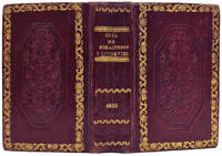
183314840Madrid: Imprenta Real 1833. 114x73mm. 4½x2¾". Madrid Imprenta Real 1833. 2 tomos en un volumen. En 12º. -I: 2 retratos portada grabada 252 pp. -II: Portada grabada 276 pp. Mapa de España plegado grabado por Carrafa. Junto con: NIFO Manuel. GuÃa de Litigantes y pretendientes para año de 1833. Madrid Núñes s.a. 1833. En 12º. 144 pp. 3 tomos en un volumen. En 12º 114 x 73mm. Encuadernación de la época en piel rueda dorada en los cantos formando un rectángulo y en centro gran rosetón gofrado hilos dorados en la lomera a modo de nervios atribuida a Tomás Cobo. Publicación de periodicidad anual fundada en 1722 por Luis Félix de Miraval y SpÃnola y que hasta 1734 se titula Kalendario particular. A partir de 1725 su impresor será Juan Sanz; después lo serán sus herederos y desde 1730 Antonio Sanz su sobrino que en 1769 cederá los derechos a la Corona española a cambio de una pensión vitalicia. En su portada se expresa que contiene los nacimientos de los reyes reinas los setenta miembros que componen el sacro colegio cardenalicio los prÃncipes de Europa los ministros que componen los tribunales de Su Magestad en sus reinos con indicación de sus residencias particulares en Madrid. En definitiva se trata de una guÃa completÃsima de la Administración del Estado del antiguo régimen con la indicación de sus órganos ejecutivos y consultivos consejos reales juntas instituciones cientÃficas y académicas y demás organismos y entidades que la monarquÃa española fue creando a lo largo del siglo dieciocho entre estas la propia Real Biblioteca Pública antecedentes de la Biblioteca Nacional de España y las reales academias con los nombres de los arzobispos y obispos de España y de las Indias la composición de los tribunales chancillerÃas y audiencias relación de reinos y provincias y partidos con los nombres de sus gobernadores intendentes y corregidores. Comienza con el calendario gregoriano con el santoral de cada dÃa y datos astronómicos y contiene también el jubileo de 40 horas asà como datos estadÃsticos de matrimonios nacimientos y fallecimientos de las parroquias madrileñas y un resumen de los enfermos en sus hospitales. También otra sección sobre los dÃas en que la corte se viste gala o los dÃas en que vienen y parten los correos en la Estafeta General de Castilla en esta corte o la relación de los caballeros del Toisón de Oro. Asimismo incluirá los valores de las monedas españolas y sus valores de cambio con las más importantes de Europa. Desde 1768 le acompañará el Estado militar de España con portada propia con los nombres de los capitanes y tenientes generales del Ejército de Su Magestad mariscales de campo brigadieres y oficiales de Marina etc. En la edición de 1767 comienza a incluir grabados como los de Carlos III los PrÃncipes de Asturias o el del Palacio de Aranjuez y después los de Carlos IV y la reina Maria Luisa para en el siglo XIX incluir los de Fernando VII y los de su hija la joven reina Isabel II. Asimismo llegará a estampar una docena de mapas de España y planos de Tomás López y sus hijos. En 1774 saldrá ya de la Imprenta Real de la Gazeta incluirá las relaciones de caballeros de Carlos III de catedráticos de los Estudios Reales de embajadores y cónsules y vicecónsules del Rey en el extranjero la cronologÃa de los reyes de España o el calendario de las principales ferias. En 1790 ya incluye un Ãndice al final o al comienzo y en el siglo diecinueve las relaciones de la Real Orden de Damas Nobles de las sociedades económicas o del Real Seminario de Nobles. Su volumen irá aumentando a lo largo de los años desde el centenar hasta superar las cuatrocientas páginas. Durante la invasión del ejército napoleónico el kalendario no aparecerá en 1809 ni en 1810 y para 1811 saldrá de la Imprenta de D. Miguel Segovia impresor de la Real Marina desde la Real Isla de León en Cádiz elaborado por dos redactores de los que se encargaban de las principales guÃas de forasteros de litigantes de comercio y hacienda y de guerra y marina de Madrid y se titulará GuÃa patriótica de España. Incluye una introducción narrando las dificultades que se dan para elaborarla y constará de dos partes. En la primera se dará cuenta del gobierno legÃtimo de sus tribunales y estado militar y la segunda de los cuerpos y oficiales de los ejércitos residentes en Cádiz asà como de la relación de diputados de las Cortes acompañada de un artÃculo. Las de 1812 y 1813 se titularán GuÃa polÃtica de las Españas y es también impresa en Cádiz la primera en la oficina de la viuda de Comes y la segunda en la Imprenta Nacional. En este caso es elaborada por un solo redactor e incluye unas efemérides patrióticas de los principales acontecimientos que se han venido producido durante la guerra contra los ejércitos franceses y artÃculos introductorios a la relación del cuerpo legislativo listado de diputados y del tribunal y secretarÃa de Estado de Cortes poder ejecutivo consejo supremo de Regencia Consejo de Estado embajadores y comandantes de los ejércitos. La de 1813 incluirá una addenda titulada Exércitos nacionales. Al regreso de Fernando VII retornará de nuevo a su tÃtulo anterior y a prácticamente a los mismos contenidos que publicaba durante el antiguo régimen hasta que durante el trienio liberal modifica otra vez su cabecera y algunos de sus contenidos al incluir de nuevo la relación de diputados a Cortes y las nuevas instituciones administrativas que el incipiente Estado liberal comienza a crear. En 1821 se titula GuÃa de forasteros en Madrid y en 1822 y 1823 GuÃa polÃtica y militar estampándose en la denominada Imprenta Nacional antes Imprenta Real. Por su parte el Estado militar de España que venÃa publicándose conjuntamente con el kalendario en 1821 1822 y 1823 se titulará Estado de los ejércitos de la monarquÃa española. El calendario para 1825 resulta asimismo interesante porque en las relaciones no aparecerán los "purificados". Esta publicación seguirá editándose hasta 1837 cuando es sustituida por la titulada GuÃa de forasteros en Madrid incluyendo los grabados de la reina gobernadora Maria Cristina y su hija Isabel II y dando cuenta de la nueva organización que el Estado liberal estaba creando en sustitución a la del viejo régimen por lo que el kalendario es una fuente de información básica para el conocimiento tanto de la evolución de la estructura estatal como de quienes eran titulares de sus numerosos órganos e instituciones desde la monarquÃa absolutista e ilustrada del dieciocho hasta las primeras décadas de construcción del Estado liberal con sus dos episodios más influyentes el constituyente de las Cortes de Cádiz y su epÃgono del trienio. Imprenta Real unknown
<p>20 cm, rilegatura coeva in mezza pergamena, titolo e anno in oro su tasselli al dorso; p. XXXVI, 284, complessivamente: 14 belle tavole incise in rame, tre delle quali più volte ripiegate: la pianta di Bologna incisa da Gaetano Canuti con 51 riferimenti a luoghi della città.in antiporta; la pianta della Chiesa di San Petronio e carta dei sobborghi della città. Copioso indice delle chiese, dei palazzi e degli artisti citati nella guida. Marginali bruniture che non insistono sul testo</p>
8°, mm 220x140, due volumi in un tomo di pp. (2), 199, (1); 208, (2), con una grande carta geografica ripiegata in fine. Elegante legatura novecentesca in mezza pelle rossa con punte e piatti in carta decorata. Magnifico esemplare, in barbe. Edizione originale in italiano, già apparse in inglese e francese tra il 1772 e il 1773. La prima parte è dedicata alla storia della regione, mentre nella seconda si denunciano i soprusi della Compagnia Inglese delle Indie Orientali. "Bolts was a Dutch adventurer who entered the Bengal civil service and got into trouble for private trading in the name of the East India Company. After being deported to England in 1768, he published this work attacking the government in Bengal".
Illustrations de MM. Rouargue Frères. Nouvelle Edition revue et corrigée par l’Auteur. Paris, Morizot 1865. In 8vo gr., pp. 514, con 23 tavv. ill. f. t., dal tratto assai fine, disegnate e incise su acciaio dai fratelli Rouargue e protette da veline, di cui 6 colorate a mano e raffiguranti tipici costumi e mestieri; le restanti sono pittoresche vedute di città, leg. in percallina rossa, titolo e fregi dorati al dorso, contropiatti e fogli di guardia in carta avorio, tagli oro. Questo celebre figurato francese sull’Italia ha rappresentato per lungo tempo l’introduzione più aggiornata a un viaggio nella penisola. Minime tracce alla legatura e un po’ di foxing alle pagine ma discreto esemplare..
Palermo, Stamperia Reale, 1805. In 8vo, pp. 279 (con Indice de' Capitoli, Errata Corrige e il Prospetto dell'Opera intitolata “Dritto Georgico - Sicolo dell'Avvocato Francesco di Paola Avolio), leg. in cartonato con piatti rivestiti in carta marmorizz. e titolo oro al dorso. Prima e assai rara compilazione di quest'opera dell'avvocato Francesco Avolio di Paola (1763 – 1838): si parla molto delle tonnare, si espone il trattato intono al viaggio dei tonni (se detti pesci siano cioè passeggieri o abbiano nascimento e stanziamento nei mari siciliani), si discute sopra i privilegi concessi ai marinari impiegati nelle tonnare e su certe liberalità delle medesime; si parla di pesca nazionale, delle leggi sulla pesca del corallo, della pesca nei porti e si accenna a quella fatta nel porto di Siracusa, delle leggi dei fiumi, laghi, vivai; delle magistrature marittime della Sicilia, proponendone l'abolizione in favore di una Società Economica; infine si affrontano i regolamenti per la vendita del pesce e le gravità che pesano sulle pescagioni siciliane. Censito da iccu in pochissimi esemplari (Mira, I, pp. 64). Esemplare in vecchia ma non originale e modesta legatura (con sottostante rimanenza, al front. e all'ultima bianca, di carta azzurrina della brossura originale) rivestimento del dorso difettato, modestissimo foxing solo a poche carte, una piccola mancanza della carta al foglio delle pp. 91 recto e 92 verso ha creato una lacuna al margine superiore e ha omesso un paio di parole, peraltro esemplare completo, pulito e marginoso, ben conservato nel suo insieme.
carta incisa in rame, a colori, cm. 83 x 63, in 16 sezioni montate su tela, cofanetto coevo con titoli al dorso, macchia alla base del cofanetto, la datazione è presuntiva
Milano, Fratelli Treves, 1897. Nuova edizione illustrata da 257 incisioni e 2 carte. In folio, pp. 575, mm. incisioni n. t. con le vedute delle più importanti città, dei monumenti e delle particolarità architettoniche e folcloristiche locali, leg. in mz. pelle con punte, piatti in percallina color vinaccia sguardie rivestite. Le zone trattate sono: Venezia, Chioggia, Trieste, L’istria, il Quarnero e le sue isole, la Dalmazia, il Montenegro, Ravenna, Ancona, Loreto, Foggia, Brindisi, Lecce, Otranto. L'autore infatti descrive e illustra le terre percorse nel suo viaggio lungo le coste dell'Adriatico: parte da Venezia e va verso l'Istria, il Quarnero, la Dalmazia e il Montenegro, ritorna sulla costa italiana e, da Ravenna, raggiunge Otranto costeggiando il mare. Leggere e piccole abrasioni al piatto, fioriture e gore di umido alle sole ultime pagine dell’indice, normali macchiette al taglio; peraltro esemplare pulito all’interno e in buono stato.
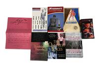
1990210581990. Hale Keith; White Edmund; Bledsoe Lucy Jane ed.; Frommer's Editors; Damron Guides; Fraternal Order of Gays. Gay and lesbian travel guide and narrative collection circa 1980s-2004 documenting the development of LGBTQ travel culture through both directory-based guides and personal travel writing. These materials situate travel as a means of accessing queer community exploring identity and navigating geographic differences in visibility and acceptance. The collection provides insight into how LGBTQ individuals located social spaces documented cultural environments and articulated travel experiences across the United States and internationally.<br /> <br /> Collection comprises 8 items including travel guides literary travel narratives and one organizational brochure. <br /> <br /> <br /> 1 Vintage Fraternal Order of Gays FOG activity brochure .circa 1980s FOG was an organization with a mission to "bring gays together just to have fun meet others with similar interests and make new friends". Brochure advertises numerous activities such as group trips game nights language classes and others.<br /> <br /> 2 Hale Keith. In the Land of Alexander: Gay Travels With History and Politics in Hungary Yugoslavia Turkey and Greece. Boston: Alyson Publications 1990. A travel memoir concerning the authors journey through the queer underground of the Balkans and Turkey. The author reflects on the appeal each country has for gay travelers while also delivering remarks on the country's history and politics. 285 pages and in very good condition. <br /> <br /> 3 White Edmund. States of Desire: Travels in Gay America. Famous travelogue of Edmund White's travels throughout the US that explores gay culture and the queer underground throughout the country. The narrative includes many of the most popular cities in the US as well as smaller cities and rural areas. 340 pages and in very good condition. <br /> <br /> 4 The Queerest Places: A Guide to Gay and Lesbian Historic Sites. 1997. A travel guide that emphasizes historic queer monuments and location in each state across the US. Features various parks homes of historic LGBT icons queer bookstores movie theaters and more. 350 pages with hundreds of listings across the country. <br /> <br /> 5 Lesbian Travels: A Literary Companion. 1998. First edition. Ed. Lucy Jane Bledsoe. A compilation of personal essays from lesbian writers on themes of travel adventure and intercultural romance.<br /> <br /> 6 Frommer's Gay & Lesbian Europe 1999. First Edition. 688 pages. A comprehensive guide to restaurants hotels tourist destinations and nightlife across the UK and mainland Europe compiled by gay and lesbian editors.<br /> <br /> 7 Frommer's Gay & Lesbian Europe 2003. 621 pages. A comprehensive guide to restaurants hotels tourist destinations and nightlife across the UK and mainland Europe compiled by gay and lesbian editors.<br /> <br /> 8 Damron Men's Travel Guide 2004. 726 pages. Measures 3.5" x 6.5". Includes USA Mexico Canada Caribbean and European Cities and features over 12000 locations in total with 544 pages dedicated to just US locations in every part of the country. <br /> <br /> Produced during a period of expanding LGBTQ visibility following the late twentieth-century gay rights movement these materials demonstrate how travel functioned as both a practical and cultural activity within queer communities. The coexistence of directory-style guides and literary narratives reflects multiple approaches to documenting LGBTQ space from logistical mapping to experiential writing. Light wear consistent with use; bindings intact and pages clean; overall very good condition. This collection offers a combined record of LGBTQ travel infrastructure and personal engagement with queer environments across multiple regions. unknown
elala3104Dublin: Philip Dixon Hardy & London: Richard Groombridge 1835. First Edition. Scarce. The anonymous author remarks on prospects the difference in the management of farms the danger of being defrauded in the purchase of land the comparative desirability of “the bush†and of a “cleared farm†the incivility and rudeness of the lower classes equipment hotels choice and prices of land cost of clearing land wages cattle and live stock sawing timber dairies crops &c. Casey I 1476. Dionne II 1104. Sabin 10379. TPL 1826. 12mo. pp. 3 p.l. 5-132. original cloth rebacked covers stained some foxing & light browning Dublin: Philip Dixon Hardy & London: Richard Groombridge, 1835 hardcover
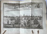
15320Illustrated travel book on Amsterdam. With decorated paper binding marbled. Many illustrations of the most important buildings and also flagues 8 pages of flagues. Lit: Nijhoff / Van Hattum 120 vgl. 321. Gids voor Amsterdam met vele bijzonderheden over gebouwen etc. en met 29 ongesigneerde meest uitslaande gravures van: gezicht op de stad vanaf het IJ de Oude Kerk de Nieuwe Kerk de Olofskapel de Nieuwezijds kapel de Zuiderkerk de Westerkerk de Lutherse kerk aan het Spui de nieuwe Lutherse kerk de Portugees-joodse synagoge binnenplaats Burgerweeshuis het Diaconieweeshuis vier stadspoorten op één blad de Waag op de Dam binnenplaats Beurs het Admiraliteitshof of Prinsenhof het arsenaal van de admiraliteit op Kattenburg het Oost-Indisch arsenaal op Oostenburg loskranen in de haven 8 platen met ieder 6 of 2 vlaggen de brug over de Amstel en de lijnbanen van de V.O.C. op één plaat en het stadhuis op de Dam. Het betreft hier een titeluitgave van Le guide ou nouvelle description. uit 1734 met een kleine variatie in de prenten. Deze guide uit 1734 was een vertaling van de 2e druk van de Wegwyzer door Amsterdam . uit 1726. Nijhoff spreekt over 4 vlaggenkaarten. Ons exemplaar heeft er 8 genummerd 1 t/m 8. unknown
In-8°, mm 190x110, quattro parti in due volumi di pp. 32, 240; 328; 359, (1); VIII, 291, (13), con 4 antiporte incise (raffiguranti Colombo, Las Casas, Cortes e Pizarro) e 4 carte geografiche ripiegate, capilettera e fregi silografici all'interno. Legature coeve in piena pelle con titoli in oro su doppio tassello al dorso. Qualche abrasione, più marcata ai dorsi e limitate tracce di foxing al margine di poche carte, nell'insieme un buono e fresco esemplare. Prima traduzione italiana pubblicata l'anno appresso all'originale inglese per le cure di Antonio Pillori. Non comune quando completa del bell'apparato iconografico perché, come si dichiara all'inizio dell'opera, le carte geografiche non sono state ancora incise e verranno pubblicate successivamente. Le carte disegnate appositamente dal Kitchin, idrografo di sua maestà, raffigurano l'America meridionale; i paesi sopra il Mare Meridionale da Panama a Guayaquil, il Messico o Nuova Spagna, dove si possono rintracciare i movimenti di Hernan Cortes al tempo della conquista e la carta del golfo del Messico con le isole adiacenti. Bibliografia: Sabin 71997
In 8° (220x150), pagg. 720 con 2 carte geogr. e 172 incisioni in acciaio fuori testo raffiguranti località descritte, monete, reperti archeologici, maschere teatrali, scene popolari. Mezza pergamena ottocentesca con titolo in oro su tassello. Volume da "L'universo o storia e descrizione di tutti i popoli, loro religioni, costumi, usanze". Ben conservato anche se mancante di occhiello e frontespizio del volume, tassello moderno e sguardie rinnovate. Alla fine è presente l'indice dell'opera di La Salle sulla Sicilia generalmente unito all'Italia, manca il testo. Fossati Bellini cita l'edizione francese del 1835.
1920217674China.: No publication details. Circa1920. Colour folding pictorial map 39.5 x 54cm lower corners a little stained one panel browned and some folds strengthened with washi on reverse an attractive map. This is a pictorial guide map of Yíheyuan the Summer Palace in Beijing. Kunming Lake is feature in the centre where a fancy pleasure boat is floating. Numerous buildings and walking paths are drawn in detail. No publishing date is recorded on the map. . No publication details. unknown
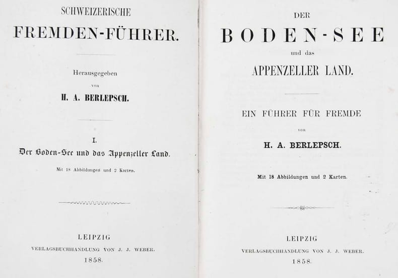
140633aafLpz, Weber (=Schweiz. Fremdenführer, I. Der Bodensee und das Appenzeller Land), 1858, kl. in-8°, 3 Bl. + 89 S. mit 18 Abb. + 2 Panorama’s auf 1 gef. Blatt : Panorama vom Bodensee vom Freudenberg & vom Gebhardsberg + Karte / II: Abb. + 4 Karten / III: Abb. + Karte / IV: Abb. + 2 Karten, Ex libris Peter E. Obergfell, Original Halb-Lederband d. Zeit mit gebrauchsspuren.
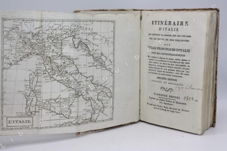
14446Florence, Joseph Tofani et Compagnie, Se vend chez Nicolas Pagni, 1801 ; in-8. 208 pp. - 26 cartes dépliantes. Couverture d'attente de l'époque en papier marbré. Frottements sur le dos et les plats. Inscriptions anciennes au crayon sur la première et la dernière garde. Ex-libris manuscrit sur le titre "Bigot de Préameneu" (il s'agit peut-être de Félixe Julien jean Bigot..., juriste et homme politique, un des quatre rédacteurs du Code civil de 1804).
1951mon0000144386Times Books 1951-01-01. Hardcover. Acceptable. in x in x in. NOT ex-library. Well read copy with some spine wear but still very useable. Outer cover is ripped in places. Times Books hardcover