MareMagnum

50 682 résultats
Due voll. in 12° (cm. 18,0) pp. XXVIII + 291 (1) con due piante di Roma, antica e moderna, ripieg. e 24 tavv. f.t. ; 1 c.n.n. + pp. 295-612 (num. continua) e 23 tavv. f.t. per un totale di 49 tavv. inc. in rame (sulle 50 annunciate all'indice). Legatura Cartone coevo con titt. manoscritti al dorso. Numerose note manoscritte a matita ai margini bianchi (in fiammingo). Timbretti di antica biblioteca ai frontesp. Ben conservati, con tavv. nitidamente impresse. Rara edizione di questa celebre guida di Roma. Rossetti, G-1491 riporta questa edizione, ma con due mappe f.t. e 25 tavv. al primo vol. e 19 tavv. al secondo volume, per un totale di 46 tavv. inc. in rame.
1963220706Hong Kong.: Hong Kong Tourist Association. July 1st1963. Colour folding map at rear colour and black and white illustrations and advertisements 84pp. Booklet measures 22 x 10.5cm; map measures 39 x 52.5cm. Covers somewhat worn with few small closed tears on the lower cover now secured overall a very good copy. A charming companion for tourists to Hong Kong complete with a folding map of Kowloon Peninsula and Central. Within the guide provides an outline of the colony's history generally useful information for travellers advice on transportation and a rundown of attractions. Copious advertisements abound throughout with further leaflet advertisements loosely inserted. . Hong Kong Tourist Association. unknown
195913220Editions Aimery Somogy 1959 316 pages in8. 1959. pleine toile éditeur avec jaquette. 316 pages. Ouvrage de référence sur les chefs-d'œuvre de la peinture conservés au musée du Prado rédigé par Francisco Javier Sánchez Cantón. Cette édition revue et corrigée de 1966 présente 317 pages avec de nombreuses illustrations en couleur et en noir et blanc décrivant les œuvres et leur contexte
185599677Paris, Alphonse Taride, Bookseller 1855 Livre en anglais. In-16 cartonnage éditeur couleur crème illustré d’une vue de la Seine, 16 cm sur 10. 102 pp - 9 pp alphabetical list - 10 pp de catalogue. Nombreuses illustrations en noir et blanc in et hors-texte. Fendu partiellement aux mors. Corps du livre en bon état. Rares et pales rousseurs dans le texte. État correct d’occasion.
ORD-80942°édition. Lacroix. Verboeckhoven et Cie éditeurs à Bruxelles, à Leipzig et à Livourne. 1867. 2 Parties en 4 volumes dos chagrin rouge, fx.-nerfs, tr. mouchetées.|1°Partie: XIVpp. (titre, avis des éditeurs et tables du 1°volume, le fx-titre a été placé en tête du second volume), 3ff.n.ch. (fac-similés de signatures), et XLIV pp. d'introduction par Victor Hugo;902pp.; 27pp.: Nomenclature des rues, Bds, Quais, Passages, Plans, Impasses, etc).51 planches h.-t. dont 16 doubles (plans des principaux théâtres de Paris).|2°Partie: (XIVpp. (fx-titre reporté au 4°volume, titre, avis des éditeurs et tables), 9pp. d'autographes et pp.903 n.ch. à 2139 (Les renseignements divers sont compris dans la pagination alors qu'ils sont non paginés dans la description de Vicaire pour l'E.O.); 64pl.h.-t. dont 3 plans. Les 4 cartes sont absentes de cette édition. Petits défauts mais bel exemplaire.
Lee, PhilIn Pristine Condition. unknown
Very Good Turkish Original manuscript map of Alexandria Port and its immediate hinterland. Folio. (33 x 41 cm). In Turkish (Modern). Folded. No scale. The manuscript shows Alexandria Port and the Palace of the King Farouk of Egypt, customs shores, ports and harbors, locations of the British ships, radio station, location of SS Ramlah, strait, Great Pass (?), waterfront for the lumber ships, sea current zones and probably entrance and exit routes etc. A very detailed map, decorated with ships. Some repairs with tape, tears, foxing and stains. Overall a good copy.
Very Good French This attractive color lithographed map shows the Imperial Ottoman territories in the Balkan Peninsula, Anatolia, also North African shores and Maghreb countries, Egypt and Vilayet de Tripoli (Libya) and Liva de Benghasi. It has small views with a small scale of Tripoli, Europe, Egypt, and Nubia with the Arabian Peninsula. This map reflects the territories and situation of the last period of the Ottoman Empire soon after the Second Constitutional Era in 1908. Inside the red lines in this map shows the Ottoman territories in 1909 with its maximum extent, just before the Balkan Wars, (1912-1913). In Europe, Western Thrace territories up to Montenegro including Adrianople are within the borders of the Empire. E. Nardin was a French cartographer who prepared more than sixty maps in the early 19th century, especially mapping Middle Eastern, North African, Sub-Saharan African areas. Original color lithograph folded map in its original wrappers. Oblong double elephant folio. (77x95 cm). Wrappers dimensions: (21,5x14 cm). In French. Echelle 1/4.165.000 (Scale). Only two copies in OCLC. Extremely rare. No date.
Very Good Turkish, Ottoman (1500-1928) Original color map on cloth. Oblong atlas folio. (44 x 58 cm). Scale: 1/200.000. Toponyms in Ottoman script /Turkish with Arabic letters). Shows southwest of the Gallipoli Peninsula [and the Hellespont], Edremid Gulf, Tenedos, and North Aegean shores of Anatolia]. Folded. This is one of the series of the Bonn projection maps which are the first map series in modern techniques in Turkey and the Ottoman Empire. In order to produce these maps covering Turkish territory, Reconnaissance Branch was incorporated into The Mapping Commission. The maps were produced in the datum based on the latitude and longitude of the Ayasofya Mosque in equal area Bonn Projection. The field works for the 123 sheets covering the country were conducted by 76 staff. The production was completed in 18 years starting from east-west. Fieldworks continued without stopping except in the years 1914 and 1920. This map series called also reconnaissance maps contributed a lot to producing 1:25.000 scale maps. Hegira: 1336 = Gregorian: 1920. Not description on map-maker. Extremely rare.
Very Good Turkish, Ottoman (1500-1928) Original color map of Eastern Anatolia, Dogu Beyazit, Bayazid, Bargiri, Nakhchevan, Karakilise, Van, etc. 50x60 cm. In Ottoman script (Enverî). 1 p. Scale: 1:200.000. Slightly toned, several small holes on paper. Otherwise a very good copy. Enverî script is the war minister Enver Pasha's alphabet and writing amendment, which he tried to implement within the Ministry of War between 12 March 1914 and 10 August 1914. Starting from the Tanzimat (Westernization) period in the Ottoman Empire, the discussions on simplification in language, writing, alphabet and reading-writing had increased and at the end of the 19th century, military necessities also became one of the concerns. The problems such as the low rate of literacy among the recruited soldiers, the need to teach the soldiers how to read and write in a short time, and their misconceptions about the spelling of proper nouns led Enver Pasha to add the writing problem to his reform agenda, once he took office. Enver Pasha's reform is based on the principle of writing the Ottoman letters, which take different forms in the beginning, in the middle and at the end according to their unification with the other letters, separately in their original state without merging them. While this new alphabet was being created, the existing 32 letters in the Ottoman were preserved. The 8 vowels in the Turkish language, which could not be written with the old letters, was shown by placing small marks on the existing vowels and by doing so a new alphabet consisting of a total of 40 letters was created. With this alphabet, officially called 'Ordu Elifbasi', rules were adopted such as writing of the letters without merging them, writing the words as they are pronounced. At first glance, Enver Pasha's writing reform, which appeared as a definite solution to the theory of the solution of the ongoing debates on the alphabet and the spelling, formed a wide experiment field in the military. It was not possible to use Ordu Elifbasi, which essentially is a transliteration alphabet that allows transferring the sounds of these three different languages (Turkish, Arabic, Persian) to a single alphabet, in the daily life. Thanks to this new alphabet and spelling, learning to read and write were accelerated to some extent. However, it was seen that the literacy rate of the well-educated, literate people fell to the spelling and did not even progress. This alphabet and spelling reform, which Enver Pasha thought of spreading to the whole country, caused much more problems as it was experienced in the army. Although it was postponed until the end of the mobilization period following the declaration of the mobilization, Ordu Elifbasi, which remained in force for 152 days, eventually failed to be realized. (Source: Karakus: Enver Pasha's Alphabet And Spelling Attempt: Ordu Elifbasi (Army Alphabet)).In this extremely rare document, there are some articles and thoughts on a case. This is one the serie of the Bonn projection maps which are the first map series in modern techniques in Turkey and the Ottoman Empire. In order to produce these maps covering Turkish territory, Reconnaissance Branch was incorporated into The Mapping Commission. The maps were produced in the datum based on the latitude and longitude of Ayasofya Mosque in equal area Bonn Projection. The field works for the 123 sheets covering the country were conducted by 76 staff. The production was completed in 18 years starting from east west. Field works continued without stopping except in years 1914 and 1920. This map series called also reconnaissance maps contributed a lot to producing 1:25.000 scale maps. Extremely rare. KW: "Harfleri Islah Cemiyeti" Hurûf-i munfasila Reform Turkish Letter revolution First World War WW 1 Map Geography Military maps.
Very Good Turkish, Ottoman (1500-1928) Original chromolithograph folded map. Oblong atlas folio. (49 x 65 cm). In Ottoman script. Repaired with a band in the contemporary period from its backside. Set including 4 sheets. Other sheets are Basrah, Bagdad, and Qut al-Amare. This is the first sheet including 'Samawah'. Rare. Scale is 1/500.000. Samawah city was settled by the Arab tribe of Banu Quda'a around the 3rd century AD. It is built on both sides of the Euphrates river; there are four bridges in the center of town for crossing between the two sides. The west bank of the city contains the commercial heart of the city and includes the old town and the Jewish quarter, Agd al Yahood. The west bank is the site of the covered market Suq Al Masgoof, which dates to the Ottoman period. The area surrounding the market is the old city with its Byzantine maze of crowded markets and streets. The eastern side of the city including 'Qushla' has a more modern feel and contains a number of estates of apartment blocks built during the 1970s and 1980s, As Samawah Stadium, which is home to the local Muthanna football team Samawa FC, as well as technical colleges and the polytechnic. There too is Al Qushla, the historic "Ottoman Barracks". The most famous attraction of Samawah in the ruins of the ancient Sumerian city of Uruk which dates to 4000 BC. This was the largest city in Sumer, extending over 2 km2. Uruk was not only the largest conurbation of the first urban civilization on earth, but it is also the place where the first written script was discovered, the oldest dating back to 3300 BC. The palm groves of Samawah: Samawah is built on both sides of the Euphrates and is surrounded by hundreds of palm groves that give it a tropical feel, especially in the southern and northern suburbs. These groves provide cool respite from the scorching heat of Mesopotamia and were the inspiration for the famous Iraqi folk song "The Palm of Samawah".
Very Good French A rare color lithograph map of French Indochina, showing international and provincial boundaries, transportation, and water features. Relief is shown by shading, spot heights, and bathymetric contours, as well as Cambodge, Thailande, Hai-Nan Island, Golfe du Tonkin, Mer de Chine, Yunnan Kouang-si, Kouang-Toung, Laos, Annam, Tonkin, Golfe du Siam, Bangkok, etc. Depths shown by contours. Prime meridians: Greenwich and Paris. "Compliled and drafted by l'Institut ge?ographique national, 1938. Revised by the Service ge?ographique de l'Indochine, 1948. Copied by AMS, 1951.". Original color map. Good. Folded. Double elephant folio. (93 x 66 cm). In French. 2 copies in OCLC (1948 Edition).; LCCN map59000405. Scale: 1/2000000. Restored on folded trace on right corner. A good copy.
Very Good Turkish, Ottoman (1500-1928) Original map of Kars Fortress. Oblong: 45x57 cm. In Ottoman script. Scale: 1/21000. [PLAN OF KARS FORTRESS] Kars Kal'asi plâni (Based on 1898 discoveries and 1908 practice). A very detailed plan in Ottoman script of Kars Fortress and is environment. Some red markings. Extremely rare.
Very Good German Original b/w city plan. Atlas folio. (58x47 cm). In German. Folded. [CITY PLAN of BRAILA -IBRAIL-] Stadtplan von Braila. Scale (Masstab): 1/10.000. No cartographer. 33 descriptive articles on bottom-right corner of the plan. Slightly chipped at extremities of paper and soiling. It shows Braila and Donau. Braila (Turkish: Ibrail) is a city in Muntenia, eastern Romania, a port on the Danube and the capital of Braila County. There's some Ottoman manuscript including translations of the German descriptive text on the plan, and also "'Ibrail' sehir plâni" written on verso in Ottoman script. Extremely rare.
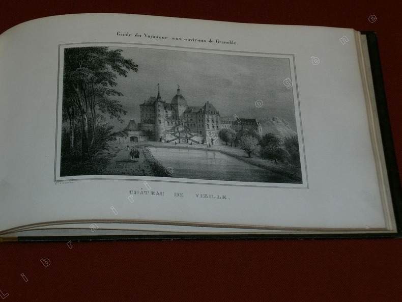
81545Grenoble, Ch. Vellot & Cie, Libraires de l'Académie, 1854, 1 volume de 245x155 mm environ de format à l'italienne, demi-basane fauve, dos lisse orné de filets dorés. Avec 10 planches gravées hors texte dont une carte des Environs de Grenoble. Avec un envoi sur la première garde. Un mors interne fendu mais structure solide, frottements sur le cuir et le cartonnage, intérieur bon état.
Interessante lotto composto da 432 pellicole fotografiche di cm.8,5x11 circa, contenute rispettivamente in 4 confezioni di cartone, tre 'Veloz Kodak Limited', una 'Grand prix Lumière'. Le fotografie, di cui ne sono state selezionate alcune e da noi riprodotte su un libriccino composto da 56 pagine. Bellissimi scatti che testimoniano i viaggi della famiglia Gray intrapresi agli inizi del '900. Le pelliccole sono contenute in piccole buste sulle quali è calligrafata la località visitate: Aswam, Amin Hammaci, Member of Parliament, Creta - Corfù nel 1927, K“m Ombo, Il Tempio, Ismailia: Natale a Port Said, Port Tewfill. nel 1927, Luxor nel 1904; Piramidi di Giza, Thebes: Ramesseum, Valle delle Regine, Valle dei Re, Deir El Bahari; Kerdasa: Alui Roash; Karnak; Cairo; Edfu Esna; Viaggio in paesi africani; Sud Africa, Cape Town, Venezia e Lucerna, 1927; Montagna e paesi svizzeri: Lugano. Bellissime cene animate, ambientazioni usi e costumi di popolazioni africane; ritratti di personaggi e scatti del Villino Gray in Via Cassia Antica 30, Roma. Bellissimo affascinante insieme.
Firenze, presso Giuseppe Tofani e comp. si vende da Niccolò Pagni mercante di stampa presso la locanda dell'Aquila nera, 1807, in-8, graziosa cartonatura "a busta" coeva, in carta decorata, pp. XXXII, 243, [1]. Con 13 tavole calcografiche recanti le carte itinerarie dei viaggi. Pochi segni a matita su una cartina. Alcuni esemplari di questa edizione sono corredati anche da una carta generale d'Italia ripiegata f.t., qui non presente. Tuttavia il volume appare in condizioni più che buone, nella sua cartonatura originale, senza lo spazio per una grande carta ripiegata.
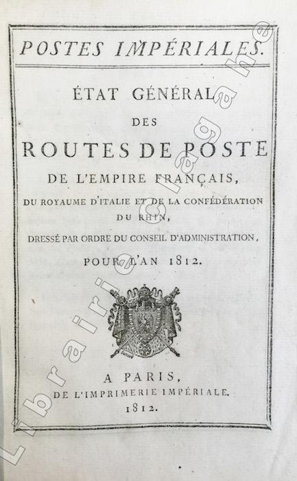
181716310Paris, Imprimerie impériale, 1817 ; in-8, vélin à rabat portefeuille (reliure ancienne, parchemin réutilisé) ; 362 pp.
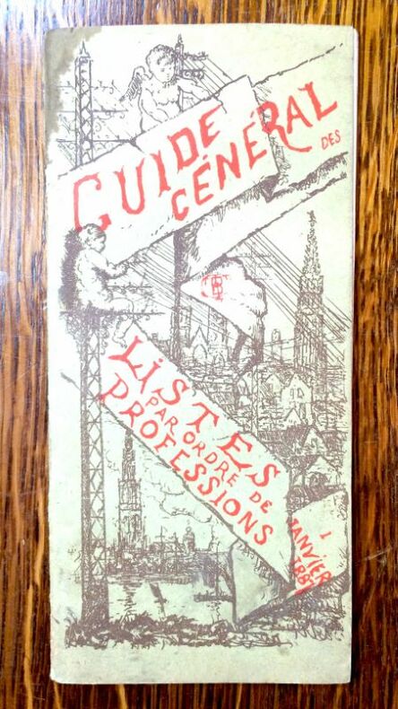
8151 Plaquette broché, couverture illustrée. Petite tache au coin sup. g. du 1er plat. 17,5 x 8 cm, 40 p. Bruxelles, Compagnie belge du téléphone Bell, 1er janvier 1887. Edition originale
8151 Plaquette broché, couverture illustrée. Petite tache au coin sup. g. du 1er plat. 17,5 x 8 cm, 40 p. Bruxelles, Compagnie belge du téléphone Bell, 1er janvier 1887. Edition originale
228711Paris, Marchand, 1806 2 vol. in-16, [4]-iv-302 pp., 310 pp., demi-chagrin vert, dos à nerfs, filets à froid (rel. de la fin du XIXe s.). Petit manque à la coiffe supérieure du tome 2.