EUGÈNE-HENRI FRICXLivre Rare Book
11 983 résultats
171260165Brussels, 1712. Folio (512 x 315 mm). In contemporary half calf with seven raised bands. Spine and hindges with wear. Leather brittle and upper and lower 10 cm hindges detached. Two library labels pasted on to pasted down front end-paper. Upper margin of first three leaves blind-stamped. Handwritten (19th century hand) index mounted in on verso of first map and each map numbered. With 75 maps and plans, many double-page or folding: 24 cartes des Pays Bas, Carte générale de Brabant, Carte du Pays de Waes, Carte des Postes d'Allemagne, 48 plans des Villes, Sièges & Batailles (complete). 3 maps with minor marginal tear (outside plate), 2 with minor split to lower part of middle folding. A few maps at end with browning. A few plates (primarily 61, 50, 33, 25) heavily trimmed with slight loss to upper margin. An overall fine and clean copy.
Brussels, 1712. Folio (512 x 315 mm). In contemporary half calf with seven raised bands. Spine and hindges with wear. Leather brittle and upper and lower 10 cm hindges detached. Two library labels pasted on to pasted down front end-paper. Upper margin of first three leaves blind-stamped. Handwritten (19th century hand) index mounted in on verso of first map and each map numbered. With 75 maps and plans, many double-page or folding: 24 cartes des Pays Bas, Carte générale de Brabant, Carte du Pays de Waes, Carte des Postes d'Allemagne, 48 plans des Villes, Sièges & Batailles (complete). 3 maps with minor marginal tear (outside plate), 2 with minor split to lower part of middle folding. A few maps at end with browning. A few plates (primarily 61, 50, 33, 25) heavily trimmed with slight loss to upper margin. An overall fine and clean copy.
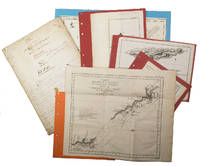
1755ABC_474521755. Manuscript of 24 pages 6 printed maps on cardboard. This wonderful logbook details the journey of a French captain from Manila to the Maluku Islands in todays Indonesia. The journey took place during the months of March to May of 1755. The captain of the ship recounted with great detail the events of every day of the journey with detailed daily accounts of the weather winds manoeuvres of the ship its departures anchorages and precise coordinates at every point of the journey. The captain furthermore had a keen eye for the geographical and nautical details along the journey. He recounted the exact locations of for example sandbanks and bays where ships and their crews can take provisions and fresh water. The accounts are detailed and captivating: "After our boats were back on board we set sail . in the afternoon to moor under the old Portuguese fort on the Solor island Indonesia the winds for the tide were fresh at 1:34 a.m. . sand and gravel and then I went back to mooring. The pavilion of the fort . the village is under the said fort at 3 cables from us .". The captain goes on to describe the geographical features of the islands as well as other places en route with great detail. Curiously we find inscriptions in Spanish and the names of one don Phelipe Qui who describes himself as el piloto and one Padre Don Estevan de Melo. The latter might be identical with Don Estevan Roxas y Melo a native of Lima Peru and secretary to the Archbishop of Manila Rodriguez since 1736. Roxas y Melo was part of the 1751 reconstruction of the Cathedral of Manila working under the auspice of the Italian architect Juan de Uguccioni.The logbook comes with six printed maps partly illustrating the journey of the captain pasted on contemporary cardboard. They depict the Bay of Sulavesi with the city of Bantang Pitcairn the coast of New Guinea the coast of Queensland the Santa Cruz Islands in the present-day Solomon Islands and Alejandro Selkirk Island. The plates stem from the French translation of James Hawkesworths An Account of the Voyages Hawkesworth Relation des voyages entrepris par ordre de sa Majesté Britannique actuellement regnante; pour faire des découvertes dans l'hemisphère meridional Paris 1774.Some holes on the first sheet not affecting the text. Small water damage some slighlty affecting the text. Remnants of seals on last page. Otherwise in good condition. unknown
2 nautical charts. Standard issue, 70 x 103 cm approx. with a single fold. Two fine British Admiralty Hydrographic Charts for the Gulf region, covering the entire north-eastern coastline of the Arabian Peninsula. The set comprises the comprehensive map of the entire Arabian Gulf (2858), covering the area from Basra to Ras al-Hadd, as well as the map of Trucial Oman (3705) encompassing plans of Umm Al Qaywayn, Dubai and Abu Dhabi. - First issued in 1955 and 1965 respectively, the present charts are enhanced editions from the early 1970s. The practice was to print an initial edition based on a major hydrographic survey, and then to overprint them with subsequent data as it became available. - Small creases. Very well preserved.
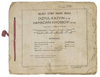
1944ABC_4794483 Rep Group. I.E." 1944. Original beige printed paper wrappers side stichted by hand through 3 holes with a reddish pink cloth ribbon. Oblong 21 x 255 cm. With 1 index map and 16 numbered folding strip maps. Exceptionally rare collection of folded strip maps of roads in Western Iran which was very likely meant for military use during the Second World War. The abbreviated inscription on the front wrapper possibly stands for "24th brigade branch transportation office" though it is unknown which 24th brigade this would have been. The maps were originally printed on quarter inch sheets in 1942 and have been significantly enlarged for this edition to a scale of 1 inch to 2 miles. We have not been able to trace any other copies of either the first or second edition of this work anywhere.With an owner's inscription on the front wrapper. The maps and back wrapper have been reinforced with bookbinder's gauze. The wrappers are somewhat soiled creased and the edges are somewhat frayed. The maps have slightly browned and the index map has a small brown stain in the lower outer corner without affecting the image. Otherwise in good condition. 83 Rep Group. I.E.", hardcover
Kupferstich von Samuel Nagy nach Mikolai Tóth Istvan. 415:780 mm. Unter Passepartout. Prachtvolle und großformatige, als Einzelblatt erschienene Gesamtansicht der Stadt Targu Mures (dt. Neumarkt am Mieresch, ungar. Marosvásárhely) in Siebenbürgen. - Bei der in den Jahren 1822-25 entstandenen Ansicht der Stadt aus der Vogelschau handelt es sich um die bis dahin genaueste topographische Aufnahme der Stadt, die bis zum Beginn des 20. Jahrhunderts unübertroffen bleiben sollte. Vorangegangen waren dem vorliegenden Blatt lediglich zwei kleinere und recht ungenaue Veduten von 1736 bzw. 1750; die früheste bei Nebehay/Wagner genannte Ansicht der Stadt datiert überhaupt erst von 1840. Die eingedruckte Legende im unteren weißen Rand benennt die wichtigsten Gebäude und Monumente, dazwischen ein Adler das Stadtwappen haltend. - Breitrandig mit umlaufendem Plattenrand und sehr sauber. Minimale Randläsuren außerhalb des Passepartoutausschnittes fachmännisch restauriert. Von größter Seltenheit. Keresztes Gyula. Marosvásárhely látképe és házsorainak képe Mikolai Tóth István rajzai alapján, Milléniumi megemlékezés, Juventus Kiadó, Marosvásárhely, 2000, SS. 230-237.
Kolorierte Umrissradierung. Unter Glas gerahmt. 630:840 mm. Prachtvolle Gesamtansicht der Stadt Wien, von der Westseite gezeichnet von Högl, gest. von Schwartz. - Ansprechendes, großformatiges Blatt im Originalkolorit der Zeit.
1775LBW-4998[1775-1781]. 333 x 484 mm.
176570765Recueil de cartes et planches en 25 feuilles de format 36 x 50 cm (mesures en marges), en 1 vol. petit in-folio cartonnage moderne (XXe siècle) demi-basane verte, Contient : Carte des diverses positions de la Sphère, des Systèmes de l'Univers, des Planettes, des Eclypses &c. en deux feuilles, [s.l.n.d.] contient notamment Sphère armillaire oblique, globe céleste, globe terreste [ Avec : ] Mappe monde Carte universelle de la Terre dressée sur les Nouvelles Observations de Messieurs de l'Académie Royale des Sciences, Chez Bourgoin Graveur, Rue de la Harpe vis-à-vis le passage des Jacobins à côté du café de Condé, Paris, 1773 [Avec : ] Carte itinéraire de la France divisée par Gouvernements Militaires et en ses Provinces Contenant les Routes Royales et Particulières, Dressée sur la Carte des Triangles levée géométriquement, Première Feuille contenant la Bretagne, la Normandie, le Maine et Perche, Chez Bourgoin 1773 [ Avec : ] Deuxième feuille contenant la Flandre Françoise, Picardie, Artois, Isle de France, Champagne, Lorraine et Alsace [ Avec : ] Troisième feuille contenant une partie de la Bretagne, l'Anjou, la Touraine, le Poitou, la Saintonge, la Marche et le Limosin [ Avec : ] Cinquième feuille contenant la Guienne, le Bearn, la Basse Navarre, le Comté de Foix et une partie du Languedoc [ Avec : ] Sixième feuille contenant le Languedoc, le Dauphiné, la Provence et le Roussillon [ Avec : ] Carte de l'Amérique Septentrionale, Chez Bourgoin, s.d. avec une note sur les découvertes de l'Amiral de Fonte jugées suspectes "Dans cette Partie on avoit mis les pretendues Decouvertes de l'Amiral de Fonte. La relation en ayant eté trouvé suspecte par plusieurs Auteurs on n'a pas cru devoir les mettre dans cette Carte, dans la Mappemonde elles sont pointées en attendant la verification" [ Avec : ] Carte de l'Amérique Méridionale, Chez Bourgoin, Paris, s.d. [ Avec : ] Carte de l'Asie Divisée en ses principaux Empires et Royaumes, Chez Bourgoin, Paris, s.d. avec cette précision : "Cette Projection supposant l'œil du Spectateur au Centre de l'Equateur représente cette Partie comme détachée d'un grand Globe et applatie, les Meridiens et les Paralleles du centre se trouvant plus resserrées et s'elargissant a mesure quils s'en éloignent, cette projection et toutes celles de cette nature ne peuvent souffrir d'Echelles, les quelles seroient fausses" [Avec : ] Carte de l'Europe Divisée en ses Grands Etats, Chez Bourgoin, Paris, s.d. [Avec : ] Cartes des Isles Britanniques, Chez Bourgoin, Paris, s.d. [Avec : ] Carte du Royaume d'Espagne et de Portugal Divisé par Provinces et Royaumes, Chez Bourgoin, Paris, s.d. [ Avec : ] Carte du Royaume de France divisé par Provinces, Chez Bourgoin, Paris, 1765 [ Avec : ] Carte des Pays Bas Divisée en Provinces Hollandoises, Autrichiennes et Françoises, Chez Bourgoin, Paris, s.d. [ Avec : ] Carte de l'Empire d'Allemagne Divisée par Cercles, Chez Bourgoin, Paris, s.d. [ Avec : ] Carte de l'Italie et des Isles adjacentes, Chez Bourgoin, Paris, s.d. [ Avec : ] Carte des XIII Cantons Suisses leurs Alliés et leurs Sujets, Chez Bourgoin, Paris, s.d. [ Avec : ] Royaume d'Hongrie Principauté de Transilvanie et Banat de Temeswar, Chez Bourgoin, Paris, s.d. [ Avec : ] Carte de l'Empire de Turquie en Europe, Chez Bourgoin, Paris, s.d. [ Avec : ] Carte du Royaume du Dannemarck, Chez Bourgoin, Paris, s.d. [ Avec : ] Carte du Royaume de Suède Norwege et Partie du Dannemarck, Chez Bourgoin, Paris, s.d. [ Avec : ] Carte de l'Empire des Russies en Europe Partie Septentrionale, Chez Bourgoin, Paris, 1765 [ Avec : ] Carte de la Judée ou Terre Sainte pour l'Intelligence de l'Histoire Sacréen Chez Bourgoin, Paris, s.d.
- TERZO STATO con l'imprint della Libreria Spithöver - Terzo stato, del celebre panorama dal Gianicolo che viene attribuito alla mano di Lugi Nisi-Cavalieri (Roma XIX sec.) e Augusto Marchetti (Forli 1813 – Roma 1871) per l'editore Tommaso Cuccioni.Scrive Barbara Jatta: "L'opera non è citata dai comuni repertori e la mancanza di iscrizioni ci induce a formulare solamente delle ipotesi attributive. È noto un esemplare della stampa (Roma, BASA) che indica come editore, e committente, Tommaso Cuccioni, attivo a via Condotti n. 18. Di lui si conosce anche un piccolo panorama della città che, perfettamente corrispondente a questo in esame, seppure di dimensioni molto ridotte, reca le indicazioni A. Marchetti inc il paesaggio L. Nisi-Cavalieri inc. il Panorama. Sembra dunque possibile, vista la corrispondenza tra i due incisori, che anche la presente sia da ricondurre ai medesimi autori. […] Il Cuccioni fu anche uno dei primi e più noti fotografi romani dell'Ottocento. […] Il panorama di Roma dal Gianicolo qui esposto ha senza dubbio una stretta relazione con gli esordi della tecnica fotografica. Eseguito ad acquaforte e bulino, esso deve la sua impostazione di base all'uso di strumenti meccanici". (cfr. Barbara Jatta in Roma Veduta, p. 230).Dunque, se l'attribuzione al Nisi-Cavalieri e al Marchetti è, sebbene plausibile, puramente congetturata, la commitenza di Tommaso Cuccioni e invece certa. Fatto che ci induce ad indicarlo, in qualità di editore, commitente e fotografo, come l'autore principale di questa veduta. Della grande vedute esiste una prova di stampa, prima di gran parte dei ritocchi a bulino, che possiamo considerare un primo stato della lastra. La stesura definitiva, con ritocco a bulino e completamento della lastra, reca l'imprint "Si trova vendibile presso l'Editore Tommaso Cuccioni, Negoziante di Stampe. Roma, Via della Croce n. 88". L'indirizzo di via della Croce 88 mette anche in dubbio la datazione assegnata da Barbara Jatta all'opera (1848 circa) che potrebbe essere quindi anche precedente. In accordo con le sue note biografiche infatti (cfr. Marina Miraglia - Dizionario Biografico degli Italiani - Volume 31, 1985) il Cuccioni viene descritto gia attivo all'indirizzo di Via Condotti 18 nel prima della morte di papa Gregorio XVI (1846). Una datazione intorno al 1840, ci sembra più compatibile con le note biografiche.La terza stesura dell'opera - che qui presentiamo - reca l'imprint della Libreria Spithöver ed è probabilmente databile a dopo il 1864, anno della scomparsa di Cuccioni.Josef Spithöver (Sendenhorst, 11 oct. 1813 - Roma, 12 genn. 1892), nato in Germania, è stato un animatore della cultura romana di metà ottocento, gestendo una libreria-casa editrice. Fu anche un pioniere della fotografia.Acquaforte e bulino, stampata su tre fogli di carta databile alla seconda metà del'800, brunitura diffusa, macchie e ossidazioni sparse, strappi nel margine bianco, per il resto in buono stato di conservazione. - THIRD STATE with the imprint of the Spithöver Bookshop - Third state, of the famous panorama from the Janiculum Hill that is attributed to the hand of Lugi Nisi-Cavalieri (Rome XIX sec.) and Augusto Marchetti (Forli 1813 - Rome 1871) for the publisher Tommaso Cuccioni.Barbara Jatta writes: "The work is not mentioned by the common repertories and the lack of inscriptions leads us to formulate only attributive hypotheses. It is known a copy of the work (Rome, BASA) that indicates as publisher, and client, Tommaso Cuccioni, active in Rome, via Condotti n. 18. We also know of him a small panorama of the city that, perfectly corresponding to this one, even if of very small dimensions, bears the indications "A. Marchetti inc. il paesaggio L. Nisi-Cavalieri inc. il Panorama". It seems therefore possible, considering the correspondence between the two engravers, that also the present one is to be traced back to the same authors. [...] Cuccioni was also one of the first and most famous Roman photographers of the nineteenth century. [...] The panorama of Rome from the Janiculum Hill exhibited here has without doubt a close relationship with the beginnings of photographic technique. Carried out with etching and burin, it owes its basic approach to the use of mechanical instruments". (cf. Barbara Jatta in Roma Veduta, p. 230).Therefore, if the attribution to Nisi-Cavalieri and Marchetti is, although plausible, purely conjectured, the commission of Tommaso Cuccioni is certain. A fact that leads us to indicate him, as publisher, commissioner and photographer, as the main author of this view. Of the great view there is a proof, before most of the burin retouches, which we can consider a first state of the plate. The final issue, with the engraving additions, bears the imprint ""Si trova vendibile presso l'Editore Tommaso Cuccioni, Negoziante di Stampe. Roma, Via della Croce n. 88". The address of via della Croce 88 also puts in doubt the dating assigned by Barbara Jatta to the work (about 1848) that could be therefore also previous. In accordance with her biographical notes in fact (see Marina Miraglia - Dizionario Biografico degli Italiani - Volume 31, 1985) Cuccioni is described already active at the address of Via Condotti 18 before the death of Pope Gregory XVI (1846). A dating around 1840, seems to us more compatible with the biographical notes.The third issue of the work - which we present here - bears the imprint of the Libreria Spithöver and can probably be dated after 1864, the year of Cuccioni's death.Josef Spithöver (Sendenhorst, 11 oct. 1813 - Rome, 12 Jan. 1892), born in Germany, was an animator of Roman culture in the mid-nineteenth century, managing a bookshop-publishing house. He was also a pioneer of photography.Etching and engraving, printed on three sheets of paper datable to the second half of the nineteenth century, widespread burnishing, scattered stains and oxidations, tears in the white margin, otherwise in good condition. Roma Veduta, p. 230, n. 72; Marigliani p. 364, n. 298.
Pianta archeologica a proiezione verticale con elevazione dei soli monumenti antichi. Disegnata ed incisa da Etienne Duperac per l’editore Antonio Lafreri. Si tratta di un’elegante rappresentazione della pianta archeologica, che mostra in alzato prospettico i monumenti principali. La morfologia segue quella della pianta del Bufalini (1551), ma per l’orografia, molto ben delineata, anche quella del Paciotto (1557) edita sempre da Lafreri. La pianta è inserita in alcuni esemplari dello Speculum Romanae Magnificentiae dell’editore francese. La lastra è descritta nel catalogo del Lafreri (n. 113), come “Roma con tutti gli edificii che hoggi si vegono in piede et che se ne può veder vestigie”. Quindi è inclusa nell’inventario di Stefano Duchetti del 1581 (n. 31) come “Roma con li monti dif.o Imperaiale” ed infine compare nel catalogo di Pietro de Nobili (inv. 1585, n. 32, come “La Roma antiqua de Stefano imperiale”, che la ristampa invariata aggiungendo il proprio excudit. Figura anche nell’atto della divisione della tipografia de Nobili del 30 maggio 1589, dove la lastra, denominata “Roma in pianta imperiale”, passa al figlio Pietro Paolo. Il primo stato della lastra era stato congetturato da Destombes sulla base dell’evidente integrazione nella data MDLXXIII, dove l’ultimo numerale è addossato alla parola seguente, suggerendo che sia stato aggiunto successivamente. Durante lo studio per questa pubblicazione abbiamo riscontrato l’esistenza di una prova della pianta con la data 1572 nella collezione della Bibliothèque Nationale de France. Oltre alla differenza nella data, la prima stesura dell’opera si distingue per la dedica allo STVDIOSO LECTORI preceduta dal termine TIPOGRAPHUS – ovvero Antonio Lafreri – che, nella ristampa del 1573, verrà sostituito dalla firma STEPHANUS DU PERAC ARCHITET. Nel lato sinistro, al centro, si legge: STEPHANUS DU PERAC ARCHITET STVDIOSO LECTORI. En tibi lector nuc prodit specimen, seu perfecta urbis antquae imago ex piscis illis monumentis scriptorum veterum, et cunctis quae ad hunc usq[ue] diem superesse videntur reliquijs, et parietibus quam acuratissime delineata: quecumque oculis nostri subiecta esse possunt exigua tabella comprehendens; opus ut immensum sanè, sic nec minus antiquitatis omnigenae studiosis apprime necessarium, his recentibus formis aencis, typis exaratum impensa Antonij lafrerij Anno MDLXXIII Hoc fruere libens et Vale. Nell’angolo inferiore destro, in un cartiglio, è incisa una legenda numerica di 89 rimandi a luoghi notabili, distribuita su tre colonne. Segue l’iscrizione: DE VESTIGITS URBIS ANTIQUAE EPIGRAMA: Quam brevis haec presens oculis sit carta requiris Urbem dum modico continet in spatio Desine mirari: vestigia maxima claudit Quae modo ROMA potens subijcit his oculis. Antiquae monstrans Urbis signacula promptè Dum numeris certis cuncta notata signat Discuta mira solers: novanu sint prima vetustis: Anue vetusta novis nunc manifesta patent. Nella tavola sono fornite ulteriori indicazioni toponomastiche. Orientazione nei quattro lati al centro con il nome dei punti cardinali: SEPTENTRIO, MERIDIES, ORIENS, OCIDENS, il nord è a sinistra.Acquaforte e bulino in ottime condizioni di conservazione. Esemplare nel secondo stato di tre, con la dedica che inizia con "STEPHANUS DU PERAC ARCHITET STVDIOSO LECTORI" (cfr. Bifolco-Ronca p. 2354).Altra Bibliografia:Alberti (2009): p. 153, n. 33; Frutaz (1962): n. XXI e tav. 36; Hülsen (1915): X, pp. 58-59, nn. 51-52; Hülsen (1921): p. 142, n. 1a-b; Hülsen (1933): p. 107, X; Lincoln (2000): p. 185; Marigliani (2016): n. XI.6; Pagani (2008): pp. 15, 374; Pagani (2011): p. 133; Rubach (2016): n. 259; Scaccia Scarafoni (1939: n. 17. Alberti (2009): p. 153, n. 33; Frutaz (1962): n. XXI e tav. 36; Hülsen (1915): X, pp. 58-59, nn. 51-52; Hülsen (1921): p. 142, n. 1a-b; Hülsen (1933): p. 107, X; Lincoln (2000): p. 185; Marigliani (2016): n. XI.6; Pagani (2008): pp. 15, 374; Pagani ... Pianta archeologica a proiezione verticale con elevazione dei soli monumenti antichi. Disegnata ed incisa da Etienne Duperac per l’editore Antonio Lafreri. Si tratta di un’elegante rappresentazione della pianta archeologica, che mostra in alzato prospettico i monumenti principali. La morfologia segue quella della pianta del Bufalini (1551), ma per l’orografia, molto ben delineata, anche quella del Paciotto (1557) edita sempre da Lafreri. La pianta è inserita in alcuni esemplari dello Speculum Romanae Magnificentiae dell’editore francese. La lastra è descritta nel catalogo del Lafreri (n. 113), come “Roma con tutti gli edificii che hoggi si vegono in piede et che se ne può veder vestigie”. Quindi è inclusa nell’inventario di Stefano Duchetti del 1581 (n. 31) come “Roma con li monti dif.o Imperaiale” ed infine compare nel catalogo di Pietro de Nobili (inv. 1585, n. 32, come “La Roma antiqua de Stefano imperiale”, che la ristampa invariata aggiungendo il proprio excudit. Figura anche nell’atto della divisione della tipografia de Nobili del 30 maggio 1589, dove la lastra, denominata “Roma in pianta imperiale”, passa al figlio Pietro Paolo. Il primo stato della lastra era stato congetturato da Destombes sulla base dell’evidente integrazione nella data MDLXXIII, dove l’ultimo numerale è addossato alla parola seguente, suggerendo che sia stato aggiunto successivamente. Durante lo studio per questa pubblicazione abbiamo riscontrato l’esistenza di una prova della pianta con la data 1572 nella collezione della Bibliothèque Nationale de France. Oltre alla differenza nella data, la prima stesura dell’opera si distingue per la dedica allo STVDIOSO LECTORI preceduta dal termine TIPOGRAPHUS – ovvero Antonio Lafreri – che, nella ristampa del 1573, verrà sostituito dalla firma STEPHANUS DU PERAC ARCHITET. Nel lato sinistro, al centro, si legge: STEPHANUS DU PERAC ARCHITET STVDIOSO LECTORI. En tibi lector nuc prodit specimen, seu perfecta urbis antquae imago ex piscis illis monumentis scriptorum veterum, et cunctis quae ad hunc usq[ue] diem superesse videntur reliquijs, et parietibus quam acuratissime delineata: quecumque oculis nostri subiecta esse possunt exigua tabella comprehendens; opus ut immensum sanè, sic nec minus antiquitatis omnigenae studiosis apprime necessarium, his recentibus formis aencis, typis exaratum impensa Antonij lafrerij Anno MDLXXIII Hoc fruere libens et Vale. Nell’angolo inferiore destro, in un cartiglio, è incisa una legenda numerica di 89 rimandi a luoghi notabili, distribuita su tre colonne. Segue l’iscrizione: DE VESTIGITS URBIS ANTIQUAE EPIGRAMA: Quam brevis haec presens oculis sit carta requiris Urbem dum modico continet in spatio Desine mirari: vestigia maxima claudit Quae modo ROMA potens subijcit his oculis. Antiquae monstrans Urbis signacula promptè Dum numeris certis cuncta notata signat Discuta mira solers: novanu sint prima vetustis: Anue vetusta novis nunc manifesta patent. Nella tavola sono fornite ulteriori indicazioni toponomastiche. Orientazione nei quattro lati al centro con il nome dei punti cardinali: SEPTENTRIO, MERIDIES, ORIENS, OCIDENS, il nord è a sinistra.Acquaforte e bulino in ottime condizioni di conservazione. Esemplare nel secondo stato di tre, con la dedica che inizia con "STEPHANUS DU PERAC ARCHITET STVDIOSO LECTORI" (cfr. Bifolco-Ronca p. 2354).LiteratureAlberti (2009): p. 153, n. 33; Frutaz (1962): n. XXI e tav. 36; Hülsen (1915): X, pp. 58-59, nn. 51-52; Hülsen (1921): p. 142, n. 1a-b; Hülsen (1933): p. 107, X; Lincoln (2000): p. 185; Marigliani (2016): n. XI.6; Pagani (2008): pp. 15, 374; Pagani (2011): p. 133; Rubach (2016): n. 259; Scaccia Scarafoni (1939: n. 17. Alberti (2009): p. 153, n. 33; Frutaz (1962): n. XXI e tav. 36; Hülsen (1915): X, pp. 58-59, nn. 51-52; Hülsen (1921): p. 142, n. 1a-b; Hülsen (1933): p. 107, X; Lincoln (2000): p. 185; Marigliani (2016): n. XI.6; Pagani (2008): pp. 15, 374; Pagani (2011): p... Bifolco Ronca (2018): tav. 1212, II/III
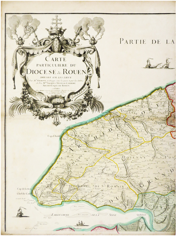
1715LBW-6529Paris, Berey, 1715. En six feuilles pouvant être jointes pour former une carte de 1,36 x 1,59 m.
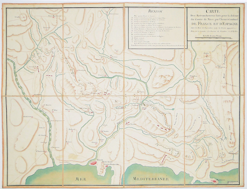
1747LBW-28191747. En 8 sections montées sur toile et pliées, formant une carte de 570 x 740 mm ; étiquette au dos avec titre manuscrit de l'époque.
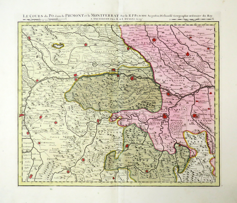
1735LBW-4481Amsterdam, R. & I. Ottens, [circa 1735]. En 5 feuilles pouvant être jointes pour former une carte de 0,42 x 2,48 m.
26 drawings (25 in pencil, 1 in red chalk) on paper, various formats (mostly folio), mounted on backing paper, some signed and dated. In contemporary paper wrappers, captioned: "Handzeichnungen von Wilhelm von Rally 38 [corrected to 35] St. Ansichten aus Nieder-Oesterreich Inv. Nr. 10133". The drawings were created during excursions made to the Wachau, Thaya, and Vienna regions, as well as to southern Lower Austria and the foothills of the Alps. They show the ruins of Johannstein near Sparbach, Starhemberg near Wiener Neustadt, St. Othmar in Mödling, three views of Molz, Kollmitz, Weißenburg, Schauenstein, Lichtenwörth, Tulln, Greifenstein, the church in Muthmannsdorf, Scharfeneck near Mannersdorf, Kaya, Hardegg, Aggstein, Pottschach, Klamm, Wald, Albrechtsberg, Gamming, as well as two views of Neuberg/Mürz (Styria). In spite of their not always convincing artistic quality, these highly detailed views constitute a valuable topographic source.
Rara carta del mondo pubblicata separatamente da Luigi Rosaccio. La carta deriva dal planisfero murale di suo padre, Giuseppe Rosaccio (1597, Bifolco-Ronca n. 31). Rodney Shirley nota che “This curiously elaborate world map is to be found in a speculative world geography by Giuseppe Rosaccio... The right-hand hemisphere is surrounded by bands denoting the climates; the left-hand one by lively windheads and celestial constellations. In the centre cusp is a dyspeptic portrait of the young Duke Cosimo II de Medici, and in the spandels are circular representations of the four elements. The lower part of the engraving consists of a neatly engraved Ptolemaic map of the world and a set of spherical diagrams showing the zones, meridians, and geographical features”. La mappa è molto rara; questo è un esempio del secondo stato, con una barba aggiunta al ritratto di Cosimo de Medici. Priva di datazione, la carta risulta stampata a Firenze, dove la famiglia Rosaccio si era trasferita dopo il periodo veneziano, il 28 novembre 1606, ottenendo il privilegio della stampa per le proprie opere - vedi Casali, Il 'Teatro "del mondo. GR (ca 1530-1620) tra Firenze e Bologna, in L'Europa divisa e i nuovi mondi. Per Adriano Prosperi, II, a cura di M. Donattini - G. Marcocci - S. Pastore, Pisa 2011, p. 56. Aloisio, Aluigio, Alovigi o probabilmente Luigi Rosaccio, figlio del cosmografo Giuseppe Rosaccio, si formò a Firenze, forse con Antonio Tempesta, alla corte dei Medici. Fin dai primi anni Novanta, Giuseppe Rosaccio si stabilì a Firenze, dove il 13 luglio 1594 entrò nella compagnia dell'"Arte dei medici e speziali" (Casali, 2011, p. 56 e n. 15 p. 62) come venditore di libri, ponendosi al servizio e sotto la protezione del Granduca dal suo 'banco' aperto sulla prestigiosa Piazza del Palazzo e dedicando alcune delle sue opere più significative a Ferdinando, Cosimo II e alla granduchessa Cristina. Sempre nella città dei Medici, il 28 novembre 1606 ottenne il privilegio di stampare per le proprie opere (Casali, 2011, pp. 56 s.). Luigi Rosaccio si cimentò nell'arte incisoria, traducendo in stampa le numerose opere del padre. Nel 1610 realizzò il ciclo di illustrazioni incluse nella descrizione delle "Esequie d'Arrigo Quarto cristianissimo re di francia e di Navarra celebrate in Firenze dal Serenissimo DON COSIMO II Gran Duca di Toscana". Descritto da Giuliano Giraldi pubblicato a Firenze da Bartolomeo Sermartelli, importante come testimonianza visiva del complesso delle decorazioni più che per le qualità stilistiche e tecniche, non particolarmente brillanti. Sempre al periodo fiorentino sono legate le tre splendide carte geografiche raffiguranti l'Italia, una grande carta che precede l'Italia Nova di Giovanni Antonio Magini, la Toscana (la cosiddetta "Carta del Cavallo"), e il Piemonte. Bibliografia Shirley, The Mapping of The World, #268. Rare separately published map of the World by Luigi Rosaccio, after the of the largest World Map of his father Giuseppe Rosaccio (1597, Bifolco-Ronca n. 31). Rodney Shirley notes: “This curiously elaborate world map is to be found in a speculative world geography by Giuseppe Rosaccio... The right-hand hemisphere is surrounded by bands denoting the climates; the left-hand one by lively windheads and celestial constellations. In the centre cusp is a dyspeptic portrait of the young Duke Cosimo II de Medici, and in the spandels are circular representations of the four elements. The lower part of the engraving consists of a neatly engraved Ptolemaic map of the world and a set of spherical diagrams showing the zones, meridians, and geographical features” The map was engraved by Giuseppe’s relative Alovisio Rosaccio and is very scarce. This is an example of the second state, with a beard added to the portrait of de Medici. Without the data, the map is printed in Florence, where the Rosaccio family was transferred after the Venetian period, on 28 November 1606, obtaining the privilege of printing for their works - see Casali, Il 'Teatro "del mondo. GR (ca 1530-1620) tra Firenze e Bologna, in L’Europa divisa e i nuovi mondi. Per Adriano Prosperi, II, a cura di M. Donattini - G. Marcocci - S. Pastore, Pisa 2011, p. 56. Aloisio, Aluigio, Alovigi or probably Luigi Rosaccio, son of the cosmographer Giuseppe Rosaccio, was trained in Florence, perhaps with Antonio Tempesta, at the Medici court. Since the early nineties, Giuseppe Rosaccio settled in Florence, where on 13 July 1594 joined the company of “Arte dei medici e speziali (Art of doctors and apothecaries)” (Casali, 2011, p. 56 and n. 15 p. 62) as a seller of books, placing himself at the service and under the protection of the Grand Duke from his 'bench' opened on the prestigious Piazza del Palazzo and dedicating some of his most significant works to Ferdinando, Cosimo II and the Grand Duchess Cristina.. Still in the city of the Medici, on 28 November 1606 he obtained the privilege of printing for his own works (Casali, 2011, pp. 56 s.). Luigi Rosaccio tried his hand at engraving art, translating his father's numerous works into a print. In 1610 he made the cycle of illustrations included in the description of the “Esequie d’Arrigo Quarto cristianissimo re di francia e di Navarra celebrate in Firenze dal Serenissimo DON COSIMO II Gran Duca di Toscana”. Described by Giuliano Giraldi published in Florence by Bartolomeo Sermartelli, important as visual testimony of the complex of the decorations rather than for the stylistic and technical qualities, not particularly brilliant. Always in the Florentine period are related to the three wonderful geographic maps depicting Italy, a great map preceding the Italia Nova of Giovanni Antonio Magini, Tuscany (the so-called “Carta del Cavallo”), and Piedmont. Bibliografia Shirley, The Mapping of The World, #268.
(Amsterdam, 1608-30. 25x56 cm. Kobberstukket søkort over Kattegat og Øresund med den svenske vestkyst fra Marstrand i nord til Falsterbo i syd, Skagen ses samt Læsø og Anholt og nordøstsjælland med Roskilde Fjord. Skibe i søen. Kompasroser og barokkartouche. Kortet er trimmet indtil stregrammen.
15161Paris Au Dépôt Général de la Marine 1822 petit in folio (38x29) 1 volume reliure cartonnée de l'époque (dos absent). Titre gravé et 91 planches gravées hors-texte, toutes sur double page, non rognées, et montées sur onglets. Rédigé par Beautemps-Beaupré, ingénieur Hydrographe en Chef de la Marine, Membre de l'Académie Royale des Sciences de l'Institut de France et de la Société Royale des Sciences de Goettingen. Bel exemplaire complet, tel que paru
17804613Gray, 8 janvier 1780. 1780 1 vol in-folio (436 x 300 mm.) de : 75 ff. numérotés en lettres dont [93] pp. manuscrites à l'encre brune, [3] pp. bl., [28] plans aquarellés tracés à l'encre rouge et noire dont 26 à pleine page et 2 sur une page; [4] ff. bl. Plein veau granité d'époque, dos lisse orné et titré sur piéce de maroquin brun, titre de maroquin rouge au centre du premier plat, double filet doré sur les coupes, tranches rouges. (Taches, salissures et défauts d'usage).
16876047<p>Das von den Türcken lang-gequälte nun durch die Christen neu-bescelte Königreich Hungarn Theodoro Tscherning; maps by Martin Stier. Published by Martin Endter Nuremberg 1687. First Edition. 16mo up to 6½" tall. 464pp. fold out dedication to the Holy Roman Emperor Leopold I dated 1687 with detailed engraving of a double-headed eagle holding a scepter and orb; 12 folding maps as called for; index 12pp. Individual maps removed and placed together form one large map. Half leather over marbled boards banded spine red edges. Browning to title page and light toning thereafter. Maps are in very good to fine condition. Partial split to leather at outer upper hinge and partial crack to inner hinge. In very good condition.</p><p>The Kingdom of Hungary long tormented by the Turks now blessed by the Christians. According to the attached XII most accurate maps clearly handled and provided with the newest most remarkable events extending up to the present time. A brief presentation and description of the Hungarian cities fortresses and castles including the neighboring lands of Austria Moravia Carinthia Carniola Styria Bosnia Dalmatia Croatia Slavonia Bulgaria Transylvania etc.</p><p>Published during a pivotal era for the Habsburgs shortly after the 1683 Battle of Vienna and the same year 1687 as the Battle of Mohács which helped solidify Habsburg control over Hungary.</p> Martin Endter hardcover
Fine Turkish, Ottoman (1500-1928) Modern light brown cloth bdg. gilt lettering on the front board. [1], 99 p., 36 numbered maps printed in black and red ink, 5 numbered folded plates. A fine copy. First and only edition of this extremely rare atlas in user guide form including the instructions and descriptions of the routes of vessels by an advisor of the British naval officer and German prince related to the British royal family, Prince Louis Alexander of Battenberg (1854-1921), who was the first Marquess of Milford Haven, commanded the Atlantic Fleet from 1908 to 1910 and became first sea lord in 1912. This book was translated by Nusret, who was a lieutenant in the Ottoman Naval Forces in its period and prepared only for use of Turkish naval officers. The plates include the maneuver plate of an officer named "Martin", who is not able to be recognized. Every map and plate depending on the current position of the ship has its own descriptive text. Özege 12270.; Not in OCLC and Library Hub.
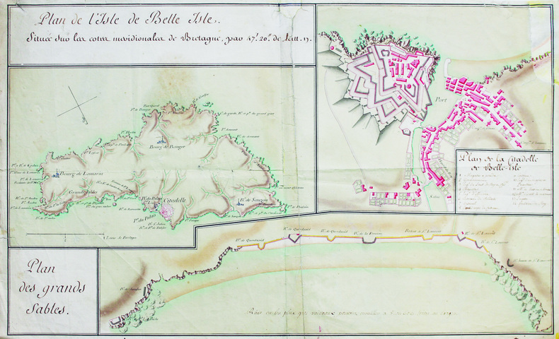
LBW-6588[Milieu du XVIIIe siècle]. 35 x 57,5 cm, sur une feuille de 37 x 60 cm.
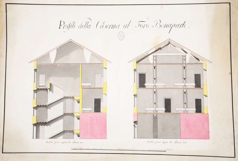
107696S.l., 450 x 650 mm., deux coupes en élévation sur une planche : coupe des escaliers d'accès et des dortoirs d'une caserne.
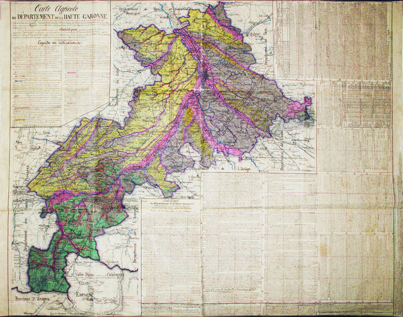
1853LBW-41661853. 950 x 1135 mm, sur papier marouflé sur toile de lin, avec un galon noir cousu en bordures haute et basse.
1700LBW-4187[circa 1700]. 480 x 660 mm.