DALRYMPLE Alexander.; FREVILLE M. de (trad.):Livre Rare Book
11 984 résultats
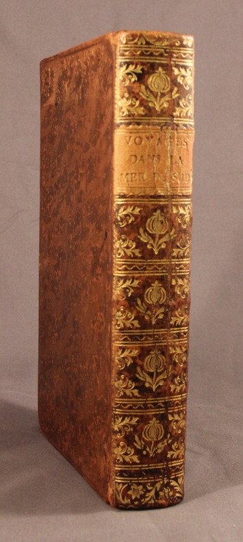
17742118A Paris, Chez Saillant & Nyon; Pissot, 1774. In-8 de [4]-XIV-[2]-502-[2] pages, plein veau brun moucheté, dos lisse orné de fleurons et motifs dorés, étiquette de titre orange, plats encadrés d’un filet à froid, tranches rouges.
17829809A Paris, chez Debure l'aîné, 1782. 7 volumes in-12 de [2]-XLVIII-442; [4]-516; 570; [4]-548; [4]-565-[3]; [4]-LX;537 et [4]VII-497-[3] pages, plein veau moucheté, dos lisses ornés de filets, fleurons, encadrements et titre dorés, étiquettes de titre bordeaux et de tomaison vertes, triple filet doré encadrant les plats, simple sur les coupes, tranches rouges. Quelques épidermures, la coiffe sup. manque au second volume et souffre d'un petit manque au premier, rares rousseurs, 2 cahiers très légèrement déboîtés au volume 3, accroc au mors inférieur du vol. 7.
170813757Hagae Comitum [La Haye], Apud Petrum van Thol, 1708. 2 volumes in-8 de [68]-103-[5]-378; [2]-379 à 855-[167] pages, plein maroquin citron, dos lisse orné de filets et roulette dorée, pièces de titre, de tomaison (et de cote au premier volume) bordeaux, double filets dorés sur les plats, simple sur les coupes, tranches dorées, roulette int. Tampon avec un L couronné répété au début du texte de chaque volume. Coiffes supérieures frottées.
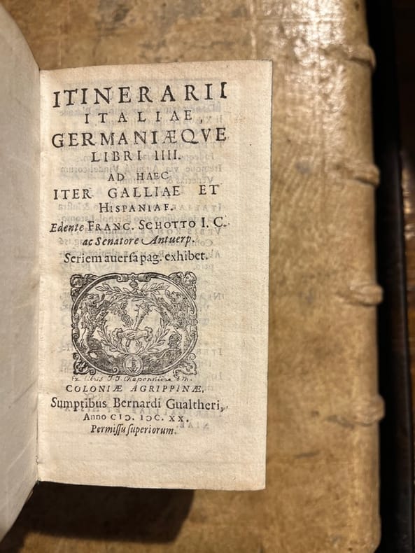
16533Coloniae Agrippinae [et] Coloniae, sumptibus Bernardi Gualtheri [et] Theodoricum Baumium, 1620 - 1569. Trois tomes en un volume in-12 de [30]-456 (chiffrée 454)-[10] ; 161-[3] ; 216 pages, plein vélin à recouvrement, titres inscrit à la plume au dos.
169442217Amsterdam, Gerardi Valk et Petri Schenk, n.d. (around 1694). 46,5 x 52 cm. Engraved map China in orig. handcolouring. Showing all the Chinese provinces, Korea and the island of Formosa in the south. Ships in the sea and cartouche with Chinese costumes. A small rupture in a border due to etching from the colour used (no loss). Left margin with a small tear, no loss. Right, very broad, margin with a tear, not reaching the image.
178325416Paris, chez le Sr Desnos, (ca 1783). 46,5x64,5 cm. Engraved map of Africa with the Mediterranean Sea at north. Contemporary handcoloured. Cartouche uncoloured. A few tears showing in right grade-scale, no loss.
Amsterdam, Gerardi Valk et Petri Schenk, n.d. (around 1694). 46,5 x 52 cm. Engraved map China in orig. handcolouring. Showing all the Chinese provinces, Korea and the island of Formosa in the south. Ships in the sea and cartouche with Chinese costumes. A small rupture in a border due to etching from the colour used (no loss). Left margin with a small tear, no loss. Right, very broad, margin with a tear, not reaching the image.
Paris, chez le Sr Desnos, (ca 1783). 46,5x64,5 cm. Engraved map of Africa with the Mediterranean Sea at north. Contemporary handcoloured. Cartouche uncoloured. A few tears showing in right grade-scale, no loss.
Sorprendente veduta a volo d'uccello di Roma con cartiglio decorativo con titolo, che mostra la città com'era nel 1550. Sono incluse varie strutture superstiti dell'antica Roma: le mura circostanti, il Pantheon, il Colosseo, l'Arco di Costantino e il Foro Romano. Nell'angolo sinistro in primo piano si possono vedere il Palazzo Papale e l'Obelisco dal circo di Caligola e Nerone. In basso due figure in primo piano e due ampie tabelle con la legenda."E' una copia ridotta della pianta del Camocio (o della precedente di Leon Pitor come sostiene Scaccia Scarafoni) nella quale la città è ritratta a volo d'uccello dal Gianicolo" (cfr. Marigliani p. 152). L’opera è inserita nel Civitates Orbis Terrarum, il primo atlante devoto esclusivamente alle piante e vedute delle principali città del mondo. Il primo volume delle Civitates Orbis Terrarum fu pubblicato a Colonia nel 1572. Il sesto e ultimo volume apparve nel 1617. Questo grande atlante di città – cartografia urbana - curato da Georg Braun e inciso in gran parte da Franz Hogenberg, conteneva 546 prospettive, vedute a volo d'uccello e vedute cartografiche di città di tutto il mondo. Franz Hogenberg realizzò le tavole dei primi quattro volumi e Simon van den Neuwel (Novellanus, attivo dal 1580) quelle dei volumi V e VI. Georg Braun (1541-1622), un ecclesiastico di Colonia, fu il principale redattore dell'opera e fu molto aiutato nel suo progetto dalla vicinanza e dal continuo interesse di Abraham Ortelius, il cui Theatrum Orbis Terrarum del 1570 fu, come raccolta sistematica e completa di mappe di stile uniforme, il primo vero atlante. Le Civitates, in effetti, erano destinate ad accompagnare il Theatrum, come indicato dalla somiglianza dei titoli e dai riferimenti contemporanei sulla natura complementare delle due opere. Tuttavia, le Civitates erano progettate per avere un approccio più popolare, senza dubbio perché la novità di una raccolta di piante e vedute di città rappresentava un'impresa commerciale più rischiosa di un atlante mondiale, per il quale c'erano stati diversi precedenti di successo. Franz Hogenberg (1535-1590) era figlio di un incisore di Monaco che si era stabilito a Malines. Incise la maggior parte delle tavole del Theatrum di Ortelius e la maggior parte di quelle delle Civitates, e potrebbe essere anche indicato come il responsabile dell'origine del progetto. Oltre un centinaio di artisti e cartografi diversi, il più importante dei quali fu l'artista di Anversa Georg Hoefnagel (1542-1600), fornirono i disegni per le tavole delle Civitates. Hoefnagel non solo contribuì alla maggior parte del materiale originale per le città spagnole e italiane, ma rielaborò e modificò anche quello di altri collaboratori. Dopo la morte di Hoefnagel, il figlio Jakob continuò il lavoro per le Civitates. Gli autori della raccolta si proponevano di raffigurare "non icones et typi urbium", cioè non immagini generiche e tipizzate, "sed urbes ipsae admirabili caelaturae artificio, spectantium oculis subiectae appareant": non intendeva alludere o idealizzare, ma rappresentare fedelmente sulla carta, riprodurre esattamente, e in tempo reale, ciò che l'occhio vede, come annunciato nella prefazione al primo volume delle Civitates Orbis Terrarum. Incisione in rame, finemente colorata a mano, lieve gora d'acqua nel margine inferiore destro, piega di carta centrale, per il resto in ottimo stato di conservazione.BibliografiaA. P. Frutaz, "Le piante di Roma", tav. 123; C. Marigliani, "Le Piante di Roma delle collezioni private", n. 52; M. Gori Sassoli (a cura di), "Roma Veduta" n. 12; Scaccia Scarafoni, "Le Piante di Roma", n. 156. Striking bird's-eye plan of Rome with decorative title cartouche, showing the city as it was c. 1550. Included are various surviving features of ancient Rome: the surrounding walls, the Pantheon, the Coliseum, the Arch of Constantine, and the Forum Romanum. In the left corner in the foreground can be seen the Papal Palace and the Obelisk from the circus of Caligula and Nero. With two figures in the foreground, and two extensive tables of explanations."E' una copia ridotta della pianta del Camocio (o della precedente di Leon Pitor come sostiene Scaccia Scarafoni) nella quale la città è ritratta a volo d'uccello dal Gianicolo" (cfr. Marigliani p. 152). The work is included in the Civitates Orbis Terrarum, the first atlas devoted exclusively to plans and views of the world's major cities. Printed in six volumes between 1572 and 1617 it was so successful and widespread that several editions translated into Latin, German and French were printed. The first volume of the Civitates Orbis Terrarum was published in Cologne in 1572. The sixth and the final volume appeared in 1617. This great city atlas, edited by Georg Braun and largely engraved by Franz Hogenberg, eventually contained 546 prospects, bird-eye views and map views of cities from all over the world. Fransz Hogenberg produced the plates for the first four books, and Simon van den Neuwel (Novellanus, active since 1580) those for volumes V and VI. Georg Braun (1541-1622), a cleric of Cologne, was the principal editor of the work, and was greatly assisted in his project by the close, and continued interest of Abraham Ortelius, whose Theatrum Orbis Terrarum of 1570 was, as a systematic and comprehensive collection of maps of uniform style, the first true atlas. The Civitates, indeed, was intended as a companion for the Theatrum, as indicated by the similarity in the titles and by contemporary references regarding the complementary nature of two works. Nevertheless, the Civitates was designs to be more popular in approach, no doubt because the novelty of a collection of city plans and views represented a more hazardous commercial undertaking than a world atlas, for which there had been a number of successful precedents. Franz Hogenberg (1535-1590) was the son of a Munich engraves who settled in Malines. He engraved most of the plates for Ortelius's Theatrum and the majority of those in the Civitates, and may have been responsible for originating the project. Over a hundred of different artists and cartographers, the most significant of whom was Antwerp artist Georg Hoefnagel (1542-1600), engraved the cooper-plates of the Civitates from drawings. He not only contributed most of the original material for the Spanish and Italian towns but also reworked and modified those of other contributors. After Hoefnagel's death his son Jakob continued the work for the Civitates. The author set out to depict "non icones et typi urbium," that is, not generic and typified images, "sed urbes ipsae admirabili caelaturae artificio, spectantium oculis subiectae appareant": not intended to allude or idealize but to represent faithfully on paper, to reproduce exactly, and in real time, what the eye sees, as announced in the preface to the first volume of Civitates Orbis Terrarum. Etching on copperplate with original hand colour, a light waterstain in the lower right corner, otherwise in good conditions.BibliografiaA. P. Frutaz, "Le piante di Roma", tav. 123; C. Marigliani, "Le Piante di Roma delle collezioni private", n. 52; M. Gori Sassoli (a cura di), "Roma Veduta" n. 12; Scaccia Scarafoni, "Le Piante di Roma", n. 156.
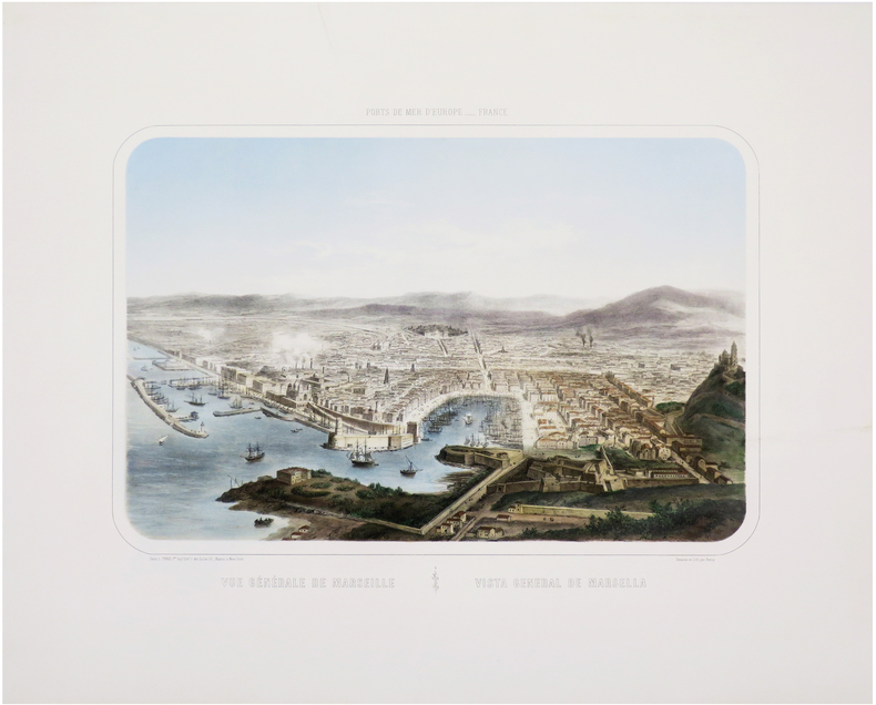
1870LBW-7618Paris et New-York, L. Turgis J.ne, [vers 1870]. 375 x 497 mm.
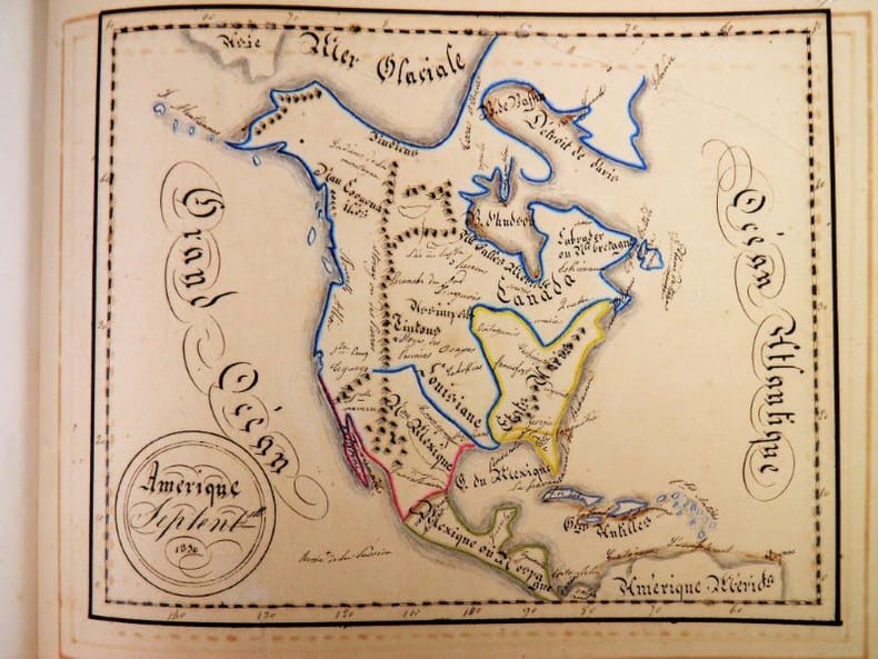
2322Sans lieu, sans éditeur, pièce unique, 1830. In-4 oblong – 33,5 x 24 cm. Reliure de l’époque en demi-maroquin rouge à grain long avec coins sertis d’un filet doré, dos à 5 faux-nerfs orné de doubles filets, dentelle et petits fers dorés, supra-libris doré au premier plat, toutes tranches dorées. 29 ff. Bel atlas entièrement manuscrit composé en 1830 par une jeune fille dénommée Angélique Fillon.Il renferme un titre calligraphié et 14 cartes détaillées et rehaussées en couleurs : Europe, Suède et Norvège, Iles britanniques, France, Allemagne, Pologne, Espagne, Italie, Asie, Turquie d'Asie, Chine, Afrique, Amérique du Nord et Amérique du Sud. Un feuillet de texte donne parfois des informations sur le pays ou le continent représenté.
1795PHO-1771Paris, Déterville, De l’Imprimerie de H. L. Perronneau, s.d. [1795] & Jansen et Compagnie, L’An IVe de la République, une et indivisible. Ensemble 2 ouvrages en 3 volumes in-4, reliure moderne jaune pour les 2 voyages, ex-libris en page de garde, cachets, quelques rousseurs.
Incisione in rame, montata su tela coeva e divisa in 32 stacchi. Riporta in basso la nota “Publicata spese di Venanzio Monaldini Libraio e Cartolaro in Piaz.ª di Spagna Nº19 an.º 1824”. Molto ben conservata. La mappa raffigura la città entro la cinta delle mura, come incisa su una lastra di pietra. Sui lati la pianta è arricchita da sono16 piccole vedute raffiguranti alcuni tra i maggiori monumenti: Basilica di S. Pietro; Basilica di S.M. Maggiore; Pantheon di Agrippa; Foro romano; Basilica di S. Giovanni in Laterano; Basilica di S. Paolo; Campidoglio; Anfiteatro Flavio; Piramide di C. Cestio; Foro Trajano; Monte Cavallo. Ai lati della pianta vi è poi un lungo elenco di toponimi.Prima edizione della più nota e migliore pianta di Pietro Ruga, pubblicata da Venanzio Monaldini. La città è raffigurata come se fosse incisa su una grande lastra di pietra affissa a parete mediante grappe metalliche, riprendendo in questo un'invenzione del Piranesi (la pianta inserita nell'opera Le Antichità Romane del 1756). Piazza del Popolo è rappresentata con i due emicicli appena completati (1823). Secondo Scaccia Scarafoni la pianta ha una scla di 1:7000. First edition of the "marble map" of Rome by Pietro Ruga.Copper engraving, mounted on coeval canvas and divided into 32 pieces.Below is the note ublicata spese di Venanzio Monaldini Libraio e Cartolaro in Piaz.ª di Spagna Nº19 an.º 1824".Very well preserved. The map depicts the city within the walls, as carved on a stone. On the sides the plant is enriched by 16 small views representing some of the major monuments: Basilica di S. Pietro; Basilica di S.M. Maggiore; Pantheon di Agrippa; Foro romano; Basilica di S. Giovanni in Laterano; Basilica di S. Paolo; Campidoglio; Anfiteatro Flavio; Piramide di C. Cestio; Foro Trajano; Monte Cavallo. On the sides of the plant there is also a long list of toponyms. Marigliani, Le Piante di Roma nelle collezioni private, p. 319, n. 249; Frutaz 188, Scaccia Scarafoni n. 264.
GOR006174352Paperback. Very Good. paperback
GOR008482209Paperback. Very Good. paperback
171932306London, Printed for T. Bowles & John Bowles, (ca. 1719). 67,8 x 97,5 cm. Senex's generalkort over Danmark i overstørrelse er sammensat af to plader. Kobbertukket og i samtidig konturkolorering. Det er tæt beskåret in til gradskalaen og har enkelte smårifter og brunpletter i disse marginer.
158430762(Antwerpen, between 1584 a. 1612). 35x51 cm. Engraved map of France in fine contemporary handcolouring. Framed so that verso is shown. Latin text on verso ""Gallia"" with the initial Q handcoloured.
London, Printed for T. Bowles & John Bowles, (ca. 1719). 67,8 x 97,5 cm. Senex's generalkort over Danmark i overstørrelse er sammensat af to plader. Kobbertukket og i samtidig konturkolorering. Det er tæt beskåret in til gradskalaen og har enkelte smårifter og brunpletter i disse marginer.
(Antwerpen, between 1584 a. 1612). 35x51 cm. Engraved map of France in fine contemporary handcolouring. Framed so that verso is shown. Latin text on verso ""Gallia"" with the initial Q handcoloured.
Paris, Barrois L'Ainé,1817. 4to. Textvol. in contemp. hcalf with richly gilt spine. A paperlabel pasted on lower part of spine. Atlas-vol. in modest clothbacked boards. Lower part of spine with tears and taped. Stamp on titlepages. IV,358,(1) pp. Atlas: (4) pp. and with 14 mostly large and folded engraved maps.
Kjöbenhavn, Chr. Steen & Søn, (1849-61). Titelbladet uden år. Stor folio. Samt. hldrbd. Forperm med orig. bogtrykt omslag påsat. Udvendig noget slidt og med brugsspor. Litograferet titelblad med trykt indholdsfortegnelse over atlassets 20 dobbeltsidede foliokort, alle litograferede og håndkoloreret (hvert målende ca 52x64 cm). Her og der med lidt brunpletter, særligt marginer, men indvendigt iøvrigt i god stand. Kortene er litograferede hos Emil Bærentzen & Co. Lith. Institut og alle daterede mellem 1849 og 1861, opsat på false.
175842093Paris, Imprimerie royale, 1758. In-12 de XLVIII-138 pp. [FALLE (Philip) ; LE ROUGE (Georges-Louis)]. Histoire détaillée des Isles de Jersey et Guernesey, traduite de l'anglois. Paris, Veuve Delaguette, Duchesne, 1757. In-12 de (2)-IV-(2)-181-(3) pp., 2 cartes repliées.2 pièces reliées en 1 vol. in-12, veau granité dos orné à nerfs, pièce de titre en maroquin rouge, tranches rouges, table manuscrite à l'encre du temps sur la garde supérieure (reliure de l'époque).
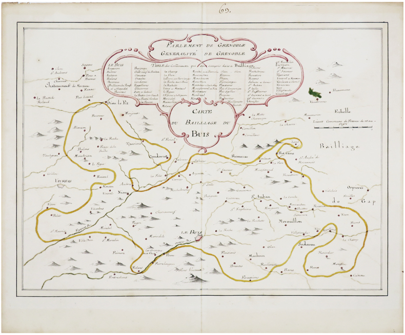
LBW-7469[fin du XVIIIe siècle]. 36 x 47,5 cm.
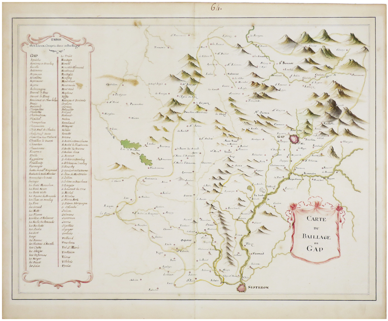
LBW-7470[fin du XVIIIe siècle]. 38 x 49 cm.
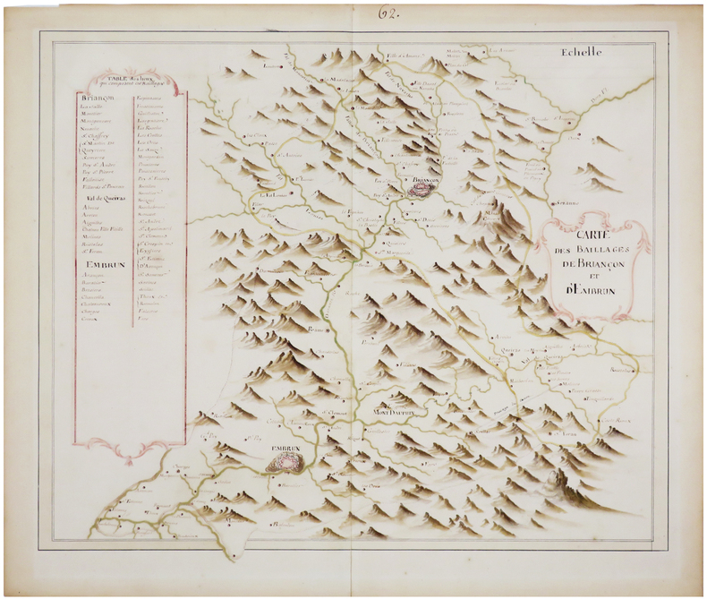
LBW-7471[fin du XVIIIe siècle]. 37 x 45,5 cm.