[INAGAKI, RIKICHI]. 稲垣利吉.Biblio.com
11 983 résultats
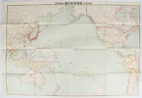
169329東京. Tokyo.: 九段書房.Kudan shobo. 大正十四 1925. Coloured folding Japanese map showing the military strength of Japan the United States and the United Kingdom in the Pacific original pictorial envelope scale not given. Some small holes at folds occasional light foxing a prior owner's signature on reverse minor wear envelope. Very good copy in like envelope. Map measures 54.4 x 78.8cm. The explanatory text in Japanese printed on the reverse in blue summarises the colonial possessions of the US and the UK as well as providing a comparison between the land size naval presence natural resources immigration issues and maritime transport capacities of Japan the United States and the United Kingdom. Legend indicates national regional provincial territorial boundaries canals undersea cables airline routes metropolitans capital cities mining fields hot springs ancient battle fields major trade ports Japanese embassies and consular offices. A large area marked 日本委任统治 "South Pacific Mandate" highlighted in a box is adjacent to Australian occupied Papua New Guinea. . 九段書房.[Kudan shobo]. unknown
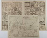
1904216797大阪. Osaka.: 大阪毎日新聞社. Ōsaka Mainichi Shinbunsha. Meiji 37 1904. Two black and white newspaper maps issued in the Ōsaka Mainichi Shinbunsha one pictorial with accompanying text and adverts printed on newsprint folded. 39.5 x 55cm Very good condition. This pictorial map of Port Arthur and Dalian was published on 4 July 1904 by the Osaka Mainichi Shinbun as a supplement. It shows Port Arthur encircled by Japanese naval vessels while Dalian is depicted as being occupied by Japanese troops. On the reverse there is an essay on the war accompanied by illustrations of Russian generals and a list of wounded soldiers who had been transported to the rear.<br><br>A second map detailing developments in the Russo-Japanese War was published by the same newspaper just days later on 8 August 1904. This map provides the dates of various battles along with a chronology of the movements of the Russian Vladivostok fleet and Japanese attacks on Port Arthur. These two maps are rare examples of the kind of information made available to the general public on a day-to-day basis during the war. . 大阪毎日新聞社. [Ōsaka Mainichi Shinbunsha]. unknown
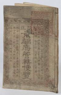
1873216097京都. Kyoto.: 村上勘兵衛. Murakami Kanbei. Meiji 5 1873. Black and white woodblock maps and city plan 22 x 15.3cm 17 double-folded leaves 4 hole string binding. Covers worn and soiled chop on upper cover. This guide to Kyoto and its surroundings includes two double-page and twelve single-page pictorial maps published around Meiji 5 1873. Each map highlights geographical features place names and major buildings such as Buddhist temples within Kyoto and its surrounding areas. The latter section covers three counties of the Tanba region offering a detailed look at the area beyond Kyoto itself. . 村上勘兵衛. [Murakami Kanbei]. unknown
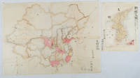
1902220266Japan. No date. Circa1902. Two very attractive colour folded manuscript maps one showing China and the other Korea. <br> <br>Map of China: Watercolour map 48 x 63.5cm. Closed tear now professionally repaired. <br> <br>Map of Korea: Finely detailed watercolour map a few tiny holes very neatly repaired on the verso with archival washi. 33 x 24.5cm Two delicate hand-painted maps one of China and one of Korea produced by a Japanese student cartographer named Koike Tokushige 小池徳重. <br> <br>The undated map of China appears to have been produced in the first five years of the twentieth century: a time when Japan had recently colonized Taiwan and when Japanese economic and political interest in the region was rapidly expanding. The inscription on the map suggests that it was a third year college project. But the high level of detail suggests that the artist had considerable experience of map making. The map of China shows the main provinces rivers major transport routes the Great Wall and the location of key cities although the names of the cities are not included. It also shows outlines of the Korean Peninsula Taiwan and the Japanese island of Kyushu but not the rest of Japan. <br> <br>The map of Korea is more detailed. It provides an accurate outline of the Korean Peninsula with careful hatching indicating changes in elevation. Rivers and major road routes are shown on the map and the locations of major towns are marked though only Busan and Incheon are named. Dotted lines show coastal sea routes and routes between Kyushu and Busan and between Incheon and China. The map shows the Gyeongin railway line between Seoul and Incheon which was completed in 1899 and route of the Gyeongbu railway line between Busan and Seoul whose construction started from both ends in 1901. But the map depicts only small sections of this line close to Seoul and Busan as being completed with the rest more lightly outlined to show the projected route implying that the map was drawn around 1901-1902 and certainly before the Gyongbu line was opened in 1904. <br> <br>Inserted text gives the land area and population of Korea. Rather strangely though the figure given for the Korean population is vastly underestimated. Ikeda gives this as 5.7 million when in fact at that time is was around 18 million. . unknown
2008169215北京.Beijing.: 星球地图出版社.Xing qiu di tu chu ban she. May2008. Two large coloured maps printed on double sided on a single sheet folded issued shortly after the devastating 2008 Wenchuan Earthquake which was occurred on 12 May 2008. Small tears along folds mended by both non-acidic tape and cello tape some creasing generally good. Text in Chinese. Sheet measures 84.9 x 119.7cm. <br> <br>Map of Sichuan Province: scale 1: 1100000 inset map lower right corner showing the provincial capital city Chengdu a statistical chart lower section listing counties within Sichuan Province their population and territory size. <br> <br>Map of Wenchuan County and Its Vicinity: 1: 300000 various colour representing altitude differences inset map showing the position Wenchuan County within Sichuan Province a mileage chart listing the distance between Wenchuan County to nearby cities. A brief introduction of Wenchuan on left section accompanying the images of the rescue forces. The Great Wenchuan Earthquake was the biggest earthquake in Chinese history with a casualty over 69000 people. . 星球地图出版社.[Xing qiu di tu chu ban she]. unknown
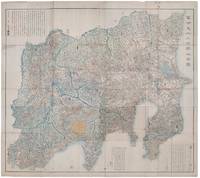
1418159850Shūseidō 衆星堂. Reprint. Tenpō 14 1843. Large folding handcoloured map of the thirteen provinces from which Mt. Fuji can be viewed. 159 x 178cm. Folds into paper covered card covers measuring 40 x 24cm. Title label upper cover. A little browning along folds occasional spotting and soiling. A little worming causing approximately 1cm of loss in places. Two chops in lower section. A very striking and attractive map. This very large handsome map is a detailed map of the thirteen provinces from which one can see Mt. Fuji. Provinces shown are the eight provinces of the Kantō region Sagami 相模 Musashi 武蔵 Kazusa 上総 Shimofusa 下総 Awa 安房 Kōzuke 上野 Shimotsuke 下野 and Hitachi 常陸 and five other provinces Izu 伊豆 Suruga 駿河 Tōtōmi 遠江 Kai 甲斐 and Shinano 信濃. The map offers a large amount of detailed information such as province and county borders rivers high ways post towns checkpoints villages and scenic spots. <br> <br>The cartographer Akiyama Einen or Nagatoshi 秋山永年 came from Edo and the editor Funakoshi Seizō 船越清蔵 studio name: Shugu 守愚 1805-62 a Confucian scholar from Nagato Province now the western half of present-day Yamaguchi Prefecture. A dedication by Funahashi Akira 舟橋徴 is dated 1843. . Shūseidō 衆星堂 unknown
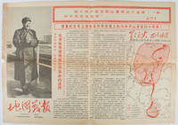
1967169746Beijing.: 地图戰報.Di tu zhan bao. September1967. Maps printed in red and black single sheet printed on both sides folded scale not given photographic image of Mao Zedong. Some light browning at edges with tears and losses on left edge still good. Text in Chinese. Sheet measures 26.5 x 38.4cm. Includes a map of Autumn Harvest Uprising and also shows the routes of the military advancing towards Jinggangshan between September and October 1927. On reverse left section a map shows the route along which Chairman Mao led the Fourth Army of the Chinese Red Army marching towards south of Anhui and Jiangxi Provinces in 1929. On reverse right section a map titled "The Long March of The Chinese Workers' and Peasants' Red Army October 1934-October 1935". Quotations of Chairman Mao about the Long March insert on corners of the map. <br> <br>Issue no. 6 of a series of maps with text issued by the Red Guards organisations in the form of Cultural Revolution tabloid-sized newspaper. This issue is designed to celebrate the 40th anniversary of the Autumn Harvest Uprising which was one of the earliest armed uprisings organised by the Chinese Communist Party. . 地图戰報.[Di tu zhan bao]. unknown
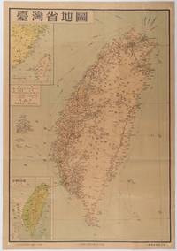
1954215869地圖出版社. Reprint. 1954. Colour folding map of Taiwan showing all major cities towns and villages railways highways roads rivers and sea routes. Topographical inset map at lower left Taiwan Straits with mainland coast inset map at top left. Each map has its own scale. Text in traditional Chinese characters. Washi repairs along some folds on reverse pin marks at corners evenly browned and a little faded. A nice map of Taiwan in fair condition. 77 x 53.8cm. . 地圖出版社. unknown
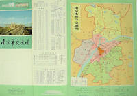
1977137003No place of publication.: 江苏人民出版社.Jiangsu ren min chu ban she. 1st Edition 2nd Printing. 1977. Colour Chinese transportation map featuring the city of Nanjing capital city of Jiangsu Province and its surrounding regions. Upper side: A transpiration map of Nanjing and neighbouring counties right section with a list of names of stations buses trains coaches ferries and their addresses lower right edge tourist guide including the addresses and phone numbers of major travel agents hospitals cinemas and more left section accompanied by two tables of bus routes. On reverse: a "Map of Nanjing Municipal Transpiration Map" scale not given a chart of terminus for bus and trolley bus lower right section. Some soiling on reverse stamp of a prior dealer in Guangzhou a handwritten date of "September 17th 1977" upper side light creases good copy. Text in Chinese. Sheet measures 37.8 x 52.3cm. . 江苏人民出版社.[Jiangsu ren min chu ban she]. unknown
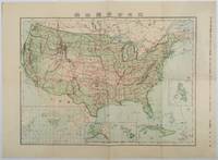
1911179415Tokyo.: 楠山正雄. Kusuyama Masao. Meiji 44 1911. Colour folding map 40 x 55cm inset maps showing the Philippines Alaska and Hawaii very good copy. This map was a supplement of October 1911 issue of a monthly magazine Shin Nippon 新日本 which was published between 1911 and 1918. The main map covers the contiguous United States with inset maps of the world showing the American territories of Alaska Hawaii and the Philippines. Curiously Cuba has been marked as an American territory having been directly occupied from 1906 to 1909 though at the time still beholden to the 1903 Cuban-American Treaty of Relations. . 楠山正雄. [Kusuyama Masao]. unknown
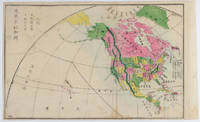
1877159812Kyoto.: 村上勘兵衛 文部省刊行. Murakami Kanbē; Monbushō kankō. Meiji 10 1877. Colour woodblock map of North and Central America. From the Journal of World Geography 萬國地誌略 published in 1877. Printed area measures 33.5 x 21cm a good copy with occasional soiling. . 村上勘兵衛, 文部省刊行. [Murakami Kanbē; Monbushō kanko& unknown
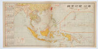
1572160545No place of publication.: 朝日新聞社. The Asahi Shimbun. 昭和十五1940. Published by 朝日新聞社 The Asahi Shimbun Japanese folding coloured WWII map with a calendar from January to June Shōwa 15 at the left scale 1:300000. Map includes French Indochina Dutch East Indies and parts of the territory of Papua China and British India. Some light browning and foxing otherwise very good. Text in Japanese. 25.3 x 51cm. Legend at lower left lists the boundaries between continents countries and provincials or regions railways airline routes capitals and Japanese embassies and consulates. <br> <br>The natural resources are indicated across the map. The map also shows parts of the territory of Papua under Australia's administration " 濠洲委任統治領 Gōshū inin tōchiryō". . 朝日新聞社. [The Asahi Shimbun]. unknown
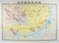
1978171343北京. Beijing.: 地图出版社.Di tu chu ban she. 1978. Large Chinese map in colour showing southern part of China and northern Vietnam folded in original envelope scale 1: 150000 inset map upper left corner scale 1:800000. Both maps show the battles between Qing court and French army between 23 Aug 1884 and 25 Mar 1885. Original paper envelope repaired with acidic free tape map in very good condition. Text in Chinese. Sheet measures 76.8 x 107.1cm. . 地图出版社.[Di tu chu ban she]. unknown
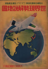
1937208633大阪朝日新聞社. Osaka Asahi Shinbunsha. Showa 12 1937. 10 colour maps not including insets or sketch maps in text on 12 pages. Handsome world map features as the centre fold colour pictorial paper wrappers. A little light soiling and horizontal crease wrappers. An attractive atlas. 38 x 26.7cm. A large format atlas with six pages of coloured maps showing the nations of the world and five pages of Japanese text. The publication seems to have been produced to celebrate the 1937 world record flight from Tokyo to London by Iinuma Masaaki and Tsugayoshi Kenji in their plane 'Kamikaze' which was sponsored by the Asahi Newspaper. The front cover depicts the plane soaring over a map of the world while the back cover also had a colour image of the 'Kamikaze' with an advertisement for the Oji Paper Company which we are told donated a hundred million yen to support the flight. The name 'Kamikaze" had at that stage not yet taken on the connotations which it acquired during the Pacific War. <br> <br>The maps inside the volume show political boundaries major cities and transport routes. The opening pages show the Japanese Empire including Japan proper Korea Karufuto and Manchukuo with small insets covering Taiwan the Chishima Archipelago and Japan's South Sea mandate. The accompanying text focuses on Japan's newly acquired client state of Manchukuo detailing its area population principle products etc while the map includes graphs illustrating Japan's trade with the world and with Manchukuo. China receives an entry of its own with a map of the Chinese Republic and information on the political situation population trade and infrastructure. The central pages of the volume are taken up with a double-spread map of the world including depictions of the flags of a selection of the world's nations. Other sections of the work cover Asia Europe America Africa and Oceania grouped together. The discussion of Oceania includes a section on Hawaii and some small and improbable depictions of Maori and Indigenous Australians. . 大阪朝日新聞社. [Osaka Asahi Shinbunsha]. unknown
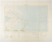
1519173266Tokyo.: 大日本帝國陸地測量部. Dainihon Teikoku Rikuchi Sokuryōbu. Taisho 15. 1926. Folding colour Japanese map of Shanghai and coastal areas of Jiangsu and Zhejiang Provinces. Scale 1:100000 embossed stamp lower right corner. Legend lower edge showing different landforms on the left section forests deserts wildlands plateaus rivers and lakes middle section showing various facilities such as post offices telecommunication offices temples ancestral halls ancient battle ground mines military fortifications submarine communications cables city walls and gates etc. right section showing different sizes of cities towns and villages and administrative boundaries. <br> <br>Occasional foxing along edges and folds ink annotation in Kanji on reverse good copy. Text in Japanese. Sheet measures 45.2 x 57.7cm. This very detailed map was originally surveyed by the Land Survey Department Empire of Japan in Taisho 7 1918. This revised edition features the railway line connecting Hangzhou - Jiashan - Shanghai - Suzhou - Wuxi. . 大日本帝國陸地測量部. [Dainihon Teikoku Rikuchi Sokuryōbu]. unknown
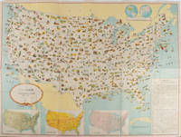
1955172003Washington D.C.: 国務省. Kokumishō. No date. circa1955. Large folding Japanese coloured map of the United States with 3 inset maps at foot of map showing main railways air and highway routes and hemispheres at the top right. Some browning mainly visible on reverse still a good copy. 66 x 81cm. An intricate and detailed pictorial map of the United States published in Japanese by the US State Department. The same type of map had been published since 1945 in English and subsequently in other languages. The Japanese language map is hard to find. The map is undated but was probably produced in the 1950's. The images include depictions of women board riders in two piece swimsuits of the sort popular in the 1950s but the inset text lists Alaska and Hawaii as external territories of the US indicating that the map was produced before they attained statehood in 1959. <br> <br>An inset panel provides information on the area and population of the US the population of major American cities mineral and other resources climate and topography. A note at the bottom right hand corner of the map states that copies of the map can be obtained free of charge from your nearest US Information Office. <br> <br>Every region of the country is decorated with an illustration of the natural resources industries or cultural or historical resources associated with that particular place. These include images of early colonial settlers the birthplaces of Mark Twain and Woodrow Wilson Booker T. Washington's house and Abraham Lincoln's grave; images of major dams oil fields coal mines cotton plantations etc. various animals and crops and images of ships cars and public buildings including the Statue of Liberty located rather oddly far out at sea. . 国務省. [Kokumishō]. unknown
18658064DBBerlin, Druck und Verlag von F. G. Mittler und Sohn, 1865. 8°. 22 cm. 54 Seiten. Einfacher Halblederband der Zeit.
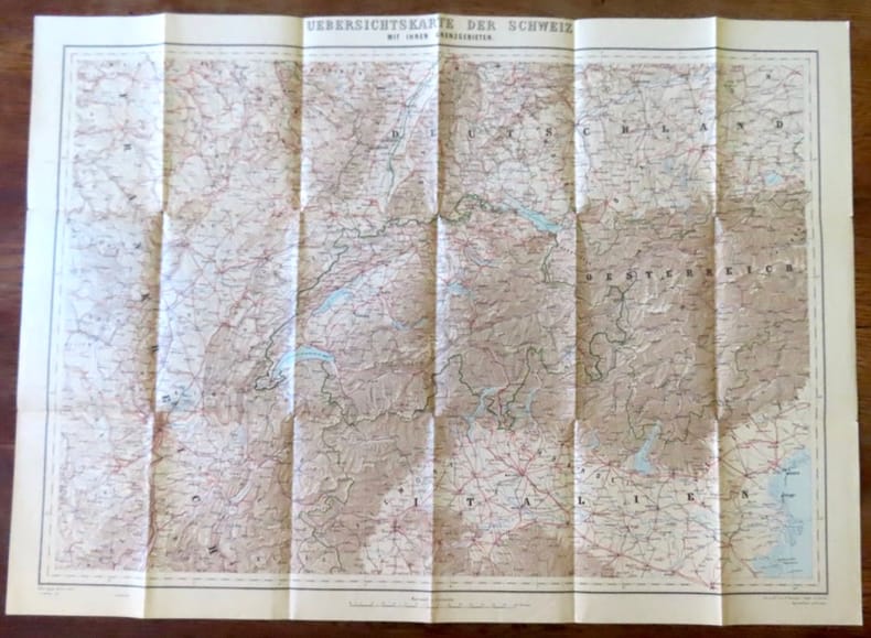
191718661Berne, Schweiz. Landestopographie / Service topographique fédéral, 1917. Carte au 1: 100.000, au format ouvert de 77 x 55 cm.
195088200Hamburg, Atlantik-Verlag, 1950]. Mehrfach gefalt. farbiger Plan. Maßstab 1:50.000. Blattmaß 73,5 x 50 cm. Falzmaß 26,5 cm.
1746LBW-570Dijon, F. Desventes, 1746. 438 x 613 mm.
228886Paris, Librairie ancienne de Deflorenne [Imprimerie de Hennuyer], 1851 in-4, [2] ff. n. ch., 248 pp., [4] ff. n. ch., avec une planche hors texte, demi-chagrin noir, dos à nerfs, tranches mouchetées, couvertures bleues imprimées conservées (reliure de la fin du XIXe siècle). Petits frottements au dos.
19057reliure éditeur - 14x17 - 62 tours - maxi livres 2002
Paris, Delamarche, 1838; 336/475 mm, 1 pp., une feuille. Bon état.
1838A92Paris, Delamarche, 1838 ; 336/475 mm, 1 pp., une feuille. Bon état.
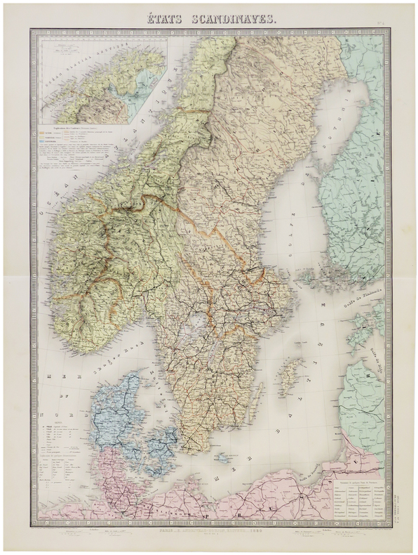
1880LBW-5786Paris, E. Andriveau-Goujon, 1880. 660 x 462 mm.