[Genève]:Livre Rare Book
11 973 résultats
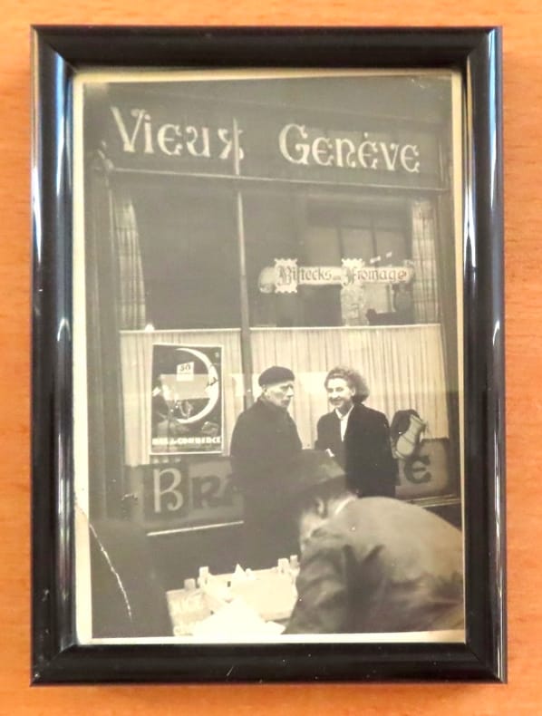
26122Carte postale du bistro, petit pli au coin inférieur. Encadrée, format du cadre 10 x 14 cm.
173520088Paris Prault 1735 In-12 xvi + 523 pp en deux parties , 2 cartes dépliantes et un frontispice. mauvais état de la reliure, 2 plats séparés, A restaurer ?
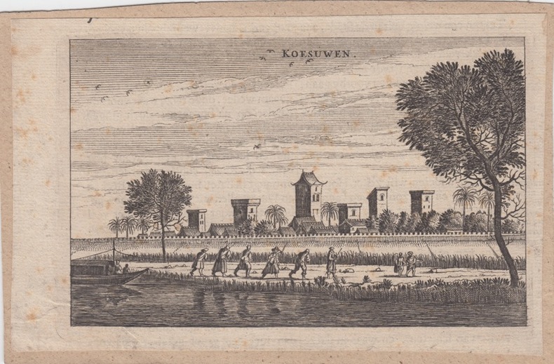
1699260611699 Amsterdam, 1699. original copper-engraving, 10 x 16 cm, taken from Joan Nieuhof: Het Gezandtschap der Neêrlandtsche Oost-Indische Compagnie, aan den grooten Tartarischen Cham, den tegenwoordigen Keizer van China, Amsterdam, 1666-99
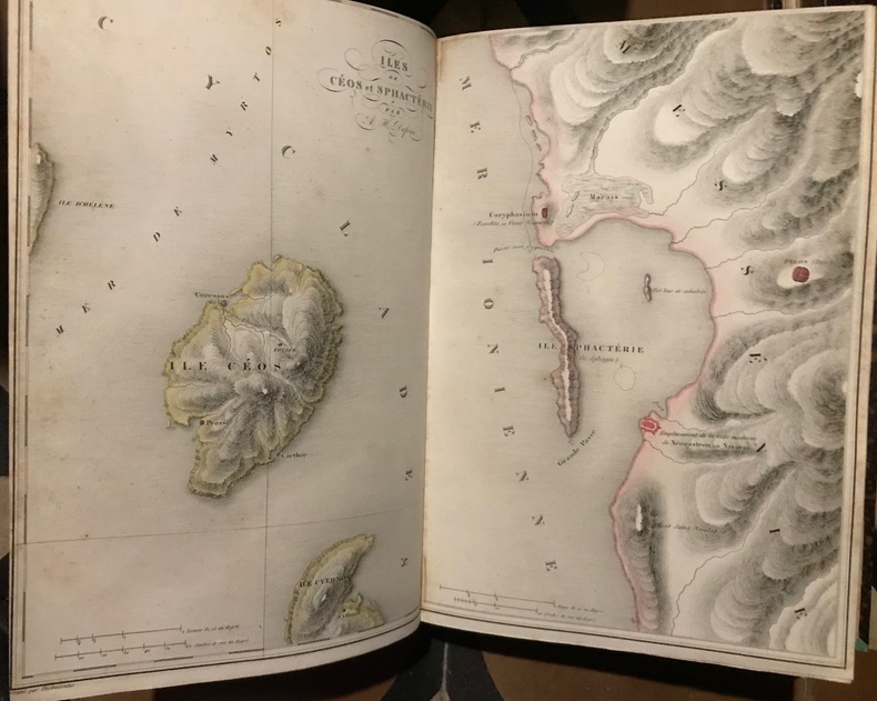
1828107481828 Paris , Aug. Dubois, 1828-1833; 5 volumes in-4°, demi - chagrin rouge de l'époque, dos à 5 nerfs plats cernés de filets à froid, filet maigre doré sur les nerfs, auteur, titre et tomaison dorés, tête dorée. Illustré de nombreux portraits tirés sur chine appliqué et de cartes et plans hors texte à double page en couleurs.Nous possédons les Tomes I, IX,X, XI et XII de cette édition, reliés en 5 volumes tomés de 1 à 5 et renfermant :Tome I, daté de 1830. Vie de Plutarque. Thésée. Romulus. LI - 324 pp. Portraits et 5 cartes hors texte. / Tome IX , daté de 1828. Alexandre, César. 432 pp. Portraits et 9 cartes sur 11 (manque la carte de l'Italie septentrionale au temps de César et le plan d'Alexandrie). / Tome X, daté de 1831. Nicias, Crassus, Sertorius, Eumène, Artaxerce. 428 - (3)pp. Portraits et 8 cartes sur 9 (manque carte de la Mauritanie). / Tome XI, daté de 1833. Agésilas, Pompée, Phocion. 397pp. Portraits et 8 cartes ou plans. / Tome XII, daté de 1828. Caton d'Utique, Démosthène, Cicéron. 396pp. Portraits et 9 cartes.
2012500196306LGF 2012 96 pages 14x1 8x18 4cm. 2012. pocket_book. 96 pages.
Book is in excellent condition. Binding is solid and square, covers have sharp corners, exterior shows no blemishes, text/interior is clean and free of marking of any kind. Dust jacket has numerous small tears at edges, now wrapped in clear protective cover. 176 pages with large b&w photos throughout, mostly exteriors, some interior, many detail shots, of commercial and public buildings, churches, residences, and misc. structures, maps, drawings; 49 individual structures featured with photos and a detailed description. Buildings include the: Fowler building, Bartlett, Waterman and katz, C.F. Clapp, Franklin House, Capt. Tibbals, Fowler-Caines, Hastings, N.D. Hill, James and Hastings, Terry, Siebenbaum, etc.
2004100177Great Britain: David & Charles 2004. Victorian Ordnance Survey Maps: London Originally engraved in the early 1820s these four maps cover the Victorian city of London and the surrounding area including Windsor Watford Brentwood Southend Maidstone Guildford and Bracknell. in very good slipcase We carry a wide selection of titles in The Arts Theology History Politics Social and Physical Sciences. Academic and Scholarly books and Modern First Editions and all types of Educational Reference Literature. . First Thus. Very Good. Maps . David & Charles unknown
Inscription inside front cover and light indenting to front cover. No other marks, light creasing to covers and spine. A clean very tight copy with lightly rubbed covers and no bumping to corners. 72pp. With coloured photographs and black & white line drawings of this Canadian city with a little text.
118 pages including index and black and white illustrations. A remarkable volume of archive photographs, early maps, business documents and correspondence from British Columbia's past. Letter and diary excerpts give extraordinary insights into the personalities and problems facing these key figures. Book clean, bright and unmarked with very light wear. Light wear to illustrated dust jacket. Nice copy. Book
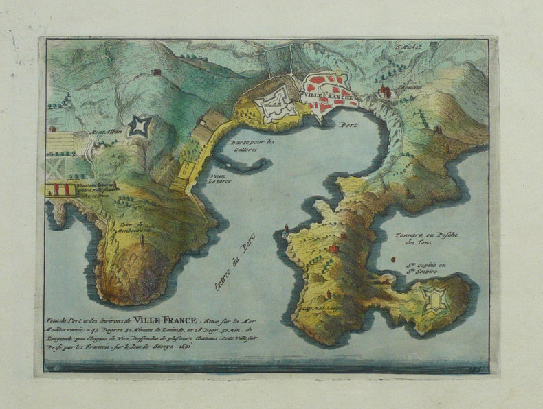
1860LBW-1247Paris, [circa 1860]. 130 x 170 mm.
83274Zaltbommel (Pays-Bas), Bibliothèque Européenne, 1984. 21 x 15, sans pagination, 76 illustrations en N/B, reliure d'édition pleine toile, bon état.
1760LBW-623Paris, Charpentier, [circa 1760]. 336 x 516 mm.
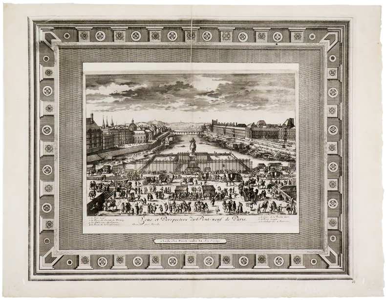
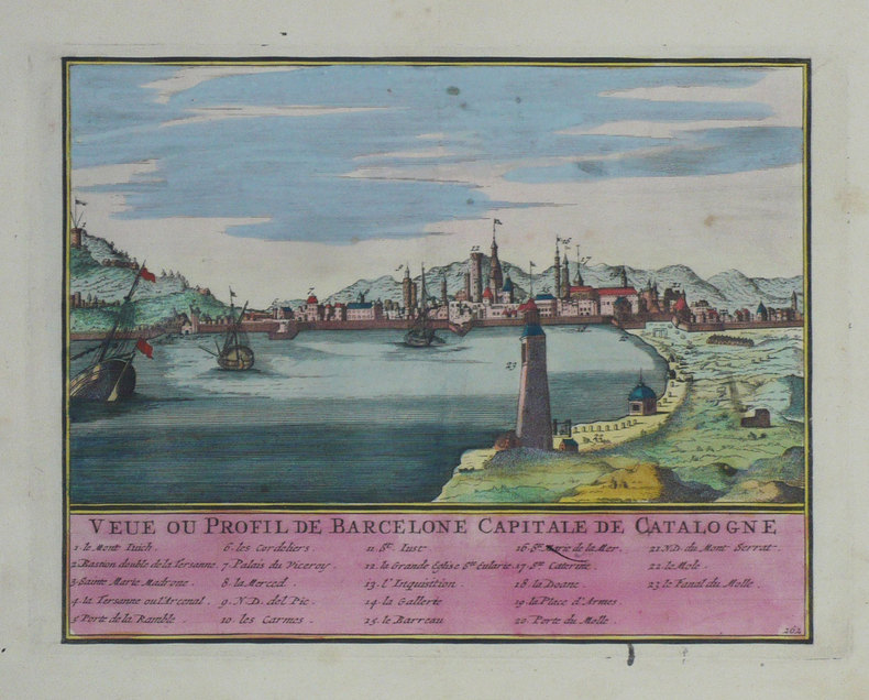
1710LBW-5724Leyde, Pierre Vander Aa, [circa 1710]. 336 x 412 mm.
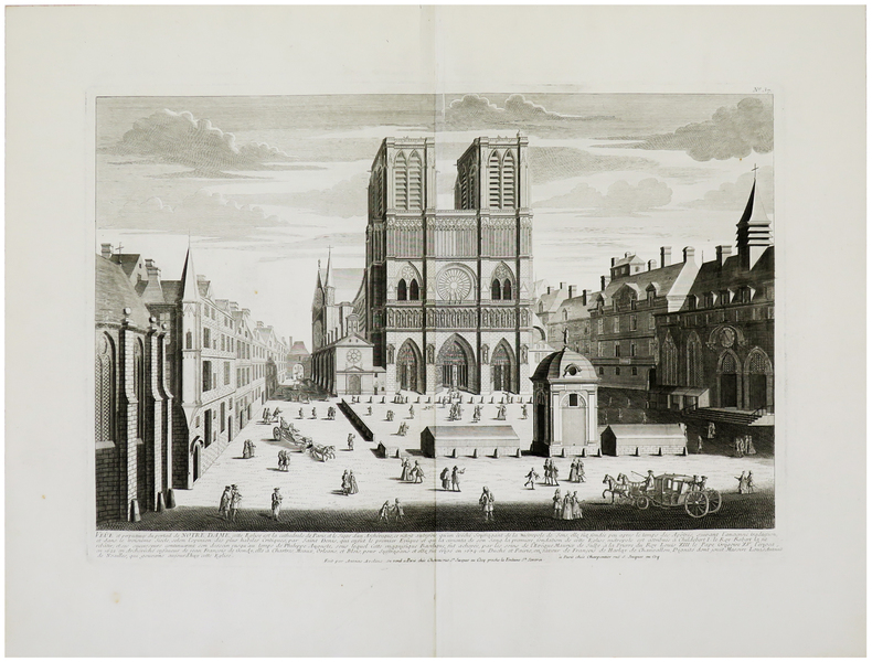
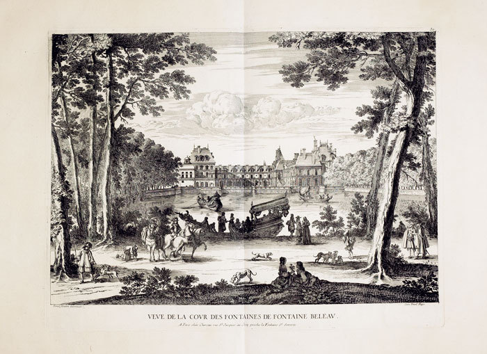
1740LBW-962Paris, Chéreau, [circa 1740]. 352 x 508 mm.
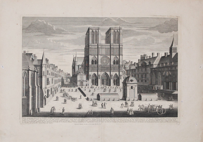
1740LBW-3228[circa 1740]. 352 x 511 mm.
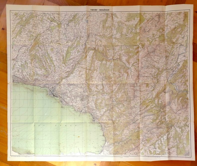
193424918Berne, Service topographique fédéral / Atlas topographique de la Suisse, 1934. Carte au 1:25 000, au format ouvert 93,5 x 79 cm.
1760LBW-624Paris, Chéreau, [circa 1760]. 367 x 484 mm.
1702LBW-1304Amsterdam Pierre Mortier 1702 210 x 270 mm.
1702LBW-1359Amsterdam Pierre Mortier 1702 154 x 205 mm.
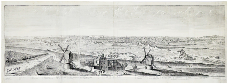
1736LBW-5901Paris, V.e de F. Chéreau, 1736. 0,34 x 1,02 m.
Pianta della città edita da Mattheus Seutter, inclusa nel suo "Atlas" del 1730. La pianta deriva da quella di Giovan Battista Falda del 1676, della quale è una fedele ed accurata riduzione. In alto a sinistra compare il ritratto del papa Benedetto XIII (1724-30) e a destra il suo stemma. In basso a sinistra un elenco del XIV rioni ed a destra una breve descrizione della città dal titolo di Rom. Sebbene stampata intorno al 1725, probabilmente in occasione del Giubileo visto l'inserimento delle Sette Basiliche, raffigura la città intorno al 1676. L'opera infatti non contempla le innovazioni architettoniche alla città durante il pontificato di Innocenzo XII e nemmeno il Porto di Ripetta del 1704. Matthäus Seutter (1678 - 1757) fu uno dei più importanti e prolifici editori tedeschi di mappe del XVIII secolo. Attivo, come incisore sotto la tutela dell'importante J. B. Homann. All'inizio del 1700 Seutter lasciò Homann per tornare ad Augusta, dove lavorò per l'importante editore d'arte Jeremia Wolff (1663 - 1724), per il quale incise mappe e altre stampe. Intorno al 1717 fondò la propria casa editrice cartografica indipendente ad Augusta. La maggior parte delle mappe di Seutter sono pesantemente basate, se non addirittura copie, di lavori precedenti fatti dalle calcografie Homann e De L'Isle. Ciononostante, dal 1731/32 Seutter era uno degli editori più prolifici del suo tempo e fu onorato dall'imperatore tedesco Carlo VI che gli diede il titolo di Geografo Imperiale, dopo il quale la maggior parte delle mappe successive includeva la denominazione Avec Privilege. Seutter continuò a pubblicare fino alla sua morte, all'apice della sua carriera, nel 1757. Incisione in rame, tipica coloritura a mano editoriale, in ottimo stato di conservazione. Map of the city edited by Mattheus Seutter, included in his "Atlas" of 1730. The map derives from that of Giovan Battista Falda of 1676, of which it is a faithful and accurate reduction. On the upper left is the portrait of Pope Benedetto XIII (1724-30) and on the right his coat of arms. In the lower left a list of the XIV districts and on the right a brief description of the city entitled Rom. Although printed around 1725, probably on the occasion of the Jubilee given the inclusion of the Seven Basilicas, it depicts the city around 1676. The work in fact does not contemplate the architectural innovations to the city during the pontificate of Innocenzo XII, nor the Port of Ripetta of 1704. Matthäus Seutter (1678 - 1757) was one of the most important and prolific German map publishers of the 18th century. Seutter was born the son of a goldsmith but apprenticed as a brewer. Apparently uninspired by the beer business, Seutter abandoned his apprenticeship and moved to Nuremberg where he apprenticed as an engraver under the tutelage of the prominent J. B. Homann. Sometime in the early 1700s Seutter left Homann to return to Augsburg, where he worked for the prominent art publisher jeremiad Wolff (1663 - 1724), for whom he engraved maps and other prints. Most of Seutter's maps are heavily based upon, if not copies of, earlier work done by the Homann and De L'Isle firms. Nonetheless, by 1731/32 Seutter was one of the most prolific publishers of his time and was honored by the German Emperor Karl VI who gave him the title of Imperial Geographer, after which most subsequent maps included the Avec Privilege designation. Copper engraving, typical editorial hand coloring, in excellent condition. Huelsen (1915): n. 121; Marigliani, Le Piante di Roma nelle Collezioni private, pag. 235, 140.
Pianta della città edita da Mattheus Seutter, inclusa nel suo Atlas Novus del 1730. La pianta deriva da quella di Giovan Battista Falda del 1676, della quale è una fedele ed accurata riduzione. Sebbene stampata intorno al 1725, probabilmente in occasione del Giubileo visto l'inserimento delle Sette Basiliche, raffigura la città intorno al 1676. L'opera infatti non contempla le innovazioni architettoniche alla città durante il pontificato di Innocenzo XII e nemmeno il Porto di Ripetta del 1704. E’ ancora riportato il terzo braccio di chiusura del colonnato di San Pietro, mai realizzzato. In alto a sinistra vedutine delle Sette Chiese principali e a destra stemma del papa Benedetto XIII (1724-1730). A sinistra in basso compare un elenco dei XIV rioni ed a destra una breve descrizione della città dal titolo Rom. In basso una scena allegorica con divinità fluviali. Matthäus Seutter (1678 - 1757) fu uno dei più importanti e prolifici editori tedeschi di mappe del XVIII secolo. Attivo, come incisore sotto la tutela dell'importante J. B. Homann. All'inizio del 1700 Seutter lasciò Homann per tornare ad Augusta, dove lavorò per l'importante editore d'arte Jeremia Wolff (1663 - 1724), per il quale incise mappe e altre stampe. Intorno al 1717 fondò la propria casa editrice cartografica indipendente ad Augusta. La maggior parte delle mappe di Seutter sono pesantemente basate, se non addirittura copie, di lavori precedenti fatti dalle calcografie Homann e De L'Isle. Ciononostante, dal 1731/32 Seutter era uno degli editori più prolifici del suo tempo e fu onorato dall'imperatore tedesco Carlo VI che gli diede il titolo di Geografo Imperiale, dopo il quale la maggior parte delle mappe successive includeva la denominazione Avec Privilege. Seutter continuò a pubblicare fino alla sua morte, all'apice della sua carriera, nel 1757. Acquaforte con coloritura editoriale, in ottimo stato di conservazione. Bibliografia Marigliani p. 234, n. 139; Scaccia Scarafoni n. 223. Map of the city edited by Mattheus Seutter, included in his "Atlas" of 1730. The map derives from that of Giovan Battista Falda of 1676, of which it is a faithful and accurate reduction. Although printed around 1725, probably on the occasion of the Jubilee given the inclusion of the Seven Basilicas, it depicts the city around 1676. The work in fact does not contemplate the architectural innovations to the city during the pontificate of Innocent XII, nor the Port of Ripetta of 1704. It still shows the third arm of the closing of the colonnade of St. Peter, never realized. In the upper left corner views of the Seven Main Churches and on the right the coat of arms of Pope Benedict XIII (1724-1730). On the lower left is a list of the XIV districts and on the right a brief description of the city entitled Rom. At the bottom an allegorical scene with river gods. Matthaeus Seutter (1678 - 1757) was one of the most important and prolific German map publishers of the 18th century. Seutter was born the son of a goldsmith but apprenticed as a brewer. Apparently uninspired by the beer business, Seutter abandoned his apprenticeship and moved to Nuremberg where he apprenticed as an engraver under the tutelage of the prominent J. B. Homann. Sometime in the early 1700s Seutter left Homann to return to Augsburg, where he worked for the prominent art publisher jeremiad Wolff (1663 - 1724), for whom he engraved maps and other prints. Most of Seutter's maps are heavily based upon, if not copies of, earlier work done by the Homann and De L'Isle firms. Nonetheless, by 1731/32 Seutter was one of the most prolific publishers of his time and was honored by the German Emperor Karl VI who gave him the title of Imperial Geographer, after which most subsequent maps included the Avec Privilege designation. Copper engraving, typical editorial hand coloring, in excellent condition. Bibliografia Marigliani p. 234, n. 139; Scaccia Scarafoni n. 223.
Pianta a proiezione verticale, orografica, orientata con il nord in alto. Ristampa della pianta archeologica pubblicata nel 1819; nel cartiglio in basso a sinistra si legge, al luogo della dedica a papa Pio VII: "Pianta delle Vestigia di Roma secondo le osservazioni di Antonio de Romanis, arch. e socio dell' accad. di archeol. e di Antonio Nibby profess. di archeologia nell Vniv. di Roma e socio della stessa accademia dallo stesso corretta ed ampliata secondo le vltime scoperte. Data in luce da Venanzio Monaldini Libraio l'anno MDCCCXXVI".Pianta disegnata dagli archeologi Antonio De Romanis e Antonio Nibby, incisa da Giovanni Acquaroni per l'editore e committente Venanzio Monaldini.Come sottolinea Scaccia Scarafoni si tratta di un primo tentativo di riliebo scientifico dei soli ruderi allora conservati; intorno alla pianta sono diseganti i frammenti della Forma Urbis Severiana.Antonio de Romanis è un celebre architetto il cui nome è legato soprattutto al volume "Le antiche camere Esquiline dette comunemente delle Terme di Tito" del 1822, di fatto la prima relazione scientifica sugli ambienti della domus aurea in luce dopo gli scavi napoleonici.Antonio Nibby (Roma, 14 aprile 1792 – Roma, 29 dicembre 1839) è stato uno storico, archeologo e topografo italiano. Delle suddette discipline pose rigorosi fondamenti scientifici basandosi sull'analisi delle fonti classiche e medievali, lo studio dei monumenti e l'indagine diretta sul terreno. Fu studioso di topografia soprattutto di Roma antica e della Campagna Romana.Acquaforte, stampata su un grande foglio di carta coeva, con margini, in perfetto stato di conservazione. A vertical projection map, orographic, oriented with the north at the top. Reprint of the archaeological map published in 1819; in the cartouche at the bottom left we read, instead of the dedication to Pope Pius VII: "Pianta delle Vestigia di Roma secondo le osservazioni di Antonio de Romanis, arch. e socio dell' accad. di archeol. e di Antonio Nibby profess. di archeologia nell Vniv. di Roma e socio della stessa accademia dallo stesso corretta ed ampliata secondo le vltime scoperte. Data in luce da Venanzio Monaldini Libraio l'anno MDCCCXXVI".The map was drawn by the archaeologists Antonio De Romanis and Antonio Nibby, engraved by Giovanni Acquaroni for the publisher and customer Venanzio Monaldini.As Scaccia Scarafoni points out, this is a first attempt at scientific re-enactment of the only ruins then preserved; around the map are fragments of the Forma Urbis Severiana.Antonio de Romanis is a famous architect whose name is mainly linked to the volume "Le antiche camere Esquiline dette comunemente delle Terme di Tito" of 1822, in fact the first scientific report on the environments of the Domus Aurea after the Napoleonic excavations.Antonio Nibby (Rome, 14 April 1792 - Rome, 29 December 1839) was an Italian historian, archaeologist and topographer. He laid rigorous scientific foundations of the above mentioned disciplines based on the analysis of classical and medieval sources, the study of monuments and the direct investigation on the ground. He was a scholar of topography especially of ancient Rome and the Roman countryside.Etching, printed on a large sheet of contemporary paper, with margins, in perfect condition. Scaccia Scarafoni p. 46, n. 66.
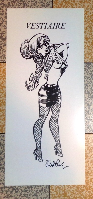
6245[Khani], sans date. Planche sur plastique, parfois annoncée comme "plaque de porte", au format 11 x 25 cm.
Format (Abb): 33 x 21 cm. Blattgröße ca. 40 x 26 cm. *Alt kolorierte Karte aus dem Atlas von Ortelius, rückseitig blank (ohne Text). - Veromanduorum (eine alte gallo-römische Siedlung), zeigt eine kleine Region rund um Saint-Quentin in Nordfrankreich nordöstlich von Paris. - Sehr gut erhalten. Landkarten de