11 983 résultats
42p. + Plus four double page maps. Inked ownership of John Mears, Talbot House. 12mo. Original stiff paper wraps, gold lettered. Slight loss on spine. SCIENCE BOX 4
1334743568.Gpaperback. Good. Access codes and supplements are not guaranteed with used items. May be an ex-library book. paperback
Book in mint unread condition. 132pp. For those who come to the Lake District to unwind and enjoy some time relaxing in a glorious waterside setting. This book tells you the places to go.
No marks or inscriptions. No creasing to covers or to spine. A very clean very tight copy with bright unmarked cream cloth boards, slight rubbing to spine ends and no bumping to corners. Dust jacket price clipped but not marked with nicks to upper and lower edges and traces of storage. 200pp. Three itineraries which take us firstly through the ancient buildings of Athens, Cape Sounion, Marathon and Delphi and then Corinth, Epidaurus, Sparta, Mycenae and Olympia.
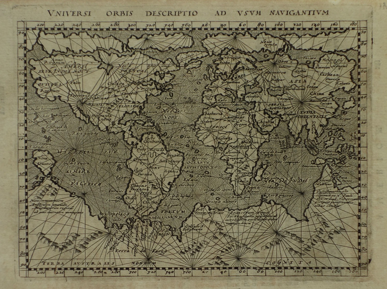
1617LBW-1922[Arnhem, Joannes Jansson, 1617]. 131 x 172 mm.
Rara carta del mondo pubblicata separatamente da Luigi Rosaccio. La carta deriva dal planisfero murale di suo padre, Giuseppe Rosaccio (1597, Bifolco-Ronca n. 31). Rodney Shirley nota che “This curiously elaborate world map is to be found in a speculative world geography by Giuseppe Rosaccio... The right-hand hemisphere is surrounded by bands denoting the climates; the left-hand one by lively windheads and celestial constellations. In the centre cusp is a dyspeptic portrait of the young Duke Cosimo II de Medici, and in the spandels are circular representations of the four elements. The lower part of the engraving consists of a neatly engraved Ptolemaic map of the world and a set of spherical diagrams showing the zones, meridians, and geographical features”. La mappa è molto rara; questo è un esempio del secondo stato, con una barba aggiunta al ritratto di Cosimo de Medici. Priva di datazione, la carta risulta stampata a Firenze, dove la famiglia Rosaccio si era trasferita dopo il periodo veneziano, il 28 novembre 1606, ottenendo il privilegio della stampa per le proprie opere - vedi Casali, Il 'Teatro "del mondo. GR (ca 1530-1620) tra Firenze e Bologna, in L'Europa divisa e i nuovi mondi. Per Adriano Prosperi, II, a cura di M. Donattini - G. Marcocci - S. Pastore, Pisa 2011, p. 56. Aloisio, Aluigio, Alovigi o probabilmente Luigi Rosaccio, figlio del cosmografo Giuseppe Rosaccio, si formò a Firenze, forse con Antonio Tempesta, alla corte dei Medici. Fin dai primi anni Novanta, Giuseppe Rosaccio si stabilì a Firenze, dove il 13 luglio 1594 entrò nella compagnia dell'"Arte dei medici e speziali" (Casali, 2011, p. 56 e n. 15 p. 62) come venditore di libri, ponendosi al servizio e sotto la protezione del Granduca dal suo 'banco' aperto sulla prestigiosa Piazza del Palazzo e dedicando alcune delle sue opere più significative a Ferdinando, Cosimo II e alla granduchessa Cristina. Sempre nella città dei Medici, il 28 novembre 1606 ottenne il privilegio di stampare per le proprie opere (Casali, 2011, pp. 56 s.). Luigi Rosaccio si cimentò nell'arte incisoria, traducendo in stampa le numerose opere del padre. Nel 1610 realizzò il ciclo di illustrazioni incluse nella descrizione delle "Esequie d'Arrigo Quarto cristianissimo re di francia e di Navarra celebrate in Firenze dal Serenissimo DON COSIMO II Gran Duca di Toscana". Descritto da Giuliano Giraldi pubblicato a Firenze da Bartolomeo Sermartelli, importante come testimonianza visiva del complesso delle decorazioni più che per le qualità stilistiche e tecniche, non particolarmente brillanti. Sempre al periodo fiorentino sono legate le tre splendide carte geografiche raffiguranti l'Italia, una grande carta che precede l'Italia Nova di Giovanni Antonio Magini, la Toscana (la cosiddetta "Carta del Cavallo"), e il Piemonte. Bibliografia Shirley, The Mapping of The World, #268. Rare separately published map of the World by Luigi Rosaccio, after the of the largest World Map of his father Giuseppe Rosaccio (1597, Bifolco-Ronca n. 31). Rodney Shirley notes: “This curiously elaborate world map is to be found in a speculative world geography by Giuseppe Rosaccio... The right-hand hemisphere is surrounded by bands denoting the climates; the left-hand one by lively windheads and celestial constellations. In the centre cusp is a dyspeptic portrait of the young Duke Cosimo II de Medici, and in the spandels are circular representations of the four elements. The lower part of the engraving consists of a neatly engraved Ptolemaic map of the world and a set of spherical diagrams showing the zones, meridians, and geographical features” The map was engraved by Giuseppe’s relative Alovisio Rosaccio and is very scarce. This is an example of the second state, with a beard added to the portrait of de Medici. Without the data, the map is printed in Florence, where the Rosaccio family was transferred after the Venetian period, on 28 November 1606, obtaining the privilege of printing for their works - see Casali, Il 'Teatro "del mondo. GR (ca 1530-1620) tra Firenze e Bologna, in L’Europa divisa e i nuovi mondi. Per Adriano Prosperi, II, a cura di M. Donattini - G. Marcocci - S. Pastore, Pisa 2011, p. 56. Aloisio, Aluigio, Alovigi or probably Luigi Rosaccio, son of the cosmographer Giuseppe Rosaccio, was trained in Florence, perhaps with Antonio Tempesta, at the Medici court. Since the early nineties, Giuseppe Rosaccio settled in Florence, where on 13 July 1594 joined the company of “Arte dei medici e speziali (Art of doctors and apothecaries)” (Casali, 2011, p. 56 and n. 15 p. 62) as a seller of books, placing himself at the service and under the protection of the Grand Duke from his 'bench' opened on the prestigious Piazza del Palazzo and dedicating some of his most significant works to Ferdinando, Cosimo II and the Grand Duchess Cristina.. Still in the city of the Medici, on 28 November 1606 he obtained the privilege of printing for his own works (Casali, 2011, pp. 56 s.). Luigi Rosaccio tried his hand at engraving art, translating his father's numerous works into a print. In 1610 he made the cycle of illustrations included in the description of the “Esequie d’Arrigo Quarto cristianissimo re di francia e di Navarra celebrate in Firenze dal Serenissimo DON COSIMO II Gran Duca di Toscana”. Described by Giuliano Giraldi published in Florence by Bartolomeo Sermartelli, important as visual testimony of the complex of the decorations rather than for the stylistic and technical qualities, not particularly brilliant. Always in the Florentine period are related to the three wonderful geographic maps depicting Italy, a great map preceding the Italia Nova of Giovanni Antonio Magini, Tuscany (the so-called “Carta del Cavallo”), and Piedmont. Bibliografia Shirley, The Mapping of The World, #268.
20121-0792233786Natl Geographic Society Maps 2012. Map. New. lam map edition. 1 pages. 31.00x2.00x1.70 inches. Natl Geographic Society Maps unknown
20111-0792233794National Geographic Maps 2011. Paperback. New. lam map en edition. 1 pages. 50.00x4.33x4.33 inches. National Geographic Maps paperback
20111-0792293215Natl Geographic Society Maps 2011. Map. New. rol map en edition. 1 pages. 50.50x2.00x1.80 inches. Natl Geographic Society Maps unknown
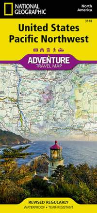
20179781566957120-2025Natl Geographic Society Maps 2017. Paperback. New. <p><strong>Author:</strong> National Geographic Maps - Adventure</p><p><strong>Publisher:</strong> Natl Geographic Society Maps</p><p><strong>Binding:</strong> Paperback</p><p><strong>ISBN:</strong> 9781566957120</p><p><strong>Release Date:</strong> 2017</p><p><strong>Number Of Pages:</strong> 2</p><p><strong>Details:</strong> • Waterproof • Tear-Resistant • Travel MapThere are few nations as vast and spectacularly diverse as the United States of America. From the Atlantic to the Pacific "America the Beautiful" offers boundless destinations and experiences for travelers seeking outdoor adventures small town delights or the excitement of urban culture.The United States Pacific Northwest Adventure Map will guide you through one of the most stunning regions in North America. The states of Washington Oregon and Idaho contain Olympic Mt. Rainier Crater Lake and North Cascades National Parks Mt. Saint Helens and Mount Hood volcanoes Columbia River Gorge and dozens of magnificent National Monuments Forests and Wilderness Areas. The map includes the cities of Seattle Portland Boise Spokane and Eugene as well as Puget Sound and the spectacular Pacific coastline of Washington and Oregon. It covers western Montana and Wyoming including Glacier and Yellowstone National Parks along with Northern California Nevada and Utah. There is simply no better map for exploring the Pacific Northwest of the United States.National Geographic's US Adventure Maps provide the most authoritative and convenient travel maps available to plan and guide your USA Adventure. Each map delivers the perfect combination of detail and perspective highlighting travel routes topography and points of interest for those venturing beyond the city centers. Whether you're on a classic American road trip or planning a grand tour to visit several cities or national parks these maps offer the ultimate geographic resource as only National Geographic can provide.Every Adventure Map is printed on durable synthetic paper making them waterproof tear-resistant and tough — capable of withstanding the rigors of international travel.Map Scale = 1:1300000Sheet Size = 25.5" x 37.75"Folded Size = 4.25" x 9.25"</p> Natl Geographic Society Maps paperback
A9780792283195Sheet map. New. unknown
A9780792293217Sheet map rolled. New. unknown
A9780792233794Sheet map. New. unknown
20131-0792239156Natl Geographic Society Maps 2013. Map. New. lam map edition. 1 pages. 30.10x1.60x1.40 inches. Natl Geographic Society Maps unknown
A9780792229872Sheet map. New. unknown
7 colour printed maps. Scale 1:50,000 and 1:1,000,000. In English and Arabic. Folded. First edition. A set of exceedingly rare UAE topographic maps, compiled from 1:30,000 scale aerial photography taken during 1986 and 1987, presumably based on UK versions. The maps show international boundaries, tracks and paths, bridges, historical landmarks, schools, tree and date plantations, mangroves, oil and gas injection wells, mosques and cemeteries, emergency telephones, water pipelines and tanks, cliffs and rocky areas, as well as other details encountered in the vast desert. Occasionally the average relative height of the dunes is given, reaching up to 45 metres at certain points. - The 6 maps of the 1:50,000 series are sheets number NF-40-01-14, NF-40-01-22, NF-40-01-34, and NF-40-02-11, as well as NG-40-13-54, and NG-40-13-63. The maps of this series "were used extensively for UTM [Universal Transverse Mercator projection coordinate system] Zone 39 rectification. These maps have a local UAE national grid which is equivalent to the UTM grid if a bias of 2,150,000 m in the y-dimension and 150,000 m in the x-dimension are added" (Jensen). The single map of the 1:100,000 series, dating from 1992, is sheet number NG-40-136. - Some pencil marks and circles. The 1:50,000 scaled maps have a stamped six-digit number and a round stamp in Arabic type on the reverse; the 1:100,000 scaled map has a square stamp in Arabic type on the reverse. A few small tears and creases; occasional adhesive tape; paper variously pierced. No copies traceable in libraries internationally. Jensen [et al.], Coastal Environmental Sensitivity Mapping for Oil Spills in the United Arab Emirates [...] 8.
2000Q-0880976403Hagstrom Map Co 2000-01-28. paperback. New. In shrink wrap. Looks like an interesting title! Hagstrom Map Co paperback
19807042Boston: Houghton Mifflin Company 1980. Book Club Edition. Hardcover. pp. xxiv 483. 8vo. Quarter-brown spine over mustard-yellow boards with red lettering and ornamentation to the spine; map endpaper. Black-and-white maps charts etc. Lightest edgewear contents without blemish with bright clean and unmarked pages and firm sound binding; very good and housed in lightly rubbed unclipped dustjacket showing light wear along the edges of the panels. Overall very good. <br/><br/> Houghton Mifflin Company hardcover
1192 pages plus 16 pages of maps. Includes over 500 photos, maps and drawings. No marks noted. A little above average wear to green cloth covered boards. Binding intact. Light soiling. Prior owner's small address label atop preface. Solid working copy of this excellent reference. Book
1980005434Boston: Houghton Mifflin 1980. First Printing with complete number row.Near Fine very scant and faint foxing to end pages in a Fine dust jacket. Map attached at rear. Uncommon in such exceptional condition a lovely copy. . First American Edition. Cloth. Near Fine/Fine. 8vo. Houghton Mifflin Hardcover books
1980047136Boston: Houghton Mifflin Harcourt 1980. Book. Fine. Hardcover. First Edition/First Printing. A square solid tight clean unread copy. The 15.00 unlaminated jacket as issued has some lightish rubbing wear some edge wear some edge chipping two short closed tears. Light green cloth boards with silver/green inlay. First US Edition. A very nice overall copy in a worn jacket. Map by Christopher Tolkien tipped to rear endpaper as issued has neber been removrf from this copy. THIS COPY IS IN MY POSSESSION AND WILL NORMALLY SHIP NEXT DAY. Houghton Mifflin Harcourt Hardcover
1994AUB-6307Ed. Plon /UNESCO 1994. Bel exemplaire relié, couverture carton souple, fort in-8, 626 pages.
Petit in-8 oblong, non paginé, illustré de 105 cartes postales et photos anciennes en sepia, broché. Tres bon état. [BAT-7]
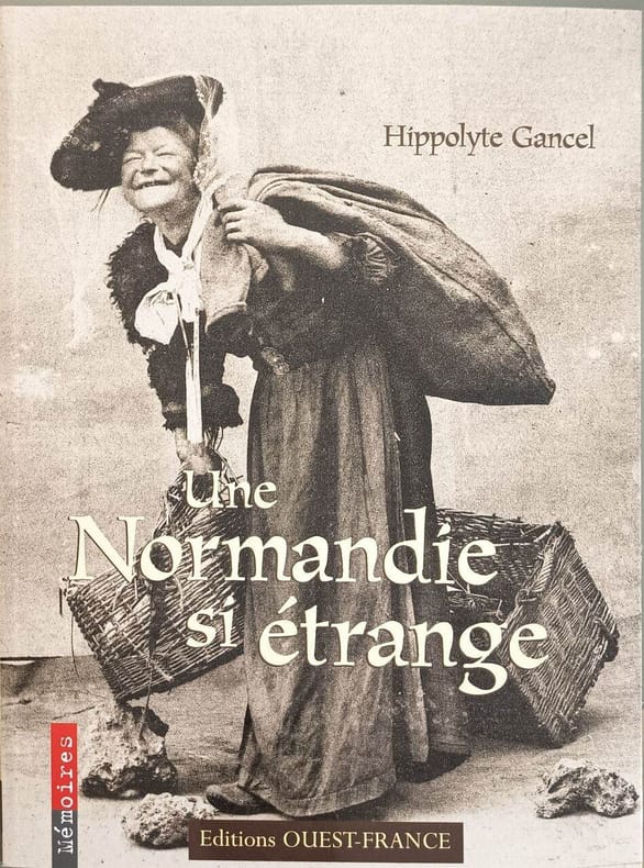
20019109OUEST FRANCE 2001 128 pages 19 5x25 5x1 2cm. 2001. Broché couverture rempliée. 128 pages. Ce livre explore la Normandie du début du XXe siècle à travers des pratiques métiers et traditions aujourd'hui disparus ou insolites comme la vigne normande le brûlage du varech les attelages de vaches ou le métier de langueyeur. Il s'appuie sur des cartes postales anciennes pour révéler un monde surprenant vieux de moins d'un siècle