Maps, HedbergBiblio.com
11 981 résultats
1593530110.Gmap. Good. Access codes and supplements are not guaranteed with used items. May be an ex-library book. unknown
LFA-126713406Un ouvrage de 50 pages, format 170 x 235 mm, illustré, broché couverture couleurs, s.d., Presses Parisiennes de Publications, bon état
No inscriptions or marks. No creasing to covers or to spine. A lovely clean crisp very tight copy with bright unmarked covers and no bumping to corners. Browning to page edges. 127pp. The Observer Guide to hotels and restaurants.
60 pages. Features: Arthur Erickson and Canada's mirror-sheathed pavilion at Expo '70; Clarence Eckert and his Rolls-Royce; Angela Davis; Black Panther Lonnie McLucas and the New Haven Eight; Who's Come a Long Way, Baby? - Feature article on women's rights; The Liberation of Kate Millett; What it Would Be Like if Women Win; Middle East - Toward the Start of Talks; Watch on the Suez - Intelligence Gaps - air photos purport to show Egypt installing SAM-2 missiles in cease-fire zone; Maps of possible Israel/Egypt border; Lovely one-page color photo of Senegalese Dancer Issa Teuw Niang with friends in Dakar; Three additional pages of nice color photos of prominent black women in Africa; The Spetsopoula Incident; Urban Trend in Vietnam - with photo of horrific canal-side squatter structures; Joseph Rhodes Jr. and the Kent State investigation; Musical group "The Band" - photo and article; Cholera epidemic in Lebanon; Film producers Christopher Dewey and Dennis Friedland; Reuben Maury; Aquaculture - article with photo of streetcar being lowered into the Sea of Japan to provide 'apartments' for fish; Golfer Dave Stockton; Sculptor Alberto Sanchez; Passing of Leo Ciceri, Beniamino Fubano, Eugene Barnett, General Archimede Mischi and William Hamm Jr.; The Energy Shortage Worsens; Blighted corn in the U.S. South; Financial challenges for U.S. airlines as the upgrade to the 747; Interesting one-page color Hitachi ad illustrates "Floating Train of the Future"; and more. Moderate wear. Unmarked. A sound copy. Magazine
2005LFA01804Revue mensuelle concernant la philatélie : environ 110 pages en couleurs, format 300 x 210 mm, illustrée, brochée couverture couleurs + fiches détachables
LFA01da2Revue mensuelle concernant la philatélie : environ 110 pages en couleurs, format 300 x 210 mm, illustrée, brochée couverture couleurs + fiches détachables
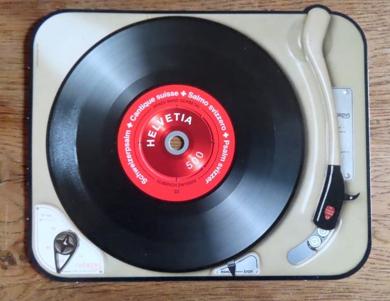
201420821Poste Suisse, 2014. Timbre à la valeur faciale de 5.-, sur un carton au format 17 x 13,5 cm. Très très léger pli à un bord, la rondelle centrale commence à se détacher, en très bon état néanmoins.
Magnifico esemplare di questa rara carta del mondo di Philippe Galle, realizzata per la prima edizione dello Spieghel del Werelt, il primo atlante tascabile pubblicato nel 1577. Questa carta del mondo è una fedele ed accurata riduzione della prima mappa del mondo di Ortelius del 1570, che era la tavola di apertura del suo celebre atlante Theatrum Orbis Terrarum (Shirley, 122; Koeman, Ort 1; Karrow: 1/6, van der Krogt AN: 0001:31A). La lastra incisa da Philippe Galle, reca la data del 1574, sebbene la prima edizione dell'Epitome (secondo il titolo che diventerà comune nei secoli successivi), sia stata pubblicata nel 1577.Questa mappa verrà utilizzata per le sole edizioni dell'Epitome edite dal 1577 al 1585, e sarà poi sostituita da una lastra più piccola, a partire dal 1588. A differenza delle altre carte dell'Epitome, il mappamondo ha un formato più largo. La citazione latina nel margine inferiore, già presente nel modello di Ortelius, è da Cicerone (Tusculanae Disputatianes IV. 1 7. 37) "Quid ei potest videri magnum in rebus humanis, cui aeternitas omnis, totiusque mundi nota sit magnitudo" ovvero "Che cosa, tra le vicende umane, può sembrare grande a colui al quale è nota la grandezza del mondo e l'eternità dell'universo?".La carta del mondo di Ortelius, incisa e firmata da Franciscus Hogenberg, è di fondamentale importanza per la storia della cartografia in quanto costituisce la PRIMA MAPPA DEL MONDO a essere realizzata per un atlante di formato uniforme e non composito, quali gli atlanti del Lafreri. Le fonti cartografiche della carta sono il mappamondo di Mercator del 1569, quello di Gastaldi del 1561 e il portolano dell'Atlantico di Diego Gutierrez. La forma ovale rimanda, invece, ad Appiano e Bordone.Esemplare tratto dalla seconda edizione in lingua francese de Le Miroir du Monde.Le Miroir du Monde è l’edizione in lingua francese in prosa dello Spieghel der Werelt, il primo atlante tascabile pubblicato nel 1577, in lingua olandese, da Philip Galle, con testo in rima curato da Peeter Heyns, e stampato dalla tipografia Plantin. Lo Spieghel der Werelt era una versione ridotta del Theatrum Orbis Terrarum di Ortelius.Le lastre, quasi tutte derivate dal Theatrum, furono disegnate e incise da Philip Galle. Due anni dopo, nel 1579, fu data alle stampe l’edizione in lingua francese in prosa, perché Heyns non aveva avuto il tempo necessario per la resa in versi, col titolo Le Miroir du Monde. Il successo di questa edizione francese, è provato proprio dalla seconda edizione pubblicata a soli 4 anni di distanza, nel 1583.Complessivamente Galle pubblicò 5 edizioni in lingua francese, di cui solo le prime due con il titolo Le Miroir du Monde; a partire dal 1588, e così per le edizioni del 1590 e del 1598, il titolo dell’opera fu modificato in Epitome du thétre du Monde d’Abraham Ortelius, e il nome di Peeter Heyns non figurò più sul frontespizio. Rispetto alla prima edizione del 1579, che conteneva 72 mappe, la seconda edizione fu aumentata di 11 nuove mappe, per un totale di 83 tavole.Dal 1577 al 1598, Galle & Heyns pubblicarono ben 11 edizione, di cui l’ultima – edita nell’anno della morte di Ortelius – conteneva ben 123 mappe. Fine example of Philippe Galle's rare map of the World, engraved for the first edition of his Spieghel del Werelt, the first miniature edition of Ortelius' Theatrum Orbis Terrarum.This map is a neatly-engraved smaller copy of Ortelius' first world map plate, published in 1570, that is the first map of the Theatrum Orbis Terrrarum (Shirley, 122; Koeman, Ort 1; Karrow: 1/6, van der Krogt AN: 0001:31A). The Galle's plate is dated 1574 although the first printing of Galle's atlas did not taken place until 1577. The motto below the map is a quotation from Cicero (Tusculanae Disputatianes IV. 1 7. 37) Quid ei potest videri magnum in rebus humanis, cui aeternitas omnis, totiusque mundi nota sit magnitudo (For what human affairs can seem important to a man who keeps all eternity before his eyes and knows the vastness of the universe?). The worl map published by Galle is larger that the other maps in the atlas. The cartographic sources for the Ortelius world map are: Gerard Mercator's 1569, Gastaldi's 1561 world map and Diego Gutierrez' portolan map of the Atlantic. The oval shape goes back to Apianus and/or Bordonius. The world map by Ortelius, signed by Franciscus Hogenberg, is first one occurring in the first regular atlas the "Theatrum Orbis Terrarum", so the map is of fundamental importance in the history of cartography.This map appeared only in the earliest editions of Ortelius' Epitome, published between 1577-1585 - and from 1588 was replaced by the much smaller Typus Orbis Terrarum.Shirley quotes the rarity fo this map as "S" (Scarce). Map published taken from the second French edition of ‘Le Miroir du Monde’, published by Galle & Heyns in 1583, printed by Plantin. Le Miror du Monde is the French transaltion of the Duch poems Spieghel der Werelt, the first modern pocket-atlas, published by Philip Galle with text by Peeter Heyns in 1577, based on Abraham Ortelius’ Theatrum Orbis Terrarum. The maps were drawn and engraved by Galle. Two years later, in 1579, Galle & Heyns published the first French edition: Heyns translated the Dutch poems into French prose because he did not find time to put them into rhyme. This French edition became very popular and in 1583 an amplified reprint appeared.Galle & Heyns published 5 French edition, two with the title Miroir, and three (1588, 1590, 1598) with the title Epitome du thétre du Monde d’Abraham Ortelius, that appeared from 1588 onwards (Peeter Heyns’ name no longer figures on the title pages of the Antwerp editions).Second French edition of this rare miniature atlas, "enlarged with eleven maps... six are double sized" (Koeman p. 275).Compared to the first edition of 1579, which contained 72 maps, the second edition was increased by 11 new maps, for a total of 83 plates.Between 1577 & 1598 Galle issued 11 editions, all printed by Christopher Plantin. Shirley, 132; Koeman, Ort 47
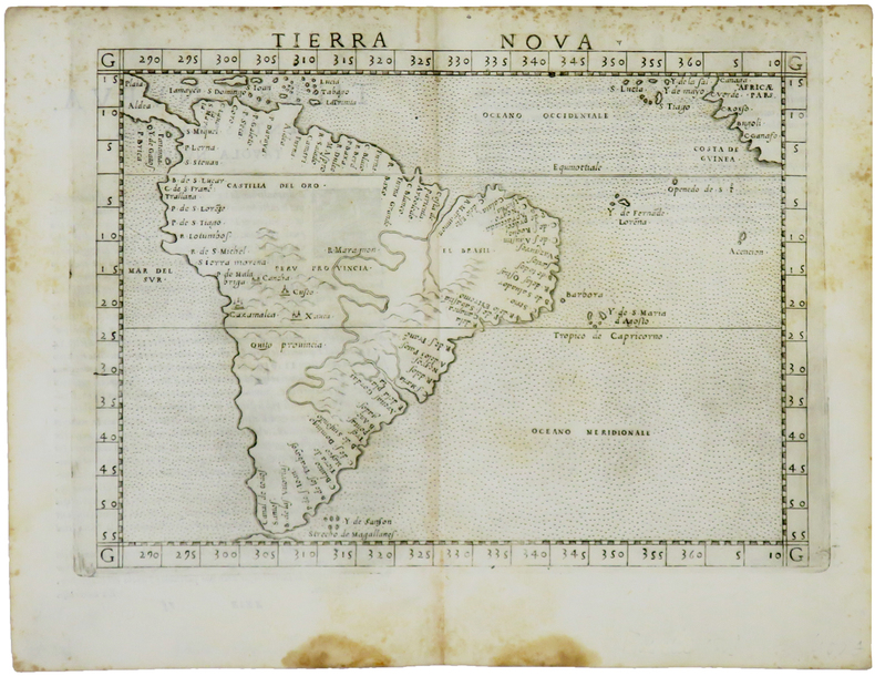
1561LBW-5048[Venise, 1561]. 184 x 245 mm.
19940105671994 Gemeentekrediet Hardcover As New
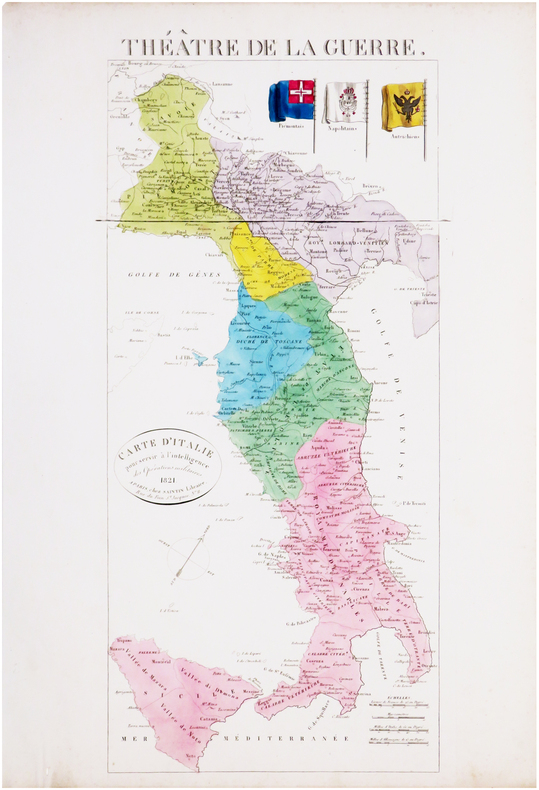
1821LBW-8033Paris, Saintin, 1821. 535 x 241 mm.
206667Paris, chez l'auteur [étiquette de Desnos apposée ultérieurement], 1788 carte in-folio de 80 x 104 cm, contours rehaussés de couleurs, en feuille.
44204Editions Traditionnelles.1988.In-8,couv.souple bleue. TBE
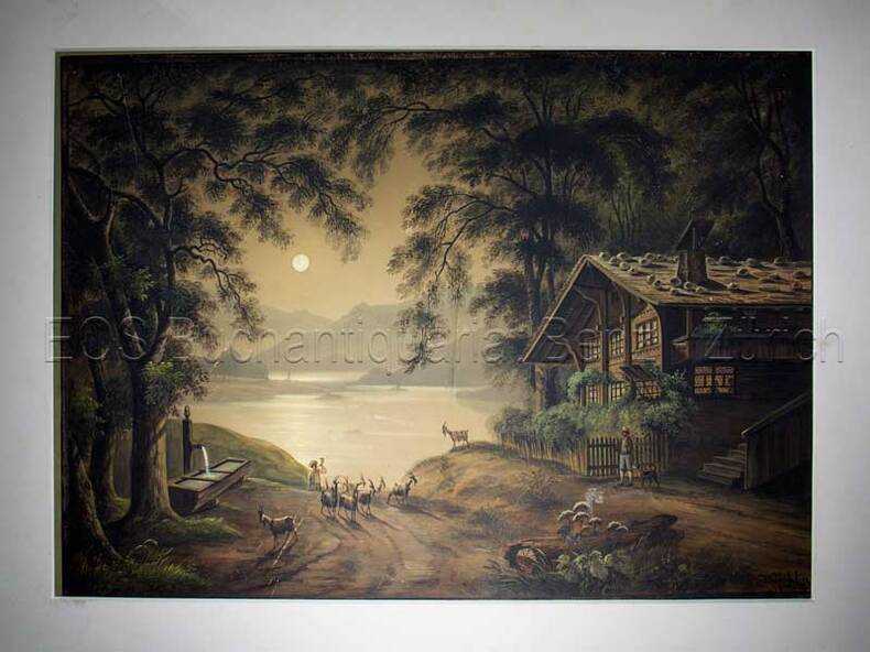
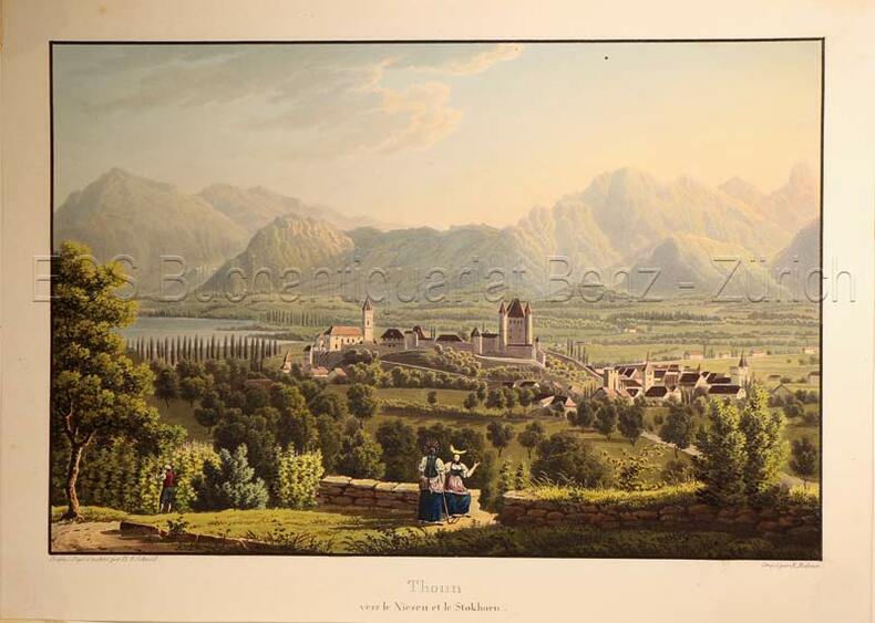
1850597BG(um 1850). Gouache. Bildgrösse: 34,5 x 48 cm. Blattgrösse: 42 x 55,5 cm. + Wichtig: Für unsere Kunden in der EU erfolgt der Versand alle 14 Tage verzollt ab Deutschland / Postbank-Konto in Deutschland vorhanden +, Abb.
1850597BG(um 1850). Gouache. Bildgrösse: 34,5 x 48 cm. Blattgrösse: 42 x 55,5 cm.
Slightly marked front. Has been stored neatly folded in two. 20pp. With 23 town plans from Almeiria to Zaragoza plus 8 district through routes. A fascinating reminder of the pre-satnav days.
A few stains to first two pages, not affecting maps. Calculations on blank part of cover. Has been stored folded in two. 40pp. With 66 town plans from Abbeville to Vichy plus 3 district through routes. A fascinating reminder of the pre-satnav days.
Carta della Tracia antica, che si estende da Bisanzio (Istanbul) e dallo stretto del Bosforo alla Macedonia, pubblicata da Abraham Ortleius.La regione comprende l'attuale Grecia nordorientale, la Bulgaria meridionale e la Turchia nord-occidentale.La mappa si basa sulla mappa di Gastaldi dell'Europa sudorientale e sulle informazioni di numerose fonti antiche, in particolare Erodoto, Plinio, Strabo, Appiano, Virgilio, Plutarco e Sidone. Opera tratta dal Parergon, il primo atlante storico mai pubblicato. Fu inizialmente concepito da Ortelius come appendice del suo Theatrum Orbis Terrarum ma visto il notevole successo di queste carte storiche divenne in seguito un lavoro indipendente e rimase la fonte principale di tutti i lavori simili per tutto il XVII secolo. Come sottolinea Koeman “il Parergon deve essere considerato come lavoro personale di Ortelius. Per quest'opera, infatti, diversamente dal Theatrum, non copiò le mappe di altri cartografi, ma ne disegnò lui stesso di nuove ed originali…prese luoghi, regioni e territori delle civiltà classiche illustrandone e spiegandone la storia, una materia molto vicina al suo cuore. Le mappe e le lastre del Parergon devono essere valutate come le più importanti incisioni che rappresentano il diffuso interesse per la geografia classica nel XVI secolo”. Il Theatrum Orbis Terrarum e che è considerato il primo vero “atlante” moderno. L’opera fu pubblicata in 7 lingue e 36 edizioni, per il quale – nel 1570 - Ortelius ottenne il privilegio, ovvero una sorta di diritto d'autore che impediva ad altri cartografi di pubblicare i propri lavori. Il Theatrum rappresentava il lavoro più avanzato del lavoro della descrizione cartografica. L’Ortelius vi raccolse il sapere geografico e cartografico del suo tempo, proponendo in 147 spettacolari tavole incise l’immagine più fedele del mondo allora conosciuto e, in alcune straordinarie “carte storiche”, regioni e itinerari tratti dalla letteratura, dalla mitologia, dalla tradizione. Incisione in rame, fine coloritura, in ottimo stato di conservazione. Fine map of ancient Thrace, extending from Byzantium (Istanbul) and the Bosphorus Straits to Macedonia, published by Abraham Ortleius. This finely engraved map shows Thrace, present-day north eastern Greece, southern Bulgaria, and northwest Turkey, and identifies main settlements with their original latinised names. The map is based on Gastaldi's 1560 map of South East Europe, and on information from numerous ancient sources, specifically Herodotus, Plinius, Strabo, Appianus, Virgilius, Plutarchus, and Sidonius. Portions of the Black Sea, Sea of Marmara, and Thrakikon Pelagos, all stipple engraved and fully colored, make this a very handsome map. Map taken from the Parergon, the first historical atlas ever published. It was initially conceived by Ortelius as an appendix to his Theatrum Orbis Terrarum, but given the considerable success of these historical maps it later became an independent work and remained the main source of all similar works throughout the seventeenth century. Koeman wrote: "This atlas of ancient geography must be regarded as a personal work of Ortelius. For this work he did not, as in the Theatrum, copy other people's maps but drew the originals himself... He took many places and regions from the lands of classical civilization to illustrate and clarify their history, a subject very close to his heart... The maps and plates of the Parergon have to be evaluated as the most outstanding engravings depicting the wide-spread interest in classical geography in the 16th century." The Theatrum Orbis Terrarum, which is considered the first true modern "Atlas". The work was published in 7 languages and 36 editions, for which - in 1570 - Ortelius obtained the privilege, a kind of copyright that prevented other cartographers from publishing his works. The Theatrum represented the most advanced work of cartographic description. Ortelius collected in it the geographical and cartographic knowledge of his time, proposing in 147 spectacular engraved plates the most faithful image of the world then known and, in some extraordinary "historical maps", regions and routes taken from literature, mythology, tradition. Copper engraving, contemporary coloring, in good condition. Van den Broecke #214.
Carta gegrafica tratta da "Christophori Cellarii Smalcaldensis Geographia antiqua" stampata a Londra da Sumptibus J & T Pote nel 1786.Incisione in rame, firmata da R. W. Scale, finemente colorata a mano, in ottimo stato di conservazione. Carta gegrafica tratta da "Christophori Cellarii Smalcaldensis Geographia antiqua" stampata a Londra da Sumptibus J & T Pote nel 1786.Incisione in rame, firmata da R. W. Scale, finemente colorata a mano, in ottimo stato di conservazione.
1830627DG(Zürich, Keller & Füssli), um 1830. Altkolorierte Aquatinta von Rudolf Bodmer (1805-1841). Bildgrösse: 16 x 24,1 cm. Blattgrösse: 19,4 x 27 cm. + Wichtig: Für unsere Kunden in der EU erfolgt der Versand alle 14 Tage verzollt ab Deutschland / Postbank-Konto in Deutschland vorhanden +, Abb.
1830627DG(Zürich, Keller & Füssli), um 1830. Altkolorierte Aquatinta von Rudolf Bodmer (1805-1841). Bildgrösse: 16 x 24,1 cm. Blattgrösse: 19,4 x 27 cm.
1581742401.Gpaperback. Good. Access codes and supplements are not guaranteed with used items. May be an ex-library book. paperback
1581742738.Gpaperback. Good. Access codes and supplements are not guaranteed with used items. May be an ex-library book. paperback
0528956477.Gpaperback. Good. Access codes and supplements are not guaranteed with used items. May be an ex-library book. paperback
1581742495.Gpaperback. Good. Access codes and supplements are not guaranteed with used items. May be an ex-library book. paperback