333 résultats
1997017766Mansfield Centre Connecticut: Martino Fine Books 1997. Brand New in perfect condition. 2 vols in 1. STILL SEALED in the publisher's clear plastic SHRINKWRAP. NO rubbing. NO fading. Bright clean square and tight. Sharp corners. NO owner's name or bookplate. NOT a remainder. Fresh and crisp -- obviously never read. n. d. but 1997. HARDCOVER reprint limited to 150 copies of the 1950 and 1953 Library of Congress originals. 2 volumes bound as 1 with a total of 767 pages. Because this edition is bound in sturdy cloth it is much better suited to heavy use than the paper bindings of the original editions. A welcome reprint of an important and scarce reference. Described here are 6696 atlases. Entries are first arranged geographically and by subject national; state; and within the various states by county/parish city and region; special subject atlases include agriculture aviation canals climate coal geology history languages railroads etc. Then the atlases are re-listed by author/publisher in the index. A typical entry includes the atlas title; cartographer; publisher; city and date of first publication; dimensions in centimeters; number of pages plates and maps; the number that are colored etc. Occasional notes on contents. In the second part copies of the atlases held by some 180 libraries are located. Hodgkiss/Tatham KEYGUIDE TO INFORMATION SOURCES IN CARTOGRAPHY: "An indispensable reference for students of American history or of the development of American cartography." Bound in the original gilt-stamped blue cloth. Besterman 6267. Sheehy CL288. KEYGUIDE 94. 1997 reprint of 1950/53 originals. Hardcover. New/in publisher's shrinkwrap. 2 vols in 1: viii445pp. xiii301pp. 767 total. Great Packaging Fast Shipping. Martino Fine Books Hardcover
1997017659Mansfield Centre Connecticut: Martino Fine Books 1997. Brand New in perfect condition. STILL SEALED in the publisher's clear plastic SHRINKWRAP. NO rubbing. NO fading. Bright clean square and tight. Sharp corners. NO owner's name or bookplate. NO remainder mark. Fresh and crisp -- obviously never read. Limited to 100 copies. n. d. but 1997. Reprint of the expanded 1964 edition. The best edition of the best cartography of Texas maps. Describes and comments on some 1000 Texas maps from 1527 to 1900. Entries identify full title publisher map maker date content scale color dimensions etc. Illustrated. Bound in the original gilt-stamped bluish-green cloth. Moeb's U. S. REFERENCE-IANA 748: "A basic reference in the field. This 1964 issue contains 88 maps not in the prior printing." See Ristow 325. From the publisher: "This important work is the most extensive cartography devoted exclusively to Texas maps. It comprises the map collection of the Texas State Archives. In all approximately 1000 maps are meticulously described. There are excellent annotations describing coloring rivers mountains towns forts Indian tribes trails trading posts and a host of other subjects depicted in the maps. There is also interesting background information about the history of the territory or the map described. And of course dimensions and scales are given.". Reprint of the expanded 1964 edition. Hardcover. New/in publisher's shrinkwrap. iv 178pp. Great Packaging Fast Shipping. Martino Fine Books Hardcover
19984973<p>The Nautical & Aviation Publishing Company of America 1998. 6110 pages. New Hardcover New DJ. 10.1"x7.0". be5</p> The Nautical & Aviation Publishing Company of America hardcover
1928008291Paterson New Jersey:: The Benjamin Franklin Press 1928. 8" wide by 11" tall. A square reasonably tight copy. Inner hinges are perfect. Bound in the original blue cloth -- moderately rubbed. The front cover is stamped in black with a surveyor's tripod. Gilt lettering on the spine and front cover is still quite bright and shiny. Pages are clean and free of markings except for previous owner's ink name and a thin stain 1/4 inch by 3 inch at the edge of 7 leaves in the margin only NO text is affected. Illustrated with 28 plates -- maps portraits photographs and document facsimiles. Attractive decorative endpapers. For his inventions in the hydraulic engineering field Erskine was elected a fellow of the Royal Society. He left Britain for New Jersey in 1771 where he worked for the American Iron Company whose extensive mines were located in what is now upper Passaic County. In 1775 he organized the men in his employ and was commissioned a captain in the Bergen County militia. Soon afterward General Washington offered him the position of geographer and surveyor-general to the Continental Army. According to the DICTIONARY OF AMERICAN BIOGRAPHY "Erskine worked zealously for the colonial cause and his maps. were important factors in the ultimate victory." Reprinted here are the letters between Erskine and Washington. There is also an appendix that lists 129 of his maps. The DAB cites this book as a primary source for its article on Erskine. Contains chapters on: Erskine the Inventor; Romance of the Ringwood Mines; The Iron Master in the Making; The Hudson River Obstructions and Campaigns against the Indians; and others treating the history of the American Iron Co. New York City Bergen County militia; surveying for Washington Washington at Pompton N.J.; Washington at Morristown for the winter of 1779-1780 etc. From the intro: "Robert Erskine F.R.S. the Surveyor-General of the Continental Army and the trusted friend of the Commander-in-chief was the silent man behind the scenes who mapped out the by-ways and back-roads over the mountains and -- by his familiarity with the great 'middle-ground' between the Hudson Highlands and the Delaware -- provided Washington with that thorough knowledge of the topography of the country which enabled him repeatedly to out-maneuver the enemy.". First Edition. Hard Cover. Very Good condition./No jacket. xii 216pp. 28 plates. . The Benjamin Franklin Press Hardcover
1978021557La Crosse Wisconsin: Sumac Press 1978. NEW in a NEW dust jacket. The jacket is protected by a removable Brodart clear-plastic sleeve. Sharp corners. First Edition Limited to 300 copies. Includes a hand-mounted genuine 13 cent Ben Franklin The Theatre of War USA bicenntenial stamp from 1976. Illustrated with numerous facsimiles of stamps showing maps. Tells their stories. Published by Emerson Wulling at the Sumac Press. Bound in the original red cloth stamped in bright gold. Complete with errata page and dust jacket. First Edition 1/300 copies. Hardcover. New/New. 8vo. 67pp. Great Packaging Fast Shipping. Sumac Press Hardcover
1984018064Utrecht: H&S / Hes Uitgevers 1984. This is the original 1984 FIRST EDITION in PERFECT condition. Brand New in a Brand New dust jacket. STILL SEALED in the publisher's clear plastic SHRINKWRAP thanks to a lucky warehouse find. NO chips. NO tears. NO creases. NO rubbing. NO fading. Bright clean square and tight. Sharp corners. NO owner's name or bookplate. NO remainder mark. Fresh and crisp -- obviously never read. A history of early globe production and their makers. Extensive descriptions of 340 globes made in London Paris Brussels Nuremberg Venice Amsterdam etc. Illustrated with 83 photos 9 in color. Translated into English from the Dutch manuscript by Willie ten Haken. Bound in the original gilt-stamped green cloth. Complete with a pristine dust jacket. 7" wide by 9.75" tall 18cm x 24.5 cm. . First Edition. Hardcover. New/in publisher's shrinkwrap. 290pp. Great Packing Fast Shipping. H&S / Hes Uitgevers Hardcover
1969018432New Haven Connecticut & London: Yale University Press 1969. SIGNED by co-author Christian Brun on the title page his signature only NOT personalized to anyone. Very Good condition. Mild crease to one corner of a few early leaves. NOT a library discard. NO owner's name or bookplate. NO underlining. NO highlighting. NO margin notes. 1969. First Edition. Expertly described here are all separately published maps and charts in America until 1800 as well as those in books pamphlets almanacs magazines atlases and gazetteers. Illustrated with 18 map reproductions frontispiece in color; 1 folding. Bibliography. Index. Bound in the original gilt-stamped blue cloth. 7.75" wide by 10.25" tall. Signed by Christian F. Brun. First Edition. Hardcover. Very Good condition/No jacket. xxii 215pp. 18 plates . Great Packaging Fast Shipping. Yale University Press Hardcover
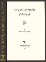
1999017926Mansfield Centre Connecticut: Martino Publishing 1999. Brand New HARDCOVER in perfect condition. STILL SEALED in the publisher's clear plastic SHRINKWRAP. NO rubbing. NO fading. Bright clean square and tight. Sharp corners. NO owner's name or bookplate. NOT a remainder. Fresh and crisp -- obviously never read. 1999 reprint of the 1944 original. A standard work. Illustrated with 22 FOLD-OUT maps. "An excellent study of those maps from Ptolemy to 1798 important in the development of the cartography of the Pacific area with facsimiles of 22 of the 104 maps described." -- Ristow 393 in GUIDE TO THE HISTORY OF CARTOGRAPHY. Hodgkiss/Tatham 137 in KEYGUIDE TO INFORMATION SOURCES IN CARTOGRAPHY. Bound in the original gilt-stamped brown cloth. Because this edition is bound in sturdy cloth it is much better suited to repeated use than the paper binding of the original edition. 1999 reprint of the 1944 original. Hardcover. New/in publisher's shrinkwrap. 8vo. vi pp. 87-268 22 folding plates. Great Packaging Fast Shipping. Martino Publishing Hardcover
8424141202.Gpaperback. Good. Access codes and supplements are not guaranteed with used items. May be an ex-library book. paperback
1920Map725London: G.W. Bacon 1920. Hardback. Vg. 8vo. ND.c1920. The Map Publishing Company Oxford Priced 7/6. Each map 39 x 25 inches cloth backed and disected into 9 sections folding down Attractive inset plan of London "Main Roads out of London" and a distance table. Copyright K2474. The Ministry of Transport is mentioned in the 'explanation' in the title and this was formed after the first world war in 1919. No split but a little grubby to the reverse. The plain maroon cloth case is worn and split to the spine. A large and attractive pair of folding maps <br/> <br/> G.W. Bacon hardcover
1885MH045London: Blackie & Son 1885. 1st Edition . Hardcover. Fine. small 4to. Volume One only of two. cxiv 468pp. Original half calf with raised bands and dec. compartments. Green morocco label with titles in gilt. Original pub. half calf binding bound by Blackie of an interesting and well illustrated view of the world in the late Victorian period. 9 maps 16 plates <br/> <br/> Blackie & Son hardcover
1842Map 807Edinburgh: A&C Black 1842. No Binding. Fine/uncoloured. Folding MAP OF DENMARK. Beautiful steel engraving from Encyclopaedia Britanica Seventh edition dated 1842. Plate CCLXXXIV. Fine example with no wear. 410x260mm. Relief is shown by hachures. Engraved by S. Hall Bury Strt. Bloomsbury. Published by A. & C. Black. <br/> <br/> A&C Black unknown
1842Mao 810Edinburgh: A&C Black 1842. No Binding. Fine/uncoloured. Beautiful steel engraving from Encyclopaedia Britanica Seventh edition dated 1842. Plate CCCVII -1 Fine example with no wear. 410x260mm. Engraved by Sidney Hall Bloomsbury. Published by A. & C. Black. An area extending from Birmah Indonesia and the Straits of Malacca to China and the Philippines. <br/> <br/> A&C Black unknown
Map2791695. No Binding. Fine. COLOURED F 16x11 <br/> <br/> 1695. unknown
Map2781695. No Binding. Fine. UNCOLOURED F 16x11 <br/> <br/> 1695. unknown
1848Map 255London: George Virtue No 26 Ivy Lane 1848. No Binding. Vg. 10.75"x 8.25" Later hand-colour <br/> <br/> George Virtue No 26 Ivy Lane unknown
1848Map 492London: George Virtue 1848. No Binding. Vg. 10.75"x 8.25" Later hand-colour. Original steel engraving <br/> <br/> George Virtue unknown
1769MAP1026London: Russell and Price 1769. Original Map . No Binding. Fine. 4to. Single page map of the County of DURHAM John Roque. Published in ENGLAND DISLAYED Being a New Complete and Accurate Survey and Description of the Kingdom of England and Principality of Wales. Plate 16 x20cm sheet 160 x 243mm. Fine original map printed on laid paper. Uncoloured. 2ND EDITION pub. 1769. <br/> <br/> Russell and Price unknown
1769MAP1011London: Russell and Price 1769. Original Map . No Binding. Fine. 4to. Single page map of the County of NORFOLK John Roque. Published in ENGLAND DISLAYED Being a New Complete and Accurate Survey and Description of the Kingdom of England and Principality of Wales. Plate 16 x20cm sheet 160 x 243mm. Fine original map printed on laid paper. Uncoloured. 2ND EDITION pub. 1769. OTHER COUNTIES ARE AVAILABLE FROM THIS ISSUE. <br/> <br/> Russell and Price unknown
1769MAP1025London: Russell and Price 1769. Original Map . No Binding. Fine. 4to. Single page map of the County of CUMBERLAND John Roque. Published in ENGLAND DISLAYED Being a New Complete and Accurate Survey and Description of the Kingdom of England and Principality of Wales. Plate 16 x20cm sheet 160 x 243mm. Fine original map printed on laid paper. Uncoloured. 2ND EDITION pub. 1769. OTHER COUNTIES ARE AVAILABLE FROM THIS ISSUE. <br/> <br/> Russell and Price unknown
1627Map132London: George Humble 1627. 1st Edition . No Binding. Fine. An original uncoloured issue of Van Der Keere's map of Denbeigh and Flintshire. Lovely dark impression of this 'miniature Speede map'. 5 x 3.5 inches <br/> <br/> George Humble unknown
1627Map362London: George Humble 1627. 1st Edition . No Binding. Fine. An original uncoloured issue of Van Der Keere's map of Linster. Lovely dark impression of this 'miniature Speede map'. 5 x 3.5 inches <br/> <br/> George Humble unknown
1627Map395London: George Humble 1627. 1st Edition . No Binding. Fine. An original uncoloured issue of Van Der Keere's map of Montgomery and Merionethshire. Lovely dark impression of this 'miniature Speede map'. 5 x 3.5 inches <br/> <br/> George Humble unknown
201537931El Dorado Hills CA: Savas Beatie. Fine in Fine dust jacket. 2015. Second Edition. Hardcover. 1611212006 . Illus. color maps jacket now in a clear protector ; 310 pages . Savas Beatie hardcover
1643Map275aLondon: Thomas Jenner 1643. 1st Edition . printed Map. Vg. An uncoloured original map of Dorsetshire with a distance grid showing the miles between the principal towns 125x130mm. A nice dark copy with a couple of worm holes <br/> <br/> Thomas Jenner unknown