Findlay, Alexander G.MareMagnum

5 782 résultats
"Comprised in twenty-six maps showing the various divisions of the world as known to the ancients composed from the most authentic sources with an index of the ancient and modern names." - from title page. Includes the following maps: Orbis Veteribus Notus; Roma; Italia Meridionalis; Athenae; Peloponnesus et Attica; Graecia Septentrionalis; Insuleae Maris Aeg Aei; Macedonia, Thracia, Illyria, Moesia, et Dacia; Britannia; Insuleae Britannicae; Gallia; Germania; Vindelicia, Noricum, Rhaetia, Pannonia, et Illyricum; Hispania; Africa Septentrionalis; Aegyptus; Asia Minor; Palaestina; Syria; Armenia, Mesopotamia, Assyria, et Babylonia; Arabia; Imperium Persicum; Indiae. Fold-out map entitled 'Central Italy with the Adjacent Countries from the Peutingerian Tables, constructed about A.D. 393'. Extensive 44-page index of place names. Hand done colour outlines to most maps. Average external wear. 1.5" opening to upper corner of front free endpaper. Toning to endpapers. Gilt titling clearly legible upon backstrip. Binding sound. A quality copy of this wonderful reference. Book
1807Map942Paternoster Row London: Longman Hurst Rees & Orme 1807. 1st Edition 1st Printing. No Binding. Fine. Original early 19th century MAP OF THE WORLD On MERCATORS PROJECTION BY AARON ARROWSMITH. A FINE CLEAN AND DARK IMPRESSION. Original folding plate covering THE WHOLE WORLD printed on heavy paper dated 1807. A scarce example and in fine un-coloured original condition. 41x27cms. Double-page folding map.Engraved by Lodge.A LOVELY COPY <br/> <br/> Longman, Hurst, Rees & Orme unknown
1920Map889London: Geographia Ltd 1920. 1st Edition . paperback. Fine. Folding map. FOLDING MAP: Lithographic colour map MOUNTED ON LINEN c1920 measuring 1460x950 mm 37.5 x 57.25 inches. A fine copy of a scarce map. Green board covers gilt spine worn but complete. A very attractive map of the world and British Empire just after the first world war. <br/> <br/> Geographia Ltd paperback
1871Pa586St Gallen 1871. Hardback. Fine. SAENTIS-PANORAMA HERAUSGEGEBEN VON DER SECTION ST GALLEN DES S.A.C.Folding lithographic panorama of the Alps. RUNDISCHT VOM GIPFEL DES SENTIS The View Round the Summit Sentis. 4.45m in length. One extra flap on lower edge present. A lithographic printing of a drawing of the mountains of the Alps drawn between October 1870 and July 1871 showiing a beautiful vista with each peak indentified at the top of the sheet with a faint dotted line down to each location. Santis is the highest mountain in Apline area of North-East Switzerland. A lovely copy in fine condition. No splits foxing marks or wear. Original covers trifle sunned to the red spineand fold creases a trifle toned. Attractive lithographic illustrations of Alpine wildlife to the boards. PLEASE EMAIL FOR PHOTOS. <br/> <br/> hardcover
1845GT070London: J&C Walker 9 Castle Street Holborn 1845. 1st Edition . No Binding. Vg. Fine hand-coloured map of the Isle of Wight and the Solent with 18 sections. Coloured boundaries sands roads woods etc. Some handling. ND c 1845. 65x44cms. Folding map covered with green boards with an original Walker's Map of the Isle of Wight label soiled but complete pasted to the front cover which is detached but present. Nice 'Tours in the Isle of Wight' pasted page to the reverse of the cover. Shows miles destinations and stops 15 x 11.5cms. Nicely hand-coloured. Title to the head of the plate with a scale of 1 inch to the mile. J&C Walker traded from 1841-1847 9 Castle Street Holborn from 1841-1847. <br/> <br/> J&C Walker, 9 Castle Street, Holborn unknown
1758T371Dublin: John Exshaw Dame Street 1758. 1st Edition . No Binding. Fine. 8vo. 481-536pp. A disbound copy of the Dublin version of the Gentleman's Magazine for the month of Sept 1758. Fine fresh paper with no foxing wear or marks. The title-page lists 25 articles on the title-page and includes a fine copy of the rare 'Plan of the Country from the LANDING PLACE with the Encampments and Marches of the Troops under Major General ABERCROMBIE to the Attack of TICONDEROGA . 19 x11 cms. Together with an account from the action. Also a fine plan of St Malo with map of part of French Coast inset 19 x 11cms together with an account of shipping lost in recent action. Also a PLAN of Cherburg with Channel map inset 19 x 11cms with an account. All 3 plans engraved by Ridge. Please email for photos. <br/> <br/> John Exshaw, Dame Street unknown
5 volumes Hardcover in-4° (22x28 cm), + de 2500 pages, BW & colour illustrations. Bibliography & indexes. Text in French. Très bel ensemble, état proche du NEUF ! DEDICACE des auteurs et collaborateurs. [P-48] Vol.I: Cartes de Belgique. Vol.II: Carte topographique de la Belgique au 1:20000. Vol. III: Villes et communes de Belgique (hors Bruxelles). Vol IV: Bruxelles. Vol. V: L'Atlas universel (1825-1827)
24°, mm 140x750, pp. 456, (10), piena pelle coeva con dorso a cinque nervi e scomparti riccamente impressi da decori e motivi floreali, titolo in oro su tassello, piccole mancanze alle cuffie, segni d'uso alle cerniere e generali segni del tempo ai piatti, nel complesso un buon esemplare genuino. Antiporta allegorica incisa e 27 tavole ripiegate di incisioni raffiguranti città, vedute, palazzi e monumenti; ingiallite uniformemente le pagine, nitide e ben fresche le carte ripiegate. Edizione originale di questa rinomata guida più volte ristampata nel secolo successivo, non comune così completa delle tavole poste rispettando le indicazioni per il legatore poste in fine del volume. ID 6453
Very Good Turkish Original manuscript color map of Middle East including Syria, Palestine and Transjordan. Signed by cartographer. 28x20 cm. In Turkish (with Latin letters). The Mapping Department, which moved to Ankara from Istanbul after the Independence War, settled in the Attar Basi Khan in Koyunpazari and the press section also started its studies in the building which is the Art School in Ulus today. In 1924, the department, which is still inside the General Directorate Garrison, moved to the hut-shaped buildings with single floor between the Military Sewinghouse and the General Directorate. On the other hand, the production of maps and plans, which were to be used in development services carried out in parallel to the revolutions starting with the declaration of the Republic and following each other, was considered to be based on a legal arrangement. Because of the necessity of an urgent legal arrangement, the bill of law concerning to the General Directorate of Mapping, whose preparations were initiated by Lieut. Gen. M. Sevki (Ölçer) who knew the importance of the subject, was sent to the Ministry of Defense at the beginning of 1925. After the approval of Ministry of Defense, the bill, which was sent to the Prime Ministry, was discussed in the Council of Ministers and presented to the Grand National Assembly of Turkey. As a result; the Mapping Department was re-organized as the General Directorate of Mapping affiliated with the Ministry of Defense with the law bearing the number 657 on May 2, 1925 in order to do all mapping works and meet the needs of maps and plans of all ministries, institutions and organizations. [.] The first application of photogrammetry was made in Kayas, Ankara with the Wild Autograph plotting apparatus which was purchased in that year. Captain Ömer Kadri and Captain Niyazi came back from their photogrammetry education in Germany. Major Halit and Major Nüzhet were sent to France for photogrammetry education and Captain Ishak and Captain Bahri were sent to Germany. Captain Ahmet (Denkmen) and Captain Ömer Kadri attended the Congress of Photogrammetry assembled in Berlin. (Source: The Illustrated History Of Turkish Cartography). Halid Ziya was born in Izmir, Tire. He went to Istanbul and continued to Hendese-i Mülkiye and Engineer Mekteb-i Âlîsi for seven years. After starting with "Aydin Province Umur-i Nafia Third Class Engineering", Halid Ziya Bey, who continued to work as a deputy chief engineer on 14 March 1910, left Aydin and returned to Istanbul after continuing this duty for about six and a half months. As a teacher, he taught Accounting, Algebra, Geometry, and Topography at Halkali Ziraat Mekteb-i Âlîsi and Darussafaka. Halid Ziya Bey, who was appointed as a teacher of Hendese and Cosmography in Kabatas High School, started to practice the profession of engineering and cadastral, which was his main specialty in 1327. After the First World War, the Istanbul Government started its activities in order to capture and neutralize Halid Ziya Bey and his friends. Upon the harsh measures taken, Halid Ziya Bey had to live as a fugitive in the Hasirci Mountains of Eskisehir for a while with the armed force attached to him. Halid Ziya Bey, who was involved in the movement in Anatolia until the end of the National Liberation Struggle, returned to his engineering duty after the proclamation of the Republic and was included in the cadastral works again. In 1925, Halid Ziya Bey was appointed as the Head of the Science Committee of the new cadastre organization. He wrote 5 books on cadastre, photogrammetry, trigonometry, and cadastral tools in 1928 and 1929. In addition, as a result of personal work in 1928, the road between the provincial division of the Republic of Turkey with cities has prepared a comprehensive map to show up in the forest and mining. (Source: Kadastro ne idi, nedir, ne olacaktir, Kadioglu - Yildirir. From Preface.). No scale.
Very Good Turkish, Ottoman (1500-1928) A very attractive chromo-lithograph map on paper. Oblong: 26,5x37,5 cm. In Ottoman script (Old Turkish with Arabic letters). Light foxing and fading on margins and printed area. A very detailed and fine double hemisphere map of the northern and southern skies, showing the various constellations, together with a third map showing the zodiacs on one paper. On the bottom margin, it's written 'Printed in the 549 Numbered Press', and 'Dersaadet...'. This map seems to be influenced (or, a direct translation) from the map of the sky of Sir Francis Baily, (1774-1844), who was one of the leading English Astronomers of the first part of the 19th Century. He is most famous for his observations of "Baily's beads" during a total eclipse of the Sun. Baily was also a major figure in the early history of the Royal Astronomical Society, as one of the founders and as the president four times. After a tour in the unsettled parts of North America in 1796-1797, his journal of which was edited by Augustus de Morgan in 1856, he entered the London Stock Exchange in 1799. The successive publication of Tables for the Purchasing and Renewing of Leases (1802), of The Doctrine of Interest and Annuities (1808), and The Doctrine of Life-Annuities and Assurances (1810), earned him a high reputation as a writer on life-contingencies; he amassed a fortune through diligence and integrity and retired from business in 1825, to devote himself wholly to astronomy. He had already, in 1820, taking a leading part in the foundation of the Royal Astronomical Society. In 1827, the Society awarded him its Gold Medal for preparation of the Astronomical Society's Catalogue of 2881 stars. He was instrumental in the reform of the Nautical Almanac in 1829. In 1837, he recommended to the British Association and later worked extensively on the reduction of Joseph de Lalande's and Nicolas de Lacaille's catalogues containing about 57,000 stars. He also supervised the compilation of the British Association's Catalogue of 8377 stars (published 1845) and revised the catalogues of Tobias Mayer, Ptolemy, Ulugh Beg, Tycho Brahe, Edmund Halley and Hevelius. His notice of Baily's Beads, during an annular eclipse of the sun on May 15 1836, at Inch Bonney in Roxburghshire, started the modern series of eclipse-expeditions. Very rare.
<br/> NOTE: mende alla copertina inn particolar modo alla cerniera del piatto anteriore<br/> TITOLO: Atlas des enfans ou nouvelle méthode pour apprendre la Géographie avec un nouveau traité de la Sphere et XXIV cartes enluminées. <br/> AUTORE: --<br/> CURATORE: Nouvelle edition Corrigée & Augment.<br/> EDITORE: Chez Jean Marie Bruyset pere & fils.<br/> DATA ED.: 1784,<br/> COLLANA: (mende alla cop
3 vol. in-4 oblungo, legatura edit. t. tela blu con tit. oro ai dorsi, custodia fig. Il vol. di testo si compone di pp. XVI, 293, con 67 illustraz. n.t. Importante catalogo completo di tutte le carte della città conservate presso musei o collezioni private: il II vol. contiene 85 grandi tavole f.t. (molte più volte ripieg.) di cui la prima a colori raffigura una veduta del porto di Napoli, tutte le altre sono riproduz. di celebri vedute e di antiche carte topografiche; il III vol. é composto di 35 tavole sciolte più volte ripieg. che compongono il facsimile della ''Mappa Topografica della Città di Napoli e de' suoi contorni'' redatta da Giovanni Carafa Duca di Noja nel 1775; alle tavole sono premesse 23 pp. sciolte con la ristampa della ''Lettera ad un amico, contenente alcune considerazioni sull'utilità, e gloria, che si trarrebbe da una esatta carta Topografica della Città di Napoli, e del suo contado'', con la quale il Carafa, nel 1750, segnalava alle autorità la necessità di redigere la mappa. Ediz. di 800 esempl. su carta di pregio. Come nuovo.. .
21415À Paris : Chez l'auteur... , chez Pasquier et Ramonet, vis-à-vis Le Collège Louis Le G, 1768. Atlas portatif au format in-18, reliure du temps plein veau, roulette cernant les plats, dos lisse décoré. Ouvrage entièrement réalisé par le cartographe Louis Denis (1725-1794). (2) f, frontispice-titre gravé (1) f. préf., 166 p., 62 cartes légendées gravés et coloriés à la main incluses dans la pagination en comptant la carte dépliante (collationné sans manques). Les coins sont enfoncés les ors passés, coiffes saines et solides, non épidermé. Très agréable pagination sur vélin (cf clichés). Rare, l'Itinéraire de 1768 est également particulièrement précieux car c'est un volume complet et achevé, contrairement au Conducteur français, du même auteur, un projet qui ne fu jamais achevé.
2687Un très fort volume in 4. reliure éditeur rouge à coins et plats blancs , filets dorés entourant les coins. titres dorés. dos lisse avec titre et fleurons dorés. ébarbé. tête dorée. 2 Tomes en un très fort volume. GRENOBLE Capitale des Alpes françaises. Editeur Grenoble Rey. avril 1911. ouvrage orné de 180 gravures en phototypie dont 8 panoramas en noir , 1 en couleurs et 1 carte des alpes. 156 pages. couvertures conservées. LE PAYS BRIANCONNAIS de Briançon au Viso , La vallée de Névache et le Queyras. Les Montagnes Dauphinoises. Edité à Grenoble chez Gratier et Rey. 1909. ouvrage orné de 154 gravures imprimées en phototypie. couvertures conservées. 120 pages et table des Matières. OUVRAGE EN PARFAIT ETAT.
6010Chez les héritiers d’Homann très bon Hormann XVIIè siècle
Augusta, 1730 circa. Incisione in rame all’acquaforte, colore d’epoca, cm 50,5 x 58,5 (alla lastra) più stretti margini, ricco cartiglio con figure in alto a sinistra. Una piccola mancanza dell’inciso su una delle figure al cartiglio, èperaltro in bella coloritura e in ottimo stato di conservazione.
8°, mm 195x130, pp. (4), XLVIII, 244, una tavola ripiegata al fondo, carta topografica della città e 4 vedute incise fuori testo. Bel cartoncino coevo decorato conservato all'interno di legatura moderna in mezza tela con tassello al dorso. Il nome dell'autore si ricava dalla dedica. Rara guida pisana, nella più rara variante B su carta azzurra, bell'esemplare in barbe. ID 6437
16°, mm 160x110, pp. 978, una carta di errata al fondo, una carta ripiegata del Cantone in antiporta, una veduta di Lugano fuori testo. Legatura moderna in tutta tela con titolo su tassello rosso al dorso. Esemplare in buono stato, leggermente rifilato e con sporadiche lievi gore alle prime pagine. Rara edizione originale di questa esauriente guida del Ticino che non tratta solo di problemi storico-artistici, ma anche politici, statistici, economici e attinenti la storia naturale del cantone.
Bologna, 1598 circa. Incisione in rame all'acquaforte, b/n, cm 35,5 x 43,5 circa (alla battuta) più margini, titolo in cartiglio in alto a ds., in piccolo cartiglio in basso a ds., sorretto da due figure femminili che sorreggono una scala grafica, “Scala di Miglia dieci”, si legge: "All'Ill.mo Sig.r mio Pron. (Patronus) Col.mo Il Sig.r Enea Magnani Co: di Thetule e Senator di Bologna. Fabio di Gio. Ant.o Magini", orientazione sui quattro lati, al centro, con il nome latino dei quattro punti cardinali Septentrio, Meridies, Oriens, Occidens, il nord in alto. La prima stesura di questa carta fu redatta da Antonio Magini e edita a Bologna intorno al 1598 –1600. L’opera, che si componeva di un breve testo descrittivo e risultava corredata da sessantuno carte geografiche della penisola, costituì il primo esempio di atlante italiano e fu realizzato per intero da Antonio Magini che ne iniziò la stesura intorno al 1594, dando alla luce, per prima, nel 1595, la carta del territorio di Bologna. Per la realizzazione delle lastre il Magini si servì di due fra i più famosi intagliatori dell’epoca, il belga Arnoldo Arnoldi e l’inglese Benjamin Wright. Questo esemplare è tratto da “L’Italia”, redatta e curata dal figlio Fabio e edita a Bologna intorno al 1620, tre anni dopo la prematura morte del padre. In ogni caso, tutte le carte vennero alle stampe, nelle loro prime stesure, prima del 1620 e successivamente furono soltanto corrette e aggiornate per l’edizione definitiva curata dal figlio Fabio. Carta fine e solo lievemente ingiallita con punti di foxing marginale, tenue impressione, buono stato di conservazione. .
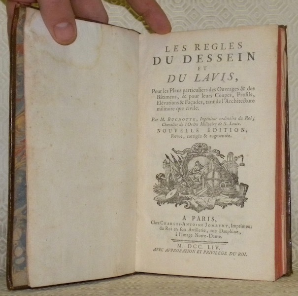
66431Paris, chez Charles-Antoine Jombert 1754, 203x124mm, XV - 214pages, 24 planches dépl. Reliure veau marbré de l’époque, dos à nerfs, étiquette de titre, fleurons dorés, tranches rouge. Belle reliure. Bel exemplaire.
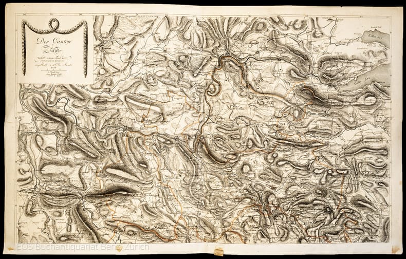
18161047CGZürich, Füssli, 1816. 2 Kupferstichkarten. 44 x 70 cm.
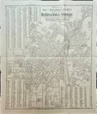
1910List3117Los Angeles California: Bekins Van & Storage 1910. Map measuring 15 ¼ x 13 ¼ inches. Folded with some wrinkling; Near Fine. A map of Los Angeles between Aldama Street South Indiana Street Slauson Ave and Arlington Street published by Bekins Van & Storage. The map is undated but based on the city’s population listed on the map—a mere 125000—it was created some time between 1900 when the population was about 103000 and 1910 when it had ballooned to over 319000. Bekins Van & Storage unknown
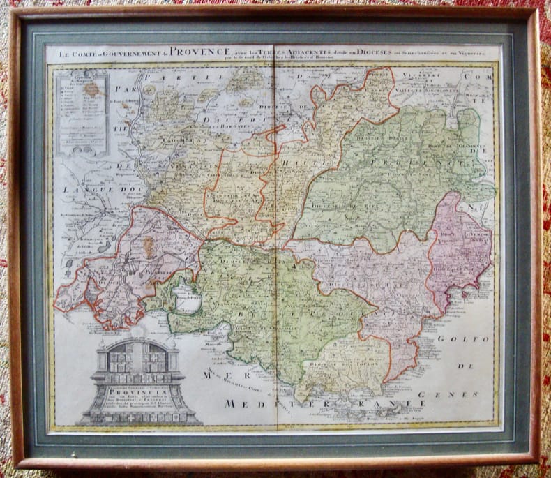
178149841781 Paris Lattré 1781-1791 5 cartes anciennes. Env. 30 x 41,5 cm hors marges, 36,5 x 51 cm toutes marges comprises. Frontières rehaussées. Bonnes conditions. Quelques menues déchirures marginales à certaines cartes. Pliure partiellement fendue à la carte du Dauphiné et de la Provence.
Cm. 25 x 22. Certa geografica incisa in rame e colorata all'epoca. Inquadrata in cornice ottocentesca di noce.
Paris, Chez Desaint & Saillant, rue S. Jean de Beauvais (de l'Imp. de P. G. Le Mercier, rue S. Jacques), 1750-56, volumi 5 (su 6), in-4, bella legatura coeva in pieno vitello marmorizzato, dorso a 5 nervi con titolo su tassello ed eleganti fregi floreali impressi in oro a piccoli ferri negli scomparti, piatti riquadrati da triplo filetto oro, come il merletto interno, tagli e sguardie marmorizzati, nastrino in seta rossa, pp. VIII, (8), 616, (22); (8), 507, (17); (4), 546; (4), 500; (4), 540. Fregi xilografici al frontespizio e in forma di testate e finali. Con 4 carte geografiche (Germania, Impero dei Parti, Palestina, Dacia, Mesia e Tracia) di Jean Baptiste Bourguignon d'Anville incise in rame da Guillaume Nicholas Delahaye, su tavole piegate fuori testo. Ricordiamo che d'Anville, che fu geografo del Re di Francia è considerato il 1° cartografo moderno per l'accuratezza delle sue mappe; De la Haye fu membro di una famiglia di ugonotti francesi che contò diversi incisori al servizio dei più importanti cartografi francesi del 700. Qualche difetto alle coperte, ed alcune carte brunite, ma ottime condizioni. Edizione originale. Manca il volume IV.