333 résultats
1875Z032London: William Collins Sons and Company 1875. Second Edition . Hardback. Vg. small 8vo. BEING A CONCISE DESCRIPTIONS OF THE CHIEF PLACES OF INTEREST IN THE METROPOLIS ii 192 iipp. 58 illustrations by Sargent and Others and a Clue-Map by Bartholomew one section has a long closed tear with no loss. Advert end-papers. Orig. dec. brown cloth blocked in black and gilt. The British Library has an earlier edition of 1871. <br/> <br/> William Collins, Sons, and Company hardcover
20587<p>Atlanta: Georgia Dept. of Natural Resources. 1976. 33pp. illus. paperback oblong folio: Very Good. An unusual study in black and white photos and maps.</p> Atlanta: Georgia Dept. of Natural Resources paperback
1885MH045London: Blackie & Son 1885. 1st Edition . Hardcover. Fine. small 4to. Volume One only of two. cxiv 468pp. Original half calf with raised bands and dec. compartments. Green morocco label with titles in gilt. Original pub. half calf binding bound by Blackie of an interesting and well illustrated view of the world in the late Victorian period. 9 maps 16 plates <br/> <br/> Blackie & Son hardcover
1847GT028London: Charles F. Cheffins 1847. fifth Edition . No Binding. Vg. FOLDING MAP c1847. Lithographic folding map mounted on linen with 20 dissected sections with an additional section for Cornwall attached at the lower left corner. An inset map at the top of Scottish lines.Outline blue colour to the coast-line and colouring to the railways in black and red with additional hand-coloured marks and amendments to the details by a previous owner please email for photos. Encased in simple green cloth card covers with a pasted title and an engraved inside cover. 71x57cms. A grubby map but scarce in all editions. <br/> <br/> Charles F. Cheffins unknown
161910Amsterdam Theatrum Orbis Terrarum Ltd. 1967. Original publisher's black cloth hardback gilt title on spine and frontcover small 4to: Each volume ca. 500 pages - several essays with illustrations maps references bibliographical notes. Very fine copies - as new. Volumes XIII & XIV missing. Amsterdam, Theatrum Orbis Terrarum Ltd. 1967 hardcover
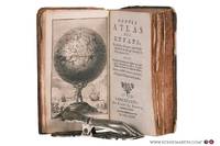
178078258Bruxelles: Benoît Le Francq 1780. Full leather hardcover. xx240 pp. illustrated with a black-and-white frontispiece showing Atlas as a child holding up the celestial sphere and 24 old hand-colored folding maps/plates after G. Dellisle. Rare Brussels pocket atlas based on the 5th Amsterdam edition published by B. Vlam in the same year 1780. Includes B. Vlam's bookseller's list at the end. One map has a repaired taped tear and some maps have frayed edges. Bound in a leather cover with various damages. The book is complete and the maps remain visually attractive. Text in French / Français. See pictures. Benoît Le Francq hardcover
8424139070.Gpaperback. Good. Access codes and supplements are not guaranteed with used items. May be an ex-library book. paperback
8424141202.Gpaperback. Good. Access codes and supplements are not guaranteed with used items. May be an ex-library book. paperback
8424141210.Gpaperback. Good. Access codes and supplements are not guaranteed with used items. May be an ex-library book. paperback
1837TS145London: Longman & Co. 1837. 1st Edition . original half red morocco. Grubby. octavo. 23 attractive double page maps of the ancient world with outline hand-colouring. Index. A scruffy original binding but with clean maps. <br/> <br/> Longman & Co. unknown
1790Map924London: Thomas Bowen 1790. 1st Edition . printed Map. Fine. Folio. ND 1790. Engraved by Thomas Bowen for Barlow's General Hostory of Europe. A fine copy printed on thick paper with two folds. Nice strong impression with strong plate mark and good margins. No wear or splits. A lovely example. One small fox mark. 36x47cms. Interesting map in that Portugal is not mapped in this cartographic original merely the ' Portugal' where the country should be.ESCT 97895 Barlows History c1790. <br/> <br/> Thomas Bowen unknown
1760Map1001London: T. Bowen 1760. Original First Edition . No Binding. Fine. c1760 A fine example of Bowens map of Portugall. Title within an oval frame. An uncoloured example and printed of thick paper. 2 vertical folds to the page but nice clean margins and a dark impression. Some minor foxing reflecting its age but a nice example. 'Prepared for Barlow's General History of Europe'. Blank reverse. 33x34cms Barlows volume is often very damp stained and foxed. This map is however a fine example. Thomas Bowen 1714-1767 <br/> <br/> T. Bowen unknown
1744Map918London: Eman. Bowen 1744. 1st Edition . Hardcover. Fine. Double hemisphere map of the world with four seated allogorical women in each corner of the plate. Uncoloured state with a trimmed right hand side but no loss to the map. Plate impress 31.5 x 53.5 cms with sheet size 36.5 x 54 cms. Centre fold. Pre-Cook outlines of Australia and New Zealand. PLEASE EMAIL FOR PHOTOS. <br/> <br/> Eman. Bowen hardcover
1747Map882London: E. Bowen 1747. 1st Edition . printed Map. Fine. . Drawn from the Most approv'd Foreigners Mpas and Charts and Regulated By Astron'l Observations. An original printed map with outline hand-colour to the coast-line and cartouche in the lower right corner. A lovely plate impressed map with sharp clear engraving and title cartouche to the lower right-hand corner. Emanuel Bowen 1694- 1767. Plate 31.7x22.0 paper 38.5 x 26.5 cms. Nice margins. From the 1747 'A Complete System of Geography'. <br/> <br/> E. Bowen unknown
1645Map910Amsterdam: Joan Blaeu 1645. Original printed issues 1st Editions . No Binding. Vg. Large folio. ND c1645-. 410 x 495mm Double page folding map of the county of Gloucestershire with attractive original hand-colour outline and wash. Nice wide margins and German text to the reverse. One lateral paper crease but no loss. PLEASE EMAIL FOR PHOTOS. <br/> <br/> Joan Blaeu unknown
1964P268Amsterdam: Theatrum Orbis Terrarum Ltd 1964. facimile reprint . Hardback. Fine/Fine. Oblong 4to. xiii 60 114 118 s. : illus maps 41 fold. port. Fascimile of the first edition printed in English. Theatrum Orbis Terrarum. Series of Atlases in Facsimile. First Series Volume VI <br/> <br/> Theatrum Orbis Terrarum Ltd hardcover
1961020975New York: The Bibliographical Society of America 1961. Fine condition. The spine is square and flat with NO creases. NO owner's name or bookplate. NOT a library discard. Pages are clean and unmarked. NO foxing. THE PAPERS OF THE BIBLIOGRAPHICAL SOCIETY OF AMERICA Volume Fifty-Five Vol. 55 LV Fourth 4th Quarter 1961. 1300 copies printed. Contains: A STONE THROWN AT THE MAP MAKER by Kenneth Nebenzahl; plus contributions by G. Thomas Tanselle; George N. Belknap; etc. Includes the title-page laid-in and index bound-in for the whole of Volume 55. Composed and printed by the Anthoensen Press Portland Maine. Bound in the original wraps. 6.25" wide by 9.5" tall. First Edition. Softcover. Fine condition. xiv pp. 283-426. Great Packaging Fast Shipping. The Bibliographical Society of America Paperback
1951020965New York: The Bibliographical Society of America 1951. Very Good condition. The spine is square and flat with NO creases. NO owner's name or bookplate. NOT a library discard. Pages are clean and unmarked. NO foxing. THE PAPERS OF THE BIBLIOGRAPHICAL SOCIETY OF AMERICA Volume Forty-Five Vol. 45 XLV Third 3rd Quarter 1951. 1300 copies printed. Contains: THE RUYSCH MAP OF THE WORLD 1507-1508 by Bradford F. Swan; EARLY WEST VIRGINIA IMPRINTS by Boyd B. Stutler; a contribution by Lawrence C. Wroth; etc. Composed and printed by the Anthoensen Press Portland Maine. Bound in the original wraps. 6.25" wide by 9.5" tall. First Edition. Softcover. Very Good condition. iv pp. 191-272. Great Packaging Fast Shipping. The Bibliographical Society of America Paperback
1839Map908London: John Betts 1839. 1st Edition . No Binding. Fine. Folio. Lithographic double page folding map with original outline colour and wash with an inset of Jamacia to the left of California the atlas 'THE LONDON SERIES OF MODERN MAPS' of c1839. Attractive decorative floral border with Texas still an independant state. A fine copy of a scarce map from John Betts Modern Altas of c1839. Nice original colour unfaded and a near mint copy of the map. PLEASE EMAIL FOR PHOTOS.14x16 inches 34x41cms. <br/> <br/> John Betts unknown
1868016331New York: F. W. Beers; A.D. Ellis; G.G. Soule 1868. Near Fine condition. NO chips. NO tears. A bright clean tight copy. The spine is square and flat with NO creases. NO owner's name or bookplate. Pages are bright white clean and crisp. This is an undated modern facsimile of the 1868 original. Oversize Softcover with black cloth spine. 10.75" wide by 14" tall. This atlas consists of a printed title-page; an outline map of Morris County; 31 single and double-page maps; a Table of Distances for Morris County; and 2 pages of lithographic views of 6 buildings George Washington's Headquarters in 1779/80; Boonton Academy; Schooley's Mountain Seminary; etc. Included are maps of: Washington; Chester; Mendham; Brookside; Stephensburg; Whippany; Morris; Morristown; Passaic; Green Village; New Vernon; Chatham; Madison; Troy; Hanover; Chatham Long Hill; Parsippany; Roxbury; Drakesville; Randolph; Dover; Oram; Jefferson; Flanders; Milton; German Valley; Schooley's Mountain; Rockaway; McCainsville; Succasunny; Hanover; Boonton; Montville; Boonton Borough; and Pequannock. Laid in is a facsimile of an old map of Morristown scale: 20 rods to the inch that unfolds to 22" wide by 25" tall. The map is keyed to the locations of Morristown businesses such as livery stables markets boot and shoe sellers manufactures physicians hotels editors merchants etc. This large book will require extra postage for Priority and International shipments but only the standard charge for media mail. Facsimile Edition. Oversize Softcover. Near Fine condition. Unpaged but 64 pages. F. W. Beers; A.D. Ellis; G.G. Soule Paperback
1903Map928London: John Bartholomew 1903. Original issue . No Binding. Fine. Large Folding Map. 21x16 inch folding Bartholomew colour printed map in 36 dissected sections laid on linen. Sheet Number 24 Oxford. A RARE example of a pre-WW1 foxing hunting map. The map has been over laid with hand-coloured boundary lines showing the areas at the turn of the century. The local fox hunts covered north of Oxford and south of Stratford Upon Avon and between Cheltenham in the west and Aylesbury in the east. Each pack hunting area shown with bright and bold water-coloured lines and their titles hand printed in black type. A large folding map cased within a pebble-grained red unmarked case. North Cotswold Cotswold V.W.H. South Oxfordshire Biscester Hey Throp Grafton and Warwickshire. Many of the samll village names under-lined in ink. <br/> <br/> John Bartholomew unknown
1997Q-0679777121Random House Reference 1997-01-28. Hardcover. New. In shrink wrap. Looks like an interesting title! Random House Reference hardcover
1970TS343Amsterdam: N. Israel 1970. reprint . paper wrappers. Fine. large 4to. 125pp. Pale blue heavy paper cover. Trifle toned to the spine but a fine copy with no annotations or marks. From the fine reprint series 1960-. Imago Mundi is the only English language periodical dedicated to fine and rare maps and the history of cartography. MORE COPIES ARE AVAILABLE FROM THIS SERIES. Please email. <br/> <br/> N. Israel unknown
1821Map884Blundtisham St Ives: R.G. Baker 1821. 1st Edition . No Binding. Vg./Fine. Rolled wall map from four engraved sheets laid on a single roll of strong linen. Surveys by R.G. Allen in the Years 1816 17 18 19 & 20. Engraved by J.Allen 17 Poplar Row New Kent Road Surrey. Dedication to 'The Right Honorable Philip Earl of Hardwicke Lord Lieutenant and Custos Rotorum of the County of Cambridge. B.L. 004813374 One inch to one mile. The first large large scale survey and map of the county of Cambridge one of the last to be surveyed in England. This map was funded by public subscription. Hand -coloured and comprising 4 sheets joined and mounted on two wooden rolls to display lacking one roll. <br/> <br/> R.G. Baker unknown
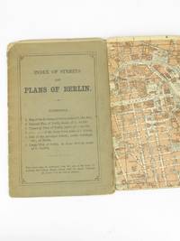
18935233Leipsic: Karl Baedeker 1893. Stiff Printed Wraps. Good. Wagner & Debes. 16mo. Pp. 11 street index 6 fold-out color maps. Saddle stapled green-gray printed wrap. Wrap fold split effaced pencil notes edges rubbed and soiled. Map corners creased. Pocket-size visitor's street guide in English with superb cartography by the firm of Eduard Wagner & Ernst Debes from the publisher's golden age under Fritz Baedeker. Preserved in a clear archival sleeve. Karl Baedeker unknown