333 résultats
1875Pa620London: William Blackwood 1875. New Edition . Hardback. Fine. Elephant Folio - over 15" - 23" tall. 20 x 135 inches. 48 double page folding colour maps and the North Polar Chart as a frontis. Fine original red half calf binding with gilt titles. Specail; index after each map. The fourth edition with each map updated to reflect the ever changing speed of the changes taking place in the industrail age. Dedication page to Queen Victoria. Each map as an adjacent index bound in and a prospectus for the companion book to the atlas is bound in at the front Atlas Geographicus' pub. separately. A complete and fine copy <br/> <br/> William Blackwood hardcover
1643Map275bLondon: Thomas Jenner 1643. Original Map . printed Map. Vg. An uncoloured original map of Dorsetshire with a distance grid showing the miles between the principal towns 125x130mm. A nice dark copy with a couple of worm holes <br/> <br/> Thomas Jenner unknown
1643Map275aLondon: Thomas Jenner 1643. 1st Edition . printed Map. Vg. An uncoloured original map of Dorsetshire with a distance grid showing the miles between the principal towns 125x130mm. A nice dark copy with a couple of worm holes <br/> <br/> Thomas Jenner unknown
1643Map476aLondon: Thomas Jenner 1643. Original Map . printed Map. Vg. An uncoloured original map of Northampton with a distance grid showing the miles between the principal towns 125x130mm. A nice dark copy with a couple of worm holes <br/> <br/> Thomas Jenner unknown
1643Map476London: Thomas Jenner 1643. Original Map . printed Map. Vg. An uncoloured original map of NOTTINGHAMSHIRE with a distance grid showing the miles between the principal towns 125x130mm. A nice dark copy with a couple of worm holes <br/> <br/> Thomas Jenner unknown
1643Map555aLondon: Thomas Jenner 1643. printed Map. Vg. An uncoloured original map of Somersetshire with a distance grid showing the miles between the principal towns 125x130mm. A nice dark copy with a couple of worm holes <br/> <br/> Thomas Jenner unknown
1643Map588London: Thomas Jenner 1643. Original Map . printed Map. Vg. An uncoloured original map of Surry with a distance grid showing the miles between the principal towns 125x130mm. A nice dark copy with a couple of worm holes <br/> <br/> Thomas Jenner unknown
1845GT070London: J&C Walker 9 Castle Street Holborn 1845. 1st Edition . No Binding. Vg. Fine hand-coloured map of the Isle of Wight and the Solent with 18 sections. Coloured boundaries sands roads woods etc. Some handling. ND c 1845. 65x44cms. Folding map covered with green boards with an original Walker's Map of the Isle of Wight label soiled but complete pasted to the front cover which is detached but present. Nice 'Tours in the Isle of Wight' pasted page to the reverse of the cover. Shows miles destinations and stops 15 x 11.5cms. Nicely hand-coloured. Title to the head of the plate with a scale of 1 inch to the mile. J&C Walker traded from 1841-1847 9 Castle Street Holborn from 1841-1847. <br/> <br/> J&C Walker, 9 Castle Street, Holborn unknown
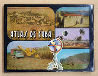
94117La Habana 1978. Quer-Gr8° 143 S. mehrfarbige Karten 3 Bl. 9 Bl. Indice OLwd. m. OU in Schuber Min. fleckig TADELL. Text: spanisch. 010 La Habana, 1978 unknown
1990Map891London: Imago Mundi King's College 1990. Original issue . Hardback. Fine/No d.j. 4to. 180pp.Pub. blue cloth gilt. A fine copy in the original blue cloth. Trifle shelf rubbed. No inscriptions or stamps. Medieval manuscript maps; The map of Bahamas; Maps in 16th century bibles; Land Company mapping in North America in the 'new republic'. etc etc. Imago Mundi is a scholarly journal on the history of maps and was first pub. in 1935. <br/> <br/> Imago Mundi King's College hardcover
1960508064Praeger 1960. First Edition. Hardcover with Dust Jacket. NEAR FINE/NEAR FINE. 10 11-126pp. 12mo sewn binding in black cloth gilt spine lettering. Illustrated throughout with Horrabin's hand-drawn maps and pithy political and historical commentary on facing pages. Owner's name to FFEP and some very faint toning to the endpapers exceedingly clean and sharp otherwise; DJ with a short tear and creasing to rear head clean and bright otherwise and now wrapped in mylar. A lovely book by the famed Socialist Cartographer and illustrator showing aspects of ancient and colonial eras with a particular interest in the African Nationalist movement then hotly active; final publication before his death in 1962. Praeger hardcover
1928008291Paterson New Jersey:: The Benjamin Franklin Press 1928. 8" wide by 11" tall. A square reasonably tight copy. Inner hinges are perfect. Bound in the original blue cloth -- moderately rubbed. The front cover is stamped in black with a surveyor's tripod. Gilt lettering on the spine and front cover is still quite bright and shiny. Pages are clean and free of markings except for previous owner's ink name and a thin stain 1/4 inch by 3 inch at the edge of 7 leaves in the margin only NO text is affected. Illustrated with 28 plates -- maps portraits photographs and document facsimiles. Attractive decorative endpapers. For his inventions in the hydraulic engineering field Erskine was elected a fellow of the Royal Society. He left Britain for New Jersey in 1771 where he worked for the American Iron Company whose extensive mines were located in what is now upper Passaic County. In 1775 he organized the men in his employ and was commissioned a captain in the Bergen County militia. Soon afterward General Washington offered him the position of geographer and surveyor-general to the Continental Army. According to the DICTIONARY OF AMERICAN BIOGRAPHY "Erskine worked zealously for the colonial cause and his maps. were important factors in the ultimate victory." Reprinted here are the letters between Erskine and Washington. There is also an appendix that lists 129 of his maps. The DAB cites this book as a primary source for its article on Erskine. Contains chapters on: Erskine the Inventor; Romance of the Ringwood Mines; The Iron Master in the Making; The Hudson River Obstructions and Campaigns against the Indians; and others treating the history of the American Iron Co. New York City Bergen County militia; surveying for Washington Washington at Pompton N.J.; Washington at Morristown for the winter of 1779-1780 etc. From the intro: "Robert Erskine F.R.S. the Surveyor-General of the Continental Army and the trusted friend of the Commander-in-chief was the silent man behind the scenes who mapped out the by-ways and back-roads over the mountains and -- by his familiarity with the great 'middle-ground' between the Hudson Highlands and the Delaware -- provided Washington with that thorough knowledge of the topography of the country which enabled him repeatedly to out-maneuver the enemy.". First Edition. Hard Cover. Very Good condition./No jacket. xii 216pp. 28 plates. . The Benjamin Franklin Press Hardcover
2015054404El Dorado Hills CA: Savas Beatie. Fine in Near Fine dust jacket. 2015. 1st Edition; 1st Printing. Hardcover. 1611212006 . Hardcover with dustjacket first printing as stated on copyright page signed by both authors book has a mild lean to the spine the binding remains tight the contents are fine and there are no other remarkable flaws the jacket is in excellent condition with no remarkable flaws the original price is present and a professional removable mylar cover is included nice gift copy of this "first battlefield guide for this celebrated assault"; ; 310 pages; Signed by Author . Savas Beatie hardcover
201537931El Dorado Hills CA: Savas Beatie. Fine in Fine dust jacket. 2015. Second Edition. Hardcover. 1611212006 . Illus. color maps jacket now in a clear protector ; 310 pages . Savas Beatie hardcover
1871Pa586St Gallen 1871. Hardback. Fine. SAENTIS-PANORAMA HERAUSGEGEBEN VON DER SECTION ST GALLEN DES S.A.C.Folding lithographic panorama of the Alps. RUNDISCHT VOM GIPFEL DES SENTIS The View Round the Summit Sentis. 4.45m in length. One extra flap on lower edge present. A lithographic printing of a drawing of the mountains of the Alps drawn between October 1870 and July 1871 showiing a beautiful vista with each peak indentified at the top of the sheet with a faint dotted line down to each location. Santis is the highest mountain in Apline area of North-East Switzerland. A lovely copy in fine condition. No splits foxing marks or wear. Original covers trifle sunned to the red spineand fold creases a trifle toned. Attractive lithographic illustrations of Alpine wildlife to the boards. PLEASE EMAIL FOR PHOTOS. <br/> <br/> hardcover
1740TH228London: Printed for Thomas Wright Mathematical Instrument-Maker. And E. Cushee Globe-Make 1740. fifth Edition . Hardback. Vg. 8vo. THE DESCRIPTION AND USE OF THE GLOBES AND THE ORRERY To which is prefixed by way of introduction a brief Account of the Solar System.viii 190pp. 6 folding plates. Pub. advert to the reverse of the title-page. Index of the astronomical terms. Original full calf polished calf binding with gilt dbl. ruled border to the boards. Five raised band and neat owners to the top edge of the title-page. A tight clean and fresh copy with a plain but period binding Near fine Nicholson Calvert 1816 an English Whig politicain who fought at the Battle of Waterloo. <br/> <br/> Printed for Thomas Wright, Mathematical Instrument-Maker. And E. Cushee, Globe-Make hardcover
1745TH352London: Printed for Thomas Wright Mathematical Instrument-Maker. And E. Cushee Globe-Make 1745. sixth edition . Hardback. Vg. 8vo. To which is prefixed by way of introduction a brief Account of the Solar System.viii 190pp. 6 folding plates. Pub. advert to the reverse of the title-page. Index of the astronomical terms. Original full calf calf binding. Five raised bands. A tight clean and fresh copy with a plain but period bindng/ Original binding intact but worn to the extremities and joints cracked but the boards attached. A tight and clean text with beautiful crisp plates. <br/> <br/> Printed for Thomas Wright, Mathematical Instrument-Maker. And E. Cushee, Globe-Make hardcover
1997018214Staten Island New York: Maurizio Martino 1997. BRAND NEW in perfect condition. NO rubbing. NO fading. Bright clean square and tight. Sharp corners. NO owner's name or bookplate. NOT a remainder. Fresh and crisp -- obviously never read. No date but 1997 First Martino printing "strictly limited to 300 copies". This is a facsimile edition with significant additions of Neal Harlow's work that was first published by the Book Club of California in 1950. To this edition Harlow has added a new preamble as well as expert descriptions historical notes and full page reproductions of two new maps that came to light after the 1950 edition was published. Also added here is a new introduction with useful historical and biographical details by Alfred Newman President of California Maps Society. Illustrated with 41 full page maps several that spread over two pages or foldout. Reproduced are 31 maps of the Bay and 10 maps of the Town of San Francisco from 1769-1847. Bound in the original gilt-stamped red cloth. Oversize Hardcover. 9" wide by 12.25" tall. This large heavy book will require extra postage for Priority and International shipments but only the standard charge for media mail. Reprint with additions; Limited 300 . Oversize Hardcover. New/No jacket as issued. xviii 144pp. 41 maps 203 total pages. Great Packaging Fast Shipping. Maurizio Martino Hardcover
1839TH225London: Aldam and Co. Et al. 1839. 1st Edition . Hardback. Fine. 8vo. 100pp. Large folding table of distances frontis. A wonderful early Victorian geography in the orginal stiff card cover with fine buckram cloth cover and a lozenge label pasted to the front cover. A RARE ITEM. Copac 1 copy only 1839. A second edition was published in 1850. <br/> <br/> Aldam and Co. Et al. hardcover
1829Map917London: Longman Rees Orme Brown & Green 1829. 1st edition later issue . No Binding. Fine. Double page large folding map of North America with outline hand-colour to the boundaries and divisions and with a printed decorative border.57x49cms. Originally pub. in 1829 this folding issue had the dated neatly erased. The plate impress mark cropped on the upper half not affecting the border or map. Nicely coloured. Short tear to the upper edge with no loss. Neatly repaired. PLEASE EMAIL FOR PHOTOS. From Halls 'New General Atlas with the Divisions and Boundaries.1843 <br/> <br/> Longman, Rees, Orme, Brown & Green, unknown
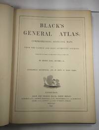
1844026815Edinburgh / London / Dublin: Adam and Charles Black / Longman / Simpkin / Whittaker / Hamilton / Cumming 1844. Good - Very Good condition. Bound in green cloth with black leather spine and corners elaborately gilt decorated. The leather is surprisingly well preserved. The cloth is faded and soiled with frayed edges. SEE PHOTOS. NO owner's name or bookplate. NOT a library discard. Imprinted "MDCCCXLIV" at the foot of the title page with "1844" hand inked beneath. All other pages are crisp clean and umarked with almost no foxing. Full title; "Black's General Atlas: Comprehending Sixty-One Maps from the Latest and Most Authentic Sources Engraved on Steel in the First Style of the Art by Sidney Hall Hughes etc. with Geographic Descriptions and an Index of 56000 Names." The maps several double page are tissue guarded and most are handcolored in red yellow and green. SEE PHOTOS. With the binder's ticket of Smith & Son 306 Lawnmarket Edinburgh. All edges gilt. Oversize hardcover. 13.25" wide by 17.75" tall. This large heavy book will require SUBSTANTIAL extra postage depending on destination that will be charged at our cost. 1844 edition. Oversize Hardcover. Good - Very Good condition. Illus. by NOT a library discard. 12pp. 61 maps 57 page Index. Great Packaging Fast Shipping. Adam and Charles Black / Longman / Simpkin / Whittaker / Hamilton / Cumming Hardcover
1842Map 807Edinburgh: A&C Black 1842. No Binding. Fine/uncoloured. Folding MAP OF DENMARK. Beautiful steel engraving from Encyclopaedia Britanica Seventh edition dated 1842. Plate CCLXXXIV. Fine example with no wear. 410x260mm. Relief is shown by hachures. Engraved by S. Hall Bury Strt. Bloomsbury. Published by A. & C. Black. <br/> <br/> A&C Black unknown
1842Mao 810Edinburgh: A&C Black 1842. No Binding. Fine/uncoloured. Beautiful steel engraving from Encyclopaedia Britanica Seventh edition dated 1842. Plate CCCVII -1 Fine example with no wear. 410x260mm. Engraved by Sidney Hall Bloomsbury. Published by A. & C. Black. An area extending from Birmah Indonesia and the Straits of Malacca to China and the Philippines. <br/> <br/> A&C Black unknown
1842Map 818Edinburgh: A&C Black 1842. No Binding. Fine/uncoloured. Beautiful steel engravings from Encyclopaedia Britanica Seventh edition dated 1842. Plates CCCXVIII and CCXIX 1-2 . Fine examples with no wear. Trifle foxing. 270x380mm. Engraved by Sidney Hall Bloomsbury. Published by A. & C. Black. <br/> <br/> A&C Black unknown
1842Map 816Edinburgh: A&C Black 1842. No Binding. Fine/uncoloured. Beautiful steel engravings from Encyclopaedia Britanica Seventh edition dated 1842. Plates CCCXVIII and CCLXIV-V .Fine examples with no wear. 270x380mm. Engraved by Sidney Hall Bloomsbury. Published by A. & C. Black. <br/> <br/> A&C Black unknown