5 782 résultats
1816Map685Edinburgh: John Thomson 1816. 1st Edition . No Binding. Fine. Original hand-colour fine scarce unfolded copy minor damp stain 510 X 610 From John Thomsons New General Atlas 1817 beautifully hand-coloured on thick paper <br/> <br/> John Thomson unknown
Oblong folio (380 x 510 mm), title page followed by 13 plans, scale, 1 inch to 900 feet, 1 inch to 100 feet; enlargements: 1 inch to 6 chains, unfortunately all leaves and wrappers badly water damaged.
Steel-engraved map on paper; measuring 8.0 x 10.5 ins (approx. 20.00 x 26.5 cms), FINELY COLOURED BY HAND; attractively mounted in bevelled-edge steel-grey card with bevelled edges, a very good, bright, clean copy. The map is enclosed by an elaborate pictorial border incorporating four coats-of-arms and various other symbolic figures, and includes three charming vignettes of Greenwich Hospital, Rochester and Dover.
Hardback, 325x245mm, 400p, 200 colour illustrations, Dutch (NL) edition . ISBN 978906153124113. De Atlas van Mercator, de beroemdste atlas ter wereld, werd in 1595 in meerdere fascikels gedrukt en was al voor zijn tijdgenoten een sensatie. Gerard Mercator bedacht niet alleen het woord atlas voor een systematische verzameling van kaarten, maar hij ontwierp ook de zogenaamde Mercatorprojectie die vandaag nog altijd wordt gebruikt. Van de Atlas van Mercator zijn nog slechts weinig volledige exemplaren bewaard en daarvan zijn er maar enkele ingekleurd. In dit boek wordt een inleiding gegeven op leven en werk van de grote kosmograaf en worden alle kaarten uit de 'Editio principissima' die in de Staatsbibliothek zu Berlin wordt bewaard, in waarheidsgetrouwe kleuren gereproduceerd. Het werk is een hommage aan de uitvinder van het moderne wereldbeeld wiens vijfhonderste geboortedag in 2012 wordt gevierd.
First edition, 8vo (210 x 140 mm), 35, [1]pp., recent quarter calf, marbled boards, morocco title label to spine. Richard Thomas (1779-1858), civil engineer and surveyor, often referred to as Richard Thomas of Falmouth. This was his first appearance in print, on the verso of the terminal leaf is an advert for "A Chart of the Severn, On a large Scale, from an Actual Survey, Size 6 feet by 2 feet, by Richard Thomas". The former owner of this scarce pamphlet has noted "I have this Chart of the Severn - now with my other charts. 1890. N. W." Skempton, 1629; Not in the British Library.
2 Parts, 16 plates, orig. printed wrappers, 937 lots.
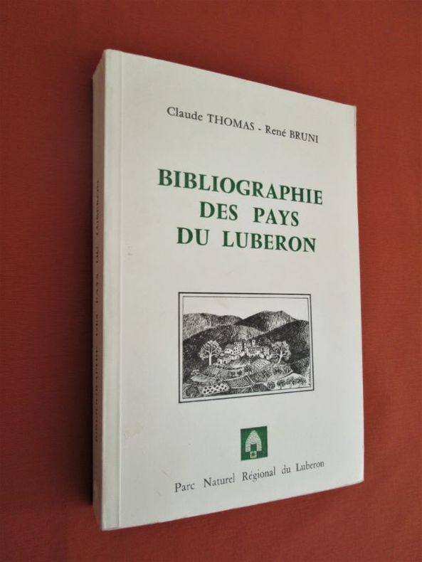
198228648Parc Naturel Régional Du Luberon, Isle sur la Sorgue, 1982. In-8 broché (21,5 x 14,5 cm), 368 pages, Illustrations in-texte et à pleine page. Carte dépliante en fin. Préface, avant propos.-670g.C. - Très bon état
30884, Mercator/ Mercatorfonds , 2011 Hardback, 325x245mm, 400p, 200 colour illustrations, Dutch (NL) edition . ISBN 9789061531241.
1926187311Berlin, 1926. M. einigen Tab. 50 S. OBr. Umschl. kaum angestaubt. (Mitteil. d. Reichsamts für Landesaufnahme So.-H. 3).
1928187313Berlin, 1928. M. einigen Tab. 55 S. OBr. Umschl. kaum angestaubt. (Mitteil. d. Reichsamts für Landesaufnahme So.-H. 5).
7851Paris, Furne, Jouvet et Cie, Libraires-Editeurs / J. Claye, Imprimeur, s.d. (vers 1880). In-folio relié demi-toile verte. 32 cartes en noir : Plan de Strasbourg, Bataille de Monthabor, Pyrénées orientales et occidentales... Très bon état : rousseurs discrètes, bords de couv. élimés.
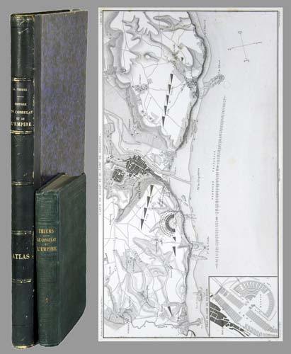
71051aafParis, Paulin-Lheureux, 1845-62, atlas (1866), in-8vo, atlas in-folio, chaque volume env. 500 p., l'atlas comprend 66 cartes dont 7 sur double-page montées sur onglets (deux coloriées), non paginé, toutes les cartes en excellent état + 2 cartes ajoutées: une carte du Nord de l'Italie pour l'étude de la campagne de Napoléon III en1859 par le colonel Suisse F. Lecomte et une carte en fac-similé de la ville de Paris en 1576, reliures en pleine percaline verte, dos et plats estampés de filets à froid, quelques frottements et usures. Atlas in-folio relié en demi-chagrin, dos à nerfs orné de filets dorés, Généralement bel ensemble.
In-8° (cm. 21,4), pp. LIII, (2). Bross. edit. Lista delle pubblicazioni e delle CARTE GEOGRAFICHE re piante dal 1847 al 1955. In fine indice alfab. degli Autori, indice delle Carte, e regolamenti dell Società.
1758T370Dublin: John Exshaw Dame Street 1758. No Binding. Fine. 8vo. 427-480pp. A disbound copy of the Dublin version of the Gentleman's Magazine for the month of August 1758. Fine fresh paper with no foxing wear or marks. The title-page lists 24 articles on the title-page and includes a fine copy of the rare 'A PLAN of the Harbour and TOWN of LOUISBOURG in the Island of CAPE BRETON Drawn on the Spot. Folding page 28 x 20 cms with a plate impression 24 x 18 cms.4 page description of the plan and town. Other articles include an estimate of the Naval Debt; Part of the trial of William Barnard; Journal of the Seige of Louisbourg; General Abercromby's Account of the Exped. to Crown Point. Single page map of 'The Country between CROWN POINT and ALBANY being the Great Pass from the English to the French Settlements in North America'.11.5 x 19.1 cms. Please email for photos. <br/> <br/> John Exshaw, Dame Street unknown
1758T372Dublin: John Exshaw Dame Street 1758. 1st Edition . No Binding. Fine. 8vo. 313-368pp. A disbound copy of the Dublin version of the Gentleman's Magazine for the month of June 1758. Fine fresh paper with no foxing wear or marks. The title-page lists 24 articles on the title-page and includes a fine copy of the rare folding map 'A NEW MAP OF THE ENGLISH CHANNEL' engraved by Ridge 25 x 17 cms. Map engraved by Ridge. Title contents calls for a Sheet map of Germany and not the English Channel. Please email for photos. <br/> <br/> John Exshaw, Dame Street unknown
1758T373Dublin: John Exshaw Dame Street 1758. 1st Edition . No Binding. Fine. 8vo. 3-64pp. A disbound copy of the Dublin version of the Gentleman's Magazine for the month of January 1758. Fine fresh paper with no foxing wear or marks. The title-page lists 21 articles on the title-page and includes a fine copy of the rare folding map 'Island Rathlin showing the Ballycastle Colleries 21x18 cms. Also A PLAN OF THE CITY OF BRESLAU Capital of Silesia 18x12 CMS.Please email for photos. <br/> <br/> John Exshaw, Dame Street unknown
1758T374Dublin: John Exshaw Dame Street 1758. 1st Edition . No Binding. Fine. 8vo. 369-425pp. A disbound copy of the Dublin version of the Gentleman's Magazine for the month of July 1758. Fine fresh paper with no foxing wear or marks. The title-page lists 19 articles on the title-page and includes a fine copy of the rare folding sheet map 'A New and Accurate Map of Germany Drawn from the latest surveys Discribing the Port Roads & Distances from Town to Town according to the original Map of the Prussion Routs Published at berlin By Richd Bennet Engineer'. Engraved by S. Wheatley.33x26 cms. Trifle margin crop lower corner. Title-page call for a map of the Channel Islands but Germany map present. Please email for photos. <br/> <br/> John Exshaw, Dame Street unknown
1758T371Dublin: John Exshaw Dame Street 1758. 1st Edition . No Binding. Fine. 8vo. 481-536pp. A disbound copy of the Dublin version of the Gentleman's Magazine for the month of Sept 1758. Fine fresh paper with no foxing wear or marks. The title-page lists 25 articles on the title-page and includes a fine copy of the rare 'Plan of the Country from the LANDING PLACE with the Encampments and Marches of the Troops under Major General ABERCROMBIE to the Attack of TICONDEROGA . 19 x11 cms. Together with an account from the action. Also a fine plan of St Malo with map of part of French Coast inset 19 x 11cms together with an account of shipping lost in recent action. Also a PLAN of Cherburg with Channel map inset 19 x 11cms with an account. All 3 plans engraved by Ridge. Please email for photos. <br/> <br/> John Exshaw, Dame Street unknown
1758W196Dublin: John Exshaw Dame Street 1758. 1st Edition . Audio Book DVD. Fine. 8vo. 595-648pp. A disbound copy of the Dublin version of the Gentleman's Magazine for the month of November 1758. Fine fresh paper with no foxing wear or marks. The title-page lists 25 articles on the title-page and includes a fine copy of the rare map 'A Plan of Milford Haven' by Ridge; 19 x 12 cms. Articles include the capture of Fort Frontemac. Major Grant debacle at Fort Quesne. Please email for photos. <br/> <br/> John Exshaw, Dame Street unknown
1758W204Dublin: John Exshaw Dame Street 1758. 1st Edition . No Binding. Fine. 8vo. 131-192pp. A disbound copy of the Dublin version of the Gentleman's Magazine for the month of April 1758. Fine fresh paper with no foxing wear or marks. The title-page lists 24 articles on the title-page. Articles include History of the last campaign in North America 214-221; The Idler A New Paper; Account of the pilgrimages to Mecca; Temoray foot bridge over the Thames is consumed by fire; etc Please email for photos. <br/> <br/> John Exshaw, Dame Street unknown
1758W201Dublin: John Exshaw Dame Street 1758. 1st Edition . No Binding. Fine. 8vo. 259-312pp. A disbound copy of the Dublin version of the Gentleman's Magazine for the month of May 1758. Fine fresh paper with no foxing wear or marks. The title-page lists 22 articles on the title-page. Articles include The Effects of Camphire on a 'lunatic'.; York rioters ordered for execution; Shipping lists; The conduct of Admiral Knowles. Please email for photos. <br/> <br/> John Exshaw, Dame Street unknown
1972127575The Automobile Association of South Africa - Keartland Press, Johannesburg, 1972. 232 S. ; 25,5 x 19 cm ; Pp. ;
13019aafAmsterdam, Meridian, 1971, in-4°, XX + 270 p., richly illustrated in the text and full page, and with 14 fac-simile maps, original cloth binding.
24 cm, brossura illustrata; pp. v, 111; 40 tavole in nero e a colori fuori testo, timbretto al frontespizio