TESI MARIO ( A CURA DI )MareMagnum

5 782 résultats
IN 8°, pp.VI, 111. COPERTINA EDITORIALE PATINATA ILLUSTRATA A COLORI CON TITOLO. CATALOGO DELLA IX CONFERENZA INTERNAZIONALE DI STORIA DELLA CARTOGRAFIA<BR>( PISA - FIRENZE - ROMA , MAGGIO - GIUGNO 1981 ).IN CUI SONO ELENCATE 278 SCHEDE .<BR>TAVV. XL f.t. in b/ n/ col. CHE RIPRODUCONO CABREI, MAPPAMONDI, CARTE, ECC.<BR>OTTIMA CONSERVAZIONE DI QUESTO RARO CATALOGO. ID, 6640
ACQUATINTA, cm.26 X 37 ( impr.) / 23 X 34 ( ved.) + AMPI MARGINI. PUBBLICATA IN: FONTANI FRANCESCO, VIAGGIO PITTORICO DELLA TOSCANA. OTTIMA CONSERVAZIONE. ID, 6700
ACQUATINTA cm.26 X 36 ( impr.) / 23 X 34 ( ved.) + AMPI MARGINI. PUBBLICATA IN: FONTANI FRANCESCO, VIAGGIO PITTORICO DELLA TOSCANA. OTTIMA CONSERVAZIONE. ID, 6699
Very light shelfwear and creasing else fine. ; Lecture given in May 1997 by Commander Christopher Terrell, Head of the Department of Navigation at the National Maritime Museum at Greenwich until 1987, on the evolution of the sea chart from its origins to nowadays. In a long journey that began from the early thirteenth-century sea charts on vellum to reach the nineteenth-century sophisticated British hydrographical surveys, chart-making underwent a variety of phases ranging from the Mediterranean portolans to the great contribution of the French eighteenth-century school of organised hydrography. ; Cyprus Cartography Lectures No. 4. the Helen Wallis Memorial Lecture; 4to 11" - 13" tall; 46 pages
3 voll.in 4 tomi, completo <br/> TITOLO: L'évolution de la lithosphère. Vol.I: Pétrogénèse. Vol.II (premier fascicule): Orogénèse. Vol.II (second fascicule): Orogénèse. Vol.III: Glyptogénèse. <br/> AUTORE: Termier,Henri et Geneviève.<br/> EDITORE: Masson et Cie, Editeurs<br/> DATA ED.: 1956-1961,<br/> COLLANA: ant.e ai dorsi. Legg. sbiadite ma solide ed eccellenti interni.<br/>
TEN HOORN NICOLAUS PADOVA. , 1703, Ottimo (Fine) ottime condiz.. incisione in rame <br> in dodicesimo cm. 16 x 12 <br> <br> <br>
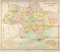
55306Kyiv: Vydavnytstvo politychnoi literatury Ukrainy 1965. Single leaf measuring 95 × 80 cm color offset lithograph. Creases from folding; light fading due to stock; else about very good. A colorful infographics map showcasing cultural development of Soviet Ukraine in 1965 likely published ahead of the celebrations planned for the 50th anniversary of the October Revolution in 1967. The map promotes the Ukrainian SSR as having exceptional educational and cultural resources showing the size and locations of universities trade schools theatres museums as well as TV and radio towers print runs of magazines newspapers and educational literature. Two inserts at the lower corners show locations of libraries and archives left corner and culture clubs and cinemas right corner. Eight additional graphs at the bottom show consistently growing numbers of students enrolled in technical schools universities and other secondary education institutions as well as the number of scientific workers. The graphs also show a growing number of theatres and museums print runs of magazines newspapers and books as well as retail sales of books in millions of rubles. <br /> <br /> The map was published by the Political Literature publishing house of Ukraine rather than by the Academy of Sciences and the scale is not mentioned on the map but is likely 1:1750000 to 1:1500000 typical for Soviet maps of this period suggesting that this publication was made primarily for propaganda purposes. Likely for this reason no mention of this map is made in the Ukrainian cartographic references such as Rostyslav Sossa's "Political and Administrative maps of Ukraine 1918-2008 Politiyko-administratyvni i administratyvni karty Ukrainy 1918-2008 which does mention several other maps by Teledido as map designer and Povolots'kyi as editor. In addition to this map the authors collaborated on other statistical/cartographic projects which mapped and diagrammed the five-year plans of the 1960s-1970s. <br /> <br /> Rare despite the 33000 copies printed. As of December 2025 KVK OCLC show two copies worldwide both in North America. unknown
Supplemento alle vie d'Italia. in custodia edit.
Very Good Turkish, Ottoman (1500-1928) Original map of Kars Fortress. Oblong: 45x57 cm. In Ottoman script. Scale: 1/21000. [PLAN OF KARS FORTRESS] Kars Kal'asi plâni (Based on 1898 discoveries and 1908 practice). A very detailed plan in Ottoman script of Kars Fortress and is environment. Some red markings. Extremely rare.
Sm. 8vo., First Edition, with 40 full-page coloured plates, neat signature on front free endpaper, some faint offsetting from fold-ins to free endpapers; original series binding of printed boards, a near fine copy in unclipped dustwrapper. King Penguin, 61.
<p>23x21,5 cm, cartoncino editoriale illustrato; p. 111, 291 schede sulla rappresentazione cartografica,sui manufatti edilizia, aspetti produttivi e bibliografia. Numerose illustrazioni e carte geografiche</p>
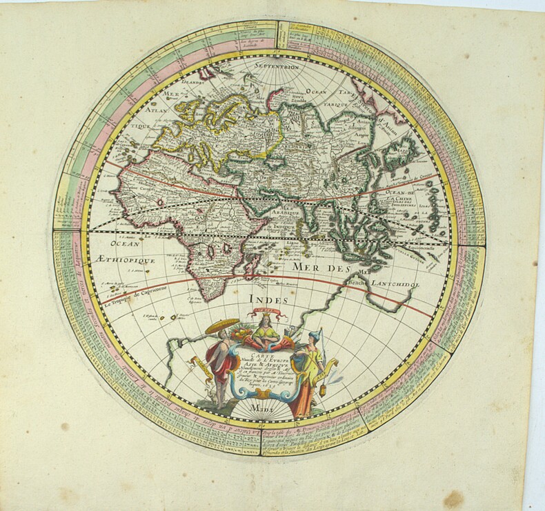
1639PHO-2225Paris, Melchior Tavernier, 1639, 37 x 35 cm, cuvette 30 x 30 cm. Gravure sur cuivre, en couleurs, renforcé au milieu PAIRE COMPLÈTE ET RARE
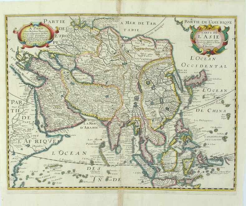
1639PHO-2226Paris, Melchior Tavernier, 1639, 378x345mm, cuvette 360x280mm, renfort au pli, manque 1mm au centre
14251, Brussel, Koninklijke Belgische Academie, 1970., softcover, Broche, couverture d' editeur, 29,5x21cm, 32pp.
softcover, Broche, couverture d' editeur, 29,5x21cm, 32pp. Royaume de Belgique. Comite national de geographie. Commission de l' atlas national. Atlas de Belgique, planche 17.
50698, Brussel, Koninklijke Belgische Academie, 1970., softcover, 29,5x21cm, 32pp. Nederlands,
softcover, 29,5x21cm, 32pp. Nederlands Royaume de Belgique. Comite national de geographie. Commission de l' atlas national. Atlas de Belgique, planche 17.
163046404471s. l. (Paris), , (vers 1630) ; in-8 oblong, demi-basane rose, dos lisse orné de motifs dorés. (Reliure du XIXe siècle). Titre gravé dans un encadrement baroque de rocailles, table gravée, 51 planches numérotées pour ce titre auxquelles on a ajouté 15 autres gravures.Cartes des gouvernements, plans et vues des villes. Les plans de Champagne concernent les principales villes de l’actuelle Champagne, mais aussi les Ardennes et la Lorraine. Ay, Chaalons, Charleville, Chaumont, Clermont, Dormans, Espernay, Langres, Maubert Fontaine, Mery sur Seine, Meszière, Monteclair, Montigny le Roy, Mouzon, Ste Menehould, Troyes, Verdun, Villefranche, Virty le François. Pour chaque gouvernement, une carte de la région, chaque ville est ensuite représentée par un plan et une vue. La table annonce pour la planche 29 un plan de Maubert-Fontaine, elle a été remplacée ici par une vue de Dampierre non numérotée qui n’est pas annoncée dans la table. Les 15 cartes et vues ajoutées sont du même format, certaines, du XVIIe, de la même facture que l’album, semblent être également de Tassin, d’autres sont plus tardives, toutes montrent des vues et plans de villes de Champagne. Certaines planches, en particulier les figues ajoutées, ont été montés sur papier vergé par le relieur du XIXe siècle qui a aussi doublé un marge. De la bibliothèque de Louis Morin, typographe à Troyes (ex-libris du XIXe), ce dernier a noté sur la garde : “Il a été ajouté des vues et plans, ce qui (...) rend le présent recueil des plus intéressants”.
Grande carte dressée par PELTIER, format 110 X 120, sous couverture.- Tirage en 6 couleurs. Très bon état général. [ARCH]