5 783 résultats
1832Pa402London: A. Arrowsmith and B. Fellowes 1832. 1st Edition . Hardback. Vg. 12mo. Engraved title engraved index and 19 engraved maps with outline colour lower half of Italy lacking. Double page and folding maps. Some edges of folds split. Original binding with detached front board. The ancient world by Arrowsmith 'Hydrographer to the King' William IV <br/> <br/> A. Arrowsmith and B. Fellowes hardcover
1837TS145London: Longman & Co. 1837. 1st Edition . original half red morocco. Grubby. octavo. 23 attractive double page maps of the ancient world with outline hand-colouring. Index. A scruffy original binding but with clean maps. <br/> <br/> Longman & Co. unknown
1960508064Praeger 1960. First Edition. Hardcover with Dust Jacket. NEAR FINE/NEAR FINE. 10 11-126pp. 12mo sewn binding in black cloth gilt spine lettering. Illustrated throughout with Horrabin's hand-drawn maps and pithy political and historical commentary on facing pages. Owner's name to FFEP and some very faint toning to the endpapers exceedingly clean and sharp otherwise; DJ with a short tear and creasing to rear head clean and bright otherwise and now wrapped in mylar. A lovely book by the famed Socialist Cartographer and illustrator showing aspects of ancient and colonial eras with a particular interest in the African Nationalist movement then hotly active; final publication before his death in 1962. Praeger hardcover
Sm. 8vo., First Edition, with 40 full-page coloured plates, neat signature on front free endpaper, some faint offsetting from fold-ins to free endpapers; original series binding of printed boards, a near fine copy in unclipped dustwrapper. King Penguin, 61.
London, Penguin Books, 1953, 16mo (cm. 18 x 12,5) legatura cartonato con copertina e sovraccoperta illustrate a colori, pp. 32 + 40 carte a colori a piena pagina (The King Penguin Books, 61) .
<br/> TITOLO: An Outline of China's Physical Geography. <br/> AUTORE: Mei'E,Ren. Renzhang,Yang. Haosheng,Bao.<br/> CURATORE: Translated by Zhang TingQuan and Hu Genkang.<br/> EDITORE: Foreign Languages Press<br/> DATA ED.: 1985,<br/> COLLANA: Coll.China Knowledge Series.<br/> EAN: 9780835111911 First edition.
(Codice TU/1055) Due volumi in 8° (23 cm) XLVIII-555, 679 pp. Manca il 3° volume. Legature originali mezza pergamena, tasselli e titolo oro. Una tavola ripiegata, piegatura parzialmente lesa. Tracce di antichi timbri, iniziali ai frontespizi, leggeri aloni nelle sole prime e ultime pagine.Testo in ottimo stato. ~~~ SPEDIZIONE IN ITALIA SEMPRE TRACCIATA
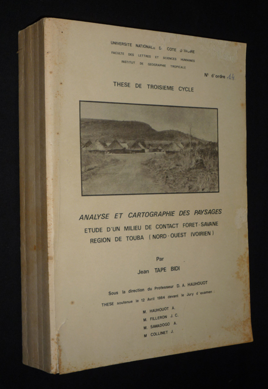
1984xs2308Université Nationale de Côte d'Ivoire Dos carré collé 1984 In-4 (21 x 29 cm), dos carré collé, 458 pages, thèse de doctorat 3e cycle ; pliures au dos, quelques traces et rousseurs aux plats et tranches, déchirure sans manque et éraflures au premier plat, par ailleurs intérieur bien conservé, état moyen. Livraison a domicile (La Poste) ou en Mondial Relay sur simple demande.
175811077Sans lieu, sans nom, [1758-1762]. 6 cartes géographiques en noir au format de 92.5 x 59.5, entoilées, au format plié de 15.5 x 20 cm., chacune avec l'étiquette de Ch. Picquet (géographe ordinaire du Roi et de S.A.A. Monseigneur le Duc d'Orléans) contrecollée, languette de vélin portant le numéro des cartes. Etui-boite cartonné bordeaux orné de roulettes, de la mention "Bibliothèque V. Perdonet" et du titre, le tout doré. Etui un peu frotté, avec quelques piqûres sur la partie cachée de l'emboîtement. Cartes en très belle condition.
Folding coloured map on paper measuring 32 x 40.00 ins (approx. 81.25 x 101.5 cms) folding in 28 panels to 8.25 x 6.0 ins (approx. 17.75 x 15.25 cms); original pictorial card wrappers, wrappers very lightly rubbed else a near fine copy.
<br/> TITOLO: Ancient Microworlds. <br/> AUTORE: Foster,Giraud. Barker,Norman.<br/> CURATORE: With a foreword by francis Hueber. <br/> EDITORE: Custom & Limited Editions<br/> DATA ED.: 2000,<br/> EAN: 9781881529651
Nel cartiglio a forma di nastro posto nel mare, è inciso il titolo: ANCONA. Lungo il margine inferiore, distribuita su undici colonne, troviamo una legenda alfanumerica (A-Z, AA-RR e 1-45) con rimandi a luoghi e monumenti notabili. Segue l’imprint Romae Claudij Ducheti formis 1585 e la firma Ambrosius Bram. fe. Orientazione fornita da una rosa dei venti nel mare, il nord è a sinistra. Pianta prospettica della città di Ancona incisa da Ambrogio Brambilla per l’editore Claudio Duchetti. Si tratta di una replica, di formato ridotto, dell’opera di Giacomo Fontana. Le sole modifiche riguardano l’assenza del cartiglio con la dedica, in alto a destra, rimpiazzato da due golette, e l’aggiunta di tre voci nella legenda. Nipote di Antonio Lafrery, Claude Duchet o Duchetti ne eredita il patrimonio cartografico in lastre e prosegue l’attività di editore dello zio, morto nel 1577, incrementando la serie di piante e carte a stampa. Duchetti incaricò il suo principale collaboratore, l’incisore milanese Ambrogio Brambilla, di realizzare una copia della carta del Fontana, della quale perse il possesso nella divisione ereditaria tra lui e il cugino Stefano. L’opera viene stampata per la prima volta proprio nell’anno della scomparsa di Claudio Duchetti (1585) e la lastra fu ereditata da Giacomo Gherardi. Possiamo identificarla con l’Ancona, n. 431 dell’inventario della vedova di Gherardi, Quintilia Lucidi del 17-19 ottobre 1598. La matrice, nel 1602, venne acquisita da Giovanni Orlandi che la ristampò inalterata con la sola aggiunta del proprio imprint. Acquaforte e bulino, 1585, firmata in lastra dall’editore. Esemplare del secondo stato di due recante l’indirizzo di Giovanni Orlandi, e la data Roma 1602. Magnifica prova, impressa su carta vergata coeva, con margini, in ottimo stato di conservazione. Bellissimo esemplare di questa rara pianta. Bibliografia Bifolco-Ronca, Cartografia e topografia italiana del XVI secolo, p. 2120, tav. 1075, II/II; Bonasera (1979): p. 87, n. 17; Cartografia Rara (1986): n. 7; Christie’s (1998): n. 1078; Christie’s (2012): n. 54; Destombes (1970): n. 67; Ganado (1994): II, n. 94 & III, n. 119 & VI, n. 65 & p. 213, n. 57; Shirley (2004): III, n. 3; Sotheby’s (2000): n. 238; Marinelli (1902): p. 160; Pagani (2012): p. 82; cfr. Rubach (2016): p. 264; Tooley (1939): nn. 107, 109; Tooley (1983): n. 109a. Perspective plan of the city of Ancona engraved by Ambrogio Brambilla for the publisher Claudio Duchetti. This is a replica, in a reduced format, of the work of Giacomo Fontana. The only changes are the absence of the cartouche with the dedication, at the top right, replaced by two schooners, and the addition of three entries in the legend. Grandson of Antonio Lafrery, Claude Duchet or Duchetti inherited the cartographic heritage in plates and continued the activity of publisher of his uncle, who died in 1577, increasing the series of plants and maps in print. Duchetti commissioned his main collaborator, the Milanese engraver Ambrogio Brambilla, to make a copy of Fontana's map, of which he lost possession in the hereditary division between him and his cousin Stefano. The work was printed for the first time in the year of Claudio Duchetti's death (1585) and the plate was inherited by Giacomo Gherardi. Etching and engraving, 1585, signed on the plate by the publisher. Specimen of the second state of two bearing the address of Giovanni Orlandi, and the date Rome 1602. Magnificent proof, printed on contemporary laid paper, with margins, in excellent condition. Bibliografia Bifolco-Ronca, Cartografia e topografia italiana del XVI secolo, p. 2120, tav. 1075, II/II; Bonasera (1979): p. 87, n. 17; Cartografia Rara (1986): n. 7; Christie’s (1998): n. 1078; Christie’s (2012): n. 54; Destombes (1970): n. 67; Ganado (1994): II, n. 94 & III, n. 119 & VI, n. 65 & p. 213, n. 57; Shirley (2004): III, n. 3; Sotheby’s (2000): n. 238; Marinelli (1902): p. 160; Pagani (2012): p. 82; cfr. Rubach (2016): p. 264; Tooley (1939): nn. 107, 109; Tooley (1983): n. 109a.
cm. 94x115, impressa solo recto in bianco e nero. Con almeno 68 differenti segni convenzionali su strade,sentieri (con segnalazioni di difficoltà), mulattiere, acquedotti, (sotterranei sopraelevati, dscoperti, diruti), canali, pozzi, fontane, abbeveratoi, cascate, quote geod. ecc., boschi, vigneti, coltivazioni, muri, palizzate, staccionate ecc. ecc. Spettacolare
11479, Swerthe, Pangaea Verlag, 1994., Gebunden, original kartoniert illustriert koloriert, 15x21,5cm, 432pp, illustriert s/w.
Gebunden, original kartoniert illustriert koloriert, 15x21,5cm, 432pp, illustriert s/w. Bibliographie der Handatlanten. Handatlanten des deutschen Sprachraums ( 1800 - 1945). Nebst Vorlaufen und Abkommlingen im In- und Ausland. Bibliographisches Handbuch. Mit einem Vorwort von Lothar Zogner.
1899REIS0251Bielefeld u. Leripzig, Velhagen & Klasing 1899. Folio, 2 Bl. Titelei, 186 farb. Karten, 179 S.; OHLdr., stark berieb., bestoß., Rücken fehlt zur Hälfte, Leder beschabt, Schmuckvorsätze, Karten in gutem Zustand.
189352669BBBielefeld und Leipzig, Verlag von Velhagen & Klasing, 1893. 2°. 43 x 30 cm. 140 Blatt Karten, 168 Seiten Verzeichnis. Halbleinenband, Rücken erneuert. [3 Warenabbildungen]
1903621841Bielefeld, Velhagen & Klasing, 1903. Fol. 126 farb. Haupt- 139 farb. Nebenktn. 2 Bl. Nachgeb. Hlwdbd. m. mont. Deckeltitel. Leicht angeschmutzt. Priv. St. A. Tit. Einige Karten m. schwacher Nässespur. Ohne das Register.
Very Good Turkish Original huge color city plan of Ankara city. 83x67 cm. In Turkish. Scale: 1:8.000. Very detailed and huge city plan of Ankara prepared and printed at the early period of the Republican Turkey. There's one copy in the VEKAM collection of 'Ankara on the maps: Ankara maps and plans, a selection from collections' (p. 64).
1994B82481Sint-Niklaas, 1994 464pp. geïllustreerd met o.m. 68 kaarten in zw/w en 1 kaart in kleur, 24cm., goede staat, B82481
464pp. geïllustreerd met o.m. 68 kaarten in zw/w en 1 kaart in kleur, 24cm., goede staat, B82481
11058, Sint-Niklaas, 1982.**, Originele geillustreerde uitgeversomslag z/w, 17,5x27cm, 190pp, geillustreerd in kleur en z/w.
11064, Sint-Niklaas, 1973.**, Originele geillustreerde uitgeversomslag z/w, 17,5x27cm, 185 - 322pp, geillustreerd z/w.