Klemp, Egon [Hrsg.]Antiquariat.de

5 783 résultats
197651715BBNew York [u.a.], Holmes & Meier Publishers, 1976. 2°. 52 cm. 293 Seiten. Original-Leinenband im illustrierten Pappschuber.
Incisione in rame di mm 275 x 390 alla battuta in probabile coloritura d'epoca su carta di cellulosa. Sulla destra la dicitura "America Meridionale"; sopra la figura "Geografia (Carte Geografiche)" e più a destra "Tav. VII". Il foglio proviene dall'Atlante dell'opera dal titolo "Nuova enciclopedia popolare italiana, ovvero Dizionario generale di scienze, lettere, arti, storia, geografia, ecc. ecc.: opera compilata sulle migliori in tal genere, inglesi, tedesche e francesi coll'assistenza e col consiglio di scienziati e letterati italiani …" stampata dalla Societa l'Unione tipografico-editrice nel 1866.
ZATTA ANTONIO (1757 - 1797) AMERICA MERIDIONALE DIVISA NE' SUOI PRINCIPALI STATI. , 1779, Molto buono (Very Good) Ottimo es. a pieni margini. acquaforte acquerellata a mano <br> inciso cm. 42 x 32,8 <br> <br> <br>
Incisione in rame di mm 275 x 390 alla battuta in probabile coloritura d'epoca su carta di cellulosa. Sulla sinistra in riquadro la dicitura "America Settentrionale"; sopra la figura "Geografia (Carte Geografiche)" e più a destra "Tav. VI". Il foglio proviene dall'Atlante dell'opera dal titolo "Nuova enciclopedia popolare italiana, ovvero Dizionario generale di scienze, lettere, arti, storia, geografia, ecc. ecc. : opera compilata sulle migliori in tal genere, inglesi, tedesche e francesi coll'assistenza e col consiglio di scienziati e letterati italiani …" stampata dalla Societa l'Unione tipografico-editrice nel 1866.
ZATTA ANTONIO (1757 - 1797) AMERICA SETTENTRIONALE DIVISA NE' SUOI PRINCIPALI STATI. , 1785, Molto buono (Very Good) Ottimo es. a pieni margini. acquaforte acquerellata a mano <br> inciso cm. 42 x 32,8 <br> <br> <br>
1992121523(München), Prestel, (1992). 4°. M. zahlr. (teils farb./teils blattgr.) Abb. 192 S. OLwd.
196998859New York, Kraus Reprint Co., 1969. 738 S. Gr.-8°, Halbleinen
Mm 230x280 Mostra biblio-cartografica. Catalogo della mostra del Museo Leonardiano, Palazzo Uzielli, Vinci, 18 ottobre -30 novembre 2003. Brossura editoriale con bandelle, 108 pagine, ricco apparato iconografico a colori. Libro in condizioni di nuovo. SPEDIZIONE IN 24 ORE DALLA CONFERMA DELL'ORDINE.
Tratta dal "Grand Atlas Universel Physique, Historique et Politique de Géographie Ancienne et Moderne..." (Abel Pilon Éditeur, Paris, 1865 circa), un atlante in folio massimo composto di 40 grandi tavole realizzate a doppia pagina e incise su acciaio (Dressée par A. H. Dufour - Gravée par Ch. Dyonnet), incisione in colore d'epoca, cm 60 x 82 circa. Alcuni normali strappi marginali date le notevoli dimensioni e il tipo di carta, buono lo stato di conservazione.
Cm 65 x 91,4; cartina geografica delle americhe nella loro totalità divise in due Litografie colorate a mano: Nella prima “Amerique du nord” è rappresentata l’America del nord e quella centrale. Nella Seconda “Amerique du sud” viene presentata tutta la parte sud delle Americhe. Vi è una ricchezza di particolari geomorfi, e divisione coeva degli Stati.
Rarissima carta, non censita in nessun repertorio, che raffigura, durante l'assedio di Amiens, 'attacco francese per la riconquista della città, nel settembre del 1597, nell’ambito dell’ottava guerra di religione (1585–1598).Sei mesi prima, infatti, la cittadina francese era stata conquistati dalle truppe spagnole di Filippo II d’Asburgo.La carta mostra la tecnica d'assedio e la cavalleria schierata per l'attacco.Sulla destra, l'indirizzo di Giovanni Orlandi.Incisione su rame, in ottimo stato di conservazione. A very rare, unknown by literature, map showing the French attack to reconquer AmiensThe Siege of Amiens between 11 March and 25 September 1597, was a battle fought during the Franco-Spanish War (1595-1598) as part of the French Wars of Religion and the Anglo-Spanish War (1585–1604). The Spanish captured the city, but the city ultimately fell back into French hands.On the right, the publisher's address: Ioannis Orlandii formis.Copper engraving, in very good condition.
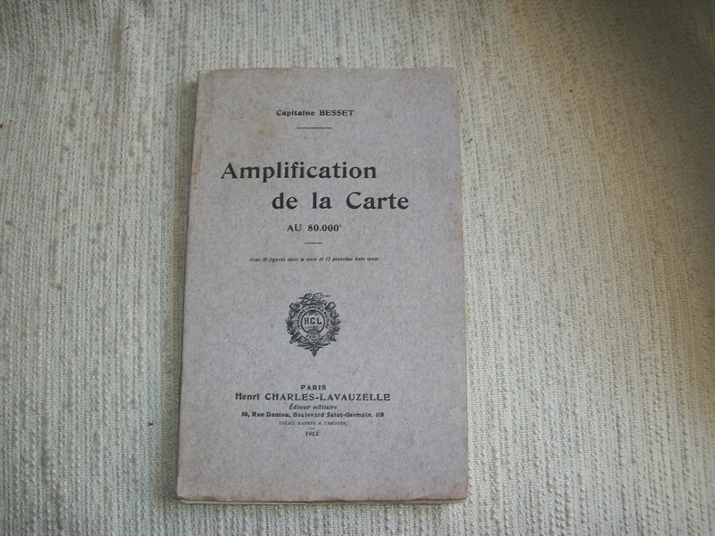
1913GITc088Paris Charles-Lavauzelle 1913. In-8 broché 68pp. Orné de 28 figures dans le texte et 12 planches volantes dépliantes sous rabat spécial. Exemplaire en bon état, bien complet de toutes ses planches.
1769MAP1047London: Russell and Price 1769. Original Map . No Binding. Vg. 4to. Single page map of DEVONSHIRE. T.Kitchen. Published in ENGLAND DISLAYED Being a New Complete and Accurate Survey and Description of the Kingdom of England and Principality of Wales. Plate 19x27 cm sheet 243 x 160mm Fine original map printed on laid paper. Uncoloured. 2ND EDITION pub. 1769. OTHER COUNTIES ARE AVAILABLE FROM THIS ISSUE. <br/> <br/> Russell and Price unknown
1769MAP1045London: Russell and Price 1769. Original Map . No Binding. Vg. 4to. Single page map of OXFORDSHIRE T.Kitchen. Published in ENGLAND DISLAYED Being a New Complete and Accurate Survey and Description of the Kingdom of England and Principality of Wales. Plate 19x27 cm sheet 243 x 160mm Fine original map printed on laid paper. Uncoloured. 2ND EDITION pub. 1769. OTHER COUNTIES ARE AVAILABLE FROM THIS ISSUE. <br/> <br/> Russell and Price unknown
1769MAP1043London: Russell and Price 1769. Original Map . No Binding. Vg. 4to. Single page map of Yorkshire T.Kitchen. Published in ENGLAND DISLAYED Being a New Complete and Accurate Survey and Description of the Kingdom of England and Principality of Wales. Plate 19x27 cm sheet 243 x 160mm Fine original map printed on laid paper. Uncoloured. 2ND EDITION pub. 1769. OTHER COUNTIES ARE AVAILABLE FROM THIS ISSUE. <br/> <br/> Russell and Price unknown
1769MAP1048London: Russell and Price 1769. Original Map . No Binding. Vg. 4to. Single page map of DORSETSHIRE. T.Kitchen. Published in ENGLAND DISLAYED Being a New Complete and Accurate Survey and Description of the Kingdom of England and Principality of Wales. Plate 19x27 cm sheet 243 x 160mm Fine original map printed on laid paper. Uncoloured. 2ND EDITION pub. 1769. OTHER COUNTIES ARE AVAILABLE FROM THIS ISSUE. <br/> <br/> Russell and Price unknown
1769MAP1040London: Russell and Price 1769. Original Map . No Binding. Vg. 4to. Single page map of CARDIGANSHIRE T.Kitchen. Published in ENGLAND DISLAYED Being a New Complete and Accurate Survey and Description of the Kingdom of England and Principality of Wales. Plate 19x27 cm sheet 243 x 160mm Fine original map printed on laid paper. Uncoloured. 2ND EDITION pub. 1769. OTHER COUNTIES ARE AVAILABLE FROM THIS ISSUE. <br/> <br/> Russell and Price unknown
1769MAP1046London: Russell and Price 1769. Original Map . No Binding. Vg. 4to. Single page map of CORNWALL T.Kitchen. Published in ENGLAND DISLAYED Being a New Complete and Accurate Survey and Description of the Kingdom of England and Principality of Wales. Plate 19x27 cm sheet 243 x 160mm Fine original map printed on laid paper. Uncoloured. 2ND EDITION pub. 1769. OTHER COUNTIES ARE AVAILABLE FROM THIS ISSUE. <br/> <br/> Russell and Price unknown
1769MAP1042London: Russell and Price 1769. Original Map . No Binding. Vg. 4to. Single page map of Cheshire T.Kitchen. Published in ENGLAND DISLAYED Being a New Complete and Accurate Survey and Description of the Kingdom of England and Principality of Wales. Plate 19x27 cm sheet 243 x 160mm Fine original map printed on laid paper. Uncoloured. 2ND EDITION pub. 1769. OTHER COUNTIES ARE AVAILABLE FROM THIS ISSUE. <br/> <br/> Russell and Price unknown
1769MAP1049London: Russell and Price 1769. Original Map . No Binding. Vg. 4to. Single page map of SOMERSETSHIRE. T.Kitchen. Published in ENGLAND DISLAYED Being a New Complete and Accurate Survey and Description of the Kingdom of England and Principality of Wales. Plate 19x27 cm sheet 243 x 160mm Fine original map printed on laid paper. Uncoloured. 2ND EDITION pub. 1769. OTHER COUNTIES ARE AVAILABLE FROM THIS ISSUE. <br/> <br/> Russell and Price unknown
1769MAP1038London: Russell and Price 1769. Original Map . No Binding. Vg. 4to. Single page map of BUCKINGHAMSHIRE G. Rollos. Published in ENGLAND DISLAYED Being a New Complete and Accurate Survey and Description of the Kingdom of England and Principality of Wales. Plate 16x20 cm sheet 160 x 243mm. VG original map printed on laid paper. SOME MOTTLING. Uncoloured. 2ND EDITION pub. 1769. OTHER COUNTIES ARE AVAILABLE FROM THIS ISSUE. <br/> <br/> Russell and Price unknown
1769MAP1039London: Russell and Price 1769. Original Map . No Binding. Vg. 4to. Single page map of BERKSHIRE G. Rollos. Published in ENGLAND DISLAYED Being a New Complete and Accurate Survey and Description of the Kingdom of England and Principality of Wales. Plate 16x20 cm sheet 243 x 160mm. VG original map printed on laid paper. Uncoloured. 2ND EDITION pub. 1769. OTHER COUNTIES ARE AVAILABLE FROM THIS ISSUE. <br/> <br/> Russell and Price unknown
1769MAP1037London: Russell and Price 1769. Original Map . No Binding. Vg. 4to. Single page map of ANGELSEY G. Rollos. Published in ENGLAND DISLAYED Being a New Complete and Accurate Survey and Description of the Kingdom of England and Principality of Wales. Plate 16x20 cm sheet 160 x 243mm. VG original map printed on laid paper. SOME MOTTLING. Uncoloured. 2ND EDITION pub. 1769. OTHER COUNTIES ARE AVAILABLE FROM THIS ISSUE. <br/> <br/> Russell and Price unknown
Engraved map with contemporary outline hand-colouring, (540 x 715 mm), divided into 16 sections and laid on linen, contained in a contemporary marbled slipcase with publisher's printed paper label on upper cover.
First and only edition, [2], vi, 37,[1] + 2pp., of adverts, orig. printed blue boards with white paper spine, the spine is worn with some loss to the original cover at base, some brown damp staining to lower inner margins which correspond with the damage to base of spine, partly unopened, uncut. A good acceptable example of this very rare work which was bought out to accompany Henry Price's New Map of the County of Hereford which is advertised at the rear of the book. Copac listing a single copy at Cardiff University Libraries.