5 843 résultats
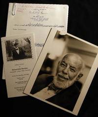
198424561New York New York: Photo By Bill Ray 1984. Black and white photograph 8" x 10" on heavy photographic paper; on back is handwritten "For my old and valued friend Bob Greene" and with Harrison's name and the date of April 1984 at the lower border; with the studio stamp of Photo by Bill Ray 350 Central Park West New York. with A group of copy-pages of drawings from the New Yorker by Harrison and presented "for Bob Greene Richard Edes Harrison on his 66th Birthday" with the black and white illustrated memorial service pamphlet for R. E. Harrison 1901 - 1994 Cartographer-Artisan-Birder-Raconteur on the 93rd Anniversary of his Birth March 11 1994. in good condition. Robert S. Greene 1922 - 2013 American writer jazz musician documentarian and historian friend of the artist who innovated U.S. cartography in the 20th century. see Timothy Barney "Richard Edes Harrision and the Cartographic Perspective of Modern Internationalism" U. of Richmond 2012 for his more on his contributions to cartography. Photograph. Soft Cover. Very Good. Photo By Bill Ray Paperback books
2 volumi, 8°, 23 cm, pp. 506; 479; 30; 5; 166, 2 carte geografiche ripiegate al primo volume e 107 incisioni complessivamente. testo su due colonne, Rilegatura coeva in mezza pelle, titolo in oro su tassello al dorso, piatti marmorizzati. Fanno parte di: L'universo o storia e descrizione di tutti i popoli ec, loro religioni, costumi, usanze ec. Leggere tracce d'uso al dorso del secondo volume, per il resto esemplare molto buono
2 volumi, 4°, 23 cm, pp. 415; 170, (2), 192, 172, IV, 124. testo su due colonne, completo delle 97 tavole incise al primo volume e 29 tavole incise al secondo. Traduzione del primo volume di A. F. Falconetti. Rilegatura coeva in mezza pelle, titolo in oro al dorso, piatti marmorizzati. Fa parte di: L'universo o storia e descrizione di tutti i popoli ec. Esemplare molto buono
New Turkish Original illustrated bdg. HC. 4to. (32 x 23 cm). In Turkish. 3 volumes set: (440 p., 1 folded color panorama of Istanbul; 442-875, [5] pp., 1 folded color panorama of Istanbul, 877-1289, [8] pp., 1 folded color panorama of Istanbul, b/w and color plates and photos. 20. Yüzyil'dan 21. Yüzyil'a Necip Bey Haritalari'ndan günümüze öncesi ve sonrasi Istanbul. 3 volumes set. [In special box]. First and Only Edition. Best and only reference on Nedjib [Necip] Bey maps.
2012SCI5006MBroché, 111 pages, paru en 2012 chez Lunar Publishing, très bon état général.
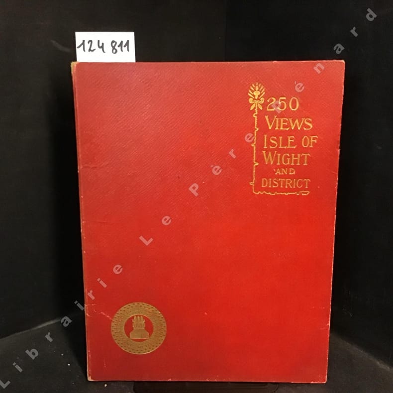
124811sd rigide Published by Rock Bros., Ltd., London - sans date - In-4 cartonné - Sans pagination
1 Vol. In-4(40x25) pag. Trattasi di tavole dell'"Atlante Geografico Universale Antico e Moderno composto di 56 carte disegnate e compilate sulle più recenti dei signori...".I confini dei territori sono colorati.Scale in PROG 1423 CATT_ATT 38
Barcelona 1993. 8°grande :pp.241n. bross.origin.
31 illustrazioni e 3 cartine
Udine, Gaspari Editore, 2006, in-8vo tutta tela ed. con sovracc. trasparente, pp. 218 decine di splendide ill. in nero e a colori anche a piena pagina nel testo
Mm 285x290 Volume cartonato rigido con sovraccoperta in acetato opaco, 239 pagine con 210 illustrazioni a colori. Opera in condizioni pari al nuovo. SPEDIZIONE IN 24 ORE DALLA CONFERMA DELL'ORDINE.
Incisione in rame (mm. 525x630), abilmente dipinta da mano coeva, verso velato da finissimo foglio di carta Giappone. Bella e rara carta nautica, tratta dal celebre atlante di De Witt ''Orbis Maritimus ofte Zee Atlas": la mappa si estende dal Senegal a nord fino all'Angola a sud, centrata sulla Baia di Guinea. Le indicazioni toponimiche e le caratteristiche geografiche sono strettamente limitate alle coste. Rosa dei venti, linee lossodromiche e splendido cartiglio, in alto, dove commercianti olandesi contrattano per gli schiavi ammanettati con i capi indigeni. Sullo sfondo si può vedere una fornace che fonde quello che presumibilmente è oro. L'abile rinforzo con carta Giappone evita il deperimento da acidità ai verdi e marroni; quindi l'esemplare si presenta in ottimo stato, anche grazie alla splendida coloritura del cartiglio. "Frederick de Wit deve essere considerato uno dei più importanti editori di mappe della seconda metà del XVII secolo. La maggior parte delle sue mappe sono di ottima qualità, sono caratterizzate da un'incisione chiara e bella, dall'attualità e ricchezza dell'immagine cartografica nonché dall'equilibrio delle decorazioni cartografiche". (Lexikon der Kartographie II, p. 899), Koeman M. Wit 1, 27. Koeman, Atlantes Neerlandici, IV, pp.191 e 518-519. Shirley 444. Putnam, Early sea charts, 75.. .
Very Good Russian Original dark green cloth bdg. Oblong folio. (28 x 36 cm). Eight languages of the title on the colophon, the text is completely Russian. [6], [ii], 108 p., [36] maps in various sizes, some of folded: (62x47 cm, 52,5x45,5 cm, 49,5x27 cm [x3], 61x47 cm; other maps are 36x28 cm). Four unnumbered leaves with half-title and contents for each section. Two small millimetric cuttings on two text pages. Ex-owner's name is on the title page. Markings on the index. Otherwise a very good and clean copy. Rare complete and the first atlas including a fine collection of 36 attractive chromo-lithograph maps mostly with tissue papers of the Soviet Union, edited by the Central Executive Committee and Enukidze (1877-1937), who was a prominent Georgian "Old Bolshevik". One of 11000 copies. Being published only 10 years after the USSR was established, this is the earliest atlas of the country. It seems to have been published with a wider audience in mind, with a title page in various European languages. The borders of many areas -including not just administrative regions throughout the USSR, but also entire autonomous republics (especially in Central Asia)- were in a state of flux; as such, the borders in this Atlas (including the wax-paper overlays meant to update various maps with changes made between when they were drawn and when the Atlas was published) often don't look anything like the borders they were set at the end of the Soviet Union and have continued on to modern times. Since the boundaries were often ideologically- (sometimes ethnically-, less so economically-) motivated, this offers an interesting insight into the mindset of the administration that was making these changes. Map list: World map, General USSR, USSR in Europe, Asia and USSR, Karelian Autonomous Soviet Socialist Republic, Komi-Zyryan Autonomous Oblast, Avt, Votskaya Oblast, Maryinskaya, Cherepovetsky District, Vologda Oblast, Avt. Chuvashskaya SSR (Chuvashia), Avt. Tatarskaya SSR (Tatarstan), Avt. Bashkirskaya SSR (Bashkiria), ASSR Nemchev Povoljiya, Kalmykia (Kalmykia), Krimskaya SSR (Crimea), Adigeiskaya (Tscherkeskaya) Obl. (Cherkesia), Kabardino-Balkarskaya Avt. Obl. (Kabardino-Balkarian Rep.), Karachayskaya Avt. Obl. & Tscherkesskiy Nation. Okrug (Karachay-Cherkessia), Chechenskaya Avt. Obl. (Chechnya), Ingushetiya, Severo-Osetiya, Avt. Daghestanskaya SSR, Avt. Kazakskaya SSR, Kyrgyzkaya ASSR, Avt. Oiuratskaya Oblast, Burito - Mongolskaya SSR (Kazakhstan), Avt. Yakustkaya SSR (Yakutia), Beloruskaya SSR (Belarus), Ukrainskaya, SSR (Ukraine), Moldavskaya SSR (Moldovia), Zakavkazkaya SSR (Abkhazia), Azerbaijanskaya SSR (Azerbaijan), Arminskaya SSR (Armenia), SSR Gruzii (Georgia), Central Asian SSR (Karakalpakstan, Kyrgyzstan, Turkmenistan, Uzbekistan), Uzbekistan, Turkmenistan. OCLC shows copies in twenty-three libraries worldwide: 7852120, 968755133, and 822577467.
Very Good Turkish, Ottoman (1500-1928) Contemporary red cloth. Roy. 8vo. (24 x 16 cm). In Ottoman script (Old Turkish with Arabic letters). [1], 229, [1] p., many b/w and color ills., 30 chromo-lithographed maps. Wear and fading on spine, some ex-library stamps on the colophon and several blank pages, ownership ink inscription and signature on the first page-overall a good copy. First edition of this rare Ottoman atlas for the primary schools in the late Ottoman Empire, including beautiful 30 chromo-lithographed maps of the Ottoman land according to administrative regions (provinces) and richly illustrated with b/w plates of the cities and provinces in the Middle East. Map list: 1. World map 2. Complete Imperial Ottoman 3. Arabian Peninsula 4. Anatolia 5. Asia Minor 6. Marmara and Black Sea 7. Aegean (The Archipelago) 8. Demography of Anatolia and Syria, Libya, etc 9. Administrative map of Anatolia 10. Map of mines of Anatolia 11. Agricultural map of the Imperial Ottoman 12. Arabian Peninsula 13. Map of the Edirne Vilayat [Adrianople Province of the Ottoman Empire] 14. Map of the Bosphorus 15. Map of the Hüdavendigâr Vilayat [Brusa Province] 16. Maps of Izmit and Biga Sanjaks 17. Map of Aydin Vilayat and Mentese Sanjak 18. Map of the Konya Vilayat 19. Maps of the Adana Vilayat and the Mediterranean Sea 20. Maps of the Erzurum and Ankara Vilayats 21. MAps of Kastamonu Vilayat and Bolu Sanjak 22. Map of the Trebizond Vilayat 23. Maps of the Van and Bitlis Vilayats 24. Maps of the Sivas and Harput Vilayats 25. Maps of the Bagdad and Basrah Vilayats 26. Map of the Mosul Vilayat and Day al-Zor Sanjak 27. Map of the Aleppo Vilayat and Urfa Sanjak 28. Map of the Syria and Beirut Vilayats 29. Map of the Arabia 30. Maps of the Yemen vilayat and Asir Sanjak. This atlas was printed four times for the different classes of the early Turkish / Ottoman schools, during World War 1 (two times in 1916) and the National Struggle (two times in 1921). Geylangil was born in Istanbul in 1887 and studied in Aleppo and Baghdad. Geylangil, who also studied economic geography, taught geography at many schools, including Galatasaray High School. Until his death, he wrote 14 books on geography, most of which were geographical atlases. In 1941, he was among the founding members of the Turkish Geographical Society. Özege 23216.; TBTK 11481.; We couldn't find any copy of this edition worldwide.
Very Good Turkish, Ottoman (1500-1928) Contemporary quarter leather bdg. Rebacked boards. Foolscap 8vo. (18 x 12 cm). In Ottoman script (Old Turkish with Arabic letters). 220 p. Very rare early book of the concise biographies of 137 people who served as admirals in the Ottoman Empire between 1352 and 1853, written by Mehmed Izzet Pasha (d. 1853), son of Turkish admiral Abdullah Râmiz Pasha (d. 1813). Ceridehâne Printing House was founded for publishing Ceride-i Havâdîs [i.e. The Journal of News], which was the first semi-official newspaper in the Ottoman Empire. This journal was published from 1840 to 1877 and was founded by William Nosworthy Churchill (1796-1846), a British-born journalist who moved to Turkey aged 19. He was the cause of a diplomatic incident that resulted in the temporary severance of diplomatic relations between Britain and the Ottoman Empire. Babinger p. 323/2.; Özege 6951.; Library of Congress. Karl Süssheim Collection, no. 1336., OCLC: 11810438, 880485954.
Pianta topografica di Genova in bicromia, foglio cm37x31 (illustrazione cm32x24) ripiegata e con copertina in brossura con titoli blu, cm13x19; stampa Cartoleria Carabelli.
178149841781 Paris Lattré 1781-1791 5 cartes anciennes. Env. 30 x 41,5 cm hors marges, 36,5 x 51 cm toutes marges comprises. Frontières rehaussées. Bonnes conditions. Quelques menues déchirures marginales à certaines cartes. Pliure partiellement fendue à la carte du Dauphiné et de la Provence.
Very Good Turkish, Ottoman (1500-1928) Original bdg. 4to. (28 x 24 cm). In Ottoman script (Old Turkish with Arabic letters). 24 p. First and only edition of this scarce atlas printed in Leipzig for the Ottoman market before the proclamation of the Republic, distributed by Jewish agent A. M. Karmi of this atlas located in Dersaadet (Constantinople), including beautiful and attractive 34 chromo-lithographed maps of Africa, Australia, Americas, Europe, Turkey, Asia, and a celestial map. Özege 8803.; Only two copies in OCLC: 632952950, 949536147 (the Bogaziçi University of Turkey and Universitätsbibliothek Bamberg of Germany).
Very Good English Original color city map of Isfahan. 70x50 cm. In English. Folded. No scale. This detailed Isfahan city map includes a very detailed alphabetical index as well. There are some b/w photos indicated several important places and buildings on the map. Remarks says, "Please note that most Government Departments, Point 4, Fao, Banks etc. are situated around the Shah Sqaure. Ask for Ostandari i.e. the Governor's Office at F6 or find the Information Dept. at D6. All streets, avenues, kuchehs are listed under the name of khiaban eg. Khiaban Abbasssad is under K. not A. Historic places are listed both under their own names e.g. Ali-Qapu, Chehel-Sotoon etc.; and under Mosques, Minarets, etc.".
Very Good German Original b/w city plan. Atlas folio. (58x47 cm). In German. Folded. [CITY PLAN of BRAILA -IBRAIL-] Stadtplan von Braila. Scale (Masstab): 1/10.000. No cartographer. 33 descriptive articles on bottom-right corner of the plan. Slightly chipped at extremities of paper and soiling. It shows Braila and Donau. Braila (Turkish: Ibrail) is a city in Muntenia, eastern Romania, a port on the Danube and the capital of Braila County. There's some Ottoman manuscript including translations of the German descriptive text on the plan, and also "'Ibrail' sehir plâni" written on verso in Ottoman script. Extremely rare.
Very Good German Original b/w city plan. Atlas folio. (58x47 cm). In German. Folded. [CITY PLAN of BRAILA -IBRAIL-] Stadtplan von Braila. Scale (Masstab): 1/10.000. No cartographer. 33 descriptive articles on bottom-right corner of the plan. Slightly chipped at extremities of paper and soiling. It shows Braila and Donau. Braila (Turkish: Ibrail) is a city in Muntenia, eastern Romania, a port on the Danube and the capital of Braila County.
Rarissima carta della Dalmazia centrale di Martino Rota, nella ristampa seicentesca curata da Stefano Mozzi Scolari, conosciuta sinora solo per l’esemplare della collezione Novacco. Carta senza titolo. In basso a destra troviamo la firma: Martinus Rotta. In basso al centro, nel mare, è disegnata la MESURA DELLE MIGLA, una scala grafica priva di indicazioni, costituita da 3 e 6 unità di miglia, pari a mm 52. Orientazione con una rosa a otto venti nel mare, il nord è in alto. Priva di graduazione ai margini. Esemplare nel terzo stato di tre descritto in Bifolco-Ronca; viene abrasa la firma del Doino, sostituita dall’imprint Stefano Scolari formis in Venetia. Acquaforte e bulino, circa 1570, firmata in lastra in basso al centro-destra. Magnifica prova, impressa su carta vergata coeva, con margini, in eccellente stato di conservazione. “Carta prospettica, priva di data, della Dalmazia centrale che descrive la regione di Split (it. Spalato) qui nella forma italianizzata Spalato. Si tratta di un’innovativa ed importante rappresentazione, in alzato prospettico, che ebbe repliche anche nel secolo successivo. Si estende sulla costa dalla città di Trogir fino ad Omi (Almisa) ed è firmata dal sebenicense Martino Rota. Per analogia con le altre opere del Rota, la carta è databile al 1570 circa. Meurer stabilisce come terminus ante quem della lastra il 1568, quando Martino Rota si trasferisce alla corte imperiale viennese, ma poi si corregge, sostenendo che la collaborazione tra l’incisore e gli editori veneti sia da collocare ben oltre questa data. Secondo Mliinarić la carta – che descrive come datata in lastra - sarebbe stata stampata da Camocio tra il 1558 ed il 1568, ma la teoria ci sembra molto debole, in assenza di elementi che possano corroborarla. L’opera, scarsamente diffusa nelle raccolte cinquecentesche, ebbe due tirature successive per mano degli editori Catarin Doino e Stefano Scolari. Il secondo stato della lastra, a firma Doino, è databile al 1620 circa. Viene descritto da Shirley per l’esemplare conservato nella raccolta fattizia della British Library [Maps C.7. e 3.(1)]. Altri esemplari censiti sono quelli alla Newberry Library e alla Bibliothèque Nationale. Una terza stesura della lastra viene stampata da Stefano Scolari verso la metà del XVII secolo. Illustrata nel catalogo della collezione Novacco, viene descritta già da Almagià”. (cfr. S. Bifolco – F. Ronca, Cartografia e topografia italiana del XVI secolo (2018), p. 1370. Martino Rota (Sebenico 1520 – Venezia 1583) era un incisore e editore di Sebenico, attivo a Venezia, Vienna e Praga. La prima opera datata risale al 1558. Probabilmente lavorò a Venezia fino al 1572. Lastre del 1571/2, con soggetti relativi alla vittoria sui Turchi, a Lepanto, sembra siano state realizzate a Venezia. A Vienna, realizzò ritratti tra il 1573 e il 1576, accreditato alla corte di Massimiliano II. Si trasferì a Praga nel 1580. A Venezia le sue lastre vennero pubblicate da Luca Guarinoni, Luca e Ferrando Bertelli, Giovanni Francesco Camocio, Giovanni Mastini, Benedetto Stefani, Claudio Duchetti, Nicolò Nelli e Bolognino Zaltieri. Stefano Mozzi Scolari era un disegnatore, incisore e editore bresciano, attivo a Venezia dal 1644 al 1687. La sua bottega era una delle migliori calcografie veneziane del ‘600. Esercitò l’arte delle stampe e del commercio di carte geografiche a S. Zulian all’insegna delle Tre Virtù. Si servì dei rami di Bertelli, Valegio e Van Aelst. Curò anche le ristampe di importantissime carte quali la Lombardia del Gastaldi, e le carte dell’Italia di Greuter e Magini. Magnifico esemplare, appartenuto alla collezione di Fritz Hellwig. Bibliografia S. Bifolco – F. Ronca, Cartografia e topografia italiana del XVI secolo (2018): pp. 1370-1371, tav. 625, III/III; Almagià (1929): p. 40, n. 1; Borroni Salvadori (1980): n. 205; Cartografia Rara (1986): n. 39; Meurer (2002): n. 50; Mliinarić (2011): pp. 77-78, tav. 3 &4; ... A very rare map of central Dalmatia by Martino Rota, in the seventeenth-century reprint edited by Stefano Mozzi Scolari, known so far only from the example in the Novacco collection. Untitled map. In the lower right corner we find the signature: Martinus Rotta. Bottom center, in the sea, is drawn the MESURA DELLE MIGLA, a graphic scale without indications, consisting of 3 and 6 units of miles, equal to mm 52. Orientation with an eight-wind rose in the sea, north is at the top. Devoid of graduation in the margins. Exampelin the third state of three described in Bifolco-Ronca; Doino's signature is abraded, replaced by the imprint Stefano Scolari formis in Venetia. Etching and engraving, circa 1570, signed in plate lower center-right. Magnificent proof, impressed on coeval laid paper, with margins, in excellent condition. “Carta prospettica, priva di data, della Dalmazia centrale che descrive la regione di Split (it. Spalato) qui nella forma italianizzata Spalato. Si tratta di un’innovativa ed importante rappresentazione, in alzato prospettico, che ebbe repliche anche nel secolo successivo. Si estende sulla costa dalla città di Trogir fino ad Omi (Almisa) ed è firmata dal sebenicense Martino Rota. Per analogia con le altre opere del Rota, la carta è databile al 1570 circa. Meurer stabilisce come terminus ante quem della lastra il 1568, quando Martino Rota si trasferisce alla corte imperiale viennese, ma poi si corregge, sostenendo che la collaborazione tra l’incisore e gli editori veneti sia da collocare ben oltre questa data. Secondo Mliinarić la carta – che descrive come datata in lastra - sarebbe stata stampata da Camocio tra il 1558 ed il 1568, ma la teoria ci sembra molto debole, in assenza di elementi che possano corroborarla. L’opera, scarsamente diffusa nelle raccolte cinquecentesche, ebbe due tirature successive per mano degli editori Catarin Doino e Stefano Scolari. Il secondo stato della lastra, a firma Doino, è databile al 1620 circa. Viene descritto da Shirley per l’esemplare conservato nella raccolta fattizia della British Library [Maps C.7. e 3.(1)]. Altri esemplari censiti sono quelli alla Newberry Library e alla Bibliothèque Nationale. Una terza stesura della lastra viene stampata da Stefano Scolari verso la metà del XVII secolo. Illustrata nel catalogo della collezione Novacco, viene descritta già da Almagià”. (cfr. S. Bifolco – F. Ronca, Cartografia e topografia italiana del XVI secolo (2018), p. 1370. Martino Rota (Sibenik 1520 - Venice 1583) was an engraver and publisher from Sibenik, active in Venice, Vienna and Prague. The earliest dated work is from 1558. He probably worked in Venice until 1572. Plates from 1571/2, with subjects related to the victory over the Turks, at Lepanto, appear to have been made in Venice. In Vienna, he made portraits between 1573 and 1576, credited to the court of Maximilian II. He moved to Prague in 1580. In Venice his plates were published by Luca Guarinoni, Luca and Ferrando Bertelli, Giovanni Francesco Camocio, Giovanni Mastini, Benedetto Stefani, Claudio Duchetti, Nicolò Nelli, and Bolognino Zaltieri. Stefano Mozzi Scolari was a Brescian draughtsman, engraver and publisher, active in Venice from 1644 to 1687. His workshop was one of the best Venetian chalcographers of the 1600s. He practiced the art of printing and trading maps in S. Zulian all’insegna delle Tre Virtù. He made use of the plates of Bertelli, Valegio and Van Aelst. He also edited reprints of such important maps as Gastaldi's Lombardia, and Greuter and Magini's maps of Italy. Magnificent example belonged to the collection of Fritz Hellwig. Bibliografia S. Bifolco – F. Ronca, Cartografia e topografia italiana del XVI secolo (2018): pp. 1370-1371, tav. 625, III/III; Almagià (1929): p. 40, n. 1; Borroni Salvadori (1980): n. 205; Cartografia Rara (1986): n. 39; Meurer (2002): n. 50; Mliinarić (2011): pp. 77-78, tav. 3 &4; Novak (2005): p. 92, fig. 3; Shirley (2004): p. 393, ...
Very Good Turkish, Ottoman (1500-1928) Original color lithograph map. Folded. Oblong folio. (35 x 52 cm). In Ottoman script (Old Turkish with Arabic letters). It shows Sudan and West Africa, Atlas Ocean shores, Sahra Desert, and other parts of Africa. Scale: 1:15.000.000. A very detailed and attractive map. Slightly fading. Otherwise a very good copy. Dated Hegira: 1310 = [Gregorian 1894]. Taken from his attractive atlas titled "Yeni cografya atlasi. [i.e. New Geographical Atlas]". The cartographer, Ali Seref, or Hafiz Ali Seref (or Esref) Pasha (1840-1907) was an Ottoman soldier and mapmaker who was schooled in Paris as a cartographer around 1862. While in Paris he published his first atlas with 22 maps, called the Yeni atlas. Upon his return to Istanbul, he became the chief cartographer at the Matbaa-i Amire Printing Press in Beyazit. Chipping on extremities. Slight foxing. Overall a good copy. Not in OCLC.; Not in TBMM Map Collection.
Very Good Turkish Original manuscript map on cloth. Chipped margins, stains on cloth. Folded. Oblong folio. (32x35 cm) In modern Turkish. Sealed. It shows the exploration of an area of ??1487 hectares and some stone and brick mosques, fountains, buildings and geographic status of the region in the upper corner. Scale: 1:25.000. Extremely rare.
Very Good Arabic Original hand-colored map on tissue paper. 23x19 cm. In Ottoman script and Arabic. No scale. Manuscript notes of toponyms. The manuscript shows Egypt, Ethiopia, Sudan, the Red Sea along the line of Red Sea shores. Manuscript notes show that the map was used for military purposes in the last Ottoman Imperial period. Habesh Eyalet, Ethiopia in northeast Africa was conquered by Özdemir Pasha in 1557. His son, Osman Pasha, transformed the region into an eyalet, which remained under Ottoman suzerainty until the early 19th century when Egypt assumed its administration. (Source: Pashas, Begs, Effendis: A historical dictionary of titles and terms in the Ottoman Empire, Bayerle, Gustav.).