AA.VV.MareMagnum
Centro Amilcar CabralMareMagnum

Laura Guerra · Bologna, IT15,00 €
5 783 résultats
(33f).
Carta a colori di cm. 40 X 50 con tracce del tempo e fasc. manca l'opuscolo indice Conservati in busta edit. ill in similpergamena con guasti.
Carta (anni '30 circa) di cm. 114 x 61, colorata a mano, alla scala 1 : 50.000
In alto a destra, con caratteri grandi sotto il bordo superiore, è inciso il titolo BONONIA. Sempre in alto a destra è disegnato lo stemma della città. Lungo il margine inferiore, distribuita su quattordici colonne, una legenda alfanumerica con 179 rimandi (A-N e 1-168) a luoghi e monumenti notabili. Nell’ultimo riquadro, all’angolo inferiore destro, si legge: Vero ritratto dela Citta de bologna co tutti gli nomi dele cose principali di essa como Al presente si ritrova per claudio duchetto Nepote di Ant: lafreri 1582. La pianta della città di Bologna, incisa da Ambrogio Brambilla per l’editore Claudio Duchetti, rappresenta la prima derivazione dell’opera di Agostino Carracci (1581) disegnata su diretta commissione del cardinale Gabriele Paleotti (Bologna 1522 - Roma 1597), arcivescovo di Bologna dal 1566. La legenda alfanumerica incisa nella parte bassa della tavola deriva dal prototipo della cartografia cinquecentesca bolognese, e lo stemma della città è inserito nella parte alta della tavola. Sono delineati e localizzati chiaramente gli edifici religiosi, sia quelli all’interno del perimetro romano (San Pietro e San Petronio) che quelli all’esterno (Santo Stefano, San Procolo e SS. Naborre e Felice). L’opera del Duchetti fu presto replicata da Fransz Hogenberg, che ne incise una derivazione molto simile per il quarto volume del Civitates Orbis Terrarum realizzato in collaborazione con Georg Braun (Anversa, 1590 circa). Ambrogio Brambilla, nato a Milano, visse nella città per alcuni anni e, in quanto membro dell’Accademia milanese della Val di Bregn, compose poesie in dialetto che firmava con lo pseudonimo Or Compà Borgnin. Il Brambilla è però più conosciuto per la sua attività di incisore al bulino e all’acquaforte, a cui si dedicò a Roma nell’ultimo ventennio del XVI secolo, dove nel 1579 risulta iscritto alla Congregazione dei Virtuosi al Pantheon. La sua produzione venne pubblicata in gran parte da Claudio Duchetti e, anche, da Nicola van Aelst. Esemplare nel primo stato di tre, avanti l’indirizzo di Giovanni Orlandi. Acquaforte e bulino, impressa su carta vergata coeva, con margini, piccolo restauro perfettamente eseguito lungo il margine superiore, per il resto in perfetto stato di conservazione. Bibliografia Bifolco-Ronca, Cartografia e topografia italiana del XVI secolo, pp. 2126-2127, tav. 1178bis, I/III; Benevolo (1969): pp. 47-51, tav. III; Brighenti (1979): n. 16; Comelli (1914): p. 44; L’Immagine delle città italiane (1998): p. 129, n. 4; Tooley (1939): n. 139. In the upper right corner, in large letters below the top edge, is engraved the title BONONIA. Also at the top right is drawn the coat of arms of the city. Along the lower margin, distributed on fourteen columns, an alphanumeric legend with 179 references (A-N and 1-168) to notable places and monuments. In the last square, at the lower right corner, reads: Vero ritratto dela Citta de bologna co tutti gli nomi dele cose principali di essa como Al presente si ritrova per claudio duchetto Nepote di Ant: lafreri 1582. The map of the city of Bologna, engraved by Ambrogio Brambilla for the publisher Claudio Duchetti, represents the first derivation of the work of Agostino Carracci (1581) drawn on direct commission of Cardinal Gabriele Paleotti (Bologna 1522 - Rome 1597), archbishop of Bologna since 1566. The alphanumeric legend engraved in the lower part of the table derives from the prototype of sixteenth-century Bolognese cartography, and the coat of arms of the city is inserted in the upper part of the plate. The religious buildings are clearly delineated and located, both those within the Roman perimeter (San Pietro and San Petronio) and those outside (Santo Stefano, San Procolo and SS. Naborre and Felice). Duchetti's work was soon replicated by Fransz Hogenberg, who engraved a very similar derivation for the fourth volume of the Civitates Orbis Terrarum produced in collaboration with Georg Braun (Antwerp, circa 1590). Ambrogio Brambilla, born in Milan, lived in the city for several years and, as a member of the Milanese Academy of Val di Bregn, composed poems in dialect that he signed with the pseudonym Or Compà Borgnin. Brambilla, however, is best known for his activity as a burin and etching engraver, to which he dedicated himself in Rome in the last twenty years of the sixteenth century, where in 1579 he was enrolled in the Congregazione dei Virtuosi at the Pantheon. His production was published in large part by Claudio Duchetti and, also, by Nicola van Aelst. Example in the first state of three, ahead of the address of Giovanni Orlandi. Etching and engraving, printed on contemporary laid paper, with margins, small restoration perfectly executed along the upper margin, otherwise in perfect condition. Rare. Bibliografia Bifolco-Ronca, Cartografia e topografia italiana del XVI secolo, pp. 2126-2127, tav. 1178bis, I/III; Benevolo (1969): pp. 47-51, tav. III; Brighenti (1979): n. 16; Comelli (1914): p. 44; L’Immagine delle città italiane (1998): p. 129, n. 4; Tooley (1939): n. 139.
This collection of old maps is designed to illustrate the course of American history from the earliest time down to the close of the Revolutionary War. The editors have brought them together from their hiding places in dark, dusty, and, in some cases, forgotten repositories. The seventy-four maps here reproduced were selected from many thousands examined by the editors in the great libraries in Am <br/> STATO: USATO, MOLTO BUONO.<br/> TITOLO: Book of Old Maps: Delineating American History from the Earliest Days Down to the Close of the Revolutionary War. Fite, Emerson D. & Archibald Freeman, Compilers & Editors<br/> AUTORE: Fite,Emerson David. Archibald Freeman.<br/> EDITORE: Dover<br/> DATA ED.: 1969,<br/>
2010ARCH2607MRelié, 192 pages, illustré en couleur avec des plans et des dessins, quelques marques d usage et d humidité presque anodines. Éditions Koegui
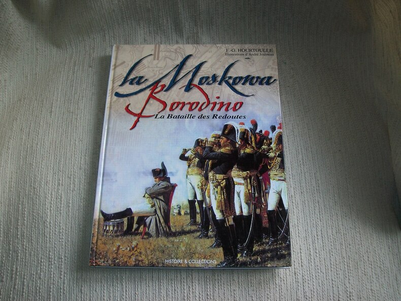
2000GITj301Paris Histoire et Collections 2000. In-4 120pp imprimées sur 2 colonnes. Cartonnage éditeur papier glacé bradel illustré en couleurs. Abondante et belle illustration d'après des documents anciens, en noir et en couleurs, planches d'uniformologie par André Jouineau, cartographie de Morgan Gillard. Bel exemplaire frais et complet. Excellente documentation, très bien illustrée.
500322736Gautier-Languereau Sans date.
IN HEBREW, ENGLISH AND ITALIAN. 22X15 cm. 153+61 pages. Softcover. Cover slightly stained. Else in good condition.
Carta geografica dell'estensione territoriale attorno a Bolzano. Incisione in rame, misure all'immagine cm. 22,7x17 più i margini. Buono stato di conservazione.
8676carte entoilée Feuille 71 n°117. A Paris chez Vignon marchand de cartes. Sans date, XVIIIème siècle.590x930mm, 130x200 pliée. Très bon état.
62443, Köln, Selbstverlag, 2000 softcovers 9 Bände. 4°, 21 x 29,5 cm, mit zahlreichen Abbildungen, illustrierter Original-Broschureinband mit Leinenrücken in schöner Erhaltun.
50385BBo.J. Gerhard Mercator , geboren am 5. März 1512 in Rupelmonde, Grafschaft Flandern, gestorben am 2. Dezember 1594 in Duisburg, Mathematiker, Geograph und Kartograf.
Amsterdam, 1640 circa. Incisione in rame all'acquaforte, colore d'epoca, cm 39,7 x 53 (alla lastra) più margini, testo francese al verso. Difetti del foglio lungo il margine sinistro, strettissimi margini, tracce di umido visibili al solo verso del foglio, discreto stato.
UNICO ESEMPLARE CONOSCIUTO Nel piccolo cartiglio di destra troviamo il titolo: BRANDICI. Nel cartiglio di sinistra si legge: EL. VER. SITO. DI. BRANDICI. IM PUGLIA. STAMPATO IN VENETIA. PER. FRANCESCO. LIBRA[RIA] DALA. SPERANZA. A. M.DXXXVIII. Sulla tavola, priva di orientazione e scala grafica, sono presenti alcuni toponimi, che identificano i luoghi notevoli della città. Tavola silografica rappresentante la città di Brindisi, firmata da Francesco di Salò nel 1538. Conosciamo l’opera solo attraverso l’esemplare che - per la prima volta - Szathmáry pubblica nel primo numero di Cartographica Hungarica del 1992. La tavola era parte di una piccola raccolta di incisioni silografiche firmate da Matteo Pagano, Giovanni Andrea Vavassore e Tommaso di Salò, che lo studioso ungherese Tibor Szathmáry acquistò sul mercato antiquario di Arezzo nel 1987; le carte furono poi vendute separatamente. La tavola di Brindisi fu parte della famosa collezione di Fritz Hellwig, poi dispersa in varie aste. Come prova l’iscrizione nel mare ARMA DE ANDREA DORIA, l’opera fu realizzata probabilmente per illustrare il ritorno della flotta di Andrea Doria dalla battaglia di Prevesa (1538). Il 28 settembre 1538 una flotta cristiana della Lega Santa (la coalizione militare voluta da papa Paolo III per contrastare l’invadenza navale ottomana nel Mediterraneo, e sottoscritta nel febbraio di quell’anno da Spagna, Repubblica di Genova, Repubblica di Venezia ed i Cavalieri di Malta) era finalmente riuscita a bloccare il Barbarossa nel canale di Corinto presso Prevesa. La battaglia di Prevesa avrebbe probabilmente avuto un esito diverso, risolvendo definitivamente i problemi creati da Khayr al-Dīn Barbarossa, se Doria, ritiratosi dal combattimento, non avesse lasciato campo libero al corsaro ottomano. Lo sganciamento operato dall’ammiraglio era giustificato dalle difficoltà di manovra, per la mancanza di vento, dei velieri cristiani e in particolare della poderosa nave ammiraglia Galeone di Venezia, contrapposti all’agile e veloce naviglio avversario. Francesco di Salò (si firmava Francesco Tommaso di Salò) fu un tipografo attivo a Venezia, figlio di Tommaso e fratello di Alessandro. Lavorò quasi sempre con soci non identificati: “Poche notizie si hanno su questo editore che spesso si firmava con l’imprint In Venetia: per Francesco de Tomaso di Salo e compagni, in Frezzaria, al segno della Fede. Secondo Reinach la tipografia sarebbe attiva dal 1550, ma più studiosi concordano per il periodo 1564-74. Le date, tuttavia, sono in contrasto con alcune opere pubblicate nel nostro catalogo; la pianta di Brindisi, ad esempio, reca la data 1538” (cfr. Bifolco-Ronca, Cartografia e topografia italiana del XVI secolo, p. 2525). Come giustamente afferma Bagrow - Leo A. Bagrow, Matheo Pagano: a Venetian cartographer of the 16th century. A descriptive list of his maps, Jenkintown 1940 – il nome di Francesco di Salò appare su ristampe delle opere di Matteo Pagano, del quale probabilmente acquisì la tipografia. Silografia, impressa su carta vergata coeva, con sottili margini oltre la linea di demarcazione, restauri di tarlo perfettamente eseguiti alla piega centrale – come detto era parte di un piccolo album – per il resto in perfetto stato di conservazione. Prezioso documento sulla città. Bibliografia Bifolco-Ronca, Cartografia e topografia italiana del XVI secolo, p. 2129, tav. 1080; Shirley (1994): p. 29-32, n. 7; Szathmáry (1992): pp. 6-25, n. 5. THE ONLY KNOWN EXAMPLE In the small cartouche on the right we find the title: BRANDICI. In the left cartouche we read: EL. VER. SITO. DI. BRANDICI. IM PUGLIA. STAMPATO IN VENETIA. PER. FRANCESCO. LIBRA[RIA] DALA. SPERANZA. A. M.DXXXVIII. On the table, without orientation and graphic scale, there are some place names, which identify the remarkable places of the city. Silographic plate representing the city of Brindisi, signed by Francesco di Salò in 1538. We know the work only through the example that - for the first time - Szathmáry published in the first number of Cartographica Hungarica in 1992. The map was part of a small collection of silographic works signed by Matteo Pagano, Giovanni Andrea Vavassore and Tommaso di Salò, which the Hungarian scholar Tibor Szathmáry bought on the antiquarian market of Arezzo in 1987; the maps were then sold separately. This one of Brindisi was part of the famous collection of Fritz Hellwig, then dispersed in various auctions. As evidenced by the inscription in the sea ARMA DE ANDREA DORIA, the work was probably made to illustrate the return of Andrea Doria's fleet from the battle of Prevesa (1538). On September 28, 1538 a Christian fleet of the Holy League (the military coalition wanted by Pope Paul III to counter the Ottoman naval invasion in the Mediterranean, and signed in February of that year by Spain, the Republic of Genoa, the Republic of Venice and the Knights of Malta) had finally succeeded in blocking Barbarossa in the channel of Corinth at Prevesa. The battle of Prevesa would probably have had a different outcome, resolving once and for all the problems created by Khayr al-Dīn Barbarossa, if Doria, having withdrawn from combat, had not left the Ottoman corsair a free field. The disengagement operated by the admiral was justified by the difficulties of maneuver, due to the lack of wind, of the Christian sailing ships and in particular of the mighty flagship Galeone di Venezia, opposed to the agile and fast adversary ship. Francesco di Salò (signed Francesco Tommaso di Salò) was a typographer active in Venice, son of Tommaso and brother of Alessandro. He worked almost always with unidentified partners: "Little is known about this publisher who often signed his name with the imprint In Venetia: per Francesco de Tomaso di Salo e compagni, in Frezzaria, al segno della Fede. According to Reinach, the printing house would have been active since 1550, but more scholars agree on the period 1564-74. The dates, however, are at odds with some works published in our catalog; the plan of Brindisi, for example, bears the date 1538" (cf. Bifolco-Ronca, Cartografia e topografia italiana del XVI secolo p. 2525). As Bagrow rightly states - Leo A. Bagrow, Matheo Pagano: a Venetian cartographer of the 16th century. A descriptive list of his maps, Jenkintown 1940 - the name of Francesco di Salò appears on reprints of the works of Matteo Pagano, whose typography he probably acquired. Woodcut, printed on contemporary laid paper, with thin margins beyond the line of demarcation, perfectly executed woodworm restorations at the central fold - as mentioned it was part of a small album - otherwise in perfect condition. Bibliografia Bifolco-Ronca, Cartografia e topografia italiana del XVI secolo, p. 2129, tav. 1080; Shirley (1994): p. 29-32, n. 7; Szathmáry (1992): pp. 6-25, n. 5.
1991018014London: Studio Editions 1991. Fine condition in a Near Fine dust jacket. NO chips. NO tears. Bright clean square and tight. Sharp corners. NO owner's name or bookplate. Not a remainder. Pages are crisp and unmarked. 1991 First Studio edition. For this production the most decorative plates were selected from Braun & Hogenberg's CIVITATES ORBIS TERRARUM which was first published in 6 volumes between 1572 and 1617. Sixty gorgeous full-color maps are reproduced each spread across two folio pages. Full annotations provide facts about the maps their makers and history of the various cities. Bound in the original gilt-stamped green boards. Complete with dust jacket. Oversize Hardcover. 11.25" wide by 15.25" tall 285mm x 380mm. This large heavy book will require extra postage for Priority and International shipments but only the standard charge for media mail. First Edition Thus. Oversize Hardcover. Fine condition/Near Fine dust jacket. 128pp. Great Packaging Fast Shipping. Studio Editions Hardcover
60317BBo.J. Matthäus Merian der Ältere, geboren am 22. September 1593 in Basel, gestorben am 19. Juni 1650 in Langenschwalbach. Schweizerisch-deutscher Kupferstecher und Verleger von Landkarten, Städteansichten und Chroniken heraus. Hauptwerk: Topographia Germaniae. [2 Warenabbildungen]
1 49x34,5 cm., mappa a colori per i confini dei Paesi trattati, in inglese, buoni margini, piccolo strappo agli angoli inferiori, senza danno.
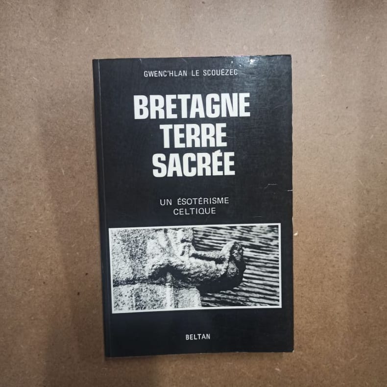
19925561992 - broché - Editions de Beltan - Deuxième édition - 1992 - In-8 (24 x 15,5 cm) broché - 219 pages - Photographies de Jean-Robert MASSON en noir et blanc - ISBN : 2-905939-05-2
55025, Breda's Museum 2002, 2002 Hardcover, 112 pagina's, Nederlands, 325 x 245 mm, in goede staat. ISBN 9789080610828.
108176circa 1607-1637. Folio 14 1/2 x 12 3/4†hand-colored engraving 10 1/2 x 12 1/2â€. Edges and outer margins chipped and slightly darkened repaired; good. § Early edition probably for Camden’s Britannia in Latin. An accurate illustrative map of Brecknock Shire in South Wales. unknown books
60302BBo.J. Matthäus Merian der Ältere, geboren am 22. September 1593 in Basel, gestorben am 19. Juni 1650 in Langenschwalbach. Schweizerisch-deutscher Kupferstecher und Verleger von Landkarten, Städteansichten und Chroniken heraus. Hauptwerk: Topographia Germaniae. [2 Warenabbildungen]
4 volumi, 18 cm, pp. 96; 80; 88; 96, il primo volume ha 4 tavole più volte ripiegate. Rilegatura coeva in mezza pelle, titolo in oro al dorso, piatti marmorizzati, tagli spruzzati, esemplare molto buono e fresco
In 8, pp. 23. Br. ed. Cenni relativi alla stesura della carta geografica della campagna romana e delle regioni limitrofe in scala 1/100.000 e classificazione delle formazioni geologiche.