5 783 résultats
1376321Dakar: Ifan, 1975 in-8, 254 pages, 10 + 3 planches, 1 carte se dépliant. Broché, très bon état. Sommaire: Abdoulaye BATHILY, A discussion of the traditions of Wagadu with some références to ancien Ghana, including of review of oral accounts, Arabic sources and archaelogical evidence. - Guy THILMANS, Les planches sénégalaises et mauritaniennes des "Atlas Vingboons" (XVII e siècle), 10 fig. - Oumar BA, Les Peuls du Diolof au XIXe siècle. - Mamadou NIANG, Réflexions sur le régime des terres au Sénégal. - Cheikh Anta DIOP, Comment enraciner la Science en Afrique : exemples walaf (Sénégal). -Annie RAVISE, Recensement de sites paléolithiques et néolithiques du Sénégal, 1 carte.
1984131971Sofia: Verlag Wissenschaft und Kunst, 1984. 70, 42 S. ; 41,5 x 28,5 cm ; Leinen.
446pp.avec planches et cartes dépliantes (texte complet, 7 planches manquent), belle reliure cart., 26cm., cachet, bon état, [contient e.a. WAUWERMANS, Histoire de l'école Cartographique Anversoise (pp.259-442 à suivre, avec 5 planches des 12)], B50375
contient pp.113-459 (manque: avril-septembre 1893), reliure cart., 26cm., cachet, bon état, [contient e.a. WAUWERMANS, Histoire de l'école Cartographique Anversoise (suite et à suivre) pp.119-326 & MARISCHAL, Le Japon pittoresque (pp.330-355), …], B50376
524pp., tout complet avec 5 planches hors-texte (dont 1 portrait et trois cartes dépliantes), 25cm., brochure originale (peu restauré), pages toujours non coupées, texte et intérieur en très bon état, A98710
497pp. + 18 planches hors-texte (dont des dépliantes), à noter: une seule planche (carte) manque à la p.232, 25cm., reliure cart. avec qqs. traces d'usage, sinon en bon état, [Contient e.a. DELGEUR L.: La carte de l'Afrique équatoriale depuis un demi-siècle (pp.293-309, avec 10 cartes hors-texte)], A98484
565pp., + 4 planches hors-texte (dont un grand tableau dépliant), 25cm., brochure originale (peu restauré), pour la plupart non coupé, bon état, texte et intérieur en très bon état, A98708
453pp. avec 6 planches hors-texte (dont des cartes dépliantes), 25cm., brochure originale, pour la plupart non coupé, bon état, [Contient e.a.: COQUILHAT C.: La haut Congo (pp.231-250 avec 4 planches sur les objets exposés par Coquilhat)], A98709
2 Vols., folio, [2], 460; [2], [441]-990, [2, directions to the binder], [4, list of subscribers]pp., lacks most plates and maps, text age-toned and with occasional staining, cont. red morocco, rubbed and worn. With 8 plates and 3 torn and defective maps: Vol. I. Plate. p. 157. Plate. p. 203. Plate. p. 407. Vol. II. Frontispiece. Map. p. 541. Map. p. 580. Plates x 2. p.685. Map. p. 906. Plates x 2. p. 920.
60381BBo.J. Matthäus Merian der Ältere, geboren am 22. September 1593 in Basel, gestorben am 19. Juni 1650 in Langenschwalbach. Schweizerisch-deutscher Kupferstecher und Verleger von Landkarten, Städteansichten und Chroniken heraus. Hauptwerk: Topographia Germaniae. [2 Warenabbildungen]
RARE early 20th-century fold-out map of Cable Telegraph Map operated under the presidency of Clarence Hungerford Mackay (1874-1938), an American financier, chairman of the board of the Postal Telegraph and Cable Corporation and president of the Mackay Radio and Telegraph Company. Clarence Mackay took over the firm from his father John Mackay in early 20th century and led it during World War I and enabled the State Department to have access to selected diplomatic traffic carried over Commercial's cables. The company flourished for a time but in 1928, together with other elements of the Mackay System, came under the control of International Telephone and Telegraph (ITT) under a wholly owned subsidiary, the Postal Telegraph & Cable Corporation. The map draws all the commercial cables of postal telegraph in the United States and affiliations operating throughout the world, such as The Mackay System (Commercial Cable Co., Postal Telegraph Cable Co., Commercial Pacific Cable Co., Commercial Cable Co. of Cuba) and affiliated companies which include All America Cables Inc., Canadian Pacific Ry. Company's Telegraph, Halifax & Bermudas Cable Co., Direct West India Cable Co., Eastern Telegraph and associated Companies, Great Northern Telegraph Co., Deutsch Atlantische Telegraphengesellschaft (German Atlantic Cable Co.), Italian Cable Co. [MAP COVER]: 185x115mm. Softcover with green lettering on front. Cover yellowing and slightly stained. Cover corners and spine edges bumped. Spine stained. [MAP]: 755x350mm. Cloth fold-out map. Two tiny stains and one small fingerprint-mark on map. [SUMMARY]: This extremely rare old communications map, of interest to any map collector, is in good condition.
IN 4°, pp.327. LEGATURA EDITORIALE TELATA RIGIDA + SOVRACOPERTINA ILLUSTRATA CON TITOLO.VOLUME RICCAMENTE ILLUSTRATO CON 270 ILLUSTRAZIONI in b/n/col. NEL LIBRO, VIENE DEFINITO IL CONCETTO DI CABREI, LA LORO DIFFUSIONE DAL 500 ALL'800 + ALCUNI ESEMPI DI CABREI IN VARIE PARTI DELLA TOSCANA. NELLA PARTE FINALE BIBLIOGRAFIA.<BR>PERFETTA CONSERVAZIONE. ID, 6801
4°, 30 cm, pp. 327, 270 figure a colori e in bianco e nero nel testo, rilegatura editoriale, titolo al piatto e dorso, sovracoperta editoriale illustrata. Edizione per la Federazione Casse di Risparmio della Toscana, esemplare molto buono. Storia dei grandi possedimenti ecclesiastici e signorili in Toscana
In 4°, piena tela edit. con sovrac. ill, pp. 327. Ottimo es. corredato da ricco apparato iconografico
Fine English Original bdg. HC. Folio. (48 x 33 cm). [vi], 4 p., 103 color cadastral maps. In French and Turkish. Cadastral maps of Constantinople, Pera. Cadastre de la ville de Constantinople. VI. Cercle Municipale. A very heavy volume.
197825656Nantes Imprimerie Marthe Chantreau et Compagnie 1978 -in-4 broché revue (magazine) in-quarto, première de couverture illustrée (front cover illustrated), illustrations : bien documenté (well-documented), sans pagination (unpaginated), sans date (1978) à Nantes Imprimerie Marthe Chantreau et Compagnie,
19711203621971 R. Dalongeville, I.G.P.M.O., Beyrouth - Octobre 1971 - In-4, cartonnage noir muet - Sans pagination - Cahier de planches et de cartes dépliantes + Très nombreuses photographies en N&B contrecollées in texte - Nombreuses reproductions manuscrites et textes dactylographiés
LFA-126750385Une plaquette de 40 pages, format 175 x 220 mm, illustrée, brochée, s.d., bon état
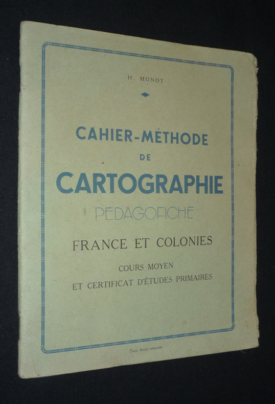
vg236Monot H. Dos agrafé In-8 (17,8 x 21,8 cm), dos agrafé, 40 pages, sans date ; rabat du premier plat frotté et fendu aux extrémités, par ailleurs assez bon état général. Livraison a domicile (La Poste) ou en Mondial Relay sur simple demande.
Splendida veduta a volo d’uccello della città, edita a Siena alla fine del XVI secolo. Allievo di Antoine de Lafrery e Claude Duchet, il Florimi si trasferisce a Siena dove inizia la sua fiorente attività di editore fino al 1612. Per le caratteristiche peculiari delle opere del Florimi e per la loro rarità, queste vengono classificate tra le carte di scuola lafreriana. Incisione in rame, in ottime condizioni. Molto rara. Il Florimi (1581-1613), commmerciante di libri e di stampe, fu anche editore. Di origini calabresi, si stabilì a Siena nel 1581, con un negozio in Banchi. La prima testimonianza della sua attività indipendente si ha nel 1589. Nel 1591 pubblicò un libro di schemi per fiori di ricami, a Venezia; la seconda edizione dello stesso venne edita in Siena nel 1593.Nel 1597 pubblicò la Vita di Santa Caterina, incisa da De Jode su opera del Vanni, e la Passione di Cristo, sempre di De Jode su ispirazione di Andrea Boscoli. Pubblicò un grande numero di mappe e soggetti religiosi. Si avvalse dell’aiuto di incisori del calibro di Agostino Carracci, Cornelis Galle, Pieter De Jode e Thomassin. Splendid bird’s eye of the city, printed in Siena during the first years of the XVII century. A pupil of Antoine de Lafrery and Claude Duchet, Florimi moved to Siena where he started his flourishing business as publisher until 1612. Due to the peculiar characteristics of Florimi’s works, and also to their rareness, these are classified among the maps of the lafrerian school. Copper engraving, in excellent condition, very rare. Florimi (1581-1613), book and prints trader, was also a publisher. He was born in the Calabria region but then moved to Siena where he established his shop in Banchi. The first evidence of his independent activity is in 1589. In 1591 he published in Venice a book of schemes to embroider flowers; the second edition of the same book was published in Siena, in 1593. In 1597 he published the Vita di Santa Caterina, engraved by De Jode after Vanni, and the Passione di Cristo, always engraved by De Jode after Andrea Boscoli. Florimi published a great number of maps and religious subjects, helped by famous engravers such as Agostino Carracci, Cornelis Galle, Pieter De Jode and Thomassin. Dimensioni 465x340. Tooley Dictionary p. 216.; Bella, Cartografia Rara p. 32, 24.
Antonio Zatta, Venezia, 1793. Incisione in rame all’acquaforte, colore d’epoca (ritoccato), cm 32,5 x 42,5 (alla lastra) più margini. Minimo foxing, buono stato di conservazione.
Incisione in rame, colorata da mano coeva (cm 38,5x50 e ampi margini). Tratta dall'edizione latina dell'Atlas Novus pubblicato ad Amsterdam nel 1640 ca. Esemplare fresco e marginoso. (Blavius o Guilielmus Caesius o Guilielmus Jansonius). Cartografo olandese (Uitgeest 1571-Amsterdam 1638). Allievo a Praga dell'astronomo Tycho Brahe, nel 1599 si stabilì ad Amsterdam, dove iniziò la pubblicazione di atlanti e carte geografiche e la costruzione di mappamondi. Nel 1633 fu nominato cartografo della Repubblica. Alla sua morte l'azienda proseguì per opera dei suoi due talentuosi figli Cornelius (1616-1648) e Johannes (1596-1673) che ampliarono l'ambizioso progetto cartografico del padre. L'Atlas Major è il risultato dell'immenso lavoro dei Blaeu ed è riconosciuto unanimamente come uno dei momenti più alti nella storia della cartografia. Il lavoro dei Blaeu si interruppe nel 1672 quando il grande incendio di Amsterdam distrusse l'officina e gran parte delle lastre. L'anno seguente Johannes morì e le lastre rimanenti vennero disperse e acquistate dai rivali Frederick De Wit, Schenk e Valk. La casa editrice chiuse definitivamente nel 1695.. .
Incisione in rame, colorata da mano coeva (cm 38,3 x50 e ampi margini). Tratta dall'edizione latina dell'Atlas Novus pubblicato ad Amsterdam nel 1640 ca. Esemplare fresco e marginoso. (Blavius o Guilielmus Caesius o Guilielmus Jansonius). Cartografo olandese (Uitgeest 1571-Amsterdam 1638). Allievo a Praga dell'astronomo Tycho Brahe, nel 1599 si stabilì ad Amsterdam, dove iniziò la pubblicazione di atlanti e carte geografiche e la costruzione di mappamondi. Nel 1633 fu nominato cartografo della Repubblica. Alla sua morte l'azienda proseguì per opera dei suoi due talentuosi figli Cornelius (1616-1648) e Johannes (1596-1673) che ampliarono l'ambizioso progetto cartografico del padre. L'Atlas Major è il risultato dell'immenso lavoro dei Blaeu ed è riconosciuto unanimamente come uno dei momenti più alti nella storia della cartografia. Il lavoro dei Blaeu si interruppe nel 1672 quando il grande incendio di Amsterdam distrusse l'officina e gran parte delle lastre. L'anno seguente Johannes morì e le lastre rimanenti vennero disperse e acquistate dai rivali Frederick De Wit, Schenk e Valk. La casa editrice chiuse definitivamente nel 1695.. .
(Codice OS/0217) Quaderno in 16°, 16 pp. La prima pagina è stata anticamente compilata. Brossura editoriale, un esempio alla copertina posteriore. Buono stato. ~~~ SPEDIZIONE IN ITALIA SEMPRE TRACCIATA