12 890 résultats
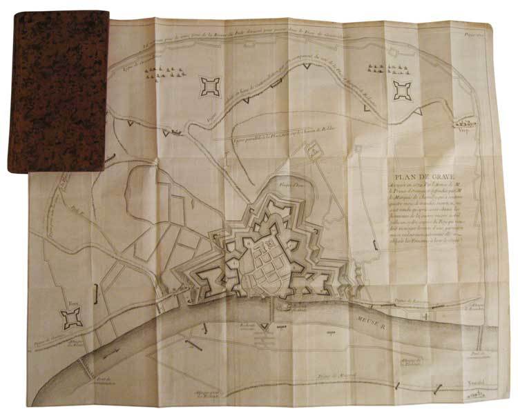
In-12, plein veau marbré de l'époque, dos lisse orné de compartiments cloisonnés et fleuronnés, pièce de titre de maroquin bordeaux, tranches rouges, xii, 356 p. et (4) p. d'approbation et privilège, 2 très grands plans dépliants hors texte. Première édition collective illustrée de 2 très grands plans dépliants des villes de Grave et Mayence. En juillet 1674, les Hollandais mirent le siège pendant 93 jours devant Grave dans le Brabant-Septentrional, ville occupée par les français depuis 1672. Les pertes furent considérables des deux côtés. Fin octobre, le gouverneur de la place, le marquis de Chamilly, reçut l’ordre du roi de se rendre. Ce qui restait de la garnison défila devant l’armée hollandaise qui lui rendit les honneurs et le Prince Guillaume III d'Orange récupéra la ville le 28 octobre 1674. Le siège de Mayence se déroula du 1er juin au 8 septembre 1689, pendant la guerre de la Ligue d’Augsbourg. "Récit méthodique, composé par un témoin oculaire. Exposé par ordre chronologique. Correct, froid, très détaillé et très utile" (Sources de l’Histoire de France, n° 3973). Petite étiquette imprimée à l’époque de la librairie Cellot et Jombert, "Rue Dauphine, la seconde porte cochère à droite par le Pont-Neuf, au fond de la cour". Bel exemplaire, frais, très bien relié à l’époque.
34837In-12, plein veau marbré de l'époque, dos lisse orné de compartiments cloisonnés et fleuronnés, pièce de titre de maroquin bordeaux, tranches rouges, xii, 356 p. et (4) p. d'approbation et privilège, 2 très grands plans dépliants hors texte. Paris, C.A. Jombert, 1756.
18198439Paris Garnery 1819 petit in-4° (19.5 x 25.5 cm) demi-chagrin vert non paginé Précédé d'une liste des planches, avec la correspondance dans le livre, et d'une analyse critique des cartes par M. Barbié du Bocage. Complet en 32 planches.
Very Good Turkish, Ottoman (1500-1928) Original color map. Folded. Oblong atlas folio. (50 x 60 cm). In Ottoman script. Shows Southeastern parts of Asia Minor and Syria; Siverek, Sard (Iraq) and Ras Al-Ayn (Rasulayn - Resualyn) in Syria. Hegira: 1333 = Gregorian: 1917. Not description on map-maker. Scale: 1: 200.000. This is one the serie of the Bonn projection maps which are the first map series in modern techniques in Turkey and the Ottoman Empire. In order to produce these maps covering Turkish territory, Reconnaissance Branch was incorporated into The Mapping Commission. The maps were produced in the datum based on the latitude and longitude of Ayasofya Mosque in equal area Bonn Projection. The field works for the 123 sheets covering the country were conducted by 76 staff. The production was completed in 18 years starting from east west. Field works continued without stopping except in years 1914 and 1920. This map series called also reconnaissance maps contributed a lot to producing 1:25.000 scale maps. According to Türkezer & Çobanoglu: History of Mapping in Turkey-1:200.000 Scale Maps, last cartographer of Diyarbakir regio is M. Sait Malatyali. No his biographic material and info in 'Savaslarda Haritacilar'. Rare.
11328A Paris, Chez F. Buisson, Imprimeur-Libraire, An XII (1804). 1 volume in-4, reliure ancienne demi-basane, plats cartonnés fortement frottés, intérieur propre, comportant une collection de 37 Planches et 4 Cartes dessinées à Londres, et gravées en taille-douce par Tardieu l'aîné, bon état.
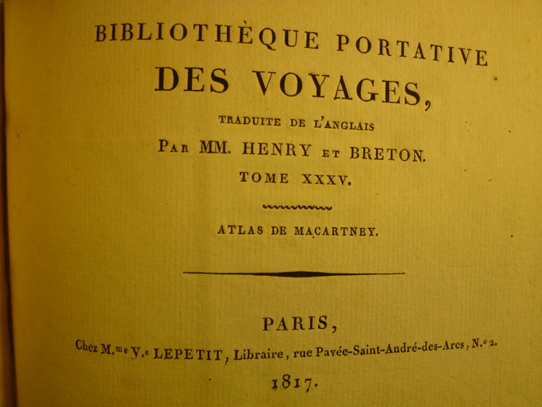
3602Paris, Chez M.me V.e Lepetit, Libraire, 1817. 1 volume in-12 oblong, couverture cartonnée d'éditeur salie (soiled covers), enrichi d'une carte dépliante de la Chine et de 22 petites gravures en noir et blanc (1 map of China and 22 small prints), quelques rousseurs (some foxing), état correct.
5582A Paris, Chez F. Buisson, Imprimeur-Libraire, An XII (1804). 5 volumes de texte, reliure plein veau, plats ornés de liserés, dos ornés, très beaux exemplaires et 1 volume d'atlas in quarto, reliure ancienne plein veau, comportant une collection de 37 Planches et 4 Cartes dessinées à Londres, et gravées en taille-douce par Tardieu l'aîné, excellent état. REMISE POSSIBLE POUR ACHAT DIRECT - DISCOUNT OFFERED FOR DIRECT SALE - PLEASE CONTACT THE BOOKSELLER FOR MORE INFORMATION
Very Good Turkish Original manuscript color map of Middle East including Syria, Palestine and Transjordan. Signed by cartographer. 28x20 cm. In Turkish (with Latin letters). The Mapping Department, which moved to Ankara from Istanbul after the Independence War, settled in the Attar Basi Khan in Koyunpazari and the press section also started its studies in the building which is the Art School in Ulus today. In 1924, the department, which is still inside the General Directorate Garrison, moved to the hut-shaped buildings with single floor between the Military Sewinghouse and the General Directorate. On the other hand, the production of maps and plans, which were to be used in development services carried out in parallel to the revolutions starting with the declaration of the Republic and following each other, was considered to be based on a legal arrangement. Because of the necessity of an urgent legal arrangement, the bill of law concerning to the General Directorate of Mapping, whose preparations were initiated by Lieut. Gen. M. Sevki (Ölçer) who knew the importance of the subject, was sent to the Ministry of Defense at the beginning of 1925. After the approval of Ministry of Defense, the bill, which was sent to the Prime Ministry, was discussed in the Council of Ministers and presented to the Grand National Assembly of Turkey. As a result; the Mapping Department was re-organized as the General Directorate of Mapping affiliated with the Ministry of Defense with the law bearing the number 657 on May 2, 1925 in order to do all mapping works and meet the needs of maps and plans of all ministries, institutions and organizations. [.] The first application of photogrammetry was made in Kayas, Ankara with the Wild Autograph plotting apparatus which was purchased in that year. Captain Ömer Kadri and Captain Niyazi came back from their photogrammetry education in Germany. Major Halit and Major Nüzhet were sent to France for photogrammetry education and Captain Ishak and Captain Bahri were sent to Germany. Captain Ahmet (Denkmen) and Captain Ömer Kadri attended the Congress of Photogrammetry assembled in Berlin. (Source: The Illustrated History Of Turkish Cartography). Halid Ziya was born in Izmir, Tire. He went to Istanbul and continued to Hendese-i Mülkiye and Engineer Mekteb-i Âlîsi for seven years. After starting with "Aydin Province Umur-i Nafia Third Class Engineering", Halid Ziya Bey, who continued to work as a deputy chief engineer on 14 March 1910, left Aydin and returned to Istanbul after continuing this duty for about six and a half months. As a teacher, he taught Accounting, Algebra, Geometry, and Topography at Halkali Ziraat Mekteb-i Âlîsi and Darussafaka. Halid Ziya Bey, who was appointed as a teacher of Hendese and Cosmography in Kabatas High School, started to practice the profession of engineering and cadastral, which was his main specialty in 1327. After the First World War, the Istanbul Government started its activities in order to capture and neutralize Halid Ziya Bey and his friends. Upon the harsh measures taken, Halid Ziya Bey had to live as a fugitive in the Hasirci Mountains of Eskisehir for a while with the armed force attached to him. Halid Ziya Bey, who was involved in the movement in Anatolia until the end of the National Liberation Struggle, returned to his engineering duty after the proclamation of the Republic and was included in the cadastral works again. In 1925, Halid Ziya Bey was appointed as the Head of the Science Committee of the new cadastre organization. He wrote 5 books on cadastre, photogrammetry, trigonometry, and cadastral tools in 1928 and 1929. In addition, as a result of personal work in 1928, the road between the provincial division of the Republic of Turkey with cities has prepared a comprehensive map to show up in the forest and mining. (Source: Kadastro ne idi, nedir, ne olacaktir, Kadioglu - Yildirir. From Preface.). No scale.
18421191842 Sans lieu, sans nom, sans date [circa 1842]
187961342Chicago: J.H. Beers & Co. Publishers Lakeside Building Cr. of Clarks & Adams 1879. Atlas folio. 15 x 17.5 in. 82 pp fairly continuous pagination including maps & lithographs. With 39 hand-coloured lithographed maps several double-page Indiana United States World Columbus Township Columbus Plat Sand Creek & Wayne numerous lithographed plates some large double-page tables charts. Quarter-sheep over black embossed publisher’s cloth gilt lettering stamped on front cover borders embossed in blind wear & bumping to corners some chipping head & foot of spine some wear to fore-edges somewhat shaken still a G copy. First edition of this uncommon original 19th-Century plat map atlas for Bartholomew County Indiana during the Gilded Age. J.H. Beers specialized in County Plat Map atlases and histories from 1878-1900 and also focused on producing municipal history and biographical history titles primarily in and around the Midwest. Their well-executed lithograph birds-eye views of businesses towns family farms and more were quite popular were generally pre-sold through subscription and prosperous towns businesses and farms who paid extra were able to secure a biographical section or view within the volumes. Bartholomew County located about 40 miles south of Indianapolis was originally established in 1821 and named for Lt. Col. Joseph Bartholomew a militia officer wounded at the battle of Tippecanoe. The County featured such companies as the Reeves Pulley Co. Ceraline Manufacturing Orinoco Furniture and others in the 19th Century and as of this publication the population was about 30000 inhabitants and today the County features approximately 82000 inhabitants. The atlas was later reprinted in 1969 1979 and 1986 in very poor smaller reproductions. J.H. Beers & Co., Publishers, Lakeside Building Cr. of Clarks & Adams, hardcover
Very Good Turkish, Ottoman (1500-1928) Original color map on cloth. Oblong: 67x75 cm. In Ottoman script. Folded originally. A very detailed map. Scale: 1:210.000. Shows Shkodra Lake, its shores, Bog Mountains, Karadag (Montenegro), Iakoh, Has etc. [MAP of OTTOMAN PROVINCE of BALKANS-ALBANIA] 52 Ipek (Peja). 53 Yakoh. 59 Akola. 60 Iskodra (Shkodra).
Very Good Turkish, Ottoman (1500-1928) Original color map. Folded. Very good. Large oblong 8vo. (21 x 26 cm). In Ottoman script. [MAP of OTTOMAN PROVINCE of DIYAR-I BEKR] Diyarbakir Vilâyeti. Province of Diyarbekir in Southeast Anatolia and its around. Many sandjaks and provinces with their detailed place names. Scale: 1/500.000.
Very Good Turkish, Ottoman (1500-1928) Original color map. Folded. Very good. Large oblong 8vo. (21 x 26 cm). In Ottoman script. [MAP of OTTOMAN PROVINCE of DIYAR-I BEKR] Diyarbakir Vilâyeti. Province of Diyarbekir in Southeast Anatolia and its around. Many sandjaks and provinces with their detailed place names. Scale: 1/1.500.000.
Very Good Turkish, Ottoman (1500-1928) Original color map. Folded. Very good. Large oblong 8vo. (21 x 26 cm). In Ottoman script. [MAP of OTTOMAN PROVINCE of EASTERN ROUMELI] Rumeli-yi Sarkî Vilâyeti, Bulgaristan Eyâleti, Edirne Vilâyeti, [Trakya], Selânik Vilâyeti. [East Roumeli, Salonica, Adrianople provinces; Old Zagra Sandjak, Bulgarian State]. Scale: 1/1.500.000. Ottoman Provinces in the Balkan Peninsula.
Very Good Turkish, Ottoman (1500-1928) Original color map. Folded. Very good. Large oblong 4to. (19 x 37 cm). In Ottoman script. [MAP of OTTOMAN PROVINCE of ERZURUM] Erzurum Vilâyeti. Province of Erzurum of east Anatolia and its around. Many sandjaks and provinces with their detailed place names. Scale: 1/1.500.000.
Very Good Turkish, Ottoman (1500-1928) Original color map. Folded. Very good. Oblong 4to. (21 x 42 cm). In Ottoman script. [MAP of OTTOMAN PROVINCE of KONIA] Konya Vlâyeti and around; Burdur, Isparta, Teke sandjaks, Hüdavendigâr Province Tozlu Ova, Tuz Gölü etc. Scale: 1/500.000.
Very Good Turkish, Ottoman (1500-1928) Original color map. Folded. Very good. Large oblong 8vo. (26 x 26 cm). In Ottoman script. [MAP of OTTOMAN PROVINCE of SIVAS] Sivas Vilâyeti, Trabzon Vilâyeti, Tokat Sancagi. [Sivas and Trabzon Provinces, Tokat Sandjak]. Scale: 1/1.500.000.
Very Good Turkish, Ottoman (1500-1928) Original color map. Folded. Very good. Obblong 4to. (21 x 38 cm). In Ottoman script. Scale:: 1/500.000. [MAP of OTTOMAN PROVINCE of TREBIZOND] Trabzon Vilâyeti, Trabzon Sancagi, Canik Sancagi, Sivas Vilâyeti. [Provinces of Trabzon and Sivas; Canik and Trebizond Sandjak]. Black Sea at north.
Very Good Turkish, Ottoman (1500-1928) Original color map. Folded. Very good. Large oblong 8vo. (21 x 26 cm). In Ottoman script. [MAP of OTTOMANT SALONICA -THESSALONIKI-] Selânik Vilâyeti. Ottoman Greece. Scale: 1/1.500.000. It shows Thessaloniki and its around. Manastir Vilayat, At north Kosovo, Siroz Sandjak etc.
1935114270Horizons de France, 1935, in-4°, 96 pp, introduction du Résident général Henri Ponsot, préface par J. Gotteland, nombreuses illustrations dont certaines en couleurs de Théophile-Jean Delaye et Stéphane Lamarche, 15 cartes en noir et en couleurs, plans et graphiques, cartonnage papier simili-maroquin bleu vif de l'éditeur, vignette représentant un méhariste, titre et frise d'encadrement dorés au 1er plat, dos toilé noir avec titre doré, bon état
Lausanne, Éditions André Delcourt, 1990; in-4, 224 pp., broché. Ouvrage d'anatomie à destination des neurologues, illustré par des photos très réalistes. Très bon état.
Very Good Turkish, Ottoman (1500-1928) Original color map. 65,5x63 cm. In Ottoman script. This rare and decorative Gallipoli map including Hellespont, Gallipoli Peninsula, Suvla Bay, Seddülbahir, and Tenedos, the places of Gallipoli Aar in 1915 (Dardanelles Campaign) during World War 1, separated two map views. Seddulbahir and Suvla Bay at north and Straight, Peninsula, and its shores with Tenedos (now Bozcaada) at the southwest of the map. It's a very detailed and rare map printed with the series of "History of the Dardanelles Campaign" after the seven years of war. The Gallipoli campaign, also known as the Dardanelles campaign, the Battle of Gallipoli or the Battle of Çanakkale (Turkish: Çanakkale Savasi, or, Muharebâti), was a military campaign in the First World War that took place on the Gallipoli peninsula (Gelibolu in modern Turkey), from 17 February 1915 to 9 January 1916. The Entente powers, Britain (with Anzacs), France, and Russia, sought to weaken the Ottoman Empire, one of the Central Powers, by taking control of the Turkish straits.
179966610Wien, 26. November 1799. Fol. Beidseitig bedrucktes Privileg.
2222Sans lieu, sans nom, sans date. 1 vol. in-folio non-paginé de 26 planches en double-page, demi-veau brun moucheté, dos à nerfs orné de fleurons dorés, tranches dorées. Accrocs aux coiffes, dos, coins et coupes frottés, plats griffés.