12 890 résultats
195059129Portland OR: Multnomah County Assessor’s Office ca. 1950. Oblong folio. 21 x 13.5 in. 1 1-71 74 leaves as issued. Including Multnomah County key map w/ 73 whiteprint diazo process maps all w/ borders key map w/ small closed tear at lower fore-edge w/ ghosting from old removed scotch tape now neatly repaired on verso. Original black cloth post-binder gilt lettering stamped on front cover 3 nickel-plates screwposts at gutter margin minor rubbing still VG copy. First edition thus of this exceedingly scarce plat map atlas for Multnomah County Oregon surveyed and issued after the famed May 30 1948 Memorial Day flood destroyed Vanport the Wartime Housing Authority of Portland project still existing following V-J Day 3 years earlier. The Vanport community housed the majority of African-American residents in Oregon who were prevented through racist real estate covenants and local ordinances from moving elsewhere prior to the flood and afterwards 1000’s were confined to the Albina area of North Portland. In addition the ongoing highway project for Highway 99 or the Pacific Highway is still demarcated without reference to I-5 which after the 1956 Highway Act would eventually serve to sever North Portland and eliminate entire neighborhoods when later completed. These maps offer an essential snapshot of development in Post-War Portland and guide to neighborhoods and land developments radically changed by expansion of the Portland Airport Interstate Construction and more. Worldcat locates 1 copy OR Hist. Soc. Lib. incorrect collation. Multnomah County Assessor’s Office, hardcover
192955692Portland OR & Tacoma WA: Metsker the Map Man 1929. Oblong atlas folio. 18 x 14.5 in. 45 leaves cyanotype blueprints. Including 44 detailed blueprint plat maps consistently dated 1929 1 large folding key map sized 24.5 x 14.25 in. Publisher’s flexible simulated calf post-binder gilt lettering title stamped on front cover burgundy-coloured silk more pastedowns neat typed label affixed to upper fore-edge of spine minor rubbing shelfwear NF copy. First edition thus of this exceedingly scarce Marion County Metsker plat map atlas providing invaluable historical and genealogical data for 1920s Salem Turner Silverton Stayton and as far north as the area around Aurora Oregon. The index provides specific names and locations for Donation Land Claims Fruit Farms and Tracts including logging and sawmill tracts as well as cities towns and suburban additions. Metsker 1881-1966 civil engineer and mapmaker began working as a teenager with his father in a Winlock WA sawmill by 1900 and later by 1910 ahd become a draftsman in an engineering office in Tacoma WA followed during the next 15 years by stints at engineering firms in Seattle Tacoma and Portland before striking out on his own as a mapmaker surveyor and mapmaker during the Roaring 20s. Metsker’s maps were sold by subscription and updated on an ongoing basis so the subscribers were supposed to throw out the earlier versions of the maps and replace them in the succeeding decades. They all received heavy use and the earliest versions created in the 1920s and 1930s are by far the scarcest of the atlases produced by the firm. Worldcat locates 3 copies of the 1929 Multnomah County Library OHS State Library of Oregon. Metsker the Map Man, unknown
Very Good Turkish, Ottoman (1500-1928) Contemporary red cloth. Roy. 8vo. (24 x 16 cm). In Ottoman script (Old Turkish with Arabic letters). [1], 229, [1] p., many b/w and color ills., 30 chromo-lithographed maps. Wear and fading on spine, some ex-library stamps on the colophon and several blank pages, ownership ink inscription and signature on the first page-overall a good copy. First edition of this rare Ottoman atlas for the primary schools in the late Ottoman Empire, including beautiful 30 chromo-lithographed maps of the Ottoman land according to administrative regions (provinces) and richly illustrated with b/w plates of the cities and provinces in the Middle East. Map list: 1. World map 2. Complete Imperial Ottoman 3. Arabian Peninsula 4. Anatolia 5. Asia Minor 6. Marmara and Black Sea 7. Aegean (The Archipelago) 8. Demography of Anatolia and Syria, Libya, etc 9. Administrative map of Anatolia 10. Map of mines of Anatolia 11. Agricultural map of the Imperial Ottoman 12. Arabian Peninsula 13. Map of the Edirne Vilayat [Adrianople Province of the Ottoman Empire] 14. Map of the Bosphorus 15. Map of the Hüdavendigâr Vilayat [Brusa Province] 16. Maps of Izmit and Biga Sanjaks 17. Map of Aydin Vilayat and Mentese Sanjak 18. Map of the Konya Vilayat 19. Maps of the Adana Vilayat and the Mediterranean Sea 20. Maps of the Erzurum and Ankara Vilayats 21. MAps of Kastamonu Vilayat and Bolu Sanjak 22. Map of the Trebizond Vilayat 23. Maps of the Van and Bitlis Vilayats 24. Maps of the Sivas and Harput Vilayats 25. Maps of the Bagdad and Basrah Vilayats 26. Map of the Mosul Vilayat and Day al-Zor Sanjak 27. Map of the Aleppo Vilayat and Urfa Sanjak 28. Map of the Syria and Beirut Vilayats 29. Map of the Arabia 30. Maps of the Yemen vilayat and Asir Sanjak. This atlas was printed four times for the different classes of the early Turkish / Ottoman schools, during World War 1 (two times in 1916) and the National Struggle (two times in 1921). Geylangil was born in Istanbul in 1887 and studied in Aleppo and Baghdad. Geylangil, who also studied economic geography, taught geography at many schools, including Galatasaray High School. Until his death, he wrote 14 books on geography, most of which were geographical atlases. In 1941, he was among the founding members of the Turkish Geographical Society. Özege 23216.; TBTK 11481.; We couldn't find any copy of this edition worldwide.
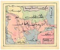
1910ABC_47241Ottoman Empire 1910. Gold-stamped cloth with the tughra of Mehmed V ruled 1908-18 on the front board when reading right to left and "Album" on the back board the front when reading left to right with an inscription below the tughra and the European numerals 16 and 2 flanking an ornament below the inscription the whole framed by 4 large floral cornerpieces. Oblong 4to 26.5 x 19.5 cm. 14 leaves with 10 pen-and-ink maps hand coloured with watercolours. Tissue guards. An album of hand-drawn maps forming an atlas of the western mostly European parts of the Ottoman Empire with legends in Ottoman Turkish written in the Arabic script. The overview map shows Albania Kosovo Macedonia and the Ottoman controlled northern parts of Greece coloured together with Thrace and the northwest parts of Anatolia shown treating them as a single unit while Serbia and Bulgaria like the small parts of territories outside Ottoman control are coloured separately. Most of the other maps give more detailed views of some of these regions including the Bosporus the Dardanelles Halkidiki Chalcidice Albania etc. but there is also a map of Crete not in the overview map.In fine condition. hardcover
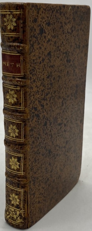
230174Paris, Jombert, 1716 in-12, (12)- 215 pp., 14 planches repl., veau brun moucheté, dos à nerfs orné, tranches rouges (rel. de l'époque). Premier feuillets brunis.
190953081Seattle & Berkeley CA: Ellis A. Davis 1909. Folio. 190 pp. Illust. & decorated title 100s of photo illusts. over 100 colour maps many double page 1 very large folding colour map tipped-in on rear pastedown a couple minor closed tears at creases. Red cloth silver lettering & decoration embossed on front cover minor bumping to corners bumping & minor fraying head & foot of spine very faint tidemark to fore-edges still a VG- copy very clean and bright textblock. First edition of this well-illustrated commercial atlas intended to promote the Pacific Northwest during the Alaska-Yukon Exposition carefully listing most of the major and minor cities their counties industries local products and 100s of photos of buildings logging railroads shipping and more. The atlas includes detailed economic statistical maps of Oregon Washington and Idaho; street maps of Spokane WA Portland OR Seattle WA Boise ID and more. The large folding colour map at rear is of Oregon State -- these atlases were also issued with Idaho Washington and Oregon & Washington colour maps separately. Ellis A. Davis, hardcover
ORD-16352Sans indication de lieu ni de date [Genève. Pellet. 1780]. In-4 (183 x 261mm) dos lisse maroquin rouge orné de filets et d'un semis d'étoiles or, plats veau raciné à double encadrement de filets or, gardes marbrées, bien complet des 23 tableaux et des 50 cartes dressées par Bonne, la plupart dépliants. Menus défauts mais bon exemplaire.
194764270Portland OR: Oregon Blue Print Co. 1947-1959. Oblong atlas folio. 21 x 17.5 in. 52 leaves not contiguously numbered. all dyazo-print whjteprint maps w/ first consisting of a large folding “Oswego Oregon Street Map†many leaves w/ creasing corners worn some with closed tears secured at gutter margin w/ 4 brass split-pins over thick brown paper stock still a VG- exemplar. First edition thus of this exceedingly rare realty atlas for Oswego Oregon chronicling its’ explosive growth following World War II prior to the consolidation with surrounding suburbs and renaming as the City of Lake Oswego in 1960. These real estate atlases were sold in installments to Lake Oswego & Portland area real estate agents land use boards and public institutions with installments appearing from 1947-1959 but the Oswego atlas sheets are far scarcer than even the very rare Portland issues. Oswego and surrounding suburbs such as Alto Park Acres Forest Hills Lake Grove Rainbow Terrace Uplands Crest and Woodmont were all developed initially by the Ladd Estate Company which first platted the area with Paul C. Murphy overseeing the design with the aid of of Frederick & John Olmsted to create a park like setting around the Lake. This atlas with key map opening details the evolution from 1947-1959 the street-by-street and plat-by-plat of the surrounding area providing essential information on the emergence of these suburbs from the original donation land claims as the city grew from about 1500 to over 10000 by 1959. The more than 100 new residential plats created from the original donation land claims throughout the Lake Oswego area including the plats on the south side of South Shore Drive which created the Palisades Neighborhood and just prior to the July 2 1959 annexation which brought all of Oswego Lake parts of Lake Grove Palisades and others in the Lake Grove Sanitary District all evolve through these maps. Researchers can trace the evolution of the Portland-Salem Expressway later called the Baldock Freeway and further developed into the I-5 corridor alongside Lake Oswego along with the rapid growth of the area. Original Donation Land Claims are clearly demarcated including those of Charles Brown Bryant Waters Carman Albert Durham and many others. Oregon Blue Print Co. was established on SE Hawthorne in Portland OR by the early 1940’s and were the printers for the Pittmon maps which were extensively used and continually updated in the Portland area. Under Walter & Min Underwood the company focused on blueprinting and engineering plans as well as land promotion brochures and street maps. Company still remains family owned. It appears that later versions of the Oswego Oregon Street Map were used as land promotion brochures and some early versions do survive in holdings of Lake Oswego City Government and 1 in OHS but no other examples are located in Worldcat. No similar versions of this atlas have survived in institutional holdings that this cataloguer could identify accurately. See: Mid-Century Lake Oswego: A Look at Lake Oswego’s Modern Developments 1935-1965 August 2010. Oregon Blue Print Co., hardcover
1996LFA-126722826Revue de 172 pages, format 160 x 240 mm, illustrée, brochée, Institut de Géographie Alpine, bon état
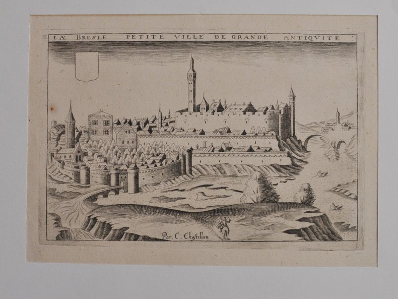
46405254[Paris, Boisseau, vers 1640], 11,5 X 17,5 cm. sur une feuille de 20 x 27 cm., monté dans un passe-partout. Vue de la ville tirée de Topographie françoise parue chez Boisseau.
français An XII (1803). Carte entoilée dépliante (55x73 cm) de 18 panneaux, aux contours finement aquarellés de l'époque. Etui en plein papier bleu de l'époque orné de dentelle dorée, titre frappé or sur le plat supérieur. Revue et corrigée suivant les nouvelles divisions. Bel exemplaire.
1827794551827 Paris, Firmin-Didot, 1827, petit in folio relié demi-veau vert olive, dos lisse orné de filets dorés, titre en long.
1831D19539Karlsruhe: Verlag Von Gottlieb Braun 1831. Neue Ausgabe. Hardcover. Good. Two volumes bound in one. Oblong with cloth spine and corners marbled paper boards printed label to upper board. 45 21 & 24 hand-colored lithographed maps some folding. Rubbing and wear to boards spotting throughout but hardly untypical. A rather scarce student atlas. <br/><br/> Verlag Von Gottlieb Braun hardcover
177622987Paris Antoine BOUDET 1776 -in-folio plein-veau 1 volume, reliure d'époque plein veau brun in-folio (binding full calfskin in-folio) (30 x 45 cm), Reliure d'Epoque, dos à nerfs (spine with raised bands), décoration "or" et à froid (gilt and blind-stamping line decoration), la pièce de titre manque, tomaison frappée "or", pièce de tomaison sur fond marron foncé avec deux filets "or" en encadrement, filets à froid de part et d'autre des nerfs, coiffes arasées, entre nerfs à fleuron "or" dans un encadrement à double filets "or" avec fleurons fleurettes "or" aux angles, filet et roulette large "or" en tête et en pied, mors du 1er plat fendu sur 20 cm, manques de cuir aux plats, coins écornés (à restaure, double filets "or" sur les coupes (blind stamping fillets on the cuts) avec manques de dorure, toutes tranches lisses rouges, ATLAS DE PLANCHES N°II, de la planche N° 147 à la Planche N° 312, soit 165 gravures hors-texte gravées sur bois en noir majoritairement gravées par Dheulland et Hérisset, représentent les inventions techniques concernées, utiles aux arts les plus divers : militaire, hydraulique, horlogerie, astronomie, machines de calcul, arpentage et topographie, etc des Années 1714 à 1728, sans paginations (165 feuillets), légères mouillures claires en marge de quelques gravures, mais l'ensemble est en bon état, 1776 Paris Antoine BOUDET Editeur,
1989LFA-126748726Une revue de 24 pages, format 150 x 240 mm, illustrée, brochée, publiée en 1989, Société des Amateurs de Jardins Alpins, bon état
184040835(Mainz, um 1840). 39,5 x 48 cm. Mittig gefaltet (wie erschienen).
191413240Berne, Bureau de Statistique du Département fédéral de l'intérieur, 1914. In-folio oblong de [2]-6 pages et 64 tableaux imprimés en couleurs. Coupes et coins légèrement frottés, plats un peu sali.
Very Good Arabic Original chromo-lithograph map in brown tones. On a special paper with an ongoing blindstamped "Regestre Robur" during the borders. Folded. 70x100 cm. In Arabic. Scale: 1 /1.000.000. Chipped on margins, split on folded traces. Slight discoloration and one stain on lower margin. Otherwise a good copy. An attractive and detailed map of Syria shows the capital (as Aleppo n that map), other cities like Damascus, Raqqa, Homs, Latakia, Ayn al-Arab, Idlib, Hama, Deir Ez-Zor, Jarabulus, et alli. And it shows Turkey on the north (as Turkey containing Hatay and Alexandrette), The Mediterranean shores of the land as well as Lebanon and Palestine (and Jerusalem) on the west, Sharq al-Urdun (Jordan) and Iraq on the south and east. It's very detailed on showing the roads spread throughout the land like railways and ancient roads from the Roman period. Additionally this roads can be followed to the other Arabic countries and regions on the map. This map was calligraphed by Kamel Al-Baba, (1905-1991), who was a Lebanese contemporary / modern calligrapher. He is the son of famous calligrapher Mokhtar Al-Baba. Cannot be found in WorldCat.; Not in Library of Congress Map Collection. Very scarce.
181055228[Wien, um 1810]. Grenzkolor. Kupferstich-Karte von B. Biller aus D. v. Görög, Magyar Atlas (Blattgröße 36,6 x 28,9 cm, Darstellung 27,5 x 22 cm).
181055226[Wien, um 1810]. Grenzkolor. Kupferstich-Karte von J. Berken aus D. v. Görög, Magyar Atlas (Blattgröße 27,5 x 35 cm, Darstellung 22,5 x 28,2 cm).
181155229[Wien], 1811. Grenzkolor. Kupferstich-Karte aus D. v. Görög, Magyar Atlas (Blattgröße 37 x 28,5 cm, Darstellung 29,2 x 22,2 cm).
181055227[Wien, um 1810]. Grenzkolor. Kupferstich-Karte aus D. v. Görög, Magyar Atlas (Blattgröße 27,1 x 37,5 cm, Darstellung 22,3 x 28,9 cm).
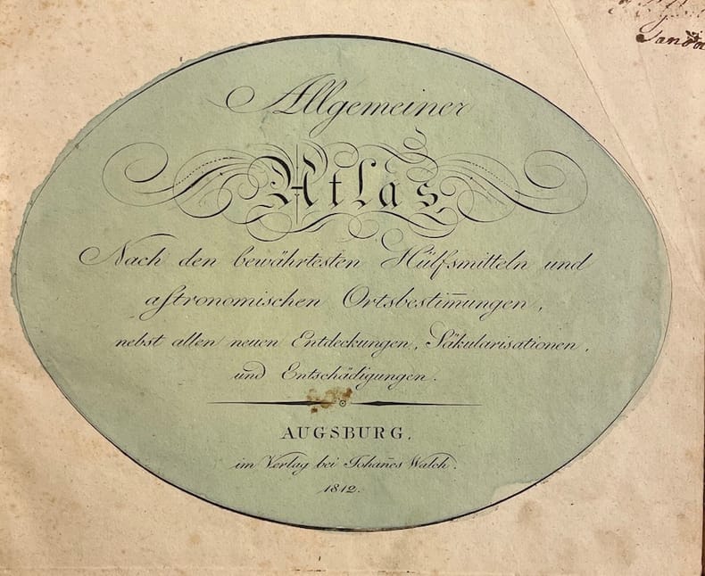
39755Augsburg, im Verlag bei Johannes Walch, 1812. Pt. in-4° oblong (25,5 x 21 cm), 36ff. Reliure d'époque demi-basane à coins, pièce de titre rouge au dos.
177064868Ohne Ort, ohne Verlag bzw. Drucker, o. J. (um 1770). Qu.-4° (32,5 x 28 cm). Mit gest. Titel von J. J. Mezger u. 19 grenz- u. flächenkolor. Kupferkarten. Einfacher grüner Kart.-Umschlag d. Zt. m. handschriftl. Deckeltitel.
188162541Neillsville & Wasau WI: Bussell & Holway Civil Engineers 1881. 8vo. 180 pp unpaginated. with double-page engraved title plat maps throughout primarily on facing recto & verso of leaves while some are overlapping and on next blank continuing w/ laid-in Township Range Plat Map MS on form 4-590 demarcating Government Land and dated March 6 1895 inserted into rear pocket annotations demarcating plat changes red ink markings of “Government Land†w/ V’s and other annotations on several of the maps in Marathon County by former real estate land surveyor. Contemporary black calf rebacked hinges restored w/ thumbing some edgewear still a VG- copy. First edition of this detailed and compact pocket plat map atlas issued by Bussell b. 1854 was a surveyor/civil engineer based out of nearby Neillsville Clark WI and his partner Holway for lands platted through Marathon County Wisconsin in the 19th-Century as the centrally located County opened for logging and settlement on lands driven by the Wisconsin Central Railroad and the Wisconsin Valley Railroad later the Wisconsin Valley Land Company. This exceptional reference provides names of all the original homesteaders and plat-holders as of the time of publication as well as demarcating houses churches schools mills U.S. Government lands state lands as well as the lines for the Lake Shore Traffic Co. Dundee Land Co. and development lands of the C.P. Haseltine Co. Worldcat locates only 1 physical copy at Library of Congress Wisconsin Historical Society does have a scanned searchable copy available online; See: Louise Marchetti History of Marathon County Wisconsin and Representative Citizens 1913. Bussell & Holway, Civil Engineers, unknown