1 372 résultats
18703825Baltimore MD 1870. First Edition. Very Good. Light foxing minor even toning small closed tear at one edge else bright and clean. 15.25"x12.25". Handcolored plate. <br/><br/>A decorative floral boards surrounds this handcolored map of the districts of Baltimore. A handsome copy of a rather scarce plate. hardcover books
1884333035Philadelphia 1884. unbound. Map. Engraving with original hand coloring. 14 1/4 x 11 1/2 inches.<br/> <br/> Early map of Palestine or the Holy Land from the Dead Sea to Lebanon with part of Syria showing the biblical names of the tribes of Israel. Royal cities noted with towns waterways and geographical features also labeled. Turkish names noted as well as ruins. An inset of modern Jerusalem is included. In the index a color line should denote 'Land of the Philistines' but it was not colored in. In very excellent condition.<br> <br> Samuel Augustus Mitchell Sr. 1792-1868 was one of the leaders in American cartography of the 19th century and pioneered the conversion of engraved map plates to more affordable lithographic plates. His son Samuel Augustus Mitchell Jr. continued his father's successful mapmaking and publishing business and was one of the most prolific and renowned 19th century American publishers.<br/> <br/> unknown
1890D17725Boston: Houghton Mifflin 1890. First Edition. Hardcover. Near Fine. 8vo. 6 70 pp. Original white cloth-backed green paper-covered boards paper spine label. Boards soiled wear to label internally fine. BAL 14141. First edition inscribed on the f.f.e.p.: "My dear Ned If you find anything within to interest I shall be glad Weir". One of 322 copies <br />printed. Loosely inserted is a 12 line poem of Mitchell's printed on a card with a botanical illustration at top printed Corell Press from its Mount Washington Mass. shop 1917. <br/><br/> Houghton Mifflin hardcover
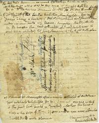
183828052Washington DC 1838. From James Mitchell addressed to Hon. George P. Marsh a letter outlining libraries transactions and booksellers many in England. James Mitchell was the British author of 'Conversations On General Knowledge or Universal Catechist Consisting of Superior Separate Catechisms of all Arts and Sciences' in 1837. <br /> <br /> The letter is addressed to Honorable George P. Marsh considered America's first environmentalist. In 1864 he published "Man and Nature" later revised as 'The Earth as Modified by Human Action.' He applied science to life with the aims and methods of a humanist rather than a scientist.<br /> <br /> Marsh was also the first US ambassador to Italy. He reported to the Secretary of State in Washington DC detailed and updated descriptions of the political social economic and cultural situation on the peninsula.<br /> <br /> 4to 2pp original folds undated however a postmark of "Dec. 9 Washington City DC" listed on the front with an amended address. Originally addressed to 'Mr. Marsh Member of Parliament for Vermont who possesses one of the best libraries in the United States' which is then crossed out and written "Hon. Geo. P. Marsh Astor House New York." Paper toned split at one fold otherwise very good. unknown
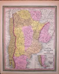
1849M1415A detailed map of Chile Uruguay and Argentina. Inset map of the tip of Patagonia. <br /><br /> In "A New Universal Atlas Containing Maps of the various Empires"
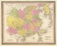
184630792Philadelphia 1846. Other. In excellent condition. 285 by 355mm 11¼ by 14 inches. Lithograph period hand color in wash and outline when published. unknown
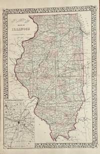
187921Philadelphia: Mitchell S. Augustus 1879. 1879 edition. 14 1/4 x 21 2=3/4 inches. Very good with separations to the folds at the extremes repaired with archival mending tape. Mitchell S. Augustus. Contemporary-color highlights this double page map. The State of Illinois covers 400 miles from North to South. This map show all the counties along with the townships within. A dramatic rr network is shown. The Illinois Central Railroad Chicago and Alton Railroad and the Rock Island Railroad are accurately shown among the network.On the versos can be found a one page map of Cincinnati and Vicinity. It two has a well defined rr network. The Amin map has an inset of Central Illinois centered on Springfield. Mitchell, S. Augustus unknown
1882101048Philadelphia: Bradley 1882. Unbound colored engraved map 22 1/2"x 14 1/2". Slight toning and aging; overall bright and clear and in very good shape. Maps are wrapped with acid free board or in rigid sleeves. The Mitchell family started to produce atlases in 1846 and continued into the early 1890s. Around 1860 S. Augustus Mitchell Jr. took over and the atlas would be called Mitchell's New General Atlas. This is an attractive double page map of the West from the 1882 installment. Within the borders of Montana Idaho and Wyoming several Indian Reservations are highlighted including those for the Flat Head Crow and Blackfeet tribes. Ristow 311-313 Phillips 907 Bradley unknown
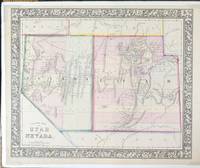
186570400Philadelphia: S. Augustus Mitchell Jr. 1865. Map. Very Good. Hand-colored map with decorative floral vine-patterned borders 13 6/8" x 11 3/8" and margins 15 1/4" x 12 1/8". Plate from "Mitchell's New General Atlas." With foam core backer board and shrink wrap. Moffat 79. Entered according to Act of Congress in the year 1865 by S. Augustus Mitchell Jr. in the Clerks Office in the District Court of the U.S. for the Eastern District of Pennsylvania.<br /> <br /> Samuel Augustus Mitchell Jr. was the son of Samuel Augustus Mitchell Sr. the most prominent American map publisher of his generation. Mitchell Sr. began publishing maps because he was frustrated with the low quality and inaccuracy of early 19th century maps. Samuel Augustus Mitchell Jr. carried on the Mitchell family business until the late 1880s. Information from National Museum of American History Behring Center Smithsonian Institution<br /> <br /> A bright hand colored map of the state of Nevada and the Territory of Utah.<br /> <br /> Fort Bridger in Utah. "No Kane Piute Sevier or Rich Counties shown. Shows Hastings Road Telegraph Route roads and mining districts in Nevada. Colored by counties. Utah's western border is at 115° W. Preuss Lake is in western Beaver County." - Moffat. S. Augustus Mitchell, Jr. unknown
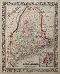
1860310371Philadelphia: Mitchell Samuel Augustus Jr. 1860. unbound. Map. Steel engraving with original hand coloring. Image measures 13 3/8" x 10 5/8".<br/> <br/> Lovely map of Maine published in 1860 divided into counties. Shows major towns and cities routes railroads and waterways. Features an inset of Portland Harbor. In excellent condition with a minor chip to lower margin not affecting the image.<br> <br> Samuel Augustus Mitchell Sr. 1792-1868 was one of the leaders in American cartography of the 19th century and pioneered the conversion of engraved map plates to more affordable lithographic plates. His son Samuel Augustus Mitchell Jr. continued his father's successful mapmaking and publishing business and was one of the most prolific and renowned 19th century American publishers.<br/> <br/> Mitchell, Samuel Augustus Jr. unknown
1872108Philadelphia: Mitchell S. Augustus 1872. 14 x 11 1/4 inches. Very good. Single page map from Mitchell's atlas. Superb contemporary hand color. Shows General Kearney's route and Lt. Colonel Cook's wagon route. Mitchell, S. Augustus unknown
1869101063Philadelphia 1869. Unbound colored engraved map decorative boarder 22 1/2"x 14 1/2". Slight toning and aging; overall bright and clear and in very good shape. Maps are wrapped with acid free board or in rigid sleeves. The Mitchell family started to produce atlases in 1846 and continued into the early 1890s. Around 1860 S. Augustus Mitchell Jr. took over and the atlas would be called Mitchell's New General Atlas. This is an attractive double page map of New York State from the 1869 installment. Buffalo Rochester Albany and West Troy and New York Harbor are highlighted in five insets. Ristow 311-313 unknown
1865101062Philadelphia 1865. Unbound colored engraved map decorative boarder 22 1/2"x 14 1/2". Slight toning and aging; overall bright and clear and in very good shape. Maps are wrapped with acid free board or in rigid sleeves. The Mitchell family started to produce atlases in 1846 and continued into the early 1890s. Around 1860 S. Augustus Mitchell Jr. took over and the atlas would be called Mitchell's New General Atlas. This is an very attractive and colorful double page map of New York and surrounding states from the 1865 installment of that atlas. While New York is a little less prominent in this version of the map it is one of the more colorful editions. Boston and New York Harbor are featured in insets. Ristow 311-313 unknown
189140775Detroit: Rogers & Thorpe Publishers. Fair with no dust jacket. 1891. 1st Edition. Flexible cloth. Brown flexible boards with gilt stamping front panel remaining portion of rear panel detached heavy chipping and loss to covers with some soiling tearing to margins of final page. Else a complete copy here in fair to good condition being sold here AS IS. An uncommon early Detroit item with numerous biographical sketches of late nineteenth century businessmen and companies flourishing in downtown Detroit Michigan. With photographs of both people and businesses - residential homes Detroit Stove Works several tobacco companies Hudson's and other retail establishments etc. ; MCN33619; 4to 11" - 13" tall; 160 pp . Rogers & Thorpe, Publishers hardcover
1866111872New York: Scribner 1866. First Edition. hardcover. near fine. 2 vols. 12mo green cloth. New York: Scribner 1866. Near fine.<br/> <br/> "Covers the period from 1812 to 1848." Wright II 1720. A.L.S. by the author laid in. Bookplate.<br/> <br/> Scribner unknown
1848W2301Philadelphia: Thomas Cowperthwaite & Co. 1848. This map is from the 1848 edition of A NEW UNIVERSAL ATLAS CONTAINING MAPS OF THE VARIOUS EMPIRES. The atlas was based primarily on the H. S. Tanner UNIVERSAL ATLAS the rights to which were purchased by Mitchell from Carey & Hart. The early Mitchell maps are distinguished by their vivid hand-coloring and attractive decorated borders. They are among the most sought after ante-bellum maps published in the United States. This map is guaranteed to be authentic and more than 170 years old. It is in very good condition: clean and bright with some toning; There are two 1/4 inch closed tears in the margin on one edge--far away fron the image. Original. Single Sheet. Very Good. Folio - over 12" - 15" tall. Map. Thomas, Cowperthwaite & Co.
1893328661Philadelphia: George Jacobs 1893. hardcover. very good. 5 black & white illustrations. 49 pages. Small slim 8vo white cloth-backed pictorial boards lightly worn. Philadelphia: George W. Jacobes 1893. First Edition. A very good copy.<br/> <br/> With the bookplate of Weir Mitchell on the inside front cover.<br/> <br/> George Jacobs unknown
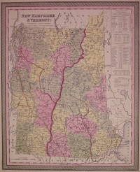
1850203546Philadelphia: Mitchell Samuel Augustus 1850. unbound. very good. Map. Engraving and lithograph with original hand coloring. Image measures 15" x 12".<br/> <br/> Classic map of New Hampshire and Vermont divided into counties. Details towns major routes railroad waterways and topography. A table at right lists populations of individual counties and towns. Small chip to lower right corner. <br> <br> Samuel Augustus Mitchell Sr. 1792-1868 was one of the leaders in American cartography of the 19th century and pioneered the conversion of engraved map plates to more affordable lithographic plates. His son Samuel Augustus Mitchell Jr. continued his father's successful mapmaking and publishing business and was one of the most prolific and renowned 19th century American publishers.<br/> <br/> Mitchell, Samuel Augustus unknown
1865106765<p>Unbound colored engraved map decorative border 14"x 11". Slight toning and aging a little margin staining a few small nicks in margins wide margins; overall bright and clean. Maps are wrapped with acid free board or in rigid sleeves. The Mitchell family started to produce atlases in 1846 and continued into the early 1890s. Around 1860 S. Augustus Mitchell Jr. took over and the atlas would be called Mitchell's New General Atlas. This is a nice colorful map of Boston including an inset of Boston Harbor from the 1865 installment of this atlas. Ristow 311-313.</p>
1865106764<p>Unbound colored engraved map decorative border 14"x 11". Slight toning and aging one or two margin nicks; overall bright and clean. Maps are wrapped with acid free board or in rigid sleeves. The Mitchell family started to produce atlases in 1846 and continued into the early 1890s. Around 1860 S. Augustus Mitchell Jr. took over and the atlas would be called Mitchell's New General Atlas. This is a nice colorful map of Washington DC from the 1865 installment of this atlas. Ristow 311-313.</p>
18670356New York: Charles Scribner & Co 1867. First Edition. Hard Cover. Near Fine. Octavo. First issue with "iv" on the final page of the preface. x 295 pages 3 pages of ads at rear; brown endpapers original green cloth.Mitchell was also known as IK. Marvel. The present volume is well illustrated showing country architecture landscape gardening and farm building. Small blemish on FEP a fine copy. BAL 13944. <br/><br/> Charles Scribner & Co hardcover
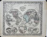
18691845Philadelphia: S. Augustus Mitchell Jr. 1869. Map no binding. Very good . MAP. New General Atlas. 12 ¼" x 15 1/8" 9 11/16" x 11 ½" within the neat line; engraved map showing the two hemispheres of the world 5 additional projections rivers and surrounded by a vining border; lightly hand-colored; one spot in the center at the lettering light age-toning of paper; very good plus. A nicely detailed hand-colored map of the two hemisphere's of the world positioned over two views of "The World on a Polar Projection" one view titled "North Polar Region" and two views of "Land and Water Hemispheres." Comparative-length representations of rivers and their tributaries and distributaries are shown with a water body titled "The Ocean.". S. Augustus Mitchell, Jr. unknown
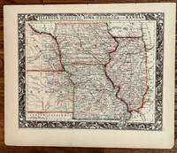
1860251Philadelphia: S. Augustus Mitchell 1860. 13 1/4 x 10 3/4 inches. Very Good. Beautiful lithograph hand colored in bright hues at the time of publication. This is effectively the extent of cultivation headed to the Weston the eve of the Civil War. An exceptionally graphic border highlights this cartographic presentation. It is the apex of the mapmakers art in ante-bellum mapmaking. S. Augustus Mitchell unknown
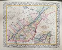
1877M11300Philadelphia: S. Augustus Mitchell 1877. Very Good. Notes: An attractive Map of Quebec showing its counties and the St. Lawrence River. With an inset map showing the Environs of Montreal. Size : 270x339 mm 10.63x13.35 Inches Coloring: Printed in Color with Some Hand Coloring Category: Maps Canada East Quebec; S. Augustus Mitchell unknown
1823004664Newcastle Upon Tyne: W. A. Mitchell 1823. 3 ii-xx 1 2-155pp 1. Modern cloth title in gilt to spine. Externally very good. Internally lightly browned especially to edges occasional spot of soiling to margins but generally clean. With a lithographic frontispiece which is slightly chipped to fore edge. States 'Vol. I' but all published. Anonymous epistolary satire about Newcastle politics probably written by the publisher. Goldsmiths 23755. First Edition. Hardback. Good. 8vo. W. A. Mitchell Hardcover