Thwaites, Reuben Gold, edBiblio.com
7 654 résultats
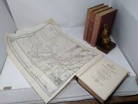
1906351477Cleveland Ohio: Arthur H. Clark Co 1906. Reprint . Hardcover. Very Good. Large 8vo 9" - 10. But for two round and faint scuffs to front cover of first volume particularly nice-looking exemplars of the four- volume run reprinted from Volumes XIV XV XVI and XVII of Thwaites's Early Western Travels: 1748-1846. These four volumes comprise a portion of Reuben Gold Thwaites's massive 31-volume series on travel in the American West in the 18th and 19th centuries. The title pages continue: "Compiled from the notes of Major Stephen H. Long Mr. T. Say and other gentlemen of the party by Edwin James botanist and geologist to the expedition." Edited with notes introductions and index by Reuben Gold Thwaites. Stephen H. Long was in 1819-1820 sent to find the source of the Platte River in the Rocky Mountains. Large fold-out map in the first volume depicts the drainage of the Mississippi River other plates depict in black-and-white images of people and sights seen during the expedition. Bound handsomely in rust cloth-covered boards with gilt-stamped titles on spines. Top edges gilt all three edges of all volumes in deckle-cut. Illustrations galore in black-and-white and duotone. Bound in Imperial octavo hardcover format. Comprised of 9 10-321; 11 12-356 pp.; 11 12-291; 11 12-308 pp.Member I.O.B.A. C.B.A. and adherent to the highest ethical standards. Additional postage may be required for oversize or especially heavy volumes and for sets. Arthur H. Clark Co hardcover
18930803169Glasgow: A. Bryson & Co 1893. First edition / 1st Printing. Hard Cover. Good/No Jacket As Issued. 8vo - over 7¾" - 9¾" 7 books bound in 2 volumes. Covers the First throught Seventh tournaments from 1893 through 1899. First Edition / First Printing. Call's 149. Bound in 1/2 brown calf over brown cloth boards with red leather spine labels original covers not bound. Tournaments 1-4 in Vol. 1 5-7 in Vol. 2. Good spines faded but lettering still stron rubbing to leather edges bottom 3/4 inches of spine on Vol. 2 is unevenly chipped 1.5 inch split at top of front spine hinge chipped around top of spine. 14 x 21. hard cover. 63 63 70 100 72 80 & 80pp. B1903A. A. Bryson & Co unknown
4000375-nnew. unknown
6636563Taylor & Francis Group pp. xvi 323 . Hardback. New. Taylor & Francis Group hardcover
184874990New York: Munn & Co. 1848-49. The entire fourth volume Nos. 1-52. Folio 11 x 15 inches. 419 pp with an index at the rear. Illustrated throughout. Each number is 8 pp. Full contemporary sheepskin with green morocco gilt lettering label. Leather a bit dry some scattered foxing and toning as to be expected. Overall a very good copy.Chiefly of interest for the many references to the Gold Rush in California. The first printed announcement of the famous discovery at Sutter's Mill was published in March of 1848 in Sam Brannan's San Francisco newspaper The Californian. The news was first announced in an East Coast newspaper the New York Herald on August 19th 1848. Issue No. 1 of Vol. 4 is dated September 23 1848 and we find an article about the Gold Rush on the second page. The header is Gold Gold and it gives an early report of about six months after the event “of the discovery of an immense bed of gold one hundred miles in extent on the American Fork and Feather riversâ€."The Golden Land" found in No. 13 states - "A short time ago the most flattering accounts were received in this city from California about the mountains of gold and the valleys flowing with silver. Some believed it was a joke while others believed it to be a ‘hue and cry’ for some speculative purpose and to the latter implication we must plead guilty. We believed that the accounts received here a short time ago about vessels being deserted by their crews and houses by their inhabitants who had proceeded to the El Dorado valley were all a hoax or something worse. But it seems after all that Madam Rumor sometimes tells true tales. The golden hills of California it seems are not imaginary elevations but bona fide treasure houses.â€In "Gold and Gold Washings" in No. 15 we read that the Gold Rush extends to both side of the Sierra Nevada Mountains and as far south as the headwaters of the San Joaquin River; an area 100 miles wide and 400 miles long. There are numerous other articles about the gold rush gold mining equipment and many other aspects of the 49er Gold Rush. Munn & Co. hardcover
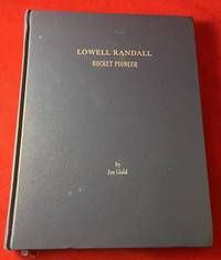
20087745Las Cruces NM: Privately Printed 2008. First Edition. Hardcover. Near Fine. 8 1/2 X 11 1/8 Inches. 156 PP. Original blue buckram boards with silver title stamping to cover. Signed by Lowell Randall and Joe Gold. Randall was an early jet propulsion pioneer and a member of Robert Goddard's team. His work is credited with helping the U.S. launch it's space program. He later became the Goddard team's chief test engineer at the Naval Research Station at Annapolis. This book "Lowell Randall: Rocket Pioneer Glimpses of a Rocket Pioneer During Various Portions of his Career" inscribed by Gold to Canadian filmmaker Michael Lennick. Lennick interviewed Gold as part of his 12-part Rocket Science documentary for The Discovery Channel. A scarce privately printed book with OCLC only locating "1" copy. Privately Printed hardcover
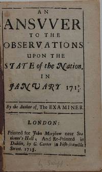
13454Dublin: London: Printed for John Morphew near Stationer’s Hall; and Re-Printed in Dublin by C. Carter in Fish-shamble Street 1713. . 14pp. 12mo. Disbound. First Dublin edition reprinted from the leading article in The Examiner No. 17 27 February 1713. Delariviere Manley and Joseph Browne were the principal editors of the journal at the time with Swift playing a major role as well. Swift has been suggested as a possible author of this article but it is not included in the Teerink/Scouten bibliography. Of this edition ESTC records only the Royal Irish Academy copy in the British Isles and three in the United States. [Dublin:] London: Printed for John Morphew near Stationer’s Hall; and Re-Printed in Dublin, by C. Carter in Fish-shamble Stree unknown
19562049<p>Published Quarterly by Jones Publ. 1956 1956. Hard Cover. No Jacket. First Edition. HBNODJ 1956 1st editionFINE -/F- AS-IS NOJACKETJ Black cloth decorated Green cover light wear Rub tiny Chips Extremities Interior light FoX wear basically Nice . First Edition. Hard Cover. Very Good/No Jacket.</p> Published Quarterly by Jones Publ. 1956 hardcover
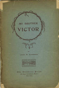
191222953New York: Dreamers Press 1912. First edition. Light blue paper wrappers decorated in brown. Wrappers split at spine chipped at the corners small tear to front edge faint crease to wrapper end paper and title page leaves clean crisp and unmarked. A good or better copy of this scarce item. 2 28 2 p. 8 p. of plates. Illus. with b/w plates. Sm. 8vo. "The Memorie was written at Paris France in the author's twenty-third year; while studying Art at Julians." A long memoir in verse by Louis Michel Eilshemius or Elshemus 1864-1941 a unique American artist rediscovered by Marcel Duchamp in 1917 only a few years before Eilshemius gave up painting. RLIN and OCLC list only five locations for this title. Dreamers Press unknown
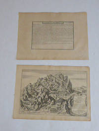
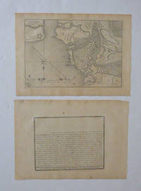
51-6469Paris: chez l'auteur dans l'Isle du Palais sur le quay de l'orloge a la Sphére Royale avec privilége du Roy 1705-1717. Engraved text broadside and engraved map.Each 27.3 x 38cm. Contemporary laid paper uniformly time aged.Published in "L'atlas curieux ou le monde reÌpreseÌnteÌ dans des cartes geÌneÌrales et particulieres du ciel et de la terre : diviseÌ tant en ses quatre principales parties que par eÌtats et provinces et orneÌ par des plans et descriptions des villes capitales et principales et des plus superbes edifices qui les embelissent comme sont les eglises les palais les maisons de plaisance les iardins les fontaines &c. ". OCLC Number / Unique Identifier:79022119.LThe Atlas Curieux is geographic encyclopedia of images and maps of France with detailed views of the grand waterworks at Marly views of the great palaces and chateaux views and plans of the Paris Observatory and samples of military architecture. Issued in six annual parts from 1700-1705 the maps are based on the new observations of the Académie des Sciences and drawn up with the assistance of Philipe de La Hire.Library of Congress:The French cartographer and engraver Nicolas de Fer was a master at creating maps that were works of art. The maps that he published were printed during the Baroque period when the decorative arts were characterized by ornate detail. De Fer’s detailed maps and atlases were valued more for their decorative content than their geographical accuracy.Nicolas de Fer was born in 1646. His father Antoine de Fer owned a mapmaking firm. At the age of twelve Nicolas was apprenticed to a Parisian engraver named Louis Spirinx. The family business was starting to decline when his father died in 1673. Nicolas de Fer’s mother Genevieve took over the business after the death of her husband. In 1687 the business was passed on to Nicolas and the profits increased after he took over the firm. Nicolas de Fer was a prolific cartographer who produced atlases and hundreds of single maps. He eventually became the official geographer to King Louis XIV of France and King Philip V of Spain.One of de Fer’s major works is an atlas titled L’atlas curieux The curious atlas. Paris: chez l'auteur dans l'Isle du Palais sur le quay de l'orloge a la Sphére Royale avec privilége du Roy, 1705-1717 unknown
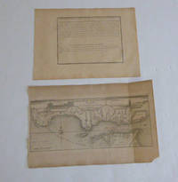
51-6470Paris: chez l'auteur dans l'Isle du Palais sur le quay de l'orloge a la Sphére Royale avec privilége du Roy 1705-1717. Engraved text broadside and engraved map.27.3 x 38cm. and 27.3 x 43cm. Missing piece in lower right corner. Fold mark on right side. Contemporary laid paper uniformly time aged.The Tagus is the longest river in the Iberian Peninsula. The river rises in the Montes Universales between Cuenca and Teruel in mid-eastern Spain flows 1007 km generally westward and empties into the Atlantic Ocean in Lisbon.Published in "L'atlas curieux ou le monde reÌpreseÌnteÌ dans des cartes geÌneÌrales et particulieres du ciel et de la terre : diviseÌ tant en ses quatre principales parties que par eÌtats et provinces et orneÌ par des plans et descriptions des villes capitales et principales et des plus superbes edifices qui les embelissent comme sont les eglises les palais les maisons de plaisance les iardins les fontaines &c. ". OCLC Number / Unique Identifier:79022119.LThe Atlas Curieux is geographic encyclopedia of images and maps of France with detailed views of the grand waterworks at Marly views of the great palaces and chateaux views and plans of the Paris Observatory and samples of military architecture. Issued in six annual parts from 1700-1705 the maps are based on the new observations of the Académie des Sciences and drawn up with the assistance of Philipe de La Hire.Library of Congress:The French cartographer and engraver Nicolas de Fer was a master at creating maps that were works of art. The maps that he published were printed during the Baroque period when the decorative arts were characterized by ornate detail. De Fer’s detailed maps and atlases were valued more for their decorative content than their geographical accuracy.Nicolas de Fer was born in 1646. His father Antoine de Fer owned a mapmaking firm. At the age of twelve Nicolas was apprenticed to a Parisian engraver named Louis Spirinx. The family business was starting to decline when his father died in 1673. Nicolas de Fer’s mother Genevieve took over the business after the death of her husband. In 1687 the business was passed on to Nicolas and the profits increased after he took over the firm. Nicolas de Fer was a prolific cartographer who produced atlases and hundreds of single maps. He eventually became the official geographer to King Louis XIV of France and King Philip V of Spain.One of de Fer’s major works is an atlas titled L’atlas curieux The curious atlas. Paris: chez l'auteur dans l'Isle du Palais sur le quay de l'orloge a la Sphére Royale avec privilége du Roy, 1705-1717 unknown
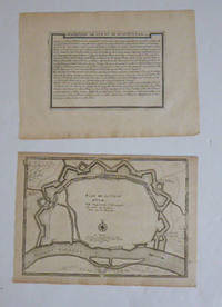
51-6466Paris: chez l'auteur dans l'Isle du Palais sur le quay de l'orloge a la Sphére Royale avec privilége du Roy 1705-1717. Engraved text broadside and engraved map.Each 27.3 x 38cm. Contemporary laid paper uniformly time aged.Published in "L'atlas curieux ou le monde reÌpreseÌnteÌ dans des cartes geÌneÌrales et particulieres du ciel et de la terre : diviseÌ tant en ses quatre principales parties que par eÌtats et provinces et orneÌ par des plans et descriptions des villes capitales et principales et des plus superbes edifices qui les embelissent comme sont les eglises les palais les maisons de plaisance les iardins les fontaines &c. ". OCLC Number / Unique Identifier:79022119.LThe Atlas Curieux is geographic encyclopedia of images and maps of France with detailed views of the grand waterworks at Marly views of the great palaces and chateaux views and plans of the Paris Observatory and samples of military architecture. Issued in six annual parts from 1700-1705 the maps are based on the new observations of the Académie des Sciences and drawn up with the assistance of Philipe de La Hire.Library of Congress:The French cartographer and engraver Nicolas de Fer was a master at creating maps that were works of art. The maps that he published were printed during the Baroque period when the decorative arts were characterized by ornate detail. De Fer’s detailed maps and atlases were valued more for their decorative content than their geographical accuracy.Nicolas de Fer was born in 1646. His father Antoine de Fer owned a mapmaking firm. At the age of twelve Nicolas was apprenticed to a Parisian engraver named Louis Spirinx. The family business was starting to decline when his father died in 1673. Nicolas de Fer’s mother Genevieve took over the business after the death of her husband. In 1687 the business was passed on to Nicolas and the profits increased after he took over the firm. Nicolas de Fer was a prolific cartographer who produced atlases and hundreds of single maps. He eventually became the official geographer to King Louis XIV of France and King Philip V of Spain.One of de Fer’s major works is an atlas titled L’atlas curieux The curious atlas. Paris: chez l'auteur dans l'Isle du Palais sur le quay de l'orloge a la Sphére Royale avec privilége du Roy, 1705-1717 unknown
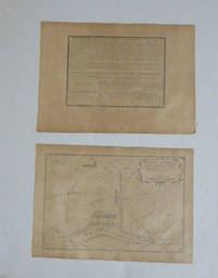
51-6471Paris: chez l'auteur dans l'Isle du Palais sur le quay de l'orloge a la Sphére Royale avec privilége du Roy 1705-1717. Engraved text broadside and engraved map.Each 27.3 x 38cm. Contemporary laid paper uniformly time aged.Published in "L'atlas curieux ou le monde reÌpreseÌnteÌ dans des cartes geÌneÌrales et particulieres du ciel et de la terre : diviseÌ tant en ses quatre principales parties que par eÌtats et provinces et orneÌ par des plans et descriptions des villes capitales et principales et des plus superbes edifices qui les embelissent comme sont les eglises les palais les maisons de plaisance les iardins les fontaines &c. ". OCLC Number / Unique Identifier:79022119.LThe Atlas Curieux is geographic encyclopedia of images and maps of France with detailed views of the grand waterworks at Marly views of the great palaces and chateaux views and plans of the Paris Observatory and samples of military architecture. Issued in six annual parts from 1700-1705 the maps are based on the new observations of the Académie des Sciences and drawn up with the assistance of Philipe de La Hire.Library of Congress:The French cartographer and engraver Nicolas de Fer was a master at creating maps that were works of art. The maps that he published were printed during the Baroque period when the decorative arts were characterized by ornate detail. De Fer’s detailed maps and atlases were valued more for their decorative content than their geographical accuracy.Nicolas de Fer was born in 1646. His father Antoine de Fer owned a mapmaking firm. At the age of twelve Nicolas was apprenticed to a Parisian engraver named Louis Spirinx. The family business was starting to decline when his father died in 1673. Nicolas de Fer’s mother Genevieve took over the business after the death of her husband. In 1687 the business was passed on to Nicolas and the profits increased after he took over the firm. Nicolas de Fer was a prolific cartographer who produced atlases and hundreds of single maps. He eventually became the official geographer to King Louis XIV of France and King Philip V of Spain.One of de Fer’s major works is an atlas titled L’atlas curieux The curious atlas. Paris: chez l'auteur dans l'Isle du Palais sur le quay de l'orloge a la Sphére Royale avec privilége du Roy, 1705-1717 unknown
51-6465Paris: chez l'auteur dans l'Isle du Palais sur le quay de l'orloge a la Sphére Royale avec privilége du Roy 1705-1717. Engraved text broadside and engraved map.Each 27.3 x 38cm. Contemporary laid paper uniformly time aged.Published in "L'atlas curieux ou le monde reÌpreseÌnteÌ dans des cartes geÌneÌrales et particulieres du ciel et de la terre : diviseÌ tant en ses quatre principales parties que par eÌtats et provinces et orneÌ par des plans et descriptions des villes capitales et principales et des plus superbes edifices qui les embelissent comme sont les eglises les palais les maisons de plaisance les iardins les fontaines &c. ". OCLC Number / Unique Identifier:79022119.LThe Atlas Curieux is geographic encyclopedia of images and maps of France with detailed views of the grand waterworks at Marly views of the great palaces and chateaux views and plans of the Paris Observatory and samples of military architecture. Issued in six annual parts from 1700-1705 the maps are based on the new observations of the Académie des Sciences and drawn up with the assistance of Philipe de La Hire.Library of Congress:The French cartographer and engraver Nicolas de Fer was a master at creating maps that were works of art. The maps that he published were printed during the Baroque period when the decorative arts were characterized by ornate detail. De Fer’s detailed maps and atlases were valued more for their decorative content than their geographical accuracy.Nicolas de Fer was born in 1646. His father Antoine de Fer owned a mapmaking firm. At the age of twelve Nicolas was apprenticed to a Parisian engraver named Louis Spirinx. The family business was starting to decline when his father died in 1673. Nicolas de Fer’s mother Genevieve took over the business after the death of her husband. In 1687 the business was passed on to Nicolas and the profits increased after he took over the firm. Nicolas de Fer was a prolific cartographer who produced atlases and hundreds of single maps. He eventually became the official geographer to King Louis XIV of France and King Philip V of Spain.One of de Fer’s major works is an atlas titled L’atlas curieux The curious atlas. Paris: chez l'auteur dans l'Isle du Palais sur le quay de l'orloge a la Sphére Royale avec privilége du Roy, 1705-1717 unknown
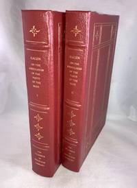
1996022149New York: The Classics of Medicine Library/Gryphon Editions Inc. 1996. Book. As New. Hardcover. First Edition Thus. 8vo - over 7¾ - 9¾" tall. Hardcovers two volumes in genuine reddish Carnelian leather bindings with raised spines lettered in 22kt gold and gilt stamped cover design by Daniel B. Bianchi and Selma Ordewer. 802 pages. Bibliography Index. Translated from the Greek with an introduction and commentary by Margret Tallmadge May. Additional refinements include bound in silk ribbon marker specially commissioned marbled end-papers designed by Richard J. Wolfe and all edges gilt. Special limited edition first edition thus prepared from the first edition of 1968 published by Cornell University Press. This collector's edition of Galen's work on anatomy and physiology makes available to both student and scholar one of the few English translations available. No previous ownership marks. A pristine unread and like new copy. As new. The Classics of Medicine Library/Gryphon Editions Inc. Hardcover
198429877Nevada City: IDHHB 1984. Second edition. Cloth bound in very good condition. 11" x 8.5"; 147 pages. IDHHB unknown
198029872Nevada City: IDHHB 1980. First edition. Cloth bound in very good condition; Small amount of wear to spine ends and soil on covers. Numbered limited edition of 200 copies; 11" x 8.5"; 131 single-sided pages. IDHHB unknown
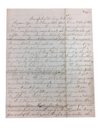
1862899701862. Near Fine. Interesting content in this Maine Infantry Civil War Letter of almost 4 full pages written in a clear hand from Beaufort South Carolina and dated Aug. 22 1862. 25 cm. Envelope not present. The writer probably a Lieutenant references colored negro troops from Connecticut and gives a long opinion on how the north should win the war with the resources at its disposal. He also mentions troop misconduct at a "Negro Meeting: "Last night one of my sergeants attended a "Negro Meeting: in company with a few men belonging to the 6th Connecticut Vols. and as they had been drinking whiskey rather freely they thought to show their smartness by breaking in doors and windows of the meeting house and by kicking up a row generally. The sergeant was arrested and will probably be tried by a Court Martial. If he is found guilty I hope he will be punished to the full extent of the law. The sergeant George J. Card is quite young and smart and I have tried to make a man of him but it is of no use -- it can't be done. unknown
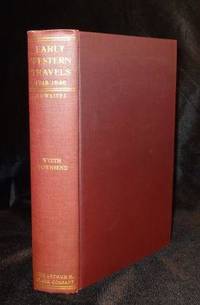
1905000937AThe Arthur H. Clark Co. Cleveland OH 1905. 1st Edition. Hardcover. Fine. A fine clean and tight hardcover copy published by The Arthur H. Clark Co. Volume 21 of Early Western Travels 1748-1846. A very copy. No bumped corners to book. Pages are clean and white. Top edge gold gilt is clean and bright as is the gold lettering to spine. No bookplates. Previous penciled name has been erased from half title page with no loss of paper. = WE BOX AND SHIP ALL BOOKS WITH USPS TRACKING. = WE HAVE BEEN BUYING AND SELLING USED BOOKS FOR OVER 35 YEARS. The Arthur H. Clark Co., Cleveland, OH hardcover
2221572<p>First edition. 7" x 9". Original stiff green wrappers stamped in white cord tie oval b/w halftone photograph of water front Tacoma. Illustrated with two fold out b/w panorama views and 17 b/w mounted halftone views on stiff grey papers. Uncommon. Very good.</p><p>Printed by Albertype Co. Brooklyn N.Y.</p> P. A. Kaufer unknown
1977122184Milano: Rizzoli Editore 1977. second edition. Hardbound. VG/VG- small rip in lower rear dustjacket in VG slipcase. A large weighty book. Green cloth with color pictorial glossy dustjacket all contained in a custom slipcase. Appx. 105 pp. 115 mostly color plates tipped-in to the text portion and 34 full sheet 13.5" x 16" color plates many of them folding. A most impressive book both by its content and its volumetric displacement. Text is in Italian. Transit mass would be 272 ounces. A stunning production detailing the work of Carpaccio in the Church of San Giorgio Degli Schiavoni. Rizzoli Editore hardcover
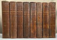
1856H39675Boston: Phillips Sampson and Company 1856. Hardcover. Very good. 8 volumes complete. Large 8vo 10 x 6.75 inches full brown calf or sheep very good overall general scuffing rubbing and light wear to bindings but all solidly bound bookplates contents generally very good with several steel-engraved plates per volume; frontispiece to the first volume with short tear a few other plates have minor tears most have slight foxing and there is some general toning to the contents. But all solidly bound and in a plain but handsome binding of the period. A substantial set: shipping will be calculated by address. Phillips, Sampson and Company hardcover
2022x-1529213797Bristol Univ Pr 2022. Hardcover. New. 480 pages. 9.44x6.77x1.00 inches. Bristol Univ Pr hardcover
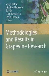
2010x-904819282XSpringer Verlag 2010. Hardcover. New. 1st edition. 290 pages. 9.25x6.25x1.00 inches. Springer Verlag hardcover
2013x-1461454468Springer Verlag 2013. Hardcover. New. 475 pages. 9.75x6.50x1.00 inches. Springer Verlag hardcover